

Mori Atlas logo
Protected areaCueva de las Manos

Analyzing the volcanic terrain and archaeological landscape of the Patagonian steppe

Cueva de las Manos: Protected Area and Pinturas River Canyon Geographic Atlas

(Cueva de las Manos, Río Pinturas)

Cueva de las Manos serves as a significant protected area within the dramatic rock formations of the Pinturas River Canyon in northwestern Santa Cruz Province. This site provides deep insight into the geological and cultural history of the Patagonian steppe, where volcanic ignimbrite bedrock creates natural shelters for complex, millennia-spanning artistic records. Understanding this protected landscape involves tracing the interplay between the sheltered canyon microclimate and the surrounding vast, windswept plains of Argentina.

rock art sitepre-Columbian heritagePatagonian steppecave paintingshunter-gatherer archaeologyUNESCO World Heritage Site
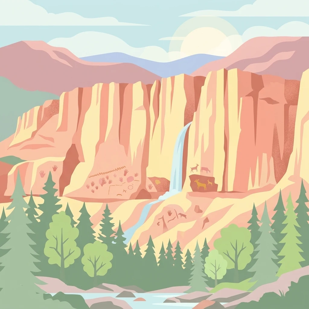
A flat vector illustration of a canyon with tall red rock walls, a small waterfall, pine trees in the foreground, and depictions of ancient cave paintings of animals and hands on the rock faces.

Cueva de las Manos

Protected area

Park overview

Structured park overview, official facts, and landscape profile for Cueva de las Manos

Cueva de las Manos park facts, protected area profile, and essential visitor context

Review the core facts for Cueva de las Manos, including designation, size, terrain, visitor scale, habitats, and operating context in one park-focused overview.

About Cueva de las Manos

Cueva de las Manos is far more than a single decorated cave. The name refers to both the main cavern and an expansive surrounding complex of rock art sites clustered within the Pinturas River Canyon near its junction with the broader Deseado River basin. The canyon walls, formed from Jurassic-era ignimbrite and related volcanic rocks of the Deseado Massif, were carved by glacial and riverine erosion, exposing the sheltered overhangs where thousands of years of human artistic tradition remain visible today.

The site's enduring significance lies in the continuity of its occupation. For millennia, the canyon served as a seasonal gathering point for nomadic hunter-gatherers of Patagonia, who depended heavily on local guanaco herds for food, clothing, and raw materials. Their seasonal rounds linked the canyon with the Central Patagonian Plateau and the forested Andean foothills, making Cueva de las Manos a node within a much wider regional network. Artistic traditions at the site evolved through distinct phases, defined by changing palettes, motifs, and techniques, while preserving continuous links to earlier imagery. The resulting layered palimpsest of hands, animals, and symbols forms a remarkable visual record of early South American cultural life.

Today, the cave and its surrounding rock art are recognized as a National Historic Monument and a UNESCO World Heritage Site, jointly protected by Argentina's national heritage institutions and the provincial government of Santa Cruz. Modern preservation efforts, including a boardwalk, fencing, guided-only access, and ongoing documentation through digital media, aim to safeguard the integrity of the paintings while still allowing visitors to engage directly with one of the most powerful artistic legacies of pre-Columbian South America.

Quick facts and research context for Cueva de las Manos

Cueva de las Manos sits at the base of a stepped cliff in the upper Pinturas River Canyon, in the Deseado River basin of Patagonia, Argentina, roughly 165 kilometers south of the town of Perito Moreno. The cave is about 20 meters deep with an entrance about 15 meters wide and high, and the surrounding painted walls stretch across a large section of the canyon face.

The site is part of both Perito Moreno National Park and the Cueva de las Manos Provincial Park. It received National Historic Monument status in 1993 and was inscribed on the UNESCO World Heritage List in 1999 under cultural criterion iii. Together with the surrounding rock art complex, it preserves one of the longest unbroken artistic sequences known from prehistoric South America, making it a landmark of both regional and continental heritage.

Protection and recognition

Examine the established terrestrial protection framework and designation timeline.

Cueva de las Manos Protection Status and Terrestrial Designation History

Cueva de las Manos holds a documented terrestrial protection status established in the designated year 1993. Conservation records trace the formal management scope and official recognition details associated with the protected area.

Protection details

Protection scope
Terrestrial
Designated year
1993
Transboundary protection
No
Buffer area
23.31 km²
Park context

Deeper park guide and search-rich context for Cueva de las Manos

Cueva de las Manos history, landscape, wildlife, and travel context

Explore Cueva de las Manos through its history, landscape character, ecosystems, wildlife, conservation priorities, cultural context, and seasonal travel timing in a structured park guide built for atlas discovery and search intent.

Why Cueva de las Manos stands out

Cueva de las Manos is best known for the remarkable density of stenciled handprints that crowd its rock walls, including more than 2,000 impressions in a blend of colors, with a striking predominance of left hands. Beyond the hands, the site is celebrated for its elaborate hunting scenes, particularly the dynamic depictions of guanaco drives in which herds are pursued into ravines using bolas and coordinated ambushes. The site also stands out for the sheer age of its art, spanning thousands of years, and for its distinct stylistic phases that document changing artistic conventions, from early naturalistic hunting imagery to later layers of superimposed handprints and abstract geometric motifs. This combination of personal, symbolic, and narrative imagery makes Cueva de las Manos one of the most important rock art sites in the Americas.
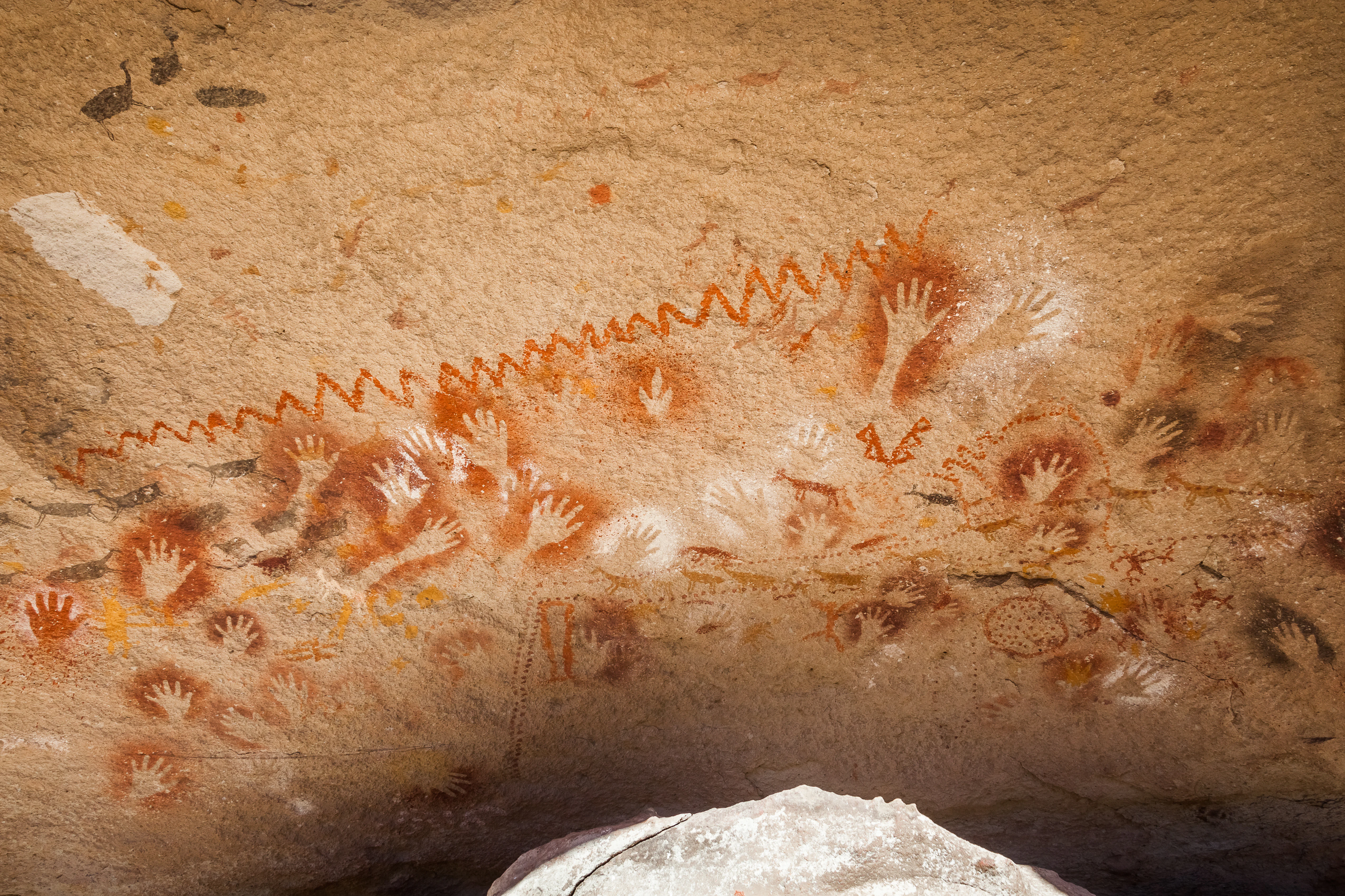
A rock wall covered in numerous ancient hand stencil paintings in red, white, and ochre, with a jagged zigzag line painted across the top.
Prehistoric hand stencils and abstract rock art at Cueva de las Manos, Argentina.

Cueva de las Manos history and protected-area timeline

The cultural layers preserved in Cueva de las Manos span more than eight thousand years. The earliest art at the site dates to around 7,300 BC, created by the first hunter-gatherer groups to use the canyon as a seasonal base. These early inhabitants left naturalistic scenes of dynamic guanaco hunts, often painted in natural earth tones and accommodated to the irregularities of the rock face. The earliest stylistic sequence at the site ended around the time of a major volcanic event associated with the Hudson volcano, which significantly altered the regional environment and likely contributed to a temporary abandonment of the area.

Following this, around 5,000 BC, new cultural groups returned to the canyon and introduced different artistic traditions. Their art emphasized static depictions of guanacos, particularly pregnant females, alongside an intensification of stenciled handprints that accumulated into the dense collages for which the site is most famous. Over time, scenes became more schematic and stylized, and hand motifs multiplied, sometimes covering entire walls in overlapping layers.

A final stylistic phase emerged around 700 AD, marked by highly abstract geometric forms, including dots, zigzags, concentric circles, and schematic figures. Shortly afterward, around the time of European contact in the wider Americas, the artistic record at Cueva de las Manos effectively ended, possibly produced by ancestors of the later Tehuelche peoples. Although earlier Western travelers had encountered the site in the nineteenth century, organized archaeological study only began in the twentieth century, with milestones including Alberto Maria de Agostini's early documentation, a 1949 La Plata Museum expedition, and the sustained research program of Carlos J. Gradin beginning in 1964. National Historic Monument recognition followed in 1993, and UNESCO World Heritage inscription was granted in 1999, cementing the site's place as one of the most important cultural landmarks in Argentina.

Cueva de las Manos landscape and geographic character

The setting of Cueva de las Manos is defined by the Pinturas River Canyon, a dramatic geological feature in the northwestern reaches of Santa Cruz Province. The canyon walls rise as stepped cliffs along the upper Pinturas River, which feeds into the broader Deseado River basin. The river itself, historically fed by glacial meltwater, was the principal sculptor of the canyon: differential erosion along a fissure in the rock face produced the deep overhang and shelter that became the cave proper, while the wider canyon shape reflects millions of years of volcanic and erosional history.

The bedrock of the canyon belongs to the Bahía Laura Group, composed primarily of ignimbrite and other volcanic rocks laid down roughly 150 million years ago during the Jurassic period as part of the larger Deseado Massif. The resulting forms offer natural alcoves, varied surface textures, and complex three-dimensional surfaces that the ancient painters incorporated directly into their compositions, using the rock's natural contours to enhance the scenes they depicted.

The surrounding region is part of Patagonia's precordilleran steppe, an environment characterized by cold, dry conditions and sparse vegetation. The canyon's sheltered topography moderates the strong winds common across the open plateau, creating a microclimate that historically supported a richer grassland ecosystem, with shrubs such as Schinus molle, edible tubers, and fruiting species. To the modern visitor, the canyon remains an austere, windswept landscape; its sudden depth and shelter provide a striking contrast to the wide Patagonian plains that surround it.
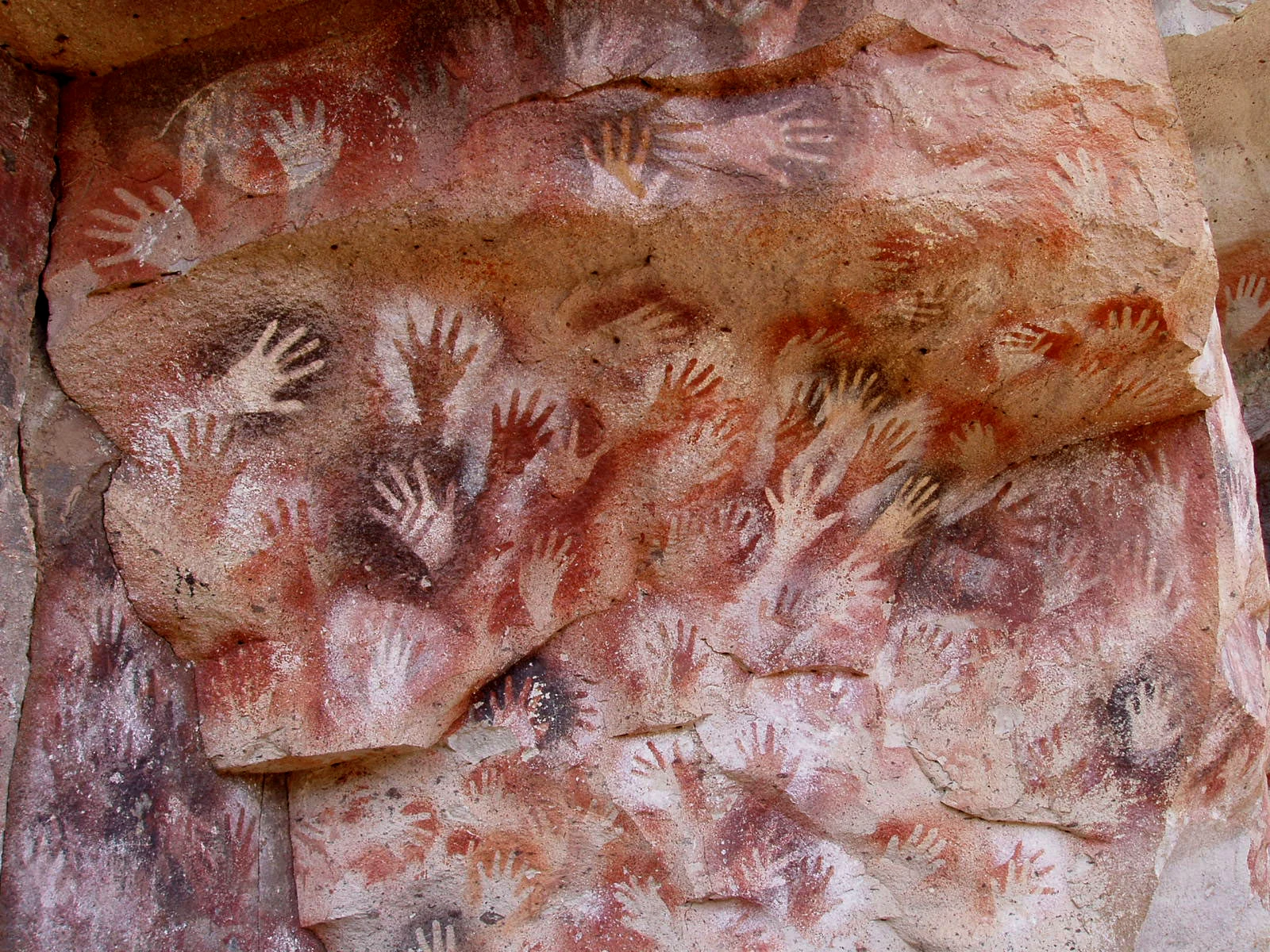
A close up view of prehistoric red and white hand stencils painted on a textured rocky cave wall.
Ancient hand stencils painted on the rock walls at Cueva de las Manos.

Cueva de las Manos ecosystems, habitats, and plant life

The ecological context of Cueva de las Manos reflects the broader transition zone between the Patagonian steppe and the forested Andean foothills. During the Pleistocene to early Holocene eras, a microclimate within the canyon supported a grassland ecosystem at elevations between roughly 400 and 500 meters above sea level, sustaining a community of plants and animals that in turn supported the prehistoric human populations who created the cave's art.

Key plant species once abundant in the area included Schinus molle, valued by the local inhabitants for resin, adhesive, and firewood, alongside rush-root tubers and fruiting plants such as Berberis species. These plants provided not only food but also materials for tool-making, ritual use, and the production of pigments. The sparse but distinctive vegetation of the modern canyon continues to reflect this semi-arid, transitional character, with hardy steppe grasses and shrubs dominating the exposed slopes.

The region's defining fauna revolves around guanaco herds, the foundation of both the prehistoric and modern ecosystems. Other animals associated with the area include rhea, foxes, pumas, and smaller mammals whose remains have been found alongside the cave's cultural deposits. Although the area today remains sparsely vegetated and climatically harsh, the canyon retains the character of a refuge for wildlife within a broader arid landscape.
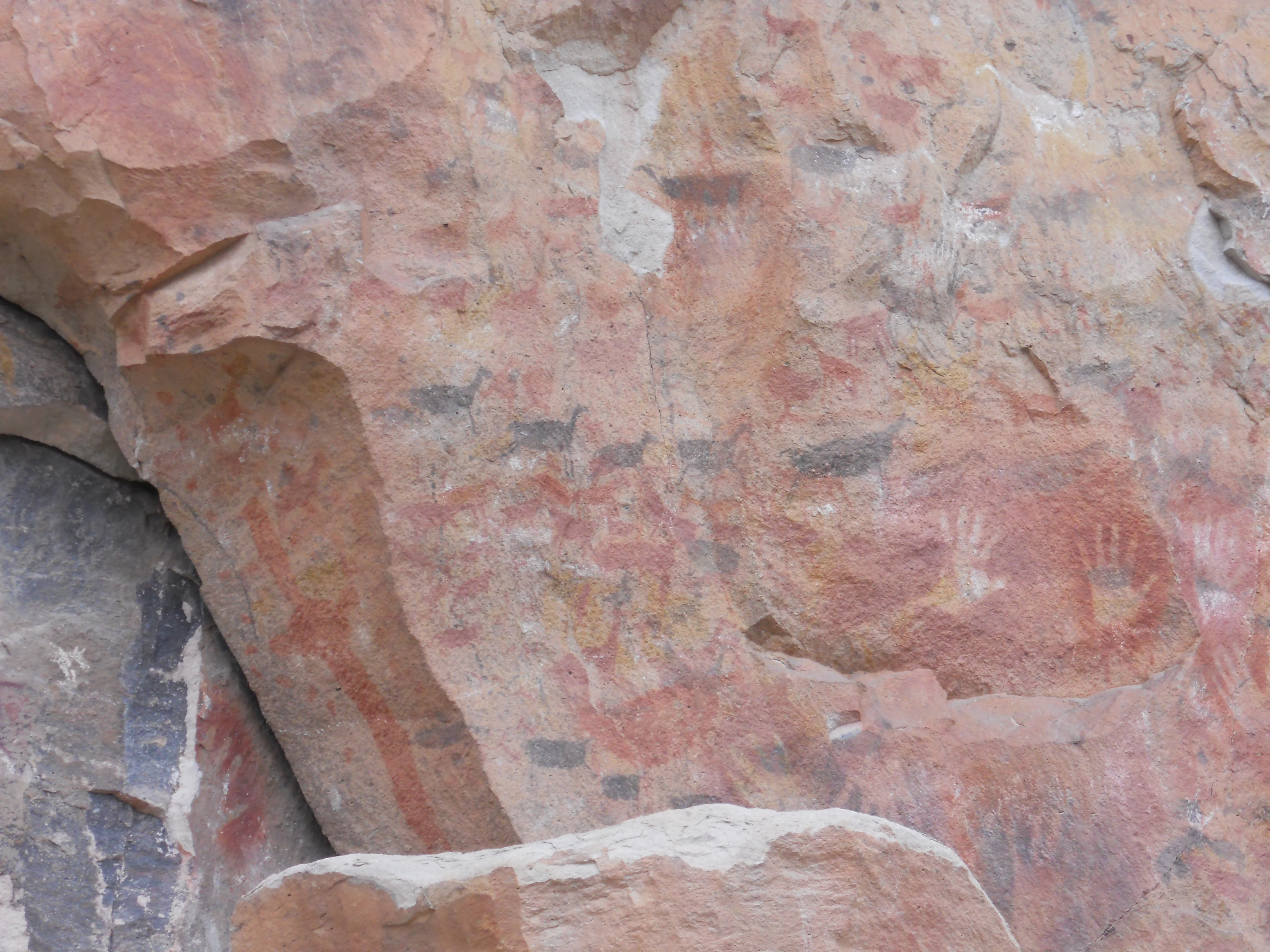
Ancient rock wall featuring faded red and black painted animal figures and hand stencils.
Prehistoric rock paintings, including guanaco figures and hand stencils, at Cueva de las Manos.

Cueva de las Manos wildlife and species highlights

Wildlife is central to the identity of Cueva de las Manos, past and present. The site's defining animal is the guanaco, a camelid that once moved in large herds through the canyon and the surrounding plains. The availability of seasonal water along the Pinturas and Deseado rivers made the area especially attractive for guanaco populations, and prehistoric communities depended on these animals for food, hides, bone tools, and other materials. The repeated appearance of guanacos in the cave art, including in vivid hunting scenes, reflects the animal's profound economic and cultural importance.

Other wildlife documented at the site includes rheas, felines such as pumas and smaller cats, foxes, and a variety of birds and small mammals. Hunting implements recovered from the cave include bolas stones and projectile points, evidence of techniques used to bring down guanacos and other prey, sometimes through coordinated game drives that exploited the canyon's topography to corral animals into ravines and confined spaces.

The wildlife depicted in the rock art remains connected to the modern region: guanacos, rheas, and several of the smaller species illustrated on the cave walls still inhabit the surrounding Patagonian steppe. This continuity between ancient imagery and modern fauna reinforces the site's role not only as a cultural landmark but also as a record of long-term ecological relationships.
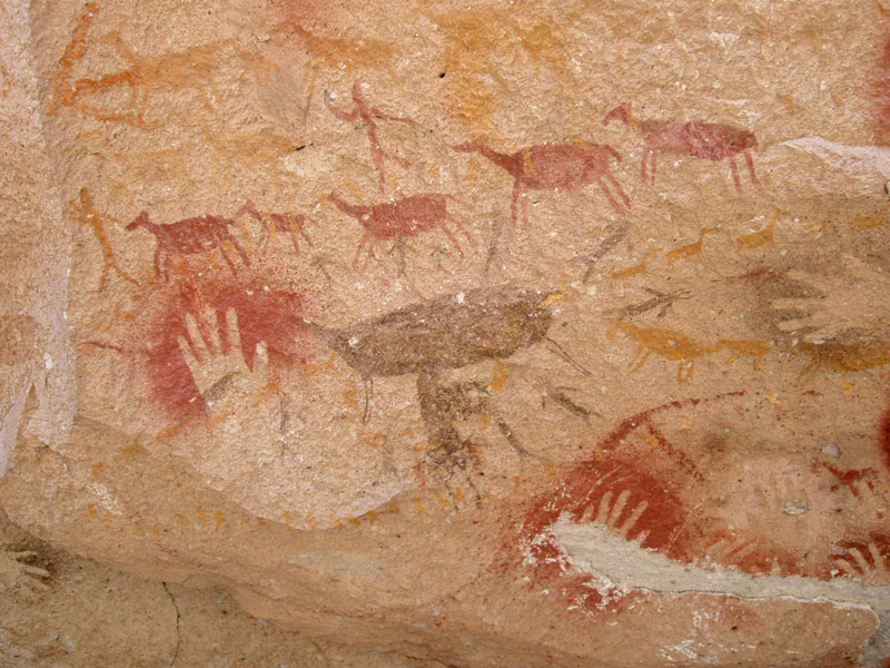
A close-up of prehistoric rock art on a textured sandstone wall, featuring red hand stencils and brown painted silhouettes of animals resembling guanacos.
Ancient hand stencils and depictions of guanacos painted on the cave walls at Cueva de las Manos.

Cueva de las Manos conservation status and protection priorities

Cueva de las Manos holds exceptional conservation significance as one of the oldest, most extensive, and best preserved sites of prehistoric rock art in South America. The continuity of its artistic sequence, spanning more than eight millennia, makes it a key reference for understanding the cultural and ecological history of hunter-gatherer societies across the continent. Its recognition as a National Historic Monument in 1993 and a UNESCO World Heritage Site in 1999 reflects both its cultural and environmental importance.

Efforts to preserve the site have intensified in response to growing tourism and visible threats such as graffiti, vandalism, the touching of painted surfaces, and the removal of small painted rock fragments. Protective measures include chain-link fencing around painted areas, a boardwalk to control the movements of visitors, mandatory guide-led access, sanctioned trails, a guide lodge, and railings. These installations were developed under the supervision of Argentina's National Institute of Anthropology and Latin American Thought (INAPL) and the National Scientific and Technical Research Council (CONICET), alongside the provincial authorities of Santa Cruz.

Documentation projects are also underway, including comprehensive recording of the rock art through 360-degree video, with the goal of producing immersive virtual experiences that can both educate visitors and reduce pressure on the physical site. Despite these efforts, experts and heritage organizations have called for stronger protective measures, including more on-site staffing, a permanent resident archaeologist, and tighter controls on tourism. Broader concerns about unregulated visitation, nearby mining operations, and natural erosion continue to shape the site's long-term conservation strategy.

Cueva de las Manos cultural meaning and human context

Cueva de las Manos lies at the intersection of regional, continental, and global heritage narratives. The site is part of a broader constellation of early South American archaeological sites that, together with locations such as Monte Verde in Chile, Pedra Furada in Brazil, and Piedra Museo in Argentina, have reshaped scientific debates about the timing and routes of the original peopling of the Americas. The deep antiquity of its paintings has positioned Cueva de las Manos as evidence in support of early, pre-Clovis occupation models.

Within Patagonia, the rock art has continued to resonate with later indigenous cultural traditions, particularly those associated with the ancestors of the Tehuelche peoples. Geometric motifs, layered handprints, and abstract figures painted near the end of the site's occupation echo design patterns later recorded on quillangos, traditional hide coverings and garments associated with Patagonian indigenous peoples. The site also occupies an important place in modern Argentine cultural identity, with annual events such as the Festival Folklórico Cueva de las Manos in nearby Perito Moreno celebrating its heritage.

The Carlos J. Gradin Museum of Archaeology in Perito Moreno, named after one of the site's most important researchers, extends this cultural legacy by connecting the cave's art to the broader story of regional archaeology. Together, the cave, its surrounding rock art landscape, and supporting regional institutions form a living cultural landscape that links ancient hunter-gatherer expression with contemporary Patagonian identity.
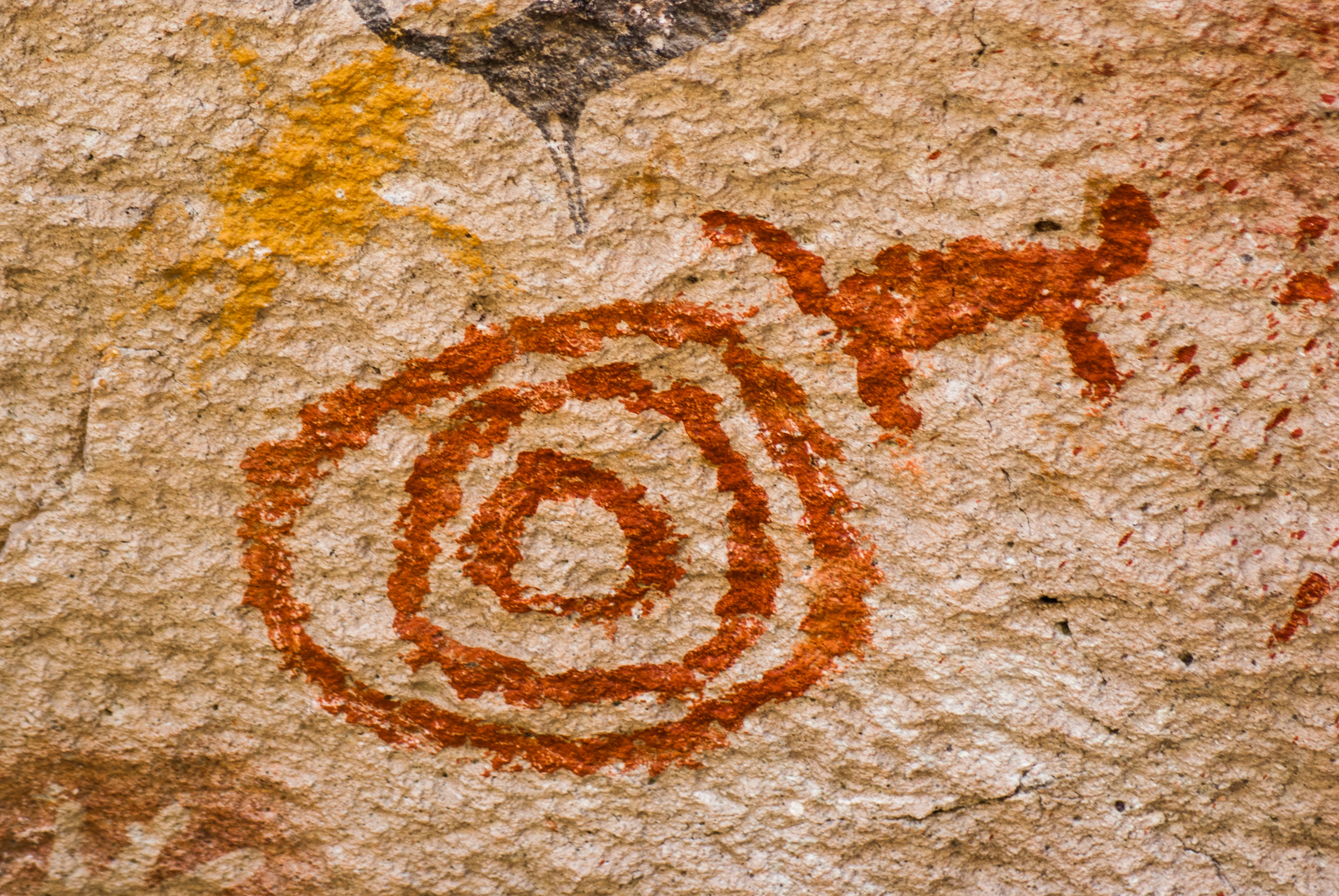
Close-up of reddish-brown rock art painted on a rough, light-colored stone surface, featuring a spiral or concentric circle design and a small four-legged animal figure.
Prehistoric rock art paintings of a concentric circle symbol and a stylized animal at Cueva de las Manos.

Top sights and standout views in Cueva de las Manos

Cueva de las Manos offers a rare opportunity to encounter a continuous record of prehistoric artistic traditions stretching back nearly ten thousand years. Its most striking highlight is the dense, layered composition of stenciled hands, predominantly left, that envelop the cave walls in a visual chorus of overlapping generations of human presence. These hands are accompanied by vivid hunting scenes, including some of the Americas' earliest known depictions of communal game drives using bolas and coordinated ambushes.

The site's broader rock art complex extends the experience across multiple painted overhangs, allowing visitors to trace stylistic evolution from naturalistic hunting imagery to abstract geometric forms. The dramatic setting within the Pinturas River Canyon adds a powerful environmental dimension to the visit, framing the artwork as part of a long-standing relationship between people and a specific, deeply sheltered landscape. Combined with its status as both a National Historic Monument and a UNESCO World Heritage Site, Cueva de las Manos offers a uniquely layered encounter between art, archaeology, and Patagonian landscape.
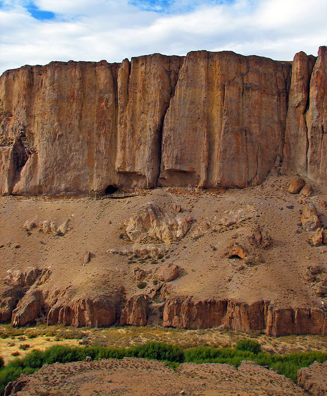
A wide shot of a tall, vertical cliff face composed of reddish-brown stone, featuring small caves and overhangs at the base, with scrubby green vegetation in the foreground.
The rugged canyon walls and rock shelter sites at Cueva de las Manos.

Best time to visit Cueva de las Manos

The climate of the Pinturas River Canyon is cold and dry, with relatively low humidity and significant temperature swings between summer highs and winter lows. Winters are moderated somewhat by the canyon's sheltered topography, which blocks the strong winds common across the broader Patagonian plateau, but conditions can still become harsh, especially at higher elevations around the canyon rim.

Most visitors choose to explore the site during the warmer months from late spring through early autumn, when temperatures are milder and access roads are more reliable. February is particularly notable in the region, as the nearby town of Perito Moreno hosts the annual Festival Folklórico Cueva de las Manos, which celebrates the heritage of the cave and offers a cultural complement to the archaeological visit. Seasonal weather should always be a consideration, since the area's semi-arid climate and remote location can affect the experience of travel to and around the canyon.

Monthly climate preview

Long-term representative monthly climate averages and weather patterns

Cueva de las Manos Climate Normals, Annual Temperature and Precipitation Records

Representative coordinate records show measured monthly temperature variations and precipitation distributions across the protected landscape. Examining the full twelve-month profile reveals detailed baseline climate normals and comparative seasonal averages.
Annual mean5 °C
-3 °C12 °C
Jan12°
Feb12°
Mar
Apr
May
Jun-2°
Jul-3°
Aug-1°
Sep
Oct
Nov
Dec11°
Warmest month
January

12 °C

Coolest month
July

-2.5 °C

Wettest month
May

1.2 mm/day

Driest month
January

0.4 mm/day

Park location guide

Geography guide, regional context, and park location map for Cueva de las Manos

Cueva de las Manos park geography, regions, and map view in Argentina

Understand where Cueva de las Manos sits in Argentina through a broader geographic reading of the surrounding landscape, nearby location context, and its mapped position within the national park landscape.

How Cueva de las Manos fits into Argentina

Argentina is a federal republic located in the southern cone of South America, bordering Chile, Bolivia, Paraguay, Brazil, Uruguay, and the Atlantic Ocean. With an area of 2,780,085 km², it is the second-largest country in South America and the eighth-largest globally. The capital and largest city is Buenos Aires, and the official language is Spanish. The country claims sovereignty over the Falkland Islands, South Georgia and the South Sandwich Islands, and a portion of Antarctica.

Wider geography shaping Cueva de las Manos in Argentina

Argentina occupies the southern portion of South America, sharing the Southern Cone region with Chile to the west. The country borders Bolivia and Paraguay to the north, Brazil to the northeast, Uruguay and the South Atlantic Ocean to the east, and the Drake Passage to the south. The Andes mountain range runs along the western border, while the Pampas plains dominate the central region. Argentina also claims territories in Antarctica.

Map view of Cueva de las Manos

Use this park location map to pinpoint Cueva de las Manos in Argentina, understand its exact geographic position, and read its mapped placement within the surrounding landscape more clearly.

Pigeon | © OpenStreetMap contributors

Location context for Cueva de las Manos

Santa Cruz Province

Visual records of the Pinturas River Canyon, rock art sites, and protected steppe terrain.

Cueva de las Manos Photos: Exploring the Landscape and Scenery of Patagonia

Visual documentation provides essential context for understanding the rugged topography and ancient rock art shelters of Cueva de las Manos. Photographic archives reveal the striking contrast between the deep canyon walls and the surrounding Patagonian plateau.

A rock wall covered in numerous ancient hand stencil paintings in red, white, and ochre, with a jagged zigzag line painted across the top.

A close-up view of numerous prehistoric hand stencils in red, white, and black paint on a light-colored rocky cliff face.

A close up view of prehistoric red and white hand stencils painted on a textured rocky cave wall.

Ancient rock wall featuring faded red and black painted animal figures and hand stencils.

A close-up of prehistoric rock art on a textured sandstone wall, featuring red hand stencils and brown painted silhouettes of animals resembling guanacos.

A wide view of a dry, rugged canyon with steep, rocky cliffs rising on both sides of a narrow, green, vegetated river valley.

Close-up of reddish-brown rock art painted on a rough, light-colored stone surface, featuring a spiral or concentric circle design and a small four-legged animal figure.

A wide shot of a tall, vertical cliff face composed of reddish-brown stone, featuring small caves and overhangs at the base, with scrubby green vegetation in the foreground.

Close-up view of two pale hand stencils painted onto a rough, reddish-brown stone surface.

A close up view of a prehistoric red pigment painting on a textured stone wall, depicting a stylized anthropomorphic or zoomorphic figure with multiple radiating limbs.

A close-up view of a prehistoric red pigment painting on a textured, light-colored rock surface, depicting a stylized human figure.

Ancient rock art paintings of several guanacos on a textured, rocky cave wall at Cueva de las Manos in Argentina.

A close-up view of a light-colored rock surface showing a negative hand stencil painted in dark pigment and an adjacent red pictograph of an animal.

A section of rock wall featuring ancient red and black painted motifs, including hand stencils, stylized human figures, guanaco shapes, and concentric circle patterns.

A wide view of a tall, vertical rock canyon wall with distinct vertical striations and a dark cave opening near the base.

A close-up view of ancient red pigment rock art depicting a stylized human stick figure on textured rock surface.

Park atlas

Compare nearby protected areas, canyon ecosystems, and regional park geography

Parks Near Cueva de las Manos and Related Protected Landscapes in Patagonia

Browsing other parks near Cueva de las Manos helps connect individual rock art sites to the broader ecological and geological context of the Patagonian steppe. Comparing adjacent protected areas reveals how dramatic canyon systems and arid plateaus shape regional conservation networks across southern Argentina.
National parkArgentina
About 50 km away#1 closest

West

Patagonia National Park: A National Park Protecting the Argentine Patagonian Steppe Landscape

Explore the mapped boundaries of this semi-arid grassland ecosystem.

Patagonia National Park is a protected national park in Argentina established to preserve the representative Patagonian steppe ecosystem. Covering 528.11 square kilometers, it offers a deep dive into the unique semi-arid grassland environment, known for its rolling plains and wind-shaped terrain. This park provides crucial context for understanding the broader geography of southern Argentina and the conservation of its distinctive natural landscapes.

Area
528.11 km²
Established
2015
IUCN
II
Climate
Arid
National parkAysén Region
About 91 km away#2 closest

West

Patagonia National Park, Chile: Exploring Protected Landscape and Regional Geography

Mapped boundaries and natural terrain in Aysén Region.

Patagonia National Park, situated within the Aysén Region of Chile, serves as a significant protected area offering rich opportunities for atlas-based geographic exploration. This national park's specific landscape identity and mapped boundaries provide a clear focal point for understanding regional conservation and natural terrain. Discover the geographic context of this protected land and its place within the broader landscape of southern Chile through structured data and map exploration.

Area
3,045.28 km²
Established
2018
IUCN
II
Relief
Mountain
National parkAysén del General Carlos Ibáñez del Campo Region
About 128 km away#3 closest

Northwest

Cerro Castillo National Park: Dramatic Granite Peaks and Patagonian Protected Landscape

Mapped geography and huemul conservation in Chile's Aysén Region.

Cerro Castillo National Park is a premier protected area in southern Chile, celebrated for its iconic Cerro Castillo granite mountain that dominates the landscape. This national park, spanning over 1,700 square kilometers in the Aysén del General Carlos Ibáñez del Campo Region, showcases a dynamic Patagonian terrain shaped by glaciers and rivers. Its significance extends to being a vital corridor for endangered huemul, offering critical habitat within a broader regional conservation strategy and the famous Route of Parks.

Area
1,795.5 km²
Established
1970
IUCN
II
Relief
Mountain
National parkArgentina
About 130 km away#4 closest

Southwest

Perito Moreno National Park: Argentina's Expansive Patagonian Protected Landscape

Explore its mapped terrain and significant protected area geography.

Perito Moreno National Park stands as a cornerstone of Argentinian conservation, safeguarding over 126,000 hectares of striking Patagonian mountain wilderness. This national park protects a rare ecological transition zone, blending wet Andean forests with dry steppe environments across its dramatic amphitheater-like terrain and dual-watershed hydrography. Its mapped boundaries encompass significant natural geography, offering a clear atlas view of protected Patagonian landscapes.

Area
1,268.3 km²
Established
1937
IUCN
II
Relief
Mountain
National parkAysén del General Carlos Ibáñez del Campo Region
About 163 km away#5 closest

West

Laguna San Rafael National Park: Explore its Mapped Boundaries and Patagonian Landscape

A National Park within Aysén del General Carlos Ibáñez del Campo Region.

Laguna San Rafael National Park stands as a key protected area within the vast geography of the Aysén del General Carlos Ibáñez del Campo Region. This entry provides an atlas-focused perspective, detailing the park's geographic significance, mapped natural landscapes, and its role as a vital conservation territory. Understand how this national park fits into the broader context of Patagonia's unique terrain and protected areas.

Area
17,420 km²
Established
1959
IUCN
II
Relief
Mountain
National parkArgentina
About 188 km away#6 closest

East

Bosques Petrificados de Jaramillo National Park: Argentina's Jurassic Petrified Forest Landscape

Explore mapped fossil trees across the Patagonian steppe.

Bosques Petrificados de Jaramillo National Park is a protected national park in Argentina's Santa Cruz Province, celebrated for its extensive collection of Jurassic period fossilized trees. Spanning nearly 80,000 hectares of Patagonian steppe, the park's unique landscape is defined by exposed petrified trunks, some of remarkable size, providing crucial evidence of the region's ancient ecosystems and paleoclimatic history. Discover this extraordinary site through its mapped geography and protected landscape identity.

Area
785.43 km²
Established
2012
IUCN
II
Relief
Mixed relief
National parkAysén del General Carlos Ibáñez del Campo Region
About 222 km away#7 closest

Southwest

Bernardo O'Higgins National Park: Southern Patagonian Ice Field & Glacial Terrain

Chile's largest protected area: a map of vast ice caps and fjords.

Bernardo O'Higgins National Park is a colossal protected landscape in Chile, safeguarding much of the Southern Patagonian Ice Field and its colossal glacial features like the Pío XI Glacier. Explore the dramatic terrain of towering granite peaks and intricate fjord systems that define this remote national park. This page provides essential context for understanding its geography, mapped boundaries, and significance as a vast wilderness preservation.

Area
35,259 km²
Established
1969
IUCN
II
Visitors
36K annual
National parkArgentina
About 288 km away#8 closest

Southwest

Los Glaciares National Park: Argentinian National Park with Patagonian Ice Fields

Explore glacial terrain and iconic Andes peaks.

Los Glaciares National Park is a vast protected area in Argentina, dominated by a massive Patagonian ice cap and numerous descending glaciers, including the renowned Perito Moreno Glacier. Its dramatic landscape of ice fields, glacial lakes, and towering granite spires like Mount Fitz Roy provides critical context for understanding regional geography and the formation of glacial terrain. This park exemplifies the unique protected ecosystems of the southern Andes, offering rich detail for atlas-based discovery.

Area
7,269.27 km²
Established
1937
IUCN
II
Visitors
688.8K annual

Common questions about visiting, size, designation, and location context for Cueva de las Manos

Cueva de las Manos FAQs for park facts, access, geography, and protected area context

Find quick answers about Cueva de las Manos, including protected-area facts, park geography, trail and visitor context, and how the park fits into its surrounding country and regional landscape.
MoriAtlas Explorer

Continue Your Protected Areas Search Across the Global Atlas

Deepen your exploration by continuing the structured search for national parks and protected areas worldwide. Utilize the comprehensive filtering capabilities to compare different conservation landscapes and refine your understanding of global park geography. Discover more about the distribution and characteristics of protected natural areas.

Global natural geography