
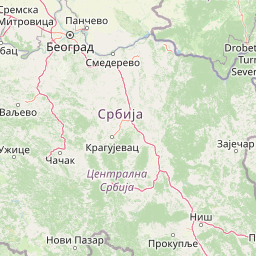
Streams
Park geography
A comprehensive analysis of terrain elevation, landscape features, and park extent.
Detailed Geographic Profile and Mapped Boundaries of Đerdap National Park in Serbia
Examine the structured geographic data for Đerdap National Park, spanning over 637 square kilometers of protected Serbian landscape. This profile details the mountain terrain, characterized by deep river valleys, dramatic cliffs, and an extensive system of karst caves. Review the mapped boundary coordinates and internal elevation data to understand the regional physical geography and ecological diversity found throughout the protected area.
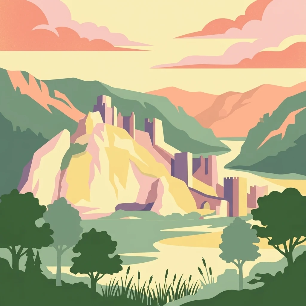
Europe's longest river gorge protecting the Danube's dramatic Iron Gate passage
Đerdap National Park
Đerdap National Park is Serbia's largest national park, established in 1974 to protect one of Europe's most spectacular river landscapes. The park stretches approximately 100 kilometers along the right bank of the Danube River in northeastern Serbia, from the Golubac Fortress to the dam near Novi Sip, bordering Romania across the river. The park's defining feature is the Đerdap Gorge, famously known as the Iron Gate—a colossal breakthrough valley carved through the southern Carpathian Mountains, representing the longest and most dramatic gorge on the Danube. This complex canyon system comprises four distinct gorges separated by ravines, with towering cliffs reaching 300 meters and river depths plunging to 82 meters in places. Beyond its dramatic terrain, the park encompasses a rich tapestry of forests, karstic springs, caves, and the vast artificial Lake Đerdap, Serbia's largest lake, created by the hydroelectric dam complex. The area holds exceptional significance as a European Geopark, Ramsar wetland site, and a repository of extraordinary biodiversity including Tertiary relict species.
- Location
- Serbia
- Park type
- National park
- Established
- 1974
- Area
- 637.9 km²
Location overview
National territory placement and inland geographic status within Serbia
Exploring the Geographic Setting of Đerdap National Park in Serbia
Đerdap National Park is situated entirely within the national borders of Serbia. As a non-coastal and non-transboundary inland protected area, its geographic status is defined by a single country membership.
- Countries
- Serbia
- Primary location
- Serbia
- Geographic setting
- Inland
Boundary and coordinates
Exploring the 637.87 square kilometer geographic area and perimeter
Đerdap National Park Boundary Map and Spatial Limits
The mapped spatial outline offers geographic context for the layout of Đerdap National Park. Regional datasets list the estimated 637.87 square kilometer area, center coordinates, and perimeter limits.
- Boundary area
- 628.9 km²
- Boundary perimeter
- 247.6 km
- Northernmost point
- 44.7111° N
- Southernmost point
- 44.3996° N
- Easternmost point
- 22.5466° E
- Westernmost point
- 21.6681° E
- Geographic centre
- 44.5645° N, 22.1121° E
- North–south span
- 34.6 km
- East–west span
- 69.8 km
Elevation and terrain
Mountain relief mapping and recorded natural features
Đerdap National Park Terrain And Elevation Summary
Recorded terrain data outlines the mountain relief summary reaching up to 800 meters within the protected area. Linked feature cards display names, types, and spatial relationships for recorded natural features.
- Maximum elevation
- 800 m
Selected named natural features
Peaks
Кулмеа Добри
606 m
Peaks
Dževrin Kamen
434 m
Peaks
Шомрдски камен
803 m
Rivers
Danube
Peaks
Велики Лишковац
803 m
Environmental setting
Temperate climate zones, mountain relief, and major water features
Đerdap National Park Environmental Setting and Physical Classifications
Recorded landscape features and habitat types provide complementary perspectives on the physical setting of Đerdap National Park. Stored classifications connect structured environmental categories directly to related atlas destinations.
- Relief
- Mountain
- Climate
- Temperate
- Water
- Major water bodies
- Forest cover
- Mostly forested
- Seasonality
- Year-round
Landscape features
Mountains · Valleys · Cliffs · Canyon · Rivers · Lakes · Cave · Karst
Habitat types
Temperate broadleaf forest · Riverine habitat · Wetland · Montane forest
Park atlas
Trace the geography of the Iron Gate region and compare adjacent protected landscapes along the Danube River and surrounding Carpathian foothills.
Explore National Parks and Protected Areas Near Đerdap National Park, Serbia
Expand your discovery from Đerdap National Park by browsing other national parks and protected areas in the surrounding region, mapping their geographic spread across the Iron Gate gorge and Carpathian foothills. Compare diverse terrain, rich biodiversity, and significant cultural heritage within these conservation landscapes, gaining essential context for further atlas exploration.
Protected landscapeRomania
Park boundaries overlap#1 closest
North

Iron Gates Natural Park: Explore Romania's Protected Landscape and Geographic Context
Detailed atlas view of a protected landscape in Romania.
Uncover the geographic dimensions of Iron Gates Natural Park, a protected landscape situated in Romania. This detailed entry offers an atlas-centric exploration of its mapped boundaries and regional setting, facilitating a deeper understanding of its protected status and landscape features within the national geography. Discover the park's intrinsic value through structured geographic data and visual map context.
- Area
- 1,156.66 km²
- Established
- 2000
- IUCN
- V
- Relief
- Mixed relief
National parkRomania
14 km away#2 closest
Northeast
Domogled-Valea Cernei National Park: National Park with Mapped Protected Landscape
Explore its protected boundaries and regional geography.
Domogled-Valea Cernei National Park is recognized as a National Park, offering a distinct protected landscape for atlas-based discovery. This page provides focused insights into its mapped geographic extent and the character of its natural terrain. Understand the park's role within Romania's protected areas network and its unique geographic identity. Utilize this structured view to navigate the park's features and its surrounding landscape context for informed exploration.
- Area
- 612.11 km²
- Established
- 2000
- IUCN
- II
- Relief
- Mountain
Protected landscapeMehedinți County
About 25 km away#3 closest
Northeast
Mehedinți Plateau Geopark Protected Landscape: Karst Geography and Regional Context
Explore Romania's unique limestone formations and karst landscapes.
The Mehedinți Plateau Geopark in Mehedinți County, Romania, is a significant protected landscape celebrated for its extensive karst features. This page offers detailed insights into the park's mapped boundaries, including its famous natural bridges like Podul lui Dumnezeu, vast limestone pavements, and cave systems. Understand its position within the broader regional geography of southwestern Romania, providing a solid foundation for atlas-driven exploration of this geologically rich area.
- Area
- 1,065 km²
- Established
- 2005
- IUCN
- V
- Relief
- Upland
National parkRomania
About 29 km away#4 closest
North
Nera Gorge-Beușnița National Park: Karst Landscape and Protected Area in Romania
Explore the mapped geography of this protected Romanian landscape.
Nera Gorge-Beușnița National Park offers a detailed view of a protected karst canyon, featuring the Nera River's dramatic gorge and the picturesque Beușnița waterfalls. This protected area in Romania provides valuable context for understanding karst terrain, subterranean systems, and the geographic distribution of protected lands within the Balkan region. Users can explore its distinct landscape features and their place within Romania's atlas of natural protected areas.
- IUCN
- II
- Relief
- Mountain
- Water
- Major water bodies
National parkRomania
40 km away#5 closest
North
Semenic-Cheile Carașului National Park: Romania's Protected Landscape Discovery
National Park Geography and Mapped Boundaries
Delve into Semenic-Cheile Carașului National Park, a protected landscape in Romania, with a focus on its atlas and geographic context. This page details the park's identity as a national park, its specific mapped boundaries, and its contribution to regional geographic understanding. Utilize MoriAtlas to explore the structured data that defines this protected area and its surrounding natural terrain, enhancing your comprehension of Romania's conservation landscapes.
- IUCN
- II
- Scope
- Terrestrial
National parkHunedoara County
55 km away#6 closest
Northeast
Retezat National Park National Park: Protected Landscape and Regional Geography
Mapped boundaries and landscape context in Hunedoara County.
Retezat National Park is a key protected area featured within MoriAtlas, offering structured geographic data and map-based insights. This national park's protected landscape is situated in Hunedoara County, Romania, contributing significantly to the regional topography and natural context of the Southern Carpathians. Explore its mapped boundaries and understand its role as a distinct natural entity.
- Area
- 380.47 km²
- Established
- 1935
- IUCN
- II
- Relief
- Mountain
Protected landscapeSerbia
About 56 km away#7 closest
Northwest

Vršac Mountains Protected Landscape: A Unique Pannonian Island Mountain Range in Serbia
Explore distinct geological formations and rich avian habitats.
The Vršac Mountains Protected Landscape offers a unique geographic perspective as one of Serbia's Pannonian island mountains, emerging dramatically from the surrounding plains. This protected area is recognized for its striking gneiss and schist formations, its status as Vojvodina's highest elevation, and its exceptional importance for birdwatching, hosting over 120 species. Delve into the mapped terrain and geological character that distinguish this vital natural region.
- Area
- 170 km²
- Established
- 1982
- IUCN
- V
- Relief
- Mountain
National parkGorj County
87 km away#8 closest
Northeast
Defileul Jiului National Park: Romania's Protected National Park Landscape in Gorj County
Explore maps, geography, and protected area context.
Defileul Jiului National Park is a vital protected natural area situated in Gorj County, Romania. This MoriAtlas page serves as a detailed entry point for understanding the park's specific geography, its mapped perimeters, and its significance within the regional landscape atlas. Discover the park's topographic features and its relationship to the surrounding terrain of the Southern Carpathians, providing essential context for geographic exploration.
- Area
- 111.27 km²
- Established
- 2005
- IUCN
- II
- Relief
- Mountain
MoriAtlas Explorer
Continue exploring the geography of Đerdap National Park's Protected Landscape
Deepen your understanding of Đerdap National Park's unique position within the regional geography by exploring its detailed maps and protected landscape features. MoriAtlas provides structured insights into its dramatic karst terrain, the significance of the Iron Gate gorge, and its role as a vital natural area for continued atlas discovery.
Browse next
Global natural geography
Explore related park routes
Explore MoriAtlas Global ParksBrowse All MoriAtlas ParksGlobal Park Map DiscoveryMoriAtlas: Browse All CountriesBrowse All MoriAtlas ContinentsNational Park Environment AtlasGrand Canyon National Park AtlasYellowstone National Park AtlasYosemite National Park Atlas and GeographySerengeti National Park AtlasGalápagos National Park Protected LandscapeBanff National Park Geography and AtlasKruger National Park Atlas EntryUluṟu-Kata Tjuṯa National Park AtlasExplore Uluru-Kata Tjuta National Park GeographyPlitvice Lakes National Park AtlasFiordland National Park Protected LandscapeGreat Smoky Mountains National Park AtlasAfghanistan National Parks and Protected AreasAlbania National Parks and Protected AreasAlgeria National Parks and Protected AreasAmerican Samoa National Parks and Protected AreasAndorra National Parks and Protected AreasAngola National Parks and Protected AreasAntarctica National Parks and Protected AreasAntigua and Barbuda Park List