Mori Atlas logo
National parkDniester Canyon National Nature Park

Discover mapped boundaries and the regional geography of this protected area in Ternopil Oblast.

Dniester Canyon National Nature Park: National Park Protected Landscape and Geographic Context

(National Nature Park «Dnistrovskyi Canyon»)

Dniester Canyon National Nature Park represents a significant protected landscape within Ukraine's Ternopil Oblast. As a national park, its geographic identity is defined by its mapped boundaries along the Dniester River system. This page provides an atlas-driven exploration of the park's terrain, its place within the regional geography of western Ukraine, and its significance as a protected natural area.

Canyon landscapeCave systemsWetland ecosystemsForest protectionGeological heritageRiver protected area
Stylized illustration of a river flowing through a canyon with steep cliffs and forested slopes

Dniester Canyon National Nature Park

National park

Park overview

Structured park overview, official facts, and landscape profile for Dniester Canyon National Nature Park

Dniester Canyon National Nature Park park facts, protected area profile, and essential visitor context
Review the core facts for Dniester Canyon National Nature Park, including designation, size, terrain, visitor scale, habitats, and operating context in one park-focused overview.

About Dniester Canyon National Nature Park

Dniester Canyon National Nature Park represents one of Ukraine's most significant natural protected areas, established to preserve the exceptional geological, ecological, and landscape values of the Dniester River canyon in western Ukraine. The park stretches approximately 100 kilometers along the middle course of the Dniester River, typically maintaining a width of 5 to 10 kilometers centered on the river corridor. This relatively narrow but extensive protected zone encompasses some of Ukraine's most visually striking terrain, where the river has carved a deep canyon through the Podilian Upland, creating a landscape of extraordinary complexity and beauty. The park's creation followed decades of advocacy by scientists and conservationists, particularly Mykola Chaikovsky, a corresponding member of the National Academy of Sciences of Ukraine, who devoted over 30 years to establishing this protected area. The park is divided into four management zones: a reserved zone for strict protection, a regulated recreation zone, a stationary recreation zone for visitor facilities, and a business zone for authorized economic activities. Within its boundaries, the park incorporates numerous smaller nature reserves, local protected sites, historical monuments, and natural attractions that form an integrated conservation landscape.

Quick facts and research context for Dniester Canyon National Nature Park

Located in Chortkiv Raion of Ternopil Oblast, western Ukraine, the park follows the Dniester River for roughly 100 kilometers as it flows from northwest to southeast. The area is characterized by a humid continental climate with warm summers. It sits at the southern edge of the Central European mixed forests ecoregion. The park contains over 50 significant caves, with the Optymistychna Cave at 230 kilometers and Ozerna Cave at 105 kilometers ranking among the longest gypsum caves globally. The park is administered by Ukraine's Ministry of Ecology and Natural Resources.

Park context

Deeper park guide and search-rich context for Dniester Canyon National Nature Park

Dniester Canyon National Nature Park history, landscape, wildlife, and travel context
Explore Dniester Canyon National Nature Park through its history, landscape character, ecosystems, wildlife, conservation priorities, cultural context, and seasonal travel timing in a structured park guide built for atlas discovery and search intent.

Why Dniester Canyon National Nature Park stands out

Dniester Canyon is best known for its extraordinary geological features, particularly the extensive network of travertine caves that include two of the world's longest cave systems. The park protects the largest canyon in Ukraine, a dramatic landscape of steep rocky cliffs, meandering river bends, and cascading waterfalls. The Dzhurynskyi waterfall, Ukraine's largest plains waterfall, is a standout feature. The canyon walls create a unique microclimate that supports diverse ecosystems and allows vegetation to bloom two to three weeks earlier than surrounding areas. The region also holds significant archaeological and geological value, with rock formations representing hundreds of millions of years of geological history.

Wide panoramic view of a winding river surrounded by green fields and forests under a clear blue sky
Panoramic view of the Dniester River flowing through lush green landscapes within Dniester Canyon National Nature Park

Dniester Canyon National Nature Park history and protected-area timeline

The establishment of Dniester Canyon National Nature Park represents the culmination of over 70 years of conservation advocacy and scientific research in the region. Initial protected territories in the Dnister region were created in the 1930s following proposals from naturalists, though systematic work to study and protect valuable natural objects began in the 1970s and 1980s. The driving force behind the park's creation was Mykola Petrovych Chaikovsky, a distinguished Ukrainian conservationist who dedicated more than three decades to advocating for national park status. In 1972, he organized the first inter-regional meeting in Zalishchyky to discuss establishing a Dniester State Park across what was then Ivan-Frankivsk, Ternopil, Chernivtsi, and Khmelnytskyi Oblasts. A significant milestone came in 1977 when the Ternopil Regional Council adopted a decision to create the Dniester State Nature Park and improve tourism in the region. In 1984, the area was reclassified as a local-level Pridnistrovian State Landscape Reserve. By 1990, a state landscape park called Dniester Canyon covering 42,084 hectares had been established. In 1998, a group of Ternopil scientists and conservationists developed a preliminary justification for creating the national park, again raising the issue with the Cabinet of Ministers. Finally, on February 3, 2010, President of Ukraine issued Decree 96/2010 establishing Dniester Canyon National Nature Park with an area of 10,829.18 hectares.

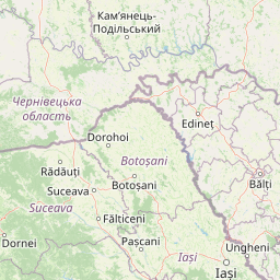
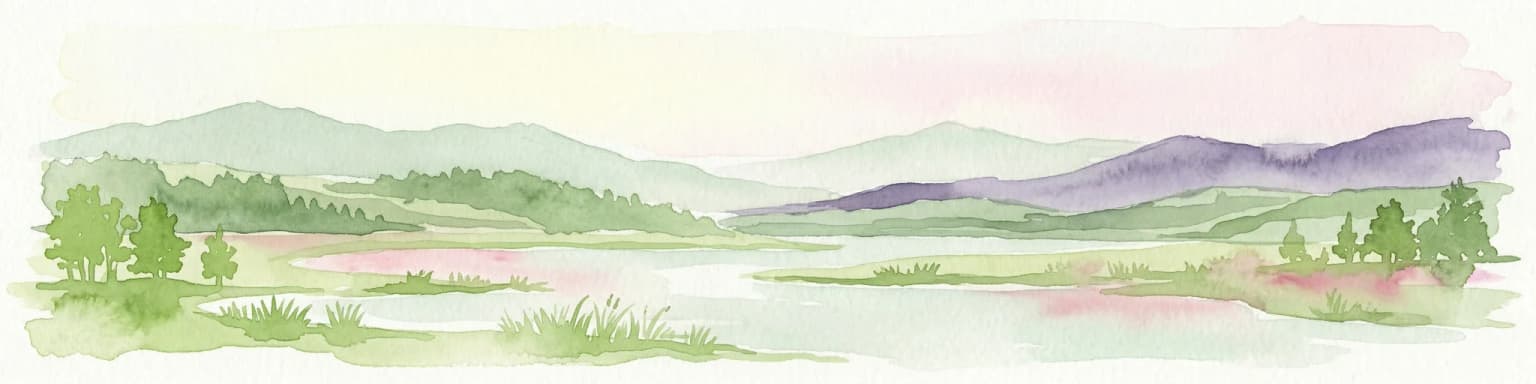
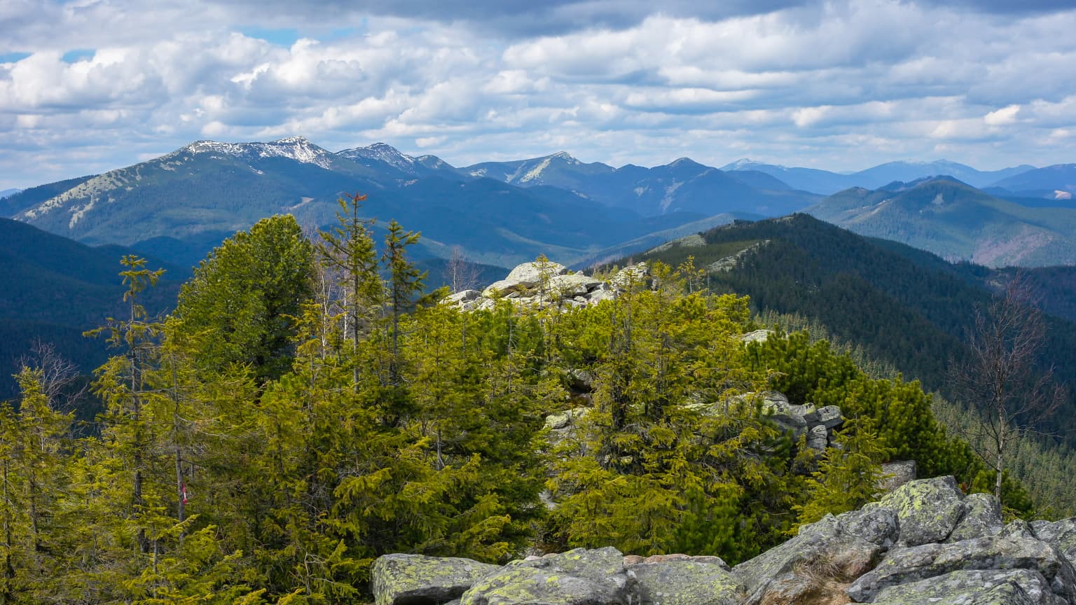
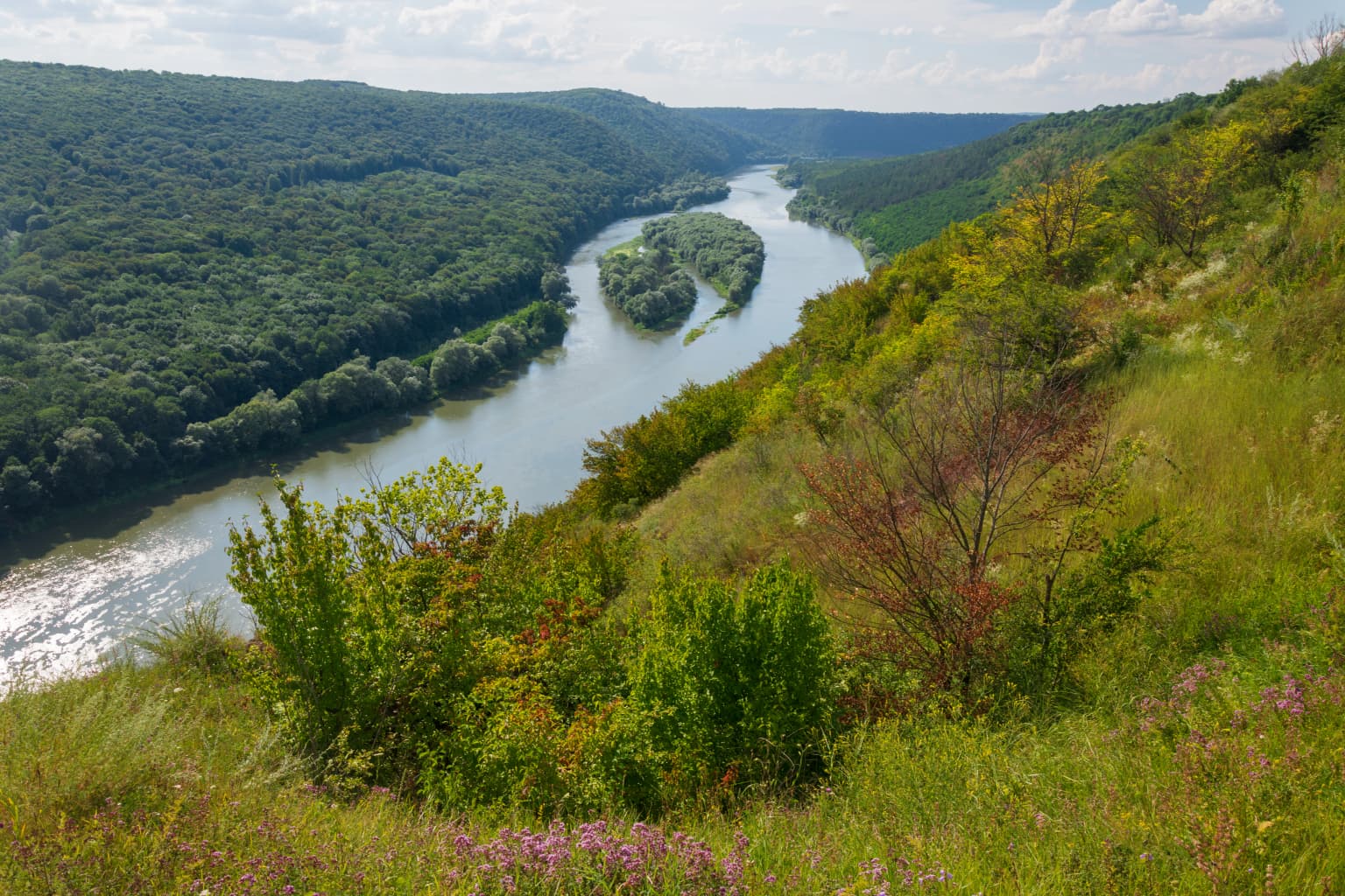
Dniester Canyon National Nature Park landscape and geographic character

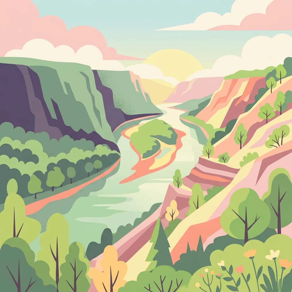
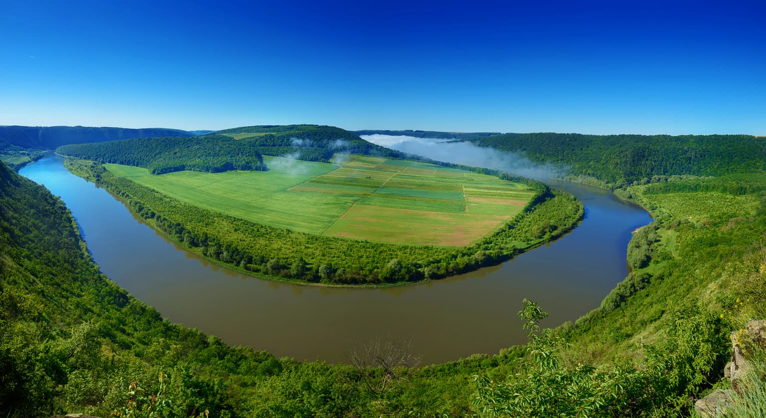
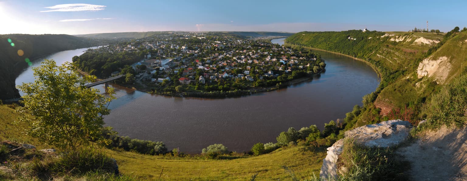
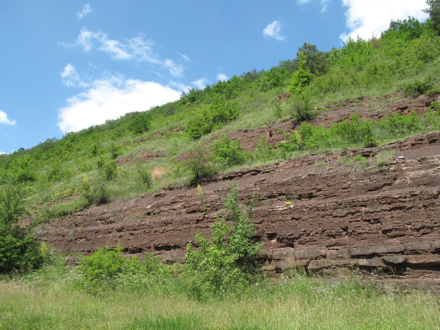
The Dniester Canyon landscape is defined by the dramatic incision of the Dniester River through the Podilian Upland, creating one of Europe's most impressive river gorges. The canyon extends approximately 250 kilometers in total, forming dozens of spectacular meanders as the river winds through the region. Within the park's boundaries, the river flows for about 100 kilometers, with the protected corridor typically spanning 5 to 10 kilometers on either side. The canyon walls rise steeply from the water, exposing geological formations spanning approximately 420 million years of Earth's history. The landscape features numerous rock cliffs, some covered in velvety green mosses and algae, with travertine formations being particularly notable for their dramatic shapes, caves, grottoes, overhangs, waterfalls, stalagmites, and stalactite formations. The park encompasses scenic islands in the river, cascading streams fed by powerful springs that tumble down to the Dniester via waterfalls, and a variety of habitats from forested slopes to riverside meadows. The Dzhurynskyi waterfall, with its three cascades totaling 16 meters in height, stands as the largest plain waterfall in Ukraine.

Wide-angle view of the Dniester River curving through a canyon, with a small town nestled on the riverbank, surrounded by rolling hills and greenery
Panoramic view of the Dniester River winding through the canyon with a riverside town visible

Dniester Canyon National Nature Park ecosystems, habitats, and plant life

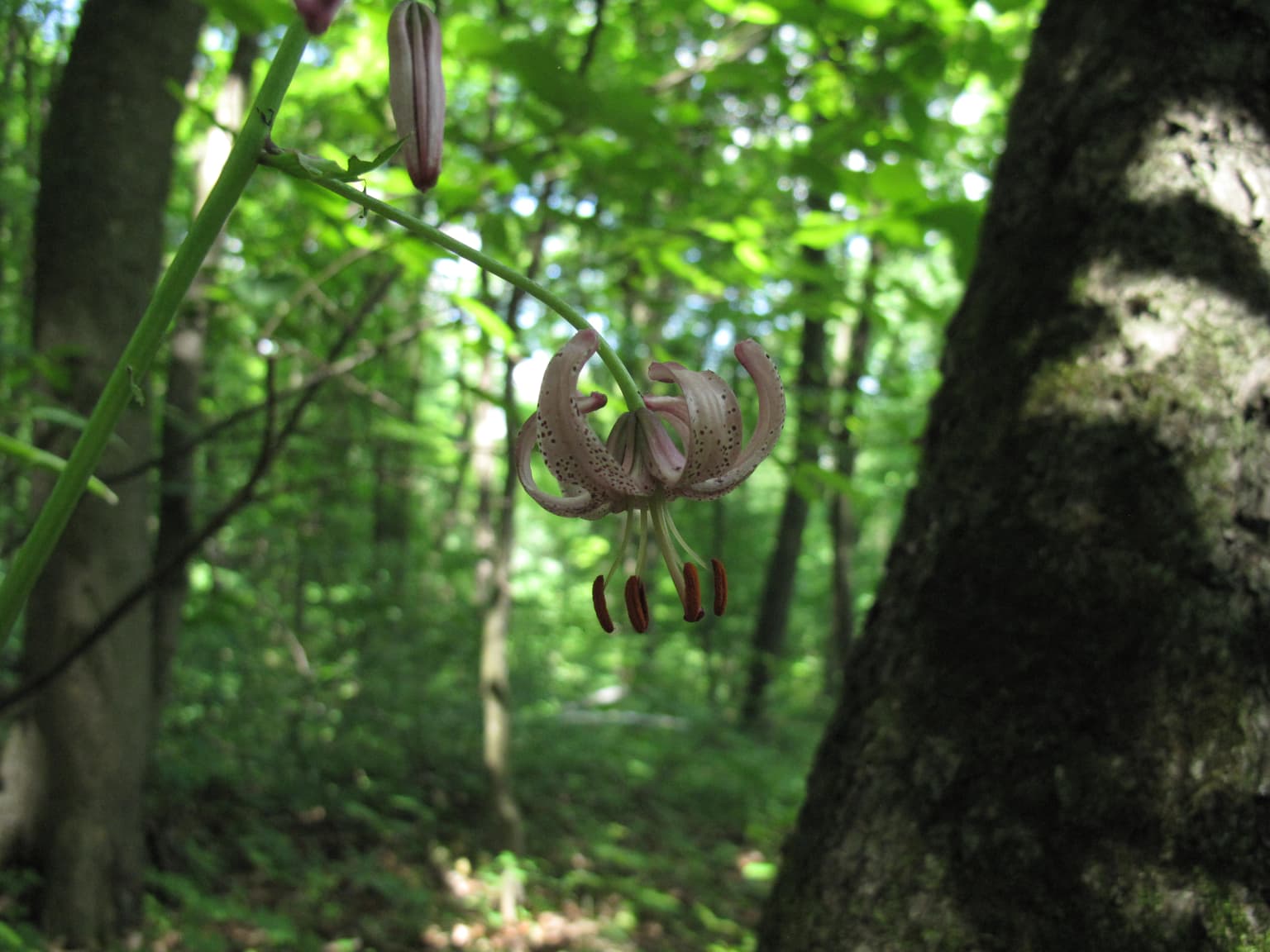
The nature of Dniester Canyon National Nature Park reflects the unique ecological conditions created by the canyon landscape and its position at the boundary between forest-steppe and Carpathian regions. The warm microclimate within the canyon, generated by the sun-warmed cliff walls that trap heat and shelter the area from cold winds, supports vegetation that blooms two to three weeks earlier than in surrounding territories. The park sits at the southern edge of the Central European mixed forests ecoregion, characterized by a humid continental climate with warm summers. The vegetation includes rare cliff-dwelling plants, relic forest communities, rock flora, and meadow-steppe species. The high left riverbanks support vegetation diversity that surpasses even the Kremenetskyi Hills and Podilian Tovtry. The slopes contain numerous relic, endemic, and rare species including Martagon lily, spring adonis, primrose, Roman chamomile, Russian houseleek, two-rowed ephedra, white fraxinella, steppe almond, round-headed leek, Podilian broom, Polish meadowsweet, feather grass, and various rare orchids.

Layered red sandstone formations on a grassy hillside under blue sky with scattered clouds
Devonian-era red sandstone cliffs in Dniester Canyon National Nature Park

Dniester Canyon National Nature Park wildlife and species highlights

The wildlife communities of Dniester Canyon support a rich diversity of species across multiple habitat types. The forests are home to roe deer, European hares, European badgers, red foxes, wild boars, and red squirrels. Rocky slopes and thickets harbor various reptiles including lizards, smooth snakes, and vipers. The bird population is particularly diverse, with species adapted to forests, meadows, river floodplains, and steep hillside habitats including cuckoos, nightingales, woodpeckers, swallows, ducks and geese, gulls, grey and white herons, black storks, ravens, hawks, and kites. The Dniester River contains approximately 40 fish species including carp, chub, perch, catfish, barbel, bream, pikeperch, pike, and bleak, with the river considered one of the cleanest in Europe. The park supports numerous rare and endangered insect species, with over 50 species listed in the Red Book of Ukraine including the beautiful demoiselles, emperor dragonfly, cordulogaster, Polish cochineal, and various beetles and butterflies.

Panoramic view of mountainous landscape with rocky foreground, dense green forests, and snow-capped peaks under partly cloudy sky
Snow-covered peaks of Gorgany and Dovzhanka visible from Yavirnyk ridge

Dniester Canyon National Nature Park conservation status and protection priorities

Dniester Canyon National Nature Park holds significant conservation value as one of Ukraine's premier protected areas for geological, ecological, and landscape preservation. The park protects the largest canyon in Ukraine and one of Europe's most significant river gorges, preserving exceptional geological heritage including Silurian and Devonian rock exposures spanning hundreds of millions of years. The travertine cliffs represent unique geological formations of exceptional beauty and scientific importance. The park incorporates numerous protected areas including nature reserves of national significance including the Kasperivskyi Landscape Reserve, Obizhevskyi Botanical Reserve, and Zhizhavskyi Botanical Reserve, along with geological monuments such as Optymistychna Cave, Ozerna Cave, Kryštaleva Cave, Verteba Cave, and Yuvileina Cave. Many plant and animal species within the park are protected under the Red Book of Ukraine, and certain plant communities are recorded in the Green Book of Ukraine. The park's caves represent some of the world's longest gypsum cave systems, making them globally significant for speleological research.

Dniester Canyon National Nature Park cultural meaning and human context

The Dniester Canyon region has been inhabited for millennia, with evidence of human use of the caves dating to ancient times when they served as dwellings and for ceremonial purposes. The dramatic landscape has shaped regional identity and settlement patterns, with historic towns and villages perched along the canyon rim. The park contains historical monuments including the ruins of Chervonohrod Castle and remnants of the Ascension of the Virgin Mary church. The canyon region forms part of the broader Dnister landscape that has been celebrated in Ukrainian culture and literature. The area is part of the historic Podilia region, which has its own distinctive cultural heritage shaped by centuries of diverse population influences.

Pink martagon lily with curved petals and brown anthers hanging from a stem in a forest
Martagon lily in forest setting

Top sights and standout views in Dniester Canyon National Nature Park

Dniester Canyon National Nature Park offers exceptional natural and cultural attractions including the dramatic canyon landscape with its towering travertine cliffs, the extraordinary Optymistychna Cave at over 230 kilometers in length making it one of the world's longest gypsum caves, the spectacular Dzhurynskyi waterfall with its three cascades descending 16 meters, the unique warm microclimate allowing early spring blooms, the rich biodiversity supporting numerous rare species, and the network of protected geological monuments and nature reserves embedded within the park. Visitors can explore tourist trails like the Farykova Krynnychka route through theHlody tract and the Ustechko-Chervone-Nyrkiv route showcasing rare flora and fauna. The park also features the Devonian red sandstones, the Maiden's Tears waterfall in the Pustelnia tract, and the oldest Early Christian cave church in Ukraine.

A winding river flows through a deep canyon with lush green hills and vegetation in the foreground
Panoramic view of the Dniester River winding through forested canyon hills

Best time to visit Dniester Canyon National Nature Park

The park can be visited throughout the warmer months, with late spring through early autumn offering the most comfortable conditions for exploration. The unique canyon microclimate means that spring arrives earlier here than in surrounding regions, often two to three weeks ahead of schedule, making late April and May particularly rewarding for observing blooming vegetation. Summer months provide warm conditions ideal for hiking the various tourist trails and exploring the cave systems, though the shaded canyon walls and river areas offer natural cooling. Autumn offers pleasant temperatures and the opportunity to witness the fall coloration of the forests that clothe the canyon slopes. The winter season is less suitable for general visitation, though the cave systems maintain relatively stable temperatures year-round.

Park location guide

Geography guide, regional context, and park location map for Dniester Canyon National Nature Park

Dniester Canyon National Nature Park park geography, regions, and map view in Ukraine
Understand where Dniester Canyon National Nature Park sits in Ukraine through a broader geographic reading of the surrounding landscape, nearby location context, and its mapped position within the national park landscape.

How Dniester Canyon National Nature Park fits into Ukraine

Ukraine is a sovereign nation in Eastern Europe, bordered by Russia, Belarus, Poland, Slovakia, Hungary, Romania, Moldova, and the Black Sea. It is the second-largest country in Europe by area. Kyiv is the capital and largest city, followed by Kharkiv, Odesa, and Dnipro. The official language is Ukrainian. Ukraine has a population of approximately 32.9 million and operates as a unitary semi-presidential republic.

Wider geography shaping Dniester Canyon National Nature Park in Ukraine

Ukraine occupies 603,628 km² in Eastern Europe, making it the second-largest country in Europe. It shares borders with Russia, Belarus, Poland, Slovakia, Hungary, Romania, and Moldova. The country has a southern coastline along the Black Sea and Sea of Azov. The terrain includes plains, steppes, and the Carpathian Mountains in the west.

Map view of Dniester Canyon National Nature Park

Use this park location map to pinpoint Dniester Canyon National Nature Park in Ukraine, understand its exact geographic position, and read its mapped placement within the surrounding landscape more clearly.

Pigeon | © OpenStreetMap contributors

Location context for Dniester Canyon National Nature Park

Ternopil Oblast

Explore the geological marvels, unique riverine habitats, and stunning scenery that define this Ukrainian protected area.

Dniester Canyon National Nature Park Photos: Visualizing Ukraine's Dramatic River Gorge and Protected Landscapes
Explore the captivating landscapes of Dniester Canyon National Nature Park through a curated visual gallery, revealing its dramatic river bends, towering cliffs, and unique geological formations. The imagery offers an essential resource for understanding the park's diverse habitats, rich geological heritage, and the distinct protected-area environment of this significant Ukrainian canyon.

Wide panoramic view of a winding river surrounded by green fields and forests under a clear blue sky

Wide landscape view of the Dniester River winding through forested hills with autumn foliage

Wide-angle view of the Dniester River curving through a canyon, with a small town nestled on the riverbank, surrounded by rolling hills and greenery

Layered red sandstone formations on a grassy hillside under blue sky with scattered clouds

Panoramic view of mountainous landscape with rocky foreground, dense green forests, and snow-capped peaks under partly cloudy sky

River reflecting sunset sky with forested hills on both sides

Pink martagon lily with curved petals and brown anthers hanging from a stem in a forest

A winding river flows through a deep canyon with lush green hills and vegetation in the foreground

Rocky cliff face with green vegetation, a small waterfall, and a cave-like opening

Common White-legged Damselfly perched on a blade of grass surrounded by green foliage and purple wildflowers

Park atlas

Trace the protected landscapes and distinct park geography of Ternopil Oblast, comparing areas adjacent to Dniester Canyon National Nature Park.

Explore Other National Parks and Protected Areas Near Dniester Canyon National Nature Park in Ukraine
Browse national parks and protected areas near Dniester Canyon National Nature Park, discovering diverse geological formations and riverine landscapes across western Ukraine. Compare the unique canyon features and cave systems of Dniester Canyon with other regional conservation efforts and protected territories within Ternopil Oblast and beyond.
Watercolor illustration of a mountainous landscape with green hills, trees, and a river valley
National parkUkraine

Khotyn National Nature Park: Ukraine's National Park Atlas and Protected Landscape

Explore geographic boundaries and natural terrain.

Delve into the details of Khotyn National Nature Park, a protected national park situated within Ukraine. This entry offers precise geographic insights, focusing on the park's mapped terrain and its role as a significant protected landscape. Discover the regional context and understand its distinct natural features, providing a structured view for atlas-based exploration of Ukrainian protected areas.

Area
94 km²
Established
2010
IUCN
II
Relief
Mixed relief
National parkChernivtsi Oblast

Vyzhnytsia National Nature Park: Protected National Park Landscape Exploration

Mapped boundaries and regional terrain in Chernivtsi Oblast.

Delve into the specific protected landscape of Vyzhnytsia National Nature Park, a designated national park in Ukraine's Chernivtsi Oblast. This detailed entry provides context on its geographic positioning, mapped natural features, and the surrounding regional terrain, aiding in structured atlas exploration and understanding its significance within the protected areas network.

Area
7,928.4 km²
Established
1995
IUCN
II
Relief
Mountain
National parkVerkhovyna Raion

Verkhovyna National Nature Park: Explore Protected Landscape Geography in Verkhovyna Raion

Discover Ukraine's Verkhovyna National Nature Park mapped terrain.

Verkhovyna National Nature Park represents a vital protected area within the Verkhovyna Raion of Ukraine. This detailed atlas entry focuses on the park's geographic significance, providing insights into its mapped boundaries and its role within the regional landscape context of the Carpathian Mountains. It serves as a focused point for understanding the park's protected status and its place in a structured geographic discovery framework.

Area
120 km²
Established
2010
IUCN
II
Relief
Mountain
Watercolor illustration of a mountainous landscape with forests, a lake, and distant peaks.
National parkChernivtsi Oblast

Cheremosh National Nature Park: Protected Landscape and Geographic Context in UA

Explore mapped boundaries within Chernivtsi Oblast

Cheremosh National Nature Park represents a vital protected area within Ukraine's Chernivtsi Oblast. This entry offers a structured exploration of the park's geographic identity, focusing on its mapped boundaries and its significance as part of the regional natural landscape. Delve into the terrain and understand how Cheremosh National Nature Park contributes to the mapped geography of western Ukraine, providing a foundation for atlas-based discovery.

Area
71 km²
Established
2009
IUCN
II
Relief
Mountain
National parkIvano-Frankivsk Oblast

Halych National Nature Park: Ivano-Frankivsk Oblast National Park Atlas & Geography

Mapped protected boundaries and landscape context.

Halych National Nature Park is a vital protected area situated in the Ivano-Frankivsk Oblast of Ukraine, characterized by its transitional landscape where Carpathian foothills merge with the East European Plain. This national park offers a rich tapestry of environments, including oak-hornbeam and oak-beech forests, vital wetlands, and scarce steppe remnants, creating a mosaic of habitats mapped meticulously within the MoriAtlas platform. Explore the park's geographic identity, its diverse terrain, and its significance as a conservation landscape for understanding regional biodiversity.

Area
147 km²
Established
2004
IUCN
II
Relief
Lowland
National parkIvano-Frankivsk Oblast

Carpathian National Nature Park: Protected Landscape Within Ivano-Frankivsk Oblast

National Park mapped boundaries and regional geography.

Carpathian National Nature Park represents a significant protected area within Ivano-Frankivsk Oblast, Ukraine. This page offers detailed insights into its protected landscape identity, helping users understand its geographic setting and mapped boundaries. As part of the Carpathian region, the park serves as a key point for atlas-based discovery, providing context for its place within the broader geography of western Ukraine.

Area
515.7 km²
Established
1980
IUCN
II
Visitors
1M annual
National parkIvano-Frankivsk Oblast

Syniohora National Nature Park: Protected Carpathian Landscape and Geographic Context

Explore the mapped terrain and protected area boundaries within the Gorgany mountains.

Syniohora National Nature Park, located in Ivano-Frankivsk Oblast, is a vital protected area safeguarding a significant portion of the Gorgany mountain massif. This park offers a unique opportunity to explore the mapped geography and natural landscape characteristic of the Ukrainian Carpathians. Its establishment as a national park underscores the importance of preserving the region's mountain terrain, protected forest ecosystems, and distinctive natural heritage for structured geographic discovery.

Area
108.66 km²
Established
2009
IUCN
II
Scope
Terrestrial
Watercolor illustration of a mountainous landscape with rolling hills, a river, and green vegetation
Protected landscapeMaramureș County

Maramureș Mountains Natural Park: Protected Landscape and Carpathian Geography

Explore the mapped boundaries and dramatic terrain of Romania's largest nature park.

Delve into the Maramureș Mountains Natural Park, a protected landscape covering extensive tracts of the northern Carpathian Mountains. This page provides detailed geographic context, showcasing the park's mapped boundaries, diverse alpine terrain, and its role within the broader regional geography of Maramureș County. Understand the natural features and protected area significance of this expansive Carpathian wilderness for structured atlas exploration.

Area
1,488.5 km²
Established
2004
IUCN
V
Relief
Mountain

Common questions about visiting, size, designation, and location context for Dniester Canyon National Nature Park

Dniester Canyon National Nature Park FAQs for park facts, access, geography, and protected area context
Find quick answers about Dniester Canyon National Nature Park, including protected-area facts, park geography, trail and visitor context, and how the park fits into its surrounding country and regional landscape.
MoriAtlas Explorer

Continue Your Protected Areas Search Across the Global Atlas

Deepen your exploration by continuing the structured search for national parks and protected areas worldwide. Utilize the comprehensive filtering capabilities to compare different conservation landscapes and refine your understanding of global park geography. Discover more about the distribution and characteristics of protected natural areas.

Global natural geography