Mori Atlas logo
National parkDomogled-Valea Cernei National Park

Detailed views of protected land boundaries and regional natural landscape context.

Domogled-Valea Cernei National Park: Protected Area & Geographic Identity

(Parcul Național Domogled-Valea Cernei)

Domogled-Valea Cernei National Park represents a significant protected natural landscape within Romania, identified as a National Park. This dedicated atlas view provides a structured exploration of its mapped boundaries, allowing for a clear understanding of its geographic placement and the surrounding natural terrain. Delve into the park's specific identity as a protected area and its contribution to regional geography, using this page as your entry point for detailed map-based discovery.

Carpathian MountainsKarst LandscapeCaves and SinkholesMountain Nature ReserveNational ParkSouthern Carpathians

Domogled-Valea Cernei National Park

National park

Park overview

Structured park overview, official facts, and landscape profile for Domogled-Valea Cernei National Park

Domogled-Valea Cernei National Park park facts, protected area profile, and essential visitor context
Review the core facts for Domogled-Valea Cernei National Park, including designation, size, terrain, visitor scale, habitats, and operating context in one park-focused overview.

About Domogled-Valea Cernei National Park

Domogled-Valea Cernei National Park occupies a substantial area of mountainous terrain in the southern Carpathian Mountains of Romania, representing a protected landscape of considerable ecological and geological importance. The park spans the border region of three counties, creating a large contiguous protected area that encompasses several distinct mountain ranges within the Retezat-Godeanu Mountains group. The terrain is dominated by rugged mountain relief including cirques, steep peaks, and deeply incised valleys carved by the Cerna River and its tributaries. Karst geology dominates much of the landscape, with limestone formations creating distinctive surface features including sinkholes, limestone pavements, and an extensive network of caves and pit caves. The park's establishment in 2000, following an earlier designation in 1982, reflects Romania's commitment to preserving this significant mountain ecosystem. The protected area serves as a corridor for wildlife movement and protects watershed areas that feed into the Cerna River system, which ultimately flows into the Danube.

Quick facts and research context for Domogled-Valea Cernei National Park

Domogled-Valea Cernei National Park encompasses over 61,000 hectares of mountainous terrain in the Southern Carpathians, making it one of Romania's larger protected areas. The park contains multiple nature reserves including Coronini-Bedina, Domogled, Piatra Cloșanilor, and Cheile Corcoaiei. Its terrain features extensive karst topography with numerous caves, sinkholes, and limestone formations. The park protects habitat types characteristic of the Retezat-Godeanu Mountains group, including beech forests, alpine meadows, and riparian corridors. The nearest settlement of note is the historic town of Orșova.

Park context

Deeper park guide and search-rich context for Domogled-Valea Cernei National Park

Domogled-Valea Cernei National Park history, landscape, wildlife, and travel context
Explore Domogled-Valea Cernei National Park through its history, landscape character, ecosystems, wildlife, conservation priorities, cultural context, and seasonal travel timing in a structured park guide built for atlas discovery and search intent.

Why Domogled-Valea Cernei National Park stands out

This park is best known for its exceptional karst landscape featuring extensive cave systems, sinkholes, and limestone pavements that create a complex underground network. The dramatic mountainous scenery includes cirques, mountain peaks, and cascading waterfalls that define the valleys. The park protects significant Carpathian biodiversity, including rare and endemic species that inhabit its diverse forest types and alpine zones. The combination of karst topography, mountain wilderness, and ecological diversity makes it one of Romania's most geologically and biologically significant protected areas.

Domogled-Valea Cernei National Park history and protected-area timeline

The protection of Domogled-Valea Cernei dates to 1982 when initial designation occurred, though the formal legal establishment came through Law Number 5 of March 6, 2000, published in the Romanian Official Paper. This legislation elevated the area to full national park status under IUCN Category II, providing stronger legal protection and a framework for organized management. The park's creation reflected growing recognition in Romania of the need to preserve the Carpathian region's unique biodiversity and geological features. The historical context includes the broader Carpathian conservation movement in Romania that identified these mountains as priorities for protection due to their ecological significance and relatively intact ecosystems.

Domogled-Valea Cernei National Park landscape and geographic character

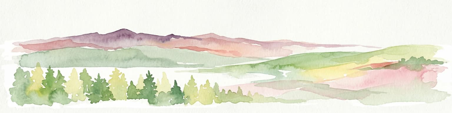
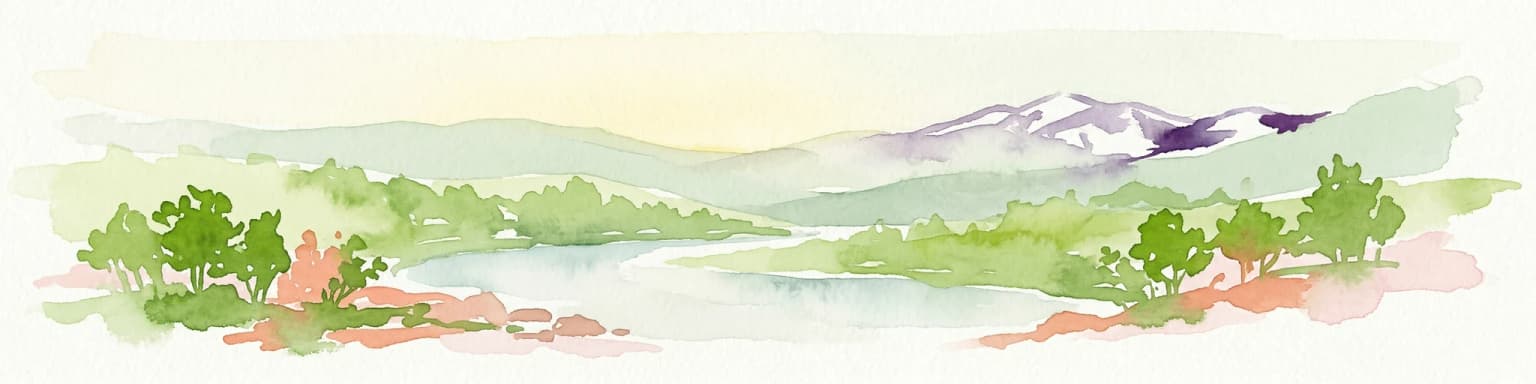
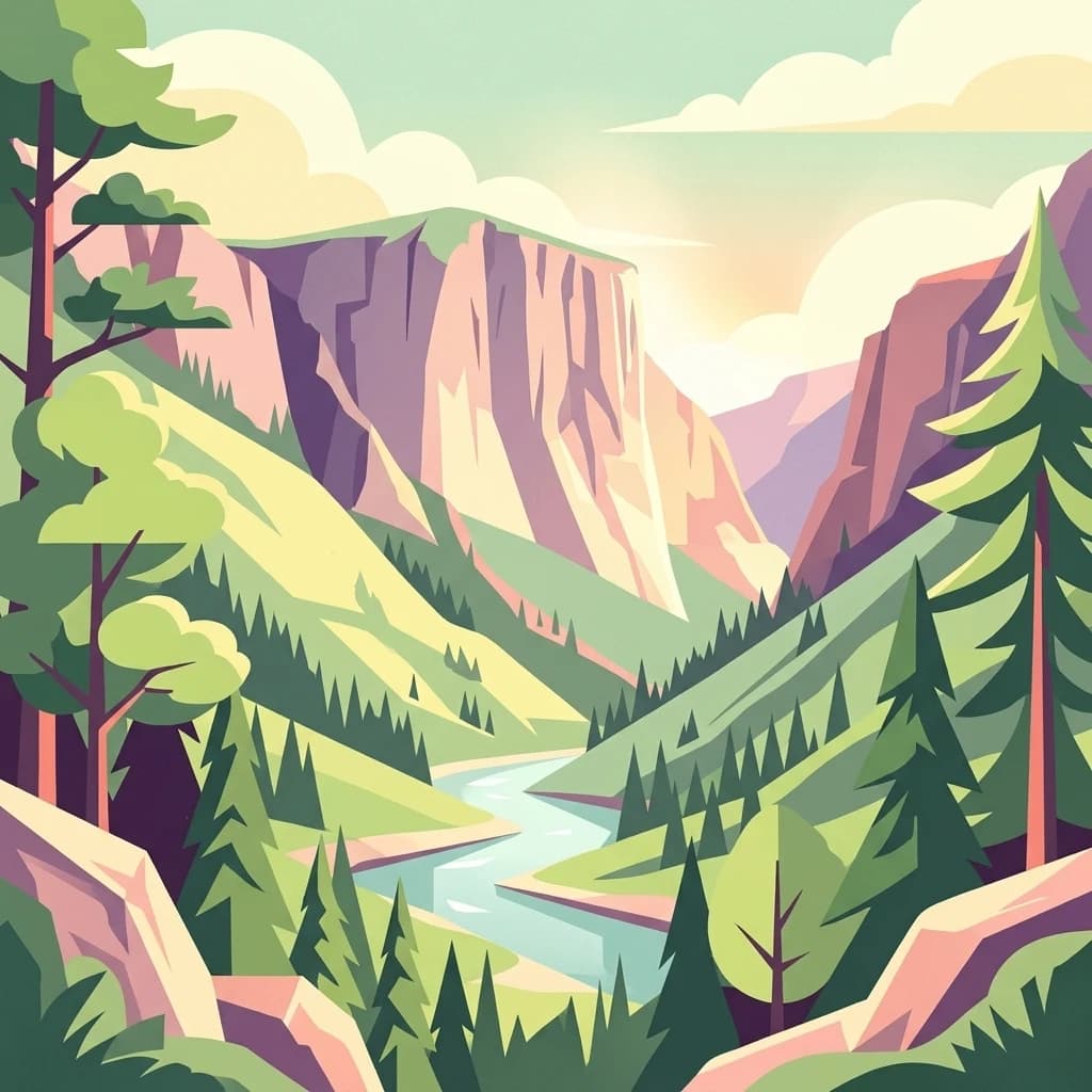
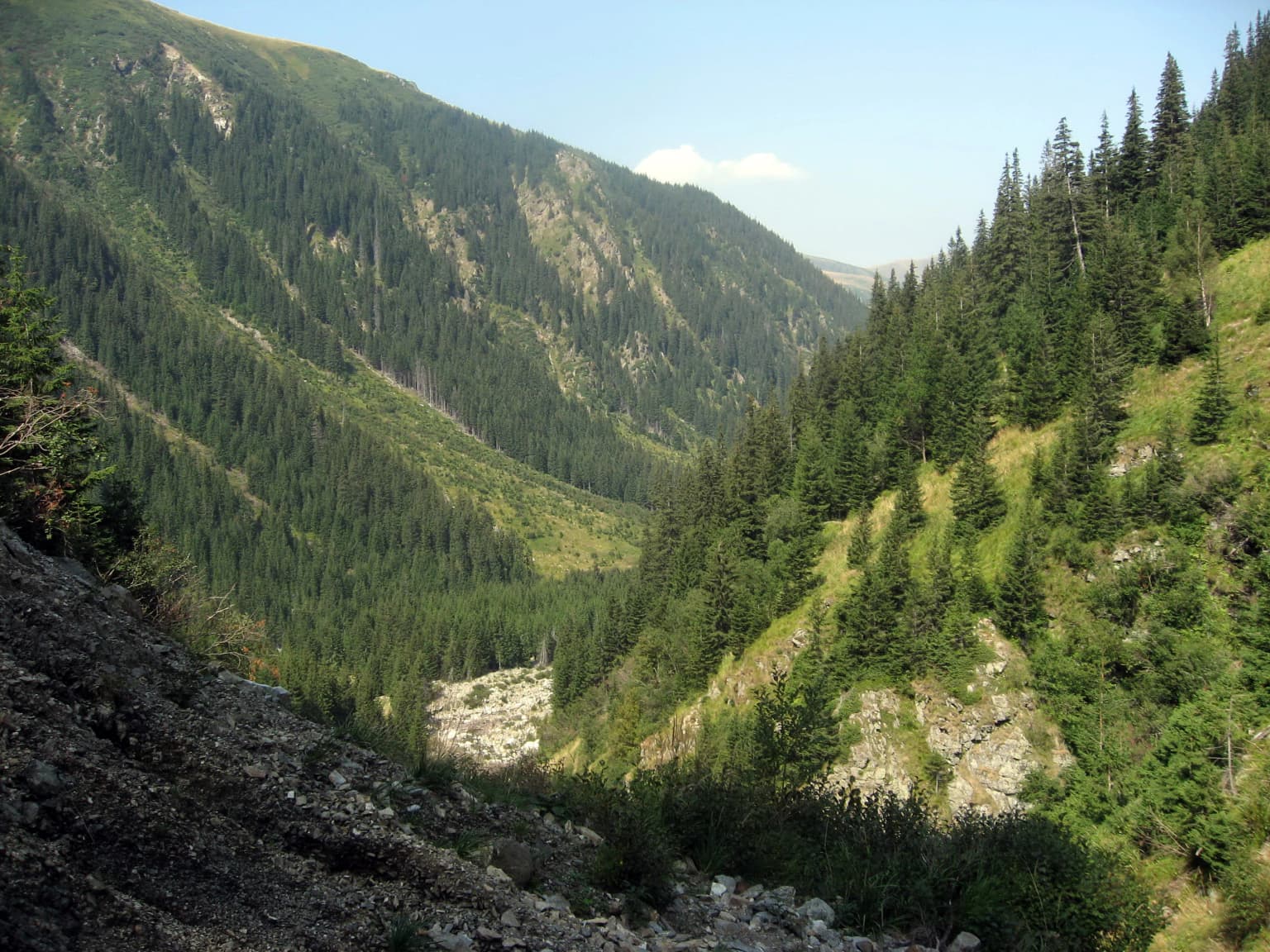
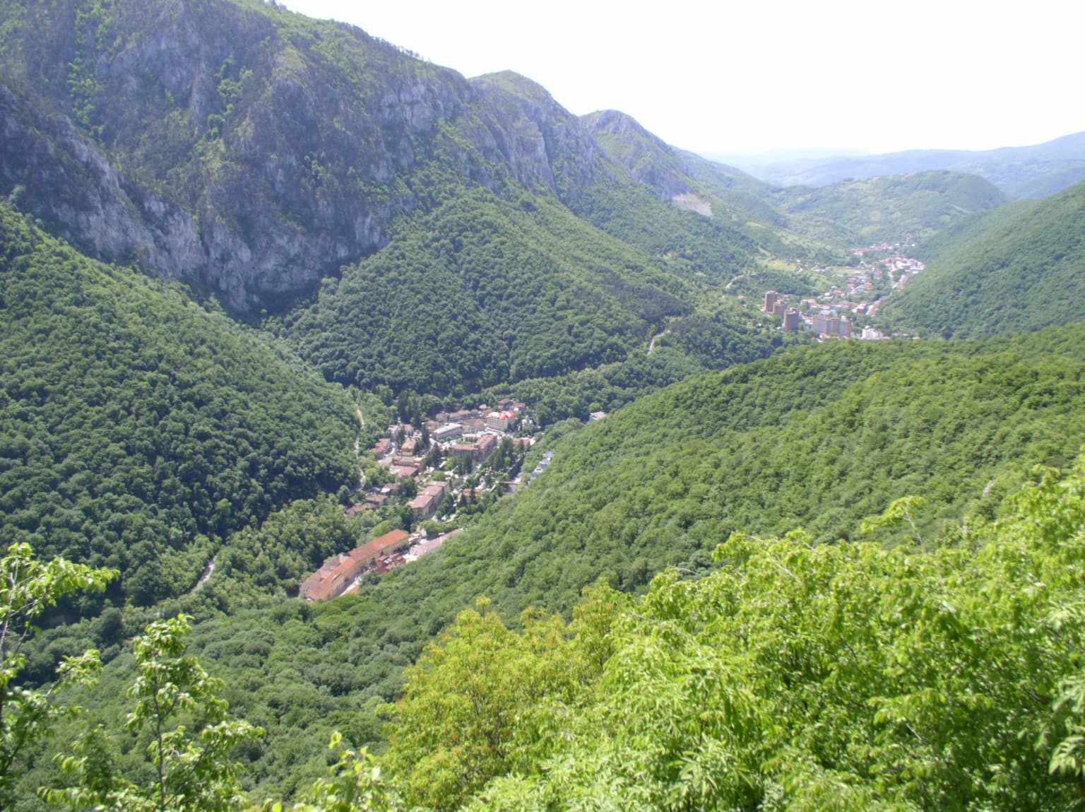
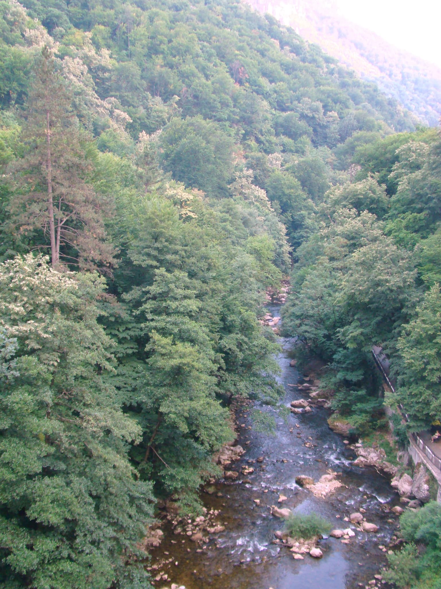
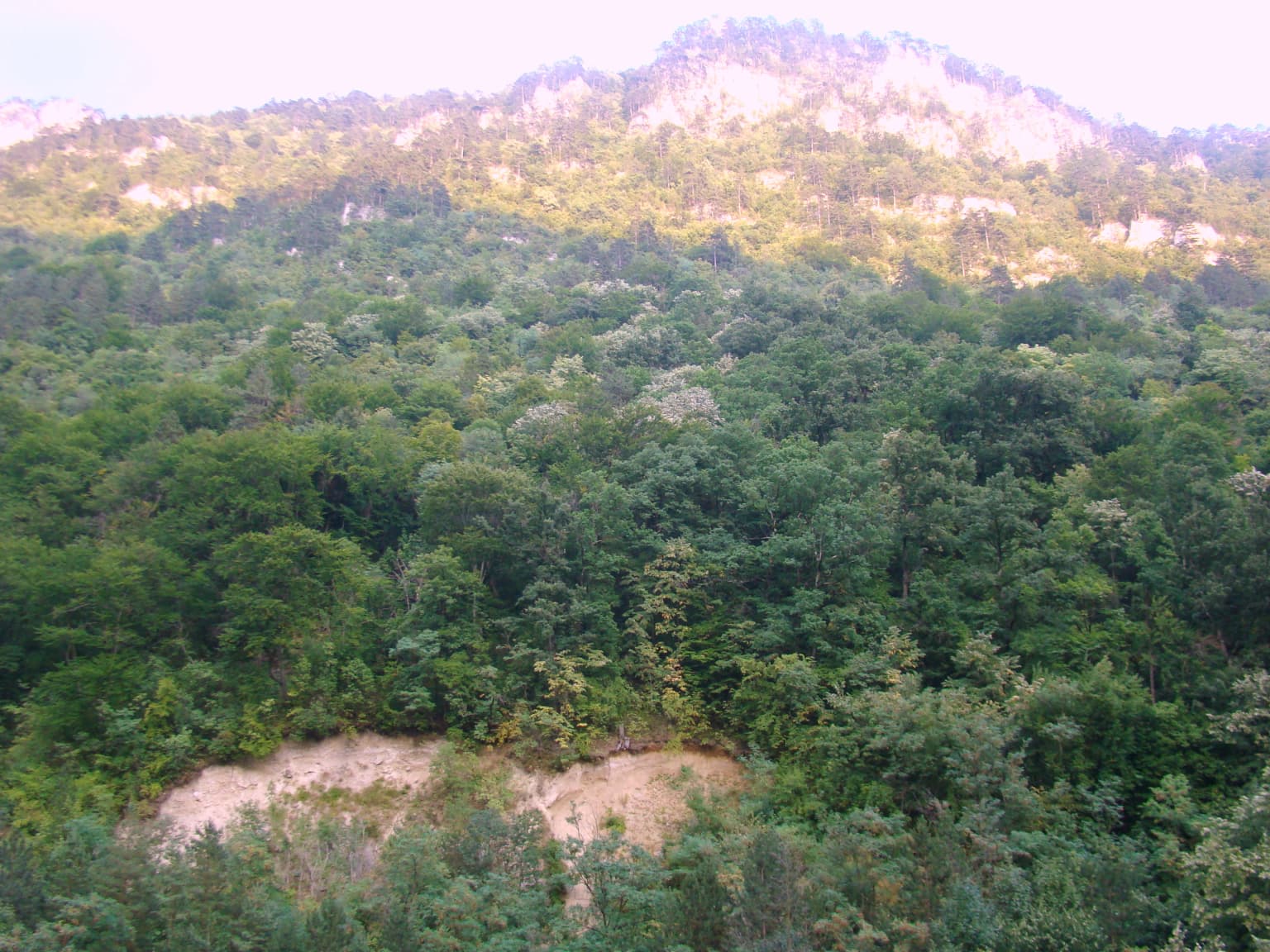
The physical landscape of Domogled-Valea Cernei is characterized by mountainous terrain of considerable diversity, shaped by both geological and erosional processes over millions of years. The park encompasses portions of several mountain ranges: the Cerna Mountains on the right side, the Godeanu Mountains rising alongside, with the Vâlcan Mountains and Mehedinți Mountains forming the left boundary. The terrain features dramatic relief including cirques, mountain peaks, and steep-sided valleys. Karst topography is a defining characteristic, with extensive limestone formations producing sinkholes, cave entrances, and distinctive limestone pavement exposures. The valley floors contain waterfalls where streams cascade over rock steps, adding to the scenic diversity. The elevation range supports distinct ecological zones from lower forested slopes up to alpine terrain.

Domogled-Valea Cernei National Park ecosystems, habitats, and plant life

The ecological character of Domogled-Valea Cernei is defined by a complex mosaic of habitat types supporting considerable biodiversity. The park contains multiple distinct forest types including Beech forests of the Symphyto-Fagion and Asperulo-Fagetum communities, Medio-European beech forests of the Cephalanthero-Fagion type, and acidic spruce forests of the Vaccinio-Piceetea class in higher elevations. The Illyrian forests of Fagus sylvatica represent southeastern European forest types, while alluvial forests along watercourses feature alder and ash. The habitat diversity extends to include Alpine and boreal shrubberies, calcareous meadows at high elevations, and riparian vegetation along mountain streams. The karst geology creates additional specialized habitats including cave systems and petrifying springs with travertine formation.

Domogled-Valea Cernei National Park wildlife and species highlights

The wildlife community within Domogled-Valea Cernei reflects the Carpathian region's status as a biodiversity hotspot in Europe. The diverse forest habitats support populations of large mammals typical of Carpathian ecosystems, while the varied elevation zones and habitat types create conditions for species ranging from lowland forest dwellers to alpine specialists. The presence of rare and endemic species within the park highlights its conservation significance, with some species found nowhere else or only in limited Carpathian populations. The cave systems provide habitat for specialized underground species, and the watercourses support aquatic communities adapted to mountain stream conditions.

Domogled-Valea Cernei National Park conservation status and protection priorities

Domogled-Valea Cernei holds significant conservation value as one of Romania's larger national parks protecting Southern Carpathian mountain ecosystems. The park's protection extends to multiple habitat types listed under European conservation frameworks, including beech forests, alpine meadows, and karst formations. The presence of rare and endemic species adds to the conservation importance, with some species representing Carpathian endemics of particular concern. The park's designation as IUCN Category II reflects its primary objective of protecting natural ecosystems while allowing for limited human use consistent with conservation values. The network of nature reserves within the park provides additional protection for specific areas of particular ecological significance.

Domogled-Valea Cernei National Park cultural meaning and human context

Domogled-Valea Cernei lies within a region of the Carpathians with historical human presence and connection to the landscape. The nearby town of Băile Herculane represents a historic spa tradition in the broader region, utilizing natural springs that emerge in karst terrain similar to that found within the park. The Carpathian region more broadly has been shaped by traditional pastoral activities and forest use, though the park's rugged mountain terrain has limited intensive human modification compared to lower-lying areas. The cultural context reflects the broader Carpathian identity of Romania, where mountain communities have maintained connections to these landscapes over generations.

Top sights and standout views in Domogled-Valea Cernei National Park

The park's most distinctive features include its extensive karst landscape with caves and sinkholes, dramatic mountain cirques, and waterfall-filled valleys characteristic of the Southern Carpathians. The diversity of forest types from beech-dominated lower slopes to spruce forests in higher elevations creates a layered landscape of ecological interest. The presence of rare and endemic species, particularly in the context of Carpathian biodiversity significance, adds scientific value to the scenic qualities. Multiple nature reserves within the park provide specific focal areas for protection and potential research.

Best time to visit Domogled-Valea Cernei National Park

The park can be visited throughout the year, with each season offering different characteristics of the mountain environment. Summer months provide the most accessible conditions for trail exploration and wildlife observation, with warmer temperatures allowing extended time in higher elevations. Autumn brings forest color changes particularly striking in the beech-dominated woodlands. Winter access is limited in higher terrain but offers opportunities for those prepared for mountain winter conditions. Spring and early summer correspond with waterfall flows sustained by snowmelt and increased water availability.

Park location guide

Geography guide, regional context, and park location map for Domogled-Valea Cernei National Park

Domogled-Valea Cernei National Park park geography, regions, and map view in Romania
Understand where Domogled-Valea Cernei National Park sits in Romania through a broader geographic reading of the surrounding landscape, nearby location context, and its mapped position within the national park landscape.

How Domogled-Valea Cernei National Park fits into Romania

Romania is a unitary semi-presidential republic located in Southeast and Central Europe. It borders Ukraine, Hungary, Serbia, Bulgaria, Moldova, and the Black Sea. The country has a population of approximately 19 million and covers an area of 238,397 km². Bucharest is the capital and largest city. Romania joined the European Union in 2007.

Wider geography shaping Domogled-Valea Cernei National Park in Romania

Romania lies on the lower course of the Danube River, north of the Balkan Peninsula, and on the northwestern shore of the Black Sea. The terrain is varied, featuring the Carpathian Mountains in the center, the Transylvanian Plateau, the Moldavian Plateau, and plains along the Danube and in the south. The country has a diverse landscape that includes forests, meadows, and wetland areas.

Map view of Domogled-Valea Cernei National Park

Use this park location map to pinpoint Domogled-Valea Cernei National Park in Romania, understand its exact geographic position, and read its mapped placement within the surrounding landscape more clearly.

Pigeon | © OpenStreetMap contributors

Location context for Domogled-Valea Cernei National Park

Caraș-Severin CountyGorj CountyMehedinți County
Park atlas

Trace the broader geographic spread of protected areas, comparing landscapes surrounding Domogled-Valea Cernei National Park in the Southern Carpathians.

Discover Nearby National Parks and Protected Areas Beyond Domogled-Valea Cernei National Park
Users can explore a curated list of national parks and protected areas geographically connected to Domogled-Valea Cernei National Park, showcasing the diverse Carpathian landscape. Continue your discovery by comparing other mountain reserves, karst regions, and significant conservation sites that share similar regional context and ecological importance.
Watercolor illustration showing rolling hills, scattered trees, and a soft pink sky
Protected landscapeMehedinți County

Mehedinți Plateau Geopark Protected Landscape: Karst Geography and Regional Context

Explore Romania's unique limestone formations and karst landscapes.

The Mehedinți Plateau Geopark in Mehedinți County, Romania, is a significant protected landscape celebrated for its extensive karst features. This page offers detailed insights into the park's mapped boundaries, including its famous natural bridges like Podul lui Dumnezeu, vast limestone pavements, and cave systems. Understand its position within the broader regional geography of southwestern Romania, providing a solid foundation for atlas-driven exploration of this geologically rich area.

Area
1,065 km²
Established
2005
IUCN
V
Relief
Upland
Watercolor illustration of a mountain range with forests, a lake, and distant hills under a light sky
National parkHunedoara County

Retezat National Park National Park: Protected Landscape and Regional Geography

Mapped boundaries and landscape context in Hunedoara County.

Retezat National Park is a key protected area featured within MoriAtlas, offering structured geographic data and map-based insights. This national park's protected landscape is situated in Hunedoara County, Romania, contributing significantly to the regional topography and natural context of the Southern Carpathians. Explore its mapped boundaries and understand its role as a distinct natural entity.

Area
380.47 km²
Established
1935
IUCN
II
Relief
Mountain
National parkGorj County

Defileul Jiului National Park: Romania's Protected National Park Landscape in Gorj County

Explore maps, geography, and protected area context.

Defileul Jiului National Park is a vital protected natural area situated in Gorj County, Romania. This MoriAtlas page serves as a detailed entry point for understanding the park's specific geography, its mapped perimeters, and its significance within the regional landscape atlas. Discover the park's topographic features and its relationship to the surrounding terrain of the Southern Carpathians, providing essential context for geographic exploration.

Area
111.27 km²
Established
2005
IUCN
II
Relief
Mountain
Watercolor illustration of a river flowing through a valley with mountains in the background
Protected landscapeRomania

Iron Gates Natural Park: Explore Romania's Protected Landscape and Geographic Context

Detailed atlas view of a protected landscape in Romania.

Uncover the geographic dimensions of Iron Gates Natural Park, a protected landscape situated in Romania. This detailed entry offers an atlas-centric exploration of its mapped boundaries and regional setting, facilitating a deeper understanding of its protected status and landscape features within the national geography. Discover the park's intrinsic value through structured geographic data and visual map context.

Area
1,156.66 km²
Established
2000
Relief
Mixed relief
Climate
Mediterranean
Protected landscapeHunedoara County

Grădiștea Muncelului-Cioclovina Natural Park: Protected Landscape in Hunedoara County Atlas

Explore protected area geography and mapped boundaries.

Gain a structured understanding of Grădiștea Muncelului-Cioclovina Natural Park, a significant protected landscape located in Romania's Hunedoara County. This resource details its geographic position and mapped protected area extent, providing essential context for atlas exploration and regional landscape analysis. It serves as a focused entry point for understanding the park's unique geographic identity within its natural setting.

Area
381.84 km²
Established
2000
IUCN
V
Relief
Mountain
National park

Đerdap National Park: Europe's Grandest River Gorge and Protected Landscape

Explore Serbia's largest national park along the Danube River.

Đerdap National Park is defined by the Iron Gate, Europe's longest and most dramatic river gorge, a geological marvel carved through the Carpathian Mountains. This protected area showcases a complex karst landscape with towering cliffs, deep river sections, and rich biodiversity, including vital Tertiary relict species. The park's vastness and unique terrain offer a profound geographic context for understanding regional natural landscapes and conservation efforts. Explore its mapped boundaries and ecological significance.

Area
637.87 km²
Established
1974
IUCN
II
Relief
Mountain
Watercolor illustration depicting a landscape with mountains, a winding river, and grassy fields
Protected landscape

Vršac Mountains Protected Landscape: A Unique Pannonian Island Mountain Range in Serbia

Explore distinct geological formations and rich avian habitats.

The Vršac Mountains Protected Landscape offers a unique geographic perspective as one of Serbia's Pannonian island mountains, emerging dramatically from the surrounding plains. This protected area is recognized for its striking gneiss and schist formations, its status as Vojvodina's highest elevation, and its exceptional importance for birdwatching, hosting over 120 species. Delve into the mapped terrain and geological character that distinguish this vital natural region.

Area
170 km²
Established
1982
Relief
Mountain
Climate
Temperate
Watercolor illustration of a landscape with mountains, trees, and a river
Protected landscapeSibiu County

Cindrel Natural Park: Protected Landscape within Sibiu County's Regional Geography

Mapped natural landscapes and protected area context.

Delve into the protected landscape of Cindrel Natural Park, situated in Sibiu County, Romania. This page offers a detailed geographic perspective, highlighting the park's mapped boundaries and its role within the broader natural terrain of the Southern Carpathians. Understand the structured atlas data that defines Cindrel Natural Park and its regional significance for protected land discovery.

Area
98.73 km²
Established
2000
IUCN
V
Relief
Mountain

Common questions about visiting, size, designation, and location context for Domogled-Valea Cernei National Park

Domogled-Valea Cernei National Park FAQs for park facts, access, geography, and protected area context
Find quick answers about Domogled-Valea Cernei National Park, including protected-area facts, park geography, trail and visitor context, and how the park fits into its surrounding country and regional landscape.
MoriAtlas Explorer

Continue Your Protected Areas Search Across the Global Atlas

Deepen your exploration by continuing the structured search for national parks and protected areas worldwide. Utilize the comprehensive filtering capabilities to compare different conservation landscapes and refine your understanding of global park geography. Discover more about the distribution and characteristics of protected natural areas.

Global natural geography