
Gorges
Park geography
A structured look at the regional coverage, mountain relief, and karst landscapes
Geography, Terrain, and Mapped Boundaries of Domogled-Valea Cernei National Park in Romania
Domogled-Valea Cernei National Park spans 612.11 square kilometers across the Romanian counties of Mehedinti, Gorj, and Caras-Severin. This geographic profile details the park's mountain terrain, extensive karst systems, and varied natural features like Valful lui Stan and 7 Izvoare Calde.
Carpathian mountain wilderness with karst caves, waterfalls, and diverse Carpathian ecosystems
Domogled-Valea Cernei National Park
Domogled-Valea Cernei National Park is a protected area in southwestern Romania, spanning the Cerna Mountains, Godeanu Mountains, Vâlcan Mountains, and Mehedinți Mountains within the Southern Carpathians. The park covers approximately 61,211 hectares of mountainous terrain characterized by dramatic cirques, sinkholes, limestone pavements, cave systems, and waterfall-strewn valleys. Established by law in 2000 but with designation dating to 1982, the park protects one of Romania's most ecologically significant mountain landscapes, harboring rare and endemic species within its complex mosaic of beech forests, alpine meadows, and karst formations. The park lies within the Cerna River basin and is administered across three counties: Caraș-Severin, Gorj, and Mehedinți.
- Location
- Romania
- Park type
- National park
- Established
- 2000
- Area
- 612.1 km²
Location overview
Administrative boundaries across Caraș-Severin, Gorj, and Mehedinți
Domogled-Valea Cernei National Park Geographic Location and Regional Atlas
Situated in Romania, Domogled-Valea Cernei National Park spans Mehedinți, Gorj, and Caraș-Severin counties. Official data confirms a strictly terrestrial, inland status with no marine or coastal boundaries.
- Countries
- Romania
- Regions
- Caraș-Severin County, Gorj County, Mehedinți County
- Primary location
- Romania
- Geographic setting
- Inland
Boundary and coordinates
Spatial footprint and coordinate limits spanning 612 square kilometers
Domogled-Valea Cernei National Park Boundary Map and Geographic Limits
Interactive boundary maps visualize the geographic outline of Domogled-Valea Cernei National Park. Accompanying data points highlight calculated area, center coordinates, and latitudinal spans for regional context.
- Boundary area
- 666.1 km²
- Boundary perimeter
- 252.8 km
- Northernmost point
- 45.2722° N
- Southernmost point
- 44.8386° N
- Easternmost point
- 22.8667° E
- Westernmost point
- 22.386° E
- Geographic centre
- 45.0872° N, 22.6228° E
- North–south span
- 48.2 km
- East–west span
- 37.9 km
Terrain and natural features
Recorded geological classifications and distinct landforms across the protected terrain
Domogled-Valea Cernei National Park Mountain Terrain and Named Features
Mountain terrain classifications organize the protected landscape, grouping natural features located entirely within the boundary. Linked feature cards supply recorded names, structural types, and spatial relationships.
Selected named natural features
Peaks
Coșteagu Mare
1,325 m
Streams
Scărița
Ridges
Culmea Radoteasa
Streams
Godeanu
Rivers
Cerna River
Environmental setting
Interpreting recorded landscape features, major forest cover, and diverse mountain habitats
Domogled-Valea Cernei National Park Environmental Classifications and Terrain Setting
Recorded landscape features, montane forests, and major water systems combine as complementary ways to read the physical setting of Domogled-Valea Cernei National Park. Each classified category connects directly to corresponding regional entries across the broader protected area atlas.
- Relief
- Mountain
- Water
- Major water bodies
- Forest cover
- Mostly forested
Landscape features
Mountains · Valleys · Cliffs · Cave · Karst · Waterfalls · Rivers
Habitat types
Temperate broadleaf forest · Montane forest · Alpine meadow · Grassland · Wetland · Riverine habitat · Karst habitat
Park atlas
Trace the broader geographic spread of protected areas, comparing landscapes surrounding Domogled-Valea Cernei National Park in the Southern Carpathians.
Discover Nearby National Parks and Protected Areas Beyond Domogled-Valea Cernei National Park
Users can explore a curated list of national parks and protected areas geographically connected to Domogled-Valea Cernei National Park, showcasing the diverse Carpathian landscape. Continue your discovery by comparing other mountain reserves, karst regions, and significant conservation sites that share similar regional context and ecological importance.
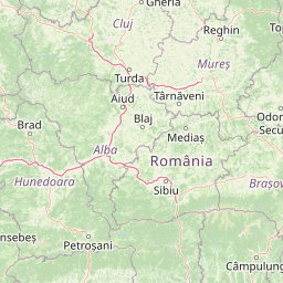
National parkHunedoara County
Park boundaries overlap#1 closest
Northeast

Retezat National Park National Park: Protected Landscape and Regional Geography
Mapped boundaries and landscape context in Hunedoara County.
Retezat National Park is a key protected area featured within MoriAtlas, offering structured geographic data and map-based insights. This national park's protected landscape is situated in Hunedoara County, Romania, contributing significantly to the regional topography and natural context of the Southern Carpathians. Explore its mapped boundaries and understand its role as a distinct natural entity.
- Area
- 380.47 km²
- Established
- 1935
- IUCN
- II
- Relief
- Mountain
Protected landscapeRomania
4.2 km away#2 closest
Southwest
Iron Gates Natural Park: Explore Romania's Protected Landscape and Geographic Context
Detailed atlas view of a protected landscape in Romania.
Uncover the geographic dimensions of Iron Gates Natural Park, a protected landscape situated in Romania. This detailed entry offers an atlas-centric exploration of its mapped boundaries and regional setting, facilitating a deeper understanding of its protected status and landscape features within the national geography. Discover the park's intrinsic value through structured geographic data and visual map context.
- Area
- 1,156.66 km²
- Established
- 2000
- IUCN
- V
- Relief
- Mixed relief
Protected landscapeMehedinți County
About 13 km away#3 closest
South
Mehedinți Plateau Geopark Protected Landscape: Karst Geography and Regional Context
Explore Romania's unique limestone formations and karst landscapes.
The Mehedinți Plateau Geopark in Mehedinți County, Romania, is a significant protected landscape celebrated for its extensive karst features. This page offers detailed insights into the park's mapped boundaries, including its famous natural bridges like Podul lui Dumnezeu, vast limestone pavements, and cave systems. Understand its position within the broader regional geography of southwestern Romania, providing a solid foundation for atlas-driven exploration of this geologically rich area.
- Area
- 1,065 km²
- Established
- 2005
- IUCN
- V
- Relief
- Upland
National parkSerbia
14 km away#4 closest
Southwest

Đerdap National Park: Europe's Grandest River Gorge and Protected Landscape
Explore Serbia's largest national park along the Danube River.
Đerdap National Park is defined by the Iron Gate, Europe's longest and most dramatic river gorge, a geological marvel carved through the Carpathian Mountains. This protected area showcases a complex karst landscape with towering cliffs, deep river sections, and rich biodiversity, including vital Tertiary relict species. The park's vastness and unique terrain offer a profound geographic context for understanding regional natural landscapes and conservation efforts. Explore its mapped boundaries and ecological significance.
- Area
- 637.87 km²
- Established
- 1974
- IUCN
- II
- Relief
- Mountain
National parkRomania
28 km away#5 closest
West
Semenic-Cheile Carașului National Park: Romania's Protected Landscape Discovery
National Park Geography and Mapped Boundaries
Delve into Semenic-Cheile Carașului National Park, a protected landscape in Romania, with a focus on its atlas and geographic context. This page details the park's identity as a national park, its specific mapped boundaries, and its contribution to regional geographic understanding. Utilize MoriAtlas to explore the structured data that defines this protected area and its surrounding natural terrain, enhancing your comprehension of Romania's conservation landscapes.
- IUCN
- II
- Scope
- Terrestrial
Protected areaRomania
About 33 km away#6 closest
North
Hațeg Country Dinosaur Geopark: Mapped Protected Area within Romania's Geography
Explore the protected landscape and regional atlas context.
Discover the Hațeg Country Dinosaur Geopark, a distinct protected area situated within the rich geography of Romania. This entry provides detailed information on its mapped boundaries and landscape characteristics, serving as a crucial anchor for understanding its place in the Southeast European region. Explore the structured geographic data and atlas context that define this significant protected landscape.
- IUCN
- V
- Scope
- Terrestrial
National parkGorj County
34 km away#7 closest
East
Defileul Jiului National Park: Romania's Protected National Park Landscape in Gorj County
Explore maps, geography, and protected area context.
Defileul Jiului National Park is a vital protected natural area situated in Gorj County, Romania. This MoriAtlas page serves as a detailed entry point for understanding the park's specific geography, its mapped perimeters, and its significance within the regional landscape atlas. Discover the park's topographic features and its relationship to the surrounding terrain of the Southern Carpathians, providing essential context for geographic exploration.
- Area
- 111.27 km²
- Established
- 2005
- IUCN
- II
- Relief
- Mountain
National parkRomania
About 38 km away#8 closest
West
Nera Gorge-Beușnița National Park: Karst Landscape and Protected Area in Romania
Explore the mapped geography of this protected Romanian landscape.
Nera Gorge-Beușnița National Park offers a detailed view of a protected karst canyon, featuring the Nera River's dramatic gorge and the picturesque Beușnița waterfalls. This protected area in Romania provides valuable context for understanding karst terrain, subterranean systems, and the geographic distribution of protected lands within the Balkan region. Users can explore its distinct landscape features and their place within Romania's atlas of natural protected areas.
- IUCN
- II
- Relief
- Mountain
- Water
- Major water bodies
MoriAtlas Explorer
Continue exploring Domogled-Valea Cernei National Park's protected landscape and geography
Deepen your understanding of Domogled-Valea Cernei National Park by examining its precise mapped boundaries and its integration within the surrounding regional geography. MoriAtlas facilitates this structured exploration, offering a clear view of the park's protected land identity and its natural terrain. Continue to uncover the geographic significance of this national park and discover its place within the broader atlas of protected areas.
Browse next
Global natural geography
Explore related park routes
Explore MoriAtlas Global ParksBrowse All MoriAtlas ParksGlobal Park Map DiscoveryMoriAtlas: Browse All CountriesBrowse All MoriAtlas ContinentsNational Park Environment AtlasGrand Canyon National Park AtlasYellowstone National Park AtlasYosemite National Park Atlas and GeographySerengeti National Park AtlasGalápagos National Park Protected LandscapeBanff National Park Geography and AtlasKruger National Park Atlas EntryUluṟu-Kata Tjuṯa National Park AtlasExplore Uluru-Kata Tjuta National Park GeographyPlitvice Lakes National Park AtlasFiordland National Park Protected LandscapeGreat Smoky Mountains National Park AtlasAfghanistan National Parks and Protected AreasAlbania National Parks and Protected AreasAlgeria National Parks and Protected AreasAmerican Samoa National Parks and Protected AreasAndorra National Parks and Protected AreasAngola National Parks and Protected AreasAntarctica National Parks and Protected AreasAntigua and Barbuda Park List