Mori Atlas logo
Nature reserveEbony Forest

Mapping the ecological restoration and volcanic terrain of southwestern Mauritian highlands

Ebony Forest Nature Reserve: An Atlas of Protected Indigenous Landscapes in Chamarel, Mauritius

(Ebony Forest Reserve Chamarel)

Ebony Forest represents a crucial protected area within the Chamarel region of southwest Mauritius, serving as a vital site for the restoration of rare semi-dry and upland native forests. This reserve maintains some of the island's last surviving mature endemic ebony stands, offering a clear view into the historical ecological composition of the central plateau flanks. By integrating remnant old-growth vegetation with extensive reforestation efforts, the area provides a definitive reference for island conservation and native habitat mapping.

endemic forestisland conservationrehabilitated forestsemi-dry forestMauritiusChamarel

Ebony Forest

Nature reserve

Park overview

Structured park overview, official facts, and landscape profile for Ebony Forest

Ebony Forest park facts, protected area profile, and essential visitor context

Review the core facts for Ebony Forest, including designation, size, terrain, visitor scale, habitats, and operating context in one park-focused overview.

About Ebony Forest

Ebony Forest Reserve Chamarel is a registered non-profit conservation organization operating a rehabilitated indigenous forest in the Chamarel area of southwest Mauritius. Rather than sitting inside a single conventional national park designation, it functions as a dedicated ecological restoration and ecotourism reserve, working to re-establish the type of native forest that once covered much of the Mauritian highlands.

The reserve lies in the upland belt of southwest Mauritius, close to Black River Gorges National Park and adjacent to the well-known Seven Coloured Earths geological formation. Its location in this part of the island is ecologically important: the southwest retains relatively higher rainfall and supports some of the island's most diverse remaining native plant communities, including semi-dry forest types that are now exceptionally rare. By restoring this habitat, Ebony Forest contributes to a wider effort to reconnect fragmented native forest patches across the central plateau.

Beyond conservation, the reserve has become a focal point for environmental education and ecotourism on the island. It offers guided visits and activities that introduce visitors to Mauritian endemics, the threats facing them, and the long process of habitat restoration. As a result, Ebony Forest plays a dual role as both a working restoration site and a public-facing interpretive landscape, helping build understanding of why protecting and rebuilding native forest matters so much for Mauritius's future biodiversity.

Quick facts and research context for Ebony Forest

Ebony Forest is a non-profit conservation reserve and ecotourism site located in Chamarel, in the southwest of Mauritius. It was formally established in June 2017 after a decade of habitat restoration that included planting more than 130,000 endemic plants and continuing invasive-species control across roughly 34 hectares.

The reserve sits within the same upland region as Black River Gorges National Park and is adjacent to the Seven Coloured Earths geomorphological site. It combines active ecological restoration, habitat protection, and public education, and is best understood as a complementary private reserve within Mauritius's broader network of native forest conservation.

Protection and recognition

Documented terrestrial protection scope and conservation designation records

Ebony Forest Protection Status and International Recognition Record

Ebony Forest maintains a documented terrestrial protection scope within its designated conservation boundaries. Official records outline the established protection status and administrative designation history without imported international recognition sources.

Protection details

Protection scope
Terrestrial
Transboundary protection
No
Park context

Deeper park guide and search-rich context for Ebony Forest

Ebony Forest history, landscape, wildlife, and travel context

Explore Ebony Forest through its history, landscape character, ecosystems, wildlife, conservation priorities, cultural context, and seasonal travel timing in a structured park guide built for atlas discovery and search intent.

Why Ebony Forest stands out

Ebony Forest is best known for its restored stands of indigenous Mauritian forest, including rare semi-dry forest communities that have almost disappeared from the island. The reserve protects some of the last surviving mature endemic ebony trees (Diospyros tessellaria), a species emblematic of Mauritius's unique but heavily degraded native flora. It is also recognized as a working example of large-scale reforestation with native plants, with more than 150,000 endemic plants established in cleared and weeded areas. This combination of genuine old-growth ebony remnants and actively rehabilitated endemic habitat makes the reserve a reference site for island conservation in the western Indian Ocean.
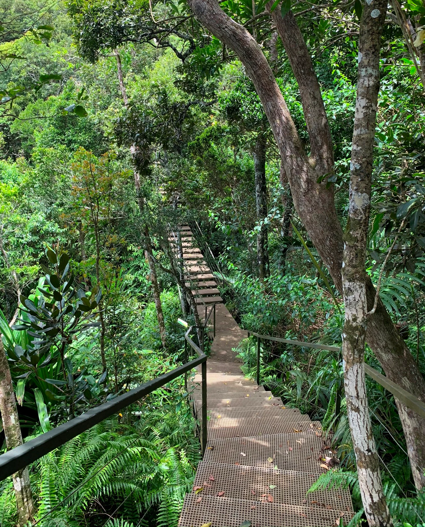
A downward-sloping metal mesh walkway with handrails passes through a dense, green forest with tall trees and ferns.
A metal boardwalk descends through the lush, restored forest canopy at Ebony Forest Reserve.

Ebony Forest history and protected-area timeline

The Ebony Forest reserve was formally established in June 2017, completing a decade of groundwork in habitat restoration and native-species planting. Before its formal designation, the project had worked through more than ten years of clearing invasive vegetation, reintroducing endemic plants, and gradually rebuilding a functioning indigenous forest ecosystem on degraded land.

By the time of its establishment, the project had already planted around 130,000 endemic plants across the site, an effort that continued to expand in subsequent years toward more than 150,000 plants and the recovery of additional habitat. The reserve also retains some of the island's few remaining patches of mature endemic ebony, giving the site both a historical baseline of original native forest and an actively restored successional landscape growing alongside it.

The reserve operates as a registered non-profit, reflecting its intent to combine conservation, research, and public engagement rather than functioning purely as a commercial attraction. Its location within the broader Chamarel and Black River Gorges conservation landscape means its history is closely tied to the wider push, both governmental and private, to safeguard Mauritius's remaining native ecosystems.

Ebony Forest landscape and geographic character

Ebony Forest occupies a section of the southwest Mauritian uplands that rises from the coastal lowlands toward the central plateau. The terrain is shaped by the ancient volcanic geology of Mauritius, producing rolling hills, ridges, and small valleys typical of the Black River region. From certain vantage points, the reserve offers views across the broader landscape of the Black River Gorges National Park.

Within the reserve itself, the physical character of the land has been substantially altered by both degradation and restoration. Cleared and eroded slopes have been stabilized through decades of replanting, while surviving pockets of original native forest, including rare semi-dry forest, give a sense of the native vegetation that once dominated these hills. The mix of recovering forest, remnant old-growth stands, and open ridgelines creates a layered mosaic that reflects both the original ecology and the long restoration effort that has shaped the modern reserve.

The Chamarel area surrounding the reserve is also known for dramatic geomorphological features, including the nearby Seven Coloured Earths dunes, which give the broader region a distinct geological identity in addition to its ecological significance.
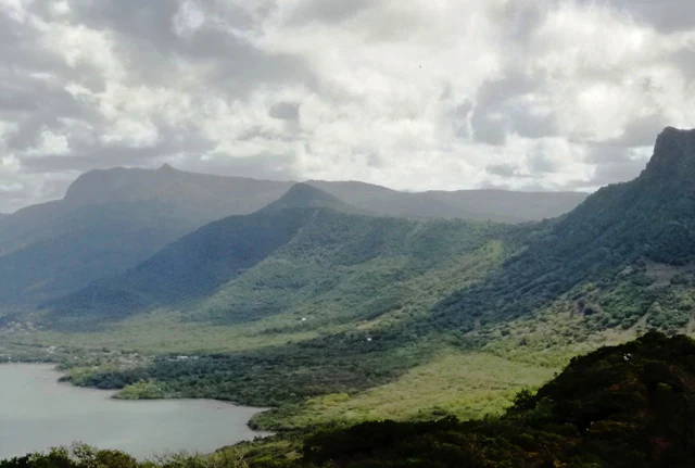
Wide landscape view of lush green mountain slopes descending toward a bay with cloudy skies above.
A scenic view overlooking the mountainous terrain and forest canopy toward the coast.

Ebony Forest ecosystems, habitats, and plant life

The reserve's ecological identity is built around Mauritian indigenous forest, particularly the rare semi-dry forest formations that have been reduced to small fragments across the island. These semi-dry forests represent one of the most threatened vegetation types in Mauritius and support a distinctive suite of endemic trees, shrubs, and ground-layer plants adapted to seasonal moisture stress.

Alongside semi-dry habitat, the reserve includes wetter upland forest types associated with the higher-rainfall southwest. Across these zones, restoration work has emphasized planting truly native species rather than exotics, allowing the plant community to gradually regain its original ecological structure. More than 150,000 endemic plants have been established across the reserve, and continued invasive-plant control has helped protect recovering areas from being overwhelmed by aggressive non-native species.

The result is a forest mosaic combining rare surviving mature native trees with actively growing restored stands. This mixture of original and regenerated forest is ecologically important because it provides both immediate refuge for native fauna and a longer-term framework for a fully functioning native forest.

Ebony Forest wildlife and species highlights

Although the reserve is primarily recognized as a plant restoration site, it supports a rich community of Mauritian endemic and native fauna typical of the southwest uplands. The restored forest and remnant mature trees provide important habitat for several of the island's most iconic bird species, many of which are globally threatened or have only recently recovered from near-extinction.

Birds commonly recorded in and around the reserve include the Mauritius paradise flycatcher, the echo parakeet (one of the rarest parrots in the world), the pink pigeon, the Mauritius kestrel, the Mauritius bulbul, the olive white-eye, and the grey white-eye. The presence of so many conservation-dependent endemics in a single landscape reflects the importance of restored native forest for the survival of Mauritius's surviving land birds.

The reserve also provides roosting and foraging habitat for bats, including the Mauritius flying fox (a large fruit bat), the smaller Mauritian tomb bat, and the Natal free-tailed bat. The combination of restored native vegetation, fruiting trees, and relatively undisturbed canopy makes the area valuable for these mammal species as well as for the island's endemic birdlife.

Ebony Forest conservation status and protection priorities

Ebony Forest's conservation significance lies in its role as an actively managed restoration site within one of the most biodiversity-rich and threatened regions of Mauritius. The island has lost the vast majority of its original native forest, and only a small fraction of original vegetation remains, making any effort to restore and reconnect native habitat disproportionately important.

By replanting more than 150,000 endemic plants and treating substantial areas to remove invasive species, the reserve contributes directly to rebuilding native forest cover and reducing pressure on surrounding remnant ecosystems. Its proximity to Black River Gorges National Park means its restored habitat effectively extends the functional range of the larger protected area network, helping create larger contiguous blocks of native vegetation that support viable populations of endemic species.

The reserve also operates as a non-profit, prioritizing long-term ecological recovery and education over short-term commercial use. This institutional model supports ongoing stewardship, including habitat management, monitoring, and engagement with visitors and schools, all of which are essential for maintaining the long-term viability of Mauritius's endemic biodiversity in a heavily modified island landscape.

Ebony Forest cultural meaning and human context

Ebony Forest sits within the Chamarel area, a region long associated with both distinctive natural heritage and the broader story of Mauritius as a heavily modified oceanic island. The Creole-speaking local communities of the southwest live alongside landscapes that combine agricultural land, remnant native forest, and iconic geological curiosities such as the Seven Coloured Earths.

The reserve's educational programming and guided tours connect visitors with the cultural and ecological meaning of restoring native forest. Through its outreach, Ebony Forest helps reinforce a broader public understanding of why preserving indigenous biodiversity matters for Mauritian identity, rather than being treated as an abstract environmental concern.

At the same time, the reserve does not foreground a specific indigenous or cultural narrative in the way some protected areas do; instead, its cultural role is linked more to environmental awareness, local ecotourism, and the gradual rebuilding of a sense of regional natural heritage in southwest Mauritius.

Top sights and standout views in Ebony Forest

Ebony Forest combines rare surviving mature ebony forest, large-scale restoration of native semi-dry and upland forest, and an active education and ecotourism program all within a single southwest Mauritian reserve. It is one of the few places on the island where visitors can see both original old-growth endemic trees and a substantial area of actively regenerated native vegetation growing alongside them.

Its position adjacent to the Seven Coloured Earths and within the wider Black River Gorges conservation landscape makes it a natural complement to other southwestern sites, extending the ecological and visitor experience of the region. For anyone interested in Mauritian endemics, restoration ecology, or the practical realities of saving an island's native biodiversity, Ebony Forest offers a compact but representative case study.

Best time to visit Ebony Forest

Mauritius has a tropical climate with warm, humid conditions year-round, and Ebony Forest can be visited across the calendar. The cooler, drier months from roughly May through October tend to offer more comfortable conditions for walking, canopy viewing, and guided tours, with less heavy rainfall and lower humidity.

The warmer, wetter summer months from November through April bring higher temperatures and more frequent rain, which can make trails muddier and the forest lusher and more insect-active. Bird activity remains a feature throughout the year, but breeding and calling behavior of some endemic species is often more conspicuous in the warmer months, which can appeal to visitors particularly interested in birdwatching.
Monthly climate preview

Long term representative point measurements for monthly weather patterns in Chamarel

Ebony Forest Climate Normals, Annual Temperature and Precipitation Rhythm

Recorded baseline data tracks shifts in average temperature and daily precipitation across the year at representative park coordinates. Examining the complete twelve month climate profile reveals full monthly variations in weather normals for this conservation landscape.
Annual mean25 °C
22 °C27 °C
Jan27°
Feb27°
Mar27°
Apr26°
May25°
Jun23°
Jul22°
Aug22°
Sep22°
Oct23°
Nov25°
Dec26°
Warmest month
February

27.1 °C

Coolest month
August

21.9 °C

Wettest month
February

4.2 mm/day

Driest month
July

1 mm/day

Park location guide

Geography guide, regional context, and park location map for Ebony Forest

Ebony Forest park geography, regions, and map view in Mauritius

Understand where Ebony Forest sits in Mauritius through a broader geographic reading of the surrounding landscape, nearby location context, and its mapped position within the national park landscape.

How Ebony Forest fits into Mauritius

Mauritius is an island nation in the Indian Ocean and part of the Mascarene Islands. The country gained independence from Britain in 1968 and became a republic in 1992. It is characterized by a diverse population of primarily Indian and Creole descent, with English and French as official languages and Mauritian Creole as the dominant spoken language.

Wider geography shaping Ebony Forest in Mauritius

Mauritius is located in the Indian Ocean approximately 2,000 km east of Africa and east of Madagascar. The main island is volcanic in origin, and the country also includes the islands of Rodrigues, Agaléga, and St. Brandon (Cargados Carajos shoals). The territory is part of the Mascarene Islands, with nearby Réunion being a French overseas department.

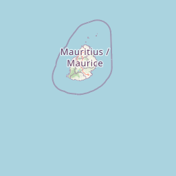
Map view of Ebony Forest

Use this park location map to pinpoint Ebony Forest in Mauritius, understand its exact geographic position, and read its mapped placement within the surrounding landscape more clearly.

Pigeon | © OpenStreetMap contributors

Location context for Ebony Forest

Chamarel

Visual exploration of endemic forest habitats, restored native vegetation, and upland terrain

Ebony Forest Photos and Protected Landscape Scenery in Mauritius

Visual documentation of Ebony Forest reveals the complex terrain of southwest Mauritius, capturing restored native habitats and surviving old-growth stands. Examining these protected-area photographs provides a clear understanding of the region's unique conservation landscape.

A downward-sloping metal mesh walkway with handrails passes through a dense, green forest with tall trees and ferns.

A close-up view of a purple flower with five petals among lush green, pointed leaves in Ebony Forest.

Wide landscape view of lush green mountain slopes descending toward a bay with cloudy skies above.

Park atlas

Compare surrounding conservation landscapes and regional upland habitats

Explore Protected Areas and Nearby Parks Around Ebony Forest

Discover protected areas and nearby national parks situated across the southwest Mauritian uplands adjacent to Ebony Forest. Comparing connected regional conservation sites reveals the broader ecological spread of native forest reserves.
Watercolor painting showing mountains in the distance, a body of water, and green vegetation in the foreground
National parkMauritius
Mapped location lies within the park boundary#1 closest

Northeast

Black River Gorges National Park: Key Protected Landscape and National Park in Mauritius

Explore mapped boundaries and endemic wildlife conservation in the southwest highlands.

Black River Gorges National Park is the largest protected area on Mauritius, critically preserving native rainforest and unique endemic species. This national park encompasses approximately 67.54 square kilometers, showcasing varied ecosystems from humid upland forests to marshy heathlands within its rugged highland terrain. The park's geography, characterized by deep gorges and steep slopes, provides essential habitats and plays a crucial role in the island's conservation efforts, making it a significant site for understanding Mauritius's natural heritage.

Area
67.54 km²
Established
1994
Relief
Upland
Climate
Tropical
Nature reserveMauritius
About 19 km away#2 closest

Northeast

Monvert Nature Park: Exploring Protected Indigenous Landscapes in Mauritius

Regenerated highland forest and endemic flora reserve

Located in the central highlands of Mauritius near Curepipe, Monvert Nature Park protects a significant portion of recovering indigenous woodland. The park functions as a major botanical conservation site, featuring an arboretum with over 150 endemic species and a network of nature trails that traverse its unique highland terrain. This reserve offers a grounded look at the island's botanical diversity and ongoing forest restoration efforts.

Relief
Upland
Climate
Subtropical
Access
Easy access
Scope
Terrestrial
A minimalist watercolor painting showing green rolling hills and distant terrain on a white background.
Nature reserveMoka District
About 31 km away#3 closest

Northeast

Le Pouce Nature Reserve: Volcanic Geography and Protected Upland Habitat in Mauritius

A rugged basalt peak in the Moka District mountain range.

Le Pouce Nature Reserve guards a critical 0.69 square kilometer patch of upland forest on the slopes of the third highest mountain in Mauritius. This protected area is recognized for its dramatic volcanic terrain and as the rare surviving home for the critically endangered Le Pouce Mountain Screwpine, providing an essential window into the island's unique ecological and geological history within the Moka Range.

Area
0.69 km²
Established
1951
Relief
Mountain
Climate
Tropical
Nature reserveGrand Port District
About 36 km away#4 closest

East

Vallée de Ferney Nature Reserve: Protected Mountain Landscapes in the Grand Port District

Indigenous rainforest, volcanic terrain, and conservation refuge

Located in the Bambou mountains of southeastern Mauritius, Vallée de Ferney is a 200-hectare nature reserve known for its protected indigenous rainforest and ongoing rewilding projects. As a key conservation site in the Grand Port District, the reserve offers a look at rare endemic species and the unique moisture-loving vegetation of the island's eastern volcanic series. Explore the mapped boundaries and natural terrain of this significant protected landscape.

Area
2 km²
Established
2006
Relief
Mountain
Climate
Tropical
Nature reserveMauritius
About 38 km away#5 closest

East

Ile aux Aigrettes: Exploring the Protected Coral Coastal Landscape of Mauritius

A critical nature reserve and rewilding site in the Grand Port bay

Ile aux Aigrettes represents a unique geographic outpost off the south-east coast of Mauritius, defined by its flat coral limestone terrain. As a protected nature reserve, it offers insights into the recovery of rare dry coastal forest ecosystems and the ongoing scientific efforts to maintain endemic biodiversity on a small maritime scale.

Area
0.27 km²
Established
1965
Relief
Lowland
Access
Easy access
A horizontal watercolor painting showing green coastal vegetation, a small waterway, and distant hills under a soft sky.
National parkMauritius
About 43 km away#6 closest

East

Île aux Fouquets National Park: Coral Islet Geography and Lighthouse Heritage in Mauritius

Protected maritime landscape and offshore reef terrain

This compact coral island represents a critical piece of the national park system in Mauritius. Known for its distinct limestone geology and nineteenth-century lighthouse ruins, it provides a unique window into the maritime history and offshore reef ecosystems of the Indian Ocean, contrasting with the volcanic landforms of the mainland.

Area
0.025 km²
Established
2004
Relief
Lowland
Access
Remote access
Watercolor illustration of a forest scene with trees, ferns, and distant mountains
National parkMauritius
About 49 km away#7 closest

Northeast

Bras d'Eau National Park: Mauritius National Park Protected Landscape Discovery

Explore coastal terrain, endemic species habitats, and wetland geography.

Bras d'Eau National Park, situated on Mauritius, offers an in-depth look at a protected coastal lowland landscape vital for conservation. This national park showcases remnant forest patches critical for endemic flora and fauna, complemented by a unique system of four mares, including the mangrove-rich Mare sarcelle. Its mapped geography provides context for island ecosystems and serves as a key location for understanding Mauritius's protected natural areas.

Area
4.97 km²
Established
2011
Relief
Lowland
Climate
Tropical
A minimalist, flat vector illustration showing a colorful island scene with a waterfall, forest, and surrounding water.
Protected areaRivière du Rempart District
About 69 km away#8 closest

Northeast

Île Plate: Protected Area Geography and Natural Features in Rivière du Rempart District

Island biodiversity and volcanic landscapes in northern Mauritius

Île Plate is a compact island covering approximately 2.5 square kilometres, notable for its basalt geology and status as a protected area. It anchors a wider system of islets, offering a rich study of indigenous vegetation, seabird habitats, and tangible maritime history in the Indian Ocean.

Area
2.53 km²
Relief
Lowland
Access
Moderate access
Scope
Mixed

Common questions about visiting, size, designation, and location context for Ebony Forest

Ebony Forest FAQs for park facts, access, geography, and protected area context

Find quick answers about Ebony Forest, including protected-area facts, park geography, trail and visitor context, and how the park fits into its surrounding country and regional landscape.
MoriAtlas Explorer

Continue Your Protected Areas Search Across the Global Atlas

Deepen your exploration by continuing the structured search for national parks and protected areas worldwide. Utilize the comprehensive filtering capabilities to compare different conservation landscapes and refine your understanding of global park geography. Discover more about the distribution and characteristics of protected natural areas.

Global natural geography