

Mori Atlas logo
National parkEl Feidja National Park

Discover the mapped geography and regional context of El Feidja National Park in Jendouba Governorate.

El Feidja National Park: Tunisia National Park and Protected Landscape Atlas

El Feidja National Park represents a significant protected natural area within Tunisia, situated in the Jendouba Governorate. This atlas-focused page provides detailed geographic context, mapping the park's boundaries and exploring its landscape identity. Understand El Feidja National Park's place within the regional geography and discover its significance as a protected national park through structured map exploration.

Mountain ForestsNorth AfricaBarbary StagWildlife ConservationArchaeological SitesTrekking

El Feidja National Park

National park

Park overview

Structured park overview, official facts, and landscape profile for El Feidja National Park

El Feidja National Park park facts, protected area profile, and essential visitor context
Review the core facts for El Feidja National Park, including designation, size, terrain, visitor scale, habitats, and operating context in one park-focused overview.

About El Feidja National Park

El Feidja National Park is located in the mountainous northwestern region of Tunisia, approximately 15 kilometers from the city of Jendouba. The park encompasses a diverse landscape of forested slopes, rocky mountain terrain, natural water sources, and small lake basins that together create a distinctive protected environment in this part of North Africa. The establishment of the park in 1990 reflected Tunisia's commitment to preserving its remaining forest ecosystems and the unique species they support. The park is managed by the Tunisian Ministry of Agriculture and operates under IUCN Category II protection, which emphasizes both ecosystem conservation and sustainable visitor use. The location in the Jendouba Governorate places the park in one of Tunisia's most ecologically varied regions, where the transition from coastal to interior landscapes creates conditions for diverse habitats. Visitors to the park can explore walking trails that traverse the forest, climb to mountain viewpoints, and visit the natural springs that dot the terrain.

Quick facts and research context for El Feidja National Park

El Feidja National Park occupies 27.65 square kilometers in the mountainous northwest of Tunisia, within the Jendouba Governorate. The park was established in 1990 under the management of the Tunisian Ministry of Agriculture and is classified as an IUCN Category II protected area. The ecosystem features a mix of forest cover, mountain terrain, and wetland areas created by natural springs. The park is particularly significant for harboring one of the last remaining populations of the Barbary stag in North Africa, a species that has been eliminated from most of its historic range across the region.

Park context

Deeper park guide and search-rich context for El Feidja National Park

El Feidja National Park history, landscape, wildlife, and travel context
Explore El Feidja National Park through its history, landscape character, ecosystems, wildlife, conservation priorities, cultural context, and seasonal travel timing in a structured park guide built for atlas discovery and search intent.

Why El Feidja National Park stands out

El Feidja is best known for its population of Barbary stag, one of the last surviving herds of this iconic deer species in North Africa. The park also stands out for its dense forest landscapes, which are increasingly rare in Tunisia, and for the presence of natural springs and small lakes that create unique wetland habitats within the mountain environment. The combination of forest protection, wildlife conservation, and archaeological remnants gives the park a distinctive character as a multi-dimensional protected area.

El Feidja National Park history and protected-area timeline

El Feidja National Park was officially established on 9 June 1990, representing a deliberate effort by the Tunisian government to protect the remaining forest ecosystems of the northwest region. The creation of the park came during a period of increased environmental awareness in Tunisia and responded to growing concerns about deforestation and habitat loss affecting species such as the Barbary stag. Since its establishment, the park has served as both a conservation area and an emerging destination for eco-tourism, offering guided tours and trekking opportunities that allow visitors to experience the park's natural environments while generating economic benefits for the surrounding region.

El Feidja National Park landscape and geographic character

The landscape of El Feidja National Park features a prominent mountain forest environment that contrasts sharply with the more arid terrain found in much of Tunisia. The park's terrain includes forested slopes rising from the lower valleys, rocky mountain ridges, and areas where natural springs emerge to form small lakes and marshy zones. The vegetation is dominated by forest species adapted to the more humid conditions of this northwestern region, creating a green corridor that stands in visual contrast to the surrounding landscapes. The water features within the park, including natural springs and seasonal lakes, add further visual and ecological diversity to the terrain.

El Feidja National Park ecosystems, habitats, and plant life

The ecological character of El Feidja is defined by its forest ecosystem, which represents one of the most significant remaining wooded areas in northern Tunisia. The park's location in the northwest receives higher rainfall than much of the country, supporting vegetation types that are uncommon in the Tunisian context. The combination of forest cover, mountain elevation zones, and wetland areas created by natural springs produces a mosaic of habitats within the park boundaries. This habitat diversity supports both plant and animal species that are characteristic of North African mountain environments, including several endemic species that are found in few other locations.

El Feidja National Park wildlife and species highlights

El Feidja National Park is notable for its population of Barbary stag, a deer species that once ranged widely across North Africa but now survives in only a few isolated populations. The park contains one of the last remaining herds of this species, making it critically important for the survival of the Barbary stag. Other notable mammals found in the park include the African golden wolf and the Barbary boar, both of which are present in the park's diverse habitats. The forest and wetland environments also support diverse bird species, contributing to the park's significance as a biodiversity refuge in the region.

El Feidja National Park conservation status and protection priorities

The park is classified as IUCN Category II, reflecting its primary designation as a national park focused on ecosystem protection and sustainable use. The protection of the Barbary stag population represents a particularly important conservation priority, as this species has been eliminated from most of its historic range. The park's forest ecosystems also serve important functions in soil protection, water cycle maintenance, and climate regulation for the surrounding region. The combination of wildlife protection, forest conservation, and sustainable tourism development positions El Feidja as a model for integrated conservation in Tunisia.

El Feidja National Park cultural meaning and human context

The area within and surrounding El Feidja National Park holds archaeological significance, with remnants of ancient civilizations found within the park boundaries. These archaeological remains provide evidence of human presence in the mountain forests of northwestern Tunisia over extended historical periods. The presence of ancient settlements and cultural artifacts adds a historical dimension to the park's value, connecting the natural landscape to the broader human history of the region.

Top sights and standout views in El Feidja National Park

The park's defining highlights include one of North Africa's last Barbary stag populations, dense forest environments that are rare in Tunisia, natural springs and lakes creating wetland habitats, mountain trails offering scenic trekking opportunities, and archaeological sites revealing ancient human presence. The combination of wildlife viewing, forest exploration, and historical discovery provides visitors with a varied experience that distinguishes El Feidja from more simply nature-focused protected areas.

Best time to visit El Feidja National Park

The optimal time to visit El Feidja National Park is during the spring and autumn months when temperatures are moderate and the forest environment is at its most pleasant for outdoor activities. Spring brings renewed vegetation and is often a good season for wildlife observation, while autumn offers comfortable conditions for trekking and exploration. The summer months can bring higher temperatures that make extensive hiking more challenging, though the forest shade provides some relief. Winter visits are possible but conditions may be cooler, and some trails may have reduced accessibility.

Park location guide

Geography guide, regional context, and park location map for El Feidja National Park

El Feidja National Park park geography, regions, and map view in Tunisia
Understand where El Feidja National Park sits in Tunisia through a broader geographic reading of the surrounding landscape, nearby location context, and its mapped position within the national park landscape.

How El Feidja National Park fits into Tunisia

Tunisia is a Maghreb country in North Africa with a Mediterranean coastline, bordered by Algeria and Libya. The country features the ancient ruins of Carthage, the Great Mosque of Kairouan, and portions of the Atlas Mountains and Sahara Desert. With a population of approximately 12 million, Tunisia operates as a unitary presidential republic with Arabic as the official language.

Wider geography shaping El Feidja National Park in Tunisia

Tunisia occupies 163,610 km² in North Africa, bordering Algeria to the west and southwest, Libya to the southeast, and the Mediterranean Sea to the north and east. The country features the eastern end of the Atlas Mountains in the north and extends into the northern Sahara Desert in the south. Its 1,300 km of coastline runs along the Mediterranean Basin. Africa's northernmost point, Cape Angela, is located in Tunisia.

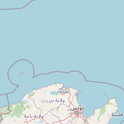
Map view of El Feidja National Park

Use this park location map to pinpoint El Feidja National Park in Tunisia, understand its exact geographic position, and read its mapped placement within the surrounding landscape more clearly.

Pigeon | © OpenStreetMap contributors

Location context for El Feidja National Park

Jendouba Governorate
Park atlas

Compare diverse mountain forest ecosystems, wetland habitats, and conservation landscapes across the region

Discover Nearby National Parks and Protected Areas Beyond El Feidja National Park in Northwestern Tunisia
Continue your exploration from El Feidja National Park to browse other protected mountain forest areas and significant conservation landscapes across northwestern Tunisia. Expanding your view helps trace regional park geography, compare diverse protected habitats, and understand the interconnected spread of North Africa's natural heritage.
National parkEl Tarf Province

El Kala National Park: Protected Wetlands and Barbary Stag Habitat

Explore its mapped geography and vital ecosystem context.

El Kala National Park represents a crucial protected landscape within El Tarf Province, Algeria, recognized internationally for its extensive Mediterranean wetlands and rich biodiversity. This national park is a vital ecological zone, comprising six major lakes and a significant stretch of coastline, offering a unique mosaic of aquatic and terrestrial environments. Its role as a sanctuary for the Barbary stag and migratory birds highlights its importance in regional conservation efforts. Exploring El Kala National Park provides insight into the mapped terrain, protected boundaries, and distinct geographic features that define this significant North African natural area.

Area
764 km²
Established
1993
IUCN
II
Visitors
30K annual
National parkTunisia

Boukornine National Park: A Protected Mediterranean Mountain Landscape in Tunisia

Explore its mapped terrain and unique protected ecosystem.

Boukornine National Park in Tunisia represents a significant protected landscape, notable for its central granite peak, Jebel Boukornine, which rises sharply above the surrounding coastal plains. This national park, covering approximately 1,939 hectares, preserves a distinctive Mediterranean mountain ecosystem. Its rugged terrain, rocky slopes, and the presence of Aïn Zargua spring support a unique concentration of species, including notable flora and fauna. Understanding Boukornine National Park provides insight into the regional geography and the importance of conserving these mountainous protected areas within Tunisia.

Area
19.39 km²
Established
1987
IUCN
II
Relief
Mountain
National parkKasserine Governorate

Chambi National Park: Tunisia's Highest Mountain Protected Area and Biosphere Reserve

Explore its mountainous terrain and conservation significance.

Chambi National Park is a protected national park in Tunisia's Kasserine Governorate, safeguarding the country's highest mountain, Djebel Chambi. This park is renowned for its mountainous terrain, semi-arid vegetation, and its role as a critical habitat for endangered species like the Cuvier's gazelle and Barbary sheep. As a UNESCO biosphere reserve, it offers significant insights into North African mountain ecosystems and landscape conservation.

Area
67.23 km²
Established
1980
IUCN
II
Relief
Mountain
National parkBatna Province

Belezma National Park National Park: Mapped Protected Landscape and Geographic Context in Batna Province

Explore its protected area boundaries and regional natural terrain.

Gain a clear understanding of Belezma National Park's protected landscape and geographic position. This entry details its mapped boundaries within Batna Province, providing essential context for atlas-based exploration of Algeria's natural terrain and protected areas. Discover the specific geographic identity that makes Belezma National Park a key feature within its regional landscape.

Area
262.5 km²
Established
1984
IUCN
II
Visitors
100K annual
National parkGafsa Governorate

Bou-Hedma National Park: Mapped Protected Area and Conservation Sanctuary in Gafsa Governorate

Discover Saharan wildlife, Roman ruins, and unique semi-arid landscapes.

Bou-Hedma National Park serves as a crucial conservation hub in Tunisia's Gafsa Governorate, renowned for its success in reintroducing endangered Saharan large mammals like the scimitar oryx and addax. The park's geography spans arid plains and seasonal wadis, encompassing the Ramsar-listed Sebkhet Noual wetland. Its unique landscape also preserves significant Roman-era archaeological sites, offering a rich context for exploring protected-area identity, conservation achievements, and ancient human history within a North African setting.

Established
1980
IUCN
II
Access
Access unknown
Scope
Terrestrial
National parkJijel Province

Taza National Park: Protected Mediterranean Coast and Tell Atlas Forest Landscape

Explore its unique mapped geography and conservation significance.

Taza National Park, situated in Algeria's Jijel Province, represents a crucial protected landscape where the Tell Atlas mountains meet the Mediterranean Sea. This 3,807-hectare national park is celebrated for its dramatic coastal cliffs, extensive cork oak and gall oak forests, the largest in Algeria, and its designation as a UNESCO biosphere reserve. The park's geography facilitates unique habitat zones, making it a key area for atlas-based discovery of North African biodiversity, including the Barbary macaque and Algerian nuthatch, within a landscape of exceptional natural beauty and conservation priority.

Area
38.07 km²
Established
1923
IUCN
II
Relief
Mountain
Watercolor painting of a landscape with rolling hills, pink wildflowers, and scattered trees
National park

Pantelleria National Park: A Protected Landscape within Italy's Atlas

Mapped boundaries and regional geographic context.

Pantelleria National Park is a designated national park in Italy offering a distinct protected landscape for exploration. This page provides essential geographic context, highlighting the park's mapped boundaries and its significance within the regional atlas. Understand the terrain and protected land features that define this important natural area.

Area
66.4 km²
Established
2016
IUCN
II
Relief
Highland
Watercolor painting of a mountainous landscape with green forests and distant hills
National parkItaly

National Park of the Gulf of Orosei and Gennargentu: Italy's Coastal and Mountain Protected Terrain

Mapped geography of a unique Sardinian protected landscape.

Delve into the atlas-level details of the National Park of the Gulf of Orosei and Gennargentu, a protected area in Italy renowned for its stark contrast between dramatic coastal cliffs bordering the Gulf of Orosei and the wild, mountainous interior of the Gennargentu massif. This page provides structured geographic context, mapping the park's boundaries and showcasing its distinctive karst landscape, hidden beaches, and rugged peaks for comprehensive protected-area exploration.

IUCN
II

Common questions about visiting, size, designation, and location context for El Feidja National Park

El Feidja National Park FAQs for park facts, access, geography, and protected area context
Find quick answers about El Feidja National Park, including protected-area facts, park geography, trail and visitor context, and how the park fits into its surrounding country and regional landscape.
MoriAtlas Explorer

Continue Your Protected Areas Search Across the Global Atlas

Deepen your exploration by continuing the structured search for national parks and protected areas worldwide. Utilize the comprehensive filtering capabilities to compare different conservation landscapes and refine your understanding of global park geography. Discover more about the distribution and characteristics of protected natural areas.

Global natural geography