

Mori Atlas logo
National parkForest Grove National Park

Discover the mapped boundaries and regional geography of this vital national park.

Forest Grove National Park: A Protected Jarrah Forest Landscape in Western Australia

Forest Grove National Park serves as a crucial protected area within the Jarrah Forest bioregion of Western Australia, safeguarding a significant example of tall open woodland ecosystems. Situated in the Margaret River hinterland, this national park offers a unique perspective on the region's inland natural landscapes, distinct from its famed coastal features. Understanding its geography and protected boundaries provides essential context for exploring Southwest Australia's diverse natural terrain.

Western AustraliaJarrah ForestNational ParkSouth West AustraliaForest Protected AreaClass A Reserve

Forest Grove National Park

National park

Park overview

Structured park overview, official facts, and landscape profile for Forest Grove National Park

Forest Grove National Park park facts, protected area profile, and essential visitor context
Review the core facts for Forest Grove National Park, including designation, size, terrain, visitor scale, habitats, and operating context in one park-focused overview.

About Forest Grove National Park

Forest Grove National Park occupies a meaningful position within Western Australia's network of protected areas, preserving a portion of the state's diminishing jarrah forest estate. The park was created in 2004 as part of a significant legislative package that established 19 new national parks across Western Australia in a single day, representing one of the state's most substantial expansions of formal nature conservation. Located in the Shire of Augusta-Margaret River, the park contributes to the protection of forest ecosystems that once covered much of the South West land division. The landscape is characterised by jarrah-dominated woodland with underlying species adapted to the Mediterranean climate of the region. Forest Grove forms an ecological linkage with adjacent protected areas, notably connecting to Blackwood River National Park through an intervening unnamed reserve, creating a more expansive forest protection corridor than the individual park boundaries suggest.

Quick facts and research context for Forest Grove National Park

Forest Grove National Park covers 1,379 hectares (3,410 acres) in the South West region of Western Australia. It was established on December 8, 2004, as Class A reserve No. 47673 through legislation passed by the Parliament of Western Australia. The park is administered by the Department of Biodiversity, Conservation and Attractions and lies within both the Jarrah Forest and Warren bioregions. The park is located in the Shire of Augusta-Margaret River, approximately 292 kilometres south of Perth.

Park context

Deeper park guide and search-rich context for Forest Grove National Park

Forest Grove National Park history, landscape, wildlife, and travel context
Explore Forest Grove National Park through its history, landscape character, ecosystems, wildlife, conservation priorities, cultural context, and seasonal travel timing in a structured park guide built for atlas discovery and search intent.

Why Forest Grove National Park stands out

Forest Grove National Park is best known for its representation of the Jarrah Forest ecosystem, one of the distinctive bioregions of Southwest Australia. The park protects sections of tall open woodland and forest characteristic of the Warren bioregion, an area recognised for its biodiversity and relatively intact natural landscapes. While not as visually dramatic as coastal parks in the Margaret River region, Forest Grove serves as a preservation anchor for forest habitats that have been extensively cleared for agriculture and timber production in surrounding areas.

Forest Grove National Park history and protected-area timeline

Forest Grove National Park was established on December 8, 2004, when the Parliament of Western Australia proclaimed it as Class A reserve No. 47673. This creation was part of a coordinated expansion of the state's national park system, with 19 new protected areas proclaimed simultaneously through acts of parliament. The establishment reflected ongoing recognition of the ecological value of Southwest Australia's forest bioregions, many of which had been subject to extensive logging and land clearing throughout the twentieth century. The Class A reserve classification provides the highest level of protection under Western Australian law, signifying legislative commitment to maintaining the area's conservation values into the future.

Forest Grove National Park landscape and geographic character

The park sits within the Jarrah Forest bioregion, characterised by tall open forest dominated by jarrah (Eucalyptus marginata) as the principal overstory species. The landscape undulates with the gentle topography typical of the Southwest Australia landscape, supporting woodland that transitions into elements associated with the adjacent Warren bioregion. The forest structure includes mid-story species and groundcover vegetation adapted to the region's Mediterranean climate, with wet winters and dry summers shaping the ecological character. While the park lacks the dramatic coastal cliffs or karst systems found in some nearby Southwest reserves, it represents an important example of relatively intact forest terrain in a region where extensive clearing has altered much of the original vegetation.

Forest Grove National Park ecosystems, habitats, and plant life

Forest Grove National Park protects representative examples of Southwest Australia's Mediterranean forest ecosystems. The jarrah forest is the defining ecological community, characterised by the iconic jarrah tree alongside other eucalypt species and a diverse understory of shrubs and grasses. This bioregion is part of the Southwest Australia Floristic Region, a global biodiversity hotspot recognised for its high concentration of endemic plant species. The park's inclusion within both the Jarrah Forest and Warren bioregions indicates ecological diversity across the protected area, with subtle transitions in vegetation communities reflecting variations in soil, aspect, and moisture availability.

Forest Grove National Park conservation status and protection priorities

The establishment of Forest Grove National Park contributed to the broader conservation of Southwest Australia's forest bioregions, which have experienced substantial reduction from their pre-colonial extent. The Class A reserve status provides statutory protection that limits extractive activities and ensures the area is managed primarily for conservation purposes by the Department of Biodiversity, Conservation and Attractions. The park forms part of a connected conservation network in the Margaret River region, with linkage to Blackwood River National Park enhancing the ecological viability of forest habitats by facilitating species movement across a larger protected landscape. This corridor function is particularly important in a landscape where agriculture and plantation forestry have fragmented much of the native vegetation.

Forest Grove National Park cultural meaning and human context

The park lies within the traditional country of Noongar peoples, the Aboriginal people of Southwest Australia. The Noongar relationship with the jarrah forest extends over many thousands of years, with the landscape providing food, medicine, and materials. While the Wikipedia source does not detail specific cultural heritage values for this particular park, the broader Margaret River region contains significant Aboriginal sites and the traditional lands of various Noongar clans. The establishment of the national park occurred within a contemporary context of evolving recognition of Indigenous connection to country in conservation planning across Western Australia.

Top sights and standout views in Forest Grove National Park

Forest Grove National Park provides a preserved example of jarrah forest in the Margaret River region, representing the quieter, more contemplative side of the area's natural offerings. The park's value lies particularly in its role as part of a connected forest protection network, with the linkage to Blackwood River National Park creating a more significant conservation corridor than either individual park represents alone. Visitors seeking to understand the forest character of Southwest Australia, as opposed to the region's more famous coastline, will find the park contributes to that understanding.

Best time to visit Forest Grove National Park

The optimal time to visit Forest Grove National Park aligns with the Australian autumn and winter months (March through August), when cooler temperatures make forest walking more comfortable and the landscape retains moisture from winter rains. Spring (September to November) brings wildflower displays across Southwest Australia and can offer excellent botanical viewing within the park. Summer months (December through February) are typically hot and dry, with increased fire risk potentially affecting access. The Mediterranean climate means visitors should be prepared for variable conditions and should check current conditions before planning trips.
Park location guide

Geography guide, regional context, and park location map for Forest Grove National Park

Forest Grove National Park park geography, regions, and map view in Australia
Understand where Forest Grove National Park sits in Australia through a broader geographic reading of the surrounding landscape, nearby location context, and its mapped position within the national park landscape.

How Forest Grove National Park fits into Australia

Australia is a constitutional monarchy and federal parliamentary democracy comprising six states and ten territories. With a population of nearly 28 million, it is one of the world's most urbanised countries, with most people concentrated on the eastern seaboard. The country has a high Human Development Index and is known for its cultural diversity, ancient Aboriginal heritage, and unique wildlife.

Wider geography shaping Forest Grove National Park in Australia

Australia occupies the entire Australian continent, the island of Tasmania, and numerous smaller islands. It is the world's flattest and driest inhabited continent, featuring vast deserts in the interior (the Outback), tropical rainforests along the eastern coast, and a coastline bordering the Indian and Pacific Oceans.

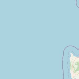
Map view of Forest Grove National Park

Use this park location map to pinpoint Forest Grove National Park in Australia, understand its exact geographic position, and read its mapped placement within the surrounding landscape more clearly.

Pigeon | © OpenStreetMap contributors

Location context for Forest Grove National Park

Western Australia
Park atlas

Compare the diverse protected landscapes and forest ecosystems of the Margaret River hinterland.

Explore Nearby National Parks and Protected Areas Surrounding Forest Grove National Park, Western Australia
After exploring Forest Grove National Park, browse other national parks and protected areas across the South West region of Western Australia. Compare different Jarrah Forest ecosystems, trace contiguous forest corridors, and understand the diverse protected landscapes of this unique bioregion.
National parkWestern Australia

Leeuwin-Naturaliste National Park: Western Australia's Protected Landscape and Geographic Context

Explore mapped natural terrain and protected boundaries.

Leeuwin-Naturaliste National Park provides a distinct focus for understanding protected lands within Western Australia. This national park offers rich opportunities to examine its mapped boundaries and unique landscape characteristics, contributing valuable context to the regional geography of the state. Discover the natural terrain and protected area status that define this significant location for atlas-based discovery and geographic comprehension.

Area
190.92 km²
Established
1957
IUCN
II
Visitors
2.3M annual
National parkWestern Australia

Wooditjup National Park: Protected Forest Landscape and Regional Geographic Context

Explore mapped boundaries of this Western Australia national park.

Wooditjup National Park stands as a testament to Western Australia's unique forest ecosystems, specifically within the Jarrah Forest bioregion. This protected area offers a distinct natural landscape contrasting with the nearby coastal attractions of Margaret River. Delve into the park's mapped geography, understand its role as a national park, and appreciate its position within the broader South West Australian landscape and its traditional Wardandi Country heritage.

Area
38.92 km²
Established
2004
IUCN
II
Relief
Lowland
National parkWestern Australia

Scott National Park National Park: Mapped Protected Landscape in Western Australia

Geographic Context and Natural Terrain Discovery

Scott National Park serves as a significant protected area within the diverse geography of Western Australia. This national park provides a focal point for understanding regional landscape patterns and mapped natural features. Explore its role as a protected land, offering insight into the state's broad natural heritage and supporting detailed geographic discovery for atlas enthusiasts.

Area
32.73 km²
Established
1959
IUCN
II
Relief
Lowland
National parkWestern Australia

Blackwood River National Park: Protected Area in Western Australia's Geography

Explore mapped boundaries and natural terrain.

Blackwood River National Park is a key protected area within the vast geographic expanse of Western Australia. This park's designation as a national park underscores its importance for conservation and landscape preservation. Users can explore its precisely mapped boundaries to understand its footprint and its contribution to the regional natural landscape context, offering a grounded perspective on protected lands within Australia.

Area
204.75 km²
Established
2004
IUCN
II
Relief
Upland
National park

Wiltshire-Butler National Park: Mapped Jarrah Forest Landscape in Western Australia

Explore protected boundaries and regional geographic context

Wiltshire-Butler National Park stands as a protected natural area celebrated for its representation of Western Australia's iconic jarrah forest ecosystems. This National Park, created in 2004, offers rich opportunities for atlas-based discovery, focusing on its distinct landscape character, mapped park boundaries, and its geographical placement within the broader South West region. Understanding its terrain and conservation significance provides valuable insight into the protected lands of the Jarrah Forest bioregion.

Area
116.45 km²
Established
2004
IUCN
II
Relief
Highland
National park

Yelverton National Park National Park: Mapped Protected Area & Biodiversity Refuge

Focusing on rare species and diverse vegetation communities.

Yelverton National Park, situated in the South West region of Western Australia, serves as a vital protected area dedicated to preserving ecological significance. Established from former timber reserves, its 729 hectares capture diverse vegetation types crucial for rare and priority species. This park's landscape identity lies in its role as a biodiversity refuge, distinct from nearby tourism hubs, offering a unique insight into conservation-driven land management and the mapped protected geography of the region.

Area
7.29 km²
Established
2004
IUCN
II
Scope
Terrestrial
National parkAustralia

Milyeannup National Park: Explore its Protected Landscape and Geographic Atlas Context

Discover the mapped terrain and boundaries of this Australian national park.

Milyeannup National Park offers a unique focus for atlas-based geographic exploration. This entry details the park's identity as a protected area, highlighting its landscape context and mapped geographic features within Australia. Use this resource to understand its role in the national park system and its specific place within the broader landscape.

Area
186.92 km²
Established
2004
Scope
Terrestrial
Forest
Mostly forested
National park

Hilliger National Park: Western Australian Protected Jarrah Forest and Memorial Landscape

Mapped boundaries of a vital national park in the South West region.

Hilliger National Park stands as a testament to forest conservation in Western Australia's South West. This 16,962-hectare national park, established in 2004, protects representative old-growth jarrah forest ecosystems and honors a significant firefighting legacy. Explore its terrain and its geographic placement within a broader network of protected lands, offering a concrete example of conservation strategy in the region. The park's mapped area contributes valuable data to the understanding of regional natural landscapes.

Area
169.62 km²
Established
2004
Climate
Temperate
Scope
Terrestrial

Common questions about visiting, size, designation, and location context for Forest Grove National Park

Forest Grove National Park FAQs for park facts, access, geography, and protected area context
Find quick answers about Forest Grove National Park, including protected-area facts, park geography, trail and visitor context, and how the park fits into its surrounding country and regional landscape.
MoriAtlas Explorer

Continue Your Protected Areas Search Across the Global Atlas

Deepen your exploration by continuing the structured search for national parks and protected areas worldwide. Utilize the comprehensive filtering capabilities to compare different conservation landscapes and refine your understanding of global park geography. Discover more about the distribution and characteristics of protected natural areas.

Global natural geography