Mori Atlas logo
National parkGorkhi-Terelj National Park

Discover the mapped boundaries and regional geography of this protected natural area in Töv Province.

Gorkhi-Terelj National Park: National Park Protected Landscape & Geographic Context

Gorkhi-Terelj National Park stands as a significant protected landscape within Mongolia's Töv Province. This page offers an atlas-focused exploration of the park's identity, detailing its mapped boundaries and its place within the region's broader geographic context. Understand the natural terrain and protected land distribution that define Gorkhi-Terelj National Park for detailed geographic discovery.

National parkMountain landscapeRock formationsBirdwatchingHot springsBuddhist heritage

Gorkhi-Terelj National Park

National park

Park overview

Structured park overview, official facts, and landscape profile for Gorkhi-Terelj National Park

Gorkhi-Terelj National Park park facts, protected area profile, and essential visitor context
Review the core facts for Gorkhi-Terelj National Park, including designation, size, terrain, visitor scale, habitats, and operating context in one park-focused overview.

About Gorkhi-Terelj National Park

Gorkhi-Terelj National Park represents a harmonious blend of natural conservation and cultural preservation in the Mongolian context. The park's strategic location near the capital makes it both a recreational outlet for urban residents and an introduction to Mongolia's protected area system for international visitors. The landscape varies from gentle valley floors along the Terelj River to steep rocky cliffs and forested slopes, creating diverse microhabitats within a relatively compact area. The developed tourist zone occupies a southern portion of the park, featuring traditional Mongolian ger camps operated by the Juulchin tourism corporation and local communities. These camps provide visitor accommodations while maintaining cultural authenticity through traditional round felt tents. Beyond the tourist infrastructure, the majority of the park remains undeveloped, with access limited to established trails and backcountry routes. The park's ecological significance extends beyond its borders as a protected corridor for the Tuul River, which originates in the mountains to the north and flows through the capital region. This watershed protection function underscores the park's importance to regional environmental stability.

Quick facts and research context for Gorkhi-Terelj National Park

Gorkhi-Terelj National Park covers 292,000 hectares in north-central Mongolia, established in 1993 under the management of Mongolia's Ministry of Environment and Green Development. The park is located approximately 37 kilometers from Ulaanbaatar's city center along a paved highway, making it one of the country's most accessible protected areas. The landscape features mountainous terrain with the Terelj River valley as its central corridor, while the Tuul River flows through the park providing ecological connectivity. Notable features include Khagiin Khar Lake, a 20-meter deep glacial lake located 80 kilometers upstream from the tourist zone, and Yestii Hot Water Springs situated an additional 18 kilometers beyond the lake. The park contains two celebrated rock formations, Turtle Rock and the Old Man Reading a Book, which have become iconic symbols of the protected area.

Park context

Deeper park guide and search-rich context for Gorkhi-Terelj National Park

Gorkhi-Terelj National Park history, landscape, wildlife, and travel context
Explore Gorkhi-Terelj National Park through its history, landscape character, ecosystems, wildlife, conservation priorities, cultural context, and seasonal travel timing in a structured park guide built for atlas discovery and search intent.

Why Gorkhi-Terelj National Park stands out

Gorkhi-Terelj National Park is best known for its dramatic rock formations, particularly Turtle Rock and the Praying Lama Rock, which stand as natural monuments recognizable throughout Mongolia. The park's accessibility from Ulaanbaatar has made it the country's most visited national park, offering visitors a compact yet diverse experience of Mongolian mountain landscapes without extensive travel. The presence of a functioning Buddhist monastery within the park provides a unique cultural dimension rarely found in other Mongolian protected areas. The combination of glacial lakes, natural hot springs, alpine forests, and the Tuul River corridor creates a ecological richness that supports significant wildlife populations including brown bears and exceptional bird diversity.

Gorkhi-Terelj National Park history and protected-area timeline

Gorkhi-Terelj National Park was established in 1993 as part of Mongolia's post-socialist expansion of its protected area network following democratic reforms. The park's designation reflected growing recognition of the need to preserve accessible natural landscapes near the capital while supporting emerging tourism sectors. Prior to formal protection, the area served as traditional grazing land for nomadic herders and contained spiritual sites associated with local Buddhist communities. The establishment of the park provided a framework for managing competing uses between conservation, traditional land use, and developing tourism. The park's management falls under the Ministry of Environment and Green Development of Mongolia, which oversees protection and visitor management. The development of tourism infrastructure, including the establishment of the Juulchin tourism corporation's operations, preceded the formal protected area designation and required integration into the park's management framework.

Gorkhi-Terelj National Park landscape and geographic character

The landscape of Gorkhi-Terelj National Park is characterized by mountainous terrain of the northeastern Mongolian forest steppe zone. The Terelj River valley forms the park's central geographic feature, a broad valley floor flanked by rolling hills and steeper ridgelines. The terrain transitions from open grasslands on valley floors to mixed forests on lower slopes, with rocky outcrops and cliff bands appearing on more exposed terrain. The park's eastern sections contain higher elevations with more pronounced alpine character. Rock formations are a defining visual element, with granite boulders and cliff faces creating distinctive silhouettes against the sky. The Tuul River, one of Mongolia's major rivers, flows through the park providing hydrological connectivity and supporting riparian vegetation corridors. The landscape supports a mosaic of habitats including riverine forests, mountain meadows, rocky talus fields, and coniferous-deciduous forest stands.

Gorkhi-Terelj National Park ecosystems, habitats, and plant life

The ecological character of Gorkhi-Terelj National Park reflects the transition between Mongolia's forest steppe and mountain forest biomes. The park contains diverse habitat types including river corridor forests dominated by Siberian larch and birch, mixed coniferous forests on northern slopes, and open meadows in valley bottoms. This habitat diversity supports the park's notable bird species count exceeding 250, making it significant for avian conservation in the region. The forest and meadow ecosystems provide crucial habitat for brown bears, a species requiring extensive territory and secure habitat corridors. The Tuul River watershed function adds aquatic and riparian ecological dimensions to the park's conservation value. The park's elevation range creates temperature gradients that support both montane and subalpine species assemblages.

Gorkhi-Terelj National Park wildlife and species highlights

Gorkhi-Terelj National Park supports meaningful populations of large mammals including brown bears, which represent a conservation priority given their limited distribution in Mongolia. The park's diverse habitats support various ungulate species typical of the forest steppe zone. The exceptional bird diversity, with over 250 species recorded, positions the park as a significant area for avian fauna in Mongolia. This includes both resident species and migratory populations that utilize the park's habitats during seasonal movements. The river systems provide aquatic habitat supporting fish species and contributing to the broader food web that includes kingfisher species, osprey, and other fishing birds. The rock formations serve as nesting sites for raptors including eagles and falcons that inhabit the cliff bands.

Gorkhi-Terelj National Park conservation status and protection priorities

Gorkhi-Terelj National Park holds IUCN Category II designation, reflecting its primary purpose of protecting natural ecosystems while allowing sustainable tourism and environmental education. The park's conservation value is enhanced by its watershed protection function for the Tuul River, which provides water resources for the capital region and downstream agricultural areas. Protection of the brown bear population addresses species conservation needs in a country where suitable habitat is limited. The park's bird diversity exceeding 250 species indicates ecological health and habitat quality that supports broader biodiversity conservation objectives. Management balances visitor access in the developed tourist zone with protection of core wilderness areas that remain largely inaccessible to maintain ecological integrity.

Gorkhi-Terelj National Park cultural meaning and human context

The cultural landscape of Gorkhi-Terelj includes a functioning Buddhist monastery that remains active and open to visitors, representing spiritual continuity in a region with deep Buddhist heritage. The monastery adds cultural dimension to the park experience beyond natural landscape appreciation. Traditional Mongolian ger camps throughout the tourist zone maintain cultural authenticity through their design and operation, preserving nomadic hospitality traditions in a permanent setting. The park's proximity to Ulaanbaatar means cultural connections between urban and rural Mongolian communities are evident in visitor activities and local livelihoods. Rock formations have accumulated cultural significance, with Turtle Rock and the Praying Lama Rock named for their resemblance to recognizable forms that have entered local popular culture and tourism branding.

Top sights and standout views in Gorkhi-Terelj National Park

The most distinctive highlights of Gorkhi-Terelj National Park include the iconic rock formations, particularly Turtle Rock with its natural shape resembling a giant tortoise, and the Praying Lama Rock that appears to show a robed figure in contemplation. The accessible hot springs at Yestii provide visitors with natural thermal bathing opportunities in a backcountry setting. The Buddhist monastery offers cultural immersion and the chance to observe active religious practice. Khagiin Khar Lake, a deep glacial lake 80 kilometers from the tourist zone, rewards adventurous visitors with a pristine mountain lake experience. The combination of these features within a park easily reached from the capital makes Gorkhi-Terelj Mongolia's most complete protected area experience.

Best time to visit Gorkhi-Terelj National Park

The optimal visiting season for Gorkhi-Terelj National Park runs from late spring through early autumn, roughly May through September, when temperatures are mild and the landscape is green. Summer months offer the warmest conditions for hiking and outdoor activities, though this coincides with peak visitor numbers at the tourist camps. The shoulder seasons of May and September provide fewer crowds and still comfortable temperatures for most activities. Winter visits are possible but conditions become challenging with cold temperatures and limited services in the tourist zone. The park's elevation means weather can change rapidly, so visitors should prepare for variable conditions regardless of season. The park is accessible year-round via the main road from Ulaanbaatar, though winter conditions require appropriate vehicle preparation.
Park location guide

Geography guide, regional context, and park location map for Gorkhi-Terelj National Park

Gorkhi-Terelj National Park park geography, regions, and map view in Mongolia
Understand where Gorkhi-Terelj National Park sits in Mongolia through a broader geographic reading of the surrounding landscape, nearby location context, and its mapped position within the national park landscape.

How Gorkhi-Terelj National Park fits into Mongolia

Mongolia is a landlocked sovereign state in East Asia, known for its vast steppe landscapes, nomadic culture, and historical significance as the heartland of the Mongol Empire founded by Genghis Khan in 1206. The country has a population of approximately 3.5 million people and is the world's most sparsely populated sovereign state. Ulaanbaatar is the capital and largest city, home to roughly half the population.

Wider geography shaping Gorkhi-Terelj National Park in Mongolia

Mongolia is located in East Asia, landlocked between Russia to the north and China to the south. The country occupies the Mongolian Plateau and features diverse terrain including grassy steppe, mountains in the north and west, and the Gobi Desert in the south. It covers 1,564,116 km2, making it the second largest landlocked country in the world.

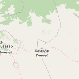
Map view of Gorkhi-Terelj National Park

Use this park location map to pinpoint Gorkhi-Terelj National Park in Mongolia, understand its exact geographic position, and read its mapped placement within the surrounding landscape more clearly.

Pigeon | © OpenStreetMap contributors

Location context for Gorkhi-Terelj National Park

Töv Province
Park atlas

Explore Surrounding Mongolian Landscapes and Compare Nearby Protected Areas for Deeper Discovery

Explore Other National Parks and Protected Areas Near Gorkhi-Terelj National Park
Browse other national parks and protected areas geographically relevant to Gorkhi-Terelj National Park, spanning Mongolia's distinctive forest steppe zone, mountain ranges, and river corridors. Compare adjacent conservation landscapes, understand regional ecological patterns, and map the spread of Mongolia's natural heritage beyond a single park entity.
Watercolor painting of a river winding through hills with trees and vegetation
National parkZabaykalsky Krai

Chikoy National Park: Protected National Park with Highland Landscape and River Basin Geography

Explore its protected boundaries and unique taiga-steppe transition in Zabaykalsky Krai.

Chikoy National Park, a protected area in Russia's Zabaykalsky Krai, showcases the rugged geography of the Khentei-Daur Highlands. As a national park, it preserves the upper Chikoy River basin and represents a significant ecological borderland, marking the transition from Siberian taiga to Mongolian steppe. This page facilitates a structured understanding of the park's mapped landscape, its prominent natural monument Bystrinsky Golets, and its role within the broader atlas of protected natural areas.

Area
6,665 km²
Established
2014
IUCN
II
Relief
Mountain
Watercolor illustration showing a mountainous landscape with green valleys and a river, rendered in soft pink and green hues
National parkKhentii Province

Onon-Balj National Park: A Protected River Valley in Mongolia's Khentii Province

Explore unique geography and diverse ecosystems at a steppe-forest transition.

Onon-Balj National Park safeguards a critical river valley area in Khentii Province, Mongolia, marking an important ecological transition zone between Siberian forests and the Daurian steppe. Discover the park's mapped landscape, characterized by mid-sized mountains and riparian habitats along the Onon and Balj rivers. This protected area offers insights into regional geography, biodiversity, and the unique natural heritage of northern Mongolia.

Area
4,158 km²
Established
2000
IUCN
II
Relief
Mountain
National parkMongolia

Khogno Khan National Park: A National Park with Distinct Mongolian Landscape Identity

Explore its mapped terrain and regional geographic context.

Khogno Khan National Park is a designated national park offering a specific focus for protected landscape discovery. Users can explore its geographic placement within Mongolia and understand its role as a mapped natural area. The park's identity as a protected territory provides critical context for those interested in the atlas of East Asian landscapes and regional geography, highlighting a distinct area for geographic study.

Area
841 km²
Established
2003
IUCN
II
Relief
Mountain
Watercolor illustration showing a lake, green vegetation, and mountains under a light sky
National parkIrkutsk Oblast

Pribaikalsky National Park: A Protected Siberian Landscape on Lake Baikal's Shores

Explore mapped boundaries and regional geography.

Pribaikalsky National Park is a key protected area in Irkutsk Oblast, critical for conserving the biodiversity and unique topography of Lake Baikal. This national park encompasses dramatic mountain terrain, coastal landscapes, and the significant Olkhon Island, offering a detailed geographic study for atlas exploration. Discover the mapped extent of this important natural reserve and its role in preserving one of Earth's most exceptional freshwater ecosystems and its surrounding Siberian environment.

Area
4,173 km²
Established
1986
IUCN
II
Visitors
400K annual
National parkMongolia

Khangai Nuruu National Park: Discover Mongolia's Protected Mountain Landscape and Atlas Context

Explore mapped boundaries and diverse ecosystems across its terrain.

Khangai Nuruu National Park stands as a vast national park in central Mongolia, characterized by its diverse protected landscapes and significant geographic scope. Spanning the Khangai Mountains, it presents a remarkable ecological transition from alpine meadows and taiga forests to steppe and riparian environments. This park offers a rich atlas exploration opportunity, highlighting its mapped boundaries and the unique regional geography that defines its protected status, making it a key point of discovery for understanding Mongolian conservation areas.

Area
8,885 km²
Established
1996
IUCN
II
Relief
Mountain
Watercolor illustration depicting layered mountains, green hills, and forested areas with purple and pink tones
National parkZabaykalsky Krai

Alkhanay National Park

Sacred Mountain & Forest Steppe

Alkhanay National Park in Russia protects a landscape where Siberian taiga meets Mongolian steppe. Explore its sacred Mount Alkhanai, diverse terrain, and protected natural features within a unique geographic setting.

Area
1,382 km²
Established
1999
IUCN
II
Relief
Mountain
National parkBuryatia

Tunkinsky National Park National Park: Protected Landscape and Geographic Context in Buryatia

Discover mapped park boundaries and regional terrain.

Delve into Tunkinsky National Park, a significant protected national park situated in the Buryatia region of Russia. This detail page provides a geographic overview, highlighting the park's mapped boundaries and its place within the surrounding natural landscape. Understand its designation as a protected area, offering a focused entry point for atlas-based discovery of its specific terrain and regional importance.

Area
11,837 km²
IUCN
II
Relief
Mountain
Climate
Boreal
National parkMongolia

Khorgo-Terkhiin Tsagaan Nuur National Park: Mongolian National Park Protected Landscape Atlas

Mapped geographic context and protected land identity in Mongolia.

Khorgo-Terkhiin Tsagaan Nuur National Park is a designated national park in Mongolia, offering a valuable component of the country's protected lands. This detailed entry focuses on its geographic position and mapped boundaries, providing essential context for understanding its unique landscape within the vast Mongolian plateau. Explore the protected area's distinct identity and its contribution to the regional natural geography, fostering a deeper appreciation for the mapped terrain.

Area
8 km²
Established
1965
IUCN
II
Relief
Mountain

Common questions about visiting, size, designation, and location context for Gorkhi-Terelj National Park

Gorkhi-Terelj National Park FAQs for park facts, access, geography, and protected area context
Find quick answers about Gorkhi-Terelj National Park, including protected-area facts, park geography, trail and visitor context, and how the park fits into its surrounding country and regional landscape.
MoriAtlas Explorer

Continue Your Protected Areas Search Across the Global Atlas

Deepen your exploration by continuing the structured search for national parks and protected areas worldwide. Utilize the comprehensive filtering capabilities to compare different conservation landscapes and refine your understanding of global park geography. Discover more about the distribution and characteristics of protected natural areas.

Global natural geography