Mori Atlas logo
National parkGrand Meadow National Nature Park

Navigate the protected landscape of this national park situated within southeastern Ukraine.

Grand Meadow National Nature Park: Mapped Boundaries and Geographic Context in Zaporizhzhia Oblast

(National Nature Park "Velykyi Luh")

Grand Meadow National Nature Park stands as a significant protected area within Zaporizhzhia Oblast, offering a unique focal point for geographic discovery. As a national park in southeastern Ukraine, its mapped boundaries provide a clear demarcation for understanding the region's natural landscape. MoriAtlas facilitates an atlas-based exploration of this protected territory, highlighting its place within the broader geography of the Sea of Azov region and emphasizing structured details for serious landscape context.

wetlandsbird migrationsteppe ecosystemsRamsar siteislandskarst landscape
Stylized illustration of a mountain landscape featuring a waterfall, river valley, pine trees, and snow-capped mountains

Grand Meadow National Nature Park

National park

Park overview

Structured park overview, official facts, and landscape profile for Grand Meadow National Nature Park

Grand Meadow National Nature Park park facts, protected area profile, and essential visitor context
Review the core facts for Grand Meadow National Nature Park, including designation, size, terrain, visitor scale, habitats, and operating context in one park-focused overview.

About Grand Meadow National Nature Park

Grand Meadow National Nature Park protects a landscape that represents the remnants of what was once one of Ukraine's largest and most ecologically significant floodplains. The historic Great Meadow extended over approximately 80,000 hectares between the Dnieper River and its tributary, the Kinska River, and was traditionally known as Kinskyi Plavni or the Great Meadow in local usage. When the Kakhovka Reservoir was filled in 1956, virtually the entire floodplain was submerged, leaving only the higher ridges, coastal strips along the reservoir shoreline, and the islands that emerged from the newly created body of water. Today, these remaining fragments, stretching along the shoreline for kilometers, constitute the park's protected territory. The landscape consists of a complex mosaic of wetland habitats, including reed beds, shallow marshes, floodplain channels, karst sinkholes, and steppe-covered ridges. The park's location within the Black Sea Lowland places it at the crossroads of several ecological zones, creating remarkable biodiversity. Beyond its ecological function, the park serves educational and recreational purposes, offering visitors trails for hiking, cycling, health activities, and ecological study while maintaining strict protection zones for sensitive wildlife habitats.

Quick facts and research context for Grand Meadow National Nature Park

Grand Meadow National Nature Park is located in Zaporizhzhia Oblast, Ukraine, along the southern bank of the Kakhovka Reservoir on the Dnieper River. The park covers 16,756 hectares and was established in 2006 under the Ministry of Ecology and Natural Resources. It lies within the Pontic-Caspian steppe ecoregion and experiences a humid continental climate with warm summers. The park is internationally recognized for its Ramsar-designated wetland sites and serves as a critical corridor for migratory birds traveling between Europe and Asia. The area contains karst topography, limestone coastal cliffs, and extensive reed beds that support diverse wildlife communities.

Park context

Deeper park guide and search-rich context for Grand Meadow National Nature Park

Grand Meadow National Nature Park history, landscape, wildlife, and travel context
Explore Grand Meadow National Nature Park through its history, landscape character, ecosystems, wildlife, conservation priorities, cultural context, and seasonal travel timing in a structured park guide built for atlas discovery and search intent.

Why Grand Meadow National Nature Park stands out

Grand Meadow is best known as one of Eastern Europe's most significant waterbird migration, nesting, and foraging areas. The park's position along the Dnieper flyway creates extraordinary bird concentrations during spring and autumn migrations. The karst sinkholes provide unique filtration systems that support clean water in the floodplain, while limestone cliffs offer prime nesting habitats for colonial waterbirds. The Sim Maiakiv Floodplain within the park is designated as a Ramsar wetland site, recognizing its international importance. The islands of the Great and Little Kuchuhury archipelago host substantial breeding colonies of herons, egrets, spoonbills, and rare species including the endangered white-tailed eagle and the globally significant yellow heron populations.

Panoramic view of mountain peaks with patches of snow, forested slopes, and rocky terrain under a partly cloudy sky
Panoramic view of snow-capped mountain peaks and forested ridges under a partly cloudy sky

Grand Meadow National Nature Park history and protected-area timeline

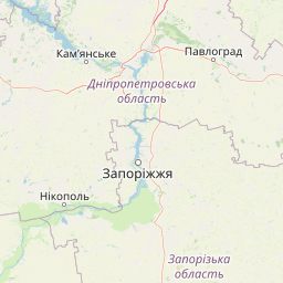
Grand Meadow National Nature Park was established on February 10, 2006, through a decree issued by the President of Ukraine. The park was created to preserve, restore, and sustainably utilize typical and unique natural landscape and historical-cultural complexes of the steppe zone that hold significant conservation, scientific, aesthetic, recreational, and health value. The new national park consolidated several pre-existing protected areas, including the regional landscape park Panai, the state ornithological reserve Veliki ta Mali Kuchuhury (Great and Little Kuchuhury), and the state landscape reserve Krutoshkly Kakhovskoho Vodoshkhovyshcha (Steep Slopes of the Kakhovka Reservoir). In 2021, the protected area expanded by more than 10,000 hectares, with wetland areas increasing by 217,000 hectares. Plans were underway in 2022 to further expand the park by over 9,274 hectares to include portions of the Vasylivka Bay and eastern sections of the Kakhovka Reservoir. However, since March 2022, the park has been under Russian occupation following the full-scale invasion of Ukraine. On June 6, 2023, the destruction of the Kakhovka Dam caused the reservoir to drain, fundamentally altering the park's hydrology and devastating two internationally important wetland sites: the Archipelago of Veliki ta Mali Kuchuhury (7,674 hectares) and the Floodplain of 7 Mayakov (2,140 hectares).

Grand Meadow National Nature Park landscape and geographic character

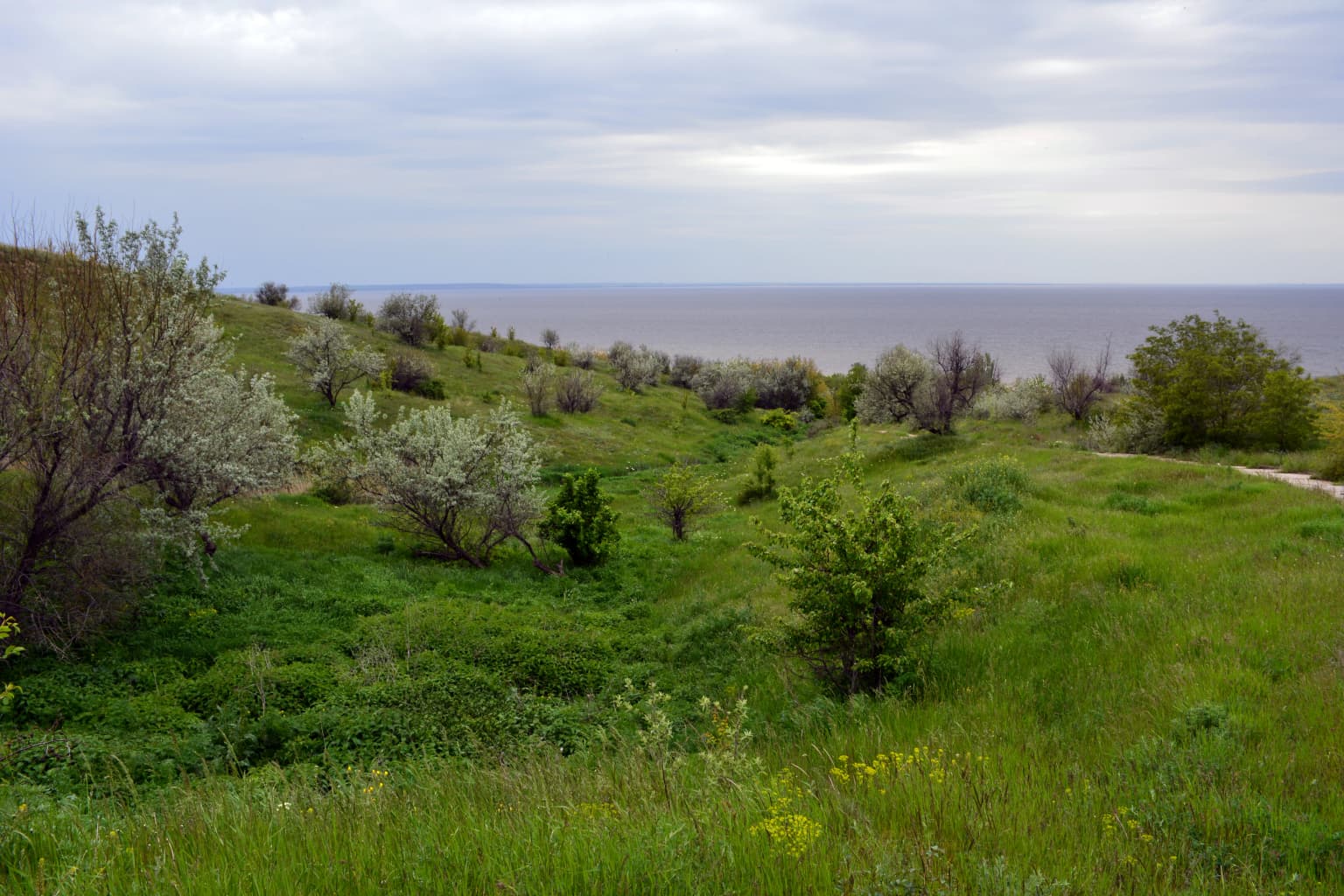
The park's landscape is defined by the remnants of a vast river floodplain transformed by the creation of a large reservoir. The terrain is predominantly flat and lies at low elevation, characterized by the terrace floodplain of the Dnieper River's southern bank. The park's territory extends along the reservoir shoreline, consisting of elevated ridges, narrow coastal strips, and a chain of islands formed when the reservoir was created in 1956. The karst topography of the region is particularly notable, with sinkholes and underground drainage systems providing natural water filtration. Limestone cliffs rise along portions of the coast, creating distinctive nesting habitats for colonial waterbirds. The floodplain areas feature highly variable water coverage depending on seasonal conditions and reservoir levels, creating dynamic wetland environments that shift between open water, marsh, and exposed mudflat. Steppe vegetation appears on the higher ground and ridges, contrasting with the aquatic habitats of the lower-lying areas.

Grassy hillside with scattered trees and shrubs leading to the Kakhovka Reservoir under an overcast sky
Grassland and shrubland landscape with the Kakhovka Reservoir in the distance

Grand Meadow National Nature Park ecosystems, habitats, and plant life

Grand Meadow National Nature Park occupies a critical position within the Pontic-Caspian steppe ecoregion, protecting remnants of what was once an extensive floodplain ecosystem. The park's wetland habitats, which include reed beds, marshes, shallow channels, and the floodplain areas around tributary mouths, support extraordinary biodiversity despite their relatively limited extent compared to the original Great Meadow. The karst geological features play a crucial ecological role by filtering water through underground systems before it reaches the surface wetlands. This process helps maintain water quality in the floodplain, supporting both aquatic life and the birds that depend on these habitats. The warm, shallow, flat areas of the submerged terrace provide extensive feeding grounds for fish, which in turn support populations of fish-eating birds including herons, cormorants, and diving ducks. The variability of water coverage across the floodplain creates a diversity of habitat conditions that benefit different species at different times, making the area valuable throughout the annual cycle.

Grand Meadow National Nature Park wildlife and species highlights

The park is internationally significant for its waterbird populations, serving as a major transmigration, nesting, and foraging area along the East Atlantic Flyway. The limestone coastal cliffs provide ideal nesting sites for colonial species, while the floodplain's variable water conditions offer feeding opportunities for a wide range of waterbirds. The karst sinkholes support substantial bat colonies, representing an important component of the park's mammalian fauna. The islands of the Great and Little Kuchuhury archipelago have become particularly important breeding grounds following the establishment of a strict protection zone in 2007, which banned hunting, fishing, recreational access, grazing, and logging that had previously impacted wildlife. Conservation successes include dramatic population increases in rare species: yellow heron pairs grew from 12 in 2007 to 47 by 2013, the globally rare avocet increased from 2 to 5 breeding pairs, and the black-headed gull grew from 1-2 to 23 pairs. The park also provides crucial habitat for the white-tailed eagle, grey goose, middle spotted woodpecker, spoonbill, and numerous other species listed in Ukraine's Red Book.

Grand Meadow National Nature Park conservation status and protection priorities

Grand Meadow National Nature Park represents one of Ukraine's most important conservation areas for wetland and waterbird protection. The park contains Ramsar-designated wetland sites of international importance, recognizing the significant ecological functions the area provides as a migratory bird corridor. The establishment of a strict reserve zone on the Kuchuhury islands in 2007 demonstrated the park's effectiveness at protecting sensitive wildlife, with documented increases in rare bird populations within just six years. The park was designed with multiple protection zones, including areas for strict nature preservation, recreation, cultural-historical tourism and study, and buffer zones. However, the destruction of the Kakhovka Dam in June 2023 represents a catastrophic conservation setback, having drained the reservoir and destroyed two internationally important wetland sites totaling nearly 10,000 hectares. The park remains occupied and faces uncertain conservation prospects under current circumstances, though it retains significance as a symbol of environmental protection and hope for restoration in Ukraine.

Grand Meadow National Nature Park cultural meaning and human context

The area holds deep historical and cultural significance in Ukraine. The Great Meadow, or Velykyi Luh, has been known by this name for centuries and was traditionally referred to as Kinskyi Plavni (Kinsky Marshes) in local usage. This vast floodplain was historically an important landscape for local communities, providing natural resources and shaping regional identity. The park's establishment in 2006 built upon earlier conservation efforts, incorporating the regional landscape park Panai and other protected areas that had been established to preserve the remaining fragments of this historic wetland. The park's creation reflected growing recognition of the need to protect both natural and historical-cultural complexes of the steppe zone. Educational and ecological awareness activities are conducted for local communities, helping to maintain connections between residents and this culturally significant landscape.

Top sights and standout views in Grand Meadow National Nature Park

The park's defining feature is its role as one of Eastern Europe's most important bird migration corridors, where enormous concentrations of waterbirds pass through during spring and autumn migrations. The Ramsar-designated Sim Maiakiv Floodplain represents one of the region's premier wetland conservation sites. The karst topography with its sinkholes provides unique geological features alongside ecological function. The limestone cliffs create dramatic coastal scenery while serving as nesting habitat for rare colonial birds. The islands of the Great and Little Kuchuhury archipelago support remarkable breeding colonies that have shown impressive recovery under protection. The combination of steppe, wetland, and coastal habitats within a single protected area creates exceptional ecological diversity. The park's location within the Pontic-Caspian steppe ecoregion adds continental significance to its local conservation value.

Best time to visit Grand Meadow National Nature Park

The park is most vibrant during spring and autumn migration periods when waterbird populations reach their peak, making these seasons ideal for birdwatching and wildlife observation. The warm summer months from May through August offer the best conditions for exploring the park's trails and enjoying the diverse landscapes, though summer temperatures can be high. The winter months present a dramatically different character as the landscape transforms, though access may be limited. The park's climate features large seasonal temperature differentials, with warm summers having at least four months averaging above 10 degrees Celsius. Visitors interested in seeing breeding waterbirds should aim for late spring and early summer when colonies are most active. Autumn migration typically produces spectacular bird congregations as birds stage before heading south. Given the current circumstances affecting the park's accessibility, visitors should check current conditions before planning any trip.

Park location guide

Geography guide, regional context, and park location map for Grand Meadow National Nature Park

Grand Meadow National Nature Park park geography, regions, and map view in Ukraine
Understand where Grand Meadow National Nature Park sits in Ukraine through a broader geographic reading of the surrounding landscape, nearby location context, and its mapped position within the national park landscape.

How Grand Meadow National Nature Park fits into Ukraine

Ukraine is a sovereign nation in Eastern Europe, bordered by Russia, Belarus, Poland, Slovakia, Hungary, Romania, Moldova, and the Black Sea. It is the second-largest country in Europe by area. Kyiv is the capital and largest city, followed by Kharkiv, Odesa, and Dnipro. The official language is Ukrainian. Ukraine has a population of approximately 32.9 million and operates as a unitary semi-presidential republic.

Wider geography shaping Grand Meadow National Nature Park in Ukraine

Ukraine occupies 603,628 km² in Eastern Europe, making it the second-largest country in Europe. It shares borders with Russia, Belarus, Poland, Slovakia, Hungary, Romania, and Moldova. The country has a southern coastline along the Black Sea and Sea of Azov. The terrain includes plains, steppes, and the Carpathian Mountains in the west.

Map view of Grand Meadow National Nature Park

Use this park location map to pinpoint Grand Meadow National Nature Park in Ukraine, understand its exact geographic position, and read its mapped placement within the surrounding landscape more clearly.

Pigeon | © OpenStreetMap contributors

Location context for Grand Meadow National Nature Park

Vasylivka RaionZaporizhzhia Oblast

Explore the unique Dnieper River floodplain, diverse wetland habitats, and distinctive coastal terrain that define this Ukrainian protected area.

Visual Guide to Grand Meadow National Nature Park: Landscapes, Habitats, and Protected Area Scenery
Browse a comprehensive collection of images showcasing Grand Meadow National Nature Park's diverse wetland, steppe, and coastal landscapes, along with its unique Dnieper River floodplain terrain. These visual insights provide essential context for understanding the park's ecological significance, its critical role for bird migration, and the distinct character of this Ukrainian protected area.

Panoramic view of mountain peaks with patches of snow, forested slopes, and rocky terrain under a partly cloudy sky

Tall reeds in the foreground, a body of water, and numerous birds flying against a clear blue sky in a wetland environment

Grassy hillside with scattered trees and shrubs leading to the Kakhovka Reservoir under an overcast sky

Park atlas

Expand your park exploration from Grand Meadow National Nature Park to trace regional protected landscapes within Zaporizhzhia Oblast and nearby areas.

Compare National Parks and Protected Areas Near Grand Meadow National Nature Park in Southeastern Ukraine
After exploring Grand Meadow National Nature Park, discover other protected areas and national parks located nearby or within the broader regional context of Zaporizhzhia Oblast, Ukraine. Trace the spread of significant wetland, steppe, and coastal conservation landscapes across southeastern Ukraine, comparing their unique ecological features and protected statuses.
National parkZaporizhzhia Oblast

Pryazovia National Nature Park: National Park Protected Landscape Atlas

Explore the mapped boundaries and regional geography of Pryazovia National Nature Park.

Pryazovia National Nature Park represents a key protected area within Zaporizhzhia Oblast, Ukraine. This MoriAtlas entry provides detailed atlas-style information, emphasizing the park's mapped boundaries and its integration into the regional geography. Understand the park's character as a protected natural landscape situated in the southeastern Ukrainian coastal zone near the Sea of Azov, offering valuable context for geographic exploration.

Area
781 km²
Established
2010
IUCN
II
Relief
Lowland
National park

Azov, Syvash National Nature Park: National Park Protected Landscape and Geography

Explore mapped boundaries and regional landscape context.

Azov, Syvash National Nature Park stands as a notable protected area, offering a distinct geographic identity within Ukraine's atlas of natural landscapes. This national park's mapped boundaries provide a foundation for understanding its landscape context and regional significance. MoriAtlas enables detailed exploration of its protected terrain and its place within the country's conservation geography, serving as a gateway to structured geographic information and detailed park data for researchers and explorers.

Area
525.8 km²
Established
1993
IUCN
II
Relief
Lowland
Watercolor illustration of a landscape with grassy fields, trees, a river, and distant hills.
National parkKherson Oblast

Oleshky Sands National Nature Park: Mapping Ukraine's Distinctive Semi-Arid Dune Landscape

Explore protected sandy steppe, dunes, and conservation areas in Kherson Oblast.

Oleshky Sands National Nature Park is a critical protected landscape in Kherson Oblast, Ukraine, renowned for its unusual semi-arid terrain dominated by expansive sand dunes and sandy steppe. This page provides detailed geographic context for the park, highlighting its unique mapped boundaries, the contrast between its Radensk and Burkut zones, and its ecological importance as part of the Pontic-Caspian steppe. Understand the specific landscape features and regional geography that make this national park a significant natural asset within Ukraine's protected area network.

Area
80.2 km²
Established
2010
IUCN
II
Relief
Mixed relief
Watercolor illustration of rolling hills, a winding river, and patches of vegetation
National parkKherson Oblast

Dzharylhach National Nature Park: Protected Landscape Atlas & Regional Geography

Explore the mapped protected area in Kherson Oblast, Ukraine.

Delve into the geographic details and protected landscape characteristics of Dzharylhach National Nature Park. As a designated national park within Kherson Oblast, this entry provides vital information for understanding its mapped boundaries and its place in the regional geography. MoriAtlas enables a structured approach to discovering and contextualizing protected areas like Dzharylhach, offering a unique perspective for atlas exploration.

Area
100 km²
Established
2009
IUCN
II
Relief
Lowland
Watercolor painting of a coastal scene with green hills, trees, and a body of water
National parkDonetsk Oblast

Meotyda National Nature Park: Coastal Wetlands and Bird Migration Hub in Donetsk Oblast

Explore protected park boundaries and unique Azov Sea ecosystems.

Meotyda National Nature Park protects a critical stretch of the Sea of Azov coastline, featuring diverse habitats such as coastal wetlands, estuaries, and steppe. Located in Donetsk Oblast, this national park is internationally recognized for its importance to migratory birds, supporting millions of waterfowl and over 100 nesting bird species annually. MoriAtlas offers an in-depth view of its geographic setting, mapped protected area, and its role within regional ecological corridors, providing essential context for understanding this significant Ukrainian natural landscape.

Area
207.21 km²
Established
2009
IUCN
II
Relief
Lowland
Watercolor illustration showing a valley with a winding river, green trees, and distant purple mountains under a light sky
National parkKharkiv Oblast

Homilsha Woods National Nature Park: National Park & Protected Landscape Atlas

Ancient oak woodlands and river valley geography in Kharkiv Oblast.

Delve into the protected natural heritage of Homilsha Woods National Nature Park, a significant national park situated in Ukraine's Kharkiv Oblast. This park preserves exceptional examples of ancient oak forests, some hundreds of years old, set within a complex geographic transition zone between steppe and forest ecosystems. Its diverse terrain, including hilly uplands and riverine plains, provides a compelling subject for mapped landscape discovery and understanding regional protected area distribution.

Area
143 km²
Established
2004
IUCN
II
Relief
Upland
Watercolor illustration showing a river winding through a forested valley with rolling hills and distant mountains under a light sky
National parkDonetsk Oblast

Holy Mountains National Nature Park: Donetsk Oblast Protected Landscape

Mapped boundaries and regional geographic context.

This entry details Holy Mountains National Nature Park, a protected national park located in Donetsk Oblast, Ukraine. It serves as a key point for exploring the mapped protected areas and natural landscapes within the Donbas region. Understand the park's geographic significance and its place within the atlas of eastern Ukraine's diverse terrain and conservation efforts.

Area
406 km²
Established
1997
IUCN
II
Relief
Mixed relief
National parkAutonomous Republic of Crimea

Charming Harbor National Nature Park: National Park Map and Protected Landscape Identity

Explore its mapped boundaries and regional geography.

Charming Harbor National Nature Park is a key protected area contributing to the natural landscape of the Autonomous Republic of Crimea. This page details its specific geographic scope and mapped boundaries, functioning as an atlas entry to understand its role within regional conservation efforts. Discover the park's distinct protected land context and its contribution to the mapped terrain of Ukraine.

Area
109 km²
Established
2009
IUCN
II
Relief
Lowland

Common questions about visiting, size, designation, and location context for Grand Meadow National Nature Park

Grand Meadow National Nature Park FAQs for park facts, access, geography, and protected area context
Find quick answers about Grand Meadow National Nature Park, including protected-area facts, park geography, trail and visitor context, and how the park fits into its surrounding country and regional landscape.
MoriAtlas Explorer

Continue Your Protected Areas Search Across the Global Atlas

Deepen your exploration by continuing the structured search for national parks and protected areas worldwide. Utilize the comprehensive filtering capabilities to compare different conservation landscapes and refine your understanding of global park geography. Discover more about the distribution and characteristics of protected natural areas.

Global natural geography