

Mori Atlas logo
National parkGreater Beedelup National Park

Mapped Boundaries and Geographic Context within Western Australia

Greater Beedelup National Park: National Park & Protected Landscape Identity

Greater Beedelup National Park represents a significant protected area within the diverse geography of Western Australia. As a national park, its mapped boundaries define a distinct natural landscape, offering users an anchor point for understanding regional protected lands. This page provides essential geographic context and atlas-style discovery, highlighting the park's role in the broader conservation of Western Australia's natural terrain.

Karri ForestWaterfallsOld-Growth ForestSouth West Western AustraliaNature ReserveMarsupial Habitat

Greater Beedelup National Park

National park

Park overview

Structured park overview, official facts, and landscape profile for Greater Beedelup National Park

Greater Beedelup National Park park facts, protected area profile, and essential visitor context
Review the core facts for Greater Beedelup National Park, including designation, size, terrain, visitor scale, habitats, and operating context in one park-focused overview.

About Greater Beedelup National Park

Greater Beedelup National Park occupies a significant position in Western Australia's network of protected areas, preserving a representative sample of the Southwest Australia biodiversity hotspot's forest ecosystems. Located in the state's South West region near the town of Pemberton, the park sits at an elevation where moisture-laden weather systems from the Southern Ocean create the damp conditions essential for karri forest development. The park's establishment in 1915 as an A Class Reserve reflects early recognition of the area's ecological and scenic value, making it one of the older national parks in Western Australia. The landscape features a network of streams and wetlands fed by the region's high rainfall, supporting the dense vegetation that characterizes the park. Visitors experience the park primarily through walking trails that traverse the forest and provide views of Beedelup Falls, the most prominent natural feature. The 1995 suspension bridge across Beedelup Brook allows safe access to viewpoints that were previously difficult to reach. While the park禁止s camping, the available facilities including picnic areas and rest spots support day visits. The management approach has included controlled burns to maintain ecosystem health and some selective logging in former State Forest areas that have since regenerated.

Quick facts and research context for Greater Beedelup National Park

Greater Beedelup National Park is located in Western Australia's South West forest region, 10 kilometers west of Pemberton along the Vasse Highway. The park features dense karri forest as its primary vegetation type, with areas of jarrah and marri also present. Its damp, loamy soils support abundant moss colonies and moisture-loving plant species including swamp peppermint, karri hazel, and lemon-scented darwinia. The park contains old-growth forest examples and areas of heath vegetation on sandy upland soils. Notable wildlife includes rare marsupials such as the woylie, numbat, and tammar. The park is managed by the Department of Parks and Wildlife with the Pemberton National Parks Board overseeing management since 1957.

Park context

Deeper park guide and search-rich context for Greater Beedelup National Park

Greater Beedelup National Park history, landscape, wildlife, and travel context
Explore Greater Beedelup National Park through its history, landscape character, ecosystems, wildlife, conservation priorities, cultural context, and seasonal travel timing in a structured park guide built for atlas discovery and search intent.

Why Greater Beedelup National Park stands out

Greater Beedelup National Park is best known for its spectacular Beedelup Falls, which flow powerfully during winter and spring, and the iconic walk-through karri tree, a 400-year-old giant with a man-made hollow large enough for visitors to stand inside. The park's exceptional karri forest, particularly the old-growth sections, represents a rare example of uncut temperate forest in Western Australia. The combination of towering karri trees, cascading waterfalls, and the suspended bridge crossing Beedelup Brook creates a distinctive visitor experience that showcases the natural character of the state's southwestern forests.

Greater Beedelup National Park history and protected-area timeline

Greater Beedelup National Park was gazetted as a protected area in 1910 and formally declared an A Class Reserve in 1915, establishing its legal protection at a time when Western Australia was developing its national park system. The reservation reflected an early appreciation for the forest's scenic and ecological values, particularly the impressive karri trees and the dramatic Beedelup Falls. From 1957 onward, the Pemberton National Parks Board assumed responsibility for park management, bringing local oversight to the area's conservation. The park's name originates from Beedelup Brook, which was named in 1875 by early European settlers exploring the region. The name's etymology connects to the Noongar language, with Beejalup interpreted as meaning place of rest or place of sleep, suggesting the area may have served as a traditional campsite or resting spot for Aboriginal people. Over the decades, management has balanced conservation objectives with visitor access, including the construction of the suspension bridge in 1995 and development of walking infrastructure around the falls. Some areas that were previously designated as State Forest underwent clear felling operations but have subsequently regenerated, demonstrating the forest's resilience.

Greater Beedelup National Park landscape and geographic character

The landscape of Greater Beedelup National Park is characterized by tall karri forest rising from loamy soils in the valley floors and more open heath communities on the sandy upland areas. The park's terrain follows the course of Beedelup Brook, which descends over a series of rock steps to create Beedelup Falls, the defining scenic feature. The karri trees, among the tallest in Western Australia, form a dense canopy that creates a moody, atmospheric forest environment particularly during the winter months when mist often hangs among the trunks. The forest floor supports abundant groundcover vegetation including ferns, mosses, and herbaceous species that thrive in the constantly moist conditions. In contrast, the higher ground features sandy soils that support more open heath vegetation with characteristic Australian shrubs. The suspension bridge crossing Beedelup Brook provides a focal point for experiencing the landscape, offering views of the falls and the forested gorge below.

Greater Beedelup National Park ecosystems, habitats, and plant life

The ecological character of Greater Beedelup National Park reflects the Southwest Australia biodiversity hotspot, one of the world's 36 biodiversity hotspots requiring urgent conservation attention. The park's vegetation is dominated by karri forest, a tall eucalypt forest type that attains its greatest development in this region of high rainfall. Mixed among the karri are stands of jarrah and marri, creating a diverse forest structure. The moist loamy soils support large colonies of moss and a rich understory including swamp peppermint, various Hibbertia species, karri hazel, waterbush, myrtle wattle, and lemon-scented darwinia. The old-growth forest sections represent particularly valuable ecological habitat, retaining large hollow-bearing trees essential for arboreal wildlife. The sandy upland areas support distinct heath communities with plants such as Crowea dentata, Crowea augustifolia, and Choretrum lateriflorum. This mosaic of forest and heath habitats, together with the streams and waterfalls, creates the diverse environmental conditions that support the park's wildlife.

Greater Beedelup National Park wildlife and species highlights

Greater Beedelup National Park provides habitat for several rare and conservation-significant marsupial species. The woylie, a small marsupial also known as the brush-tailed bettong, inhabits the forest understory where it forages for fungi, roots, and insects. The numbat, a distinctive termite-eating marsupial also called the banded anteater, represents one of Australia's more unusual small mammals and remains endangered across its remaining range. The tammar, a small wallaby species, occupies dense vegetation in the forest areas. These species occupy the broader forest ecosystem, utilizing the hollow logs, leaf litter, and groundcover vegetation that characterize the karri forest environment. While detailed species inventories are limited in the source material, the presence of these three rare mammals indicates the park's conservation significance beyond its botanical values.

Greater Beedelup National Park conservation status and protection priorities

Greater Beedelup National Park contributes to the conservation of Southwest Australia's unique forest ecosystems within the global biodiversity hotspot framework. The protection of old-growth karri forest represents a particular conservation priority, as these unmodified forest areas retain ecological processes and structures that have been lost from much of the surrounding landscape through historical logging. The park's designation as an IUCN Category II protected area confirms its national park status and the intention to preserve natural ecosystems while enabling sustainable visitor use. The presence of rare fauna including the woylie, numbat, and tammar adds mammalian conservation value to the park's botanical significance. Management practices include controlled burning, which is used to reduce fuel loads and maintain ecosystem health in a fire-prone landscape. The regeneration of previously logged areas demonstrates the capacity of karri forest to recover given appropriate protection.

Greater Beedelup National Park cultural meaning and human context

The cultural context of Greater Beedelup National Park includes both Aboriginal heritage and European settlement history. The Noongar people, the traditional owners of southwestern Western Australia, used the Beedelup area as evidenced by the etymology of the place name. The word Beejalup, from which Beedelup derives, translates to place of rest or place of sleep, suggesting the area served as a traditional campsite or shelter location within the broader Noongar cultural landscape. European settlement of the Pemberton region began in the mid-nineteenth century, with Beedelup Brook receiving its name in 1875 during early exploration and surveying of the forest regions. The establishment of the park in 1915 reflected a developing appreciation for preserving natural landscapes, a relatively new concept in early twentieth-century Australia. The combination of Aboriginal place names and later European naming creates a layered cultural history within the park.

Top sights and standout views in Greater Beedelup National Park

Greater Beedelup National Park offers visitors several standout features that distinguish it from other forest parks in the region. The Beedelup Falls, particularly impressive during winter and spring when water flow is highest, provide a dramatic natural focal point accessible via a signed walking trail. The suspension bridge across Beedelup Brook, built in 1995, enables visitors to experience the falls from viewpoints that were previously difficult to reach. The walk-through karri tree, estimated at 400 years old, features a large hollow cut into its base, allowing visitors to stand inside the living tree—an unusual and memorable forest experience. The old-growth karri forest sections showcase the ecological grandeur of unmodified temperate forest, with trees of impressive height and girth supporting complex ecological communities. The park's accessibility from Perth makes it a feasible destination for day trips or weekend excursions from the capital city.

Best time to visit Greater Beedelup National Park

The best time to visit Greater Beedelup National Park depends on the experience sought. Winter and spring, from June through November, offer the most dramatic waterfall viewing as Beedelup Falls flows strongly with seasonal rainfall. The forest environment during these months is particularly lush and atmospheric, with mist often creating moody conditions among the karri trees. Summer and early autumn provide different but equally valid experiences, with the forest offering shade from summer heat and the walking trails remaining accessible. The cooler months may be more comfortable for hiking, while the wet season showcases the park's water features at their peak. Regardless of season, the park's facilities including the picnic area and walking trails support visitors throughout the year, though the park does not offer camping accommodation.
Park location guide

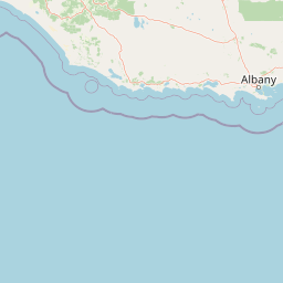
Geography guide, regional context, and park location map for Greater Beedelup National Park

Greater Beedelup National Park park geography, regions, and map view in Australia
Understand where Greater Beedelup National Park sits in Australia through a broader geographic reading of the surrounding landscape, nearby location context, and its mapped position within the national park landscape.

How Greater Beedelup National Park fits into Australia

Australia is a constitutional monarchy and federal parliamentary democracy comprising six states and ten territories. With a population of nearly 28 million, it is one of the world's most urbanised countries, with most people concentrated on the eastern seaboard. The country has a high Human Development Index and is known for its cultural diversity, ancient Aboriginal heritage, and unique wildlife.

Wider geography shaping Greater Beedelup National Park in Australia

Australia occupies the entire Australian continent, the island of Tasmania, and numerous smaller islands. It is the world's flattest and driest inhabited continent, featuring vast deserts in the interior (the Outback), tropical rainforests along the eastern coast, and a coastline bordering the Indian and Pacific Oceans.

Map view of Greater Beedelup National Park

Use this park location map to pinpoint Greater Beedelup National Park in Australia, understand its exact geographic position, and read its mapped placement within the surrounding landscape more clearly.

Pigeon | © OpenStreetMap contributors

Location context for Greater Beedelup National Park

Western Australia
Park atlas

Compare the geographic spread of protected karri forests and unique waterfalls across South West Western Australia.

Discover Other National Parks and Protected Areas Surrounding Greater Beedelup National Park, Western Australia
Browse a curated selection of national parks and protected areas near Greater Beedelup National Park, exploring adjacent karri forests, unique waterfalls, and diverse marsupial habitats within Western Australia's South West region. Gain a broader understanding of regional conservation efforts and compare distinct protected landscapes across this ecologically significant zone.
National parkWestern Australia

Warren National Park: A Protected Landscape of Ancient Karri Forests in Western Australia

Explore mapped forest boundaries and river geography.

Warren National Park offers an unparalleled glimpse into the grandeur of old-growth karri forests, showcasing some of Western Australia's most towering trees. Situated in the South West region, this national park protects a vital tract of temperate forest ecosystem, characterized by rolling terrain and the scenic Warren River. Its mapped landscape and protected-area status highlight the critical importance of preserving these magnificent natural environments for atlas-based geographic discovery.

Area
29.81 km²
Established
1977
IUCN
II
Scope
Terrestrial
National park

Greater Hawke National Park: Mapped Boundaries of Old Growth Forest Landscape

Explore the protected forest and regional geography.

Greater Hawke National Park offers a significant atlas exploration opportunity for understanding Australia's protected forest ecosystems. This national park preserves critical old growth stands of karri and jarrah trees, showcasing the unique landscape of the Warren bioregion. Its Class A reserve status and adjacency to D'Entrecasteaux National Park highlight its importance as a conservation corridor within the South West of Western Australia. Users can examine the park's geographic setting and its protected-area identity.

Area
140.04 km²
Established
2004
Climate
Mediterranean
Access
Moderate access
National parkWestern Australia

Brockman National Park: Western Australia National Park for Protected Landscape Discovery

Explore mapped boundaries and natural terrain.

Brockman National Park is a significant protected area within Western Australia, recognized as a national park. This detail page focuses on its role as a conserved landscape, offering insight into its natural geography and mapped extent. Engage with structured data to understand the park's context within the broader regional atlas of Western Australia's protected lands.

Area
0.52 km²
Established
1977
IUCN
II
Relief
Highland
National parkWestern Australia

Gloucester National Park: National Park in Western Australia's Geographic Landscape

Explore mapped boundaries and protected land context.

Gloucester National Park stands as a significant protected area within the vast geographic expanse of Western Australia. This entry focuses on its identity as a national park, detailing its mapped landscape features and regional context. Understanding Gloucester National Park involves appreciating its specific geographic setting and its contribution to the atlas of protected natural areas in Australia, providing foundational data for landscape exploration.

Area
8.78 km²
Established
1993
IUCN
II
Access
Moderate access
National parkWestern Australia

Easter National Park: Protected Jarrah Forest Landscape Atlas

Explore its mapped terrain and regional geography.

Easter National Park serves as a protected national park in Western Australia, preserving crucial jarrah forest ecosystems within the Warren bioregion. As part of the Southwest Australia biodiversity hotspot, it contributes to a contiguous block of protected land safeguarding the region's distinctive woodland and forest communities. Users can explore its mapped boundaries and understand its role within the broader South West Australian geography, offering a detailed look at a representative forest reserve.

Area
29.85 km²
Established
2004
IUCN
II
Relief
Lowland
National park

Hilliger National Park: Western Australian Protected Jarrah Forest and Memorial Landscape

Mapped boundaries of a vital national park in the South West region.

Hilliger National Park stands as a testament to forest conservation in Western Australia's South West. This 16,962-hectare national park, established in 2004, protects representative old-growth jarrah forest ecosystems and honors a significant firefighting legacy. Explore its terrain and its geographic placement within a broader network of protected lands, offering a concrete example of conservation strategy in the region. The park's mapped area contributes valuable data to the understanding of regional natural landscapes.

Area
169.62 km²
Established
2004
Climate
Temperate
Scope
Terrestrial
National parkWestern Australia

Sir James Mitchell National Park: National Park, Western Australia - Geographic Atlas View

Mapped protected area with regional landscape context.

Gain a structured understanding of Sir James Mitchell National Park as a key protected landscape within Western Australia. This atlas entry focuses on the park's geographic extent, its status as a national park, and its position within the diverse regional geography of Western Australia, offering clear insights for map-based exploration and conservation landscape analysis.

Area
2.47 km²
Established
1969
IUCN
II
Access
Access unknown
National parkAustralia

Milyeannup National Park: Explore its Protected Landscape and Geographic Atlas Context

Discover the mapped terrain and boundaries of this Australian national park.

Milyeannup National Park offers a unique focus for atlas-based geographic exploration. This entry details the park's identity as a protected area, highlighting its landscape context and mapped geographic features within Australia. Use this resource to understand its role in the national park system and its specific place within the broader landscape.

Area
186.92 km²
Established
2004
Scope
Terrestrial
Forest
Mostly forested

Common questions about visiting, size, designation, and location context for Greater Beedelup National Park

Greater Beedelup National Park FAQs for park facts, access, geography, and protected area context
Find quick answers about Greater Beedelup National Park, including protected-area facts, park geography, trail and visitor context, and how the park fits into its surrounding country and regional landscape.
MoriAtlas Explorer

Continue Your Protected Areas Search Across the Global Atlas

Deepen your exploration by continuing the structured search for national parks and protected areas worldwide. Utilize the comprehensive filtering capabilities to compare different conservation landscapes and refine your understanding of global park geography. Discover more about the distribution and characteristics of protected natural areas.

Global natural geography