
Reservoirs
Park geography
A detailed assessment of land area, regional coordinates, and natural landscape features.
Geographic Profile and Mapped Terrain of Guadiana Valley Natural Park in Beja District
This geographic profile examines the structural footprint of Guadiana Valley Natural Park, encompassing an area of 697 square kilometers within the Beja District of Portugal. The landscape is defined by arid climate conditions and a network of riverine systems, featuring prominent peaks such as Alcaria Ruiva and the notable Pulo do Lobo waterfall.
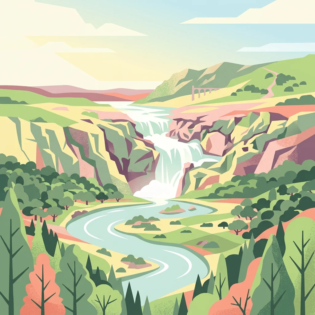
A protected river landscape in Portugal's driest region, marked by the dramatic Pulo do Lobo waterfall
Guadiana Valley Natural Park
Guadiana Valley Natural Park is a protected landscape in southeastern Portugal, spanning the Guadiana River basin and its surrounding plains in the Baixo Alentejo region. Established in November 1995, the park covers approximately 697 square kilometers across the municipalities of Mértola and Serpa in the Beja district. This is one of the driest regions in Portugal, receiving only about 600 millimeters of annual precipitation, yet it supports remarkable biodiversity where the river corridor creates a vital green artery through the semi-arid terrain. The park is classified as IUCN Category V, reflecting its role as a protected seascape and landscape where natural processes continue alongside sustainable human land use.
- Location
- Portugal
- Park type
- Protected landscape
- Established
- 1995
- Area
- 697 km²
Location overview
Regional placement and territorial limits within Beja District
Geographic Profile of Guadiana Valley Natural Park in Portugal
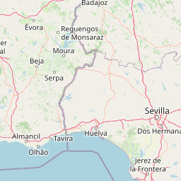
Guadiana Valley Natural Park is situated in the Beja District of Portugal as a dedicated inland sanctuary. National records outline the regional administrative borders and conservation status defining the park.
- Countries
- Portugal
- Regions
- Beja District
- Primary location
- Beja District
- Geographic setting
- Inland
Boundary and coordinates
Spatial span and geographic coordinate limits across 697 square kilometers
Guadiana Valley Natural Park Boundary Mapping and Spatial Limits
Interactive boundary mapping provides clear spatial context for Guadiana Valley Natural Park. Regional datasets detail key geographic facts including estimated area, perimeter limits, and center coordinates.
- Boundary area
- 696.6 km²
- Boundary perimeter
- 148.5 km
- Northernmost point
- 37.8576° N
- Southernmost point
- 37.5172° N
- Easternmost point
- 7.4872° W
- Westernmost point
- 7.8358° W
- Geographic centre
- 37.7001° N, 7.6488° W
- North–south span
- 37.8 km
- East–west span
- 30.8 km
Terrain and natural features
Stored lowland classifications and recorded natural features
Guadiana Valley Natural Park Terrain and Named Natural Features
Recorded lowland classifications define the protected terrain across Guadiana Valley Natural Park. Linked feature cards supply names, types, and spatial relationships for recorded streams, peaks, and reservoirs.
Selected named natural features
Streams
Barranco da Cachopa
Peaks
Milhouro
197 m
Streams
Barranco de Alfamar
Rock formations
Cadeira do Rei
Streams
Barranco da Corte
Environmental setting
Arid lowland terrain, sparse forest cover, and riverine wetland habitats
Guadiana Valley Natural Park Environmental Settings and Landscape Classifications
Stored classifications combine lowland relief, arid climate zones, and riverine habitats as interpretive categories for physical terrain. Recorded environmental metrics link specific landscape features to relevant protected area destinations within the atlas.
- Relief
- Lowland
- Climate
- Arid
- Water
- Minor water
- Forest cover
- Sparse forest
- Seasonality
- Year-round
Landscape features
Rivers · Wetland
Habitat types
Mediterranean forest · Wetland · Riverine habitat
Park atlas
Explore nearby protected landscapes and compare river basin geography across the Baixo Alentejo region.
Discover More Protected Areas Near Guadiana Valley Natural Park in Portugal's Beja District
Continue your atlas-style exploration beyond Guadiana Valley Natural Park by browsing other protected areas and natural landscapes across the Beja District and surrounding Baixo Alentejo region. Compare diverse park geographies, from semi-arid river valleys to unique wetland habitats, providing deeper context for Portugal's conservation efforts.
Protected landscapeAlgarve
About 63 km away#1 closest
South

Ria Formosa Natural Park Protected Landscape: Algarve Regional Geography
Explore mapped protected landscapes and regional geographic context.
Examine Ria Formosa Natural Park, a protected landscape that defines a significant portion of the Algarve's natural heritage. This atlas-focused exploration details the park's geographic features, its protected status, and its position within the wider regional geography. Understand the mapped extent of this protected landscape and its contribution to the natural context of southern Portugal.
- Area
- 179.01 km²
- Established
- 1978
- IUCN
- V
- Relief
- Lowland
Protected landscapeAlentejo Litoral
71 km away#2 closest
West
Southwest Alentejo and Vicentine Coast Natural Park: A Protected Landscape in Alentejo Litoral
Explore its mapped boundaries and regional geographic context.
This detail page offers a deep dive into the Southwest Alentejo and Vicentine Coast Natural Park, a protected landscape situated in Portugal's Alentejo Litoral region. Understand the park's identity as a protected area through its geographic features and mapped extent. MoriAtlas facilitates a structured understanding of this natural landscape, enabling focused discovery of its protected boundaries and regional geographical significance.
- Area
- 895.7 km²
- Established
- 1988
- IUCN
- V
- Visitors
- 12.7K annual
National parkHuelva
100 km away#3 closest
Southeast

Doñana National Park National Park: Mapped Geography and Protected Landscape Context
Explore Huelva's key protected area and its regional geographic setting.
Delve into the structured geographic data and mapped boundaries of Doñana National Park. This entry highlights its identity as a national park within the Huelva region, providing essential context for understanding its protected landscape. MoriAtlas offers this detail to facilitate a clear, atlas-driven exploration of its natural terrain and its place in the broader geographic framework of Spain.
- Area
- 543 km²
- Established
- 1969
- IUCN
- II
- Visitors
- 376.3K annual
Protected landscapePortugal
122 km away#4 closest
Northwest
Arrábida Natural Park: Protected Landscape Atlas and Geographic Context in Portugal
Mapped boundaries of this key Portuguese protected area.
Arrábida Natural Park is presented here as a significant protected landscape, offering rich details for geographic exploration and atlas-based research. Users can investigate its specific mapped boundaries, understand its environmental setting within Portugal, and utilize this data for comparative analysis of protected areas. This resource focuses on the park's inherent geographic identity and its role as a defined natural landscape.
- Area
- 176.41 km²
- Established
- 1976
- IUCN
- V
- Visitors
- 23.1K annual
Protected landscapePortalegre District
146 km away#5 closest
North
Serra de São Mamede Natural Park: A Protected Landscape Defined by Ecological Transition
Explore the unique mountain terrain and ecosystems of Portalegre District.
Delve into the geographic and ecological identity of Serra de São Mamede Natural Park, a significant protected landscape situated in Portugal's Portalegre District. This area is renowned for its dramatic quartzite ridges and its role as a crucial meeting point for Atlantic and Mediterranean plant communities, offering a unique atlas perspective on regional biodiversity. Examining its mapped boundaries and diverse terrain provides essential context for understanding its ecological importance and its distinct position within the Alentejo region's geography.
- Area
- 560.6 km²
- Established
- 1989
- IUCN
- V
- Visitors
- 4.5K annual
Protected landscapeLisbon District
169 km away#6 closest
Northwest
Sintra-Cascais Natural Park: Mapped Protected Landscape in Lisbon District, Portugal
Explore Atlantic coast geography and historic palatial terrain.
The Sintra-Cascais Natural Park is a designated protected landscape in Portugal's Lisbon District, renowned for its fusion of natural beauty and historical architecture. This page offers an atlas-style exploration of its mapped boundaries, showcasing the unique Serra de Sintra mountain range meeting the Atlantic coast. Discover the protected area's geographic features, from its lush forested slopes crowned with iconic palaces to the dramatic cliffs and beaches of Cabo da Roca, providing essential context for understanding this distinctive Portuguese natural landscape.
- Area
- 144.51 km²
- Established
- 1981
- IUCN
- V
- Visitors
- 43.5K annual
Protected landscapePortugal
193 km away#7 closest
Northwest
Aire and Candeeiros Ranges Natural Park: Protected Landscape and Regional Geographic Context
Explore the mapped boundaries and natural landscape of this Portuguese protected area.
Understand the Aire and Candeeiros Ranges Natural Park as a key protected landscape in Portugal. This page offers detailed geographic information, focusing on the park's mapped boundaries and its intrinsic connection to the surrounding regional geography. It serves as a portal for atlas exploration, providing structured data for users interested in the specific protected area and its landscape characteristics within the Iberian Peninsula.
- Area
- 383.93 km²
- Established
- 1979
- IUCN
- V
- Visitors
- 31.9K annual
National parkSpain
235 km away#8 closest
Southeast
Sierra de las Nieves National Park: Ancient Fir Forests and Karst Geography in Andalusia
Mapped protected landscape and unique geologic features
Sierra de las Nieves National Park stands as a remarkable protected area in Andalusia, Spain, celebrated for its world-leading Spanish fir forests and intricate karst topography. This national park showcases significant geological diversity, from towering limestone formations and deep caves to the striking red peridotite mountains of Sierra Bermeja. Its elevation, reaching Pico Torrecilla at 1,919 meters, offers a unique alpine landscape context within southern Europe, mapped for detailed geographic discovery and protected area exploration.
- Area
- 939.3 km²
- Established
- 1989
- IUCN
- II
- Visitors
- 100K annual
MoriAtlas Explorer
Continue Your Atlas Exploration of Guadiana Valley Natural Park's Geography
Deepen your understanding of Guadiana Valley Natural Park by examining its precise mapped boundaries and its role within the broader geography of Beja District. MoriAtlas provides structured data to compare this protected landscape with surrounding natural areas and regional terrain features, enhancing your overall geographic discovery experience.
Browse next
Global natural geography
Explore related park routes
Explore MoriAtlas Global ParksBrowse All MoriAtlas ParksGlobal Park Map DiscoveryMoriAtlas: Browse All CountriesBrowse All MoriAtlas ContinentsNational Park Environment AtlasGrand Canyon National Park AtlasYellowstone National Park AtlasYosemite National Park Atlas and GeographySerengeti National Park AtlasGalápagos National Park Protected LandscapeBanff National Park Geography and AtlasKruger National Park Atlas EntryUluṟu-Kata Tjuṯa National Park AtlasExplore Uluru-Kata Tjuta National Park GeographyPlitvice Lakes National Park AtlasFiordland National Park Protected LandscapeGreat Smoky Mountains National Park AtlasAfghanistan National Parks and Protected AreasAlbania National Parks and Protected AreasAlgeria National Parks and Protected AreasAmerican Samoa National Parks and Protected AreasAndorra National Parks and Protected AreasAngola National Parks and Protected AreasAntarctica National Parks and Protected AreasAntigua and Barbuda Park List