


Mori Atlas logo
National parkParque nacional Guaramacal

Understanding the high altitude geography and protected boundaries of this mountain massif.

Parque nacional Guaramacal: A Mapped Exploration of Andean Cloud Forests and Páramo Terrain

(Parque Nacional General Cruz Carrillo)

Parque nacional Guaramacal serves as a vital protected area within the Venezuelan Andes, spanning a dramatic elevational gradient from humid sub-Andean forests to windswept high-altitude páramo. This atlas entry details the rugged topography of the Ramal de Guaramacal, encompassing deep ravines and the basin of Laguna de Los Cedros. Learn about the geographic significance of this isolated mountain spur as a refuge for endemic species and a critical watershed anchor in Trujillo.

cloud forestpáramoAndesmountain reservenational parkVenezuela
Stylized digital illustration of a serene mountain lake surrounded by lush green forests and towering cliffs under a soft pink and orange sunset sky, featuring pathways and small shelters.

Parque nacional Guaramacal

National park

Park overview

Structured park overview, official facts, and landscape profile for Guaramacal National Park

Guaramacal National Park park facts, protected area profile, and essential visitor context

Review the core facts for Guaramacal National Park, including designation, size, terrain, visitor scale, habitats, and operating context in one park-focused overview.

About Guaramacal National Park

Guaramacal National Park is a compact but ecologically intense reserve in the Venezuelan Andes, occupying roughly 215 square kilometers of mountainous terrain between Trujillo and Portuguesa states. The park takes its name from the Ramal de Guaramacal, a short but geographically distinct mountain branch that marks the northern limit of the Cordillera de Mérida. Although small in comparison to many of Venezuela's better known protected areas, Guaramacal contains an exceptionally complete elevational sequence of Andean environments, ranging from semi-deciduous lower forests at around 1,600 meters to a high páramo that reaches about 3,100 meters at the summit of the massif.

The park was formally established on 25 May 1988 and is administered by INPARQUES, the institution that oversees Venezuela's national protected areas. Its designation as a national park reflected growing recognition that the Ramal de Guaramacal hosted unusually high biodiversity for such a limited area, with ecological transitions compressed into relatively short horizontal distances. Subsequent research has confirmed this importance: systematic inventories have documented more than 1,200 plant species and exceptionally high rates of endemism among amphibians, reptiles, and birds.

For visitors, researchers, and conservation planners, Guaramacal represents a working example of how a small Andean park can hold disproportionately high biological value. Its cloud forests stabilise watersheds that feed surrounding agricultural landscapes, including those around the Andean town of Boconó, while its páramo functions as a fragile high-altitude ecosystem that is increasingly affected by climate and land-use pressures. Together these roles make the park a meaningful focus of ecological study in northern South America, well beyond its modest size on the map.

Quick facts and research context for Guaramacal National Park

Guaramacal is administered by INPARQUES under Venezuela's national park system and is classified as an IUCN Category II protected area, granted full national park status on 25 May 1988. It lies across Trujillo and Portuguesa states, anchored to the Ramal de Guaramacal, with park boundaries generally situated between 1,600 and 1,800 meters and a summit reaching about 3,100 meters in the Guaramacal páramo. A systematic botanical inventory completed in 2000 recorded at least 147 plant families, 517 genera, and 1,227 species, including species new to science. Around 150 bird species, 36 mammal species, 14 amphibian species, and 11 reptile species have been catalogued within its territory.

Protection and recognition

Examine documented terrestrial conservation frameworks and designation records.

Parque nacional Guaramacal Protection Status and International Recognition

Terrestrial protection status records for Parque nacional Guaramacal outline the established conservation scope and management framework. Official designation details clarify the documented administrative parameters governing the protected area.

Protection details

Protection scope
Terrestrial
Transboundary protection
No
Park context

Deeper park guide and search-rich context for Guaramacal National Park

Guaramacal National Park history, landscape, wildlife, and travel context

Explore Guaramacal National Park through its history, landscape character, ecosystems, wildlife, conservation priorities, cultural context, and seasonal travel timing in a structured park guide built for atlas discovery and search intent.

Why Guaramacal National Park stands out

The park is best known for the dramatic transition it preserves between three distinct ecological zones in a compact area: a transitional sub-Andean forest below 1,600 meters, a richly epiphyte-laden humid cloud forest between roughly 1,600 and 2,500 meters, and a high-altitude páramo above that. Guaramacal is also recognized as a hotspot of endemism within the Venezuelan Andes, especially for amphibians, reptiles, and certain bird species, and as a refuge for threatened mammals such as the spectacled bear. The presence of Laguna de Los Cedros, a small glacial lake set against the surrounding peaks, adds to the park's visual and ecological identity.
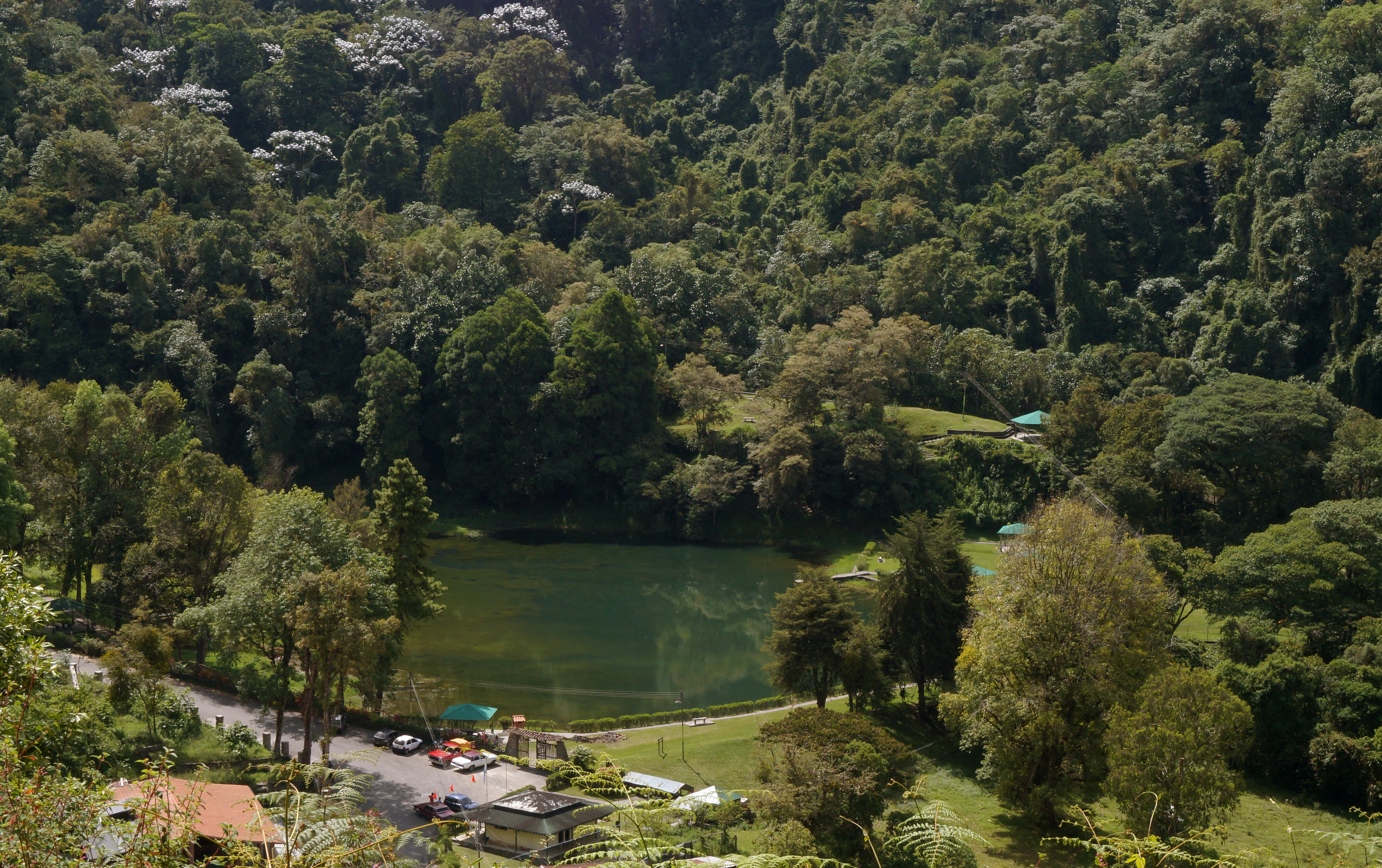
A high-angle view of a calm green lake nestled in a dense, lush mountain forest with a small parking area and structures visible near the shore.
Laguna de los Cedros, a scenic mountain lake surrounded by dense forest in Parque nacional Guaramacal.

Guaramacal National Park history and protected-area timeline

Scientific interest in Guaramacal predates its formal protection. The earliest documented botanical studies within the area date to 1987, when researchers recorded roughly 482 plant species and began to recognise the massif as a distinct biological unit within the Venezuelan Andes. Less than a year after these initial surveys, on 25 May 1988, the Venezuelan government formally designated the area as Parque Nacional Guaramacal under the national park category, placing it under the administration of INPARQUES.

A major expansion of knowledge came in 2000, when a more thorough botanical inventory catalogued 147 plant families, 517 genera, and at least 1,227 species, and described 33 taxa that were new to science. This body of work helped consolidate the park's reputation as a centre of Andean biodiversity and endemism, and it remains a reference baseline for subsequent studies of the area's flora and fauna. The park has continued to function as an active site for ecological research, with particular attention to its amphibians, reptiles, and high-altitude bird species.

Guaramacal National Park landscape and geographic character

The landscape of Guaramacal is defined by the Ramal de Guaramacal, an isolated northern spur of the much larger Cordillera de Mérida. The terrain rises in a relatively short horizontal distance from forested lower slopes near 1,600 meters to rugged ridges, cloud-shrouded summits, and finally the open, windswept páramo above 3,000 meters. Steep ravines, narrow valleys, and ridgelines give the park a deeply dissected topography, with rock outcrops visible through the forest cover at higher elevations.

A distinctive feature of the park's geography is Laguna de Los Cedros, a small mountain lake that occupies a high basin within the massif and is surrounded by a mixture of forest and open terrain. The lake is one of the most photographed points of interest in the park and offers a visual contrast between still water, dense vegetation, and the steep slopes that rise around it. Together with the surrounding páramo, the lake contributes to the sense that Guaramamal compresses a wide range of Andean scenery into a relatively limited area.

Glacial and erosional processes have shaped the higher parts of the massif, while ongoing river incision continues to define the lower valleys. The result is a park in which visitors can move between warm, humid lower forests and cold, exposed páramo in the course of a single day hike, an unusual feature for a protected area of its size.
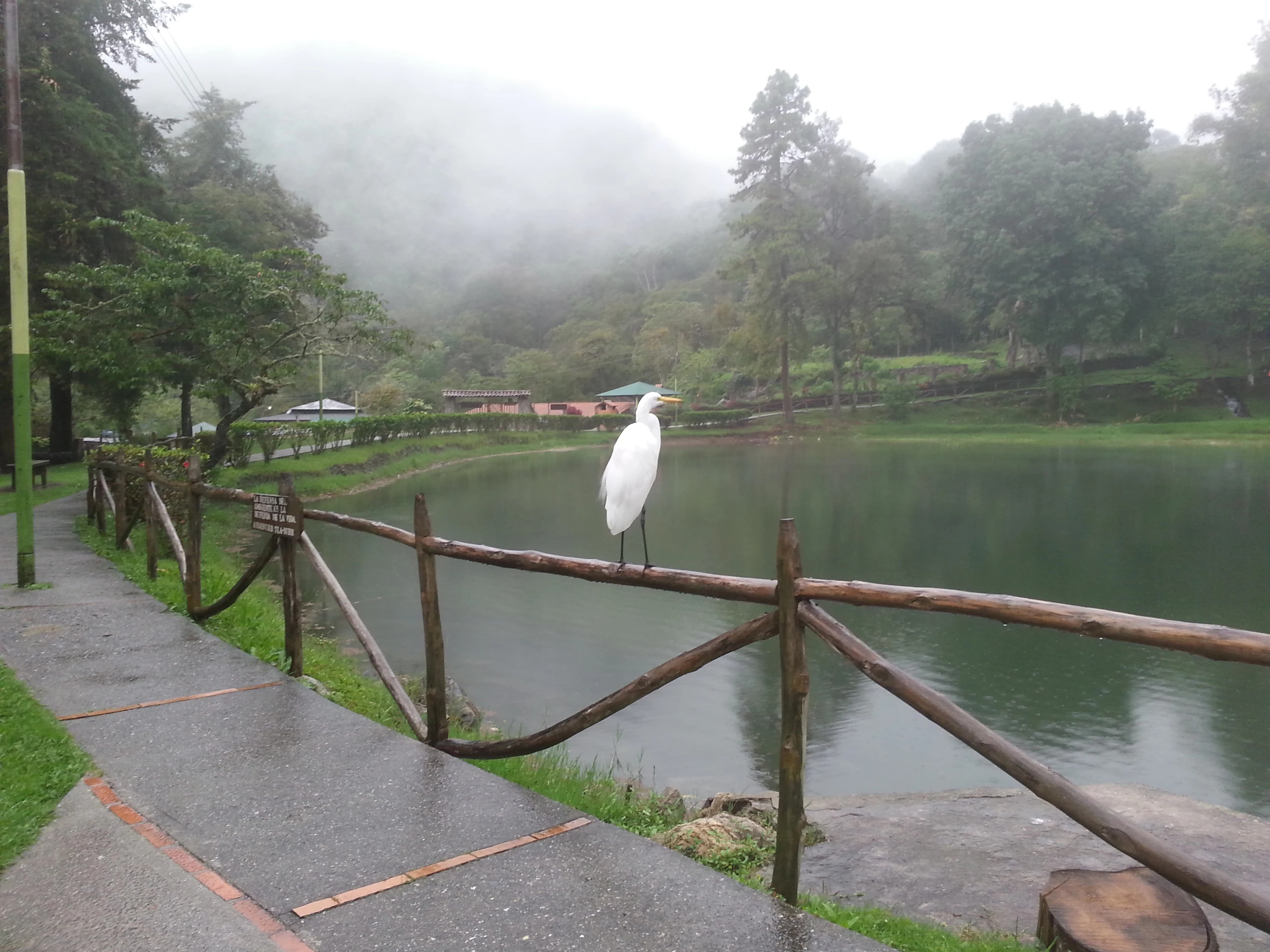
A white egret stands on a rustic wooden railing bordering a calm lake, with a misty, forested mountain background.
A white egret perched on a wooden fence overlooking the mist-covered Laguna de los Cedros in Guaramacal National Park.

Guaramacal National Park ecosystems, habitats, and plant life

Ecologically, Guaramamal captures a complete Andean elevational gradient, and this is the key to its botanical richness. Below approximately 1,600 meters the slopes support a partially deciduous forest assemblage shaped by seasonal moisture variation. Between roughly 1,600 and 2,500 meters, the park enters a humid forest zone characterised by exceptionally rich floristic composition, dense epiphyte growth, abundant orchids, and widespread fern coverage, with the yagrumo, Cecropia telenitida, forming a recognisable element of the canopy and understory.

Above this humid forest, vegetation transitions into cloud forest and ultimately into the open páramo, where low shrubs, grasses, and cushions of hardy plants dominate a colder, more exposed environment. The boundaries of the park generally begin within the humid forest zone, which is why the protected area is so strongly associated with moss-laden trunks, hanging bromeliads, and a deeply layered forest structure. The combination of these three ecological floors within a single massif is a defining feature of the park's identity.

Floristic inventories have repeatedly demonstrated that this compression of habitats translates into high species diversity. Early surveys recorded 482 plant species, while a comprehensive study in 2000 catalogued at least 1,227 species, distributed across 147 families and 517 genera, and contributed 33 taxa that were new to science at the time. Few reserves of comparable size in the Andes can claim an equivalent level of recorded botanical diversity.
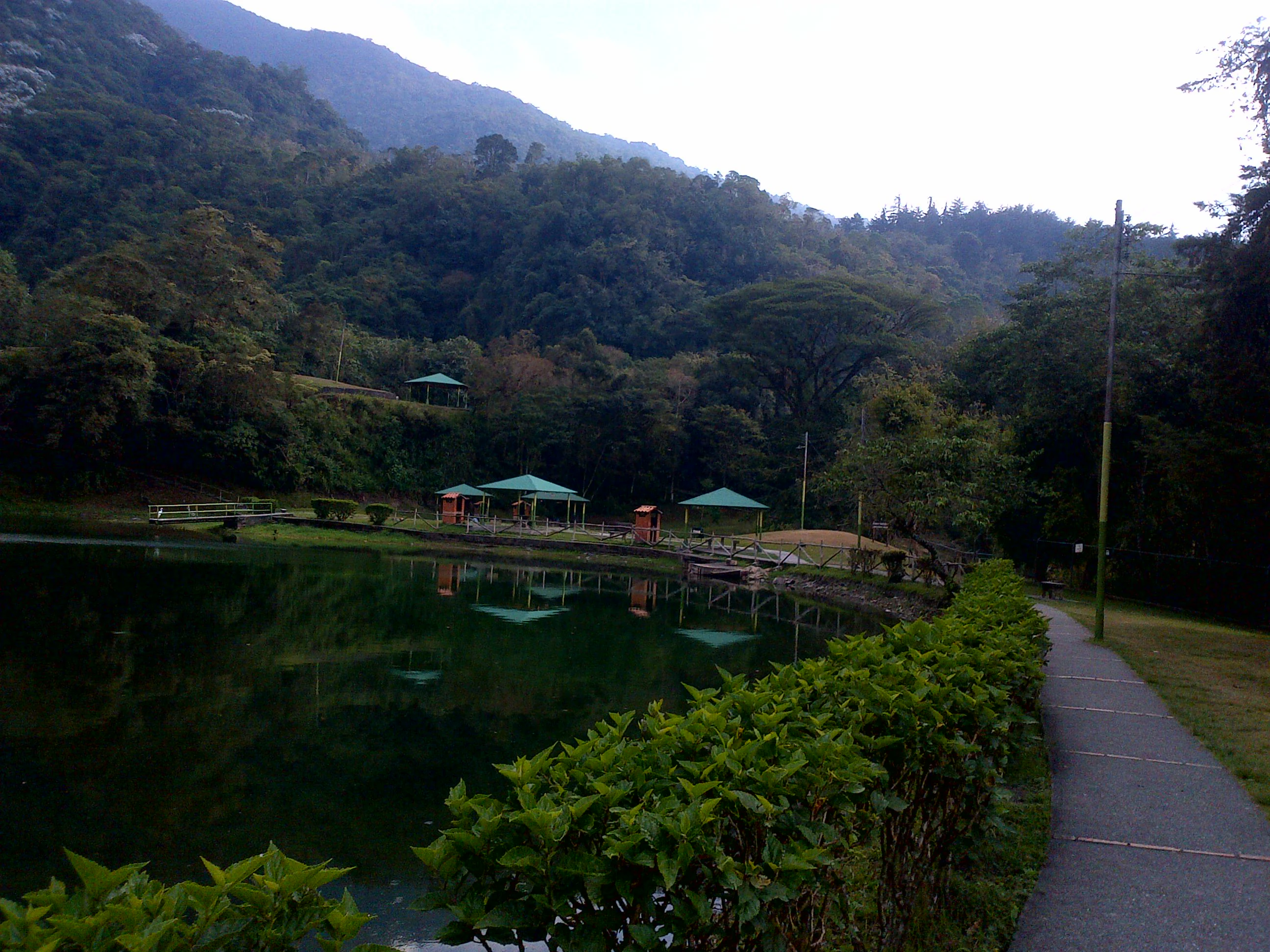
A peaceful lake surrounded by dense, forested mountains with a paved walkway and green-roofed picnic shelters along the shore.
A scenic lake at the entrance of Guaramacal National Park in Venezuela.

Guaramacal National Park wildlife and species highlights

Guaramacal supports an unusually rich cross-section of Andean fauna, a consequence of the altitudinal and habitat diversity described above. Surveys have recorded approximately 150 bird species, at least 36 mammal species, 14 amphibian species, and 11 reptile species, and roughly forty percent of the recorded amphibians and reptiles are endemic to the park's surroundings. This concentration of endemism is one of the wildlife features that most clearly distinguishes Guaramacal from neighbouring Andean areas.

Among mammals, the park provides refuge for a number of threatened and wide-ranging species. The Andean spectacled bear, Tremarctos ornatus, is present, along with the small red brocket deer Mazama rufina, the jaguar Panthera onca, the puma, the ocelot Leopardus pardalis, the mountain coati Nasuella olivacea, the olingo Bassaricyon gabbii, and the Mérida small-eared shrew Cryptotis meridensis. Bats are the most diverse mammal group, with around 16 species recorded including Eptesicus brasiliensis, Lasiurus ega, and Myotis oxyotus, and rodent diversity is also notable, with eight species recorded including Thomasomys laniger and Agouti taczanowskii. More commonly encountered mammals include the brown-throated sloth, the white-eared opossum, the red howler monkey Alouatta seniculus, and the kinkajou Potos flavus. Water opossums, Chironectes minimus, are associated with the park's streams and pools.

The park's herpetofauna is equally distinctive. Twelve frog and toad species have been recorded across the families Leptodactylidae, Dendrobatidae, Hylidae, Centrolenidae, and Bufonidae, alongside an endemic salamander of the genus Bolitoglossa. Reptiles include seven snake species and four lizard species, of which at least two, in the genera Anolis and Phenacosaurus, are considered possibly endemic to Guaramacal's vicinity, plus the venomous pit viper Bothrops. The avifauna is a particular attraction, with species such as the red siskin Carduelis cucullata, the Helmeted Curassow Pauxi pauxi, the Black-billed Mountain Toucan Andigena nigrirostris, the Black-and-chestnut Eagle Oroaetus isidori, the Rose-headed Parakeet Pyrrhura rhodocephala, the Slaty Finch Haplospiza rustica, the Ocellated Tapaculo Acropternis orthonix, the Andean Pygmy-owl Glaucidium jardinii, and the Osprey Pandion haliaetus recorded in the area.
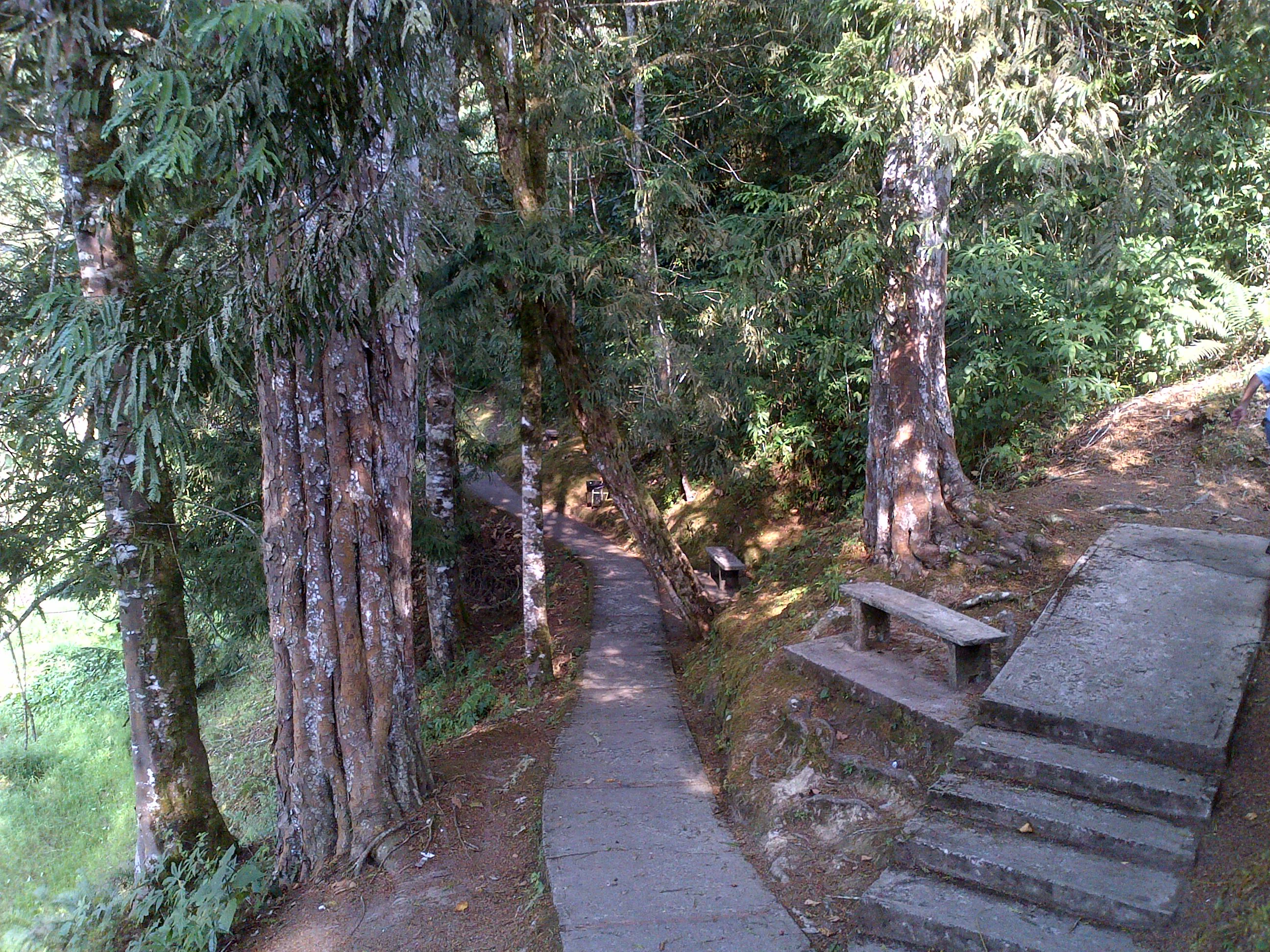
A narrow paved path leads into a lush, shaded forest, with stone steps and a wooden bench situated on the right side.
A stone-paved trail winding through a dense forest in Guaramacal National Park.

Guaramacal National Park conservation status and protection priorities

Guaramacal's conservation significance lies in the concentration of biodiversity it protects within a relatively small but ecologically complete Andean landscape. By safeguarding a continuous gradient from sub-Andean forest through cloud forest to páramo within a single protected area, the park preserves habitats and species that would otherwise be highly vulnerable to fragmentation in the surrounding agricultural and pastoral landscapes of Trujillo and Portuguesa.

The high proportion of endemic amphibians and reptiles recorded in the park makes it an important site for the conservation of Andean herpetofauna, while the continued presence of wide-ranging mammals such as the spectacled bear and the jaguar indicates that the park retains significant functional habitat for large carnivores. These factors have helped position Guaramacal as a priority site for biodiversity research and monitoring in northern Venezuela.

At a broader level, the park's cloud forests and páramo perform hydrological functions that extend beyond its boundaries, helping regulate water flows that support agriculture and rural communities downhill. Combined with its role as a refuge for threatened species, this gives the park a conservation value that is both local and regional, and reinforces the importance of sustained protection and management under INPARQUES.

Guaramacal National Park cultural meaning and human context

The park's cultural context is closely tied to the surrounding Andean region of Trujillo, with the town of Boconó acting as the main nearby population centre and a long-standing gateway for travellers, researchers, and rural producers. The agricultural and pastoral traditions of these Andean communities have shaped the landscape mosaic around the park, in which forested páramo and cloud forest stand alongside cultivated and grazed land. Guaramacal does not have a strongly documented indigenous cultural identity of its own in available sources, and the park's cultural significance is better understood in terms of its role in regional Andean identity rather than in terms of any single community or tradition.

Top sights and standout views in Guaramacal National Park

Among the park's most notable features are its compact but complete Andean elevational gradient, the botanical richness of its cloud forests, with orchids, ferns, and abundant epiphytes, and the exceptionally high level of endemism recorded among its amphibians, reptiles, and certain bird groups. The presence of the spectacled bear, the jaguar, and the endangered Helmeted Curassow adds a conservation weight that is unusual for a park of its size, and the visual anchor of Laguna de Los Cedros provides a focal landscape feature within the massif. Together these qualities make Guaramacal a small but disproportionately rich node in the network of protected areas along the Venezuelan Andes.

Best time to visit Guaramacal National Park

Seasonal guidance for Guaramacal is shaped by general Andean climate patterns rather than detailed monthly data available in the source material. The dry season, generally associated with the months when Andean trails are more accessible and páramo and forest conditions are less muddy, is commonly the most comfortable period for hiking and wildlife observation. The wetter months tend to bring heavier cloud cover, more persistent mist in the cloud forest zone, and muddier trail conditions at higher elevations, but they also coincide with peak activity for many amphibians and with the lushest display of epiphytes and orchids. Visitors with an interest in páramo scenery and clearer views tend to prefer drier periods, while those focused on frog observation, plant flowering, and the most vivid cloud forest atmosphere often favour the wetter season.

Monthly climate preview

Long-term representative point measurements tracking monthly temperature and precipitation rhythms

Parque nacional Guaramacal Climate Normals and Annual Weather Patterns

Representative coordinate records show mean monthly temperatures ranging from 23.19 to 26.01 degrees Celsius alongside recorded precipitation shifts across the year. Reviewing the complete twelve-month climate profile provides detailed long-term averages for temperature bounds and rainfall amounts at a single sampled elevation.
Annual mean24 °C
23 °C26 °C
Jan24°
Feb25°
Mar26°
Apr26°
May25°
Jun24°
Jul23°
Aug23°
Sep24°
Oct24°
Nov24°
Dec24°
Warmest month
March

26 °C

Coolest month
July

23.2 °C

Wettest month
June

6.3 mm/day

Driest month
January

0.7 mm/day

Park location guide

Geography guide, regional context, and park location map for Guaramacal National Park

Guaramacal National Park park geography, regions, and map view in Venezuela

Understand where Guaramacal National Park sits in Venezuela through a broader geographic reading of the surrounding landscape, nearby location context, and its mapped position within the national park landscape.

How Guaramacal National Park fits into Venezuela

Venezuela is a country in northern South America with coastline along the Caribbean Sea and Atlantic Ocean. It borders Colombia, Brazil, Guyana, and Trinidad and Tobago. The country has an area of approximately 916,445 km² and a population of about 31.8 million. Caracas is the capital and largest city. Venezuela consists of 23 states and the Capital District.

Wider geography shaping Guaramacal National Park in Venezuela

Venezuela is located on the northern coast of South America. The continental territory is bordered by the Caribbean Sea and Atlantic Ocean to the north, Colombia to the west, Brazil to the south, and Guyana to the east. Trinidad and Tobago lies to the northeast. The country includes various islands and islets in the Caribbean Sea known as the Federal Dependencies.

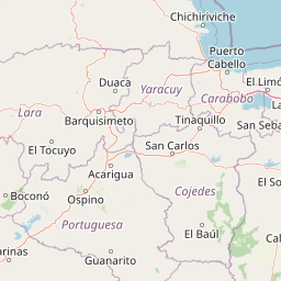
Map view of Guaramacal National Park

Use this park location map to pinpoint Guaramacal National Park in Venezuela, understand its exact geographic position, and read its mapped placement within the surrounding landscape more clearly.

Pigeon | © OpenStreetMap contributors

Location context for Guaramacal National Park

PortuguesaTrujillo

Visualizing the rugged terrain, cloud forests, and high altitude paramo habitats of the Venezuelan Andes

Parque Nacional Guaramacal Photos and Landscape Scenery Exploration

Visual documentation of Parque nacional Guaramacal reveals the dramatic elevational gradients spanning from humid subAndean forests to windswept alpine ridges. Examining these protected area photographs helps researchers and visitors understand the distinctive ecological zones and mountain topography preserved within the reserve.

A high-angle view of a calm green lake nestled in a dense, lush mountain forest with a small parking area and structures visible near the shore.

A peaceful green lake reflecting the surrounding dense forest and steep mountain slopes, with picnic shelters and walking paths on the grassy shore in the foreground.

A white egret stands on a rustic wooden railing bordering a calm lake, with a misty, forested mountain background.

A peaceful lake surrounded by dense, forested mountains with a paved walkway and green-roofed picnic shelters along the shore.

A narrow paved path leads into a lush, shaded forest, with stone steps and a wooden bench situated on the right side.

A calm, dark lake situated at the base of lush, green, forested mountains under an overcast sky.

Park atlas

Compare surrounding regional geography and connected Andean conservation areas

Parks Near Parque nacional Guaramacal and Related Protected Landscapes

Browse nearby national parks and protected areas sharing the rugged mountainous terrain of the northern Cordillera de Mérida. Comparing adjacent high altitude reserves provides broader context on the regional distribution of cloud forests and tropical páramo ecosystems.
National parkVenezuela
About 1.3 km away#1 closest

Southeast

General Cruz Carrillo en Guaramacal National Park: Venezuela's National Park Landscape

Mapped protected areas and regional geography.

Delve into the protected landscape of General Cruz Carrillo en Guaramacal National Park, a national park situated in Venezuela. This page provides essential geographic context, focusing on the park's mapped boundaries and its role as a protected natural area. Understand its place within the regional geography and discover its unique landscape characteristics, offering a foundation for detailed atlas exploration.

National parkVenezuela
About 24 km away#2 closest

North

Dinira National Park: Protected Watershed and Andean Mountain Landscape

Explore its rugged terrain and páramo ecosystem.

Dinira National Park is a significant protected area in Venezuela, covering rugged Andean terrain vital for watershed protection. This national park features dramatic mountain landscapes, including the Humocaro Mountains and the Los Nepes páramo zone, supporting diverse cloud forest and high-altitude ecosystems. Understanding Dinira National Park offers insight into the geographic context of the Cordillera de Mérida and its hydrological importance.

Area
453.28 km²
Established
1988
IUCN
II
Relief
Mountain
Natural monumentTrujillo
About 34 km away#3 closest

West

Monumento Natural Teta de Niquitao-Guirigay: Geography and Protected Area Overview

High-mountain Andean terrain and glacial lake basins in Trujillo.

Monumento Natural Teta de Niquitao-Guirigay serves as a primary example of high-Andean geography, featuring summits exceeding 4,000 meters and unique glacial landforms. The protected area encompasses diverse ecosystems from cloud forest to high-altitude páramo, functioning as a critical sanctuary for regional highland species and a defining landmark within the mountain landscape of Trujillo.

Area
335.36 km²
Established
1996
Relief
Mountain
Climate
Alpine
National parkTrujillo
About 38 km away#4 closest

Southwest

Parque nacional Dr. José Gregorio Hernández: Andean Mountain and Watershed Geography

High-altitude protected habitats in the Venezuelan Andes

This national park protects a vast stretch of Andean terrain, serving as an essential ecological link between major mountain reserves. Its steep ridges and river valleys represent a critical habitat for the spectacled bear while securing the water sources of regional watersheds.

Area
505 km²
Established
2021
IUCN
II
Relief
Mountain
National parkVenezuela
About 47 km away#5 closest

Southwest

Sierra La Culata National Park: Protected Landscape Atlas of the Venezuelan Andes

Explore the páramo ecosystems and mapped terrain of this Venezuelan national park.

Sierra La Culata National Park offers a profound look into the unique geography of the Venezuelan Andes. This protected national park is characterized by its expansive páramo ecosystems, dramatic mountain peaks, and glacial lagoons, creating a distinctive high-altitude wilderness. Use this atlas-focused entry to understand the park's mapped boundaries and its significant role within the region's natural landscape context.

Area
2,004 km²
Established
1989
IUCN
II
Relief
Mountain
Watercolor painting showing green hills, a river, and distant mountains under a light sky
National parkVenezuela
About 59 km away#6 closest

Southwest

Sierra Nevada National Park: Venezuela's Majestic Alpine Protected Landscape and Park Boundaries

Explore the highest peaks and glacial terrain of this Venezuelan national park.

Delve into Sierra Nevada National Park, a premier protected area situated in the high Venezuelan Andes. This national park protects a vast expanse of dramatic alpine terrain, including Pico Bolívar and numerous glacial valleys. Understand its mapped boundaries and the unique paramo and cloud forest ecosystems that define this significant natural landscape within Venezuela, offering rich context for atlas-style geographic discovery.

Area
2,764.46 km²
Established
1952
IUCN
II
Relief
Mountain
National parkLara State
About 75 km away#7 closest

Northeast

Yacambú National Park National Park: Protected Cloud Forest Landscape in Lara State

Mapped terrain and significant orchid diversity in Venezuela's Andean foothills.

Yacambú National Park is a significant national park in Venezuela's Lara State, protecting crucial humid cloud forest ecosystems in the Andean foothills. The park's terrain is defined by the mountainous topography of the Portuguesa Mountain Range, supporting a rich diversity of flora, including numerous orchid species. Its role in watershed protection for nearby regions underscores its importance as a conserved natural landscape with vital ecological functions.

Area
146 km²
Established
1962
IUCN
II
Relief
Mountain
National parkVenezuela
About 81 km away#8 closest

Northeast

El Guache National Park: Venezuela's Protected Andean Foothill National Park

Map exploration of vital river basins and natural landscapes.

El Guache National Park is a protected national park in Venezuela, safeguarding the headwaters of five key rivers. Its landscape comprises mountainous terrain within the Andean foothills, crucial for watershed protection and regional biodiversity. This entry provides detailed geographic context, allowing for an atlas-style exploration of the park's mapped boundaries and its role as a vital protected area.

Area
122 km²
Established
1992
IUCN
II
Relief
Mountain

Common questions about visiting, size, designation, and location context for Guaramacal National Park

Guaramacal National Park FAQs for park facts, access, geography, and protected area context

Find quick answers about Guaramacal National Park, including protected-area facts, park geography, trail and visitor context, and how the park fits into its surrounding country and regional landscape.
MoriAtlas Explorer

Continue Your Protected Areas Search Across the Global Atlas

Deepen your exploration by continuing the structured search for national parks and protected areas worldwide. Utilize the comprehensive filtering capabilities to compare different conservation landscapes and refine your understanding of global park geography. Discover more about the distribution and characteristics of protected natural areas.

Global natural geography