
Lakes
Park geography
A structured examination of physical land characteristics, river networks, and regional terrain
Hattah-Kulkyne National Park Geographic Profile: Boundaries, Terrain, and Hydrology
This geographic overview details the physical dimensions of Hattah-Kulkyne National Park across its 480 square kilometer area. The analysis covers environmental classifications including arid zone shrubland, forest coverage, and essential hydrologic networks like the Murray River, Chalka Creek, and associated lakes.
Related tags
Mallee WoodlandsRamsar WetlandImportant Bird AreaSeasonal LakesSemi-Arid Landscape
Red dirt, mallee woodlands and lakes in Victoria's Mallee region
Hattah-Kulkyne National Park
Hattah-Kulkyne National Park is a sprawling protected area in the Mallee district of northwestern Victoria, Australia. Spanning approximately 48,000 hectares, the park is characterized by its distinctive red-earth landscapes, dense mallee eucalypt woodlands, and a chain of lakes that form a critical wetland system along the border of the Murray River basin. The park was initially established as Hattah Lakes National Park in 1960, originally created to protect the scenic beauty of the Hattah lakes system, and was significantly expanded in 1980 with the addition of the Kulkyne State Forest to form the current park. The area holds significant ecological importance as a Ramsar-designated wetland and is recognized by BirdLife International as an Important Bird Area due to its population of threatened mallee bird species. The park serves as a vital refuge in one of Victoria's most arid and sparsely populated regions, offering visitors a glimpse into the unique semi-arid ecosystems of the Murray-Darling Basin.
- Location
- Australia
- Park type
- National park
- Established
- 1960
- Area
- 480 km²
Location overview
National administrative context and inland placement within Australia
Geographic Location of Hattah-Kulkyne National Park within Australia
Hattah-Kulkyne National Park is located within Australia as an inland protected landscape. The inland territory has no recorded marine, coastal, island, or transboundary boundaries.
- Countries
- Australia
- Primary location
- Australia
- Geographic setting
- Inland
Boundary and coordinates
Analyzing the 480 square kilometer geographic spread and spatial limits
Hattah-Kulkyne National Park Boundary Map and Spatial Extent
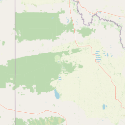
The detailed interactive map outlines the spatial footprint of the reserve within the regional landscape. Associated data panels detail the 480 square kilometer area along with estimated perimeter coordinates and central span points.
- Boundary area
- 500 km²
- Boundary perimeter
- 140.9 km
- Northernmost point
- 34.5593° S
- Southernmost point
- 34.8471° S
- Easternmost point
- 142.5194° E
- Westernmost point
- 142.2259° E
- Geographic centre
- 34.6945° S, 142.3657° E
- North–south span
- 31.9 km
- East–west span
- 26.9 km
Terrain and natural features
Lowland terrain classification and recorded hydrographic features
Hattah-Kulkyne National Park Terrain and Named Natural Features
Recorded lowland relief classifications encompass protected freshwater lakes and river channels located within the park boundary. Linked feature cards supply official feature types, measurements, and spatial relationships for each water body.
Selected named natural features
Streams
Chalka Creek
Rivers
Murray River
Lakes
Lake Roonki
Environmental setting
Arid lowland relief, dominant forest cover, and seasonal water systems
Hattah-Kulkyne National Park Environmental Classifications and Physical Setting
Recorded classifications group forest, wetland, and arid lowland attributes into complementary ways to read physical settings. Stored categories link directly to relevant atlas destinations for expanded geographic context.
- Relief
- Lowland
- Climate
- Arid
- Water
- Major water bodies
- Forest cover
- Dense forest cover
- Seasonality
- Strongly seasonal
Landscape features
Forest · Wetland · Lakes · Rivers
Habitat types
Shrubland · Wetland · Lacustrine habitat · Riverine habitat
Park atlas
Browse neighboring protected landscapes, compare mallee ecosystems, and trace regional conservation zones
Continue Park Discovery: Explore National Parks Near Hattah-Kulkyne and Regional Protected Areas
After exploring Hattah-Kulkyne National Park, expand your atlas view by browsing a curated list of other national parks and protected areas across the surrounding Victorian Mallee and Murray-Darling Basin. This geographic continuation allows you to compare diverse mallee woodlands and wetland systems, revealing the broader spread of Australia's semi-arid conservation landscapes.
National parkAustralia
0.1 km away#1 closest
West

Murray-Sunset National Park: Iconic Pink Lakes and Mallee Wilderness in Victoria's Semi-Arid Interior
Explore its unique landscape, mapped boundaries, and regional geography.
Murray-Sunset National Park offers a compelling glimpse into Australia's semi-arid heart, featuring a dramatic landscape of salt lakes, gypsum plains, extensive sand dunes, and dense mallee woodlands. This vast protected area is renowned for the vibrant pink hue of its salt lakes, a phenomenon created by microscopic algae that flourishes in the hypersaline conditions during warmer months. The park's rich biodiversity and unique ecosystem make it a significant conservation asset, providing crucial habitat for numerous species adapted to this challenging yet beautiful environment.
- Area
- 6,330 km²
- Established
- 1991
- IUCN
- II
- Relief
- Lowland
Biosphere reserveVictoria
About 23 km away#2 closest
North
Hattah-Kulkyne and Murray-Kulkyne Biosphere Reserve: Protected Geography and Mapped Landforms
An inland mosaic of river corridors and semi-arid mallee habitats.
Located in northwestern Victoria, this biosphere reserve encompasses a distinct ecological assembly of Hattah lakes, seasonal floodplains, and sand-ridge terrains. Understand the interplay between the Murray River system and the surrounding dryland vegetation through detailed geographic context.
- Area
- 515 km²
- Established
- 1981
- Visitors
- 99K annual
- Relief
- Lowland
Biosphere reserveNew South Wales
About 45 km away#3 closest
North
Barkindji Biosphere Reserve: Geography and Protected Landscapes in New South Wales
Mapping riverine wetlands and semi-arid dune systems
Barkindji Biosphere Reserve sits within the Murray-Darling Basin, creating a critical conservation area that spans river floodplains, sand plains, and semi-arid forest. This protected entity documents the transition between aquatic river environments and inland dryland terrain, highlighting complex soil and habitat variability across its vast, managed regional footprint.
- Area
- 1,918.23 km²
- Established
- 2005
- Visitors
- 133 annual
- Relief
- Mixed relief
National parkNew South Wales
About 48 km away#4 closest
North
Mallee Cliffs National Park: Protected Landscape and Geographic Atlas Entry
Explore its mapped boundaries and regional New South Wales context.
Mallee Cliffs National Park is presented here as a distinct protected landscape, offering specific insights for atlas and geographic discovery. This entry details the park's national park designation and its position within New South Wales, highlighting its mapped boundaries and the surrounding regional geography. It provides the foundational geographic context needed to understand Mallee Cliffs National Park's presence within the broader landscape of protected areas, inviting detailed exploration for those interested in mapped natural terrain.
- Area
- 579.69 km²
- Established
- 1977
- IUCN
- II
- Relief
- Lowland
National parkAustralia
54 km away#5 closest
Southwest
Wyperfeld National Park: Mapping Victoria's Vast Mallee Semi-Arid Wilderness and Sandhill Landscapes
Discover the unique geography and protected terrain of this significant Australian national park.
Wyperfeld National Park in Victoria, Australia, is a prime example of a vast semi-arid wilderness landscape. It is best known for its extensive sandhill formations, referred to as 'snowdrifts,' which punctuate the otherwise flat terrain. The park also protects a significant ephemeral lake system and is a stronghold for the mallee ecosystem, offering a unique context for understanding dryland conservation and mapped natural areas. Its protected status highlights its importance within the broader geographic context of Australia's protected landscapes.
- Area
- 3,570 km²
- Established
- 1921
- IUCN
- II
- Relief
- Lowland
National parkNew South Wales
90 km away#6 closest
East
Yanga National Park National Park: Mapped Boundaries and Regional Geographic Context in New South Wales
Protected landscape atlas entry for New South Wales.
Examine Yanga National Park, a dedicated national park situated in New South Wales, Australia. This entry provides essential details for atlas-based discovery, focusing on its mapped boundaries, protected area status, and integration into the regional geography. Understanding Yanga National Park contributes to a broader comprehension of protected lands and their distribution, offering a clear geographic perspective on conservation efforts within New South Wales for users seeking structured landscape data.
- Area
- 667.34 km²
- Established
- 2007
- IUCN
- II
- Relief
- Lowland
National parkNew South Wales
97 km away#7 closest
Northeast
Mungo National Park: Protected Landscape Atlas and Geographic Context
Explore mapped boundaries and regional terrain within New South Wales.
Mungo National Park offers a distinct focus for atlas exploration, presenting itself as a key protected landscape within the state of New South Wales, Australia. This entry details the park's geographic positioning and mapped boundaries, allowing for a clear understanding of its terrain and regional context. Engage with the park's identity as a protected area, uncovering the specifics of its natural landscape for a richer geographic discovery experience.
- Area
- 1,109.67 km²
- Established
- 1979
- IUCN
- II
- Relief
- Lowland
National parkNew South Wales
125 km away#8 closest
Southeast
Murray Valley National Park: Explore its Mapped Boundaries and Regional Geography in New South Wales
Protected landscape identity and geographic context.
Gain a structured understanding of Murray Valley National Park, a designated national park within New South Wales. This detail page provides essential geographic context, highlighting the park's mapped boundaries and its significance as a protected natural landscape. Utilize this entry point for comprehensive atlas-based exploration of its unique regional setting and terrain.
- Area
- 416.01 km²
- Established
- 2010
- IUCN
- II
- Relief
- Lowland
MoriAtlas Explorer
Continue Exploring Hattah-Kulkyne National Park's Protected Landscape and Regional Geography
Investigate the distinct red-earth terrain and seasonal wetland dynamics that define Hattah-Kulkyne National Park. Understanding its place within the broader Murray-Darling Basin geography, as mapped and cataloged for atlas exploration, reveals the park's critical role as a protected landscape. Delving deeper into its specific mapped boundaries and ecological significance offers a clearer picture of this unique Australian national park and its place in the continent's natural atlas.
Browse next
Global natural geography
Explore related park routes
Explore MoriAtlas Global ParksBrowse All MoriAtlas ParksGlobal Park Map DiscoveryMoriAtlas: Browse All CountriesBrowse All MoriAtlas ContinentsNational Park Environment AtlasGrand Canyon National Park AtlasYellowstone National Park AtlasYosemite National Park Atlas and GeographySerengeti National Park AtlasGalápagos National Park Protected LandscapeBanff National Park Geography and AtlasKruger National Park Atlas EntryUluṟu-Kata Tjuṯa National Park AtlasExplore Uluru-Kata Tjuta National Park GeographyPlitvice Lakes National Park AtlasFiordland National Park Protected LandscapeGreat Smoky Mountains National Park AtlasAfghanistan National Parks and Protected AreasAlbania National Parks and Protected AreasAlgeria National Parks and Protected AreasAmerican Samoa National Parks and Protected AreasAndorra National Parks and Protected AreasAngola National Parks and Protected AreasAntarctica National Parks and Protected AreasAntigua and Barbuda Park List