Mori Atlas logo
National parkHemis National Park

Discover the mapped boundaries and regional context of Hemis National Park.

Hemis National Park: A Protected National Park in Leh District's Geographic Landscape

Hemis National Park stands as a significant protected national park within the expansive geography of Leh district, India. This page offers an atlas-centric view, detailing the park's geographic scope, mapped boundaries, and its role as a protected landscape. Users can explore the unique natural terrain and understand its regional context, providing a foundation for structured discovery of India's conservation areas and natural heritage.

Snow LeopardsHigh Altitude ParksTrans-HimalayanCold DesertWildlife ConservationMountain Parks

Hemis National Park

National park

Park overview

Structured park overview, official facts, and landscape profile for Hemis National Park

Hemis National Park park facts, protected area profile, and essential visitor context
Review the core facts for Hemis National Park, including designation, size, terrain, visitor scale, habitats, and operating context in one park-focused overview.

About Hemis National Park

Hemis National Park occupies a unique position in India's protected area network as the largest national park in the country and the only one situated north of the main Himalayan range. Located in the Leh district of Ladakh, approximately 50 kilometers from the town of Leh, the park spans a vast expanse of approximately 4,400 square kilometers across the Zanskar region. The park's boundaries, as defined by the Wildlife Institute of India, are defined by the Indus River to the north and extend southward to encompass the catchments of the Markha and Rumbak rivers and portions of the Zanskar Range. The landscape is characterized by high-altitude arid valleys, steep mountain slopes, and alpine terrain that lies in the rain shadow of the Himalayas, resulting in very low precipitation and distinctive arid steppe ecosystems. The park lies entirely within the Palearctic realm, representing a biogeographic zone more commonly associated with Central Asia than with the Indian subcontinent, giving the park a distinctive ecological character quite different from other Indian protected areas. This trans-Himalayan position, combined with the park's exceptional size and intact ecosystems, makes it a critical conservation landscape for cold-desert biodiversity.

Quick facts and research context for Hemis National Park

Hemis National Park covers 4,400 square kilometers in Ladakh, making it the largest national park in India and South Asia. The park was established in 1981 and is situated at elevations between 3,000 and 6,000 meters. It is the only national park in India located north of the Himalayas and sits within the Karakoram-West Tibetan Plateau alpine steppe ecoregion. The park is home to approximately 200 snow leopards, representing what is believed to be the highest density of this species in any protected area globally. Over 1,600 pastoralists reside within the park boundaries, maintaining traditional livelihoods while coexisting with the park's wildlife.

Park context

Deeper park guide and search-rich context for Hemis National Park

Hemis National Park history, landscape, wildlife, and travel context
Explore Hemis National Park through its history, landscape character, ecosystems, wildlife, conservation priorities, cultural context, and seasonal travel timing in a structured park guide built for atlas discovery and search intent.

Why Hemis National Park stands out

Hemis National Park is internationally renowned as the world's premier habitat for the snow leopard, an elusive and endangered big cat that remains one of the most difficult mammals to observe in the wild. The park's high-altitude desert and alpine steppe environment supports a remarkable predator-prey system centered around snow leopards and their primary prey species: the argali (Great Tibetan sheep), bharal (blue sheep), shapu (Ladakhi urial), and Asiatic ibex. Beyond snow leopards, the park protects significant populations of Tibetan wolves, Eurasian brown bears (endangered in India), and Himalayan marmots. The dramatic landscape features the Markha and Rumbak valley systems, the Zanskar Range, and the confluence of the Zanskar and Indus rivers. The park also contains the historic Hemis Monastery, a 400-year-old Tibetan Buddhist pilgrimage site that hosts the annual Hemis Tsechu festival.

Hemis National Park history and protected-area timeline

Hemis National Park was established in 1981, initially protecting an area of approximately 600 square kilometers around the Rumbak and Markha catchments. The park underwent significant expansion in subsequent years, growing to around 3,350 square kilometers in 1988 through the incorporation of neighboring lands, and further expanding to its current extent of 4,400 square kilometers in 1990. This progressive enlargement transformed Hemis into the largest national park in India and the largest protected area in South Asia, exceeded only by the Nanda Devi Biosphere Reserve and its surrounding protected areas as the second largest contiguous protected area in the region. The establishment of the park was motivated by the need to protect the remarkable snow leopard population and the unique high-altitude ecosystems of Ladakh. The park is now managed by the Department of Wildlife Protection of the Government of Jammu and Kashmir, which has implemented various conservation initiatives including Project Snow Leopard, launched in 2004 and formally inaugurated in 2009 to conserve the entire Himalayan biosphere.

Hemis National Park landscape and geographic character

Hemis National Park presents a dramatic high-altitude landscape dominated by the catchments of the Markha and Rumbak rivers, bounded to the north by the Indus River and featuring portions of the Zanskar Range. The terrain consists of steep-sided valleys carved by glacial and fluvial processes, with elevation ranging from 3,000 meters in the valley floors to 6,000 meters along the surrounding mountain ridges. The landscape lies in the rain shadow of the Himalayas, resulting in an arid environment characterized by sparse vegetation and bare rock exposures. Valley bottoms support scattered willow and poplar forests along watercourses, while lower slopes feature juniper woodlands. Higher elevations transition into alpine shrublands, meadows, and eventually alpine tundra, with the most elevated terrain consisting of bare rock, scree, and permanent snow. The park contains several notable geographic features including the Ganda La mountain pass at approximately 4,980 meters, which provides access between the Markha Valley and Leh. The confluence of the Zanskar and Indus rivers marks an important geographic landmark along the park's northern boundary.

Hemis National Park ecosystems, habitats, and plant life

The park lies within the Karakoram-West Tibetan Plateau alpine steppe ecoregion, characterized by cold desert conditions and sparse vegetation adapted to extreme altitudes and low precipitation. The vegetation follows a distinct altitudinal zonation, with dry juniper forests and willow-poplar communities occurring at lower elevations, transitioning through subalpine birch-fir forests to alpine meadows and steppe at higher elevations. The upper mountain slopes support characteristic alpine vegetation including various species of Anemone, Gentiana, Thalictrum, Lloydia, Veronica, Delphinum, Carex, and Kobresia. The lower river courses and valley floors support steppe vegetation dominated by Caragana, Artemisia, Stachys, and Ephedra. The region is notable for Himalayan lavender (Perovskia atriplicifolia), which adds seasonal color to the landscape. The park also supports approximately 15 rare and endangered medicinal plant species, including Acantholimon lycopodioides, Arnebia euchroma, Artemisia maritima, Bergenia stracheyi, Ephedra gerardiana, Ferula jaeschkeana, and Hyoscyamus niger. The absence of significant rainfall creates an environment more typical of Central Asian cold deserts than of typical Himalayan ecosystems.

Hemis National Park wildlife and species highlights

Hemis National Park is globally significant for its snow leopard population, with an estimated 200 individuals concentrated particularly in the Rumbak catchment area, representing what is believed to be the highest density of this elusive big cat in any protected area worldwide. The snow leopard's survival in the park is supported by a viable prey base including argali (Great Tibetan sheep), bharal (blue sheep), shapu (Ladakhi urial), and Asiatic ibex, along with livestock from local pastoralist communities. The park is the only refuge in India containing the shapu (urian). Additional mammalian species include the Tibetan wolf, Eurasian brown bear (endangered in India), red fox, Himalayan marmot, mountain weasel, and Himalayan mouse hare. The avifauna includes notable birds of prey such as the golden eagle, lammergeier vulture, and Himalayan griffon vulture, while the Rumbak Valley supports bird species more typical of Tibetan plateau habitats, including brown accentor, robin accentor, Tickell's leaf warbler, streaked rosefinch, black-winged snowfinch, chukar, Blyth's swift, red-billed chough, Himalayan snowcock, and fire-fronted serin. In total, 16 mammal species and 73 bird species have been recorded within the park.

Hemis National Park conservation status and protection priorities

Hemis National Park represents a critical conservation landscape for cold-desert and high-altitude biodiversity, protecting ecosystems that are poorly represented elsewhere in India's protected area network. The park's global significance stems primarily from its snow leopard population, which has attracted international conservation attention and prompted the implementation of Project Snow Leopard by the Jammu and Kashmir Department of Wildlife Protection. This program, initiated in 2004 and formally launched in 2009, aims to conserve the entire Himalayan biosphere with a particular focus on snow leopard habitat and prey species. The park faces significant conservation challenges from the presence of over 1,600 pastoralists who raise livestock within the boundaries, resulting in considerable animal-human conflict. Snow leopards predate on livestock, sometimes killing several animals from a single flock, which has led to retaliatory killings. Overgrazing by domestic livestock further pressures the fragile ecosystems. Conservation measures have included the creation of no-grazing zones, predator-proofing of livestock pens, and community-based initiatives such as homestays, nature guide training, and eco-cafes to provide alternative livelihoods and reduce reliance on grazing.

Hemis National Park cultural meaning and human context

Hemis National Park contains significant cultural heritage sites, including the historic Hemis Monastery, a 400-year-old Tibetan Buddhist institution that has long been a place of pilgrimage. The monastery hosts the annual Hemis Tsechu festival during summer, attracting large numbers of tourists and pilgrims. Numerous gompas (Buddhist monasteries) and chortens (stupas) are scattered throughout the park, reflecting the deep connection between the region's Buddhist communities and the landscape. The park lies along historic silk routes that connected Tibet with Ladakh and beyond, making it a historic thoroughfare for trade and cultural exchange. The local population of over 1,600 pastoralists maintains traditional livelihoods, raising sheep, goats, and poultry while coexisting with the park's wildlife. The park and surrounding region were featured in the award-winning documentary Riding Solo to the Top of the World, showcasing the landscape and its cultural significance.

Top sights and standout views in Hemis National Park

Hemis National Park offers exceptional opportunities for wildlife observation, trekking, and mountaineering in one of the most remote and spectacular mountain landscapes on Earth. The park's signature wildlife experience is snow leopard tracking, with the best viewing opportunities in late winter when these elusive cats descend to lower elevations in search of prey. The Markha Valley trek and the crossing of Ganda La pass represent some of the most popular trekking routes in Ladakh, while Stok Kangri (6,153 meters) and Kang Yatze (6,496 meters) attract mountaineers from around the world. The park's cultural attractions include the Hemis Monastery and the colorful Hemis Tsechu festival. Visitors can stay in homestays operated by local communities through the Snow Leopard Conservancy India Trust program, providing authentic cultural experiences while supporting conservation. The park's status as India's largest national park and the world's most important snow leopard habitat makes it a destination of extraordinary significance for conservation-minded travelers.

Best time to visit Hemis National Park

The optimal time to visit Hemis National Park depends on the purpose of the visit. For trekking and general exploration, the period from mid-June to mid-October offers the most favorable conditions, with warm days, accessible passes, and comfortable camping weather. The Markha Valley trek and other popular routes are best undertaken during these summer months. For snow leopard observation, late winter (typically February to March) is considered the best season, as snow leopards descend to lower elevations following their prey and become more visible against the snow-covered landscape. The Hemis Festival takes place during summer, providing an opportunity to experience the park's cultural heritage. Visitors should note that the park has limited infrastructure, with no metalled roads, and that access beyond the check posts at Skiu, Zingchen, and Shang Sumdo is restricted to foot travel. The high altitude and desert conditions require appropriate preparation for extreme temperature variations and low oxygen levels.
Park location guide

Geography guide, regional context, and park location map for Hemis National Park

Hemis National Park park geography, regions, and map view in India
Understand where Hemis National Park sits in India through a broader geographic reading of the surrounding landscape, nearby location context, and its mapped position within the national park landscape.

How Hemis National Park fits into India

India is a South Asian country bordered by the Indian Ocean, Arabian Sea, and Bay of Bengal. It shares land borders with Pakistan, China, Nepal, Bhutan, Bangladesh, and Myanmar. The country has a population of over 1.4 billion people and operates as a federal parliamentary republic with its capital in New Delhi.

Wider geography shaping Hemis National Park in India

India occupies the Indian subcontinent in South Asia, bordered by the Arabian Sea to the southwest, the Bay of Bengal to the southeast, and the Indian Ocean to the south. It shares land borders with Pakistan to the west, China, Nepal, and Bhutan to the north, and Bangladesh and Myanmar to the east. The territory also includes the Andaman and Nicobar Islands in the Indian Ocean.

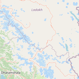
Map view of Hemis National Park

Use this park location map to pinpoint Hemis National Park in India, understand its exact geographic position, and read its mapped placement within the surrounding landscape more clearly.

Pigeon | © OpenStreetMap contributors

Location context for Hemis National Park

Leh district
Park atlas

Trace the regional spread of high-altitude protected areas surrounding Hemis National Park, comparing their diverse Himalayan geographies.

Parks and Protected Areas Near Hemis National Park: Discover More Protected Landscapes
Browse a curated selection of national parks and protected areas geographically adjacent to Hemis National Park, covering high-altitude landscapes of the Trans-Himalayan region. Compare diverse alpine ecosystems, mountain terrain, and specific conservation landscapes, gaining broader regional context and appreciating the unique natural heritage.
National parkKishtwar district

Kishtwar National Park: Discover Protected Himalayan Wilderness & Geography

Mapped terrain and protected area context in India's Kishtwar district.

Kishtwar National Park is a significant protected landscape situated in the Kishtwar district, India, offering a detailed view of high-altitude Himalayan wilderness. Its dramatic mountainous terrain, from temperate forests to alpine meadows, defines its unique geographic character. Explore the park's mapped boundaries and understand its place within the broader regional geography for comprehensive atlas discovery.

Area
2,190.5 km²
Established
1981
IUCN
II
Relief
Mountain
National parkGilgit-Baltistan

Deosai National Park: A Premier High-Altitude Alpine Wilderness and Protected Landscape in Pakistan

Mapped boundaries and unique terrain within Gilgit-Baltistan's geography.

Deosai National Park is a key protected area in Pakistan's Gilgit-Baltistan region, characterized by its high-altitude alpine meadows and expansive plateau terrain. As a national park, it offers crucial insights into mapped landscapes and regional geography, particularly for understanding conservation efforts in extreme environments. The park's setting provides a unique lens through which to explore the distribution and characteristics of protected lands within the broader atlas of natural landscapes.

Area
3,584 km²
Established
1993
IUCN
Ib
Relief
Highland
National parkSrinagar district

Dachigam National Park: Protected Landscape Atlas and Geographic Context in Srinagar District

Mapped boundaries and natural terrain within India's national park system.

Gain insight into Dachigam National Park, a significant protected area located in the Srinagar district. This page provides detailed geographic context and an atlas-style view of its protected landscape. Understand its specific role as a national park and explore its mapped features, contributing to a comprehensive understanding of India's natural territories.

Area
141 km²
Established
1910
IUCN
II
Relief
Mountain
National parkHimachal Pradesh

Pin Valley National Park: Remote Himalayan Cold Desert National Park in Himachal Pradesh

Explore its dramatic terrain and unique protected landscape in Spiti Valley.

Pin Valley National Park is a significant protected area covering roughly 675 square kilometers of the cold desert region in Himachal Pradesh, India. Established as a national park, it showcases a remote and rugged Himalayan landscape, characterized by its stark beauty, sparse vegetation, and extreme temperatures typical of high-altitude deserts. The park's geography spans dramatic mountain terrain, steep cliffs, and deep valleys, forming a vital habitat for endangered species and contributing to the unique ecological profile of the Cold Desert Biosphere Reserve.

Area
675 km²
Established
1987
IUCN
II
Relief
Mountain
National parkHimachal Pradesh

Great Himalayan National Park: Protected Landscape and Mapped Geography

Explore this national park's dramatic elevation and rich biodiversity.

Great Himalayan National Park is a vital protected area within India's Himachal Pradesh, celebrated for its exceptional biodiversity and dramatic mountain geography. This national park encompasses a remarkable range of elevations, creating distinct ecological zones from lower forest elevations to high alpine meadows and glacial zones. Its significance as a mapped protected landscape makes it essential for understanding regional natural heritage and conservation efforts within the Himalayas.

Area
1,171 km²
Established
1984
IUCN
II
Relief
Mountain
National parkGilgit-Baltistan

Nanga Parbat National Park: Protected Himalayan Landscape and Geographic Atlas

Explore mapped boundaries and alpine terrain in Gilgit-Baltistan.

Nanga Parbat National Park is a vast protected area defined by its spectacular Himalayan setting and dramatic alpine geography within Gilgit-Baltistan, Pakistan. As a national park, it safeguards the immense Nanga Parbat massif, its surrounding glaciers, and diverse altitudinal landscapes. This page offers an atlas perspective for understanding the park's geographic scope, its mapped natural features, and its significance as a protected mountain wilderness.

Area
1,785.61 km²
Established
2021
IUCN
II
Relief
Mountain
National parkPakistan

Deva Vatala National Park: Pakistan's Protected Tropical Thorn Forest Landscape

Explore mapped boundaries and regional geography within the Lower Himalayan foothills.

Deva Vatala National Park is a significant protected area located in Pakistan's Lower Himalayan Range, notable for its unique tropical thorn forest ecosystem. Occupying hilly terrain with elevations up to 1,101 meters, the park's landscape is defined by semiarid conditions and acacia-dominated vegetation, creating an unusual ecological interface. Its mapped boundaries encompass lake systems and diverse habitats, making it a critical conservation site within South Asia, distinct from typical Himalayan protected areas.

Area
70 km²
Established
1998
IUCN
II
Relief
Mountain
National parkAzad Jammu and Kashmir

Pir Lasura National Park: Pakistan National Park with Subtropical Pine Forest Landscape

Explore the mapped boundaries and geography of this unique Azad Jammu and Kashmir protected area.

Pir Lasura National Park in Azad Jammu and Kashmir, Pakistan, is a critical national park encompassing approximately 15.8 square kilometers of subtropical chir pine forest and scrub vegetation. Located in the Pir Lasura mountain range, it features a varied terrain with elevations ranging from 1,000 to 2,000 meters, contributing to its unique ecosystem at the transitional zone between major geographic regions. This page offers a detailed atlas-style exploration of the park's mapped features, its importance as a protected landscape, and its role in supporting diverse wildlife including significant vulture roosting sites and common leopard habitats.

Area
15.8 km²
Established
2005
IUCN
II
Relief
Mountain

Common questions about visiting, size, designation, and location context for Hemis National Park

Hemis National Park FAQs for park facts, access, geography, and protected area context
Find quick answers about Hemis National Park, including protected-area facts, park geography, trail and visitor context, and how the park fits into its surrounding country and regional landscape.
MoriAtlas Explorer

Continue Your Protected Areas Search Across the Global Atlas

Deepen your exploration by continuing the structured search for national parks and protected areas worldwide. Utilize the comprehensive filtering capabilities to compare different conservation landscapes and refine your understanding of global park geography. Discover more about the distribution and characteristics of protected natural areas.

Global natural geography