


Mori Atlas logo
Wildlife reserveIsla Iguana Wildlife Refuge

A rare intersection of dry tropical forest and Pacific coral reef ecosystems in Los Santos Province.

Isla Iguana Wildlife Refuge: Exploring the Protected Coastal Landscapes and Marine Geography of Panama

Isla Iguana Wildlife Refuge presents a distinctive geographic profile, spanning 53 hectares of protected land and sea off the coast of the Azuero Peninsula. This coastal sanctuary integrates dense dry tropical forest with significant coral reef formations, providing a critical corridor for migratory humpback whales and nesting sea turtles. By examining its mapped boundaries and terrain, one gains a clearer understanding of how this island habitat maintains such significant biological richness within the broader Pacific geography of Panama.

wildlife refugeislandcoral reeftropical dry forestmarine ecosystempacific coast
A flat-style digital illustration depicting a turquoise bay with a sandy shore, bordered by rocky cliffs, pine forests, and a waterfall cascading from a distant mountain range under a pale sun.

Isla Iguana Wildlife Refuge

Wildlife reserve

Park overview

Structured park overview, official facts, and landscape profile for Isla Iguana Wildlife Refuge

Isla Iguana Wildlife Refuge park facts, protected area profile, and essential visitor context

Review the core facts for Isla Iguana Wildlife Refuge, including designation, size, terrain, visitor scale, habitats, and operating context in one park-focused overview.

About Isla Iguana Wildlife Refuge

Isla Iguana Wildlife Refuge is one of Panama's most distinctive small protected areas, defined not by vast wilderness but by the density of life concentrated on and around a single Pacific island. Located a short distance offshore from the Los Santos coast on the Azuero Peninsula, the refuge encompasses the island's dry tropical forest, its beaches, and the surrounding coral reef system that together form an integrated coastal ecosystem.

The terrestrial portion of the refuge preserves a dry tropical forest that is unusual for such a small island, supporting native species such as black and green iguanas, hermit crabs, boa constrictors, and various seabirds. The reef area extending around and away from the island is the ecological heart of the reserve, with more than seventeen coral species and a fish community that numbers in the hundreds of recorded species. Moray eels, octopuses, and dolphins are also regularly spotted in these waters.

What sets Isla Iguana apart from many other Panamanian protected areas is the way it functions as a refuge across multiple habitats at once: forest, beach, reef, and open ocean all intersect within a small radius. The island is a nesting site for several species of frigatebirds as well as for sea turtles that arrive seasonally to lay their eggs, and the surrounding waters serve as a seasonal nursery for humpback whales. This layered ecological identity gives the refuge an outsized importance relative to its modest size.

The refuge is closely tied to the mainland communities of the Azuero Peninsula, particularly Pedasi and the neighboring settlement of Mariabe, which serve as the main departure points for visitor trips. Despite its small territorial footprint, Isla Iguana stands as one of the clearest examples of how Panama protects coastal and marine biodiversity alongside traditional terrestrial reserves.

Quick facts and research context for Isla Iguana Wildlife Refuge

Isla Iguana Wildlife Refuge sits in the Pacific Ocean off the southern coast of the Los Santos Province on Panama's Azuero Peninsula, approximately five kilometers from the mainland. The protected site covers about 53 hectares, of which 13 hectares form the island's dry tropical forest and roughly 40 hectares are occupied by surrounding coral reef.

The reef system is home to over 17 coral species and 347 fish species, and the area is visited by humpback whales during their Pacific calving season. Isla Iguana has been formally protected since June 15, 1981, and is administered as a wildlife refuge under Panama's national protected-area framework.

Protection and recognition

Examine documented protection scope and official recognition details.

Isla Iguana Wildlife Refuge Protection Status and Designated Area Facts

Isla Iguana Wildlife Refuge holds a documented mixed protection status within the regional conservation network. Review available designation records and management scope details across verified protected area data.

Protection details

Protection scope
Mixed
Park context

Deeper park guide and search-rich context for Isla Iguana Wildlife Refuge

Isla Iguana Wildlife Refuge history, landscape, wildlife, and travel context

Explore Isla Iguana Wildlife Refuge through its history, landscape character, ecosystems, wildlife, conservation priorities, cultural context, and seasonal travel timing in a structured park guide built for atlas discovery and search intent.

Why Isla Iguana Wildlife Refuge stands out

Isla Iguana is best known for the unusual concentration of marine and terrestrial wildlife packed into a very small protected island. Its coral reefs are unusually diverse for the Panamanian Pacific, hosting hundreds of fish species and a long list of corals, while the island's dry tropical forest supports iguanas, hermit crabs, boa constrictors, and nesting seabirds. The refuge is also widely recognized as a seasonal gathering point for humpback whales that come to the warm waters off Panama's Pacific coast to give birth and nurse their calves. Sea turtle nesting, especially by multiple species between April and September, has helped establish Isla Iguana as a flagship site for marine wildlife conservation in the region.
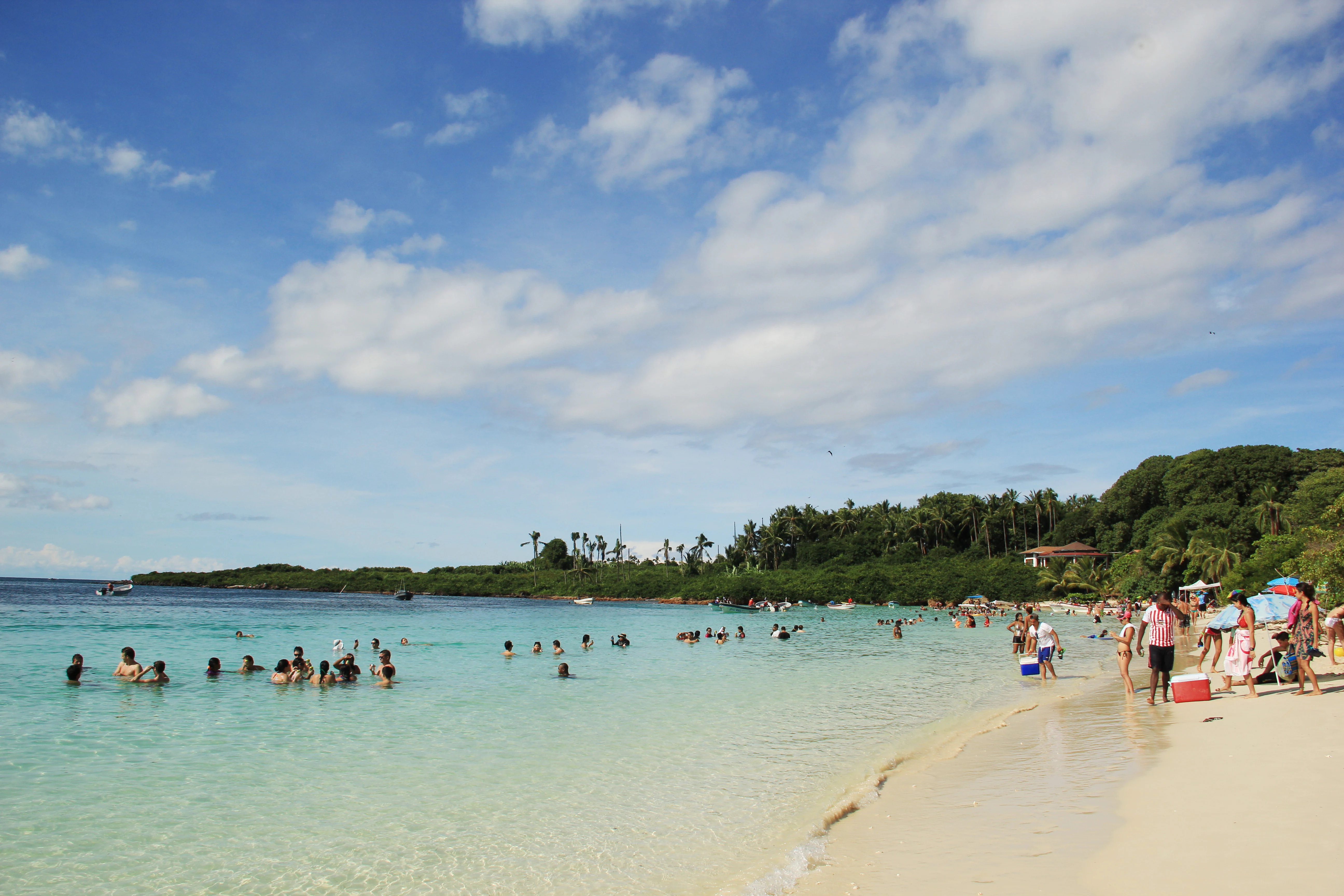
A sunny beach scene on Isla Iguana with tourists wading and swimming in turquoise water, framed by lush green trees and a white sandy shore under a bright blue sky with scattered clouds.
Visitors enjoying the clear, shallow waters at the beach on Isla Iguana.

Isla Iguana Wildlife Refuge history and protected-area timeline

Isla Iguana's more recent history is shaped by a mix of military activity, colonization, and eventual formal protection. During World War II, the United States Army used the island and surrounding waters as a bombing range, an episode that left unexploded ordnance, including large two-thousand-pound bombs, lodged in the nearby coral reef. Those munitions were cleared and detonated in the 1990s in an effort to make the surrounding marine area safer and more ecologically viable.

In the 1960s, a settler took up residence on the northern part of the island, claiming the land and introducing non-native plants such as mango and guava trees, as well as corn and sugar cane. These introduced species remain part of the island's vegetation today. The settler was eventually removed by the government near the end of the decade, clearing the way for stronger conservation management.

The reserve's modern legal foundation was laid on June 15, 1981, when Isla Iguana was formally declared a protected wildlife refuge. Since then, it has functioned as a focused conservation site for both terrestrial island habitats and the surrounding Panamanian Pacific reef system.

Isla Iguana Wildlife Refuge landscape and geographic character

Isla Iguana itself is a small, low-lying Pacific island whose landscape is dominated by tropical dry forest, sandy shorelines, and the surrounding seascape of coral reef and open ocean. The interior is shaped by the dry tropical forest that covers roughly thirteen hectares of the island, creating a relatively dense canopy considering the area involved and giving the refuge a distinctly forested island silhouette.

The marine landscape around Isla Iguana is equally important to the refuge's overall character. Coral formations occupy around forty hectares of protected seafloor and extend outward from the island's shore, creating a reef environment rich in structure and habitat diversity. This reef creates the transition between the island's beaches and the open Pacific, and it gives the refuge much of its scenic as well as ecological identity.

The combined effect of coral reef, beach, and dry forest within a very small geographic footprint gives Isla Iguana a layered coastal topography. Whereas many protected areas emphasize either forests or reefs, Isla Iguana shows both types of landscape in close association, framed by the broader southern Azuero coastline visible from the island.
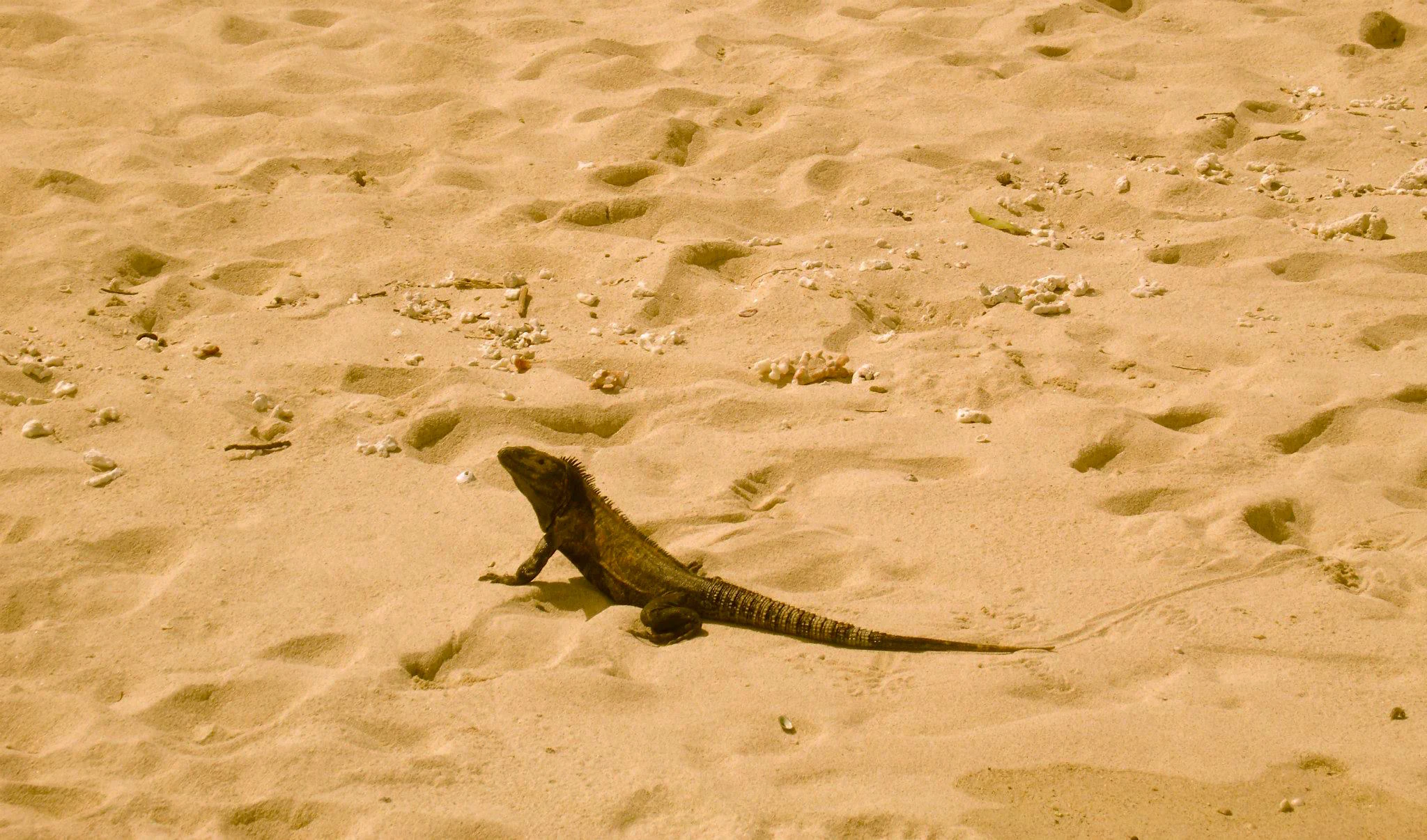
A medium-sized iguana standing on light-colored sand.
A green iguana on the sandy beaches of Isla Iguana Wildlife Refuge.

Isla Iguana Wildlife Refuge ecosystems, habitats, and plant life

The natural character of Isla Iguana Wildlife Refuge is defined by the closeness between its dry tropical forest and its marine habitats. The island's forest belongs to the dry tropical forest biome common along parts of Panama's Pacific coast, with vegetation adapted to seasonal rainfall patterns and salt-influenced conditions. The island also includes introduced plants from the mid-twentieth century, such as mango and guava, that have become part of the present vegetation cover.

Ecologically, the most significant habitat by far is the surrounding coral reef and associated marine environment. These reefs structure a community of over seventeen coral species and roughly 347 recorded fish species, forming an exceptionally diverse marine habitat relative to the refuge's size. The reef supports not only fish but also invertebrates such as octopus and moray eels, and it is visited seasonally by larger marine animals including dolphins and humpback whales.

The island's beaches and dry forest interior create nesting habitat for seabirds and reptiles, completing a chain of habitats that goes from terrestrial forest down through beach into reef and open ocean. This vertical layering of habitats within a small area is what makes the refuge ecologically unusual.

Isla Iguana Wildlife Refuge wildlife and species highlights

The wildlife of Isla Iguana Wildlife Refuge is shaped heavily by both island and marine species, and by seasonal visitors to the surrounding waters. On land, the island supports native iguanas, including black and green iguanas, along with boa constrictors, crabs, and hermit crabs that occupy the forest floor and shoreline. The avifauna is dominated by seabirds, particularly frigatebirds, including red-throated frigates, and the island is recognized as a vital nesting ground for several frigatebird species.

The surrounding reef ecosystem extends the wildlife profile well beyond the shoreline. Fish diversity is one of the refuge's most striking features, with around 347 recorded fish species sharing the reef habitat alongside corals, octopuses, and moray eels. Dolphins are also seen around the island.

Seasonal visitors add a major dimension to the refuge's wildlife significance. Humpback whales arrive in the warm Pacific waters offshore between roughly June or July and October, using the area to give birth and to nurse calves. Sea turtles of five different species also come ashore to lay their eggs, generally between April and September, making the island an important nesting site in Panama's annual sea turtle cycle.

Isla Iguana Wildlife Refuge conservation status and protection priorities

Isla Iguana Wildlife Refuge plays a focused but meaningful role in Panama's coastal conservation system, particularly for marine biodiversity on the Pacific side. Designated as a protected area in 1981, the refuge safeguards both a small dry tropical forest ecosystem on the island and a coral reef system that is unusually diverse for the region.

The conservation value of the site is amplified by its role as nesting habitat for seabirds and sea turtles, and as seasonal habitat for humpback whales. The presence of five sea turtle species using the island for egg-laying makes it a significant node within the broader regional effort to protect sea turtle populations in the eastern Pacific.

Management of the refuge has also involved addressing the legacy of mid-twentieth-century military activity. Clearance of unexploded ordnance from the surrounding reef in the 1990s reduced hazards to both wildlife and visitors, and reflects a broader commitment to restoring ecological function in the marine zone. Together with ongoing protection of the island's forest and shoreline habitats, this has helped Isla Iguana serve as a small but high-value conservation area.

Isla Iguana Wildlife Refuge cultural meaning and human context

Isla Iguana is closely tied to the coastal culture of Panama's Azuero Peninsula, a region known for its strong maritime and rural traditions. The refuge's main gateway communities are Pedasi and Mariabe, smaller settlements on the Los Santos coast that have long been associated with fishing and with seasonal movement along the Pacific shoreline.

The introduction of non-native plants such as mango, guava, corn, and sugar cane in the 1960s by a settler on the northern part of the island is a reminder that even small offshore islands in Panama have been part of rural land-use history. Those plants became part of the island's vegetation and remain part of its environment today, while the eventual government removal of the settler paved the way for formalized protection.

For local communities, Isla Iguana has also grown into part of the identity of the Azuero coast, increasingly associated with whale-watching tours, snorkeling visits, and reef-based ecotourism that link the region's traditions to modern conservation.

Top sights and standout views in Isla Iguana Wildlife Refuge

Isla Iguana Wildlife Refuge stands out for packing forest, beach, reef, and open ocean ecosystems into a very small protected footprint. The combination of dry tropical forest on land and a coral reef system supporting hundreds of fish species offshore gives the refuge an unusually rich biodiversity profile relative to its size.

Seasonal highlights include humpback whale arrivals from roughly June or July through October and sea turtle nesting between April and September, both of which have made the refuge a focal point for nature observation in Panama's Pacific. The presence of multiple frigatebird species, iguanas, and boa constrictors on the island adds further interest for visitors interested in terrestrial wildlife.

Best time to visit Isla Iguana Wildlife Refuge

The character of a visit to Isla Iguana changes meaningfully with the seasons, especially because two major wildlife events shape the annual rhythm of the refuge. The humpback whale season, generally running from around June or July into October, brings whales close to the island and to the broader Panamanian Pacific coast to give birth and to raise their calves in warm, sheltered waters. For visitors interested in whale watching, this period is the most rewarding window.

Sea turtle nesting takes place primarily between April and September, and visitors in those months may also encounter sea turtle activity on the island's beaches. Outside of these peak wildlife seasons, the refuge is generally quieter but still offers its core appeal of clear reef waters, dry tropical forest, and abundant fish life. Travelers should consider their main interest, whales, turtles, or general reef exploration, when planning the timing of a visit.

Monthly climate preview

Long term temperature and monthly precipitation averages for Isla Iguana Wildlife Refuge

Isla Iguana Wildlife Refuge Climate Normals and Weather by Month

Representative point measurements indicate steady baseline temperatures alongside shifting monthly precipitation volumes across the coordinate. Access the complete twelve month climate profile to review detailed temperature ranges and monthly precipitation metrics.
Annual mean27 °C
26 °C27 °C
Jan26°
Feb26°
Mar26°
Apr27°
May27°
Jun27°
Jul27°
Aug27°
Sep27°
Oct27°
Nov26°
Dec27°
Warmest month
April

27.4 °C

Coolest month
February

26.1 °C

Wettest month
September

11.6 mm/day

Driest month
February

0.6 mm/day

Park location guide

Geography guide, regional context, and park location map for Isla Iguana Wildlife Refuge

Isla Iguana Wildlife Refuge park geography, regions, and map view in Panama

Understand where Isla Iguana Wildlife Refuge sits in Panama through a broader geographic reading of the surrounding landscape, nearby location context, and its mapped position within the national park landscape.

How Isla Iguana Wildlife Refuge fits into Panama

Panama is a presidential republic located at the southern end of Central America in North America. It gained independence from Spain in 1821 and from Colombia in 1903, the latter enabling the construction of the Panama Canal under U.S. supervision between 1904 and 1914. The canal was transferred to Panamanian control in 1999 following the Torrijos-Carter Treaties. With a population of approximately 4.3 million and an area of about 75,400 km², Panama has a high-income economy driven primarily by canal tolls, banking, commerce, and tourism.

Wider geography shaping Isla Iguana Wildlife Refuge in Panama

Panama is located at the southern end of the Central American isthmus, stretching from the Caribbean coast in the north to the Pacific coast in the south. The country shares land borders with Costa Rica to the west and Colombia to the southeast. The terrain consists of coastal plains, mountain ranges including the Cordillera Central and Cordillera de Talamanca, and river valleys. The Panama Canal bisects the country, connecting the Atlantic and Pacific Oceans.

Map view of Isla Iguana Wildlife Refuge

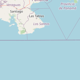
Use this park location map to pinpoint Isla Iguana Wildlife Refuge in Panama, understand its exact geographic position, and read its mapped placement within the surrounding landscape more clearly.

Pigeon | © OpenStreetMap contributors

Location context for Isla Iguana Wildlife Refuge

Los Santos Province

Visual reference guide to tropical dry forest habitats and coral reef terrain

Isla Iguana Wildlife Refuge Photos and Landscape Scenery

Photographic records illustrate the unique convergence of dry tropical forest and protected coral reef ecosystems surrounding Isla Iguana Wildlife Refuge. Visual observation helps researchers analyze coastal terrain, marine habitats, and island topography across the Panamanian Pacific.

A sunny beach scene on Isla Iguana with tourists wading and swimming in turquoise water, framed by lush green trees and a white sandy shore under a bright blue sky with scattered clouds.

A sandy beach with dark volcanic rocks in the foreground and turquoise water with people swimming, backed by a lush green forest under a cloudy sky.

A medium-sized iguana standing on light-colored sand.

Park atlas

Compare nearby protected landscapes, marine habitats, and regional coastal geography.

Exploring Parks Near Isla Iguana Wildlife Refuge and Surrounding Coastal Reserves

Browse other parks and protected areas near Isla Iguana Wildlife Refuge to examine related coastal ecosystems and marine habitats. Extending the geographic comparison reveals broader regional biodiversity patterns across the surrounding Pacific coastline.
National parkHerrera Province
About 71 km away#1 closest

Northwest

Sarigua National Park: A Protected National Park Landscape in Herrera Province

Explore mapped boundaries and regional geographic context.

Sarigua National Park represents a significant protected area within Herrera Province, Panama. This page details its identity as a national park, emphasizing its mapped geography and the regional context it inhabits. Users seeking to understand the specific protected landscape, its boundaries, and its place within the broader atlas of natural areas will find comprehensive discovery-oriented content.

IUCN
II
Relief
Lowland
Climate
Tropical
Access
Access unknown
National parkPanama
About 86 km away#2 closest

Southwest

Cerro Hoya National Park: Panama's Protected Landscape with Mapped Geographic Detail

Explore the national park's mapped boundaries and regional atlas context.

Cerro Hoya National Park presents a unique opportunity for geographic discovery, focusing on its role as a protected landscape within Panama. This park detail page allows for an in-depth atlas-style exploration of its mapped boundaries and its contribution to the regional geography of Central America. Understand the protected-area identity and the natural context that defines this significant national park, providing valuable data for landscape analysis and map-based research.

Area
333.4 km²
Established
1984
IUCN
II
Relief
Mountain
National parkPanamá Oeste Province
About 120 km away#3 closest

North

Altos de Campana National Park: National Park Protected Landscape and Geographic Context

Mapped boundaries and regional geography in Panamá Oeste Province.

Gain a structured understanding of Altos de Campana National Park, a designated national park located in Panamá Oeste Province. This page details its identity as a protected landscape, offering insights into its geographic placement and mapped boundaries for comprehensive atlas-style exploration. Understand its regional context and its contribution to Panama's network of protected areas.

Area
48.16 km²
Established
1966
IUCN
II
Relief
Mountain
National parkPanama
About 128 km away#4 closest

Northwest

Omar Torrijos "El Cope" National Park: Mapped Boundaries and Protected Landscape in Panama

Explore the geographic setting and natural terrain of this Panamanian national park.

Omar Torrijos "El Cope" National Park is a designated protected area offering rich opportunities for geographic discovery. Users can explore its mapped boundaries, understand its place within Panama's natural landscapes, and gain insight into the park's regional geographic context. This page provides a structured atlas-style view, highlighting the park's identity as a significant protected landform within Central America.

IUCN
II
Scope
Terrestrial
National parkPanama
About 159 km away#5 closest

North

Metropolitan Natural Park: Urban Protected Area and Forest Geography in Panama

Tracing the boundaries of a rare city-based wildlife refuge

Metropolitan Natural Park offers a significant study of urban conservation in Panama, protecting 265 hectares of Pacific tropical dry forest. Situated along the Panama Canal watershed, the terrain provides essential forest connectivity and diverse microhabitats, serving as a critical sanctuary within the dense metropolitan fabric of Panama City.

Area
2.65 km²
Established
1985
IUCN
II
Relief
Upland
A watercolor painting showing a stylized, panoramic view of soft green hills and distant pink-toned mountains against a white background.
Wildlife reservePanama City
About 159 km away#6 closest

North

Metropolitan Natural Park: Protected Tropical Forest in Panama City

Mapping the Pacific watershed and urban wildlife corridors

Metropolitan Natural Park stands as a rare wildlife refuge, protecting a dense secondary tropical dry forest ecosystem inside the capital. The park boundary encompasses forested slopes and ridgelines that look out over the Panama Canal, providing a unique intersection of intact biodiversity and urban geography.

Area
2.65 km²
Established
1985
Relief
Lowland
Climate
Tropical
National parkColón Province
About 164 km away#7 closest

North

Soberanía National Park: Panama National Park Atlas, Geography, and Protected Landscape Details

Explore the mapped boundaries and regional geography of this national park.

Investigate Soberanía National Park, a designated national park situated in Panama's Colón Province. This entry offers detailed geographic context, focusing on its mapped protected area, landscape character, and role within regional conservation. Understand the spatial distribution and atlas significance of this protected land, essential for a structured geographic discovery of Panama's natural heritage.

Area
220 km²
Established
1980
IUCN
II
Relief
Lowland
National parkDarién Province
About 177 km away#8 closest

East

Darién National Park: Darién Province National Park Geographic and Map Exploration

Discover its protected landscape and regional geographic context.

Darién National Park serves as a key protected area within Darién Province, offering an essential focus for geographic and atlas-based discovery. This dedicated park detail page provides insights into its mapped boundaries and its significance as a national park. Users can explore the park's specific geographic footprint and its place within the regional landscape, facilitating a structured understanding of protected natural areas. Dive into the mapped terrain and conservation landscape context that defines Darién National Park for comprehensive atlas exploration.

Area
5,790 km²
Established
1980
IUCN
II
Relief
Mountain

Common questions about visiting, size, designation, and location context for Isla Iguana Wildlife Refuge

Isla Iguana Wildlife Refuge FAQs for park facts, access, geography, and protected area context

Find quick answers about Isla Iguana Wildlife Refuge, including protected-area facts, park geography, trail and visitor context, and how the park fits into its surrounding country and regional landscape.
MoriAtlas Explorer

Continue Your Protected Areas Search Across the Global Atlas

Deepen your exploration by continuing the structured search for national parks and protected areas worldwide. Utilize the comprehensive filtering capabilities to compare different conservation landscapes and refine your understanding of global park geography. Discover more about the distribution and characteristics of protected natural areas.

Global natural geography