Mori Atlas logo
Wildlife reserveKaroo National Park

Trace the protected boundaries and natural landscapes of this significant wildlife reserve.

Karoo National Park: Mapped Protected Area and Wildlife Reserve Geography in Western Cape

Karoo National Park serves as a vital protected wildlife reserve within the diverse geography of South Africa's Western Cape. This page offers an atlas-perspective on the park, detailing its mapped boundaries and the surrounding natural landscape context. Understand its role as a protected area and its placement within the broader regional geography, providing a foundation for structured geographic discovery.

South Africa national parksSemi-desert wildernessGreat KarooGreat EscarpmentNuweveld MountainsProtected area Western Cape

Karoo National Park

Wildlife reserve

Park overview

Structured park overview, official facts, and landscape profile for Karoo National Park

Karoo National Park park facts, protected area profile, and essential visitor context
Review the core facts for Karoo National Park, including designation, size, terrain, visitor scale, habitats, and operating context in one park-focused overview.

About Karoo National Park

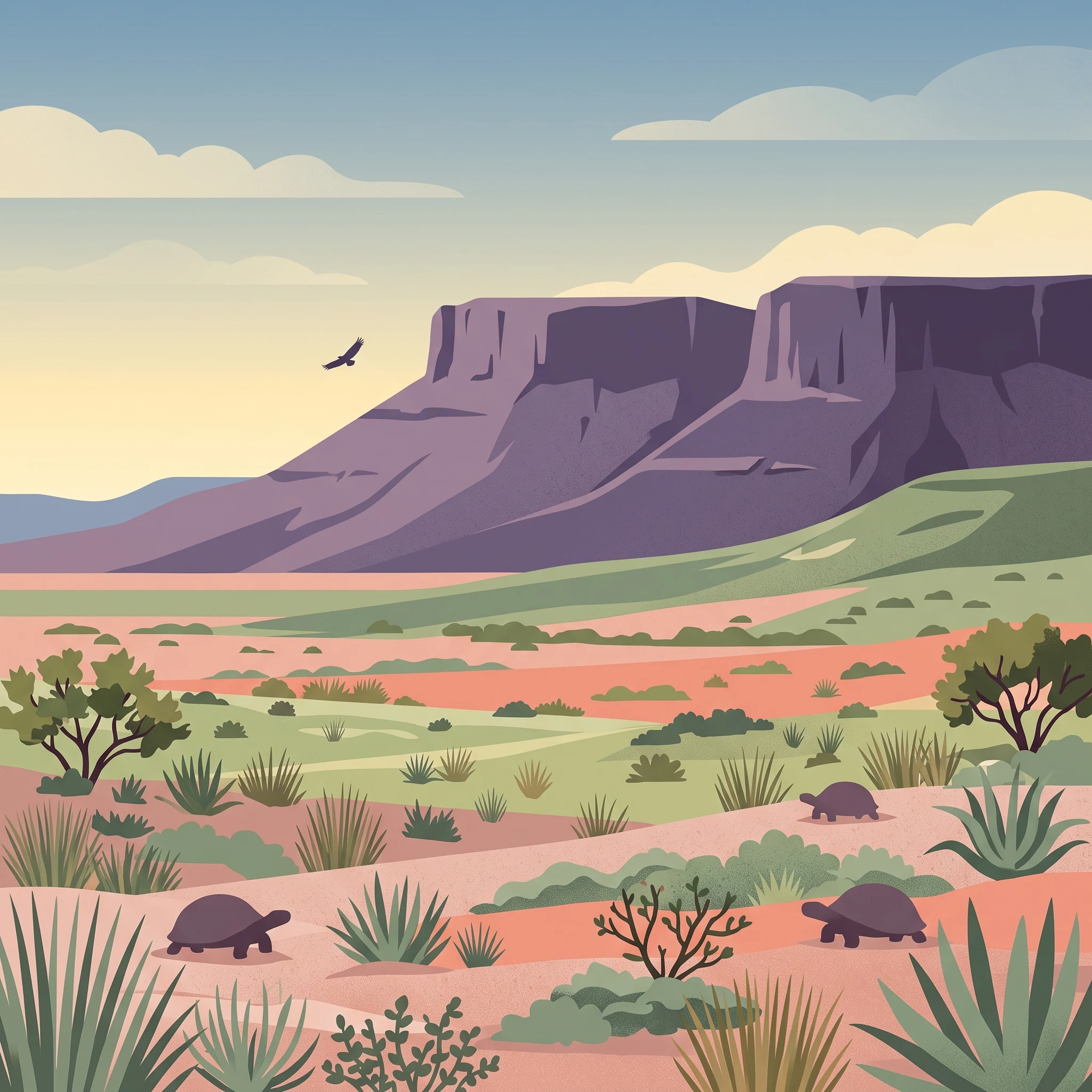
Karoo National Park protects a sweeping expanse of South Africa's distinctive semi-desert landscape within the Great Karoo, one of the country's most ecologically significant arid regions. The park's terrain encompasses two distinct elevation zones: theLower Karoo plains and the higher Upper Karoo plateau through which the Nuweveld portion of the Great Escarpment runs. The landscape is characterised by vast open plains punctuated by flat-topped hills whose level summits result from resistant dolerite sills that cap older Beaufort Group sedimentary rocks. This geological structure creates a visually dramatic environment where erosion has exposed the underlying rock formations while leaving the harder igneous layers as distinctive tablelands. The park offers visitors opportunities to explore this rugged landscape through game viewing drives, with the Klipspringer Pass providing vehicle access up onto the escarpment plateau where sweeping views across the Lower Karoo unfold from the Rooivalle View Point.

Quick facts and research context for Karoo National Park

Karoo National Park is located in the Western Cape province of South Africa, approximately 30 kilometres from Beaufort West. The protected area straddles two distinct Karoo zones: the Lower Karoo at lower elevations and the Upper Karoo on the Nuweveld plateau. The park was established in 1979 and is managed by South African National Parks. Annual rainfall averages around 200 millimetres, falling primarily as summer thunderstorms or cold fronts from the Cape, while winters bring frosty conditions and occasional snow on the Nuweveld Mountains.

Park context

Deeper park guide and search-rich context for Karoo National Park

Karoo National Park history, landscape, wildlife, and travel context
Explore Karoo National Park through its history, landscape character, ecosystems, wildlife, conservation priorities, cultural context, and seasonal travel timing in a structured park guide built for atlas discovery and search intent.

Why Karoo National Park stands out

Karoo National Park is especially known for its unique semi-desert wildlife viewing and its extraordinary geological heritage. The park safeguards one of the world's highest concentrations of tortoise species, with five different varieties present. It has also become a sanctuary for the endangered riverine rabbit, which has been successfully reintroduced here. The park houses a population of quaggas, Plains zebras that have been back-bred to resemble the extinct quagga that once roamed the Karoo in great numbers. The dramatic Great Escarpment landscape with its dolerite-capped flat-topped hills provides a striking visual signature, while the cliffs host significant populations of Verreaux's eagles and other raptor species.

Karoo National Park history and protected-area timeline

Karoo National Park was established in 1979 as part of South African National Parks' expansion of protected areas across the country. The park was created to safeguard the unique semi-desert ecosystem of the Great Karoo, an area that had historically been subjected to livestock farming but contained significant biodiversity value. The establishment of the park provided protection for the region's distinctive wildlife and the geological formations that make the Karoo paleontologically famous. Over the years, conservation efforts have included the reintroduction of species such as the endangered riverine rabbit and the establishment of quagga populations as part of broader restoration initiatives aimed at reviving aspects of the Karoo's historical fauna.

Karoo National Park landscape and geographic character

The landscape of Karoo National Park is defined by its position along the Nuweveld portion of the Great Escarpment, which creates dramatic topographical variation within the park. The Lower Karoo consists of open plains at approximately 850 metres elevation, while the Upper Karoo occupies the higher plateau above 1,300 metres where the Nuweveld Mountains rise. The most distinctive landscape feature is the flat-topped hills formed by dolerite sills, where harder igneous rock caps the softer underlying Beaufort Group sediments, creating table-like summits and sharp level edges to the escarpment. The Klipspringer Pass provides the main vehicular access up the steep escarpment face, winding through rocky terrain to reach the plateau. The Rooiwalle Canyon and other scenic viewpoints offer sweeping vistas across the semi-desert plains below.

Karoo National Park ecosystems, habitats, and plant life

The park's vegetation consists primarily of dwarf xerophytic shrubs reaching less than one metre in height, interspersed with grasses adapted to the semi-desert environment. These shrubs and grasses are largely deciduous, responding to the irregular rainfall patterns that characterise the Karoo climate. The vegetation has evolved to survive in conditions of low and unpredictable precipitation, with adaptations that allow the plants to thrive despite extended dry periods. This sparse yet resilient plant community forms the foundation of the Karoo ecosystem, supporting the diverse wildlife that depends upon it for sustenance in this challenging environment.

Karoo National Park wildlife and species highlights

Karoo National Park provides sanctuary for a diverse array of wildlife adapted to semi-desert conditions. Large mammals include springbok, gemsbok (oryx), black wildebeest, Cape mountain zebra, red hartebeest, black rhinoceros, eland, greater kudu, klipspringer, bat-eared foxes, black-backed jackal, and ostriches. The park is notable for its tortoise diversity, hosting the greatest number of species of any protected area worldwide, with five different varieties present. The endangered riverine rabbit has been successfully reintroduced here, representing a significant conservation achievement. Raptors are well represented, with Verreaux's eagles nesting prominently on the escarpment cliffs, accompanied by martial eagles, booted eagles, and Cape eagle-owls. The park also supports populations of quaggas, back-bred zebras intended to resemble the extinct subspecies that once ranged across the Karoo.

Karoo National Park conservation status and protection priorities

Karoo National Park plays a significant role in conserving South Africa's semi-desert biodiversity within a protected framework. The park's conservation significance is underscored by its hosting of the endangered riverine rabbit, one of South Africa's most threatened mammal species, which has been successfully re-established through captive breeding and reintroduction programmes. The quagga project represents an innovative conservation approach, attempting to restore an extinct subspecies through selective breeding of Burchell's zebras. The park also protects important raptor nesting habitat along the escarpment cliffs, particularly for Verreaux's eagles. The geological conservation value is substantial, with the park safeguarding exposures of Beaufort Group rocks that document millions of years of Gondwanan geological history.

Karoo National Park cultural meaning and human context

The Karoo National Park occupies a landscape that forms part of the broader cultural and historical context of the Great Karoo region, an area traditionally associated with pastoral farming communities and the indigenous Khoikhoi peoples. While the park itself does not contain specific cultural heritage sites of major significance, the Karoo landscape has long been integral to South Africa's rural character and identity. The semi-desert environment has shaped human settlement patterns and land use over centuries, with the area around Beaufort West representing a region of historical importance in the Western Cape's development.

Top sights and standout views in Karoo National Park

The Karoo National Park offers several standout features that distinguish it as a destination. The Klipspringer Pass provides a scenic drive up the Great Escarpment to the Upper Karoo plateau, with the Rooivalle View Point delivering panoramic vistas across the Lower Karoo plains. The park's remarkable tortoise diversity, with five species present, represents a world-record concentration in any protected area. The quagga reintroduction project offers a unique opportunity to observe animals resembling the extinct Karoo quagga. The dramatic flat-topped hills formed by dolerite sills create a distinctive visual landscape. The escarpment cliffs support significant Verreaux's eagle populations, making the park a notable location for raptor observation.

Best time to visit Karoo National Park

The best time to visit Karoo National Park falls during the warmer months from October through March, when conditions are most favourable for wildlife viewing and outdoor exploration. Summer temperatures can reach highs of around 40 degrees Celsius, but this season coincides with the main rainfall period when thunderstorms and cold fronts from the Cape bring moisture to the semi-desert environment. The warmer months offer the best opportunities to observe wildlife as animals are more active and congregate around remaining water sources. Winter months from May to August bring cold temperatures with frost and occasional snow on the higher peaks, though this period offers clearer skies and a different character to the landscape.
Park location guide

Geography guide, regional context, and park location map for Karoo National Park

Karoo National Park park geography, regions, and map view in South Africa
Understand where Karoo National Park sits in South Africa through a broader geographic reading of the surrounding landscape, nearby location context, and its mapped position within the national park landscape.

How Karoo National Park fits into South Africa

South Africa is the southernmost country in Africa, spanning 1.22 million km² with a population of over 63 million. The country operates with three capital cities, Pretoria (executive), Cape Town (legislative), and Bloemfontein (judicial), and is renowned for its biodiversity, national parks, and multicultural society.

Wider geography shaping Karoo National Park in South Africa

South Africa occupies the southernmost region of Africa, with coastline along both the Atlantic Ocean to the west and the Indian Ocean to the east. The interior features elevated plateaus including the Highveld, with the Drakensberg escarpment marking the eastern highlands. The country shares borders with Namibia, Botswana, Zimbabwe, Mozambique, Eswatini, and Lesotho.

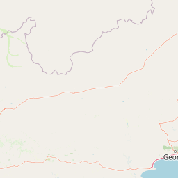
Map view of Karoo National Park

Use this park location map to pinpoint Karoo National Park in South Africa, understand its exact geographic position, and read its mapped placement within the surrounding landscape more clearly.

Pigeon | © OpenStreetMap contributors

Location context for Karoo National Park

Western Cape
Park atlas

Trace the mapped geography and protected-landscape spread across the Great Karoo, exploring nearby conservation areas for comparison.

Explore More National Parks, Protected Areas, and Regional Landscapes Near Karoo National Park
Browse other national parks and protected areas situated within or adjacent to the Great Karoo region, extending your geographic exploration beyond Karoo National Park's unique semi-desert and escarpment landscapes. This curated view provides essential regional context, allowing for a structured comparison of diverse conservation efforts and geological formations across the Western Cape.
Watercolor illustration of rolling hills and scattered trees under a pale sky
National parkNorthern Cape

Meerkat National Park National Park: Geographic Atlas and Protected Landscape Details

Explore the mapped boundaries and regional geography of Meerkat National Park.

Meerkat National Park is a significant protected area identified as a national park within the expansive Northern Cape region of South Africa. This detail page offers insight into its specific landscape character and mapped geographic extent, serving as a crucial node for atlas-based exploration. Understand the park's role as a protected national landscape and its relationship to the broader regional geography of Northern Cape, contributing to a structured understanding of conservation areas.

Area
1,352.45 km²
Established
2020
IUCN
II
Relief
Lowland
National parkEastern Cape

Camdeboo National Park: Protected Landscape Atlas and Eastern Cape Geographic Context

Discover the mapped geography and protected area identity of this Eastern Cape national park.

Camdeboo National Park represents a key protected landscape within the Eastern Cape province of South Africa. This entry provides essential details for understanding its protected-area status, geographic footprint, and its role within the regional atlas. Examine its mapped boundaries and explore the unique natural terrain it encompasses, gaining specific insight into its protected landscape characteristics.

Area
194.05 km²
Established
2005
Relief
Mountain
Climate
Arid
National parkSouth Africa

Garden Route National Park: South Africa's Protected Landscape and Forest Atlas

Explore indigenous forests, coastal cliffs, and lake systems.

Garden Route National Park is a key national park in South Africa, celebrated for its rich indigenous forests and dramatic coastline. As a protected landscape, it offers a unique geographic profile, blending ancient woodlands with rugged coastal terrain and interconnected lake systems. This page serves as an atlas entry, detailing the park's spatial extent and its significance as a conservation area within the broader geography of South Africa.

Area
1,210 km²
Established
2009
IUCN
II
Relief
Mixed relief
National parkWestern Cape

Wilderness National Park: National Park in Western Cape Province, South Africa

Explore mapped protected areas and regional geography.

Wilderness National Park stands as a significant protected area within the Western Cape province of South Africa. This page provides a detailed view of its role as a national park, emphasizing its geographic placement and mapped boundaries. Understand the park's contribution to the region's natural landscape and its significance within the broader atlas of protected lands.

Area
1,210 km²
Established
2009
Relief
Lowland
Access
Easy access
Watercolor illustration showing a mountain range with green hills and pink flowers
National parkNorthern Cape

Tankwa Karoo National Park National Park: Mapped Protected Landscape in Northern Cape

Explore regional geography and protected area boundaries.

Tankwa Karoo National Park is a key protected area situated in the vast Northern Cape region of South Africa. This entry provides a detailed atlas perspective, focusing on the park's mapped geography and its significance as a national park. Understand the park's landscape context and its position within the broader regional geography for informed exploration and geographic discovery.

Area
1,436 km²
Established
1986
Relief
Upland
Climate
Arid
National parkSouth Africa

Tsitsikamma National Park: South Africa's Protected Coastal Forest and Terrain

Explore the unique mapped landscape and protected area boundaries.

Tsitsikamma National Park in South Africa is defined by its striking coastal geography, where ancient indigenous forests descend towards rugged shores. This national park is a prime example of a protected landscape that showcases the dynamic interface between land and sea, featuring dramatic cliffs and iconic river mouths. Understanding its mapped boundaries and diverse terrain provides critical context for regional geographic exploration and the study of conservation areas within South Africa.

Established
2009
IUCN
II
Relief
Mixed relief
Climate
Mediterranean
National parkWestern Cape

Bontebok National Park: A Unique Protected Landscape in South Africa's Western Cape

Mapping the endemic bontebok's habitat and diverse fynbos.

Bontebok National Park represents a singular achievement in conservation, dedicated to protecting the rare bontebok antelope and showcasing the extraordinary biodiversity of the Cape Floristic Region. Located in the Western Cape, this smallest of South Africa's national parks features a landscape of fynbos-covered foothills beneath the Langeberg Mountains, with the Breede River defining its southern edge. Explore its mapped boundaries and unique ecosystems, offering a concentrated natural discovery experience within a UNESCO World Heritage Site.

Area
27.86 km²
Established
1931
IUCN
II
Relief
Mixed relief
National parkEastern Cape

Mountain Zebra National Park: A National Park within Eastern Cape's Geography

Explore its mapped protected boundaries and regional landscape context.

Mountain Zebra National Park serves as a key protected area within South Africa's Eastern Cape region. This page offers an atlas-driven perspective, detailing the park's geographic scope and mapped boundaries. Understand its role as a national park and its contribution to the regional landscape context, providing structured data for those interested in protected land distribution and natural terrain.

Area
284 km²
Established
1937
IUCN
II
Visitors
31.2K annual

Common questions about visiting, size, designation, and location context for Karoo National Park

Karoo National Park FAQs for park facts, access, geography, and protected area context
Find quick answers about Karoo National Park, including protected-area facts, park geography, trail and visitor context, and how the park fits into its surrounding country and regional landscape.
MoriAtlas Explorer

Continue Your Protected Areas Search Across the Global Atlas

Deepen your exploration by continuing the structured search for national parks and protected areas worldwide. Utilize the comprehensive filtering capabilities to compare different conservation landscapes and refine your understanding of global park geography. Discover more about the distribution and characteristics of protected natural areas.

Global natural geography