Mori Atlas logo
National parkKhao Lampi–Hat Thai Mueang National Park

Discover the mapped boundaries and geographic context of this unique national park in Phang Nga Province.

Khao Lampi–Hat Thai Mueang National Park: Dual Landscape Protected Area Atlas

Khao Lampi–Hat Thai Mueang National Park represents a significant protected landscape in Thailand's Phang Nga Province, offering an unparalleled duality of environments. This national park provides a comprehensive look at both the rugged, waterfall-rich tropical rainforests of the Khao Lampi mountain range and the vital coastal ecosystems of Hat Thai Mueang beach, a recognized sea turtle nesting ground. Explore the detailed geography and distinct natural features that define this protected area, contributing to a richer understanding of Thailand's natural atlas.

tropical rainforestwaterfallssea turtle nestingmangrove forestAndaman coastmountain parks

Khao Lampi–Hat Thai Mueang National Park

National park

Park overview

Structured park overview, official facts, and landscape profile for Khao Lampi, Hat Thai Mueang National Park

Khao Lampi, Hat Thai Mueang National Park park facts, protected area profile, and essential visitor context

Review the core facts for Khao Lampi, Hat Thai Mueang National Park, including designation, size, terrain, visitor scale, habitats, and operating context in one park-focused overview.

About Khao Lampi, Hat Thai Mueang National Park

Khao Lampi–Hat Thai Mueang National Park represents a distinctive protected-area model in Thailand, combining upland and coastal ecosystems within a single management framework. The park's 72-square-kilometer territory straddles the transition between the mountainous interior of the Phang Nga peninsula and the Andaman Sea coastline, creating a mosaic of habitats that support remarkable biodiversity. The mountain section, centered on the Khao Lampi range, preserves extensive tropical rainforest that serves as a critical watershed for the region's river systems. This forest cover includes valuable timber species and provides habitat for diverse wildlife. The coastal section centers on Hat Thai Mueang, a sweeping 13-kilometer white sand beach that remains relatively undeveloped compared to other Thai coastal destinations. The beach is flanked by mangrove forests along brackish water channels, creating a complex ecological interface between terrestrial and marine environments. The park's location along Route 4 (Phetkasem Road) makes it accessible while still maintaining natural character, and it serves as an important component of Thailand's protected-area network in the Andaman region.

Quick facts and research context for Khao Lampi, Hat Thai Mueang National Park

Khao Lampi–Hat Thai Mueang National Park occupies 72 square kilometers in Thai Mueang District, Phang Nga Province, on Thailand's Andaman coast. The park's highest peak reaches 622 meters at Yot Khao Kanim mountain in the northern portion of the eastern section. The park was officially established on April 14, 1986, following prior designation as Lampi Forest Park. The two sections are separated geographically: the mountainous eastern section contains the park's namesake waterfall system, while the western coastal section protects the 13-kilometer Hat Thai Mueang beach and its associated mangrove ecosystems.

Protection and recognition

Documenting the 1986 establishment and mixed protection scope of the Thai coastal reserve.

Khao Lampi, Hat Thai Mueang National Park Protection Status and Designation

Khao Lampi, Hat Thai Mueang National Park has been managed under a mixed protection scope since its official designation in 1986. Accessing the formal designation record provides essential geographic context for understanding the regional conservation framework of the Thai coastal landscape.

Protection details

Protection scope
Mixed
Designated year
1986
Park context

Deeper park guide and search-rich context for Khao Lampi, Hat Thai Mueang National Park

Khao Lampi, Hat Thai Mueang National Park history, landscape, wildlife, and travel context

Explore Khao Lampi, Hat Thai Mueang National Park through its history, landscape character, ecosystems, wildlife, conservation priorities, cultural context, and seasonal travel timing in a structured park guide built for atlas discovery and search intent.

Why Khao Lampi, Hat Thai Mueang National Park stands out

This park is best known for its remarkable dual-character landscape combining mountainous rainforest with coastal beach environments. The eastern mountain section features prominent waterfalls including Ton Phrai, the tallest at 40 meters, and the multi-tiered Lampi Waterfall after which the park was named. The beach section is significant for being a major sea turtle nesting area, with leatherback, green, and hawksbill turtles coming ashore between November and February. The mangroves behind Hat Thai Mueang beach serve as critical nurseries for marine species and provided natural tsunami buffering during the 2004 Indian Ocean event. The park also supports populations of endangered mammals including the Malayan tapir, Sumatran serow, lar gibbon, and sun bear.

Khao Lampi, Hat Thai Mueang National Park history and protected-area timeline

The area now comprising Khao Lampi–Hat Thai Mueang National Park was originally known as Lampi Waterfall and Lampi Forest Park prior to national park designation. The site gained attention for its natural beauty and ecological importance beginning in the 1970s, with formal proposals to establish protected status emerging in the early 1980s. Historical records indicate that Field Marshal Plaek Pibulsonggram (Prime Minister of Thailand from 1944-1957) visited Lampi Waterfall as early as 1955, demonstrating the site's longstanding recognition as a natural landmark. The proposal to establish the area as a national park was motivated by concerns about encroachment and the need to preserve the watershed, forest, and beach resources. Following administrative processing, Khao Lampi–Hat Thai Mueang became Thailand's 52nd national park on April 14, 1986. The establishment combined the previously separate Lampi Forest Park area with the coastal Hat Thai Mueang section into a unified protected area.

Khao Lampi, Hat Thai Mueang National Park landscape and geographic character

The park's landscape is defined by its two contrasting sections separated by the central highway corridor. The eastern mountainous section contains rugged terrain rising to 622 meters at Yot Khao Kanim, with steep ridges and valleys covered in dense tropical forest. Several waterfalls cascade down the mountain slopes, with Ton Phrai Waterfall being the most impressive at 40 meters height, followed by the park's namesake Lampi Waterfall which drops in multiple tiers. The landscape transitions dramatically as one moves westward toward the coast. The beach section features a long expanse of white sand facing the Andaman Sea, backed by a narrow strip of beach forest and then extensive mangrove systems along the canal networks that drain to the sea. The mangroves form a distinctive low-lying ecosystem with brackish water channels threading through dense vegetation. A notable feature is the presence of peat swamp forest in portions of the beach section, one of few such ecosystems along the Andaman coast.

Khao Lampi, Hat Thai Mueang National Park ecosystems, habitats, and plant life

The park's ecological diversity stems from its dual terrestrial and coastal environments. The mountain section supports tropical rainforest with canopy species including dipterocarps such as Dipterocarpus, Anisoptera costata, and Hopea odorata, along with bullet wood. Bamboo and rattan dominate the understory in lower sections. The beach and mangrove section contains distinct vegetation zones: mangroves along the brackish canals including large-leaved and small-leaved mangroves, and beach forest further inland featuring casuarina, Terminalia catappa, Derris indica, and Barringtonia species. The peat swamp forest represents a particularly rare habitat type on the Andaman coast. The mangroves serve crucial ecological functions including water filtration from higher ground, provision of nursery habitat for juvenile marine species, and natural coastal protection. The park's bird diversity includes at least 188 species, making it significant for avifauna in the region.

Khao Lampi, Hat Thai Mueang National Park wildlife and species highlights

The park supports a notable array of mammal species typical of southern Thai forests. Large mammals include the Malayan tapir, a distinctive species with its black-and-white patterning, and the Sumatran serow, a goat-antelope found on steep forested slopes. Primates are represented by lar gibbon, while the Malayan sun bear, the smallest bear species, also occurs in the park. The coastal and marine environments support significant reptile populations, particularly sea turtles. Three species nest on Hat Thai Mueang beach: leatherback, green, and hawksbill turtles. Monitoring data from Thai Mueang beach between 2003 and 2013 recorded 2,678 leatherback eggs laid, with 58.7 percent hatching successfully, though the species faces significant threats. Reptiles also include pythons and Malayan pit vipers in the forest areas. Freshwater fish in the park's streams include several species of conservation interest, while the mangrove and coastal waters support diverse marine life.

Khao Lampi, Hat Thai Mueang National Park conservation status and protection priorities

Khao Lampi–Hat Thai Mueang holds significance within Thailand's conservation framework as a protected area preserving both forest and coastal ecosystems. The sea turtle nesting beach represents one of the park's most important conservation values, with leatherback turtles returning annually to lay eggs despite facing numerous threats. Conservation challenges include irresponsible trawler fishing operations, beachfront property development that displaces nesting turtles, and traditional beliefs regarding the supposed health benefits of turtle eggs that drive illegal egg collection. The park's mangroves proved ecologically valuable during the 2004 Indian Ocean tsunami, demonstrably reducing wave energy and protecting the coastline. The presence of peat swamp forest adds to the park's conservation significance as one of few such ecosystems on the Andaman coast, representing a rare habitat type requiring protection.

Khao Lampi, Hat Thai Mueang National Park cultural meaning and human context

The park's coastal section has supported local community interactions with the marine environment over generations. Hat Thai Mueang beach has traditional significance as a nesting ground for sea turtles, a relationship that continues today though facing pressures from development and changing practices. The area was historically accessible via the route connecting Phuket and Phang Nga, making it a known destination within the region. Local festivals associated with turtle conservation, including events marking the release of hatchlings in March, reflect the continuing connection between communities and the park's natural resources.

Top sights and standout views in Khao Lampi, Hat Thai Mueang National Park

The park's defining feature is its combination of two completely different ecosystems within one protected boundary: mountain rainforest with dramatic waterfalls and a pristine beach with sea turtle nesting. Ton Phrai Waterfall at 40 meters is the tallest and most impressive waterfall, best viewed during the rainy season when water volume is highest. The Lampi Waterfall gives the park its name and offers a multi-tiered cascade. Hat Thai Mueang beach provides 13 kilometers of undeveloped sand along the Andaman Sea, a rare sight on Thailand's developed coast. The sea turtle nesting program draws attention between November and February when turtles come ashore, and a local festival celebrates hatchling releases in March. The mangrove forests behind the beach offer ecological tours and demonstrate important coastal protection functions.

Best time to visit Khao Lampi, Hat Thai Mueang National Park

The optimal time to visit Khao Lampi–Hat Thai Mueang depends on what visitors wish to experience. Waterfall viewing is best during the rainy season from May through October when rainfall creates the most impressive flows at Ton Phrai and Lampi waterfalls. For beach and sea turtle activities, the period from November through February is most significant as this is when leatherback and other sea turtles come ashore to nest. The coolest and driest conditions generally occur from December through February, making this period comfortable for general exploration though visitor numbers increase during turtle season. The park is open year-round, but those wishing to avoid peak heat might prefer the slightly cooler months from November through March. The monsoon season brings heavier rainfall to the mountain section, which while creating better waterfall conditions, may also make some trails more difficult to navigate.
Park guides

Targeted research materials covering seasonal timing and coastal environments

Khao Lampi Hat Thai Mueang National Park Focused Guides and Planning Resources

Focused reference resources help researchers examine specific environmental patterns and seasonal timing across the dual coastal terrain. Published documentation specifically addresses visit planning and optimal conditions for observing local ecosystems.
Monthly climate preview

Long term temperature and precipitation patterns for the coastal Phang Nga Province protected landscape

Khao Lampi-Hat Thai Mueang National Park Climate and Weather by Month

Long term measurements at Khao Lampi-Hat Thai Mueang National Park show warm average temperatures alongside a distinct heavy precipitation season peaking in September. Accessing the complete twelve month profile clarifies monthly temperature variations and precipitation distribution to support precise geographic comparison of the coastal landscape.
Annual mean27 °C
27 °C29 °C
Jan27°
Feb28°
Mar28°
Apr29°
May28°
Jun28°
Jul27°
Aug27°
Sep27°
Oct27°
Nov27°
Dec27°
Warmest month
April

28.6 °C

Coolest month
October

26.7 °C

Wettest month
September

13.4 mm/day

Driest month
February

1.1 mm/day

Park location guide

Geography guide, regional context, and park location map for Khao Lampi, Hat Thai Mueang National Park

Khao Lampi, Hat Thai Mueang National Park park geography, regions, and map view in Thailand

Understand where Khao Lampi, Hat Thai Mueang National Park sits in Thailand through a broader geographic reading of the surrounding landscape, nearby location context, and its mapped position within the national park landscape.

How Khao Lampi, Hat Thai Mueang National Park fits into Thailand

Thailand is a Southeast Asian nation formerly called Siam, located in mainland Southeast Asia. It operates as a unitary parliamentary constitutional monarchy under King Vajiralongkorn. The country borders Myanmar, Laos, Cambodia, and Malaysia, with maritime boundaries involving Vietnam, Indonesia, and India. Thailand has a population of nearly 66 million and covers approximately 513,120 km². Historically, the Sukhothai Kingdom marks the beginning of Thai history, followed by the powerful Ayutthaya Kingdom.

Wider geography shaping Khao Lampi, Hat Thai Mueang National Park in Thailand

Thailand occupies mainland Southeast Asia with borders to Myanmar (west/northwest), Laos (east/northeast), Cambodia (southeast), and Malaysia (south). The country has coastline along the Gulf of Thailand to the southeast and the Andaman Sea to the southwest. The territory covers approximately 513,120 km².

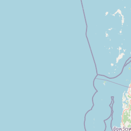
Map view of Khao Lampi, Hat Thai Mueang National Park

Use this park location map to pinpoint Khao Lampi, Hat Thai Mueang National Park in Thailand, understand its exact geographic position, and read its mapped placement within the surrounding landscape more clearly.

Pigeon | © OpenStreetMap contributors

Location context for Khao Lampi, Hat Thai Mueang National Park

Phang Nga Province
Park atlas

Discover additional protected landscapes, coastal ecosystems, and mountain rainforests across southern Thailand.

Explore Other National Parks and Protected Areas Near Khao Lampi–Hat Thai Mueang National Park

Continue your exploration from Khao Lampi–Hat Thai Mueang National Park by browsing other national parks and protected areas across the Andaman coast of southern Thailand. Compare additional protected landscapes, trace regional park geography, and discover diverse ecosystems, from mountain rainforests to coastal beaches.
National parkThailand
About 23 km away#1 closest

East

Ao Phang Nga National Park: A Protected National Park in Thailand's Geographic Atlas

Explore the mapped landscape and protected area identity.

Ao Phang Nga National Park offers a distinct protected landscape within Thailand, serving as a key entry in the national park atlas. This page focuses on delineating its geographic boundaries and understanding its specific characteristics as a national park. Users can discover the mapped context and regional setting, providing valuable insights into Thailand's protected natural areas and their conservation significance.

Area
400 km²
Established
1981
IUCN
II
Visitors
999K annual
National parkPhang Nga Province
About 31 km away#2 closest

North

Khao Lak, Lam Ru National Park: Protected National Park Landscape and Geography

Explore its mapped boundaries and regional context in Phang Nga Province.

This entry focuses on Khao Lak, Lam Ru National Park, a designated national park offering a distinct protected landscape within Phang Nga Province, Thailand. It provides structured data and map context crucial for understanding its geographic scope and regional significance. Explore the park's mapped boundaries, its role as a protected area, and its contribution to the broader landscape of southern Thailand, fostering a deeper appreciation for its natural geography and atlas-derived insights.

Area
125 km²
Established
1991
IUCN
II
Visitors
72.2K annual
National parkPhuket Province
About 38 km away#3 closest

South

Sirinat National Park: Phuket Province Protected Coastal Landscape and Marine Atlas

Mapped boundaries, beach forests, and sea turtle nesting sites.

Sirinat National Park offers a unique opportunity to explore a protected coastal geography on Phuket Island. This national park preserves critical beach forest ecosystems, extensive shorelines like Hat Mai Khao, vital sea turtle nesting grounds, and surrounding marine environments including coral reefs and mangrove habitats. Its designation as a protected area provides essential context for understanding the natural landscape and its ecological significance within Thailand's regional geography.

Area
90 km²
Established
1981
IUCN
II
Visitors
51.2K annual
National parkSurat Thani Province
About 65 km away#4 closest

Northeast

Khao Sok National Park: Protected Landscape Atlas and Geographic Detail

Explore mapped boundaries and regional terrain in Surat Thani Province.

Khao Sok National Park represents a crucial protected landscape within the expansive geography of Surat Thani Province, Thailand. This detailed entry focuses on the park's identity as a national park, emphasizing its mapped boundaries and the surrounding natural terrain. Through structured information and geographic context, users can gain a clear understanding of Khao Sok National Park's place in the atlas, contributing to a more informed approach to landscape discovery.

Area
739 km²
Established
1980
IUCN
II
Visitors
419.5K annual
National parkSurat Thani Province
About 70 km away#5 closest

Northeast

Khlong Phanom National Park: Protected National Park in Surat Thani Province, Southern Thailand

Discover its mapped boundaries and regional landscape context.

Khlong Phanom National Park is a designated national park providing valuable insight into the natural geography of Surat Thani Province. This protected landscape serves as a key entity for understanding regional terrain and the distribution of conservation areas in Southern Thailand. Explore its mapped geographic features and protected boundaries to gain a structured understanding of its place within the national park atlas.

Area
410 km²
Established
2000
IUCN
II
Visitors
1.7K annual
Watercolor illustration of a coastal landscape with rolling hills, green vegetation, pink flowers, and a body of water in the background
National parkThailand
About 71 km away#6 closest

West

Mu Ko Similan National Park: Thailand's Andaman Sea Marine National Park and Archipelago Geography

Mapped island terrain, coral reef atlas, and marine protected landscape identity.

Mu Ko Similan National Park is a significant protected area in Thailand, renowned for its island archipelago geography in the Andaman Sea. The park features striking granite boulder formations above sea level and incredibly rich coral reef ecosystems below, making it a key location for marine atlas exploration. Users can discover the mapped park boundaries, the unique natural terrain of the Similan Islands, and the vital role of this protected landscape in regional marine conservation efforts, offering a detailed geographic perspective.

Area
140 km²
Established
1982
IUCN
II
Visitors
912K annual
National parkKrabi Province
About 73 km away#7 closest

East

Khao Phanom Bencha National Park: Protected Mountainous Rainforest and Waterfall Landscapes

Explore Krabi Province's unique protected area and its dramatic geographic features.

Khao Phanom Bencha National Park represents a core protected landscape within Krabi Province, Thailand. Dominated by the imposing Khao Phanom Bencha mountain range, its terrain includes steep, forested slopes and intricate valley systems that give rise to impressive waterfalls. This national park is an essential component of the region's protected natural areas, offering a detailed look at its unique ecosystem and geographic character through mapped landscape context and atlas exploration.

Area
50 km²
Established
1981
IUCN
II
Visitors
17.3K annual
National parkPhang Nga Province
About 84 km away#8 closest

North

Si Phang-nga National Park: Protected Landscape Identity and Geographic Context in Phang Nga

Explore the park's mapped boundaries and unique karst landscape.

Si Phang-nga National Park stands as a key protected area, distinguished by its extraordinary limestone karst formations that dominate the coastal geography of Phang Nga Province, Thailand. The park's protected landscape features include dramatic pinnacles rising from mangrove-lined waters and intricate cave systems with archaeological significance. Delve into the unique natural terrain and map context that define this vital national park, offering a deep dive into its geological history and ecological importance.

Area
246 km²
Established
1988
IUCN
II
Visitors
21.3K annual

Common questions about visiting, size, designation, and location context for Khao Lampi, Hat Thai Mueang National Park

Khao Lampi, Hat Thai Mueang National Park FAQs for park facts, access, geography, and protected area context

Find quick answers about Khao Lampi, Hat Thai Mueang National Park, including protected-area facts, park geography, trail and visitor context, and how the park fits into its surrounding country and regional landscape.
MoriAtlas Explorer

Continue Your Protected Areas Search Across the Global Atlas

Deepen your exploration by continuing the structured search for national parks and protected areas worldwide. Utilize the comprehensive filtering capabilities to compare different conservation landscapes and refine your understanding of global park geography. Discover more about the distribution and characteristics of protected natural areas.

Global natural geography