Mori Atlas logo
Nature reserveKhor Kalba Nature Reserve

Discover the mapped boundaries and unique landscape of this vital UAE nature reserve.

Khor Kalba Nature Reserve: Protected Coastal Wetland and Mangrove Ecosystem Atlas

Khor Kalba Nature Reserve represents a crucial protected coastal wetland and one of the United Arab Emirates' few remaining mangrove ecosystems. This protected area centers around intricate tidal creeks and shallow lagoons, forming a unique landscape where specialized halophytic vegetation thrives. Its ecological significance is underscored by its role as a critical habitat for migratory birds, offering a distinctive natural environment within the arid Arabian Peninsula.

Mangrove ecosystemCoastal wetlandUAE protected areaEastern coast SharjahTidal creeksHalophytic vegetation

Khor Kalba Nature Reserve

Nature reserve

Park overview

Structured park overview, official facts, and landscape profile for Khor Kalba Nature Reserve

Khor Kalba Nature Reserve park facts, protected area profile, and essential visitor context

Review the core facts for Khor Kalba Nature Reserve, including designation, size, terrain, visitor scale, habitats, and operating context in one park-focused overview.

About Khor Kalba Nature Reserve

Khor Kalba Nature Reserve represents a coastal protection area in the eastern UAE that encompasses mangrove forests and associated tidal creek systems. The reserve is located near the town of Kalba along the Sharjah coast, an area where the Arabian Gulf meets the mainland coastline. Mangroves in this region grow in the shallow, tidal waters where salt and fresh water mix, creating a specialized habitat that few plant species can tolerate. The ecological importance of such mangrove areas in the UAE context derives from their role as nurseries for fish and crustaceans, their function as filtering systems for coastal waters, and their value as resting and feeding sites for migratory bird species that follow the Arabian Gulf coastline.

Quick facts and research context for Khor Kalba Nature Reserve

Khor Kalba is situated along the eastern coast of the UAE near the town of Kalba in Sharjah emirate. The reserve protects a coastal ecosystem characterized by mangrove forests growing in tidal creek systems. This type of habitat is relatively rare in the UAE and represents an important ecological zone for coastal bird species and marine life that use the shallow waters and tidal channels.

Protection and recognition

Documenting terrestrial boundaries, environmental management scope, and conservation records.

Khor Kalba Nature Reserve Official Protection Status and Land Designation

Documented terrestrial protection records for Khor Kalba Nature Reserve clarify the official conservation framework, regional management boundaries, and designation history. Accessing verified geographic designation data assists in comparing international conservation standards and understanding regional environmental preservation efforts.

Protection details

Protection scope
Terrestrial
Park context

Deeper park guide and search-rich context for Khor Kalba Nature Reserve

Khor Kalba Nature Reserve history, landscape, wildlife, and travel context

Explore Khor Kalba Nature Reserve through its history, landscape character, ecosystems, wildlife, conservation priorities, cultural context, and seasonal travel timing in a structured park guide built for atlas discovery and search intent.

Why Khor Kalba Nature Reserve stands out

Khor Kalba is best known for its mangrove forest ecosystem, one of the few remaining mangrove areas in the UAE. The reserve protects tidal creeks and coastal wetlands that provide critical habitat for migratory birds and support a distinctive coastal environment where salt-tolerant vegetation thrives in the intertidal zone.

Khor Kalba Nature Reserve landscape and geographic character

The landscape of Khor Kalba consists of coastal tidal creeks and shallow lagoon areas lined with mangrove vegetation. The terrain is flat and low-lying, typical of coastal wetland environments along the Arabian Gulf. The mangrove trees grow in waters that are exposed at low tide and submerged at high tide, creating a dynamic intertidal environment. The surrounding coastline features the characteristic arid coastal plains of the eastern UAE, with the reserve's wetlands providing a stark contrast to the generally barren terrain typical of this region.

Khor Kalba Nature Reserve ecosystems, habitats, and plant life

The nature of Khor Kalba revolves around its mangrove ecosystem, which is unusual in the UAE context where such coastal wetland habitats are limited. The mangroves serve as a foundation species for the entire coastal ecosystem, creating sheltered conditions that support a range of dependent species. The mix of saline tidal waters with occasional freshwater input from inland runoff creates conditions for specialized halophytic vegetation. The tidal dynamics of the creek system create regularly flooded root zones where mangrove trees have evolved specialized adaptations to survive in saline, waterlogged soils.

Khor Kalba Nature Reserve wildlife and species highlights

Khor Kalba's mangrove environment supports birdlife, particularly species that utilize coastal wetland habitats along the Gulf migration route. The tidal creeks and shallow waters provide feeding grounds for wading birds and shorebirds. Fish and crustaceans use the mangrove creeks as nursery areas, with species adapted to variable salinity levels found in the creek systems. The structure of the mangrove roots creates sheltered microhabitats for small marine organisms.

Khor Kalba Nature Reserve conservation status and protection priorities

Khor Kalba represents one of the significant mangrove protection efforts in the UAE, where coastal development has reduced natural mangrove coverage over decades. The reserve status provides legal protection for this coastal ecosystem, recognizing the ecological value of maintaining mangrove habitat in a region where such environments are limited. Mangrove conservation in the Gulf region carries importance for coastal protection, carbon sequestration, and biodiversity maintenance in an otherwise arid landscape.

Top sights and standout views in Khor Kalba Nature Reserve

Khor Kalba stands out as a rare example of a functioning mangrove ecosystem in the UAE, representing coastal wetland protection in a region where such habitats have been significantly reduced. The reserve demonstrates the ecological value of protecting tidal creek systems and the biodiversity they support. Its location in Sharjah emirate makes it part of the UAE's broader efforts to establish protected areas that preserve the country's limited natural habitats.
Monthly climate preview

Long-term monthly temperature and precipitation rhythm for Khor Kalba Nature Reserve

Khor Kalba Nature Reserve Climate Normals and Annual Temperature Patterns

Historical data records monthly mean temperatures ranging from 19.25 degrees Celsius to 35.15 degrees Celsius alongside sparse daily precipitation across the representative coordinate. Opening the complete profile reveals month-by-month averages to support detailed regional climate comparison.
Annual mean28 °C
19 °C35 °C
Jan19°
Feb21°
Mar23°
Apr28°
May33°
Jun35°
Jul35°
Aug34°
Sep33°
Oct30°
Nov25°
Dec21°
Warmest month
July

35.2 °C

Coolest month
January

19.3 °C

Wettest month
January

1 mm/day

Driest month
May

0.1 mm/day

Park location guide

Geography guide, regional context, and park location map for Khor Kalba Nature Reserve

Khor Kalba Nature Reserve park geography, regions, and map view in United Arab Emirates

Understand where Khor Kalba Nature Reserve sits in United Arab Emirates through a broader geographic reading of the surrounding landscape, nearby location context, and its mapped position within the national park landscape.

How Khor Kalba Nature Reserve fits into United Arab Emirates

The UAE is a federation of seven emirates established as an independent nation in December 1971, formerly part of the British Trucial States. It has transformed from a desert region reliant on pearling and trade into a modern, affluent country with a diversified economy based on oil, trade, and services. The country borders Oman and Saudi Arabia and has maritime borders with Qatar, Iran, and Oman.

Wider geography shaping Khor Kalba Nature Reserve in United Arab Emirates

The UAE is situated on the eastern Arabian Peninsula, bordering Oman to the east and northeast, and Saudi Arabia to the southwest. The country has coastlines along the Persian Gulf to the north and west and the Gulf of Oman to the east. The terrain is predominantly desert with scattered oases, and there are mountainous areas in the eastern emirates near the Oman border.

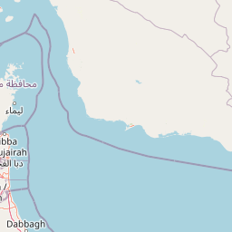
Map view of Khor Kalba Nature Reserve

Use this park location map to pinpoint Khor Kalba Nature Reserve in United Arab Emirates, understand its exact geographic position, and read its mapped placement within the surrounding landscape more clearly.

Pigeon | © OpenStreetMap contributors
Park atlas

Trace the geographic spread of protected coastal wetlands and unique arid landscapes across the UAE's eastern region.

Discover Nearby Protected Areas, Coastal Wetlands, and Regional Parks Beyond Khor Kalba Nature Reserve

Browse other national parks and protected areas that share geographic context or similar coastal wetland characteristics near Khor Kalba Nature Reserve. Compare regional conservation efforts and trace the distribution of protected landscapes, providing geographic context to the UAE's eastern coast.
National parkUnited Arab Emirates
About 46 km away#1 closest

North

Wadi Wurayah National Park National Park: Mapped Protected Landscape and Geographic Context

Explore the mapped boundaries and regional geography of Wadi Wurayah National Park.

Wadi Wurayah National Park stands as a significant national park, offering a focused area for exploring protected lands. This page provides essential details about its landscape characteristics and geographic positioning, framed for atlas-driven discovery. Understand the park's protected-area identity and its contribution to regional geographic context, making it a valuable entry for anyone mapping natural landscapes or investigating conservation areas.

Nature reserveDubai
About 76 km away#2 closest

West

Dubai Desert Conservation Reserve: Nature Reserve, Mapped Geography, and Protected Landscape Context

Explore the natural terrain and conservation atlas of this UAE protected area.

This page details the Dubai Desert Conservation Reserve, a designated nature reserve situated within the geographic scope of Dubai, United Arab Emirates. Dive into its mapped boundaries, understand its role as a protected landscape, and gain insight into its unique natural terrain. MoriAtlas provides structured data to explore the park's place within regional geography and the broader atlas of protected areas.

Area
225 km²
Established
2003
Relief
Lowland
Climate
Arid
Nature reserveEmirate of Dubai
About 76 km away#3 closest

West

Al Wohoosh Desert Conservation Reserve Nature Reserve: Mapped Protected Landscape

Desert terrain and geographic context in the Emirate of Dubai.

Delve into the Al Wohoosh Desert Conservation Reserve, a key protected natural area situated in the Emirate of Dubai. This entry focuses on its mapped geography, showcasing the desert landscape and its protected boundaries. Gain structured insights into its role as a nature reserve and its contribution to understanding regional conservation landscapes and mapped terrain.

Area
15.06 km²
Established
2014
Relief
Lowland
Climate
Arid
Nature reserveDubai
About 102 km away#4 closest

West

Al Marmoom Desert Conservation Reserve: Nature Reserve and Desert Landscape in Dubai

Mapped Geography and Protected Area Context

Explore the Al Marmoom Desert Conservation Reserve, a designated nature reserve located near Dubai. This protected area is crucial for understanding the region's desert geography and landscape. MoriAtlas provides detailed mapping and geographic context, allowing for in-depth study of its protected boundaries and its significance within the UAE's conservation landscape.

Area
0.4 km²
Established
2018
Relief
Lowland
Climate
Arid
Nature reserveDubai
About 107 km away#5 closest

West

Ras Al Khor Nature Reserve: Explore Dubai's Key Protected Landscape and Geographic Features

Mapped natural reserve boundaries and regional context in Dubai.

Delve into Ras Al Khor, a protected nature reserve offering a unique perspective on Dubai's natural geography. This detail entry focuses on its status as a protected landscape, providing clear atlas-style information about its mapped extent and its role within the regional environmental context. Understand the geographic significance of Ras Al Khor as a key area for exploring conservation landscapes within the UAE.

Area
13 km²
Established
1998
Visitors
90K annual
Relief
Lowland
Nature reserveMuscat Governorate
About 215 km away#6 closest

Southeast

Ad Dimaniyat Islands Nature Reserve: Protected Archipelago and Marine Biodiversity Map

Archipelago landscape and marine protected area in Muscat Governorate.

The Ad Dimaniyat Islands represent a critical nature reserve composed of nine distinct islands in the Gulf of Oman. The archipelago is known for its rare coral formations, nesting beaches for endangered sea turtles, and its role as a breeding site for various seabird species. This protected landscape combines complex underwater reef habitats with rocky and sandy terrain, forming a significant ecological zone within the Muscat Governorate.

Area
1 km²
Relief
Lowland
Access
Moderate access
Scope
Marine
Nature reserveAd Dakhiliyah Governorate
About 235 km away#7 closest

Southeast

Jebel Akhdar Mountains Nature Reserve: An Atlas of Oman's High Altitude Protected Landscapes

Geographic analysis of the Ad Dakhiliyah mountain massif

The Jebel Akhdar Mountains represent a critical protected nature reserve defined by dramatic limestone cliffs, deep wadis, and centuries of terraced agriculture. This elevated massif within the Ad Dakhiliyah Governorate sustains a rare montane ecology that serves as a cornerstone of regional Omani geography and environmental conservation.

Established
2011
Relief
Mountain
Climate
Arid
Access
Moderate access
Nature reserveMuscat Governorate
About 263 km away#8 closest

Southeast

Qurm Nature Reserve: Protected Mangrove Ecosystems and Coastal Geography in Muscat

Coastal wetlands and avian habitats of the Gulf of Oman

Qurm Nature Reserve serves as a critical protected landscape within the Muscat Governorate, preserving expansive mangrove forests and intricate tidal channels. The reserve functions as a hub for coastal biodiversity, supporting numerous migratory bird species and maintaining ecological health within a major urban center. Explore the mapped boundaries and natural features of this significant wetland protected area.

Area
1.72 km²
Established
1975
IUCN
IV
Relief
Lowland

Common questions about visiting, size, designation, and location context for Khor Kalba Nature Reserve

Khor Kalba Nature Reserve FAQs for park facts, access, geography, and protected area context

Find quick answers about Khor Kalba Nature Reserve, including protected-area facts, park geography, trail and visitor context, and how the park fits into its surrounding country and regional landscape.
MoriAtlas Explorer

Continue Your Protected Areas Search Across the Global Atlas

Deepen your exploration by continuing the structured search for national parks and protected areas worldwide. Utilize the comprehensive filtering capabilities to compare different conservation landscapes and refine your understanding of global park geography. Discover more about the distribution and characteristics of protected natural areas.

Global natural geography