
Mori Atlas logo
Nature reserveKhosrov Forest State Reserve

Examining the complex mountain topography, river canyons, and layered ecological zones within this ancient conservation landscape.

Khosrov Forest State Reserve: A Comprehensive Geographic Atlas of Armenia's Historic Protected Nature Reserve

Khosrov Forest State Reserve represents a significant protected area in Armenia's Ararat Province, spanning elevations from arid lowlands to subalpine slopes. This detailed geographic profile maps the reserve's unique Tertiary relict juniper and oak woodlands, deep river-cut canyons, and diverse mountain steppes. Users can trace the boundaries of this historic territory to understand its role as a vital refuge for Caucasian biodiversity and its enduring legacy as one of the world's oldest royal reserves.

strict nature reserveancient protected forestrelict juniper forestCaucasian oak forestphryganasemi-desert
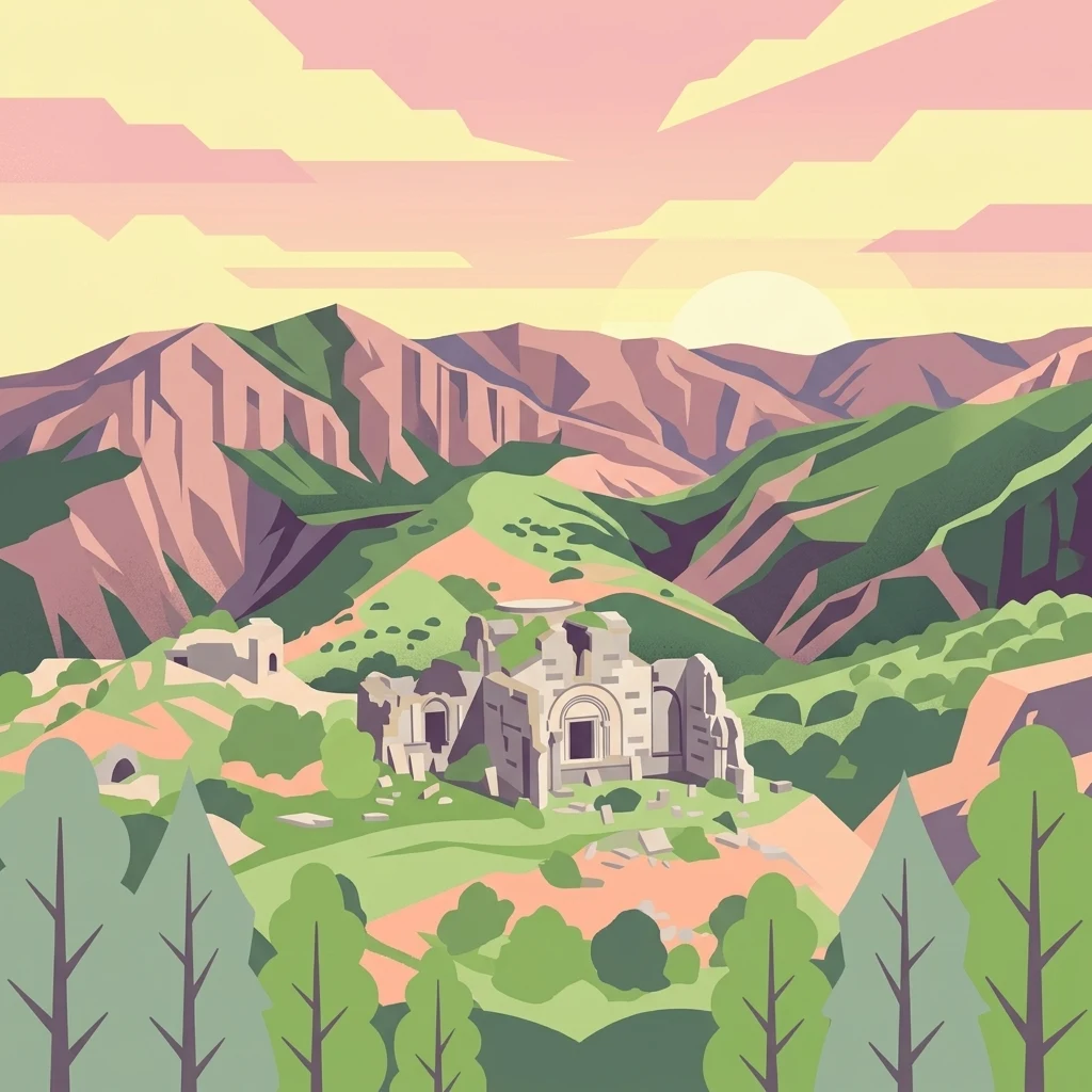
A digital illustration of ancient stone ruins nestled in a green valley surrounded by rugged mountains under a sunset sky.

Khosrov Forest State Reserve

Nature reserve

Park overview

Structured park overview, official facts, and landscape profile for Khosrov Forest State Reserve

Khosrov Forest State Reserve park facts, protected area profile, and essential visitor context

Review the core facts for Khosrov Forest State Reserve, including designation, size, terrain, visitor scale, habitats, and operating context in one park-focused overview.

About Khosrov Forest State Reserve

Khosrov Forest State Reserve lies in central Armenia, between the southern flanks of the Geghama range and the Yeranos and Yerakh mountains east of the Ararat plain. The terrain is dissected into deep river gorges, high plateaus, and shield-shaped volcanic massifs, with elevations stretching from about 700 meters near the foothills to roughly 2,800 meters at the upper tree line. Two principal rivers shape its hydrology: the Azat, which flows through the famous Garni Gorge, and the Vedi, whose tributaries Khosrov and Mankuk drain the higher mountains.

Ecologically the reserve is a vertical mosaic. Semi-desert slopes with wormwood and saltwort give way to Armenian-Iranian phrygana shrublands between 1,400 and 1,700 meters. The middle mountain belt hosts arid sparse forests of Caucasian juniper (Juniperus polycarpos) and dense stands of Caucasian oak (Quercus macranthera), while higher elevations transition into feather-grass and forb steppes, subalpine meadows, and finally alpine zones above 2,500 meters. These habitats support more than 1,849 species of vascular plants, including 80 species listed in Armenia's Red Data Book and 24 endemics found nowhere else.

What sets Khosrov apart is the combination of its ancient protection history and its biodiversity. Originating as a royal conservation area in the 4th century under King Khosrov III, it has endured through the Soviet era and post-independence Armenia as a continuous protected landscape. The reserve is a designated wetland of international importance and holds a European Diploma of Protected Areas. It is also one of the most important strongholds for the Persian leopard in the Caucasus, and its forests provide the freshwater that feeds the Azat River flowing toward Yerevan. Surrounding the reserve is a rich cultural landscape: more than 300 medieval and early Christian monuments, including monasteries, fortresses, and khachkars, remain scattered through the canyons and abandoned villages.

Quick facts and research context for Khosrov Forest State Reserve

Khosrov Forest State Reserve is a strict nature reserve (IUCN Category Ia) located in Ararat Province, Armenia, and managed under the country's Ministry of Nature Protection. It covers approximately 23,213 hectares across four districts, with elevations ranging from 700 to 2,800 meters above sea level. Although formally designated in 1958, its origin as a protected forest dates to the 4th century reign of King Khosrov III, making it one of the longest continuously maintained reserves in the world.

The reserve protects Tertiary relict juniper and oak forests, phrygana and semi-desert landscapes, mountain steppes, subalpine meadows, and the watersheds of the Azat and Vedi rivers. It hosts more than 1,800 vascular plant species (over half of Armenia's flora) and 283 vertebrate species, including the Persian leopard, brown bear, bezoar ibex, and four vulture species. In 2013 it was awarded the European Diploma of Protected Areas, recognizing its international conservation significance.

Protection and recognition

Documented terrestrial protection metrics and official designation records

Khosrov Forest State Reserve Protection Status and Designated History

Khosrov Forest State Reserve maintains a documented terrestrial protection scope established in two thousand thirteen. Official designation records and management frameworks outline the operational parameters governing this protected area.

Protection details

Protection scope
Terrestrial
Designated year
2013
Transboundary protection
No
Park context

Deeper park guide and search-rich context for Khosrov Forest State Reserve

Khosrov Forest State Reserve history, landscape, wildlife, and travel context

Explore Khosrov Forest State Reserve through its history, landscape character, ecosystems, wildlife, conservation priorities, cultural context, and seasonal travel timing in a structured park guide built for atlas discovery and search intent.

Why Khosrov Forest State Reserve stands out

Khosrov Forest is best known for its ancient Tertiary relict juniper and oak forests, which have been protected in some form for roughly seventeen centuries. These woodlands, interspersed with phrygana shrublands and semi-desert expanses, harbor a remarkable density of endemic plants and serve as one of the most important refuges in the Caucasus for the Persian leopard. The reserve is also distinguished as the only nesting place in Armenia for the cinereous vulture, and it holds key populations of brown bear, Eurasian lynx, wild goat, and Caucasian rock-dwelling reptiles. Its layered elevation zones, river-cut canyons, and centuries of continuous protection combine to make Khosrov a benchmark site for understanding Mediterranean relict vegetation and Caucasian mountain biodiversity.
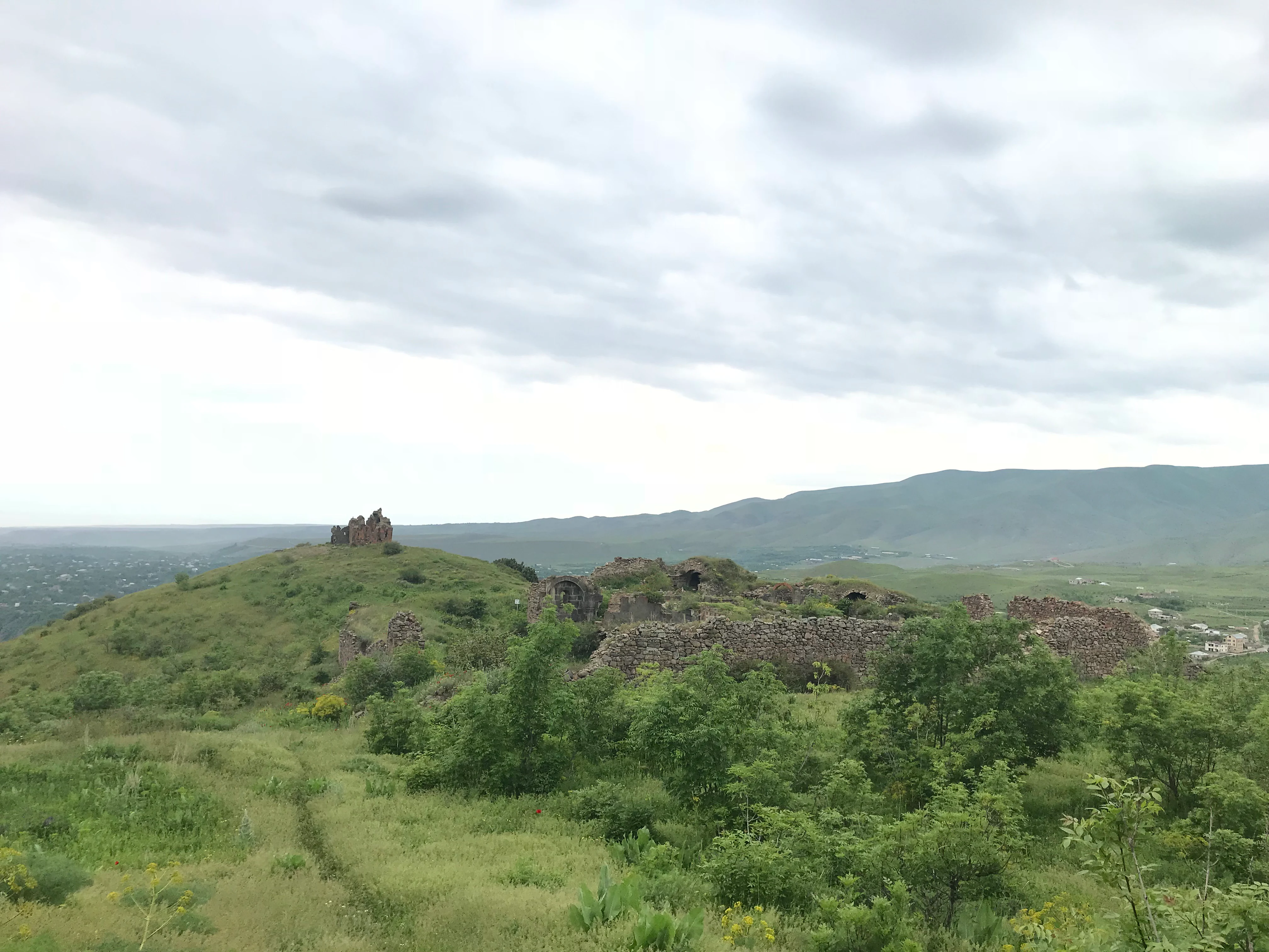
A wide view of a grassy hill containing stone ruins of an ancient monastic complex under a cloudy sky.
The historic ruins of Havuts Tar situated within the landscape of Khosrov Forest State Reserve.

Khosrov Forest State Reserve history and protected-area timeline

The reserve traces its origin to the reign of King Khosrov III of the Kingdom of Armenia, who in the years 330 to 338 AD ordered the creation of planted and protected forests around the royal capitals of Artashat and Dvin. His aim was to improve the climate of the lowlands, conserve wildlife, and provide a hunting ground; some animals were even introduced from neighboring Iran to enrich the forest. Among these forested tracts were two notable enclosed areas called Tachar Mayri and Khosrovakert, mentioned by the early historian Faustus of Byzantium and later by Moses of Chorene.

Over centuries, the original Khosrovakert section was lost, while the Tachar Mayri forest merged with surrounding natural woodlands and survived as a protected zone. The royal forest fell under various rulers through the Arab, Bagratid, and medieval Armenian periods. During the Soviet era, the area was set aside as forestry land; on 13 September 1958 the Garni Forestry was formally established as the Khosrov Reserve. The protected area was enlarged in 1990 to include more buffer lands, then partially reduced during boundary revisions in 2006 and 2007.

Institutional management has evolved alongside political change. The reserve is now administered by the Khosrov Forest State Reserve State Non-Commercial Organization under the Ministry of Nature Protection. A national management plan linked to Armenia's commitments under the Convention on Biological Diversity was developed in the mid-2000s. A Visitor Center opened in the Garni district in 2008 to support education and leopard conservation outreach. In 2013 the reserve was awarded the European Diploma of Protected Areas by the Council of Europe, marking formal international recognition of its conservation value.

Khosrov Forest State Reserve landscape and geographic character

Khosrov Forest is dominated by mountainous relief cut by a dense network of ridges, gorges, and high plateaus. About half of the reserve lies in a middle-mountain belt between 1,500 and 2,300 meters, characterized by steep, deeply fragmented terrain, while the lower foothills feature extensive badlands shaped by wind erosion and intense geological sculpting. The underlying geology includes Cretaceous volcanic deposits, igneous intrusions, and Quaternary debris that produce striking rock formations and steep slopes, most exceeding 30 degrees.

The Azat and Vedi rivers, along with tributaries such as Khosrov, Mankuk, and Kacharun, have carved out iconic canyons including the Garni Gorge and the Hazaradzor valley. Their waters feed numerous freshwater and mineral springs with remarkably stable regimes. Four notable waterfalls lie within the reserve, including the locally named cascades of Vahagn and Astghik. Landscapes shift with elevation: semi-desert in the lowest zones, dry steppes and phrygana in the middle slopes, juniper and oak forest in the higher valleys, and finally mountain steppe and meadow zones that open onto subalpine and alpine pastures above 2,500 meters.
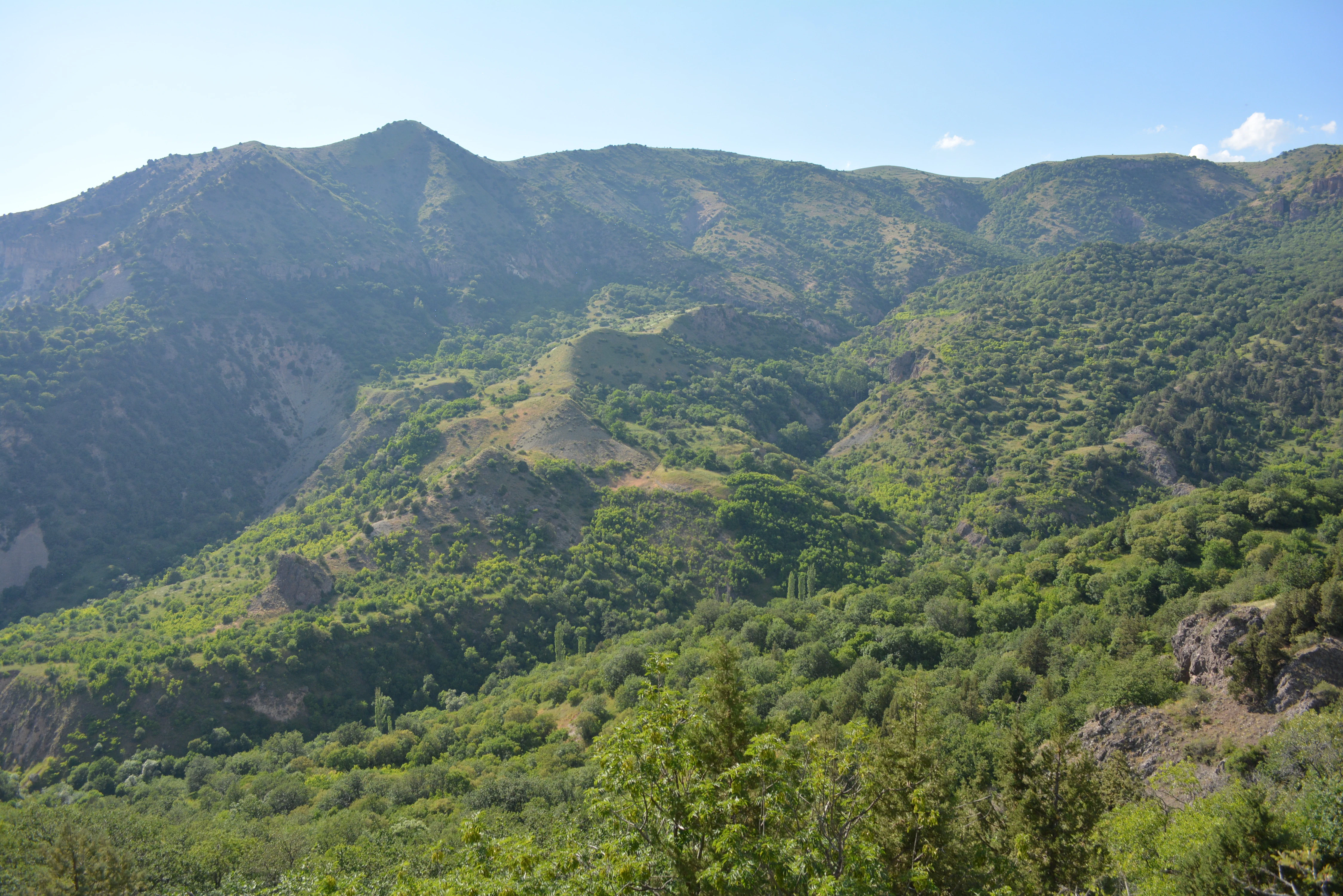
A mountainous landscape with dense green forests covering rolling hills and slopes under a clear blue sky.
A wide view of the forested slopes and rugged terrain within the Khosrov Forest State Reserve.

Khosrov Forest State Reserve ecosystems, habitats, and plant life

Within just one percent of Armenia's territory, Khosrov Forest harbors roughly 1,849 species of higher vascular plants drawn from 588 genera and 107 families, constituting over half of the country's flora and a major share of Caucasian biodiversity. More than 80 plant species are listed in Armenia's Red Data Book, and 24 are strict endemics, including the locally named Pyrus chosrovica. Vegetation patterns form zones that reflect both altitude and exposure, from wormwood semi-deserts to oak forest dominated by Quercus macranthera.

The forest zone preserves Tertiary relict juniper (Juniperus polycarpos) and oak stands that may trace their origins back millions of years. Mixed communities include ash, rowan, maple, pear, and hawthorn, while phrygana shrublands include almond, buckthorn, spiraea, hackberry, and mastic. Open landscapes yield rich herbaceous communities of fescue, stipa, tragacanth milkvetch, sainfoin, and prangos, transitioning into subalpine meadows with timothy grass, clover, and bulbous barley. Tugai riverbank vegetation of ash, willow, poplar, and tamarisk supports wetland habitats of regional importance.
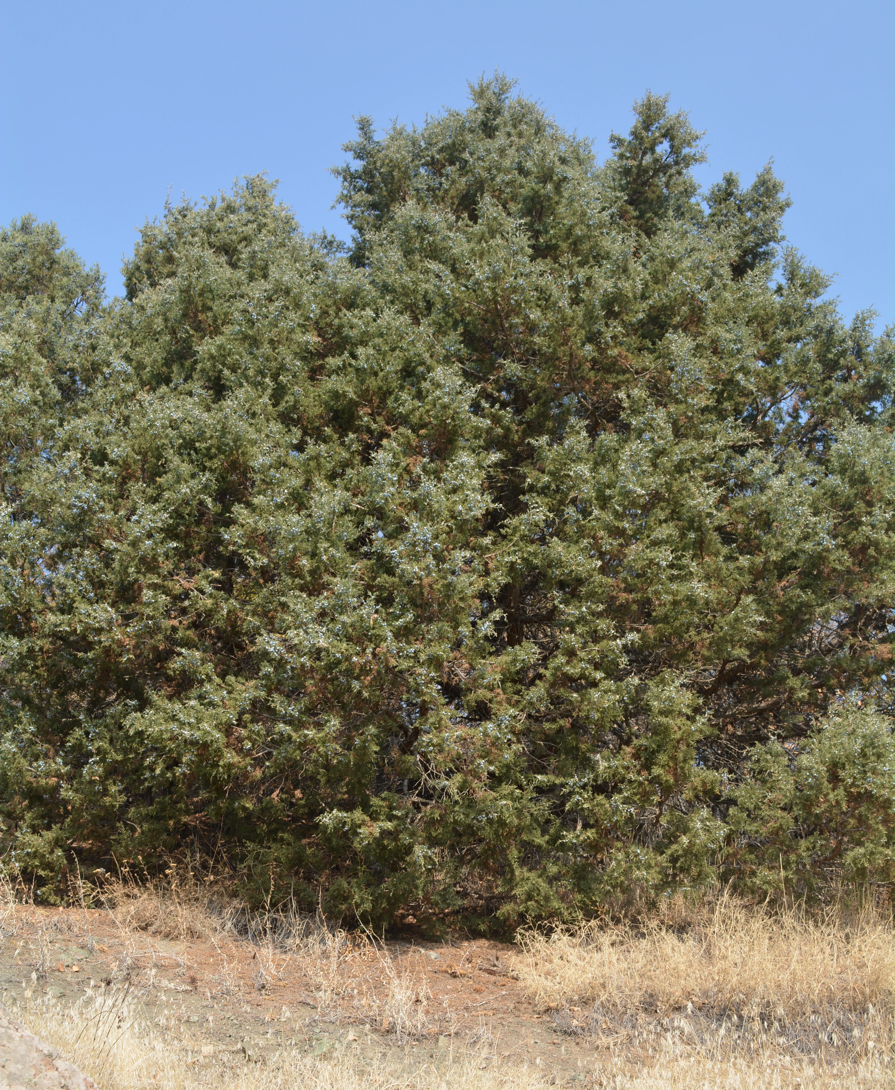
A mature juniper tree with dense, needle-like green foliage standing in a dry, grass-covered landscape under a clear blue sky.
A juniper tree within the Khosrov Forest State Reserve.

Khosrov Forest State Reserve wildlife and species highlights

The reserve supports 283 vertebrate species, including 192 bird species representing more than half of Armenia's avifauna, 44 mammal species, 33 reptile species, 9 fish species, and 5 amphibian species. Many of these are listed in Armenia's Red Data Book or the IUCN Red List. The reserve is internationally significant for large carnivores: it is one of the most important population areas in the Caucasus for the Persian leopard, supports a resident population of Eurasian lynx, brown bear, gray wolf, and European wildcat, and is a long-standing habitat for the bezoar ibex, whose presence is documented in ancient rock art.

Birdlife is exceptional. The reserve is the only known nesting site in Armenia for the cinereous vulture, whose populations nest in the tops of juniper trees. It also hosts lammergeier, Egyptian vulture, griffon vulture, peregrine falcon, lanner falcon, and short-toed snake eagle, alongside Caspian snowcock, chukar partridge, and a rich community of forest songbirds. Reptiles include Caucasian endemic vipers such as the Armenian or Radde's viper and the Armenian steppe viper, alongside Transcaucasian ratsnake, Caucasian agama, and various sand lizards and tortoises. The freshwater rivers support brown trout, Kura barbel, and Transcaucasian barb.
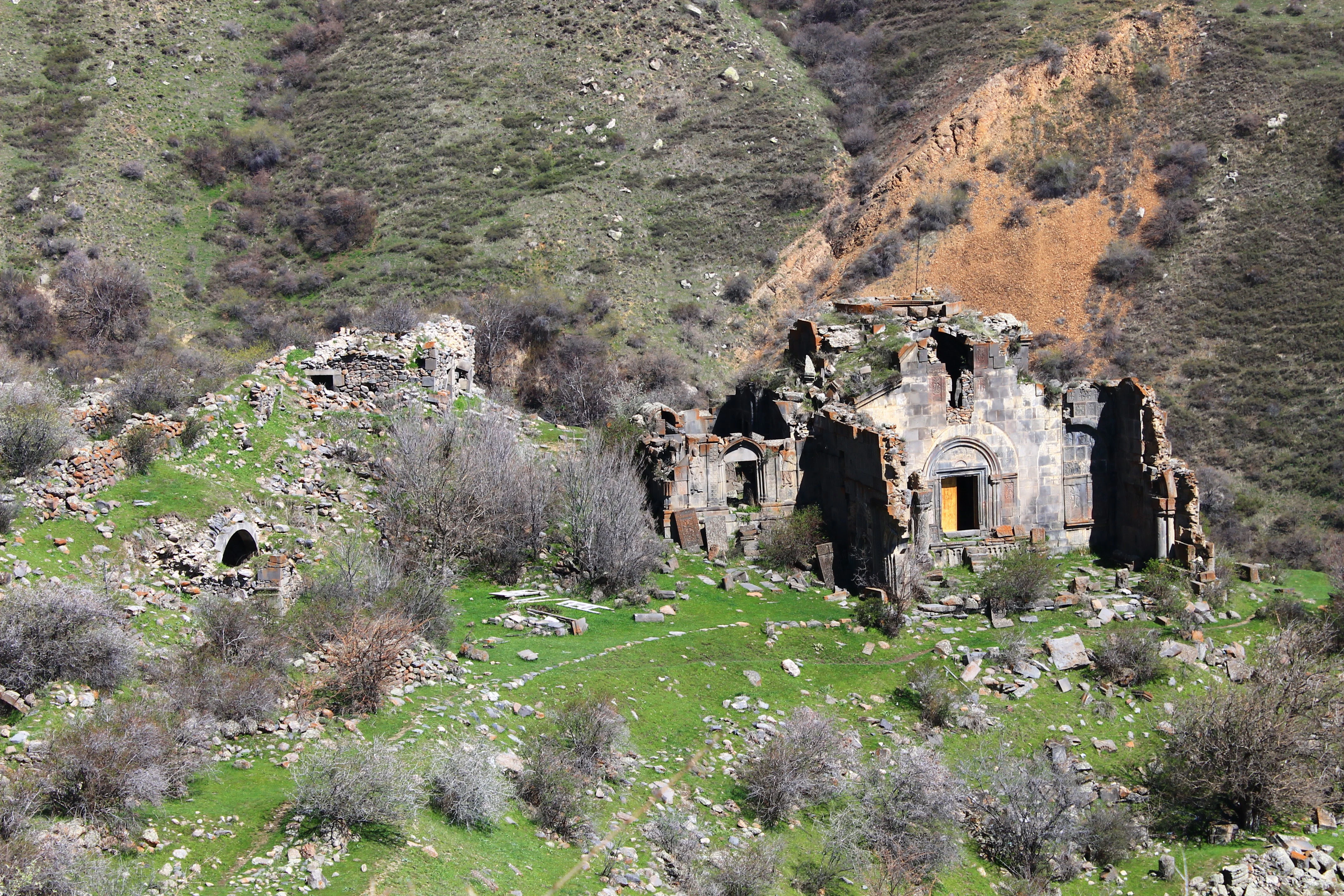
A high-angle view of the weathered stone ruins of Stepanos Monastery nestled in a green, rocky valley with steep, arid slopes in the background.
The stone ruins of the historical Aghjots Monastery set against the rugged hillsides of Khosrov Forest State Reserve.

Khosrov Forest State Reserve conservation status and protection priorities

Khosrov Forest is recognized as one of the oldest protected natural areas in the world, with a continuous protection history stretching back seventeen centuries. Its modern designation as a strict nature reserve (IUCN Category Ia) reflects the highest level of conservation intent, and in 2013 it was awarded the European Diploma of Protected Areas by the Council of Europe in recognition of its outstanding natural and cultural heritage.

The reserve's conservation value is rooted in its function as a refugium for relict and endemic species. It safeguards Tertiary juniper and oak woodlands, dry Mediterranean phrygana vegetation, and watersheds that supply freshwater to downstream communities including Yerevan. Conservation programs have focused on the Persian leopard, one of the rarest large cats in the world, with the reserve serving as a key node in trans-Caucasian leopard recovery efforts. Habitat management, anti-poaching enforcement, and community engagement programs support biodiversity, but the reserve has also faced challenges such as habitat degradation from illegal logging in the 1980s and 1990s, large-scale wildfires including the major August 2017 event, and pressures from livestock grazing in peripheral areas.

Khosrov Forest State Reserve cultural meaning and human context

The reserve's territory lies within the historic Ayrarat province of Greater Armenia, a region deeply tied to the political and religious history of the Armenian people. It served as a royal landscape across millennia: the capitals of Artashat and Dvin stood nearby, the Silk Road crossed through its valleys, and early Christian figures such as Gregory the Illuminator and Grigor Magistros lived and worked within its cloisters. The reserve contains more than 312 documented monuments, including 29 monasteries, churches, and chapels, 19 settlements, castles, and 222 khachkars and gravestones, many of which survive amid abandoned medieval villages.

Prominent monastic complexes such as Havuts Tar and Aghjots Vank originated in the early medieval period, served as centers of manuscript production and learning, and were rebuilt repeatedly after earthquakes, particularly the catastrophic 1679 event. Kakavaberd, a fortress perched on cliffs above the Azat River, was held by successive Armenian noble houses and defended the medieval kingdom. Together, these layers of religious, architectural, and folk heritage give the reserve a uniquely Armenian cultural depth rooted in its natural setting.
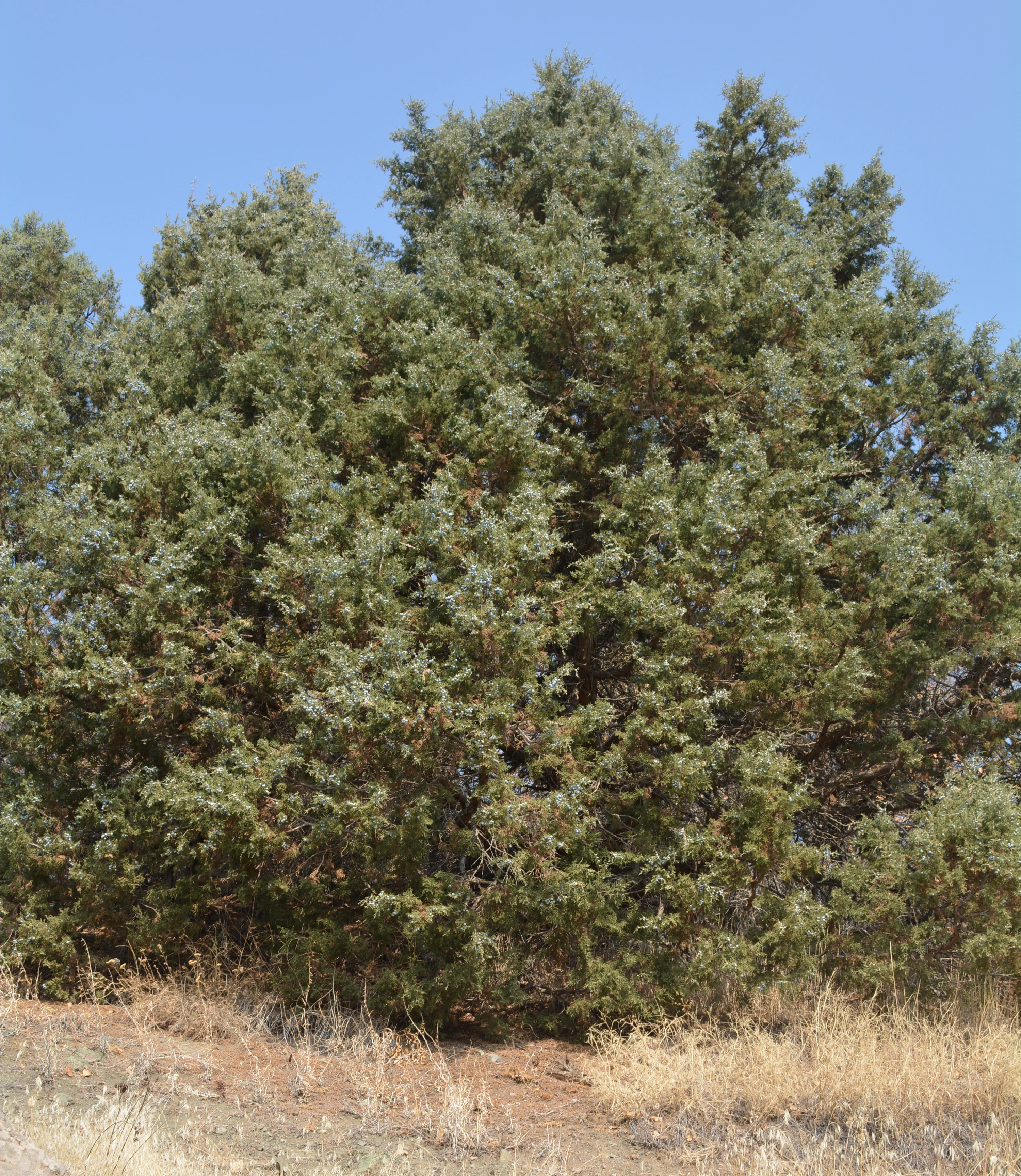
A full view of a dense, evergreen juniper tree with textured foliage against a clear blue sky, set in a dry landscape.
A mature juniper tree, a characteristic species of the Khosrov Forest State Reserve.

Top sights and standout views in Khosrov Forest State Reserve

Khosrov Forest State Reserve stands out for the extraordinary age of its protected status. Originating as a 4th-century royal reserve under King Khosrov III, it is one of the oldest formally protected forests in the world, and its surviving juniper and oak woodlands carry a direct line of human stewardship into the present day.

The reserve's ecological highlights include the only nesting population in Armenia of the cinereous vulture, globally important habitat for the Persian leopard, and one of the highest concentrations of plant endemism in the Caucasus. Its dramatic canyon landscapes, layered vegetation from semi-desert to alpine meadow, and concentration of medieval monasteries and fortresses create a heritage landscape of outstanding natural and cultural density.
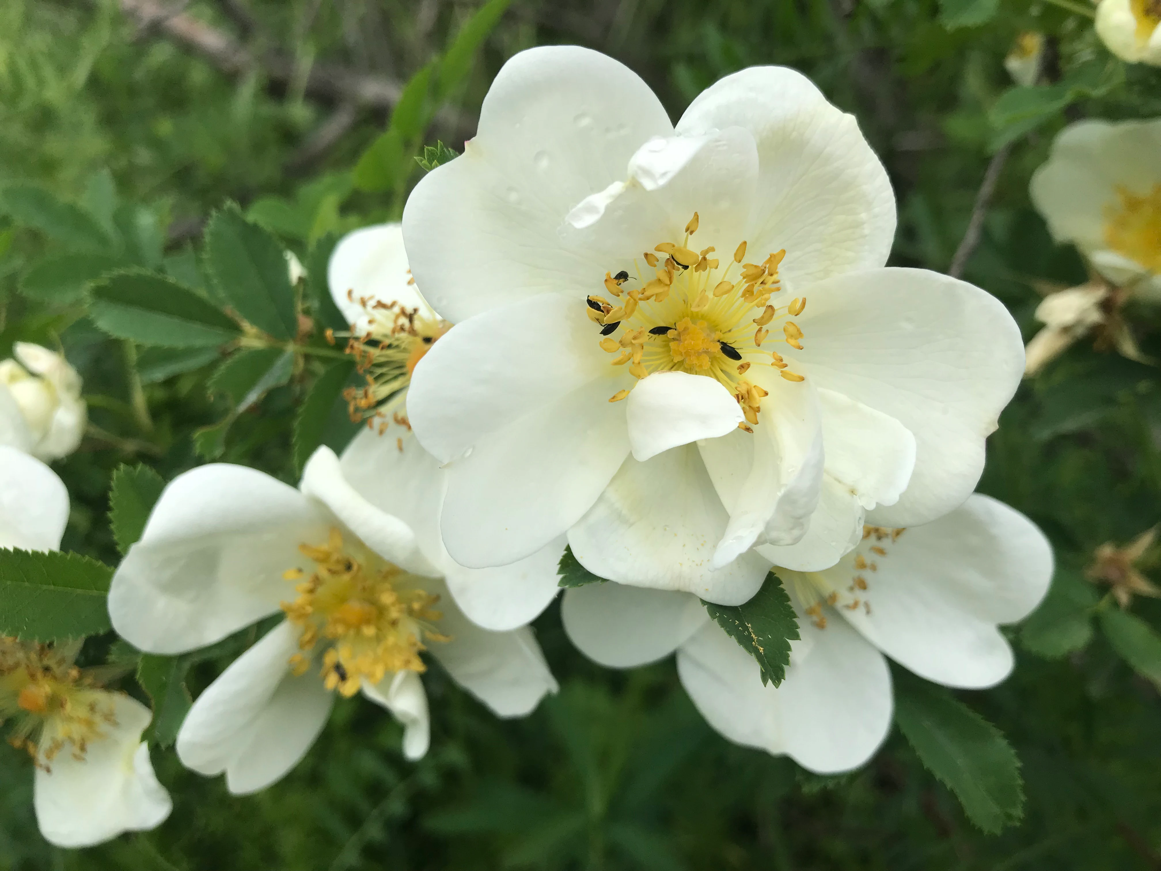
Close-up of a cluster of wild white flowers with yellow centers and green leaves in a forest setting.
Wild white flowers blooming in the Khosrov Forest State Reserve.

Best time to visit Khosrov Forest State Reserve

Khosrov Forest's elevation range of 1,100 meters gives it sharply contrasting seasonal conditions. Spring delivers wet, mild weather across the middle elevations, with flowering phrygana shrublands and active wildlife along the river valleys. Summer is hot and dry in the foothills, with maximum temperatures above 30 degrees Celsius in the lower zones, while higher elevations remain cooler and provide escape from the heat. The autumn period, especially October and November, brings vivid colors to the oak forest and the richest landscape atmosphere, paired with cooler temperatures suitable for hiking. Winters bring snow to elevations above about 2,000 meters, with the upper mountains transforming into a more austere, quiet scene. Bird activity is highest during spring and autumn migrations, while reptile and wildflower viewing is best from late spring through early summer.
Monthly climate preview

Long-term representative point measurements tracking monthly temperature and precipitation rhythms

Khosrov Forest State Reserve Climate Normals and Annual Temperature Range

Representative coordinate measurements trace annual temperature fluctuations alongside monthly precipitation averages across Khosrov Forest State Reserve. Detailed twelve-month climate normals provide a complete record of long-term temperature ranges and precipitation patterns.
Annual mean8 °C
-6 °C21 °C
Jan-6°
Feb-4°
Mar
Apr
May12°
Jun17°
Jul21°
Aug21°
Sep16°
Oct
Nov
Dec-4°
Warmest month
July

20.9 °C

Coolest month
January

-5.7 °C

Wettest month
May

1.5 mm/day

Driest month
December

0.4 mm/day

Park location guide

Geography guide, regional context, and park location map for Khosrov Forest State Reserve

Khosrov Forest State Reserve park geography, regions, and map view in Armenia

Understand where Khosrov Forest State Reserve sits in Armenia through a broader geographic reading of the surrounding landscape, nearby location context, and its mapped position within the national park landscape.

How Khosrov Forest State Reserve fits into Armenia

Armenia is a landlocked nation in the South Caucasus region of West Asia, located in the Armenian highlands. It shares borders with Turkey to the west, Georgia to the north, Azerbaijan to the east, and Iran and the Nakhchivan exclave to the south. Yerevan is the capital and largest city. Armenia was the first country to adopt Christianity as its official religion in AD 301 and maintains the Armenian Apostolic Church as its primary religious institution.

Wider geography shaping Khosrov Forest State Reserve in Armenia

Armenia is situated in the South Caucasus region of West Asia, occupying the Armenian highlands. It is bordered by Turkey to the west, Georgia to the north, Azerbaijan to the east, and Iran and the Nakhchivan Autonomous Republic to the south. The country is landlocked, though it historically had access to the Caspian Sea.

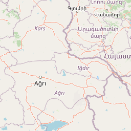
Map view of Khosrov Forest State Reserve

Use this park location map to pinpoint Khosrov Forest State Reserve in Armenia, understand its exact geographic position, and read its mapped placement within the surrounding landscape more clearly.

Pigeon | © OpenStreetMap contributors

Location context for Khosrov Forest State Reserve

Ararat Province
Recorded earthquake history

Examine the Documented Earthquake History of Khosrov Forest State Reserve

Review a detailed catalogue of recorded seismic events and associated epicentre proximity data for the Khosrov Forest State Reserve region. This archive provides historical context for researchers and visitors interested in the seismic history of this protected mountain landscape.

Khosrov Forest State Reserve Earthquake Records

Catalogued events

19 events

Strongest magnitude

Magnitude 4.9

Most recent event

Aug 11, 2024

This history includes earthquakes recorded inside the park or within 50 km of its borders

Visualizing the rugged terrain, relict juniper woodlands, and deep canyon habitats of Armenia

Khosrov Forest State Reserve Photos and Protected Landscape Scenery

Visual documentation provides a clear window into the rugged topography, ancient relict woodlands, and dramatic river canyons of Khosrov Forest State Reserve. Examining these protected habitats and mountainous terrain reveals the distinct environmental character of a historic conservation landscape.

A wide view of a grassy hill containing stone ruins of an ancient monastic complex under a cloudy sky.

Ancient stone fortress ruins with prominent circular towers overlooking a vegetated hillside under a clear blue sky.

A mountainous landscape with dense green forests covering rolling hills and slopes under a clear blue sky.

A mature juniper tree with dense, needle-like green foliage standing in a dry, grass-covered landscape under a clear blue sky.

A high-angle view of the weathered stone ruins of Stepanos Monastery nestled in a green, rocky valley with steep, arid slopes in the background.

A medium shot of a cascading waterfall flowing over dark, layered rock cliffs surrounded by lush green trees.

A full view of a dense, evergreen juniper tree with textured foliage against a clear blue sky, set in a dry landscape.

Close-up of a cluster of wild white flowers with yellow centers and green leaves in a forest setting.

Two delicate white rose flowers with yellow stamens growing on a green shrub, with smaller buds visible in the background.

Ancient stone fortress tower ruins perched on a rugged cliff edge against a clear blue sky.

Ancient stone doorway featuring detailed carved figures of saints and decorative masonry, framed against a clear blue sky and a distant grassy hill.

A wide view of grassy, green hills under a cloudy sky featuring the ancient stone ruins of the Havuts Tar monastery.

A weathered stone cross-stone, known as a khachkar, featuring intricate carvings, standing next to a carved stone pillar amidst ancient masonry ruins in a park setting.

A panoramic landscape view showing a deep canyon with rocky cliffs and green forest canopy at the base, with arid hills in the background.

A view of ancient cave dwellings built directly into a steep, rugged rock face, with a canyon landscape visible in the background.

A high angle view of the ancient, ruined stone walls of the Aghjots Vank monastery, situated on a grassy slope with a rocky hillside in the background.

Park atlas

Compare surrounding mountain terrain and connected regional conservation landscapes

Explore Protected Areas and Parks Near Khosrov Forest State Reserve

Browse nearby national parks and protected areas to compare rugged canyon topography and ancient juniper woodlands. Continuing beyond Khosrov Forest State Reserve reveals the broader ecological spread of the surrounding mountain region.
Nature reserveArmenia
About 7.5 km away#1 closest

Northwest

Erebuni State Reserve: Protected Nature Reserve and Botanical Landmark in Armenia

Transitional mountain-steppe and semi-desert botanical geography

Erebuni State Reserve functions as a critical protected area for the conservation of wild wheat genetic resources in the South Caucasus. Located on the edge of the Armenian capital, the reserve protects a mosaic of grass-dominated slopes that capture the precise shift from arid lowlands to higher altitude steppe terrain, providing an essential focus for regional botanical study.

Area
1.2 km²
Established
1981
IUCN
Ia
Relief
Upland
A horizontal watercolor illustration depicting rolling, sandy desert dunes in the foreground and light purple, hazy mountain silhouettes in the background against a white sky.
Wildlife reserveArarat Province
About 13 km away#2 closest

Southwest

Goravan Sands Sanctuary: Protected Sandy Semi-Desert Ecosystems in Ararat Province

A rare relict landscape of Armenia's Caucasus biodiversity

Goravan Sands Sanctuary preserves a striking mosaic of sandy plains, dry limestone ridges, and tertiary clay habitats within the Ararat Province. Known for hosting the only known Armenian population of the relict phog shrub, this reserve is a reference site for psammophilic flora and endemic invertebrate fauna. Explore the layered geography and arid biodiversity of this high-priority South Caucasus conservation landscape.

Area
0.96 km²
Established
1959
Relief
Upland
Climate
Arid
National parkGegharkunik Province
21 km away#3 closest

Northeast

Sevan National Park: High-Altitude Lake and Protected Landscape in Gegharkunik

Explore map context, park boundaries, and regional geography.

Sevan National Park is a vital protected area located in Armenia's Gegharkunik Province, primarily safeguarding the remarkable high-altitude Lake Sevan. Established to protect this significant freshwater ecosystem, the park encompasses diverse surrounding landscapes including wetlands, forests, and steppes. Users exploring this canonical park detail page can delve into its geographic setting within the Armenian highlands, understand its importance as a protected landscape, and access structured data relevant to its unique natural environment. This MoriAtlas entry offers a focused lens on the park's conservation status and its contribution to regional geography.

Area
342 km²
Established
1978
IUCN
II
Relief
Highland
National parkTavush Province
56 km away#4 closest

North

Dilijan National Park: Mapped Protected Landscape and Forested Terrain in Tavush Province

Explore ancient deciduous forests and medieval sites within this protected area.

Dilijan National Park offers a unique atlas perspective on Armenia's natural and cultural heritage. This protected landscape in Tavush Province is dominated by vast, ancient deciduous forests, including rare yew groves, making it a vital conservation area. Its mountainous terrain, carved by rivers and dotted with medieval monasteries like Haghartsin and Goshavank, provides a rich context for geographic discovery. Users can explore the park's mapped boundaries and understand its significance as a preserved woodland ecosystem within the Caucasus region through its detailed geographic information.

Area
240 km²
Established
2002
IUCN
II
Relief
Mixed relief
Nature reserveAzerbaijan
About 86 km away#5 closest

East

Gara-Gel State Reserve: Mapping the Protected Volcanic Landscapes of Azerbaijan

High-altitude nature reserve with glacial and volcanic crater geography.

Gara-Gel State Reserve represents a concentrated protected area built around Lake Ishigli-Gara-Gel. Situated at nearly 2,700 meters, this site showcases the convergence of volcanic geology and mountain botany. The landscape features meadows and steep slopes that define the character of this protected highland basin, offering significant insight into the transitional ecosystems found within the broader Karabakh plateau.

Area
2.4 km²
Established
1987
Relief
Mountain
Climate
Alpine
Watercolor illustration of a lake surrounded by greenery with mountains in the background
National parkAzerbaijan
About 115 km away#6 closest

East

Göygöl National Park: Iconic Alpine Lakes and Protected Caucasus Forest Landscape

Explore Azerbaijan's most visited national park and its rich geographic context.

Göygöl National Park is a key protected area in Azerbaijan, renowned for the crystal-clear alpine Lake Göygöl and its surrounding dense forests within the Lesser Caucasus mountains. This national park showcases over 420 plant species, significant wildlife populations, and dramatic mountainous terrain, making it a prime destination for understanding regional landscape diversity and protected land value. Use MoriAtlas to explore its mapped boundaries and connect it to the broader geographic context of Azerbaijan.

Area
127.55 km²
Established
2008
IUCN
II
Relief
Mountain
Watercolor illustration of a mountainous landscape with green fields, a river, and a sunset sky
National parkOrdubad District
About 120 km away#7 closest

Southeast

Zangezur National Park: National Park and Protected Mountain Wilderness in Ordubad District

Explore dramatic glacial terrain and the highest Lesser Caucasus peaks.

Zangezur National Park encompasses a significant portion of the Zangezur mountain range, presenting a striking high-altitude protected landscape within Ordubad District, Azerbaijan. Its geography is characterized by rugged alpine features, extensive glacial formations, and dramatic elevation changes culminating in the Gemiqaya summit. This park serves as a vital refuge for diverse ecosystems and is distinguished by its role in preserving the highest mountain terrain in Azerbaijan's Lesser Caucasus, offering a unique focal point for geographic and protected-area exploration.

Area
427.97 km²
Established
2003
IUCN
II
Relief
Mountain
Watercolor illustration of rolling green fields, a lake, and distant hills under a sunset sky
National parkShirak Province
132 km away#8 closest

Northwest

Lake Arpi National Park: High-Altitude Wetland Protected Landscape in Shirak Province

Mapped boundaries of an important South Caucasus conservation area.

Lake Arpi National Park offers a unique window into high-altitude wetland ecosystems on the Shirak and Javakheti plateau, located at roughly 2000 meters above sea level. Established as a national park in 2009, it protects critical habitats, including the central Lake Arpi, and serves as a vital sanctuary for numerous bird species. This protected area is distinguished by its alpine meadows, significant bird populations, and its distinct geographic setting within Armenia's northwestern region, providing rich context for atlas-based exploration of protected lands.

Area
250 km²
Established
2009
IUCN
II
Relief
Mountain

Common questions about visiting, size, designation, and location context for Khosrov Forest State Reserve

Khosrov Forest State Reserve FAQs for park facts, access, geography, and protected area context

Find quick answers about Khosrov Forest State Reserve, including protected-area facts, park geography, trail and visitor context, and how the park fits into its surrounding country and regional landscape.
MoriAtlas Explorer

Continue Your Protected Areas Search Across the Global Atlas

Deepen your exploration by continuing the structured search for national parks and protected areas worldwide. Utilize the comprehensive filtering capabilities to compare different conservation landscapes and refine your understanding of global park geography. Discover more about the distribution and characteristics of protected natural areas.

Global natural geography