Mori Atlas logo
National parkKimbi-Fungom National Park

Mapping the forest, savanna, and river basin terrain of this vital Cameroon protected area

Kimbi-Fungom National Park: A Study of Protected Primate Habitat and Watershed Geography

(Parc national de Kimbi-Fungom)

Kimbi-Fungom National Park encompasses a diverse mosaic of equatorial forest, savanna, and wetland systems within the North-West Region of Cameroon. This protected area functions as a critical refuge for the endangered Nigeria-Cameroon chimpanzee and serves as a primary headwater for the Katsina Ala River watershed. The park landscape reveals complex interactions between the Bamboutos Mountains and lowland plains, creating essential habitats that span across regional and national borders.

Cameroon national parkprimate sanctuarytropical forestwetlandssavanna mosaicwatershed protection

Kimbi-Fungom National Park

National park

Park overview

Structured park overview, official facts, and landscape profile for Kimbi-Fungom National Park

Kimbi-Fungom National Park park facts, protected area profile, and essential visitor context

Review the core facts for Kimbi-Fungom National Park, including designation, size, terrain, visitor scale, habitats, and operating context in one park-focused overview.

About Kimbi-Fungom National Park

Kimbi-Fungom National Park occupies a strategic ecological position in Cameroon's North-West Region, anchoring the boundary between the country's Bamenda Highlands and the lowlands that extend toward Nigeria. Its 657 square kilometers of protected terrain encompass a transition zone where equatorial forest gives way to patches of savanna and wetland, producing a habitat mosaic rich in both biodiversity and hydrological value. Although modest in size compared to some of Cameroon's flagship parks, Kimbi-Fungom carries disproportionate conservation weight because of the rare primate populations it shelters.

The park's identity is shaped by a long evolution of protective designations. It began in 1932 as the Fungom Native Authority Forest Reserve, was reclassified as a wildlife sanctuary under the name Kimbi Wildlife Sanctuary in 1964, and transitioned through a national park designation in 2012 before being formally established by decree on 3 February 2015. Each stage reflected changing national conservation priorities, from local forest protection through game reserve management to integrated species and watershed conservation.

Ecologically, Kimbi-Fungom is most significant for its primates. The Nigeria-Cameroon chimpanzee subspecies (Pan troglodytes ellioti), recognized as the most endangered of all chimpanzee taxa, has an important stronghold here. The forests also support a community of monkey and baboon species rarely seen together elsewhere, including mona monkeys, putty-nosed monkeys, olive baboons, and yellow baboons. The giant pangolin, a species increasingly threatened by international trade, has also been documented in the park, and field surveys have indicated that pangolins represent a particularly high share of hunted wildlife in the area.

Hydrologically, the park's forests stabilize the flow of the Katsina Ala River, which originates within the park's catchment. This river feeds the Kashimbila Dam and continues into Nigeria, supporting ecosystems and communities in Benue and Taraba states. Protecting these headwaters is therefore understood as both a national and a transboundary conservation imperative.

Despite its protected status, the park faces persistent pressures. Illegal logging, agricultural encroachment, livestock grazing, uncontrolled bushfires, and poaching for the wildlife trade all compromise the integrity of the reserve. The security situation in Cameroon's Anglophone North-West Region further complicates management and visitor access, making Kimbi-Fungom both ecologically vital and operationally challenging.

Quick facts and research context for Kimbi-Fungom National Park

Kimbi-Fungom National Park lies in Cameroon's North-West Region, immediately adjacent to the Nigerian border, and forms part of the broader highlands landscape extending toward the Bamboutos Mountains. The park covers about 657 square kilometers, making it one of the smaller national parks in Cameroon. Its establishment history spans from a 1932 native authority forest reserve, to a 1964 wildlife sanctuary, to a 2012 designation as a national park, with the official decree signed on 3 February 2015.

The park's primary conservation focus is the protection of rare and endemic primate species, including the Nigeria-Cameroon chimpanzee subspecies. It also plays an important hydrological role, anchoring the headwaters of the Katsina Ala River, which serves the Kashimbila Dam and downstream ecosystems reaching into Nigeria's Benue and Taraba regions.

Protection and recognition

Explore terrestrial protection metrics, management scope, and verified designation records.

Kimbi-Fungom National Park Protection Status and Transboundary Records

Kimbi-Fungom National Park maintains structured terrestrial protection status and documented transboundary oversight across its conserved landscape. Protected area records outline management scope, designation history, and international recognition sources where verified.

Protection details

Protection scope
Terrestrial
Transboundary protection
Yes
Park context

Deeper park guide and search-rich context for Kimbi-Fungom National Park

Kimbi-Fungom National Park history, landscape, wildlife, and travel context

Explore Kimbi-Fungom National Park through its history, landscape character, ecosystems, wildlife, conservation priorities, cultural context, and seasonal travel timing in a structured park guide built for atlas discovery and search intent.

Why Kimbi-Fungom National Park stands out

Kimbi-Fungom is best known as a refuge for rare primates in West-Central Africa, especially the Nigeria-Cameroon chimpanzee (Pan troglodytes ellioti), one of the most endangered chimpanzee subspecies on the continent. The park's mosaic of primary equatorial forest, wetlands, and savanna supports an unusually concentrated primate community that also includes mona monkeys, putty-nosed monkeys, olive baboons, and yellow baboons. The park is also closely associated with the upper Katsina Ala watershed, where its forests help regulate flow into the Kashimbila Dam and across the border into Nigeria. This dual identity, as both a primate sanctuary and a headwater conservation area, sets it apart from Cameroon's larger, better-known parks.

Kimbi-Fungom National Park history and protected-area timeline

The protected identity of Kimbi-Fungom emerged gradually across nearly a century. In 1932, the area was designated as the Fungom Native Authority Forest Reserve under local customary authority, reflecting the traditional role of chiefdoms in managing forest resources in the region. This early designation focused on woodland protection rather than wildlife management.

In 1964, the area was reclassified as a wildlife sanctuary, known as the Kimbi Wildlife Sanctuary. This marked a shift toward active conservation of fauna, although management capacity and protection intensity remained limited. The sanctuary period established the foundation for the area's later recognition as critical habitat for primates and other forest species.

The transition toward national park status began in 2012, when the area was formally designated as a national park. Official establishment came on 3 February 2015 through decree number 2015/0024/PM, formalizing Kimbi-Fungom as part of Cameroon's national park network. This long evolution, from native forest reserve to sanctuary to national park, mirrors broader shifts in Cameroon's conservation policy over the twentieth and early twenty-first centuries.

Kimbi-Fungom National Park landscape and geographic character

Kimbi-Fungom sits at the interface of the Bamenda Highlands and the adjacent lowland plains, with the Bamboutos Mountains looming above its western edge. The terrain is a mixture of forested hills, valley systems shaped by the Katsina Ala River and its tributaries, and flatter landscape units that transition into savanna and wetland. This varied relief creates a mosaic of microhabitats over a relatively compact area.

The vegetation pattern reinforces this topographic diversity. Primary equatorial forest covers much of the park, while pockets of savanna break up the canopy along forest margins and in drier exposures. Wetland systems associated with the Katsina Ala and its floodplain add another layer to the landscape, contributing both to the park's scenic character and to its hydrological function. The southern entrance of the park is accessible near the village of Essu, a useful point of reference for the park's broader geography.

Kimbi-Fungom National Park ecosystems, habitats, and plant life

The ecological character of Kimbi-Fungom is defined by the convergence of forest, wetland, and savanna systems within a single protected unit. Primary equatorial forest dominates the core of the park, providing continuous canopy cover and habitat for arboreal primates and other forest-dependent wildlife. Within this forested matrix, wetland corridors and savanna openings create ecological edges that support species requiring more open or seasonally variable habitat.

This habitat mosaic is unusually compact, allowing different vegetation types to interact closely and supporting a relatively concentrated biodiversity profile. The integrity of these habitats is central to the park's value, not only for wildlife but also for watershed regulation, since forest cover directly influences the flow regime of the Katsina Ala River. Loss or fragmentation of these habitats would have cascading effects on both biodiversity and downstream water availability.

Kimbi-Fungom National Park wildlife and species highlights

Kimbi-Fungom has a distinctive primate focus that sets it apart from many other protected areas in the region. The Nigeria-Cameroon chimpanzee (Pan troglodytes ellioti) is the park's flagship species and a primary reason for its protected status. The park also hosts mona monkeys (Cercopithecus mona), putty-nosed monkeys (Cercopithecus nictitans), olive baboons (Papio anubis), and yellow baboons (Papio cynocephalus), an unusual combination that reflects the area's transitional ecological setting.

The giant pangolin (Smutsia gigantea) is also present and has emerged as one of the most heavily hunted species in the park. Field research from 2019 indicated that pangolins accounted for more than a third of hunted wildlife in the area, driven by international demand for pangolin parts, particularly split and smoked skulls used in traditional medicine. This intense hunting pressure makes the park an important site for understanding both pangolin conservation and the broader dynamics of illegal wildlife trade in the region.

Kimbi-Fungom National Park conservation status and protection priorities

The conservation relevance of Kimbi-Fungom extends well beyond its boundaries because of its role in protecting both an endangered chimpanzee subspecies and a key river basin. The Nigeria-Cameroon chimpanzee is widely regarded as the most threatened chimpanzee taxon, and Kimbi-Fungom's population contributes directly to its regional survival prospects. At the same time, the park's headwater forests regulate the flow of the Katsina Ala River, securing water for the Kashimbila Dam and for downstream ecosystems and communities inside Nigeria.

These twin conservation functions make the park a priority for transboundary and watershed management, but also expose it to a wide range of threats. Illegal logging, agricultural expansion, livestock grazing, and uncontrolled bushfires degrade habitat and fragment forest cover, while poaching, particularly for chimpanzees and pangolins, removes key species directly. The security situation in Cameroon's Anglophone North-West Region further complicates ranger operations, enforcement, and ecological monitoring, creating a complex environment for long-term conservation.

Kimbi-Fungom National Park cultural meaning and human context

The park's history as a Native Authority Forest Reserve under traditional chiefdom control reflects the long-standing role of local communities in shaping forest management in the region. The transition from customary regulation to colonial and post-colonial conservation frameworks illustrates the broader evolution of land stewardship in the North-West Region, where communities have historically interacted closely with the surrounding forests through agriculture, hunting, and forest product use. These cultural and historical layers continue to influence the relationship between local populations and the modern national park, especially in a region where land use and identity are deeply intertwined.

Top sights and standout views in Kimbi-Fungom National Park

Kimbi-Fungom stands out primarily for its rare primate fauna, especially the endangered Nigeria-Cameroon chimpanzee and an unusually diverse community of monkeys and baboons sharing the same forest mosaic. The park's identity is also defined by its hydrological role, anchoring the headwaters of the Katsina Ala River and supporting the Kashimbila Dam across the Cameroonian-Nigerian border. Together, these features make Kimbi-Fungom an important site for both species conservation and watershed management.

Best time to visit Kimbi-Fungom National Park

The North-West Region of Cameroon has a tropical highland climate with a distinct wet season and a drier season that typically offers more favorable conditions for road travel and outdoor activity. The drier months are generally considered more suitable for accessing the park and observing wildlife along forest edges and water sources, while the wetter season brings lusher forest conditions but can also complicate travel on rural roads such as the P24 that connects the park to Fundong and Bamenda. Conditions in any given year may also be affected by regional security considerations, which can influence practical access regardless of season.

Monthly climate preview

Long-term temperature and monthly precipitation averages across the representative coordinate

Kimbi-Fungom National Park Climate Normals and Annual Weather Rhythm

Historical data records a shifting annual cycle of monthly precipitation and average temperatures at a representative coordinate in Kimbi-Fungom National Park. Examining the complete twelve-month climate profile reveals detailed long-term averages for regional weather tracking and terrain analysis.
Annual mean25 °C
23 °C27 °C
Jan24°
Feb26°
Mar27°
Apr26°
May26°
Jun25°
Jul24°
Aug24°
Sep24°
Oct25°
Nov25°
Dec23°
Warmest month
March

26.8 °C

Coolest month
December

23.4 °C

Wettest month
September

10.1 mm/day

Driest month
December

0.1 mm/day

Park location guide

Geography guide, regional context, and park location map for Kimbi-Fungom National Park

Kimbi-Fungom National Park park geography, regions, and map view in Cameroon

Understand where Kimbi-Fungom National Park sits in Cameroon through a broader geographic reading of the surrounding landscape, nearby location context, and its mapped position within the national park landscape.

How Kimbi-Fungom National Park fits into Cameroon

Cameroon is a Central African country spanning coastal, highland, and forest regions. It has a population of nearly 31 million people who speak 250 native languages alongside English and French as official languages. The country gained independence from France in 1960 and unified with British Southern Cameroons in 1961.

Wider geography shaping Kimbi-Fungom National Park in Cameroon

Cameroon is located in Central Africa, bordering Nigeria and Chad to the west and north, the Central African Republic to the east, and Equatorial Guinea, Gabon, and the Republic of the Congo to the south. The country has a coastline on the Bight of Biafra, part of the Gulf of Guinea. Terrain includes coastal plains, mountainous highlands (including Mount Cameroon), plateaus, and dense rainforest regions.

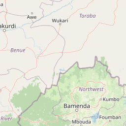
Map view of Kimbi-Fungom National Park

Use this park location map to pinpoint Kimbi-Fungom National Park in Cameroon, understand its exact geographic position, and read its mapped placement within the surrounding landscape more clearly.

Pigeon | © OpenStreetMap contributors

Location context for Kimbi-Fungom National Park

North-West Region
Park atlas

Compare surrounding regional geography and connected highland landscapes

Explore Protected Areas and National Parks Near Kimbi-Fungom National Park

Browsing nearby national parks and protected areas helps place Kimbi-Fungom National Park into a wider regional context of tropical forest reserves and highland watersheds. Examining adjacent conservation zones reveals shared ecological patterns across the Bamboutos Mountains and transboundary river basins.
National parkCameroon
About 88 km away#1 closest

Southwest

Takamanda National Park: Cameroon's National Park Protected Landscape and Geographic Context

Mapped boundaries and regional setting in Cameroon.

Takamanda National Park is a key protected area in Cameroon, offering valuable insights for understanding national park geography and protected landscapes. As a designated national park, it serves as a crucial point of reference for exploring the country's natural regions and their mapped boundaries. Discover the geographic context of Takamanda National Park and its significance within the broader Central African atlas.

Established
2008
Scope
Terrestrial
Water
Minor water
National parkTaraba State
About 125 km away#2 closest

Northeast

Gashaka Gumti National Park: A Deep Dive into Nigeria's Largest Protected Geographic Territory

Mapping the rugged terrain and ecological zones of Taraba State

Spanning over 6,000 square kilometers, Gashaka Gumti National Park is a massive protected expanse that defines the geographic character of northeastern Nigeria. The park integrates diverse environmental zones, including expansive savanna plains and the dramatic slopes of the Chappal Waddi mountain range. This protected area acts as a crucial node for regional biodiversity and remains a central feature in the mapped geography of Taraba State, offering a rare look at Nigeria's vertical landscape transition.

Area
6,402 km²
Established
1991
IUCN
II
Visitors
445 annual
National parkNigeria
About 166 km away#3 closest

Northeast

Gashaka-Gumti National Park: Geography and Protected Landscape Atlas of Nigeria

Explore mountain peaks, savanna plains, and watershed ecosystems

Gashaka-Gumti National Park serves as a centerpiece of Nigerian conservation, covering an expansive range of topographical features. This protected area connects the West African savanna zone with Central African highland ecosystems, creating a unique environment defined by deep river gorges, high-altitude ridges, and vital forest corridors that define the regional geography.

Area
6,402 km²
Established
1991
Relief
Mixed relief
Climate
Subtropical
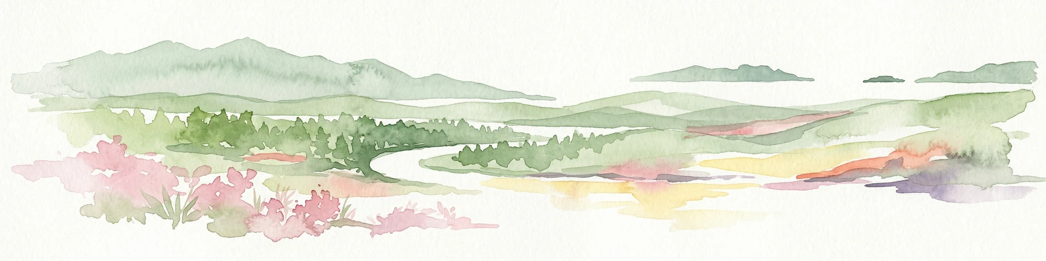
Watercolor illustration of a forested landscape with pink flowering plants, a winding river, and mountain ranges in the background
National parkCameroon
About 186 km away#4 closest

Southwest

Korup National Park: Cameroon's Ancient Tropical Rainforest Protected Area Exploration

Explore its rich biodiversity and unique geographic landscape.

Korup National Park is a significant protected area in Cameroon, covering 1,260 square kilometers of what is considered one of Africa's oldest and most biodiverse tropical rainforests. Established in 1986, this national park is renowned for its exceptional primate populations, extensive plant species, and its role as a critical conservation landscape. The park's terrain transitions from lowlands to hilly areas, with a dense network of streams, offering a rich subject for geographic and protected-area study.

Area
1,260 km²
Established
1986
IUCN
II
Relief
Mixed relief
National parkCameroon
About 189 km away#5 closest

South

Bakossi National Park: Detailed Protected Area Map and Geographic Identity in Cameroon

Explore the mapped landscape and regional context of this Cameroonian national park.

Bakossi National Park is an important protected area situated within Cameroon, functioning as a national park dedicated to conservation and geographic study. This page provides essential details on its mapped boundaries, regional setting, and the natural landscape it represents. It serves as a foundational element for understanding protected areas in Central Africa and their broader geographical significance.

Area
293.2 km²
Established
2008
Relief
Mountain
Climate
Tropical
National parkCross River State
About 202 km away#6 closest

Southwest

Cross River National Park National Park: Mapped Protected Landscape and Regional Geography

Explore the geographic features and protected area context.

Cross River National Park represents a key protected area within Nigeria, offering valuable insights into its specific landscape and regional geographic setting. This entry focuses on the park's identity as a national park, detailing its mapped boundaries and its role within the broader geography of Cross River State. Users can engage with structured data to understand the park's physical context and its significance as a protected natural landscape, supporting detailed atlas-based exploration.

Area
4,000 km²
Established
1991
IUCN
II
Relief
Mixed relief
National parkCentre Region
About 247 km away#7 closest

Southeast

Mpem and Djim National Park: Protected Landscape and Regional Geographic Atlas

Explore the mapped terrain and protected boundaries of this national park.

Mpem and Djim National Park is a protected natural area situated within Cameroon's Centre Region. This detail entry provides an atlas-focused view, emphasizing the park's protected landscape characteristics and its position within the regional geography. Understand the mapped context and discover the identity of Mpem and Djim National Park as a key protected area.

Area
974.8 km²
Established
2004
IUCN
II
Relief
Upland
Wildlife reserveNassarawa
About 251 km away#8 closest

Northwest

Pandam Wildlife Park: Geographic Overview and Protected Area Mapping

Wetland and savanna ecosystems of the Bauchi Plateau

Pandam Wildlife Park serves as a centerpiece for wetland conservation in Nigeria, protecting a diverse matrix of seasonal floodplains, savanna woodlands, and gallery forests. This entry provides geographic data on the reserve, focusing on the seasonal connectivity of Pandam Lake and its role in maintaining a rich corridor of biodiversity across the Nassarawa regional boundary.

Area
197.42 km²
Established
1972
Visitors
27K annual
Relief
Lowland

Common questions about visiting, size, designation, and location context for Kimbi-Fungom National Park

Kimbi-Fungom National Park FAQs for park facts, access, geography, and protected area context

Find quick answers about Kimbi-Fungom National Park, including protected-area facts, park geography, trail and visitor context, and how the park fits into its surrounding country and regional landscape.
MoriAtlas Explorer

Continue Your Protected Areas Search Across the Global Atlas

Deepen your exploration by continuing the structured search for national parks and protected areas worldwide. Utilize the comprehensive filtering capabilities to compare different conservation landscapes and refine your understanding of global park geography. Discover more about the distribution and characteristics of protected natural areas.

Global natural geography