
Mori Atlas logo
National parkKodar National Park

A comprehensive geographic examination of protected mountain taiga and Chara River basins

Kodar National Park: Mapping the Alpine Landscapes and Wilderness of Zabaykalsky Krai

Kodar National Park represents a significant protected landscape within the remote mountains of Zabaykalsky Krai in eastern Siberia. Spanning the rugged terrain of the Kodar Range, this national park encompasses vast mountain taiga, alpine ridges, and critical watershed systems along the Vitim and Chara rivers. The protected boundaries preserve an expansive, cold-climate refuge for specialized Siberian wildlife, including the rare Kodar snow sheep, within an largely untouched wilderness frontier.

mountain taigaKodar Rangealpine ecosystemssubarctic climateSiberian wildernessnational park (Russia)

Kodar National Park

National park

Park overview

Structured park overview, official facts, and landscape profile for Kodar National Park

Kodar National Park park facts, protected area profile, and essential visitor context

Review the core facts for Kodar National Park, including designation, size, terrain, visitor scale, habitats, and operating context in one park-focused overview.

About Kodar National Park

Kodar National Park occupies a remote and mountainous stretch of eastern Siberia, taking in the upper basins of the Vitim and Chara rivers in the Zabaykalsky Krai. The protected area is organized into two geographically distinct clusters: a northern cluster that follows the Kodar Range along the eastern boundary of the Vitim Nature Reserve, and a southern cluster situated on the watershed of the Chara River valley.

The elevation of the Kodar Range gives the park a strong alpine character, while the deep river valleys below retain dense stands of mountain taiga. This combination of high mountain terrain and contiguous taiga forest makes Kodar one of the most ecologically varied protected areas in southern Siberia. The park's climate is sharply continental and subarctic, producing long cold winters and brief, relatively cool summers that shape both vegetation patterns and wildlife behavior.

Because the terrain is so rugged and the climate so severe, human influence on the landscape has remained minimal. The park functions as a refuge for a rich suite of boreal and mountain species whose populations elsewhere in the region have come under pressure. From the high snow-capped summits of the Kodar Range to the larch- and pine-dominated slopes below, the park preserves a continuous gradient of mountain taiga ecosystems that is increasingly rare in the densely populated and heavily exploited areas of southern Siberia.

The remote setting also makes Kodar a frontier for scientific exploration. Much of the park's biodiversity remains incompletely catalogued, and ongoing surveys continue to expand knowledge of its plant and animal communities. This combination of ecological significance and scientific potential gives the park an important role in the long-term study and protection of Siberian mountain ecosystems.

Quick facts and research context for Kodar National Park

Kodar National Park covers a vast protected area of roughly 491,700 hectares in the Zabaykalsky Krai of Russia. It is centered on the Kodar Range and the river basins of the Vitim and Chara, with the nearest major city being Chita. The park is organized into two clusters: a northern cluster along the Kodar ridge next to the Vitim Nature Reserve, and a southern cluster on the watershed of the Chara valley. It is classified as an IUCN Category II national park and is focused on the conservation of mountain taiga forests and rare high-altitude wildlife.

Protection and recognition

Documented terrestrial conservation scope and official designation details

Kodar National Park Protection Status and Administrative Recognition Records

Kodar National Park maintains a documented terrestrial protection scope supported by administrative records and designation data. Structured factual metrics outline the official conservation framework without relying on external recognition programs.

Protection details

Protection scope
Terrestrial
Transboundary protection
No
Park context

Deeper park guide and search-rich context for Kodar National Park

Kodar National Park history, landscape, wildlife, and travel context

Explore Kodar National Park through its history, landscape character, ecosystems, wildlife, conservation priorities, cultural context, and seasonal travel timing in a structured park guide built for atlas discovery and search intent.

Why Kodar National Park stands out

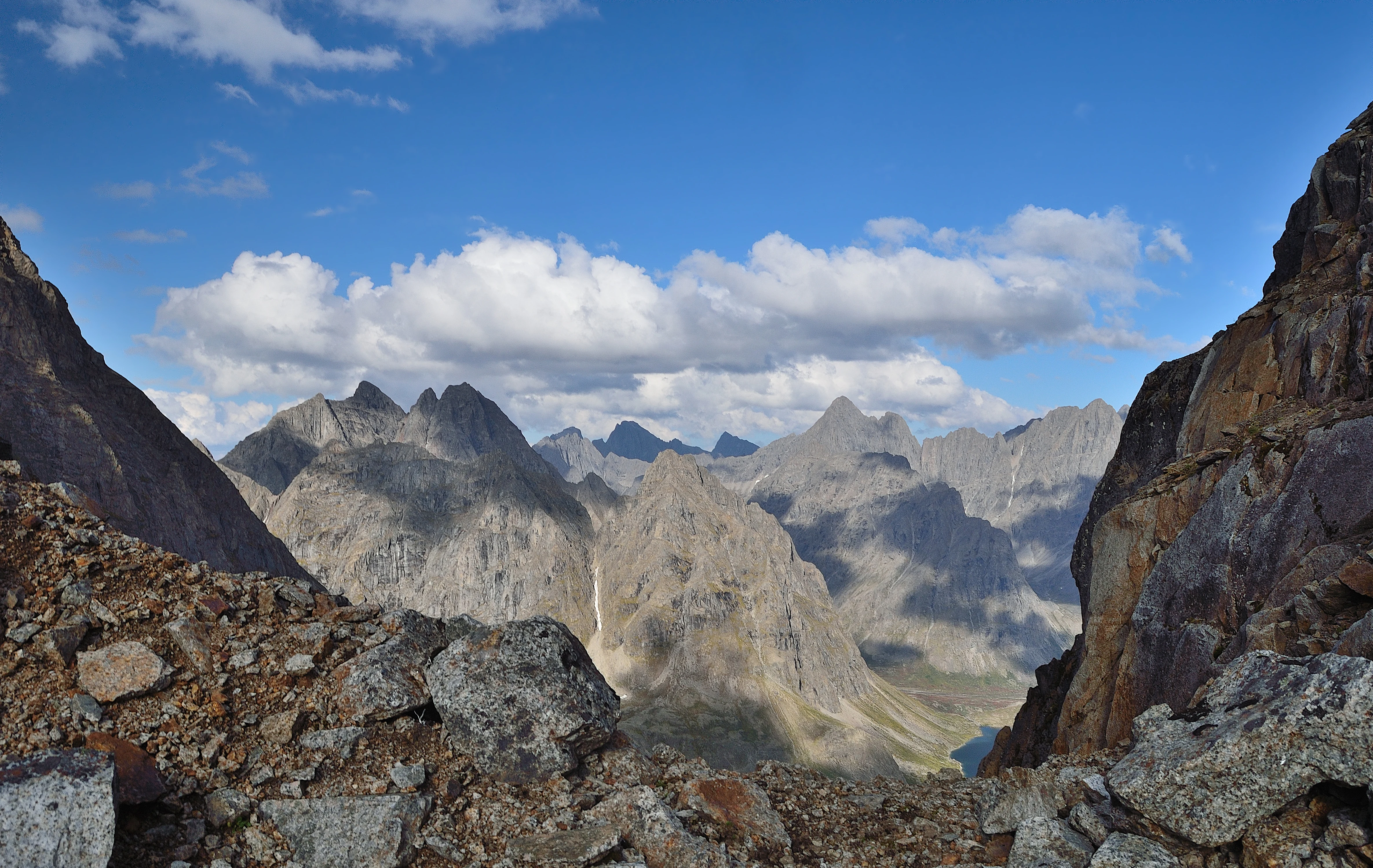
Kodar National Park is especially known for its expansive mountain taiga forests and the rugged alpine terrain of the Kodar Range, which together form one of the most remote and ecologically continuous protected landscapes in southern Siberia. The park is also closely associated with the conservation of rare or locally endemic wildlife, particularly the Kodar snow sheep, a subspecies adapted to the range's high rocky ridges, and the Pribaikalsky black-capped marmot. In addition, the park's flora includes notable rare plants such as Adams' rhododendron and golden rhododendron, both Red Book species of the Zabaykalsky Krai.
Kodar National Park history and protected-area timeline

The history of Kodar National Park as a formally protected area is very recent. The park was officially established on February 8, 2018, when Russian federal authorities designated the Kodar mountain region and surrounding taiga as a national park under IUCN Category II protections.

The park was created primarily to conserve the unique natural complex of mountain taiga forests in the basins of the Vitim and Chara rivers, and to safeguard the habitats of several rare animal species. Its establishment extended the network of large protected areas in the Zabaykalsky Krai, complementing the long-standing Vitim Nature Reserve along the park's northern edge.

Because the park is so new, much of its current research and management framework is still being developed. Baseline surveys of flora and fauna continue, and many aspects of the ecosystem remain understudied. This makes the early history of the park as much a story of ongoing scientific discovery as one of formal designation.

Kodar National Park landscape and geographic character

The defining landscape of Kodar National Park is the Kodar Range itself, a rugged mountain system in eastern Siberia whose alpine peaks and broad valleys give the park its distinctive physical character. The range rises sharply from the surrounding taiga, with characteristic high ridges, exposed rock, and glacially shaped valleys that mark the transition between the mountainous north of the park and the lower watershed areas in the south.

The park is divided into two clusters that together capture the range's main geographic zones. The northern cluster runs along the Kodar Range adjacent to the Vitim Nature Reserve, taking in much of the high-mountain terrain. The southern cluster occupies the watershed of the Chara River valley, where the landscape descends toward broader forests and river systems.

Both clusters share a sharply continental, subarctic climate that produces long, intensely cold winters and short, relatively cool summers. Snow cover persists deep into the year at higher elevations, shaping the patterns of vegetation and wildlife distribution across the park. The river systems of the Vitim and Chara, which drain the surrounding mountains, are central to the park's geography: their valleys provide corridors of comparatively accessible terrain in an otherwise remote and challenging landscape.

Kodar National Park ecosystems, habitats, and plant life

The natural environment of Kodar National Park reflects its position at the meeting point of taiga and high-mountain ecosystems. Roughly 850 species of vascular plants have been recorded on the park's territory, illustrating the richness of its flora despite the rigorous climate.

Larch is the dominant forest tree across much of the park, with Scots pine also widely distributed. On exposed slopes and at higher elevations, hardy shrubs such as dwarf Siberian pine, shrub birch, and stone birch take over, forming the characteristic transition from closed taiga forest to subalpine and alpine vegetation belts.

Among the park's rarer plants are Adams' rhododendron and golden rhododendron, both listed in the Red Book of the Zabaykalsky Krai. Their presence reflects the unusual combination of harsh alpine conditions and relict microhabitats that allow these delicate subarctic shrubs to persist. Together with the dominant coniferous forests, these rare alpine species give the park a layered vegetation profile that ranges from dense taiga to sparse montane tundra.

Kodar National Park wildlife and species highlights

The wildlife of Kodar National Park is one of its principal conservation assets, although it remains only partially surveyed. More than 45 mammal species, more than 150 bird species, 23 fish species, and 350 insect species have been documented to date, and the actual totals are likely higher given the park's size and the limited extent of field research.

Two mammal taxa of particular conservation value are protected under the Russian Red Book: the Kodar snow sheep, a local subspecies adapted to the park's rugged alpine ridges, and the Pribaikalsky black-capped marmot, a regional form that inhabits open montane habitats in the area. The presence of these endemic or near-endemic forms gives the park a specific role in the conservation of Siberian mountain fauna.

Beyond these rare taxa, the park's combination of mountain and taiga environments supports a typical suite of boreal wildlife, including forest-dwelling ungulates, predatory mammals, and a diverse community of northern bird species. The Vitim and Chara river systems also sustain the freshwater fish fauna, including migratory species that depend on clean, cold-water habitats.

Kodar National Park conservation status and protection priorities

Kodar National Park plays an important role in the conservation of mountain taiga ecosystems in southern Siberia. Designated as IUCN Category II, it provides a high level of protection for the natural landscapes, wildlife, and ecological processes of the Kodar Range and surrounding watersheds.

The park's conservation significance is enhanced by its close connection to the neighboring Vitim Nature Reserve along the northern cluster's eastern boundary. Together, the two protected areas form a much larger contiguous zone of preserved mountain terrain, allowing wildlife populations to move across extensive, relatively undisturbed habitat.

The park also has a specific role in protecting rare and endemic species. The presence of the Kodar snow sheep, a subspecies found essentially nowhere else, and the regional form of the black-capped marmot elevates Kodar beyond a general conservation area into one with a clear identity tied to its unique local biodiversity. As research continues, the park is increasingly recognized as a key site for the study and protection of Siberian alpine and subalpine ecosystems.

Top sights and standout views in Kodar National Park

Kodar National Park stands out for the scale and wildness of its mountain taiga landscapes, the rarity of its alpine-adapted species, and the sheer remoteness of its setting. Its two-cluster structure, spanning both the Kodar Range itself and the Chara watershed, allows it to capture multiple altitudinal zones and a wide range of ecological conditions within a single protected area.

The park's identity is closely tied to its rare species, including the endemic Kodar snow sheep and the regional black-capped marmot, and to the unusually sparse human footprint preserved across its mountains, forests, and river valleys. Combined with the limited extent of scientific exploration to date, this gives Kodar the character of both a functioning refuge and an open frontier for ecological research in Siberia.

Best time to visit Kodar National Park

The sharply continental, subarctic climate of Kodar National Park strongly shapes the experience of timing a visit. Winters are long, severe, and deeply snowy, restricting access to the higher elevations and making most travel difficult.

The short summer season offers the most favorable conditions for travel in the park, with warmer temperatures, snow-free lower trails, and active wildlife. Spring brings rapid snowmelt and river swelling that can complicate access through valleys, while autumn transforms the larch forests into one of the region's most distinctive seasonal displays before the long cold returns. Most visitors and researchers plan their time in the park around the narrow window of relatively mild summer weather.

Monthly climate preview

Long-term monthly weather patterns and annual temperature rhythms for Zabaykalsky Krai

Kodar National Park Climate Normals, Average Temperature and Precipitation

Kodar National Park records severe sub-zero winter temperatures alongside warm summer peaks and distinct monthly precipitation variations based on long-term data. Reviewing the complete twelve-month climate profile provides deeper context on measured thermal shifts and precipitation cycles across the representative terrain.
Annual mean-9 °C
-29 °C13 °C
Jan-29°
Feb-26°
Mar-19°
Apr-10°
May-1°
Jun
Jul13°
Aug10°
Sep
Oct-10°
Nov-22°
Dec-28°
Warmest month
July

12.9 °C

Coolest month
January

-28.5 °C

Wettest month
July

5.2 mm/day

Driest month
January

0.5 mm/day

Park location guide

Geography guide, regional context, and park location map for Kodar National Park

Kodar National Park park geography, regions, and map view in Russia

Understand where Kodar National Park sits in Russia through a broader geographic reading of the surrounding landscape, nearby location context, and its mapped position within the national park landscape.

How Kodar National Park fits into Russia

Russia is a transcontinental nation spanning eleven time zones, bordered by fourteen countries. It is the world's largest country by area, covering 17,098,246 km². Moscow is the capital and largest city, while Saint Petersburg is the second-largest and a major cultural centre.

Wider geography shaping Kodar National Park in Russia

Russia spans Eastern Europe and North Asia, covering 17,098,246 km². It shares land borders with fourteen countries, more than any other nation, and spans eleven time zones. The landscape includes vast plains, mountain ranges such as the Urals and Caucasus, and extensive coastlines along the Arctic Ocean, Pacific Ocean, Baltic Sea, Black Sea, and Caspian Sea.

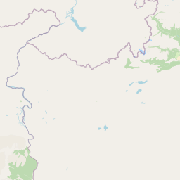
Map view of Kodar National Park

Use this park location map to pinpoint Kodar National Park in Russia, understand its exact geographic position, and read its mapped placement within the surrounding landscape more clearly.

Pigeon | © OpenStreetMap contributors

Location context for Kodar National Park

Zabaykalsky Krai
Park atlas

Compare adjacent mountain taiga landscapes, alpine ridges, and northern protected areas.

Exploring Other Parks Near Kodar National Park and Surrounding Siberian Reserves

Browse nearby national parks and protected areas sharing the rugged terrain of eastern Siberia. Compare surrounding regional ecosystems to understand the broader conservation context beyond Kodar National Park.
Watercolor illustration showing a river winding through a valley with mountains and forests
National parkZabaykalsky Krai
About 43 km away#1 closest

East

Kodar National Park: Geographic Map & Protected Landscape Analysis

Analyzing alpine terrain and Siberian taiga ecosystems

Kodar National Park presents a striking array of Siberian ecosystems, including the northernmost desert environment known as the Chara Sands, extensive taiga forests, and rugged volcanic terrain on the Udokan Plateau. This geographic resource details the park's distinct sectors, tracing the boundaries of its alpine cirques, glaciers, and mountainous corridors that characterize the Zabaykalsky Krai landscape.

Area
4,917 km²
Established
2016
IUCN
II
Relief
Mountain
Watercolor painting depicting a lake with mountain ranges, green hills, and scattered trees.
National parkBuryatia
About 634 km away#2 closest

Southwest

Zaybaykalsky National Park: Geographic Atlas of Lake Baikal Protected Terrain

Mapping the Svyatoy Nos peninsula and Barguzin mountain landscapes

Spanning over 269,000 hectares, Zaybaykalsky National Park protects a dramatic transition from the shores of Lake Baikal to high-altitude mountain complexes. This atlas resource details the park's steep topography, characterized by ancient taiga forests and geological features like the Academician Ridge and marble-limestone islands, offering a structured view of this significant Siberian protected area.

Area
2,690 km²
Established
1986
IUCN
II
Relief
Mountain
National parkBuryatia
About 634 km away#3 closest

Southwest

Zabaykalsky National Park: Geographic and Protected Area Mapping for the Eastern Baikal Shore

Mountain taiga, islands, and protected peninsula landscapes.

Zabaykalsky National Park comprises an extensive area of the eastern Baikal shoreline, characterized by the Barguzin Range, the prominent Sviatoy Nos peninsula, and a dense network of mountain taiga forests. Its protected boundaries include diverse mineral springs, karst features, and crucial marine habitats, providing a comprehensive look at the unique geomorphology and biodiversity of this Siberian wilderness.

Area
2,690 km²
Established
1986
IUCN
II
Relief
Mountain
Watercolor illustration showing a lake, green vegetation, and mountains under a light sky
National parkIrkutsk Oblast
About 696 km away#4 closest

Southwest

Pribaikalsky National Park: Geographic Context and Protected Landscape Boundaries

Coastal mountain terrain and the freshwater ecosystems of Irkutsk Oblast.

Located in Russia, Pribaikalsky National Park represents a primary protected area within the Lake Baikal basin. The region features dramatic topographical transitions from the Primorsky Range to the inland expanse of Olkhon Island. This record provides a detailed look at the park's physical geography, including its forest cover, coastal cliffs, and the significant role of the Angara River outflow in shaping the surrounding Siberian terrain.

Area
4,173 km²
Established
1986
IUCN
II
Visitors
400K annual
National parkZabaykalsky Krai
About 723 km away#5 closest

Southwest

Alkhanay National Park: Protected Mountain Terrain and Volcanic Landscapes of Zabaykalsky Krai

Mapping Siberia's forest-steppe transition and sacred mountain geography

Alkhanay National Park preserves an unusual assembly of Siberian mountain taiga, volcanic geology, and Buddhist heritage sites within the Zabaykalsky Krai region. The protected territory spans mid-elevation ranges and river valleys, offering deep insights into the intersection of ecological watershed protection and spiritual land preservation in the Russian Far East.

Area
1,382.34 km²
Established
1999
IUCN
II
Visitors
30K annual
Watercolor illustration depicting layered mountains, green hills, and forested areas with purple and pink tones
National parkZabaykalsky Krai
About 723 km away#6 closest

Southwest

Alkhanay National Park: A Study of Sacred Peaks and Daurian Forest Steppe Geography

Protected mountain landscapes in Russia's Zabaykalsky Krai

Alkhanay National Park preserves a unique transitional landscape where rugged mountain terrain meets the expansive Siberian steppe. Focused on the sacred Mount Alkhanai, the area features dramatic rock landforms, pine-covered canyons, and mineral springs. This protected zone provides a deep look into the geological and ecological history of the Mogotuyskogo Range and surrounding border regions.

Area
1,382 km²
Established
1999
IUCN
II
Relief
Mountain
Watercolor illustration showing green hills, a river, and grassy foreground
Nature reserveSakha Republic
About 729 km away#7 closest

Northeast

Lena Pillars Nature Reserve: Mapped Protected Area in Sakha Republic's Vast Geography

Explore the regional landscape and park boundaries.

Discover Lena Pillars Nature Reserve, a key protected area located within the expansive Sakha Republic of Russia. This page offers focused atlas exploration, detailing the park's geographic setting and its mapped boundaries against the backdrop of Siberia's largest federal subject. Understand the unique natural landscape context and its significance within regional conservation efforts, providing structured geographic data for your exploration.

Area
13,870 km²
IUCN
II
Relief
Lowland
Climate
Subpolar
National parkSakha Republic
About 729 km away#8 closest

Northeast

Lena Pillars National Park: Geological Formations and River Geography in Sakha Republic

Explore the unique cliff-lined river corridors and boreal wilderness.

Lena Pillars National Park stands as a significant protected landscape in the Russian Far East. The area features a massive complex of vertical limestone towers rising from the Lena River, surrounded by permafrost-rich taiga forests and unique northern desert dunes. This geographic overview highlights the park terrain, river-based ecosystems, and the historical significance of the region.

Area
12,179.4 km²
Established
1994
IUCN
II
Relief
Highland

Common questions about visiting, size, designation, and location context for Kodar National Park

Kodar National Park FAQs for park facts, access, geography, and protected area context

Find quick answers about Kodar National Park, including protected-area facts, park geography, trail and visitor context, and how the park fits into its surrounding country and regional landscape.
MoriAtlas Explorer

Continue Your Protected Areas Search Across the Global Atlas

Deepen your exploration by continuing the structured search for national parks and protected areas worldwide. Utilize the comprehensive filtering capabilities to compare different conservation landscapes and refine your understanding of global park geography. Discover more about the distribution and characteristics of protected natural areas.

Global natural geography