Mori Atlas logo
National parkKodar National Park

Detailed maps and geographic context for a key protected national park in Zabaykalsky Krai.

Kodar National Park: Exploring Russia's Protected Landscape in Zabaykalsky Krai

(National Park Kodar (Кодар))

Kodar National Park stands as a vital protected national park entity within the vast geography of Zabaykalsky Krai, Russia. This page serves as your definitive atlas entry point, detailing the park's mapped boundaries and its role as a significant natural landscape. Understand its place within regional geography and discover the structured geographic context that MoriAtlas provides for this important protected area.

Alpine MountainsGlacial LakesTaiga ForestSubarctic EcosystemsVolcanic LandscapeDesert Environment

Kodar National Park

National park

Park overview

Structured park overview, official facts, and landscape profile for Kodar National Park

Kodar National Park park facts, protected area profile, and essential visitor context
Review the core facts for Kodar National Park, including designation, size, terrain, visitor scale, habitats, and operating context in one park-focused overview.

About Kodar National Park

Kodar National Park represents one of Russia's newest and most ecologically diverse protected areas, established in 2016 to preserve the exceptional natural values of the Kodar Mountains in southeastern Siberia. The park encompasses nearly half a million hectares in Zabaykalsky Krai, a remote region of Russia that remains one of the least developed and populated areas in the country. The geographic character of the park is defined by the Kodar mountain range, a dramatic formation where elevation drops sharply over short distances, creating dramatic transitions from alpine tundra to forested valleys within the same watershed. The park's northern sector follows the Kodar range along the eastern border of the Vitim Nature Reserve, while the southern sector encompasses the volcanic Udokan Plateau and the Chara River valley. The park's establishment reflects Russia's growing commitment to protecting its northernmost mountain ecosystems and the unique transitional environments found in this corner of Siberia, where subarctic conditions create habitats found nowhere else on Earth.

Quick facts and research context for Kodar National Park

Kodar National Park covers 491,710 hectares in the Kodar Mountains of Zabaykalsky Krai, Russia, established in 2016. The park is divided into two sectors: a northern sector of 3,383 km² along the Kodar range bordering the Vitim Nature Reserve, and a southern 1,953 km² sector encompassing the volcanic Udokan Plateau. The highest peak is Pik BAM at 3,072 meters. The park contains the Chara Sands, a 10 km by 5 km dune field forming an isolated desert surrounded by taiga forest. The region features a subarctic continental climate with brief summers and long, cold winters. The park is relatively new with limited visitor infrastructure and requires special permits for access.

Park context

Deeper park guide and search-rich context for Kodar National Park

Kodar National Park history, landscape, wildlife, and travel context
Explore Kodar National Park through its history, landscape character, ecosystems, wildlife, conservation priorities, cultural context, and seasonal travel timing in a structured park guide built for atlas discovery and search intent.

Why Kodar National Park stands out

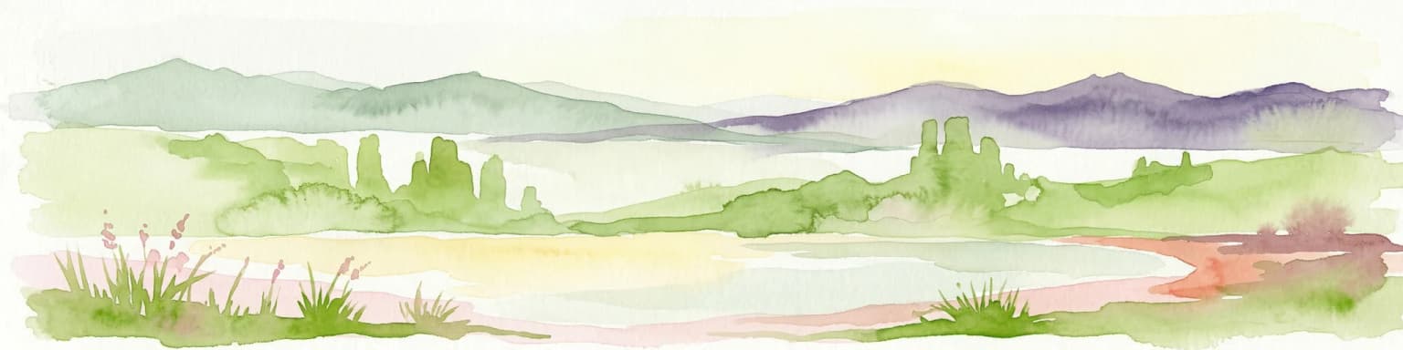
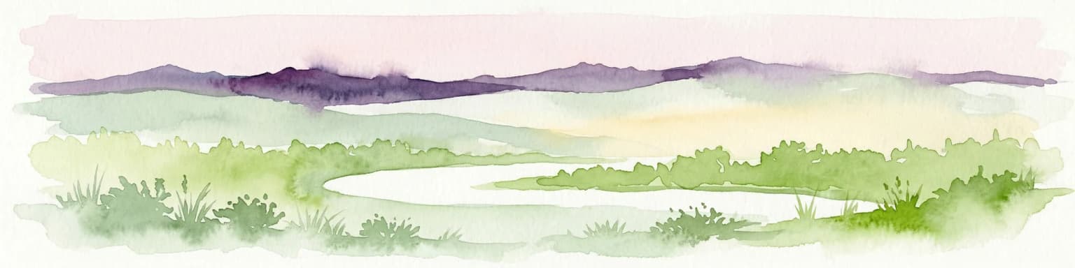
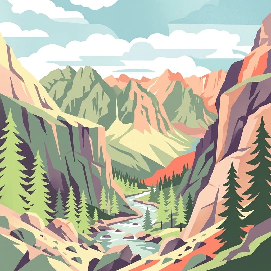
Kodar National Park is best known for its extraordinary landscape diversity, representing one of the most varied protected areas in Siberia. The park contains the Chara Sands, one of the northernmost deserts in the world, a unique sand massif surrounded by taiga forest in a mountain valley setting. Its over 570 alpine lakes, low-altitude glaciers, volcanic fields of the Udokan Plateau, and the steep alpine peaks of the Kodar range create a dramatic mountain landscape. The park also protects significant populations of black-capped marmot and Siberian bighorn sheep in a region where ecological surveys remain in early stages.

Kodar National Park history and protected-area timeline

Kodar National Park was officially established in 2016, making it one of the more recent additions to Russia's national park system. The creation of the park was driven by recognition of the region's exceptional geographic and ecological diversity, which includes glacial, alpine, volcanic, and even desert environments within a single protected area. Prior to designation, the Kodar Mountains and surrounding landscapes were part of a broader regional conservation framework, but the establishment of the park provided formal national protection status. The park is governed by FGBU Kodar, the federal budget institution responsible for managing protected areas in the region. As a relatively new protected area, the park is still developing its infrastructure and management programs, and scientific surveys of its biodiversity remain in preliminary stages.

Kodar National Park landscape and geographic character

The landscape of Kodar National Park is defined by extraordinary topographic diversity. The park is centered on the Kodar Mountains, a range whose name means steep in the Evenks language, reflecting the precipitous alpine slopes that dominate the terrain. The highest peak in the range and park is Pik BAM at 3,072 meters. The park is divided into two distinct sectors: the northern sector covers approximately 3,383 km² and runs north-south along the Kodar range, while the southern sector covers 1,953 km² and encompasses the volcanic Udokan Plateau and the Chara River valley. One of the park's most distinctive features is the Chara Sands, a dune-covered sand massif measuring 10 kilometers by 5 kilometers that forms an isolated desert surrounded by taiga forest. This desert, located in the Chara River valley, represents one of the northernmost desert environments in the world. The park also contains over 570 alpine lakes distributed across the mountain landscape, as well as low-altitude glaciers and volcanic terrain.

Kodar National Park ecosystems, habitats, and plant life

The ecological character of Kodar National Park is defined by its position at the intersection of two distinct ecoregions, creating remarkable biodiversity within a relatively compact protected area. At higher elevations, the park falls within the Trans-Baikal Bald Mountain tundra ecoregion, characterized by alpine tundra vegetation on exposed mountain slopes. At lower elevations, the East Siberian taiga dominates, with coniferous forests covering the valley floors and lower slopes. The sharp elevation drops over short distances create multiple ecological zones within the park, supporting species adapted to both alpine and boreal environments. The climate is sharply continental subarctic, with very brief summers lasting only one to three months above 10°C and long, cold winters with minimal precipitation. Preliminary scientific surveys have recorded approximately 350 species of plants within the park boundaries, though comprehensive biological inventories are still in early stages.

Kodar National Park wildlife and species highlights

The wildlife of Kodar National Park demonstrates remarkable diversity for its latitude, a consequence of the high-altitude zonation and the park's position in the transition between alpine and taiga ecosystems. Preliminary surveys have documented 47 species of mammals, 150 species of birds, 23 species of fish, 2 amphibian species, and over 350 species of insects. Among the most notable mammalian species are the black-capped marmot and the Siberian bighorn sheep, both species adapted to the harsh subarctic conditions of the region. The Siberian bighorn sheep inhabits the rocky alpine terrain, while the black-capped marmot is found in mountain meadows and tundra areas. The bird fauna includes numerous species associated with both alpine habitats and the taiga forest zones. As a relatively new protected area, ongoing research continues to expand knowledge of the park's full biodiversity.

Kodar National Park conservation status and protection priorities

Kodar National Park holds significant conservation value as one of the most geographically diverse protected areas in Siberia. The park protects a unique combination of environments including alpine tundra, taiga forest, glacial features, volcanic terrain, and an isolated desert environment, representing one of the few places where such diverse landscapes are preserved within a single protected area. The park's position at the boundary between the Trans-Baikal Bald Mountain tundra and East Siberian taiga ecoregions makes it important for conserving the ecological transition between these systems. The Chara Sands, as a northernmost desert environment, holds particular scientific interest for understanding desert formation processes in subarctic latitudes. The park also provides habitat protection for species of conservation concern including the Siberian bighorn sheep, which occupies limited habitat in Russia's mountain regions.

Kodar National Park cultural meaning and human context

The cultural context of Kodar National Park is rooted in the heritage of the Evenks, the indigenous reindeer herding people of southeastern Siberia. The park's name derives from the Evenks language, where Kodar means steep, a direct reference to the dramatic alpine terrain that characterizes the region. The park lies in the Kalarsky District of Zabaykalsky Krai, a vast and sparsely populated region of Russia that has historically been home to Evenk, Buryat, and other Siberian indigenous communities. The Chara area, where the park headquarters are located, is a rural settlement with connections to traditional land use patterns. The region's history is also linked to the construction of the Baikal-Amur Mainline railway, which passes through the broader region and influenced settlement patterns in the latter twentieth century.

Top sights and standout views in Kodar National Park

The standout features of Kodar National Park include the Chara Sands, one of the world's northernmost deserts, which creates a striking contrast of sand dunes amid taiga forest in a mountain valley. The park's over 570 alpine lakes, including many in dramatic glacial cirques, offer exceptional mountain scenery. The volcanic Udokan Plateau adds geological interest to the southern sector, while the highest peak Pik BAM at 3,072 meters provides alpine challenge. The park's exceptional landscape diversity within a single protected area, encompassing tundra, taiga, glaciers, volcanoes, and desert, makes it a unique conservation area in Siberia. The opportunity to experience a relatively untouched wilderness area, among Russia's newest national parks, represents a distinctive draw for visitors seeking remote adventure.

Best time to visit Kodar National Park

The best time to visit Kodar National Park is during the brief Siberian summer, typically from June through August, when temperatures are mildest and the park is most accessible. During these months, temperatures may reach comfortable levels in the valleys, though alpine areas remain cool. The short summer season of only one to three months above 10°C defines the visiting window. Winter visits are extremely challenging due to the harsh continental climate, with very cold temperatures and significant snow cover. As a new park with limited infrastructure, visitors should expect basic facilities and the need for advance planning, including obtaining the required visitor permits from the park administration. The park's remote location in Zabaykalsky Krai requires careful travel coordination, typically through the nearest settlement of Novaya Chara or Chara.

Park location guide

Geography guide, regional context, and park location map for Kodar National Park

Kodar National Park park geography, regions, and map view in Russia
Understand where Kodar National Park sits in Russia through a broader geographic reading of the surrounding landscape, nearby location context, and its mapped position within the national park landscape.

How Kodar National Park fits into Russia

Russia is a transcontinental nation spanning eleven time zones, bordered by fourteen countries. It is the world's largest country by area, covering 17,098,246 km². Moscow is the capital and largest city, while Saint Petersburg is the second-largest and a major cultural centre.

Wider geography shaping Kodar National Park in Russia

Russia spans Eastern Europe and North Asia, covering 17,098,246 km². It shares land borders with fourteen countries, more than any other nation, and spans eleven time zones. The landscape includes vast plains, mountain ranges such as the Urals and Caucasus, and extensive coastlines along the Arctic Ocean, Pacific Ocean, Baltic Sea, Black Sea, and Caspian Sea.

Map view of Kodar National Park

Use this park location map to pinpoint Kodar National Park in Russia, understand its exact geographic position, and read its mapped placement within the surrounding landscape more clearly.

Pigeon | © OpenStreetMap contributors

Location context for Kodar National Park

Kalarsky DistrictZabaykalsky Krai
Park atlas

Trace the regional spread of diverse protected landscapes, from alpine mountains to unique desert environments, expanding beyond Kodar National Park.

Explore Other National Parks and Protected Areas Surrounding Kodar National Park
Continue your geographic discovery beyond Kodar National Park by exploring other national parks and protected areas within its unique Siberian region, comparing diverse landscapes. This broader view allows for atlas-style comparison of distinct conservation efforts and geological features, providing deeper context for protected wilderness areas.
National parkBuryatia

Zaybaykalsky National Park: National Park Atlas and Protected Landscape Explorer

Buryatia's Protected Area and Geographic Context

Uncover the geographic identity of Zaybaykalsky National Park, a designated national park within the Republic of Buryatia. This platform facilitates a structured exploration of its protected landscape, emphasizing its mapped boundaries and its place within the regional geography of Siberia. Understand the park's significance through a dedicated atlas lens, focusing on its inherent natural terrain and protected status, aiding in detailed geographic discovery.

Area
2,690 km²
Established
1986
IUCN
II
Relief
Mountain
Watercolor illustration showing green hills, a river, and grassy foreground
Nature reserveSakha Republic

Lena Pillars Nature Reserve: Mapped Protected Area in Sakha Republic's Vast Geography

Explore the regional landscape and park boundaries.

Discover Lena Pillars Nature Reserve, a key protected area located within the expansive Sakha Republic of Russia. This page offers focused atlas exploration, detailing the park's geographic setting and its mapped boundaries against the backdrop of Siberia's largest federal subject. Understand the unique natural landscape context and its significance within regional conservation efforts, providing structured geographic data for your exploration.

Area
13,870 km²
Relief
Lowland
Climate
Subpolar
Access
Moderate access
National parkAmur Oblast

Tokinsko-Stanovoy National Park: Protected Landscape Geography and Atlas Context

National Park in Amur Oblast, Russia

Delve into the specifics of Tokinsko-Stanovoy National Park, a designated national park within Amur Oblast. This entry provides essential context on its protected landscape characteristics and its place in the regional geography. Understand the park's mapped boundaries and discover its natural terrain as part of a larger atlas-driven exploration of protected areas in the Russian Far East.

Area
2,430 km²
Established
2019
IUCN
II
Watercolor illustration depicting layered mountains, green hills, and forested areas with purple and pink tones
National parkZabaykalsky Krai

Alkhanay National Park

Sacred Mountain & Forest Steppe

Alkhanay National Park in Russia protects a landscape where Siberian taiga meets Mongolian steppe. Explore its sacred Mount Alkhanai, diverse terrain, and protected natural features within a unique geographic setting.

Area
1,382 km²
Established
1999
IUCN
II
National parkZabaykalsky Krai

Chikoy National Park: Protected National Park with Highland Landscape and River Basin Geography

Explore its protected boundaries and unique taiga-steppe transition in Zabaykalsky Krai.

Chikoy National Park, a protected area in Russia's Zabaykalsky Krai, showcases the rugged geography of the Khentei-Daur Highlands. As a national park, it preserves the upper Chikoy River basin and represents a significant ecological borderland, marking the transition from Siberian taiga to Mongolian steppe. This page facilitates a structured understanding of the park's mapped landscape, its prominent natural monument Bystrinsky Golets, and its role within the broader atlas of protected natural areas.

Area
6,665 km²
Established
2014
IUCN
II
Relief
Mountain
Watercolor illustration showing a lake, green vegetation, and mountains under a light sky
National parkIrkutsk Oblast

Pribaikalsky National Park: A Protected Siberian Landscape on Lake Baikal's Shores

Explore mapped boundaries and regional geography.

Pribaikalsky National Park is a key protected area in Irkutsk Oblast, critical for conserving the biodiversity and unique topography of Lake Baikal. This national park encompasses dramatic mountain terrain, coastal landscapes, and the significant Olkhon Island, offering a detailed geographic study for atlas exploration. Discover the mapped extent of this important natural reserve and its role in preserving one of Earth's most exceptional freshwater ecosystems and its surrounding Siberian environment.

Area
4,173 km²
Established
1986
IUCN
II
Visitors
400K annual
National parkBuryatia

Tunkinsky National Park National Park: Protected Landscape and Geographic Context in Buryatia

Discover mapped park boundaries and regional terrain.

Delve into Tunkinsky National Park, a significant protected national park situated in the Buryatia region of Russia. This detail page provides a geographic overview, highlighting the park's mapped boundaries and its place within the surrounding natural landscape. Understand its designation as a protected area, offering a focused entry point for atlas-based discovery of its specific terrain and regional importance.

Area
11,837 km²
IUCN
II
Relief
Mountain
Climate
Boreal
National parkKhabarovsk Krai

Shantar Islands National Park: Remote Archipelago Atlas with Rugged Terrain

Mapping protected marine and island geography in Khabarovsk Krai.

Shantar Islands National Park represents a significant protected landscape within Khabarovsk Krai, notable for its dramatic coastal geography, mountainous terrain, and rich marine ecosystems. This national park, encompassing a chain of islands in the Sea of Okhotsk, is a vital habitat for marine mammals and seabird colonies. Explore its mapped boundaries and unique regional atlas context, understanding its role as a protected coastal area in the Russian Far East.

Area
5,155 km²
Established
2013
IUCN
II
Relief
Mountain

Common questions about visiting, size, designation, and location context for Kodar National Park

Kodar National Park FAQs for park facts, access, geography, and protected area context
Find quick answers about Kodar National Park, including protected-area facts, park geography, trail and visitor context, and how the park fits into its surrounding country and regional landscape.
MoriAtlas Explorer

Continue Your Protected Areas Search Across the Global Atlas

Deepen your exploration by continuing the structured search for national parks and protected areas worldwide. Utilize the comprehensive filtering capabilities to compare different conservation landscapes and refine your understanding of global park geography. Discover more about the distribution and characteristics of protected natural areas.

Global natural geography