
Mori Atlas logo
Protected areaKorission Lagoon

A rare mosaic of sand dune systems, freshwater reed beds, and Mediterranean juniper woodlands

Korission Lagoon Protected Area: Mapped Coastal Landscapes and Wetland Geography in Corfu

Korission Lagoon stands as a vital protected area on the southern coast of Corfu, defined by its dramatic transition from freshwater wetland to the open Ionian Sea. The landscape features a distinct sand dune barrier covered in rare prickly juniper forests and serves as a critical habitat for migratory birds and endemic species. This atlas entry provides a detailed look at the geographical boundaries and natural terrain of this unique Mediterranean coastal site.

coastal lagoonsand dunesNatura 2000wetlandMediterraneanIonian Islands
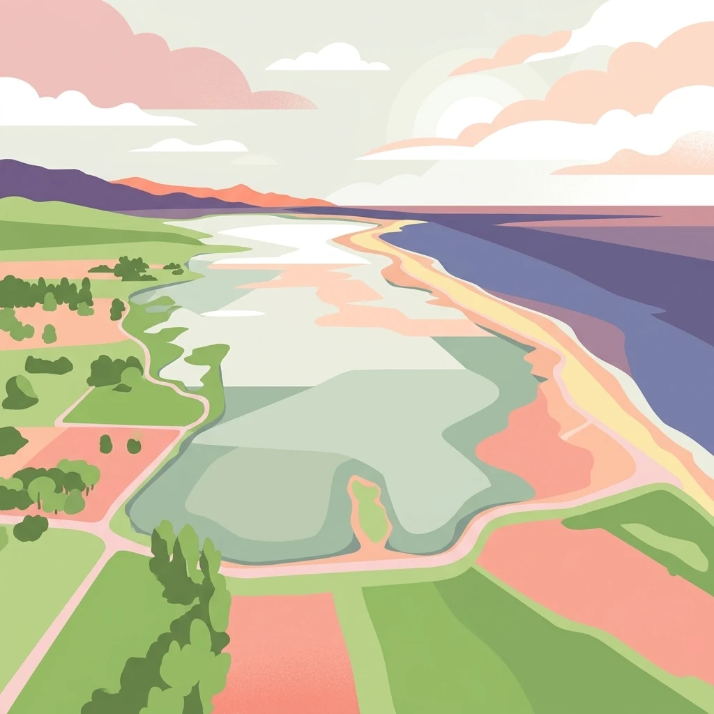
A digital illustration of a coastal lagoon from an aerial perspective, showing green marshes, sandy shores, and blue water under a soft sky.

Korission Lagoon

Protected area

Park overview

Structured park overview, official facts, and landscape profile for Korission Lagoon

Korission Lagoon park facts, protected area profile, and essential visitor context

Review the core facts for Korission Lagoon, including designation, size, terrain, visitor scale, habitats, and operating context in one park-focused overview.

About Korission Lagoon

Korission Lagoon is one of the most important natural sites on Corfu and a showcase for the ecological richness of the Ionian coast. Located on the southwestern part of the island, the lagoon forms a shallow, calm body of water that was carved off from the sea by ancient sand movement, with its basin enclosed by dunes that geologically formed between roughly 140,000 and 250,000 years ago.

The protected area around the lagoon stretches inland across dunes, juniper forest and marshy margins, and outward across the Chalikouna sand bar to the Ionian Sea. A small channel bisects Chalikouna Beach and allows the lagoon to exchange water with the open marine environment, maintaining its semi-fresh, semi-brackish character. This combination of freshwater springs, dune vegetation, Mediterranean coastal scrub and adjacent sea creates a remarkable concentration of habitats in a small geographic space.

From a conservation perspective, Korission Lagoon is recognised at the European level through the Natura 2000 network, and in Greece it has been declared a protected landscape of particular natural beauty. Its formal designation reflects the lagoon's biological value as a refuge for aquatic species, its importance for migratory birds, and the unusual presence of a mature, dune-adapted juniper forest that is uncommon elsewhere on Corfu. The site also carries archaeological weight, having yielded Paleolithic artifacts and Pleistocene fauna remains, situating it as a landscape with both deep-time ecological history and long human interaction.

For visitors and naturalists, Korission offers a compact but rich experience of southern Corfu's wilder side: walking through juniper-scented dunes, observing wetland birds at the lagoon's edge, and contrasting the still lagoon waters with the open Ionian horizon only a short distance away.

Quick facts and research context for Korission Lagoon

Korission Lagoon is a brackish to freshwater coastal lagoon on the southwestern coast of Corfu, in the Ionian Islands of Greece, near the village of Agios Mattheos. The water body is separated from the Ionian Sea by Chalikouna Beach and a substantial dune belt, and it drains to the sea through a narrow channel.

The site carries formal protection under the European Natura 2000 network and has also been designated as a Greek landscape of particular natural beauty (Τοπίο Ιδιαίτερου Φυσικού Κάλλους). Its protected area spans roughly 4.2 square kilometres of lagoon, dunes, juniper forest, reed beds and shoreline, making it one of the most significant wetland complexes on the island.

Protection and recognition

Examine the documented conservation scope and mixed protection boundaries

Korission Lagoon Protection Status and International Recognition Facts

Korission Lagoon maintains a documented mixed protection status within regional conservation frameworks and management guidelines. Official records assemble baseline designation data and administrative scope for structured geographic evaluation.

Protection details

Protection scope
Mixed
Transboundary protection
No
Park context

Deeper park guide and search-rich context for Korission Lagoon

Korission Lagoon history, landscape, wildlife, and travel context

Explore Korission Lagoon through its history, landscape character, ecosystems, wildlife, conservation priorities, cultural context, and seasonal travel timing in a structured park guide built for atlas discovery and search intent.

Why Korission Lagoon stands out

Korission Lagoon is best known for its combination of a sheltered coastal lagoon, a tall sand-dune barrier and a rare Mediterranean dune juniper forest of Juniperus phoenicea, locally referred to as cedar. It is recognised for its outstanding ornithological value, recording more than 126 bird species, and for being the only known habitat of the endemic Corfu dwarf goby. The lagoon also stands out for the dramatic juxtaposition of ecological zones, freshwater vegetation and reed beds inland, dry sand dunes and dwarf juniper woodland along the shore, and open Ionian Sea just beyond. This layered habitat mosaic within a relatively compact area is what makes Korission distinct among Greek coastal wetlands.
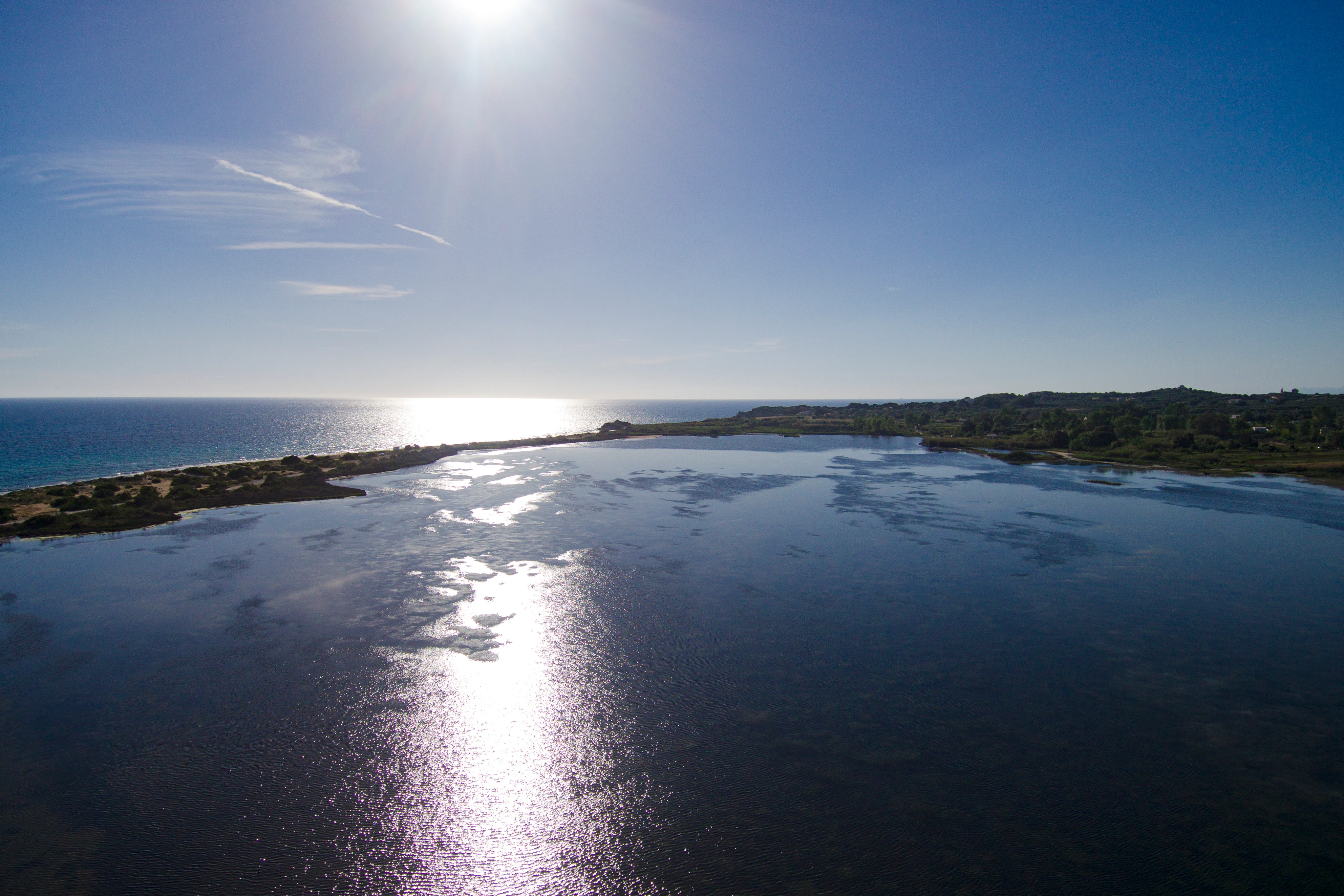
Aerial view of a coastal lagoon separated from the Ionian Sea by a narrow strip of land and sand dunes under a clear blue sky.
Sunlight reflects off the calm waters of Korission Lagoon at the edge of the Ionian Sea.

Korission Lagoon history and protected-area timeline

The Korission Lagoon basin itself is ancient: the sand dunes that separate it from the Ionian Sea developed over a span beginning roughly 140,000 to 250,000 years ago, gradually walling off what had been open coastal water into the present lagoon system. In this sense the lagoon is a geological inheritance from the late Pleistocene, its basic form persisting long before any modern human presence.

The area has also been a focus of archaeological interest because the surrounding sediments preserve evidence of very early human activity and ancient fauna. Excavations have recovered a partial hippopotamus lower jaw among other bones, alongside a worked Paleolithic stone, confirming human presence around the lagoon in prehistoric times. Subsequent work has turned up additional bones and artifacts, reinforcing the picture of the Korission area as a continually occupied landscape across deep time.

In modern conservation history, Korission Lagoon gained formal protection through its inclusion in the European Natura 2000 network, recognising its habitats and species at a transnational level. It has additionally been designated a Greek protected landscape of particular natural beauty (Τοπίο Ιδιαίτερου Φυσικού Κάλλους), formalising its status as a site of national scenic and ecological significance. Together these designations have shaped how the lagoon and its dunes, juniper forest and surrounding plain are managed today.

Korission Lagoon landscape and geographic character

The physical character of Korission is defined by the contrast between still water, mobile dunes and the open sea. The lagoon itself is a shallow coastal basin, separated from the Ionian Sea by a roughly 250-metre-wide strip of land along Chalikouna Beach. Tall sand dunes rising in places above 15 metres form the spine of this barrier, and a small channel piercing the beach allows water exchange with the sea.

Beyond the dunes inland, the terrain transitions into a thin, open woodland of prickly juniper, known locally as cedar, adapted to sandy, sun-exposed, salt-sprayed conditions. This dune-juniper community is unusual on Corfu and gives the landscape a distinctive character, with low trees scattered across pale sand and dune hollows.

Along the lagoon's northern and freshwater-influenced margins, the scene softens into small reed beds, tamarisk thickets, patches of white water lilies and other wetland vegetation. The broader catchment around the lagoon is gentle and low-lying, with the dunes themselves acting as the most visually dramatic landforms in an otherwise flat coastal plain.
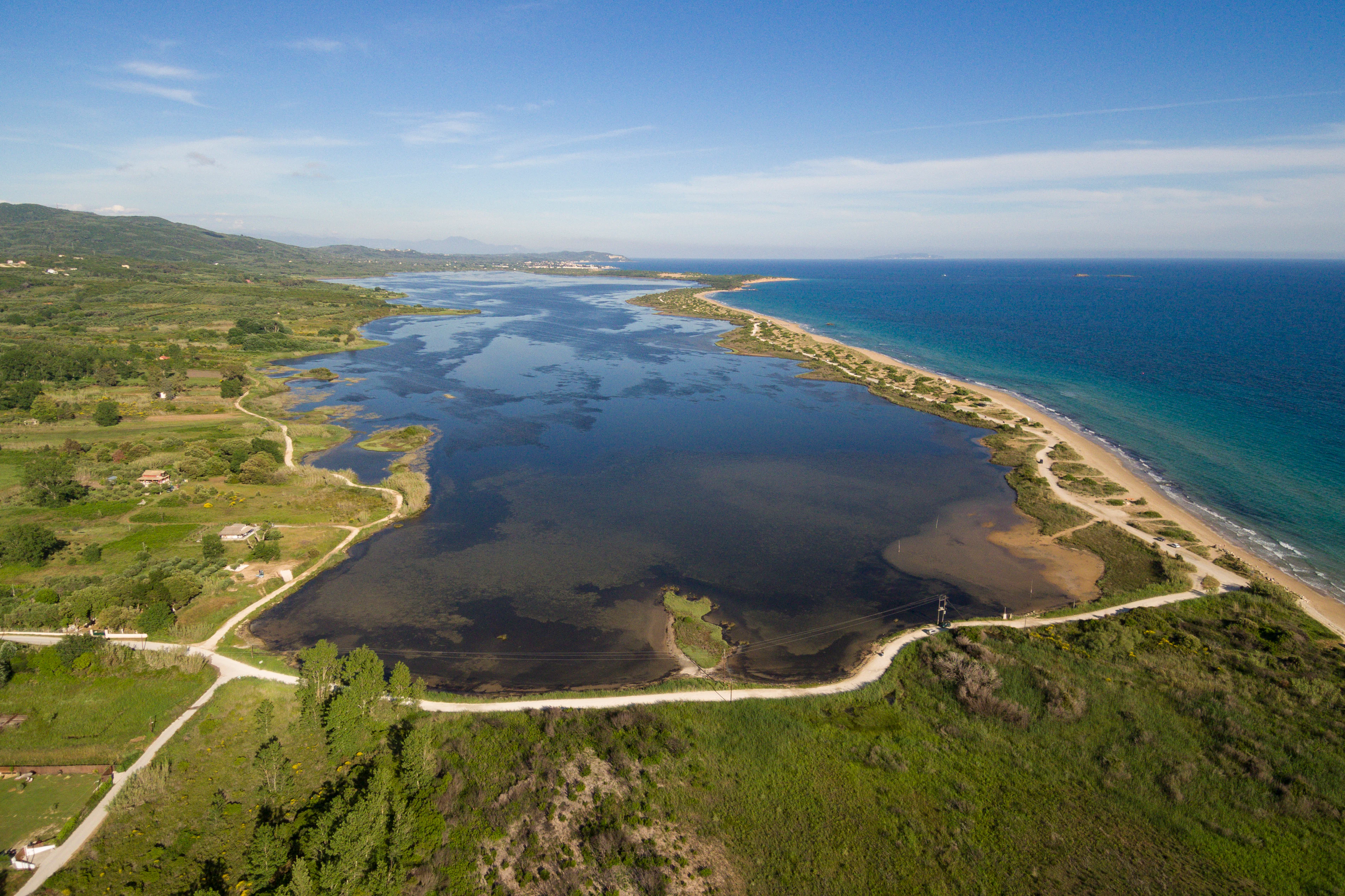
High-angle aerial photograph of Korission Lagoon in Corfu, Greece, with a large, dark-watered lagoon separated from the blue Ionian Sea by a thin, sandy coastal barrier and dunes.
An aerial view of Korission Lagoon, showcasing the separation between the tranquil lagoon waters and the Ionian Sea by a narrow coastal strip.

Korission Lagoon ecosystems, habitats, and plant life

The ecological identity of Korission Lagoon rests on its mosaic of overlapping habitats within a relatively confined area. A freshwater-influenced lagoon is bordered by reed beds, tamarisk fringes and aquatic vegetation including white water lilies, while the seaward side is dominated by tall, mobile sand dunes supporting a specialised juniper forest of Juniperus phoenicea. Together these zones form a gradient from aquatic wetland to dry Mediterranean dune ecosystem, with corresponding shifts in plant communities.

The dune system in particular is ecologically distinctive: a forest of prickly juniper persists here in a setting that is more typically associated with sparse coastal scrub, complemented by dune-dwelling plant life and at least 14 orchid species recorded among the dunes. This makes the Korission dune complex both botanically rich and unusually forested for a Mediterranean sand-dune environment.

Seasonal and migratory dynamics also shape the wetland's character. The lagoon regularly hosts large numbers of waterbirds, including flamingos, cormorants, wigeons and egrets, creating shifts in the bird life present across the year. Freshwater springs feeding the lagoon, in turn, support a small but specialised aquatic fauna, including fish found almost nowhere else.
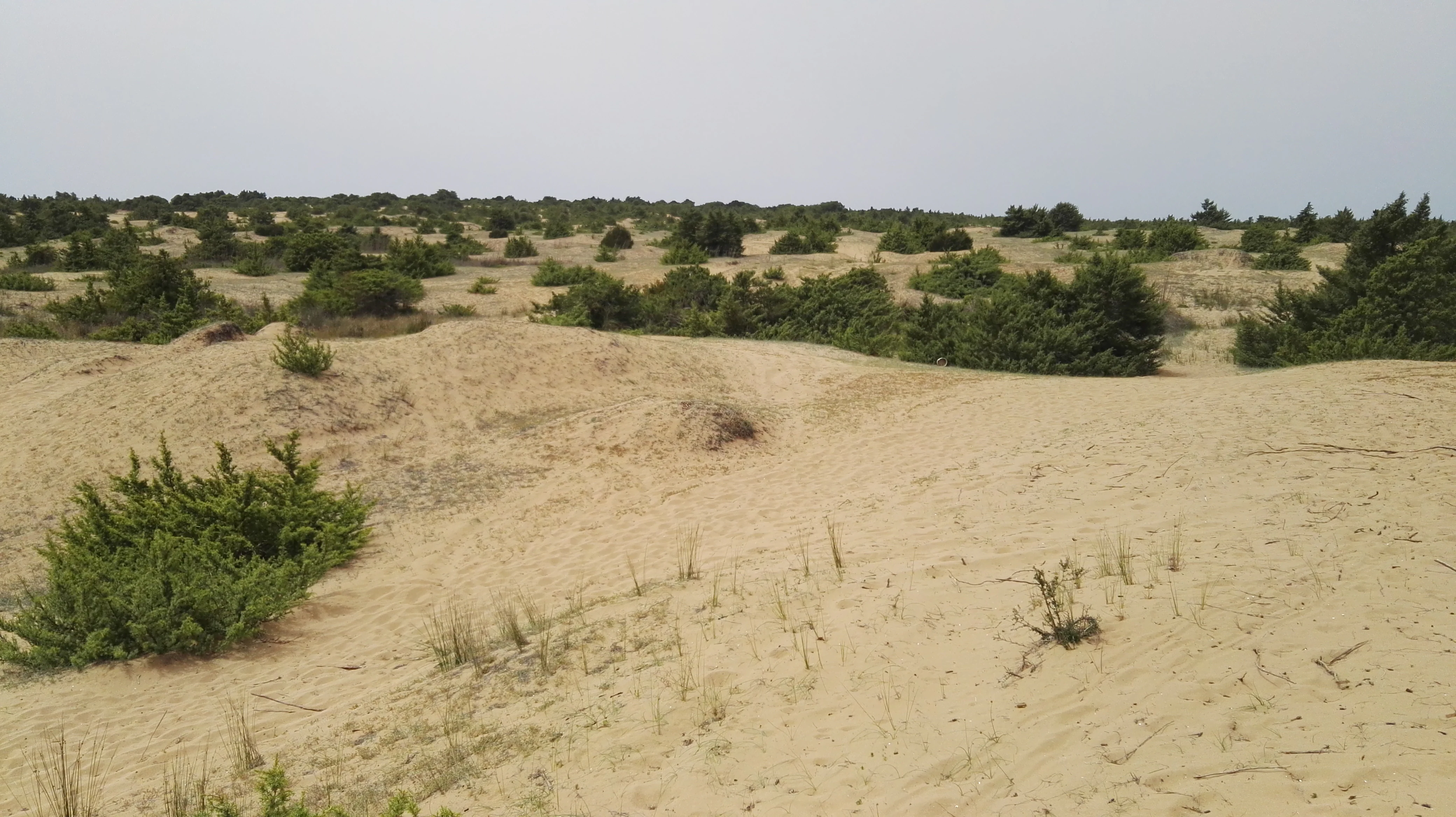
A wide, eye-level shot of a sandy coastal dune landscape dotted with low green shrubs under an overcast sky.
Sand dunes and low-lying shrubs characteristic of the coastal landscape at Korission Lagoon.

Korission Lagoon wildlife and species highlights

Korission Lagoon is one of the most bird-rich sites on Corfu, with more than 126 recorded bird species using the lagoon, its reed beds and the surrounding dune coast. Among the regularly recorded species are great cormorants, Eurasian wigeons, great egrets and greater flamingos, reflecting the lagoon's importance as both a wintering area and a stopover point along migration routes.

The waters of the lagoon and its feeder springs harbour a particularly distinctive fish fauna, highlighted by the endemic Corfu dwarf goby (Knipowitschia goerneri), which has been documented in the lagoon and its associated springs and is not known from anywhere else in the world. Other native fish recorded here include the Mediterranean killifish and the Epiros minnow, both of which depend on the lagoon's relatively undisturbed freshwater conditions.

Reptiles and small mammals also form part of the wider fauna. Tortoises are present in the area, including Hermann's tortoise, the European pond turtle and the Balkan pond turtle, and snakes include the javelin sand boa and the four-lined snake. Among mammals, greater horseshoe bats and long-fingered bats are recorded around the lagoon and its surroundings, while European otters may also be present. The invertebrate fauna includes many butterfly species and the Jersey tiger moth, contributing to the site's broader biodiversity.
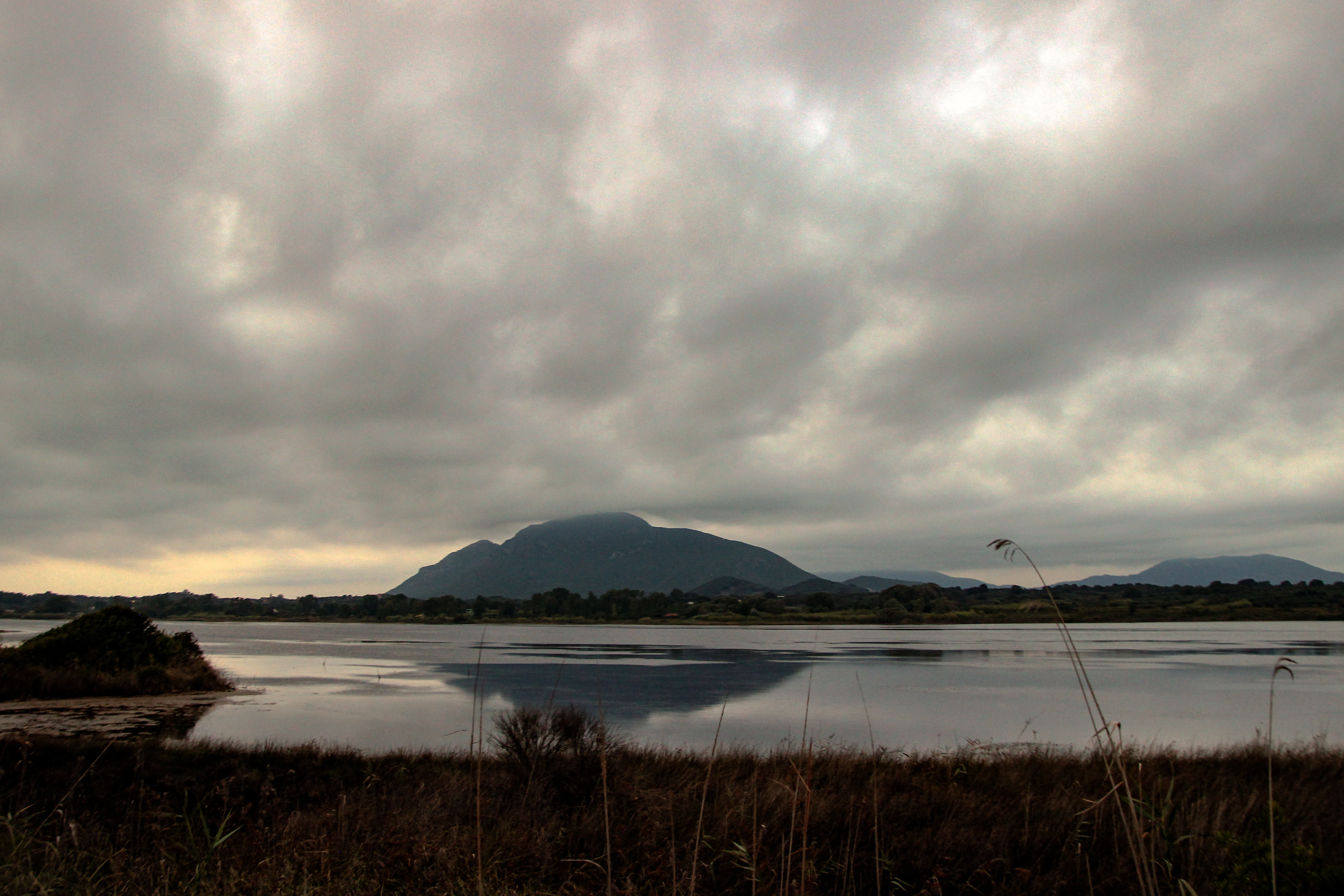
A wide landscape view of Korission Lagoon with a dark, prominent hill in the distance, mirrored in the calm water, under a heavy, overcast sky.
The Kavalovouno hill reflected in the still waters of Korission Lagoon under a cloudy sky.

Korission Lagoon conservation status and protection priorities

Korission Lagoon carries strong formal conservation recognition. The lagoon and its surroundings are designated as a Natura 2000 site under the European network, with the Greek site code GR2230002, protecting habitats such as the coastal lagoon, dune systems, juniper formations and surrounding wetland margins. The area is also classified in Greece as a protected landscape of particular natural beauty (Τοπίο Ιδιαίτερου Φυσικού Κάλλους), adding a national layer of landscape and scenic protection.

The conservation value of the site is closely tied to its biodiversity density. The lagoon supports more than 126 bird species, hosts the only known population of the endemic Corfu dwarf goby, and contains rare orchid-rich dune vegetation and an unusual juniper forest on mobile sands. Protecting these features together is significant because the dune, juniper and lagoon habitats are interdependent: the dunes shelter the lagoon from marine influence, while the lagoon groundwater supports plants along the dune margins.

Recognition at both European and national levels reflects the lagoon's combined ecological, geomorphological and scenic importance, and positions Korission as a key reference site for coastal wetland and dune conservation on the Ionian coast.

Korission Lagoon cultural meaning and human context

Korission Lagoon sits in a part of Corfu where the landscape carries deep cultural and historical layers. The Paleolithic stone and Pleistocene faunal remains recovered from archaeological work around the lagoon demonstrate that humans have interacted with this water body over extraordinarily long timescales, and the area has continued to hold a place in the island's natural and rural heritage.

The local name 'Korissia' and the persistence of traditional vegetation names such as 'cedar' for the juniper forest reflect a long vernacular familiarity with the lagoon's distinctive features. Surrounding settlements such as Agios Mattheos, Chalkounas, Agios Georgios Argyrades and the Issos beach area all relate to a rural and coastal Corfiot way of life that has historically depended on the lagoon margins, dunes and agricultural plain nearby.

Today the site also plays an educational and observational role, drawing naturalists and visitors interested in Corfu's less developed southern coast, where the lagoon forms a cultural and natural landmark distinct from the more heavily built-up northeast of the island.

Top sights and standout views in Korission Lagoon

Korission Lagoon's most distinctive highlight is the unusual meeting of three ecosystems in one place: a freshwater coastal lagoon, a tall sand-dune barrier separating it from the Ionian Sea, and a low forest of prickly juniper, locally called cedar, growing directly on the dunes. Few sites on the Ionian Islands combine these elements so compactly, and it is what gives Korission its strong visual and ecological identity.

Equally notable is the lagoon's biodiversity density: more than 126 bird species, the endemic Corfu dwarf goby, multiple orchid species on the dunes, and important reptile and bat fauna. Combined with its Natura 2000 and Greek protected landscape status and its Pleistocene and Paleolithic archaeological record, the lagoon stands out as a compact showcase of southern Corfu's natural and historical depth.

Best time to visit Korission Lagoon

The character of a visit to Korission Lagoon shifts with the seasons in ways tied closely to water levels, dune conditions and bird presence. Spring is generally rewarding for watching migratory birds arriving and for seeing the surrounding low vegetation and orchids at their freshest, while the lagoon waters tend to be calm and clear under mild weather. Late spring and early summer also bring comfortable temperatures for walking the dune-forest paths and the Chalikouna sand-bar.

Autumn and winter can be especially compelling for birdwatchers, when waterfowl, cormorants, wigeons and flamingos use the lagoon more intensively and the dunes take on a quieter, more austere atmosphere. Summer visits emphasise the contrast between the still lagoon and the lively Ionian Sea just beyond Chalikouna Beach, though midday heat can make dune walking demanding. Across the year, early morning and late afternoon tend to offer the most comfortable conditions for exploring the protected area.
Monthly climate preview

Track monthly weather averages across twelve months of recorded representative coordinate data

Korission Lagoon Climate Normals, Long Term Temperature and Precipitation Patterns

Long term temperature and precipitation measurements illustrate the annual climate rhythm recorded at a representative coordinate within Korission Lagoon. Detailed monthly breakdowns provide deeper insight into temperature ranges and precipitation totals across the entire annual cycle.
Annual mean18 °C
11 °C27 °C
Jan11°
Feb11°
Mar13°
Apr15°
May19°
Jun23°
Jul26°
Aug27°
Sep23°
Oct20°
Nov16°
Dec12°
Warmest month
August

26.6 °C

Coolest month
January

10.9 °C

Wettest month
November

5.4 mm/day

Driest month
July

0.6 mm/day

Park location guide

Geography guide, regional context, and park location map for Korission Lagoon

Korission Lagoon park geography, regions, and map view in Greece

Understand where Korission Lagoon sits in Greece through a broader geographic reading of the surrounding landscape, nearby location context, and its mapped position within the national park landscape.

How Korission Lagoon fits into Greece

Greece, officially the Hellenic Republic, is a country in Southeast Europe occupying the southern Balkans. It borders Albania, North Macedonia, Bulgaria, and Turkey, with coastlines on the Aegean, Ionian, and Mediterranean seas. The country has over 10 million people and is renowned for its ancient Greek heritage, philosophy, democracy, and the Olympic Games.

Wider geography shaping Korission Lagoon in Greece

Greece occupies the southern tip of the Balkan peninsula in Southeast Europe. It shares land borders with Albania to the northwest, North Macedonia and Bulgaria to the north, and Turkey to the east. The Aegean Sea lies to the east of the mainland, the Ionian Sea to the west, and the Sea of Crete and Mediterranean Sea to the south. The country spans thousands of islands across nine traditional geographic regions and has the longest coastline in the Mediterranean basin.

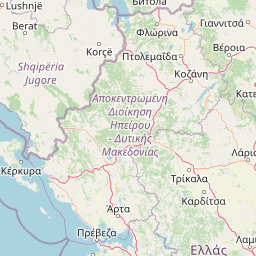
Map view of Korission Lagoon

Use this park location map to pinpoint Korission Lagoon in Greece, understand its exact geographic position, and read its mapped placement within the surrounding landscape more clearly.

Pigeon | © OpenStreetMap contributors

Location context for Korission Lagoon

Ionian Islands

Visual reference for the sand dunes, coastal habitats, and juniper forests of Corfu

Korission Lagoon Photos, Landscapes, and Protected Scenery Views

Korission Lagoon photography reveals the dramatic contrast between still coastal waters, tall mobile sand dunes, and the open Ionian Sea. Visual documentation helps researchers and observers examine the rare juniper woodland and wetland habitats defining this protected landscape.

Aerial view of a coastal lagoon separated from the Ionian Sea by a narrow strip of land and sand dunes under a clear blue sky.

A high angle aerial view showing the edge of a dark, shallow lagoon meeting a shoreline with a winding dirt path and green coastal vegetation.

High-angle aerial photograph of Korission Lagoon in Corfu, Greece, with a large, dark-watered lagoon separated from the blue Ionian Sea by a thin, sandy coastal barrier and dunes.

A wide, eye-level shot of a sandy coastal dune landscape dotted with low green shrubs under an overcast sky.

A wide landscape view of Korission Lagoon with a dark, prominent hill in the distance, mirrored in the calm water, under a heavy, overcast sky.

A wide, eye-level landscape shot of a calm blue lagoon with golden, dry grasses in the foreground and a rolling, hazy mountain range in the distance under a clear blue sky.

Park atlas

Compare regional wetland habitats, coastal dunes, and protected areas across the surrounding region

Exploring Parks Near Korission Lagoon and Other Protected Landscapes

Visitors exploring Korission Lagoon can browse nearby protected areas and coastal nature reserves to compare regional wetland habitats. Extending the geographic review provides a wider perspective on Mediterranean dune systems, bird migration corridors, and island ecosystems.
Watercolor landscape painting showing a lake, distant mountains, and vegetation
National parkVlorë County
About 27 km away#1 closest

North

Butrint National Park: Archaeological Heritage and Mediterranean Wetland Landscape

Explore its unique geography and protected park boundaries.

Butrint National Park presents a singular opportunity for geographic and protected-area discovery, showcasing an unparalleled fusion of ancient history and ecological richness. Located in Albania's Vlorë County, this national park encompasses Lake Butrint, coastal lagoons, and vital wetland habitats, recognized internationally for their biodiversity. Through MoriAtlas, users can explore the mapped extent of this unique landscape, understand its role within regional geography, and uncover the interplay between its preserved archaeological sites and the surrounding Mediterranean environment.

Area
94.244 km²
Established
2000
IUCN
II
Relief
Lowland
A soft, horizontal watercolor painting showing a serene landscape with a body of water in the foreground, surrounded by grasses and bushes, with rolling hills in the background.
Natural monumentVlorë County
About 58 km away#2 closest

Northeast

Blue Eye Natural Monument: Protected Karst Geography in Vlore County

A study of Albania's most prominent karst spring and woodland ecosystem.

The Blue Eye is a protected natural monument in southern Albania featuring a powerful, deep karst vent and vivid blue basin. This site acts as the headwater for the Bistrice River and supports a diverse forest ecosystem of oak and sycamore. The surrounding karst terrain and hydrology offer a focused look at the environmental geography of the Ionian watershed.

Area
1.8 km²
Established
1996
IUCN
III
Relief
Upland
Watercolor painting depicting mountains, forests, and valleys
National parkVlorë County
About 90 km away#3 closest

North

Llogara National Park: Vlorë County's Dramatic Ceraunian Mountain Protected Landscape

Explore Albania's rugged national park geography and mapped terrain.

Llogara National Park stands as a vital protected area within Vlorë County, Albania, renowned for its spectacular Ceraunian Mountain topography. This page provides access to detailed geographic information, highlighting the park's unique landscape characteristics, from alpine peaks to coastal vistas. Discover the mapped extent of this national park and its significance within the regional geography, perfect for structured atlas exploration.

Area
17.69 km²
Established
1966
IUCN
II
Relief
Mountain
Watercolor painting showing a river valley with mountain ranges in the background and green fields
National parkGjirokastër County
About 91 km away#4 closest

North

Vjosa Wild River National Park: Europe's Pioneer Free-Flowing River Protected Area

Mapping dynamic canyons and vital river ecosystems in Gjirokastër County.

Vjosa Wild River National Park is recognized as Europe's first Wild River National Park, a groundbreaking designation protecting an entire river system from source to sea. This protected area in Gjirokastër County preserves remarkable topography, including dramatic canyons, natural rapids, and meandering islands, all shaped by the free flow of the Vjosa River and its tributaries. Explore the mapped boundaries and unique landscape context of this significant biodiversity hotspot, offering a crucial case study for river conservation and atlas discovery.

Area
127.27 km²
Established
2023
IUCN
II
Relief
Mixed relief
National parkGreece
About 91 km away#5 closest

Northeast

Vikos-Aoös National Park: Deepest Gorge and Protected Mountain Landscape Atlas

Discover protected area boundaries and regional geography in Epirus.

Vikos-Aoös National Park in Greece's Pindus mountains is a premier destination for exploring dramatic natural geography. Best known for the Vikos Gorge, considered the world's deepest canyon relative to its width, the park also features towering alpine peaks like Mount Tymphe, glacial lakes such as Drakolimni, and rich botanical diversity. As a UNESCO Geopark and part of the Natura 2000 network, it safeguards critical habitats, including significant brown bear populations. This park offers a profound look into protected landscapes, offering detailed geographic context and mapped terrain for atlas-based discovery.

Area
126 km²
Established
1973
IUCN
II
Visitors
100K annual
A watercolor painting showing a river winding through a mountainous gorge with a stone arch bridge on the right bank.
National parkEpirus
About 92 km away#6 closest

Northeast

Northern Pindus National Park: A Geographic Survey of Mountain Landscapes in Epirus Greece

Mapped terrain, karst river gorges, and alpine forest ecosystems.

Northern Pindus National Park preserves an extensive mountain environment characterized by steep limestone ridges, the profound Vikos Gorge, and glacial lake basins. Located in the Pindus range of Epirus, this area offers deep insight into the intersection of geological processes, rare wildlife habitats, and traditional human settlements integrated into the mountainous terrain.

Area
157.4 km²
Established
2005
IUCN
II
Relief
Mountain
Watercolor painting of a landscape with green fields, scattered trees, and rolling hills under a light sky
National parkGjirokastër County
About 105 km away#7 closest

Northeast

Fir of Hotovë-Dangëlli National Park: Ancient Forests & Mountain Wilderness Atlas

Explore a premier protected landscape in Gjirokastër County, Albania.

Fir of Hotovë-Dangëlli National Park stands as a monumental protected area, celebrated for its exceptional old-growth Hotova Fir forests, which are a rare Mediterranean plant relic. This national park in Gjirokastër County offers a detailed look at a vast mountainous terrain, featuring dramatic canyons like Lengarica Canyon, and serving as a critical habitat for diverse wildlife. MoriAtlas provides structured geographic context for this significant landscape, highlighting its mapped boundaries and role as a key component of regional protected area networks.

Area
360.038 km²
Established
2008
IUCN
II
Relief
Mountain
A soft watercolor painting of a coastal landscape with green hills meeting a light, abstract water or shoreline, with faint mountains in the background.
Nature reserveVlorë County
About 109 km away#8 closest

Northwest

Karaburun Peninsula Nature Reserve: Mapping the Coastal Karst and Marine Landscapes

Protected rugged cliffs in Vlorë County, Albania

Karaburun Peninsula is a significant protected area defined by high limestone ridges and a heavily indented western shoreline. The terrain features numerous sea caves, historic bays, and prominent headlands that descend directly into the sea. As a vital nature reserve, it preserves the natural integrity of this mountainous coastal stretch within Vlorë County, offering a clear geographic overview of one of Albania's most remote wilderness areas.

Area
62 km²
Relief
Mountain
Climate
Mediterranean
Access
Moderate access

Common questions about visiting, size, designation, and location context for Korission Lagoon

Korission Lagoon FAQs for park facts, access, geography, and protected area context

Find quick answers about Korission Lagoon, including protected-area facts, park geography, trail and visitor context, and how the park fits into its surrounding country and regional landscape.
MoriAtlas Explorer

Continue Your Protected Areas Search Across the Global Atlas

Deepen your exploration by continuing the structured search for national parks and protected areas worldwide. Utilize the comprehensive filtering capabilities to compare different conservation landscapes and refine your understanding of global park geography. Discover more about the distribution and characteristics of protected natural areas.

Global natural geography