Mori Atlas logo
Protected landscapeKosmaj

Uncover the mapped geography, dense forests, and historic Serbian landscape of Kosmaj.

Kosmaj Protected Landscape: Serbia's Distinctive Island Mountain Near Belgrade

Kosmaj stands as a significant protected landscape and a unique island mountain rising from the Šumadija lowlands near Serbia's capital, Belgrade. As the highest point within the Belgrade City area at 626 meters, its three distinct peaks—Mali Vis, Goli Vis, and Rutavi Vis—shape a recognizable silhouette against the regional geography. This protected area, primarily composed of beech and oak forests, offers valuable insights into the mapped terrain, watershed origins, and the rich geological history of an ancient Pannonian Sea remnant, perfect for structured atlas exploration.

MountainForestIsland MountainProtected LandscapeHikingMonasteries
Stylized illustration showing a mountainous landscape with a winding river, cliffs, forests, and yellow wildflowers

Kosmaj

Protected landscape

Park overview

Structured park overview, official facts, and landscape profile for Kosmaj

Kosmaj park facts, protected area profile, and essential visitor context
Review the core facts for Kosmaj, including designation, size, terrain, visitor scale, habitats, and operating context in one park-focused overview.

About Kosmaj

Kosmaj mountain represents a unique blend of natural and cultural heritage within the Belgrade metropolitan region. As the highest point in the city area at 626 meters, it offers both residents and visitors a accessible mountain experience without the need for extensive travel. The mountain's identity as an 'island mountain' stems from its geological history—when the Pannonian Sea retreated 600,000 years ago, Kosmaj remained as one of several isolated peaks rising from the surrounding lowlands, a classification it retains today as the plateaux around it remain low and predominantly flat.

The mountain's cultural significance is profound, with three surviving monasteries—Kastaljan, Pavlovac, and Tresije—forming a religious complex colloquially known as 'Kosmaj's Mount Athos.' These monastic establishments, connected historically to the medieval Serbian despot Stefan Lazarević, anchor the mountain's spiritual heritage. The mountain also bears testimony to its industrial past through extensive ancient mining operations, with an estimated 100 shafts extending two kilometers underground and spanning 25 kilometers, representing one of the Roman Empire's most important mining centers.

Modern Kosmaj functions as a multi-use protected landscape offering hiking, cycling, hunting, and cultural tourism opportunities. The proximity to Belgrade has fostered the development of village tourism in surrounding settlements and weekend excursion culture. The mountain's gentle slopes, forest paths, and panoramic viewpoints make it a popular destination for outdoor recreation while its monasteries, monuments, and historic sites provide cultural enrichment.

Quick facts and research context for Kosmaj

Kosmaj rises 626 meters above sea level as the tallest peak in the Belgrade metropolitan area, situated roughly 40 kilometers southeast of the city center. As an island mountain in the Šumadija region, it dominates the otherwise flat terrain that once comprised the floor of the ancient Pannonian Sea. The mountain encompasses three peaks and supports over 70% forest cover, primarily beech and oak woodlands that create a lush green landscape accessible to Belgrade residents. Historically, Kosmaj was one of the most significant mining centers in the Roman Empire, with evidence of iron ore extraction dating to pre-Roman times and extensive underground workings extending kilometers below the surface.

Park context

Deeper park guide and search-rich context for Kosmaj

Kosmaj history, landscape, wildlife, and travel context
Explore Kosmaj through its history, landscape character, ecosystems, wildlife, conservation priorities, cultural context, and seasonal travel timing in a structured park guide built for atlas discovery and search intent.

Why Kosmaj stands out

Kosmaj is best known as one of two 'Belgrade mountains' alongside Avala, serving as the city's most prominent natural elevated recreational area. The mountain is renowned for its dense deciduous forests covering the steeper slopes, its network of three historic monasteries dating to the 14th century, and the WWII partisan monument standing atop the Mali Vis peak. The area is also notable for its extraordinary biodiversity, including 17 species of clearwing moths found nowhere else in Serbia, and its status as a protected landscape of outstanding features covering over 3,500 hectares.

Wooden observation tower with red-tiled roof under blue sky with clouds, surrounded by green trees and a pathway
Kosmaj mountain observation tower with red-tiled roof and wooden upper structure

Kosmaj history and protected-area timeline

Kosmaj's human history spans millennia, beginning with Celtic inhabitants who likely gave the mountain its name from the word 'cos' meaning forest. The Romans later rechristened the mountain 'Casa Maias' to align with their goddess of spring Maia, using it as an important mining center. Archaeological evidence indicates iron ore extraction predated Roman arrival, while the Romans established extensive operations extracting silver, iron, and lead, administered by procurator Babenius whose name survives in the modern village of Babe.

Medieval Serbian mining began around 1420 following Despot Stefan Lazarević's mining law of 1412. The mountain's monasteries—Pavlovac built between 1415-1419, Tresije established in 1309, and Kastaljan dating to the early 14th century—became spiritual and cultural centers connected to Stefan Lazarević, who tragically died crossing the mountain in 1427. The monastery of Pavlovac served as a final gathering point for Serbs fleeing during the Great Migration of 1690 before crossing into Austria.

In modern times, the mountain gained protected status in 2005 as a landscape of outstanding features. A notable 2022 controversy saw the company Serbia Zijin Bor Copper surveying the mountain for potential mining, sparking public protests that led to the immediate cessation of exploration activities.

Kosmaj landscape and geographic character

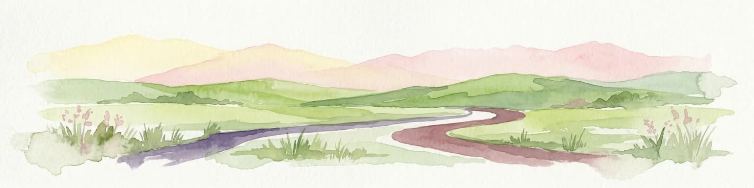
Kosmaj's landscape is defined by its character as a low island mountain rising from the Šumadija lowlands. The mountain extends approximately 5.5 kilometers in length with a crescent-shaped main ridge running southwest to northeast. Three distinct peaks break the ridge—Mali Vis (the small one), Goli Vis (the naked one), and Rutavi Vis (the hairy or bushy one)—each contributing to the mountain's recognizable silhouette against the Belgrade skyline.

The terrain varies significantly across the mountain. Steeper slopes are blanketed in deciduous forest, primarily beech and oak with patches of planted conifers, while gentler slopes support grass-covered meadows. The foothills give way to orchards and arable agricultural fields in the surrounding villages. The mountain's geology—comprising flysch, serpentine, and magmatic rocks—creates varied terrain conditions and influences the vegetation patterns across different areas.

Several rivers originate from Kosmaj's slopes, contributing to the broader watershed. The Turija river and its tributaries spring from below the mountain's western face, flowing into the Kolubara. The eastern slopes give rise to the Lug, Ralja, and Topčiderka rivers, the latter flowing directly into urban Belgrade. The Parcanski vis extension in the northwest reaches 408 meters and connects to the wooded area of Lipovička šuma.

Close-up view of the Kosmaj Monument's angular wooden and metal beams against a partly cloudy sky
Close-up of the Kosmaj Monument's angular beams against a partly cloudy sky

Kosmaj ecosystems, habitats, and plant life

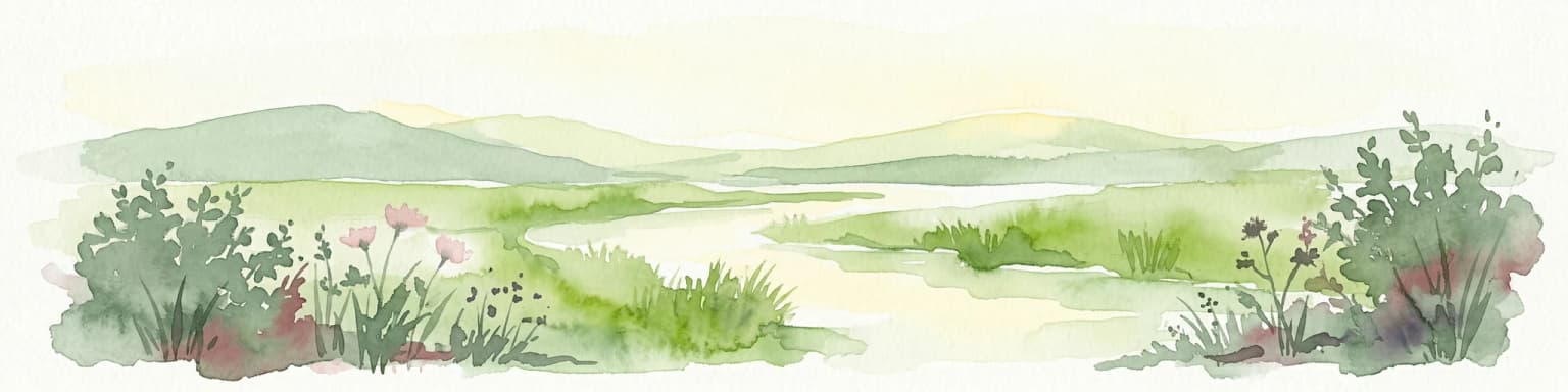
Kosmaj supports exceptionally rich biodiversity within its protected boundaries. The mountain hosts 551 plant species and 300 fungi species, with approximately 150 plant species having medicinal or edible uses. The forest ecosystem is predominantly deciduous, with beech and oak forming the natural spontaneous woodland that covers over 70% of the mountain. Coniferous patches exist but were largely planted by humans rather than occurring naturally.

The flora includes several notable species: bear's garlic (Allium ursinum), woodland strawberry, blackberry, and cornelian cherry grow wild in the forested areas. The endangered larkspur (Delphinium phissum) appears on the Red List, while the mountain supports 30 relic species, 10 sub-endemics, 25 endangered taxa, and 60 species under strict control for use and trade. Among fungi, 80 species are edible, 17 medicinal, and 11 poisonous.

The ecosystem supports significant wildlife populations including 13 amphibian species, 11 reptile species, 51 mammal species, and 96 bird species. Of particular note are 17 newly discovered species of clearwing moths that exist nowhere else in Serbia, making Kosmaj their sole known habitat. The mountain also hosts the corn crake, a rare species in Serbia that appears on the Red List.

Panoramic landscape view showing a forested mountain with lush green trees, communication towers on the left, and a blue sky with scattered clouds
Panoramic view of Kosmaj mountain with dense forest and communication towers

Kosmaj wildlife and species highlights

The wildlife communities on Kosmaj reflect the diversity of its forest and meadow habitats. Among the more commonly encountered species are hares, roe deer, pheasants, foxes, squirrels, hedgehogs, partridges, and quails, forming the visible mammalian and avian fauna that visitors encounter on walks and hikes through the mountain's trails.

The mountain supports significant bird diversity with 96 species recorded, including the corn crake—a Red Listed species that is rare within Serbia. Mammal populations include 51 species ranging from small rodents to larger species, though wolves, once present on Kosmaj, have been extinct from the mountain for some time. The reptile and amphibian communities contribute another 24 species to the overall biodiversity.

Particularly distinctive is the presence of 17 species of clearwing moths (Sesiidae family) newly discovered on Kosmaj, representing what appears to be their only habitat in Serbia. This makes the mountain significant for lepidoptera conservation within the country. The hunting tradition on the mountain also supports populations of game species including hares, roe deer, pheasants, and partridges, with specific areas designated as hunting grounds.

Wide landscape view from a mountain overlooking a valley with fields, scattered houses, and distant hills under a partly cloudy sky
Panoramic view of the valley from Kosmaj mountain

Kosmaj conservation status and protection priorities

Kosmaj received formal protected status in 2005 when a landscape of outstanding features was declared, covering 3.5145 hectares spread across the municipalities of Mladenovac and Sopot. The protected area encompasses villages including Amerić, Koraćica, Velika Ivanča, Rogača, and Nemenikuće, with the terrain divided into two levels of protection (levels II and III) reflecting different conservation intensities across the area.

The conservation significance extends beyond the formal protected zone. Together with Avala, Veliko Ratno Ostrvo, and Stepin Lug, Kosmaj forms part of Belgrade's circle of protected green areas—a network of natural spaces providing ecological, recreational, and aesthetic benefits to the metropolitan population. The mountain's biodiversity, including endemic species like the clearwing moths and endangered plants like the larkspur, contributes to Serbia's natural heritage conservation.

The 2022 mining exploration controversy demonstrated both the ongoing pressures on the mountain's natural values and strong public sentiment for their protection. The rapid public response to the proposed mining surveys resulted in immediate cessation of exploration activities, highlighting the mountain's importance to local communities and environmental consciousness in Serbia.

Kosmaj cultural meaning and human context

Kosmaj's cultural landscape centers on its network of three surviving medieval monasteries—Kastaljan, Pavlovac, and Tresije—forming what is colloquially known as 'Kosmaj's Mount Athos' due to the concentration of religious structures. These monasteries are historically linked to the medieval Serbian ruler Stefan Lazarević, who died on the mountain in 1427 while hunting. A cenotaph marking his death site stands near the Church of Saint Elijah in Nemenikuće.

The monasteries reflect different periods and styles. Kastaljan, built in the early 14th century on Roman castrum foundations, is now in ruins following demolition in the late 17th century. Pavlovac, constructed between 1415 and 1419 in the Morava architectural school style, survived multiple destructions and was fully restored in 1990. Tresije, founded in 1309 by King Stefan Dragutin, experienced repeated destruction and reconstruction, with its current konak built beginning in 1991 using a foundation stone brought from Mount Athos.

The mountain also bears wartime heritage. A monument to the Kosmaj Partisan Detachment from World War II stands on Mali Vis peak, while a WWI memorial ossuary at Beli Kamen commemorates members of the Timok Division who defended Belgrade in 1914. The mountain's villages support cultural traditions including annual festivals celebrating folk music, cuisine, and local products.

Yellow flower spikes with brown seed pods in a grassy field with trees in background
Yellow flowering plants on the grassy slopes of Kosmaj

Top sights and standout views in Kosmaj

Kosmaj offers a distinctive combination of accessible natural beauty, historical depth, and biodiversity significance within the Belgrade metropolitan area. The mountain's 626-meter summit provides panoramic views across the Šumadija lowlands, while the network of forest trails through beech and oak woodlands creates excellent hiking and cycling opportunities. The three historic monasteries—Pavlovac, Tresije, and Kastaljan—preserve medieval Serbian religious architecture and connect visitors to the era of Despot Stefan Lazarević.

The mountain's ecological significance is remarkable for its proximity to a major city, with 17 clearwing moth species found nowhere else in Serbia, over 550 plant species, and diverse wildlife communities. The protected landscape status ensures preservation of these values while allowing compatible recreational use. The wartime monuments add historical weight to the visitor experience, while the surrounding villages offer opportunities for rural tourism and local hospitality.

Wide landscape view of Kosmaj mountain showing the mountain peak with a tower, surrounded by rolling hills, agricultural fields, and scattered houses under a partly cloudy sky
Panoramic view of Kosmaj mountain with surrounding hills and fields

Best time to visit Kosmaj

Kosmaj can be visited year-round, though spring and autumn offer the most pleasant conditions for outdoor exploration. The forest trails are particularly attractive in late spring when bear's garlic carpets the woodland floor and again in autumn when the beech and oak foliage displays rich colors. Summer months can be warm but the forest shade provides relief, while winter offers a different character with snow-dusted peaks visible from Belgrade.

The monastery festivals and cultural events, including the Bear's Garlic Festival established in 2023 and the 'Under the linden trees of Tresije monastery' gathering, provide seasonal highlights. Weekend visits are popular due to the mountain's proximity to Belgrade, making it a convenient escape for city residents seeking nature, history, and outdoor activity without extensive travel planning.

Park location guide

Geography guide, regional context, and park location map for Kosmaj

Kosmaj park geography, regions, and map view in Serbia
Understand where Kosmaj sits in Serbia through a broader geographic reading of the surrounding landscape, nearby location context, and its mapped position within the national park landscape.

How Kosmaj fits into Serbia

Serbia is a landlocked country in Southeast and Central Europe, bordered by eight neighboring countries. With a population of approximately 6.6 million, it operates as a unitary parliamentary republic with Belgrade as its capital. The country has a rich history dating back to medieval statehood in the 7th century and has been independent since 2006 following the dissolution of Serbia and Montenegro.

Wider geography shaping Kosmaj in Serbia

Serbia is a landlocked country in the Balkans, spanning parts of Southeast and Central Europe. It occupies a strategic position in the heart of the Balkan Peninsula, bordered by Hungary to the north, Romania to the northeast, Bulgaria to the southeast, North Macedonia to the south, Croatia to the northwest, Bosnia and Herzegovina to the west, and Montenegro to the southwest. The terrain varies from rolling plains in the north to mountainous regions in the south and east.

Map view of Kosmaj

Use this park location map to pinpoint Kosmaj in Serbia, understand its exact geographic position, and read its mapped placement within the surrounding landscape more clearly.

Pigeon | © OpenStreetMap contributors

Location context for Kosmaj

BelgradeMladenovacSopot

A Visual Guide to Kosmaj's Island Mountain Terrain, Habitats, and Distinctive Protected Landscape

Kosmaj Photos: Mountain Landscapes, Forest Scenery, and Protected Area Views
Browse comprehensive imagery of Kosmaj Mountain to visually understand its distinctive island mountain character, dense deciduous forests, and panoramic views across the Šumadija lowlands. This visual collection offers essential geographic context for appreciating the protected area's varied terrain, from its three peaks to historic monasteries and rich wildlife habitats.

Wooden observation tower with red-tiled roof under blue sky with clouds, surrounded by green trees and a pathway

Wide landscape view of a winding river through a valley surrounded by green hills and rocky terrain with yellow flowers in foreground.

Close-up view of the Kosmaj Monument's angular wooden and metal beams against a partly cloudy sky

Panoramic landscape view showing a forested mountain with lush green trees, communication towers on the left, and a blue sky with scattered clouds

Wide landscape view from a mountain overlooking a valley with fields, scattered houses, and distant hills under a partly cloudy sky

Sunrise over Kosmaj mountain with misty landscape and trees in the foreground

Yellow flower spikes with brown seed pods in a grassy field with trees in background

Wide landscape view of Kosmaj mountain showing the mountain peak with a tower, surrounded by rolling hills, agricultural fields, and scattered houses under a partly cloudy sky

Green fields, trees, and a mountain under a cloudy sky.

Park atlas

Trace the mapped geography of protected landscapes surrounding Kosmaj and compare diverse natural areas in central Serbia.

Explore Nearby Parks and Protected Areas Beyond Kosmaj Mountain, Serbia
Continue your exploration from Kosmaj by browsing other national parks and significant protected landscapes across the Belgrade area and the broader Šumadija region of Serbia. Gain a deeper understanding of regional park geography and protected land distribution by comparing diverse terrains, forest reserves, and unique conservation sites.
Watercolor painting of a landscape featuring rolling hills, a lake, trees, and a sky with clouds
Natural monument

Avala Natural Monument: Iconic Protected Landscape and Regional Geography Near Belgrade

Explore Avala's mapped terrain and natural monument significance.

Avala Natural Monument offers a unique protected landscape and significant geographic context for the Belgrade metropolitan area. As one of Serbia's oldest protected natural sites, its distinct mountain terrain, geological composition, and panoramic views provide a rich subject for atlas-based discovery. Explore the mapped boundaries and natural features that define this prominent Serbian natural monument.

Area
5.01 km²
Established
1859
Relief
Mountain
Climate
Temperate
Watercolor illustration depicting a landscape with mountains, a winding river, and grassy fields
Protected landscape

Vršac Mountains Protected Landscape: A Unique Pannonian Island Mountain Range in Serbia

Explore distinct geological formations and rich avian habitats.

The Vršac Mountains Protected Landscape offers a unique geographic perspective as one of Serbia's Pannonian island mountains, emerging dramatically from the surrounding plains. This protected area is recognized for its striking gneiss and schist formations, its status as Vojvodina's highest elevation, and its exceptional importance for birdwatching, hosting over 120 species. Delve into the mapped terrain and geological character that distinguish this vital natural region.

Area
170 km²
Established
1982
Relief
Mountain
Climate
Temperate
Protected area

Jegrička Nature Park: Mapped Protected Area with Riverine Wetland Ecosystems

Explore the geography and protected landscape of Jegrička Nature Park.

Jegrička Nature Park is a designated protected area recognized for its significant riverine wetland character within the Pannonian Plain of northern Serbia. The park's landscape is defined by the meandering Jegrička river, extensive marshlands, and riparian vegetation, serving as crucial freshwater habitat for diverse waterfowl and migratory bird populations. This page offers detailed geographic context and atlas-level exploration of its protected boundaries and ecological importance within Eastern Europe's broader natural heritage.

Relief
Lowland
Scope
Mixed
Water
Major water bodies
Watercolor painting showing a river canyon with mountains in the background and green vegetation in the foreground
National park

Drina National Park: Bosnia and Herzegovina's Protected Canyon and Endemic Ecosystem

Explore mapped geography and natural landscapes in this Balkan national park.

Drina National Park is a protected area in eastern Bosnia and Herzegovina, celebrated for its striking Drina River canyon landscape. As a national park, it preserves vital habitats for endemic species such as the Serbian spruce and provides a crucial geographic anchor for regional conservation. Its deep gorges and steep slopes offer a rich context for understanding the natural terrain and mapped boundaries within the broader Balkan geography.

Area
63.15 km²
Established
2017
IUCN
II
Relief
Mountain
National park

Tara National Park: Endemic Flora and Dramatic Dinaric Alps Geography

Discover Serbia's iconic protected mountain landscape and its unique botanical heritage.

Tara National Park is a significant protected area in Serbia, celebrated for its exceptional botanical value and dramatic mountainous terrain. It is the last refuge for Pančić's spruce, a living fossil conifer, and hosts a remarkable diversity of Balkan flora. The park's landscape is defined by steep limestone cliffs, deep river valleys like the Drina canyon, and expansive forest ecosystems, offering a unique geographic study of protected lands. Explore its mapped features and discover a vital conservation area within the Dinaric Alps.

Area
249.92 km²
Established
1981
Relief
Mountain
Climate
Temperate
Watercolor illustration showing rolling hills, a river, trees, and distant mountains
Protected landscape

Zlatibor Protected Landscape: Explore its Mapped Geography and Unique Alpine Meadows

Discover Dinaric Alps protected terrain and landscape context.

Zlatibor Protected Landscape offers a distinct exploration of mountainous terrain and protected natural areas in Serbia. Situated in the Dinaric Alps, its landscape is defined by rolling upland plateaus, dense coniferous forests, and open alpine meadows, creating a visually rich environment. The park's geography includes notable karst features and extensive cave systems, complemented by the natural boundaries of significant rivers. Delve into the mapped protected area to understand its landscape character, from the highest peak at Tornik to the unique geological formations and the rare endemic pine subspecies, providing a concrete geographic perspective for atlas-based discovery.

Area
0.419 km²
Established
2017
IUCN
VI
Relief
Mixed relief
National park

Đerdap National Park: Europe's Grandest River Gorge and Protected Landscape

Explore Serbia's largest national park along the Danube River.

Đerdap National Park is defined by the Iron Gate, Europe's longest and most dramatic river gorge, a geological marvel carved through the Carpathian Mountains. This protected area showcases a complex karst landscape with towering cliffs, deep river sections, and rich biodiversity, including vital Tertiary relict species. The park's vastness and unique terrain offer a profound geographic context for understanding regional natural landscapes and conservation efforts. Explore its mapped boundaries and ecological significance.

Area
637.87 km²
Established
1974
IUCN
II
Relief
Mountain
Watercolor illustration of a river flowing through a valley with mountains in the background
Protected landscapeRomania

Iron Gates Natural Park: Explore Romania's Protected Landscape and Geographic Context

Detailed atlas view of a protected landscape in Romania.

Uncover the geographic dimensions of Iron Gates Natural Park, a protected landscape situated in Romania. This detailed entry offers an atlas-centric exploration of its mapped boundaries and regional setting, facilitating a deeper understanding of its protected status and landscape features within the national geography. Discover the park's intrinsic value through structured geographic data and visual map context.

Area
1,156.66 km²
Established
2000
Relief
Mixed relief
Climate
Mediterranean

Common questions about visiting, size, designation, and location context for Kosmaj

Kosmaj FAQs for park facts, access, geography, and protected area context
Find quick answers about Kosmaj, including protected-area facts, park geography, trail and visitor context, and how the park fits into its surrounding country and regional landscape.
MoriAtlas Explorer

Continue Your Protected Areas Search Across the Global Atlas

Deepen your exploration by continuing the structured search for national parks and protected areas worldwide. Utilize the comprehensive filtering capabilities to compare different conservation landscapes and refine your understanding of global park geography. Discover more about the distribution and characteristics of protected natural areas.

Global natural geography