
Mori Atlas logo
National parkKrasnoyarsk Pillars

Discover the geographic boundaries and mapped terrain of this Siberian national park.

Krasnoyarsk Pillars National Park: A Protected Landscape in Krasnoyarsk Krai

(Krasnoyarsk Stolby National Park)

Krasnoyarsk Pillars National Park stands as a significant protected area within the expansive geography of Krasnoyarsk Krai, Russia. As a key component of the Siberian landscape, this national park offers a distinct focus for atlas-based exploration. Users can delve into the mapped boundaries and regional context of Krasnoyarsk Pillars, understanding its place within one of Russia's largest federal subjects and appreciating its unique natural terrain through structured geographic data.

Rock formationsTaigaNational parkSiberiaClimbingEastern Sayan Mountains
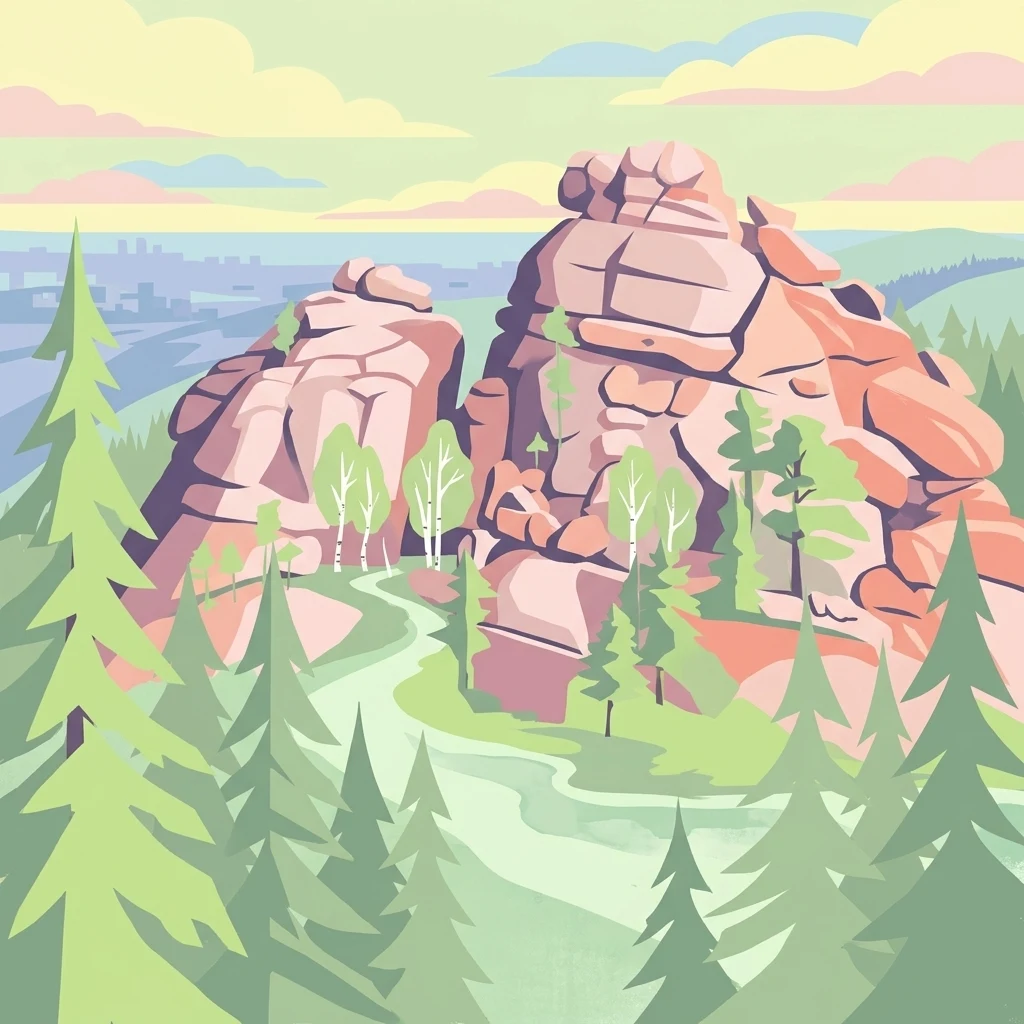
Illustration showing rock pillars surrounded by pine trees with a winding path

Krasnoyarsk Pillars

National park

Park overview

Structured park overview, official facts, and landscape profile for Krasnoyarsk Pillars

Krasnoyarsk Pillars park facts, protected area profile, and essential visitor context

Review the core facts for Krasnoyarsk Pillars, including designation, size, terrain, visitor scale, habitats, and operating context in one park-focused overview.

About Krasnoyarsk Pillars

Krasnoyarsk Pillars National Park occupies a remarkable position at the interface between Siberia's vast taiga forests and the rugged foothills of the Eastern Sayan Mountains. The park's defining characteristic is the array of dramatic rock pillars that emerge from the forested landscape, creating a spectacular contrast of vertical stone against green forest and open sky. These formations have been shaped by centuries of weathering and erosion, resulting in the distinctive spires and cliffs that draw climbers and hikers from across Russia and beyond. The park encompasses approximately 47,000 hectares of protected land, with the Bazaikha River forming its northeastern boundary and the Mana River marking the southern edge. Beyond the famous rock formations, the park preserves substantial tracts of intact East Siberian taiga, home to populations of sable, Siberian musk deer, and other characteristic species. The area has been a cultural landmark for Krasnoyarsk residents for generations, serving as both a recreational outlet and a spiritual connection to the natural world. The transition from zapovednik to national park status in 2019 expanded access opportunities while maintaining conservation protections for this ecologically and culturally significant landscape.

Quick facts and research context for Krasnoyarsk Pillars

Located in the heart of Siberia's East Siberian taiga ecoregion, Krasnoyarsk Pillars protects a unique mountainous landscape where dramatic rock pillars rise from the forest. The park lies along the Bazaikha River to the northeast and Mana River to the south, bordering the city of Krasnoyarsk. The climate is subarctic with mild summers and cold, snowy winters. The area has been a recreational destination for residents of Krasnoyarsk for over 150 years, with climbing and hiking being traditional activities. The park is divided into an accessible tourist zone (Straight Stolby) and a restricted wilderness area (Wild Stolby).

Protection and recognition

Verifying official terrestrial status and designation history within regional park registries.

Krasnoyarsk Pillars Protection Status and Terrestrial Conservation Designation

Documenting the terrestrial boundaries and protection framework of Krasnoyarsk Pillars establishes its designation history and official conservation classification since its formal recognition in 2019. Comparing certified land boundaries and official registry entries clarifies how the reserve fits into broader environmental networks.

Protection details

Protection scope
Terrestrial
Designated year
2019
Transboundary protection
No
Park context

Deeper park guide and search-rich context for Krasnoyarsk Pillars

Krasnoyarsk Pillars history, landscape, wildlife, and travel context

Explore Krasnoyarsk Pillars through its history, landscape character, ecosystems, wildlife, conservation priorities, cultural context, and seasonal travel timing in a structured park guide built for atlas discovery and search intent.

Why Krasnoyarsk Pillars stands out

Krasnoyarsk Pillars is renowned for its extraordinary rock formations, a collection of steep granite pillars and cliffs that have become the defining visual feature of the park. These natural stone spires, many bearing their own names such as Ded (Grandfather), Perja (Plumage), and Lvinnyj vorota (Lions Gate), create a dramatic mountain landscape unique within Siberia. The park is equally known for its centuries-long history of recreational climbing and hiking, with local residents visiting the Stolby for sport and adventure holidays since the mid-19th century. The combination of pristine taiga wilderness, rare Siberian wildlife, and accessible rock climbing makes this one of Siberia's most beloved natural spaces.
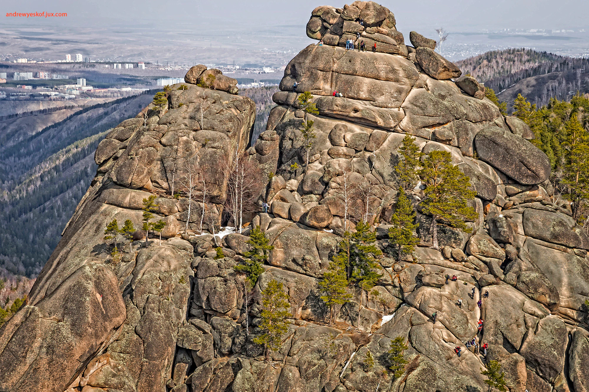
Large rocky mountain formations with scattered coniferous trees, small figures of people climbing, distant valley, and urban area visible in background
Krasnoyarsk Pillars, First Pillar, showcasing dramatic rock formations with sparse trees and distant cityscape

Krasnoyarsk Pillars history and protected-area timeline

The protected status of Krasnoyarsk Pillars traces back to June 30, 1925, when the Krasnoyarsk Soviet declared the core area a natural reserve (zapovednik) specifically to protect the picturesque syenite pillars and surrounding rocky landscape. This early protection reflected an understanding of the area's unique geological and scenic value. The site gained international attention in 2007 when it was submitted for UNESCO World Heritage status, though the inscription was deferred indefinitely. On December 4, 2019, the legal status was formally changed from nature reserve to national park, reclassifying it under IUCN category II while maintaining the core conservation framework. Prior to formal protection, the area had a long history of human use including gold mining during the Siberian gold rush starting in the 1830s, and the region was documented by numerous prominent explorers including Daniel Gottlieb Messerschmidt (1720-1727), Vitus Bering (1733-1734), and Peter Simon Pallas (1771-1773). The local tradition of climbing and visiting the pillars dates back over 150 years, with organized school trips beginning in the 1870s and 1880s under teacher Ivan Savenkov.

Krasnoyarsk Pillars landscape and geographic character

The physical landscape of Krasnoyarsk Pillars is defined by its dramatic rock formations rising from the Siberian taiga. The park sits at the northwestern edge of the Eastern Sayan Mountains, where granite and syenite pillars have been carved by natural forces into extraordinary vertical spires, cliffs, and boulder fields. Three main geographic zones exist within the park: the Takmakovsky district along the Bazaikha River valley at the foot of the Takmak rock formation, the Central Pillars area containing the most famous formations including Ded, Perja, and Lvinnyj vorota, and the Wild Pillars region in the buffer zone with restricted access. The Bazaikha River, a right tributary of the Yenisei, forms the northeastern boundary, while the Mana River marks the southern limit. Elevations range significantly across the park, creating varied microclimates and habitat zones. The combination of steep rocky outcrops, forested slopes, and river valleys produces a visually striking landscape distinctive among Siberian protected areas.
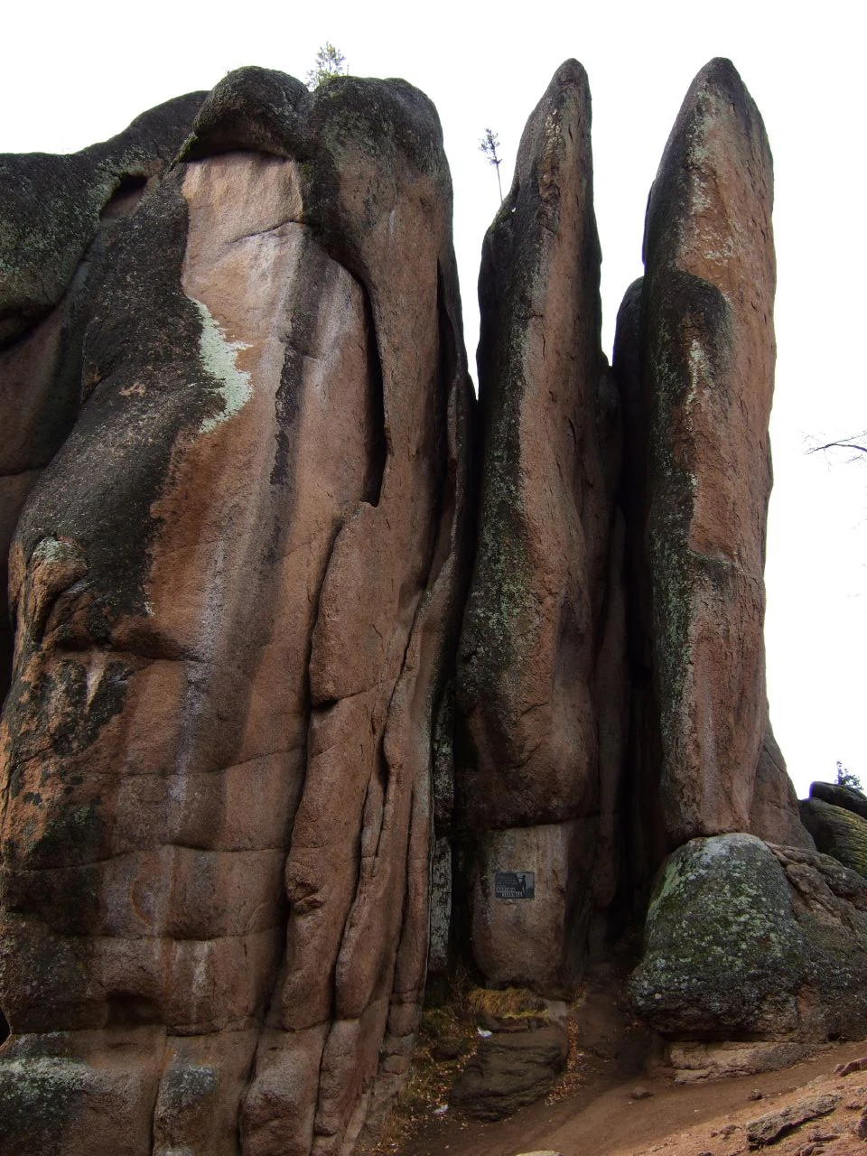
Tall reddish-brown rock pillars with vertical cracks and moss growth, featuring a small blue sign on the central formation
Dramatic syenite rock pillars with moss patches in Krasnoyarsk Pillars National Park

Krasnoyarsk Pillars ecosystems, habitats, and plant life

The ecological character of Krasnoyarsk Pillars reflects its position in the East Siberian taiga ecoregion, one of the largest continuous forest ecosystems on Earth. The park supports approximately 740 species of vascular plants and 260 kinds of mosses, with fir taiga being the dominant forest type in the midmountain zones. The diverse topography creates multiple habitat types from river valleys to rocky outcrops to dense forest, supporting a rich biodiversity. The flora includes several protected species listed in the Red Book of Russia, such as calypso bulbosa, cypripedium calceolus, and stipa pennata. The climate is classified as subarctic (Dfc) with no dry season, featuring mild summers and cold, snowy winters that influence the seasonal patterns of vegetation and wildlife activity.

Krasnoyarsk Pillars wildlife and species highlights

Krasnoyarsk Pillars is home to approximately 290 species of vertebrates, representing both taiga and forest-steppe ecological communities. The taiga fauna includes characteristic species such as the sable, a commercially valuable marten prized for its fur, as well as the Siberian musk deer and hazel grouse. Forest-steppe species found in the park include the Siberian roe deer, steppe polecat, and long-tailed ground squirrel. The avifauna is particularly notable, with several species of conservation importance including the osprey, golden eagle, saker falcon, and peregrine falcon, all protected under Russian law. The diverse wildlife community reflects the park's role as a refuge within the broader Siberian landscape, providing habitat for species that have declined in more heavily developed regions.

Krasnoyarsk Pillars conservation status and protection priorities

The transition of Krasnoyarsk Pillars from zapovednik to national park status in 2019 reflects evolving approaches to protected area management in Russia, balancing conservation with sustainable public access. The core area has been protected since 1925, making it one of Siberia's oldest nature reserves. The park preserves significant biodiversity within the East Siberian taiga, including numerous Red Book species of plants and birds. The dramatic rock formations and surrounding landscape represent a rare example of relatively intact Siberian wilderness close to a major urban center. Conservation challenges include managing the impact of over 200,000 annual visitors on the taiga ecosystem, particularly in the most accessible zones. Research conducted from the late 1940s through the early 2000s documented the effects of air pollution and recreational use on local ecosystems.

Krasnoyarsk Pillars cultural meaning and human context

Krasnoyarsk Pillars holds deep cultural significance for the residents of Krasnoyarsk, one of Siberia's largest cities. The tradition of visiting the Stolby for recreation and adventure dates back more than 150 years, with climbing routes and hiking paths passed down through generations of families. The rock formations themselves have been given individual names that have become embedded in local identity, such as Ded (Grandfather), Perja (Plumage), and Lvinnyj vorota (Lions Gate). A notable cultural tradition involves the word Svoboda (Freedom) written on the largest pillar, initially inscribed by Bolsheviks before the October Revolution and periodically renewed by climbing enthusiasts despite its inaccessibility. The Royev Ruchey area within the park was historically associated with gold mining during the 19th-century Siberian gold rush, with the name reflecting the activities of miners. A wildlife rehabilitation center established in 1947 was expanded in 2000 into the Royev Ruchey zoo, providing educational opportunities for visitors.

Top sights and standout views in Krasnoyarsk Pillars

The extraordinary rock pillars themselves remain the park's primary draw, with their vertical faces and distinctive shapes creating one of Siberia's most recognizable natural landmarks. The Central Pillars area contains the most iconic formations including the towering Ded (Grandfather) spire and the intricate Perja (Plumage) formation. The park offers over a century of established climbing history, with routes like Golubye Katushki (Blue Coils) and Dymokhod (Stovepipe) providing challenges for enthusiasts. The accessibility from Krasnoyarsk city, just 10 kilometers away, makes this a unique wilderness experience within easy reach of an urban population of over one million. The combination of geological spectacle, ecological diversity, and cultural tradition creates a multifaceted protected area that serves both conservation and recreational purposes.

Best time to visit Krasnoyarsk Pillars

The optimal time to experience Krasnoyarsk Pillars is during the summer months from June through August, when warm temperatures allow full access to the park's trails and climbing routes. Summer brings extended daylight hours and generally stable weather, though afternoon thunderstorms are possible. The subarctic climate means that shoulder seasons offer dramatically different experiences: spring brings snowmelt and emerging vegetation, while autumn paints the taiga in rich colors. Winter visits are possible but limited by cold temperatures that can drop below minus 40 degrees Celsius, and snow depth can reach 16 centimeters. The most popular time for climbing is typically late summer and early autumn when conditions are most stable. Visitors seeking to avoid crowds may prefer the shoulder seasons, though some facilities and services may have reduced availability outside the peak summer period.

Monthly climate preview

Long term average monthly weather patterns and precipitation cycles for Krasnoyarsk Pillars

Krasnoyarsk Pillars Climate Patterns and Monthly Weather Normals

Representative records at 467 meters elevation reveal average monthly temperatures ranging from below minus 19 degrees Celsius to 18 degrees Celsius, with light daily precipitation throughout the year. Accessing the complete twelve month profile provides maximum and minimum extremes to help analyze the long term atmospheric trends of Krasnoyarsk Pillars.
Annual mean0 °C
-19 °C18 °C
Jan-19°
Feb-16°
Mar-9°
Apr
May
Jun15°
Jul18°
Aug16°
Sep
Oct
Nov-10°
Dec-17°
Warmest month
July

18.3 °C

Coolest month
January

-19.3 °C

Wettest month
June

2.6 mm/day

Driest month
January

0.8 mm/day

Park location guide

Geography guide, regional context, and park location map for Krasnoyarsk Pillars

Krasnoyarsk Pillars park geography, regions, and map view in Russia

Understand where Krasnoyarsk Pillars sits in Russia through a broader geographic reading of the surrounding landscape, nearby location context, and its mapped position within the national park landscape.

How Krasnoyarsk Pillars fits into Russia

Russia is a transcontinental nation spanning eleven time zones, bordered by fourteen countries. It is the world's largest country by area, covering 17,098,246 km². Moscow is the capital and largest city, while Saint Petersburg is the second-largest and a major cultural centre.

Wider geography shaping Krasnoyarsk Pillars in Russia

Russia spans Eastern Europe and North Asia, covering 17,098,246 km². It shares land borders with fourteen countries, more than any other nation, and spans eleven time zones. The landscape includes vast plains, mountain ranges such as the Urals and Caucasus, and extensive coastlines along the Arctic Ocean, Pacific Ocean, Baltic Sea, Black Sea, and Caspian Sea.

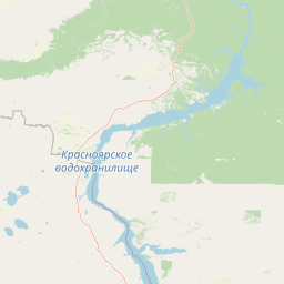
Map view of Krasnoyarsk Pillars

Use this park location map to pinpoint Krasnoyarsk Pillars in Russia, understand its exact geographic position, and read its mapped placement within the surrounding landscape more clearly.

Pigeon | © OpenStreetMap contributors

Location context for Krasnoyarsk Pillars

Krasnoyarsk Krai

Visual Reference: Discover the Towering Granite Pillars, Ancient Taiga Forest, and Unique Protected-Area Scenery of Krasnoyarsk Pillars

Krasnoyarsk Pillars National Park: Explore Dramatic Siberian Landscapes and Iconic Rock Formations

Browse a curated collection of photos showcasing the unique protected landscape of Krasnoyarsk Pillars National Park, including its iconic granite Stolby formations and dense Siberian taiga forest. These images offer an essential visual guide to the park's dramatic terrain, diverse habitats, and distinctive protected-area environment, helping you understand its natural character.

Large rocky mountain formations with scattered coniferous trees, small figures of people climbing, distant valley, and urban area visible in background

Tall dark rock formations rising above dense green forest under a partly cloudy sky

Tall reddish-brown rock pillars with vertical cracks and moss growth, featuring a small blue sign on the central formation

Park atlas

Browse the Atlas of Siberian Taiga Parks and Mountain Protected Landscapes for Geographic Comparison

Explore Other Protected Areas and National Parks Near Krasnoyarsk Pillars

After exploring the unique granite rock formations and taiga wilderness of Krasnoyarsk Pillars, discover additional national parks and protected areas within the vast Siberian landscape. Compare diverse conservation landscapes, analyze the regional spread of protected zones, and trace connected geographic features for deeper atlas-style understanding of this expansive territory.
A horizontal watercolor painting showing a meandering river flowing through a lush green taiga forest with soft rolling mountains in the background.
National parkЯмало-Ненецкий автономный округ
Park boundaries overlap#1 closest

Northeast

Красноярские Столбы National Park: Atlas Mapping of Siberian Syenite Rock Formations

Protected Eastern Sayan mountain taiga and unique geologic pillars

Красноярские Столбы National Park encompasses a sprawling mountain landscape where eroded syenite towers pierce through dense fir taiga. This protected territory provides a detailed look at the interface between the Eastern Sayan range and the Central Siberian Plateau, showcasing dramatic rock architecture and complex river-carved valleys that support diverse Siberian flora and fauna.

Area
472.19 km²
Established
1925
IUCN
II
Visitors
700K annual
Watercolor painting of green trees, rolling hills, a pink and yellow sunset sky, and a single tree on the right
National parkKrasnoyarsk Krai
About 346 km away#2 closest

South

Shushensky Bor National Park: Mapped Geography of a Siberian Protected Forest

Explore the protected landscape and regional context of Krasnoyarsk Krai.

Shushensky Bor National Park serves as a critical protected area within the vast geography of Krasnoyarsk Krai, Russia, offering detailed insights into Siberia's ecological transition zones. This national park meticulously maps the shift from the Minusinsk basin forest-steppe to the dramatic mountain taiga of the Western Sayan range. Users can explore its varied terrain, from gentler northern steppe-influenced lands to the rugged slopes of the Borus Massive, all within a defined protected landscape. The proximity to the Sayano-Shushenskoye Reservoir further defines its unique geographic setting, providing context for its conservation importance and natural beauty.

Area
392 km²
Established
1995
IUCN
II
Relief
Mountain
National parkKemerovo Oblast
About 454 km away#3 closest

Southwest

Shorsky National Park: Mapping Mountain Taiga and Protected Forest Landscapes

A comprehensive look at Gornaya Shoria geography

Shorsky National Park protects the rugged wilderness of the Altai-Sayan mountain system. Its territory showcases a dramatic topography shaped by the Mras-Su river and thick forests of Siberian stone pine and fir, offering an essential view into the biodiversity and environmental character of the southern Siberian landscape.

Area
4,138.43 km²
Established
1989
IUCN
II
Relief
Mountain
Watercolor painting of a river flowing through a valley with forested hills and distant mountains
National parkTashtagolsky District
About 454 km away#4 closest

Southwest

Shorsky National Park: Protected Taiga and Karst Landscapes in Tashtagolsky District

Mapping the mountainous wilderness of southern Siberia

Shorsky National Park protects vast swathes of dark taiga forest and dramatic karst features across 4,180 square kilometers of rugged mountain terrain. Explore the geography of this Siberian region, featuring over 60 named caves, deep river valleys, and significant rock formations that define the natural character of the Tashtagolsky District.

Area
4,180 km²
Established
1989
IUCN
II
Relief
Mountain
Watercolor painting showing a river flowing through a forested area with distant hills, using soft green, blue, and yellow tones
National parkAltai Krai
About 480 km away#5 closest

Southwest

Salair National Park: Mapped Protected Landscape and Geographic Features in Altai Krai

Discover the unique dark taiga terrain and relict flora.

Salair National Park is a significant protected area in Altai Krai, Russia, renowned for its exceptionally biodiverse dark taiga forests, often called the "rainforest of Siberia." Established in 2020, the park spans the western slopes of the Salair Ridge, covering about 161,000 hectares of gentle low mountain terrain. Its landscape is characterized by rounded mountains, a network of ravines, and the preservation of pre-glacial relict plant species. This national park offers a vital contrast to the surrounding agricultural areas, highlighting its role in conserving unique Siberian forest ecosystems and their historic flora.

Area
1,612 km²
Established
2020
IUCN
II
Relief
Upland
National parkUvs Province
About 711 km away#6 closest

South

Khan-Khokhi Khyargas Mountain National Park: Mapped Boundaries and Protected Landscape

Uvs Province National Park Geography

Khan-Khokhi Khyargas Mountain National Park is a designated national park offering critical insights into Mongolia's protected natural landscapes. This entry supports structured geographic discovery, detailing the park's mapped boundaries and its environmental context within Uvs Province. Engage with the park's identity as a protected area, uncovering its role in the regional atlas and its unique contribution to the mapped terrain.

Area
3,413 km²
Established
2000
IUCN
II
Relief
Mountain
A horizontal watercolor painting showing a soft landscape with distant purple mountains, a calm lake in the midground, and green grassy shores in the foreground.
National parkKhövsgöl Province
About 715 km away#7 closest

Southeast

Lake Khövsgöl National Park: Geography and Protected Area Landscape Analysis

Highland taiga and ancient freshwater basin in Khövsgöl Province

Analyze the complex geography of Lake Khövsgöl National Park, which protects a massive, ultraoligotrophic waterbody surrounded by the rugged Sayan Mountains. The area serves as a vital ecological transition zone, containing diverse alpine, forest, and aquatic terrains that form a central part of Mongolia's natural heritage.

Area
2,760 km²
Relief
Mountain
Climate
Alpine
Access
Remote access
A watercolor painting of a serene lakeshore with soft green grass in the foreground, a still lake reflecting soft pink and beige tones, and light green hills in the distance.
National parkUvs Province
About 732 km away#8 closest

South

Khyargas Lake National Park: Geography and Protected Area Mapping in Western Mongolia

A comprehensive look at saline and freshwater steppe ecosystems.

Khyargas Lake National Park, situated in Uvs Province, offers a rare glimpse into the saline and freshwater lake systems of the Mongolian steppe. This protected area encompasses an endorheic basin characterized by its wide, open shoreline and unique ecological contrast. Use our atlas to analyze the mapped terrain and the expansive, undisturbed wetlands that define this notable region of western Mongolia.

Area
3,328 km²
Established
2000
Relief
Lowland
Climate
Arid

Common questions about visiting, size, designation, and location context for Krasnoyarsk Pillars

Krasnoyarsk Pillars FAQs for park facts, access, geography, and protected area context

Find quick answers about Krasnoyarsk Pillars, including protected-area facts, park geography, trail and visitor context, and how the park fits into its surrounding country and regional landscape.
MoriAtlas Explorer

Continue Your Protected Areas Search Across the Global Atlas

Deepen your exploration by continuing the structured search for national parks and protected areas worldwide. Utilize the comprehensive filtering capabilities to compare different conservation landscapes and refine your understanding of global park geography. Discover more about the distribution and characteristics of protected natural areas.

Global natural geography