Mori Atlas logo
National parkLa Amistad International Park

Discover the protected landscape identity and regional geographic context of this Costa Rican natural area.

La Amistad International Park: National Park Geography and Mapped Protected Area

La Amistad International Park stands as a significant national park within the broader geography of Costa Rica. This page offers an atlas-driven exploration of its protected landscape, focusing on its mapped boundaries and its role within the country's conservation network. Understand the geographic scope and natural terrain context that defines this key protected area, providing essential insights for any map-based discovery of Central America's natural heritage.

transboundary protected areacloud forestUNESCO World Heritage Sitemountain wildernesstropical biodiversityCentral America

La Amistad International Park

National park

Park overview

Structured park overview, official facts, and landscape profile for La Amistad International Park

La Amistad International Park park facts, protected area profile, and essential visitor context
Review the core facts for La Amistad International Park, including designation, size, terrain, visitor scale, habitats, and operating context in one park-focused overview.

About La Amistad International Park

La Amistad International Park represents one of the most significant conservation achievements in Central America, established as a transboundary protected area that transcends national borders to protect a shared natural heritage. The park protects the southernmost extent of the Cordillera de Talamanca, a mountain range that forms the backbone of Costa Rica and extends into western Panama. This strategic position places the park at a critical juncture between North and South American ecosystems, creating unique ecological conditions that support extraordinary biodiversity. The park's designation as a UNESCO World Heritage Site recognizes its outstanding universal value, while its inclusion in the Mesoamerican Biological Corridor underscores its importance as a connective pathway for wildlife movement across the region. Beyond its ecological significance, the park encompasses territories inhabited by three indigenous peoples—the Naso, Bribri, and Ngöbe-Buglé—who maintain traditional lifestyles and cultural practices tied to the land. The surrounding buffer zone includes coffee producers, beef farmers, and indigenous subsistence agriculture, creating a complex landscape where conservation and human settlement intersect.

Quick facts and research context for La Amistad International Park

La Amistad International Park is the largest protected area in Central America, covering approximately 401,000 hectares split between Costa Rica and Panama. The park occupies the Cordillera de Talamanca, a mountain range that includes Costa Rica's highest point at Cerro Chirripó. It was designated a UNESCO World Heritage Site in 1983 and expanded in 1990, recognizing its outstanding universal value as a biodiversity reservoir. The park is managed cooperatively by Costa Rica's SINAC (National System of Conservation Areas) and Panama's ANAM, with management divided between the Caribbean and Pacific La Amistad Conservation Areas on the Costa Rican side. Three indigenous groups, the Naso, Bribri, and Ngöbe-Buglé, maintain traditional communities within the park boundaries.

Park context

Deeper park guide and search-rich context for La Amistad International Park

La Amistad International Park history, landscape, wildlife, and travel context
Explore La Amistad International Park through its history, landscape character, ecosystems, wildlife, conservation priorities, cultural context, and seasonal travel timing in a structured park guide built for atlas discovery and search intent.

Why La Amistad International Park stands out

La Amistad International Park is best known for its extraordinary biodiversity and status as Central America's largest wilderness preserve. The park is one of the few places in Central America displaying evidence of Quaternary glaciation, which has created diverse habitats that support remarkable rates of speciation. It hosts more than 10,000 flowering plant species, over 600 bird species including the iconic resplendent quetzal and three-wattled bellbird, and five species of big cats including jaguars and pumas. The park also protects critical habitat for endangered species such as the ornate spider monkey, Central American tapir, and the splendid poison frog, with at least seven amphibian species found nowhere else on Earth.

La Amistad International Park history and protected-area timeline

La Amistad International Park emerged from the recognition that the natural resources of the Talamanca mountain range transcended national boundaries and required cooperative management. The area was originally protected as separate national parks in Costa Rica and Panama before being recognized as a single ecological unit. In 1983, UNESCO designated the Talamanca Range-La Amistad Reserves as a World Heritage Site, making it one of the first transboundary World Heritage properties in the Americas. Following this designation, both countries agreed to establish unified management through the creation of La Amistad International Park in 1988. The park was formerly known as La Amistad National Park before being renamed to reflect its international character. Scientific exploration of the park's remote interior has been limited due to challenging terrain, with significant research efforts only beginning in the early 2000s through partnerships with the Natural History Museum London, Costa Rica's INBio, and the University of Panama.

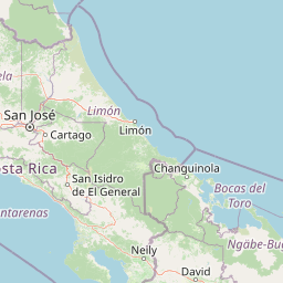
La Amistad International Park landscape and geographic character

The landscape of La Amistad International Park is defined by the rugged terrain of the Cordillera de Talamanca, a mountain range that rises dramatically from the surrounding lowlands to elevations exceeding 3,800 meters. The park encompasses both Pacific and Caribbean watersheds, creating diverse environmental conditions across its vast expanse. The highest peaks, including Cerro Chirripó at 3,820 meters, bear the marks of past glacial activity—a rare feature in Central America that has created unique alpine and subalpine habitats. The terrain ranges from steep mountain slopes and deep valleys to rolling highlands, with numerous rivers cascading down from the heights to the lowlands below. The combination of high elevation, steep gradients, and varied aspect creates a mosaic of microclimates and vegetation zones that contributes to the park's exceptional habitat diversity.

La Amistad International Park ecosystems, habitats, and plant life

The ecological character of La Amistad International Park is defined by its position at a biogeographic crossroads and its remarkable elevational range, which supports multiple distinct life zones. The park contains significant areas of cloud forest, where persistent mist and moisture support lush vegetation and specialized adaptations. The legacy of Quaternary glaciation has influenced the development of unique habitats that have driven speciation, resulting in high concentrations of endemic species. More than 10,000 flowering plant species have been documented within the park, along with approximately 250 reptile and amphibian species and 115 freshwater fish species. The park's designation as an Important Bird Area by BirdLife International reflects its significance for bird conservation, with over 600 species recorded including numerous threatened and endemic taxa.

La Amistad International Park wildlife and species highlights

La Amistad International Park supports an impressive assembly of wildlife, including five species of large cats: jaguars, pumas, ocelots, margay, and jaguarundis. The park provides critical habitat for several endangered mammal species, including the ornate spider monkey and the Central American tapir, the largest land mammal in Central America. The amphibian fauna is exceptionally significant, with at least seven species entirely restricted to park boundaries, including the Chiriquí fire salamander. The park's avifauna includes spectacular species such as the resplendent quetzal, considered one of the most beautiful birds in the Americas, the three-wattled bellbird, and the bare-necked umbrellabird. Scientific expeditions conducted since 2003 have revealed remarkable discoveries, including 12 plant species, 15 amphibian species, and three reptile species new to science, demonstrating that the park continues to yield new biological knowledge.

La Amistad International Park conservation status and protection priorities

La Amistad International Park represents a landmark in transboundary conservation, demonstrating how international cooperation can protect ecological systems that transcend political borders. Its designation as a UNESCO World Heritage Site recognizes its outstanding universal value as one of the most important biodiversity reservoirs in Central America, with the park and its buffer zone representing approximately 20 percent of the region's species diversity. The park forms a core component of the Mesoamerican Biological Corridor, a regional initiative to maintain ecological connectivity across fragmented landscapes. The Darwin Initiative, funded by the United Kingdom, supported a three-year collaborative project from 2006 to generate baseline biodiversity information and mapping for the park. Conservation challenges include managing the interface between protected core areas and the surrounding agricultural landscape, as well as addressing the needs of indigenous communities whose traditional territories overlap with park boundaries.

La Amistad International Park cultural meaning and human context

Three indigenous peoples—the Naso, Bribri, and Ngöbe-Buglé—maintain communities within the boundaries of La Amistad International Park, preserving traditional ways of life that are intimately connected to the landscape. These groups inhabit small villages scattered throughout the park and its surrounding buffer zone, practicing subsistence agriculture and maintaining cultural traditions tied to the forest and mountain environments. The presence of indigenous communities adds cultural depth to the park's identity, representing human relationships with the land that predate modern conservation frameworks. The buffer zone surrounding the core protected area includes a mix of coffee producers, beef cattle operations, and indigenous agricultural lands, creating a cultural landscape where conservation objectives must be balanced with sustainable livelihoods and traditional land use practices.

Top sights and standout views in La Amistad International Park

La Amistad International Park stands as Central America's premier wilderness preserve, offering unparalleled opportunities to experience pristine tropical forest ecosystems in a transboundary setting that exemplifies international conservation cooperation. The park's exceptional biodiversity includes over 10,000 plant species, more than 600 bird species, and significant populations of keystone species including jaguars, tapirs, and quetzals. The presence of glacial features in a tropical setting creates unique high-elevation habitats found nowhere else in Central America. The discovery of numerous species new to science in recent decades highlights how much remains to be learned from this remarkable landscape.

Best time to visit La Amistad International Park

The optimal time to visit La Amistad International Park depends on the specific area and activities planned, but the dry season from December through April generally offers more accessible conditions for hiking and wildlife observation. Higher elevations can experience significant fog and moisture year-round due to cloud forest conditions, while the Caribbean slope tends to be wetter overall. The wet season from May to November brings heavier rainfall but also offers the opportunity to experience the park's ecosystems at their most lush and to observe migratory bird species. Visitors should be prepared for variable conditions and the challenging terrain that characterizes much of the park's interior.

Park location guide

Geography guide, regional context, and park location map for La Amistad International Park

La Amistad International Park park geography, regions, and map view in Costa Rica
Understand where La Amistad International Park sits in Costa Rica through a broader geographic reading of the surrounding landscape, nearby location context, and its mapped position within the national park landscape.

How La Amistad International Park fits into Costa Rica

Costa Rica is a Central American country with coastlines on both the Caribbean Sea and Pacific Ocean. It gained independence from Spain in 1821 and operates as a unitary presidential republic with no standing military. The economy has diversified from agriculture into finance, pharmaceuticals, and ecotourism.

Wider geography shaping La Amistad International Park in Costa Rica

Costa Rica is located in Central America, bordered by Nicaragua to the north, the Caribbean Sea to the northeast, Panama to the southeast, and the Pacific Ocean to the southwest. It shares a maritime boundary with Ecuador. The terrain includes coastal plains, mountain ranges, and volcanic landscapes.

Map view of La Amistad International Park

Use this park location map to pinpoint La Amistad International Park in Costa Rica, understand its exact geographic position, and read its mapped placement within the surrounding landscape more clearly.

Pigeon | © OpenStreetMap contributors
Park atlas

Browse connected protected areas and compare park geography across the Cordillera de Talamanca region, tracing Central American conservation landscapes

Explore Nearby and Related National Parks Beyond La Amistad International Park, Central America's Transboundary Wilderness
After exploring La Amistad International Park, continue your geographic discovery by browsing other national parks and protected areas within its immediate Central American context. Compare regional park characteristics, observe how protected landscapes connect across diverse mountain terrain, and trace broader conservation efforts in this vital region.
National parkLimón Province

Cahuita National Park National Park: Geographic Atlas and Protected Landscape Identity

Explore mapped boundaries and regional context within Limón Province.

Gain an atlas perspective on Cahuita National Park, a designated national park situated in Limón Province, Costa Rica. This detailed entry focuses on its protected landscape character and geographic setting, offering insights into its mapped boundaries and its role within the region's natural geography. Understand the park's specific contribution to the protected area network through detailed geographic data.

Area
234.679 km²
Established
1982
IUCN
II
Relief
Lowland
National parkCartago Province

Chirripó National Park: A Protected Landscape within Cartago Province's Geography

Explore its mapped boundaries and natural terrain.

This page provides detailed geographic context for Chirripó National Park, a designated national park located in the Cartago Province of Costa Rica. It focuses on the park's protected landscape identity, its position within the regional geography, and its distinct mapped boundaries. Understanding Chirripó National Park through its geographic and atlas-centric attributes offers a foundational insight into its natural significance.

Area
508.49 km²
Established
1975
IUCN
II
Climate
Alpine
National parkLimón Province

Barbilla National Park: National Park Atlas Exploration and Geographic Context

Mapped protected landscape in Limón Province, Costa Rica

Barbilla National Park offers a focused view into Costa Rica's protected natural areas, specifically within the Limón Province. This entry provides an atlas-centric understanding of its geographic footprint and the character of its protected landscape. Explore the mapped boundaries and regional setting of this national park to enhance your structured geographic discovery.

Area
119 km²
Established
1982
IUCN
II
Relief
Mountain
National parkPuntarenas Province

Piedras Blancas National Park: Costa Rica National Park Protected Landscape

Explore Puntarenas Province's mapped protected areas and terrain.

Piedras Blancas National Park is a key protected area within Puntarenas Province, Costa Rica, identified for its national park status. This entry serves as a geographic anchor, detailing the park's mapped landscape and its contribution to the regional protected areas atlas. Understand its specific geographic setting and the importance of its protected boundaries for natural landscape exploration and research, contributing vital context to Costa Rica's conservation geography.

Area
140.19 km²
Established
1991
IUCN
II
Relief
Mountain
Marine protected areaBocas del Toro Province

Isla Bastimentos National Marine Park: Marine Protected Area Geography and Atlas Context

Explore the protected landscape within Bocas del Toro Province.

Isla Bastimentos National Marine Park represents a critical marine protected area offering essential geographic data for atlas-based research. Situated in Panama's Bocas del Toro Province, this entity provides a focal point for understanding protected marine territories and their mapped extent. Discover the park's specific location within the province, contributing to a detailed regional geography and a broader understanding of conservation landscapes.

Area
132.26 km²
Established
1988
IUCN
II
Relief
Lowland
National parkCosta Rica

Tapantí National Park: Costa Rica National Park Atlas and Mapped Landscape Exploration

Explore protected boundaries and natural terrain within its geographic setting.

Tapantí National Park is a designated national park in Costa Rica, offering specific insights into the country's protected natural landscapes. This page provides an atlas-style view of its geographic placement, the extent of its protected area, and the character of its natural terrain. Users can investigate the park's mapped context and understand its significance within the broader geography of Costa Rica, facilitating focused exploration of protected lands and regional landscape features.

Area
583.2 km²
Established
1982
IUCN
II
Relief
Mountain
National parkCosta Rica

Los Quetzales National Park: Costa Rica National Park Landscape and Mapped Geography

Explore protected area boundaries and regional terrain context.

Los Quetzales National Park, a designated national park within Costa Rica, offers a focused entry point for exploring protected landscapes. This page provides detailed insight into the park's geographic setting, emphasizing its mapped boundaries and its role within the national atlas. Users can discover the specific landscape characteristics and regional terrain that define Los Quetzales National Park, enriching their understanding of Costa Rican protected areas.

Area
50 km²
Established
2006
IUCN
II
Relief
Mountain
National parkCosta Rica

Turrialba Volcano National Park: Mapped Geography and Protected Landscape Context in Costa Rica

Explore the protected area's natural terrain and regional atlas placement

Turrialba Volcano National Park is a key protected landscape in Costa Rica, offering distinct geographic features and environmental context for atlas exploration. This page details the park's mapped boundaries and its significance as a national park, providing a foundation for understanding its place within the country's diverse natural terrain. Discover the unique geographic identity of this protected area and its role in the regional landscape.

Area
16 km²
Established
1955
IUCN
II
Relief
Mountain

Common questions about visiting, size, designation, and location context for La Amistad International Park

La Amistad International Park FAQs for park facts, access, geography, and protected area context
Find quick answers about La Amistad International Park, including protected-area facts, park geography, trail and visitor context, and how the park fits into its surrounding country and regional landscape.
MoriAtlas Explorer

Continue Your Protected Areas Search Across the Global Atlas

Deepen your exploration by continuing the structured search for national parks and protected areas worldwide. Utilize the comprehensive filtering capabilities to compare different conservation landscapes and refine your understanding of global park geography. Discover more about the distribution and characteristics of protected natural areas.

Global natural geography