

Mori Atlas logo
National parkLahugala Kitulana National Park

Understand the mapped boundaries and regional geography of this protected natural area in Eastern Province.

Lahugala Kitulana National Park: National Park Protected Landscape and Geographic Context

Lahugala Kitulana National Park represents a significant protected natural area within Sri Lanka's Eastern Province. This page provides detailed geographic context, focusing on the park's mapped boundaries and its role as a national park. Explore the specific landscape features and regional setting that define Lahugala Kitulana National Park, offering a clear understanding of its protected status and atlas-relevant geography.

Sri Lankan national parksElephant habitatWetland ecosystemsDry zone forestsEastern Province Sri LankaBird watching

Lahugala Kitulana National Park

National park

Park overview

Structured park overview, official facts, and landscape profile for Lahugala Kitulana National Park

Lahugala Kitulana National Park park facts, protected area profile, and essential visitor context
Review the core facts for Lahugala Kitulana National Park, including designation, size, terrain, visitor scale, habitats, and operating context in one park-focused overview.

About Lahugala Kitulana National Park

Lahugala Kitulana National Park represents a compact but ecologically significant protected area within Sri Lanka's Eastern Province. The park's landscape is characterized by a flat terrain punctuated by occasional rocky outcrops, with the three reservoir tanks forming the ecological heart of the protected area. These water bodies create a seasonal wetland environment that attracts diverse wildlife, particularly during the dry periods when water becomes scarce across the broader landscape. The park lies within the Sri Lanka dry-zone dry evergreen forests, a vegetation type adapted to the region's pronounced seasonality and lower rainfall compared to Sri Lanka's wet zone. The proximity to the ancient Magul Maha Viharaya temple adds cultural significance to the natural landscape, connecting the park to Sri Lanka's Buddhist heritage and the legendary marriage of King Kavan Tissa to Princess Viharamahadevi. Despite its status as one of Sri Lanka's smaller national parks, Lahugala Kitulana serves as a critical refuge within the country's protected area network, particularly for species dependent on dry-zone wetland habitats.

Quick facts and research context for Lahugala Kitulana National Park

Lahugala Kitulana National Park covers 1,554 hectares in Sri Lanka's Eastern Province, near the town of Pottuvil. The park was originally protected as a wildlife sanctuary in 1966 and designated a national park in 1980. It features three reservoirs that form a seasonal wetland system within the dry-zone landscape. The park is managed by Sri Lanka's Department of Wildlife Conservation and is situated within the Sri Lanka dry-zone dry evergreen forest ecoregion. Annual rainfall averages approximately 1,650 millimeters, with the northeast monsoon arriving between November and December.

Park context

Deeper park guide and search-rich context for Lahugala Kitulana National Park

Lahugala Kitulana National Park history, landscape, wildlife, and travel context
Explore Lahugala Kitulana National Park through its history, landscape character, ecosystems, wildlife, conservation priorities, cultural context, and seasonal travel timing in a structured park guide built for atlas discovery and search intent.

Why Lahugala Kitulana National Park stands out

Lahugala Kitulana is best known for its significant elephant population, with herds of approximately 150 individuals regularly using the park as a feeding ground. The park's wetland habitats support exceptional bird diversity, including notable waterfowl and wading species. The area is particularly significant for the last recorded Sri Lankan sighting of the knob-billed duck, a species now thought to be extinct in the country. The park also protects important populations of endemic birds including the red-faced malkoha and Sri Lanka spurfowl, alongside endangered mammals such as the Sri Lankan leopard, sloth bear, and fishing cat.

Lahugala Kitulana National Park history and protected-area timeline

The area that now comprises Lahugala Kitulana National Park was originally designated as a wildlife sanctuary on July 1, 1966, providing initial legal protection to the region's wildlife and habitats. This early protection reflected growing recognition of the area's ecological importance, particularly as an elephant habitat within Sri Lanka's dry zone. On October 31, 1980, the protected area was upgraded to national park status, granting it the highest level of protection under Sri Lankan law. The upgrade acknowledged the site's significance for conserving both elephant populations and the diverse bird and mammal species inhabiting the reservoir wetlands. Management responsibility falls to Sri Lanka's Department of Wildlife Conservation, which continues to address the challenges of protecting this small but important park within a landscape that faces development pressures.

Lahugala Kitulana National Park landscape and geographic character

The landscape of Lahugala Kitulana National Park is defined by its flat terrain with occasional rocky outcrops, characteristic of Sri Lanka's eastern dry zone. Three interconnected reservoirs, known locally as tanks, form the central hydrological features: Lahugala, Kitulana, and Sengamuwa. These water bodies collect rainfall primarily during the northeast monsoon season from November to December and gradually empty into the Heda Oya river system. The park sits within a broader landscape of dry-zone forests and agricultural lands, with the reservoirs providing critical wetland habitat in an otherwise seasonally dry environment. Two distinct dry periods shape the park's character: from May to October and again from January to March, when water levels recede and the surrounding grasslands become important grazing areas for elephants and other herbivores.

Lahugala Kitulana National Park ecosystems, habitats, and plant life

The vegetation of Lahugala Kitulana falls within the Sri Lanka dry-zone dry evergreen forest classification, a distinct ecosystem adapted to the region's lower rainfall and seasonal climate. The dominant grass species Sacciolepis interrupta forms extensive grasslands around the reservoir margins, providing the primary food source for the park's elephant population. This grass species is so significant to the park's ecology that it attracts herds of approximately 150 elephants seasonally. The forest composition includes several characteristic dry-zone species: Drypetes sepiaria, Manilkara hexandra, Berrya cordifolia, Vitex pinnata, Chloroxylon swietenia, and the golden shower tree (Cassia fistula). The reservoir wetlands support a distinct aquatic and semi-aquatic plant community that changes with seasonal water level fluctuations, creating dynamic habitat conditions throughout the year.

Lahugala Kitulana National Park wildlife and species highlights

Lahugala Kitulana supports a remarkable diversity of wildlife despite its small size. The park is traditionally used by elephants as a feeding ground, with herds of around 150 individuals drawn by the abundant Sacciolepis interrupta grass surrounding the Lahugala tank. The mammal community includes several endemic and threatened species: the toque macaque and tufted gray langur represent endemic primates, while the Sri Lankan leopard represents the island's apex predator. Conservation-significant species include the sloth bear, fishing cat, and rusty-spotted cat, alongside more common species such as golden jackal, wild boar, Indian muntjac, and various deer species including the Sri Lankan axis deer and sambar. The bird community is exceptionally diverse, featuring both resident and migratory waterfowl. Notable species include great white pelican, painted stork, lesser adjutant, white-bellied sea eagle, and grey-headed fish eagle. The park holds particular significance for the knob-billed duck, as the last recorded Sri Lankan sighting occurred here before the species was considered extinct in the country. Endemic birds including red-faced malkoha and Sri Lanka spurfowl also inhabit the park. The reptile and amphibian communities include Python molurus, Russell's viper, freshwater turtles, and several endemic amphibian species.

Lahugala Kitulana National Park conservation status and protection priorities

Conservation challenges at Lahugala Kitulana include several anthropogenic threats: poaching, logging, fuelwood collection, and grazing pressure from surrounding lands. The Sri Lanka Wildlife Conservation Society has initiated projects to establish electric fences protecting four villages adjacent to the park's southern boundary, helping to reduce human-wildlife conflict. A significant proposed development in the lower Uva basin threatens to increase cultivated area around the park, potentially isolating the elephant population and fragmenting its habitat. Conservation proposals include establishing a jungle corridor linking Lahugala Kitulana with Gal Oya and Kumana National Parks, which would enable elephant movement between protected areas. Environmentalists have successfully protested a proposed canal that would have run within the park, as such construction would violate environmental protection laws extending one kilometer beyond the park boundary.

Lahugala Kitulana National Park cultural meaning and human context

The cultural landscape of Lahugala Kitulana extends beyond its natural features to include the nearby Magul Maha Viharaya, an ancient Buddhist temple of significant historical importance. According to tradition, this sacred site was constructed for the marriage ceremony of King Kavan Tissa to Princess Viharamahadevi, a foundational event in Sri Lankan history. The vihara was later offered to the Sangha Buddhist community, establishing its continuing religious significance. This cultural heritage adds dimension to the park's identity, connecting the natural landscape to Sri Lanka's ancient kingdom and Buddhist traditions. The temple remains an important site for local religious practice and represents the long-standing human presence in this region of the Eastern Province.

Top sights and standout views in Lahugala Kitulana National Park

Lahugala Kitulana's significance stems from its role as a critical elephant habitat supporting approximately 150 individuals, making it an important destination for wildlife observation within Sri Lanka's national park system. The wetland bird community is exceptionally diverse, with the park holding historical importance as the last Sri Lankan sighting location for the now extinct knob-billed duck. The three reservoir tanks create a distinctive landscape within the dry zone, supporting both aquatic and terrestrial ecosystems in seasonal equilibrium. The park protects endemic species including the Sri Lankan leopard, toque macaque, red-faced malkoha, and Sri Lanka spurfowl. Conservation efforts focus on connecting this small park to larger protected landscapes through proposed corridor links with Gal Oya and Kumana National Parks.

Best time to visit Lahugala Kitulana National Park

The optimal time to visit Lahugala Kitulana coincides with the dry season when wildlife congregates around the remaining water sources. The period from May to October offers good viewing opportunities as elephants and other herbivores concentrate near the reservoirs. The secondary dry season from January to March also provides favorable conditions. The northeast monsoon from November to December brings rainfall and transforms the landscape, though some roads may become difficult to access. Visitors interested in bird observation should note that migratory waterfowl arrive during the northeast monsoon and remain through the dry season, while the grassland vegetation provides ideal habitat for elephant foraging year-round.
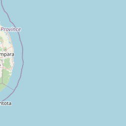
Park location guide

Geography guide, regional context, and park location map for Lahugala Kitulana National Park

Lahugala Kitulana National Park park geography, regions, and map view in Sri Lanka
Understand where Lahugala Kitulana National Park sits in Sri Lanka through a broader geographic reading of the surrounding landscape, nearby location context, and its mapped position within the national park landscape.

How Lahugala Kitulana National Park fits into Sri Lanka

Sri Lanka is a tropical island nation in South Asia with a recorded history spanning over 3,000 years. Formerly known as Ceylon, it became independent in 1948 and adopted its current constitutional name in 1972. The country features diverse geography ranging from coastal plains to mountainous highlands and maintains a population exceeding 22 million.

Wider geography shaping Lahugala Kitulana National Park in Sri Lanka

Sri Lanka is an island nation in the Indian Ocean, positioned southwest of the Bay of Bengal. It is separated from India by the Gulf of Mannar and Palk Strait to the northwest. The island has a pear-like shape with diverse terrain including coastal plains, central highlands, and river valleys.

Map view of Lahugala Kitulana National Park

Use this park location map to pinpoint Lahugala Kitulana National Park in Sri Lanka, understand its exact geographic position, and read its mapped placement within the surrounding landscape more clearly.

Pigeon | © OpenStreetMap contributors

Location context for Lahugala Kitulana National Park

Eastern Province
Park atlas

Explore adjacent protected areas and their unique wetland ecosystems within Sri Lanka's Eastern Province.

Discover Other National Parks Near Lahugala Kitulana National Park, Sri Lanka's Eastern Province
Continue your journey from Lahugala Kitulana National Park by browsing other national parks and protected areas throughout Sri Lanka's Eastern Province. Explore diverse conservation landscapes, map regional elephant habitats, and compare wetland ecosystems to gain valuable geographic context for Sri Lanka's natural heritage.
National parkEastern Province

Kumana National Park: Detailed Geographic and Protected Landscape Exploration

Mapped boundaries and regional context for this national park.

Delve into the protected landscape of Kumana National Park, a designated national park situated in Sri Lanka's Eastern Province. This dedicated exploration surface provides detailed geographic information, helping you understand the park's mapped boundaries, surrounding terrain, and its significance within the regional context. It is designed for users seeking a structured understanding of protected areas and their place in the broader atlas.

Area
356.64 km²
Established
1970
IUCN
II
Relief
Lowland
National parkUva Province

Gal Oya National Park: Protected Landscape and Reservoir Geography in Uva Province

Explore savannah grasslands, elephant populations, and mapped terrain.

Gal Oya National Park presents a unique protected landscape within Uva Province, Sri Lanka. This national park is defined by its broad savannah grasslands, known as thalawa, interspersed with forested hills and the vast Senanayake Samudraya reservoir. Its varied topography, from lowlands to mountain peaks, offers a rich canvas for geographic exploration and understanding protected-area dynamics. The park's consistent visibility of elephant populations across these diverse terrains makes it a key site for wildlife observation within Sri Lanka's atlas of natural heritage.

Area
259 km²
Established
1954
IUCN
II
Relief
Mountain
National parkSouthern Province

Yala National Park: National Park Protected Landscape and Geographic Exploration

Mapped boundaries and regional context in Southern Province

Investigate Yala National Park, a protected national park situated in the Southern Province of Sri Lanka. This entry focuses on its geographic identity, detailing mapped boundaries and the surrounding landscape context crucial for atlas-based exploration and understanding protected area distributions. Gain insight into the park's role as a significant natural landmark.

Area
978.807 km²
Established
1938
IUCN
II
Visitors
400K annual
National parkSri Lanka

Lunugamvehera National Park: Sri Lanka's Protected Area Mapping and Geographic Identity

Mapped terrain and national park boundaries in Sri Lanka.

Lunugamvehera National Park is a dedicated national park situated in Sri Lanka. This entry facilitates a focused exploration of its protected landscape, offering insight into its mapped geography and position within the country's conservation network. Understand the park's role and its physical characteristics through detailed geographic and atlas-oriented information.

Area
234.988 km²
Established
1995
IUCN
II
Relief
Lowland
National parkCentral Province

Horton Plains National Park: A Protected Landscape within Sri Lanka's Central Province

Explore its mapped geographic boundaries and park identity.

Delve into the geographic specifics of Horton Plains National Park, a designated national park located in the Central Province of Sri Lanka. This entry provides detailed insights into its protected area status, mapped landscape features, and regional geographic context. Understand how this park contributes to the atlas of protected lands and offers a distinct point for landscape exploration.

Area
31.6 km²
Established
1988
IUCN
II
Relief
Mountain
National parkCentral Province

Galways Land National Park: A Protected Landscape within Central Province, Sri Lanka

Explore the mapped geography and protected area context of this national park.

Galways Land National Park is a designated national park within the Central Province of Sri Lanka, offering a distinct focus for geographic exploration. This entry provides specific details on its protected landscape characteristics and its place within the regional atlas. Users can examine the mapped boundaries and understand the natural terrain that defines this conservation area. Discover the unique geographic identity of Galways Land National Park and its contribution to the protected areas network.

Area
0.27 km²
Established
2006
IUCN
II
Relief
Mountain
National parkSri Lanka

Udawalawe National Park: National Park Protected Landscape and Geographic Atlas

Explore Sri Lanka's mapped natural terrain and park boundaries.

Gain a comprehensive atlas-level understanding of Udawalawe National Park, a key protected landscape in Sri Lanka. This entry focuses on the park's distinct geographic identity, its mapped boundaries, and its significance as a protected area within the island's diverse natural terrain. Explore how this national park contributes to the regional geography and provides structured insights for landscape discovery.

Area
308.21 km²
Established
1972
IUCN
II
Visitors
188.4K annual
Watercolor illustration of a landscape with green hills, grassy foreground, and pink sky
National parkSri Lanka

Ussangoda National Park: Sri Lanka's National Park and Protected Landscape Atlas Entry

Mapped protected boundaries and regional geographic context.

Ussangoda National Park represents a vital component of Sri Lanka's protected natural areas, offering unique insights into its landscape and geography. This atlas entry focuses on the park's identity as a national park, providing a detailed view of its mapped boundaries and its specific location within the island's diverse geography. Understand the protected land context and the unique characteristics that define Ussangoda National Park for focused geographic discovery.

Area
3.49 km²
Established
2010
IUCN
II
Relief
Upland

Common questions about visiting, size, designation, and location context for Lahugala Kitulana National Park

Lahugala Kitulana National Park FAQs for park facts, access, geography, and protected area context
Find quick answers about Lahugala Kitulana National Park, including protected-area facts, park geography, trail and visitor context, and how the park fits into its surrounding country and regional landscape.
MoriAtlas Explorer

Continue Your Protected Areas Search Across the Global Atlas

Deepen your exploration by continuing the structured search for national parks and protected areas worldwide. Utilize the comprehensive filtering capabilities to compare different conservation landscapes and refine your understanding of global park geography. Discover more about the distribution and characteristics of protected natural areas.

Global natural geography