

Mori Atlas logo
National parkLesueur National Park

Discover the protected landscape of Lesueur National Park in Western Australia.

Lesueur National Park: National Park Geography, Mapped Boundaries, and Atlas Context

Lesueur National Park stands as a designated national park, offering a distinct protected landscape within the vast geographic expanse of Western Australia. This page serves as a focused entry point for exploring the park's specific mapped boundaries and its regional geographic context. Understand Lesueur National Park's place within the broader atlas of protected areas, providing a factual foundation for landscape discovery and geographic orientation.

National ParkWestern AustraliaGeraldton SandplainsBotanical DiversityMesa FormationsProteaceae Heathland

Lesueur National Park

National park

Park overview

Structured park overview, official facts, and landscape profile for Lesueur National Park

Lesueur National Park park facts, protected area profile, and essential visitor context
Review the core facts for Lesueur National Park, including designation, size, terrain, visitor scale, habitats, and operating context in one park-focused overview.

About Lesueur National Park

Lesueur National Park occupies a significant position in Western Australia's conservation estate, protecting a landscape of remarkable geological and ecological character. The park straddles the boundary between the Wheatbelt and Mid West regions, encompassing terrain shaped by ancient geological processes that produced the distinctive mesa formations of Mount Lesueur and Mount Michaud. These volcanic remnants rise from the surrounding sandplains, creating a varied topography that supports diverse habitat types within a relatively compact area. The Geraldton Sandplains bioregion is characterized by extensive heath vegetation with a remarkably high diversity of plants from the Proteaceae family, and Lesueur National Park represents one of the best-preserved examples of this ecosystem type. The park's vegetation structure is complex, with patches of open Eucalyptus woodland interspersed among extensive shrubland areas. This mosaic of habitats supports the incredible plant species richness that defines the park's conservation significance. The park was established following community opposition to proposed coal mining and power station developments in the 1980s, which highlighted the ecological value of the area and led to its formal protection as a national park in 1992.

Quick facts and research context for Lesueur National Park

Lesueur National Park is located in the Geraldton Sandplains bioregion of Western Australia, approximately 211 kilometres north of Perth. The park was formally gazetted in 1992 and covers 272.35 square kilometres of terrain characterized by mesa formations including Mount Lesueur and Mount Michaud. The area supports more than 900 plant species, many of which are endemic to the region. The park represents the northern range limit for jarrah and mountain marri, which grow in mallee form rather than as tall trees. The park is managed by the Western Australia Department of Environment and Conservation and faces ongoing threats from Phytophthora dieback, a soil-borne disease that affects native vegetation.

Park context

Deeper park guide and search-rich context for Lesueur National Park

Lesueur National Park history, landscape, wildlife, and travel context
Explore Lesueur National Park through its history, landscape character, ecosystems, wildlife, conservation priorities, cultural context, and seasonal travel timing in a structured park guide built for atlas discovery and search intent.

Why Lesueur National Park stands out

Lesueur National Park is best known for its extraordinary botanical diversity within the Geraldton Sandplains bioregion. The park contains over 900 indigenous plant species, many endemic to the area, representing one of the highest concentrations of plant diversity in southwestern Australia. The prominent mesa formations of Mount Lesueur and Mount Michaud provide dramatic relief from the surrounding heathland and woodland landscapes. Notable rare and threatened species include the Mount Lesueur Grevillea, Forrest's Wattle, Lesueur Hakea, and Laterite Mallee. The park also represents the northern geographical limit for several species, including jarrah and mountain marri, which reach their northernmost extent here in mallee form.

Lesueur National Park history and protected-area timeline

Lesueur National Park's modern history is closely tied to conservation debates that unfolded during the 1980s. Geological surveys during that decade identified significant coal deposits in the Mount Lesueur and Hill River areas, prompting proposals for coal mining and the construction of a power station. These development proposals generated substantial controversy due to the area's exceptional botanical significance and the threat that mining would pose to the unique ecosystem. Following sustained opposition from conservationists and the broader community, the Western Australian government committed to establishing the area as a protected reserve. The park was formally gazetted in 1992, fulfilling the commitment to preserve this botanically significant landscape. Prior to formal protection, the area had been managed as a state forest, but the establishment of national park status provided stronger conservation protections and recognition of its ecological values.

Lesueur National Park landscape and geographic character

The landscape of Lesueur National Park is defined by its prominent mesa formations and the surrounding sandplain terrain. Mount Lesueur and Mount Michaud are the park's two most distinctive geological features, rising as isolated volcanic remnants from the generally flat sandplains. These mesas create dramatic topographical variation within the park and support somewhat different vegetation communities compared to the lower-lying areas. The underlying geology consists of laterite and sandstone formations that have been eroded over millions of years to produce the current landscape. The surrounding Geraldton Sandplains are characterized by sandy soils derived from ancient weathering of sandstone bedrock. The landscape supports a complex mosaic of vegetation types, with open woodlands occurring in more sheltered locations while heath and shrubland dominate the exposed sandplain areas.

Lesueur National Park ecosystems, habitats, and plant life

Lesueur National Park lies within the Geraldton Sandplains bioregion, one of Australia's most botanically diverse heathland ecosystems. The region is renowned for its exceptionally high plant species richness, particularly among the Proteaceae family, which dominates the heathland vegetation. The park contains over 900 indigenous plant species, with many endemic to the Geraldton Sandplains or even restricted to the local area. Vegetation within the park is structurally diverse, combining patches of open Eucalyptus woodland with extensive shrubland and heath communities. The woodland areas feature species such as jarrah and mountain marri, which reach their northern range limit in this area and grow in the characteristic mallee form with multiple stems arising from a lignotuber. The understorey beneath the woodlands and within the heathland is remarkably diverse, containing numerous species of shrubs, grasses, and herbs that contribute to the park's botanical significance.

Lesueur National Park wildlife and species highlights

While the Wikipedia source focuses primarily on the park's botanical values, Lesueur National Park's diverse habitats support a range of wildlife consistent with other Wheatbelt and Mid West ecosystems in Western Australia. The woodland and heathland communities provide habitat for various bird species, reptiles, and small mammals typical of the Geraldton Sandplains region. The diverse plant communities support insect pollinators and other invertebrates that form the base of the food web. The structural complexity of the vegetation, with its mixture of woodlands, shrublands, and heath, creates varied microhabitats that support ecological communities. The presence of threatened plant species also indicates broader ecosystem health and the importance of the protected area for maintaining biodiversity in a region that has experienced significant land clearing for agriculture.

Lesueur National Park conservation status and protection priorities

Lesueur National Park represents one of the most important conservation reserves in the Geraldton Sandplains bioregion, protecting an area of exceptional botanical significance. The park contains numerous rare and threatened plant species, including the Mount Lesueur Grevillea, Forrest's Wattle, Lesueur Hakea, and Laterite Mallee, all of which have restricted distributions. The high number of endemic species and the presence of species at their range limits add to the park's conservation significance. However, the park faces significant threats from Phytophthora dieback, a soil-borne pathogen that kills susceptible plants and can spread through movement of infected soil or water. This disease poses a ongoing challenge for park management and represents a major threat to the park's botanical values. The establishment of the park in 1992 following the mining controversies of the 1980s demonstrates the conservation value that the community and government placed on protecting this unique landscape.

Lesueur National Park cultural meaning and human context

The Lesueur National Park area has historical connections to the Indigenous peoples of the Western Australian Wheatbelt and Mid West regions, though detailed information about traditional land use and cultural significance is limited in the available source material. The landscape would have held importance for local Aboriginal communities given its rich botanical resources and the prominent mesa formations. The park is named after the French naturalist Jacques Lesueur, who visited the Western Australian coast in the early nineteenth century, reflecting the colonial naming of the area.

Top sights and standout views in Lesueur National Park

The exceptional plant diversity of the Geraldton Sandplains, with over 900 species including numerous endemics. The prominent mesa formations of Mount Lesueur and Mount Michaud providing dramatic landscape features. Rare and threatened plant species including Mount Lesueur Grevillea and Lesueur Hakea. The northern range limit for jarrah and mountain marli in mallee form. The mosaic of woodland and heath vegetation communities. The historical significance of the 1980s conservation movement that led to the park's establishment.

Best time to visit Lesueur National Park

Lesueur National Park can be visited throughout the year, though the optimal time for botanical viewing is during spring when many heathland and woodland species are in flower. The winter months from June to August typically bring rainfall to the region, which promotes flowering and lush vegetation conditions. Summer months can be hot and dry, while autumn offers mild temperatures and relatively stable weather. The park's proximity to Perth, approximately 211 kilometres, makes it accessible for day trips or extended visits. Visitors interested in wildflower viewing should aim to visit during the spring months from August to November when the heathland vegetation is most colourful.
Park location guide

Geography guide, regional context, and park location map for Lesueur National Park

Lesueur National Park park geography, regions, and map view in Australia
Understand where Lesueur National Park sits in Australia through a broader geographic reading of the surrounding landscape, nearby location context, and its mapped position within the national park landscape.

How Lesueur National Park fits into Australia

Australia is a constitutional monarchy and federal parliamentary democracy comprising six states and ten territories. With a population of nearly 28 million, it is one of the world's most urbanised countries, with most people concentrated on the eastern seaboard. The country has a high Human Development Index and is known for its cultural diversity, ancient Aboriginal heritage, and unique wildlife.

Wider geography shaping Lesueur National Park in Australia

Australia occupies the entire Australian continent, the island of Tasmania, and numerous smaller islands. It is the world's flattest and driest inhabited continent, featuring vast deserts in the interior (the Outback), tropical rainforests along the eastern coast, and a coastline bordering the Indian and Pacific Oceans.

Map view of Lesueur National Park

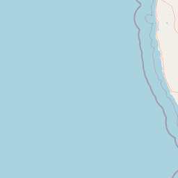
Use this park location map to pinpoint Lesueur National Park in Australia, understand its exact geographic position, and read its mapped placement within the surrounding landscape more clearly.

Pigeon | © OpenStreetMap contributors

Location context for Lesueur National Park

Western Australia
Park atlas

Trace the geographic spread of diverse conservation landscapes and botanical zones across the Geraldton Sandplains, extending beyond Lesueur National Park.

Explore Protected Areas Near Lesueur National Park, Western Australia
After exploring the unique botanical diversity and mesa formations of Lesueur National Park, browse other protected areas within Western Australia's Geraldton Sandplains bioregion. Compare their distinct landscapes, conservation priorities, and geographic features to understand the broader regional context of protected lands.
National parkWestern Australia

Drovers Cave National Park: Protected National Park Landscape in Western Australia

Discover the mapped geography and natural context of this park.

Drovers Cave National Park stands as a key protected area within the expansive Western Australian region. This national park offers a focused lens through which to explore its specific geographic identity and landscape characteristics. As a designated national park, it is mapped within the larger atlas of Australia's protected lands, providing users with structured insights into its regional setting and natural terrain.

Area
26.81 km²
Established
1972
IUCN
II
Relief
Lowland
National parkWestern Australia

Alexander Morrison National Park: Discover Its Protected Landscape and Regional Geography

Mapped protected area boundaries and landscape context in Western Australia.

Alexander Morrison National Park represents a core protected natural landscape within Western Australia. As a national park, its identity is deeply tied to its mapped geographic extent and its role in the regional atlas. This destination provides a focused lens on a specific protected area, enabling users to understand its unique landscape features and its contribution to the conservation estate of Western Australia. Delve into its protected status and geographic orientation within Australia's largest state.

Area
85 km²
Established
1970
IUCN
II
Relief
Upland
National parkWestern Australia

Badgingarra National Park: Mapped Boundaries and Protected Landscape Exploration

Explore its national park designation and regional geography.

Delve into the protected landscape identity of Badgingarra National Park, a designated national park situated in Western Australia. This entry provides detailed atlas-level information, focusing on the park's geographic scope, mapped boundaries, and its significance as a protected natural area. Understand its terrain and regional context for a deeper appreciation of Western Australia's conservation landscapes.

Area
131.08 km²
Established
1973
IUCN
II
Relief
Mixed relief
Watercolor illustration of a landscape with green rolling hills and pink clouds
National parkWestern Australia

Nambul National Park: A Protected Landscape Within Western Australia's Geographic Context

Explore mapped boundaries and regional terrain context.

Nambul National Park represents a distinct protected area within the expansive geography of Western Australia. This detailed park page offers users an atlas-driven exploration of its identity as a national park, highlighting its mapped natural landscape and its regional significance. Understand the specific geographic features and protected land context that define Nambul National Park within Australia's largest state, fostering deeper geographic discovery.

Area
192.68 km²
Established
1994
IUCN
II
Relief
Upland
National parkWestern Australia

Tathra National Park: Protected Landscape Identity and Mapped Geographic Boundaries

Western Australia national park exploration and regional context.

Delve into the protected landscape of Tathra National Park, a significant entity within Western Australia's network of natural areas. This detail provides a structured overview of its geographic position, mapped outlines, and ecological context, serving as a vital entry point for understanding Australia's diverse protected lands and regional geography.

Area
43.22 km²
Established
1970
IUCN
II
Relief
Upland
National parkWestern Australia

Watheroo National Park National Park: Mapping Protected Landscapes in Western Australia

Explore regional geography and mapped park boundaries.

Watheroo National Park represents a key protected landscape within the vast state of Western Australia. This detail page offers focused insight into the park's specific geographic character, its mapped boundaries, and its role within the regional atlas of protected areas. Understand the natural terrain and landscape context that defines this Australian national park.

Area
444.81 km²
Established
1969
IUCN
II
Relief
Upland
National parkWestern Australia

Yanchep National Park: Explore Its Unique Limestone Caves and Protected Bushland Geography

Discover the subterranean formations and coastal plain landscapes.

Yanchep National Park offers a singular opportunity for atlas-driven exploration of Western Australia's natural and cultural heritage. Situated on the Swan Coastal Plain, this national park is celebrated for its extensive network of limestone caves, including the notable Crystal Cave, providing a rare glimpse into subterranean geological processes. Beyond its underground wonders, the park encompasses diverse native bushland, supporting iconic koala colonies and offering insights into the region's ecological distinctiveness. Its deep Nyoongar heritage further enriches the understanding of this mapped protected landscape.

Area
28.76 km²
Established
1957
IUCN
II
Relief
Lowland
National parkWestern Australia

Neerabup National Park: Discover its Protected Landscape and Geographic Identity in Western Australia

Explore mapped boundaries and regional context.

Neerabup National Park represents a crucial protected landscape within Western Australia, offering a distinct geographic identity for atlas-based discovery. This page focuses on its role as a national park, detailing its mapped boundaries and situating it within the rich regional geography of Western Australia. Users can explore the park's unique natural terrain and understand its contribution to the state's protected areas.

Area
9.43 km²
Established
1965
IUCN
II
Relief
Lowland

Common questions about visiting, size, designation, and location context for Lesueur National Park

Lesueur National Park FAQs for park facts, access, geography, and protected area context
Find quick answers about Lesueur National Park, including protected-area facts, park geography, trail and visitor context, and how the park fits into its surrounding country and regional landscape.
MoriAtlas Explorer

Continue Your Protected Areas Search Across the Global Atlas

Deepen your exploration by continuing the structured search for national parks and protected areas worldwide. Utilize the comprehensive filtering capabilities to compare different conservation landscapes and refine your understanding of global park geography. Discover more about the distribution and characteristics of protected natural areas.

Global natural geography