Peaks
Cerro Inca
5,620 m

Detailed spatial analysis of terrain, regional placement, and natural land features
Examine the technical geographic landscape of Llullaillaco National Park, spanning 2687 square kilometers within the Antofagasta Region of Chile. This profile details the mountain relief, arid climate zones, and significant natural features such as the Volcán Llullaillaco, various peaks, and high-altitude wetland systems.
Related tags
High-altitude Andean volcanic wilderness in Chile's Atacama Desert region
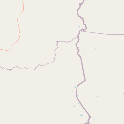
Llullaillaco National Park is a vast protected area in Chile's Antofagasta Region, situated approximately 275 kilometers southeast of the city of Antofagasta in the Andes mountain range. The park encompasses roughly 2,687 square kilometers of dramatic high-altitude terrain lying between the eastern slopes of the Cordillera Domeyko and the international border with Argentina. Its landscape is characterized by extensive semi-desert plains interspersed with quebradas, or deep ravines, while the area is crowned by the imposing summit of Llullaillaco volcano, one of the highest active volcanoes in the world. The park falls within the Central Andean dry puna ecoregion, representing one of the most ecologically distinct high-elevation desert environments on the planet. This combination of volcanic terrain, altiplano plains, and unique arid-adapted biodiversity makes the area a significant conservation priority in the Chilean protected area system.
Administrative placement in the Antofagasta Region of Chile
Interactive boundary geometry and calculated area metrics
Mountain relief classifications and recorded natural features
Peaks
5,620 m
Streams
Streams
Mountain saddles
4,787 m
Peaks
5,071 m
Peaks
4,465 m
Arid mountain relief, plateau terrain, and high-altitude desert habitats
Mountains · Valleys · Plateau · Desert
Grassland · Steppe · Desert habitat · Tundra habitat · Montane forest · Alpine meadow
Compare the geographic spread of protected areas across the Atacama Highlands, tracing similar high-altitude volcanic landscapes.
Southwest

Discover mapped boundaries and regional geography for this national park.
Pan de Azúcar National Park is a protected area situated within Chile's diverse geography. This page provides detailed information on its status as a national park, focusing on its mapped boundaries and its contribution to the regional landscape context. Users can explore its geographic significance and understand its place within the broader atlas of protected areas.
South
Explore protected landscapes and regional park context.
Nevado Tres Cruces National Park is a significant protected national park situated within the Atacama Region of Chile. This entry provides essential geographic context, detailing the park's mapped boundaries and its contribution to the region's conservation landscape. Understand its place within the broader atlas of protected areas, focusing on the natural terrain and the distinct geography that characterize this important national park.

North

High-altitude volcanic landscapes and flamingo wetlands in Potosí, Bolivia.
The Reserva nacional de fauna andina Eduardo Abaroa represents one of the most distinctive protected landscapes in the Andes. Spanning across the Altiplano, the terrain encompasses geothermal geyser fields at Sol de Mañana, dramatic volcanic summits like Licancabur, and specialized mineral lagoons. This protected area offers a look at extreme environmental adaptation, where high-altitude desert formations meet rare, nutrient-rich wetlands that sustain significant populations of Andean, James's, and Chilean flamingos.
Northwest
Explore its protected boundaries and arid terrain.
Morro Moreno National Park represents a vital protected area within the northern Chilean landscape of the Antofagasta Region. This national park serves as a focal point for understanding the specific geography and mapped terrain characteristic of this arid zone. By examining Morro Moreno National Park, users gain insight into the distribution of protected lands and the unique natural context it provides for regional geographic study.
East

Explore the mapped geography and protected area boundaries.
Los Cardones National Park represents a distinct protected landscape within Salta Province, Argentina. This page provides an atlas-driven view of its status as a national park, focusing on its geographic setting and mapped boundaries. It is designed for users seeking structured information about the park's protected-area identity and its regional landscape context, offering a foundation for broader geographic exploration.
Southeast
Explore its montane forest and mapped geographic context.
Aconquija National Park is a significant federal protected area located in Tucumán Province, Argentina. This national park is dedicated to conserving the diverse Southern Andean Yungas montane forest ecosystem, characterized by a dramatic elevational gradient. Its landscapes transition from cloud forest to high alpine terrain, offering a unique opportunity to study and appreciate a well-preserved montane environment within a critical geographic region. Discover the mapped extent and ecological importance of this protected area.
Southwest
Atacama Region National Park with Dramatic Terrain and Wildlife
Llanos de Challe National Park presents a rare protected coastal desert environment within the Atacama Region. Its unique lomas ecosystem, sustained by coastal fog, supports a surprising diversity of life. The park encompasses striking geographic features, from unspoiled white-sand beaches to rugged mountainous terrain, offering a clear example of a vital protected landscape with significant guanaco populations and unique flora, all mapped within its regional context.
East
Explore the national park's boundaries and regional terrain.
Calilegua National Park represents a vital protected landscape within Argentina's extensive geography. This detail page provides an atlas-focused view, highlighting the park's specific geographic setting and its importance as a national park. Understand its mapped terrain and how it fits within the broader conservation context of South America. This resource is crafted for in-depth geographic discovery and map-based analysis of the park's protected area features.
Deepen your understanding of Llullaillaco National Park by exploring its specific geographic features, mapped terrain, and the broader context of protected landscapes within the Antofagasta Region. This national park offers a unique opportunity to study high-altitude volcanic environments and arid ecosystems, providing valuable insights for atlas-based discovery and regional geography.