

Mori Atlas logo
National parkLulusar-Dudipatsar National Park

Discover mapped boundaries, glacial lakes, and alpine ecosystems within the Western Himalayas.

Lulusar-Dudipatsar National Park: Pakistan's Protected Mountain Landscape Atlas

Lulusar-Dudipatsar National Park represents a significant protected area within Pakistan's rugged Western Himalayas. This page offers an atlas-centric view, highlighting the park's dramatic terrain, its centerpiece glacial lakes like Dudipatsar and Lulusar, and the distribution of its high-altitude ecosystems. Explore the mapped boundaries and geographic context of this vital mountain landscape, understanding its role within Pakistan's conservation efforts and its visual prominence on the natural landscape map.

National ParkProtected AreaGlacial LakesHimalayan MountainsAlpine EnvironmentSnow Leopard Habitat

Lulusar-Dudipatsar National Park

National park

Park overview

Structured park overview, official facts, and landscape profile for Lulusar-Dudipatsar National Park

Lulusar-Dudipatsar National Park park facts, protected area profile, and essential visitor context

Review the core facts for Lulusar-Dudipatsar National Park, including designation, size, terrain, visitor scale, habitats, and operating context in one park-focused overview.

About Lulusar-Dudipatsar National Park

Lulusar-Dudipatsar National Park occupies a commanding position in the Kaghan Valley of Khyber Pakhtunkhwa province in northern Pakistan. The park was created in 2003 to protect a significant portion of the Western Himalayan landscape, centering on the scenic Dudipatsar and Lulusar lake basins. The terrain encompasses dramatic mountain scenery with peaks rising well above 3,000 meters, glacial valleys, alpine meadows, and a chain of important high-altitude lakes. The region lies at the extreme north of the Naran Valley, accessible via the town of Naran, from where treks lead to the park's interior lakes and peaks. The Western Himalayan setting provides a distinctive ecological character, with vegetation transitioning from subalpine conifer forests through alpine shrub zones to bare rock and permanent snow at the highest elevations. The park's lakes, particularly Dudipatsar, are renowned for their visual appeal, with summer waters reflecting the surrounding snow-clad peaks like a mirror. Adjacent to the park lies Saiful Muluk National Park, and together these two protected areas create a conservation corridor spanning approximately 88,000 hectares that preserves one of Pakistan's most significant mountain ecosystems.

Quick facts and research context for Lulusar-Dudipatsar National Park

Lulusar-Dudipatsar National Park is situated in the Kaghan Valley, a high-altitude valley in the Himalayan foothills of northern Pakistan. The park was formally established in 2003 and protects approximately 88,000 hectares of mountain terrain together with neighboring Saiful Muluk National Park. The name combines Lulusar, referring to a group of mountain peaks and a lake with the highest summit reaching 3,410 meters, and Dudipatsar, where the local name translates to white mountain lake reflecting the snow-capped peaks that surround it. The park lies within the Western Himalayan ecoregion, featuring both subalpine conifer forests and alpine shrub and meadow ecosystems. The region experienced significant infrastructure disruption from the 2005 Kashmir earthquake, though subsequent restoration efforts have improved access and tourism facilities.

Protection and recognition

Understanding terrestrial reserve boundaries and documented conservation records

Lulusar-Dudipatsar National Park Protected Area Status and Designation

National park datasets record Lulusar-Dudipatsar National Park as a terrestrial protected area dedicated to preserving high-altitude wilderness landscapes. Reviewing official designation status and transboundary records helps researchers evaluate the legal framework established for safeguarding regional mountain geography.

Protection details

Protection scope
Terrestrial
Transboundary protection
No
Park context

Deeper park guide and search-rich context for Lulusar-Dudipatsar National Park

Lulusar-Dudipatsar National Park history, landscape, wildlife, and travel context

Explore Lulusar-Dudipatsar National Park through its history, landscape character, ecosystems, wildlife, conservation priorities, cultural context, and seasonal travel timing in a structured park guide built for atlas discovery and search intent.

Why Lulusar-Dudipatsar National Park stands out

Lulusar-Dudipatsar National Park is best known for its spectacular glacial lake scenery, particularly Dudipatsar Lake, whose name derives from local language meaning white mountain lake. The park's high-altitude setting at the northern end of the Naran Valley places it amid some of Pakistan's most visually striking Himalayan terrain, with mirror-like lake surfaces reflecting snow-capped peaks during summer months. The park also holds significant conservation importance as habitat for the endangered snow leopard, alongside other notable species including black bear, lynx, Himalayan snowcock, and snow partridge. The presence of multiple glacial lakes including Lulusar, Pyala, Sat Sari Mala (a chain of seven alpine lakes), Daraham Sir, and Sambak Sir adds to the park's distinctive character as a destination for trekking and alpine exploration.

Lulusar-Dudipatsar National Park history and protected-area timeline

Lulusar-Dudipatsar National Park was formally established in 2003 as part of Pakistan's expanding network of protected areas. The creation of the park reflected growing recognition of the ecological and scenic value of the Kaghan Valley's high-altitude landscapes. Prior to formal protection, the area had long been recognized for its natural beauty and ecological significance, with the lakes and peaks serving as important landmarks in the region. The park's establishment came during a period when Pakistan was developing its national park system to better protect key mountain ecosystems. Access to the park and surrounding valley was significantly affected by the 2005 Kashmir earthquake, which caused widespread damage to roads and infrastructure throughout northern Pakistan. The earthquake made what had previously been relatively straightforward access more challenging. Beginning in 2006, the Pakistan government undertook efforts to restore tourism infrastructure in the Kaghan Valley, including road reconstruction and development of new tourism facilities, gradually improving access to the park and supporting its role in regional sustainable development.

Lulusar-Dudipatsar National Park landscape and geographic character

The landscape of Lulusar-Dudipatsar National Park exemplifies the dramatic topography of the Western Himalayas. The park encompasses mountainous terrain characterized by steep-sided valleys, towering peaks, and glacial cirques. The defining features are the chain of glacial lakes that dot the landscape, each set within amphitheaters of bare rock and snow. Dudipatsar Lake, the most renowned, lies encircled by snow-clad peaks at the extreme north of the Naran Valley, its name reflecting the white appearance of surrounding summits. Lulusar comprises both a lake and a group of peaks, with the highest summit reaching 3,410 meters above sea level. Additional lakes including Pyala Lake (Jalkad), the seven lakes of the Sat Sari Mala chain, Daraham Sir at approximately 4,100 meters elevation, and Sambak Sir at 3,300 meters further characterize the park's diverse lake systems. The terrain transitions through distinct elevation zones, from forested slopes through alpine meadows to exposed rock and permanent snow, creating a landscape of exceptional visual complexity.

Lulusar-Dudipatsar National Park ecosystems, habitats, and plant life

The nature of Lulusar-Dudipatsar National Park reflects its position within two significant Western Himalayan ecoregions. The lower elevations fall within the Western Himalayan subalpine conifer forests, characterized by coniferous tree cover adapted to the cool, moist conditions. At higher elevations, the vegetation shifts to Western Himalayan alpine shrub and meadows, featuring lower-growing plants adapted to the more extreme conditions of the alpine zone. This vertical zonation creates diverse habitats within a relatively limited area. The park's lakes and wetland habitats hold particular ecological importance, providing water sources and foraging areas for both resident wildlife and migratory species. These aquatic systems support aquatic invertebrates and serve as waypoints for migratory waterfowl traveling through the Himalayan flyway. The combination of forest, shrubland, meadow, and aquatic habitats creates a mosaic that supports the park's biodiversity.

Lulusar-Dudipatsar National Park wildlife and species highlights

The wildlife of Lulosar-Dudipatsar National Park includes several species of notable conservation significance. The snow leopard, an endangered large cat inhabiting high-altitude Asian mountains, is present within the park, representing one of the species that gives the protected area its conservation importance. Additional mammalian species include black bear, lynx, leopard, marmot, and weasel, each occupying different ecological niches within the mountainous environment. The avifauna features species adapted to alpine conditions, including Himalayan snowcock and snow partridge, ground-dwelling birds that inhabit the rocky terrain above the tree line. The park's lakes and wetland areas provide critical habitat for waterfowl, supporting both species that breed in the area and migratory species that use these high-altitude water bodies as stopover points along migration routes. The combination of terrestrial and aquatic habitats supports a diverse community of wildlife that reflects the park's ecological complexity.

Lulusar-Dudipatsar National Park conservation status and protection priorities

Lulusar-Dudipatsar National Park contributes significantly to conservation of Western Himalayan biodiversity. The protected area provides essential habitat for the endangered snow leopard, a species whose global population is small and fragmented across the high mountains of Central and South Asia. Beyond the snow leopard, the park protects populations of other charismatic species including black bear and lynx. The lake and wetland ecosystems hold particular importance for waterbird conservation, supporting both breeding populations and migratory species that depend on these high-altitude aquatic habitats. The park forms part of a larger conservation landscape together with adjacent Saiful Muluk National Park, creating a connected protected area network of approximately 88,000 hectares. This landscape-level protection helps maintain ecological connectivity and supports broader biodiversity conservation across the Kaghan Valley region.

Lulusar-Dudipatsar National Park cultural meaning and human context

The cultural context of Lulusar-Dudipatsar National Park is rooted in the local communities of the Kaghan Valley, who have maintained connections to this mountain landscape for generations. The place names within the park reflect the linguistic heritage of the region, with local languages contributing terms like dudi (white), pat (mountains), and sar (lake) that describe Dudipatsar's characteristic appearance. The term sar appears in the names of multiple lakes throughout the area, reflecting a consistent naming convention in the local toponymy. Access to the park traditionally came through the village of Naran, which has long served as a gateway for visitors entering the high mountain terrain. The local communities have historically engaged with the landscape through traditional land use practices, and the establishment of the national park formalized protection while maintaining the area's cultural significance.

Top sights and standout views in Lulusar-Dudipatsar National Park

The highlights of Lulusar-Dudipatsar National Park center on its exceptional alpine lake scenery and mountain landscapes. Dudipatsar Lake, with its setting surrounded by snow-capped peaks and its mirror-like summer reflections, represents the park's most iconic landscape. The chain of seven lakes known as Sat Sari Mala, accessible only during a brief window in August and September, offers a rare trekking destination for adventurous visitors. The presence of snow leopard, black bear, and other wildlife adds to the park's appeal for nature enthusiasts. The combination of accessible lakes like Lulusar and more remote destinations like Daraham Sir and Sambak Sir provides options ranging from straightforward day visits to multi-day treks. The park's position at the northern end of the Naran Valley places it within one of Pakistan's most scenic mountain regions.

Best time to visit Lulusar-Dudipatsar National Park

The best time to visit Lulusar-Dudipatsar National Park is during the summer and early autumn months, typically June through September, when the weather is most favorable for exploration. During this period, the high-altitude trails become accessible, and the lake surfaces reflect the surrounding scenery with minimal ice cover. Summer months bring warm days and relatively stable conditions suitable for trekking and camping. The brief window of August and September is particularly important for reaching higher-altitude destinations like the Sat Sari Mala lakes, which remain snowbound for most of the year and only become accessible during this short season. Earlier in the season, snow may still block some passes, while later in autumn, weather conditions become less predictable. The post-monsoon period often provides clear skies and good visibility for viewing the mountain landscapes.

Monthly climate preview

Long-term temperature ranges and precipitation patterns recorded at high elevation

Lulusar-Dudipatsar National Park Climate Normals and Monthly Weather Records

Representative coordinate data records sustained sub-zero winter temperatures alongside moderate summer maximums and varied monthly precipitation at high elevation. Examining the complete twelve-month profile provides detailed meteorological context across the protected terrain.
Annual mean-1 °C
-14 °C11 °C
Jan-14°
Feb-12°
Mar-8°
Apr-2°
May
Jun
Jul11°
Aug11°
Sep
Oct
Nov-6°
Dec-11°
Warmest month
July

11.3 °C

Coolest month
January

-13.8 °C

Wettest month
March

2.5 mm/day

Driest month
October

0.6 mm/day

Park location guide

Geography guide, regional context, and park location map for Lulusar-Dudipatsar National Park

Lulusar-Dudipatsar National Park park geography, regions, and map view in Pakistan

Understand where Lulusar-Dudipatsar National Park sits in Pakistan through a broader geographic reading of the surrounding landscape, nearby location context, and its mapped position within the national park landscape.

How Lulusar-Dudipatsar National Park fits into Pakistan

Pakistan, officially the Islamic Republic of Pakistan, is a federal parliamentary Islamic republic in South Asia. It is the fifth-most populous country and the 33rd-largest by area. The country gained independence from British India in 1947 and has a diverse history spanning ancient civilizations including Mehrgarh and the Indus Valley Civilisation. Pakistan shares maritime borders with Oman and is bounded by the Arabian Sea, Gulf of Oman, and several neighboring countries.

Wider geography shaping Lulusar-Dudipatsar National Park in Pakistan

Pakistan is located in South Asia, bordered by the Arabian Sea to the south, the Gulf of Oman to the southwest, and shares land borders with India to the east, Afghanistan to the west, Iran to the southwest, and China to the northeast. The country also shares a maritime border with Oman in the Gulf of Oman. The Wakhan Corridor in Afghanistan separates Pakistan from Tajikistan in the northwest.

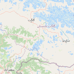
Map view of Lulusar-Dudipatsar National Park

Use this park location map to pinpoint Lulusar-Dudipatsar National Park in Pakistan, understand its exact geographic position, and read its mapped placement within the surrounding landscape more clearly.

Pigeon | © OpenStreetMap contributors

Location context for Lulusar-Dudipatsar National Park

Khyber PakhtunkhwaMansehra District
Park atlas

Browse interconnected mountain protected areas and trace the regional spread of conservation landscapes surrounding Lulusar-Dudipatsar National Park.

Discover Nearby National Parks and Protected Areas Beyond Lulusar-Dudipatsar National Park

Browse related national parks and protected areas within the Kaghan Valley, Western Himalayas, and adjacent regions, comparing shared alpine environments and glacial lake ecosystems. Compare the geographic context, landscape diversity, and conservation value of these adjacent protected areas to deepen your atlas-style park discovery.
National parkAzad Kashmir
About 11 km away#1 closest

East

Ghamot National Park: Pakistan National Park Atlas and Protected Landscape

Explore mapped boundaries and regional geography in Azad Kashmir.

Ghamot National Park represents a cornerstone for protected area exploration in Pakistan, situated within the dramatic mountainous terrain of Azad Kashmir. As a national park, it is recognized for its critical function as a wildlife corridor, especially for the survival of the Himalayan Brown Bear, and harbors diverse avian populations. This page offers detailed insight into its geographic context and its significance within a broader regional conservation strategy, providing rich data for atlas-based discovery.

Established
2004
IUCN
II
Relief
Mountain
Access
Remote access
National parkKhyber Pakhtunkhwa
About 36 km away#2 closest

Southwest

Saiful Muluk National Park: Mapped Protected Landscape and Alpine Terrain in Pakistan

Discover the geography and protected boundaries of this Himalayan national park.

Saiful Muluk National Park in Khyber Pakhtunkhwa, Pakistan, is a key protected area characterized by its stunning alpine lake and dramatic Himalayan topography. This entry details the park's geographic scope, mapped landscape features, and its role as a critical national park. Understand the unique subalpine forests and meadow habitats that define this mountainous region and its protected status.

Area
880 km²
Established
2003
IUCN
II
Relief
Mountain
National parkGilgit-Baltistan
About 46 km away#3 closest

East

Nanga Parbat National Park: Protected Himalayan Landscape and Geographic Atlas

Explore mapped boundaries and alpine terrain in Gilgit-Baltistan.

Nanga Parbat National Park is a vast protected area defined by its spectacular Himalayan setting and dramatic alpine geography within Gilgit-Baltistan, Pakistan. As a national park, it safeguards the immense Nanga Parbat massif, its surrounding glaciers, and diverse altitudinal landscapes. This page offers an atlas perspective for understanding the park's geographic scope, its mapped natural features, and its significance as a protected mountain wilderness.

Area
1,785.61 km²
Established
2021
IUCN
II
Relief
Mountain
National parkAzad Jammu and Kashmir
About 70 km away#4 closest

Southwest

Machiara National Park: A Protected National Park in Pakistan's Himalayas

Explore mapped terrain and mountain biodiversity.

Machiara National Park, located in Azad Jammu and Kashmir, Pakistan, is a designated national park preserving unique Himalayan ecosystems. This atlas-focused exploration details the park's protected landscape, encompassing steep slopes, forested ridges, and varied terrain. Discover its significance for wildlife conservation and its position within the broader regional geography, offering a clear view of its mapped natural features.

Area
135.33 km²
Established
1996
IUCN
II
Relief
Mountain
National parkPakistan
About 72 km away#5 closest

Southeast

Gurez National Park: Pakistan's Alpine Protected Landscape and Wildlife Habitat

Explore its mapped terrain and regional geographic context.

Gurez National Park stands as a protected national park within Pakistan's breathtaking Himalayan mountain system. This park is crucial for conserving the endangered musk deer and safeguarding a fragile alpine ecosystem characterized by dramatic valleys, steep peaks, and the flowing Kishenganga River. Its relative isolation preserves a unique natural landscape and traditional cultural heritage, making it a point of interest for understanding remote wilderness and conservation efforts within the South Asian atlas.

IUCN
II
Nature reserveJammu and Kashmir
About 84 km away#6 closest

Southeast

Wular Lake Nature Reserve: Protected Wetland and Freshwater Geography in the Kashmir Valley

Tectonic freshwater lake and Ramsar-recognized protected area.

Wular Lake stands as one of the largest freshwater bodies in South Asia, characterized by its tectonic origin and its role as a critical component of the Jhelum River catchment. The protected nature reserve landscape currently encompasses a mosaic of open water, reed beds, and muddy shallows that provide habitat for endemic snowtrout and migratory bird populations throughout the Kashmir Valley.

Established
1990
Relief
Lowland
Climate
Temperate
Scope
Terrestrial
Wildlife reserveGilgit-Baltistan
About 87 km away#7 closest

Northeast

Astore Wildlife Sanctuary: Protected Alpine and Mountain Landscapes in Gilgit-Baltistan

High-altitude conservation area between Nanga Parbat and Deosai

Astore Wildlife Sanctuary encompasses over 400 square kilometers of diverse mountain terrain in Pakistan. Spanning from temperate river valleys to glaciated alpine peaks, the sanctuary safeguards critical habitats for threatened species like the Astor markhor and the Himalayan brown bear. Use this geographic atlas data to understand its unique position within the western Karakoram borderlands.

Area
414.72 km²
Established
1975
Relief
Mountain
Climate
Alpine
National parkBaramulla district
About 94 km away#8 closest

South

Kazinag National Park: Protected Area Geography and Mapped Boundaries in Baramulla District

Explore the regional landscape and terrain of this national park.

Kazinag National Park represents a distinct protected area within India's Baramulla district. This entry provides structured geographic information, focusing on the park's mapped boundaries and its role as a national park. Users can explore its landscape context and understand its specific regional terrain, contributing to a comprehensive atlas view of protected lands.

Area
160 km²
Established
1992
IUCN
II
Relief
Mountain

Common questions about visiting, size, designation, and location context for Lulusar-Dudipatsar National Park

Lulusar-Dudipatsar National Park FAQs for park facts, access, geography, and protected area context

Find quick answers about Lulusar-Dudipatsar National Park, including protected-area facts, park geography, trail and visitor context, and how the park fits into its surrounding country and regional landscape.
MoriAtlas Explorer

Continue Your Protected Areas Search Across the Global Atlas

Deepen your exploration by continuing the structured search for national parks and protected areas worldwide. Utilize the comprehensive filtering capabilities to compare different conservation landscapes and refine your understanding of global park geography. Discover more about the distribution and characteristics of protected natural areas.

Global natural geography
