Mori Atlas logo
National parkMachiara National Park

Discover mapped park boundaries and diverse montane terrain in Pakistan's Western Himalayas.

Machiara National Park: Protected Himalayan Landscape in Azad Jammu and Kashmir

Machiara National Park represents a significant protected area within the Azad Jammu and Kashmir region of Pakistan. Established as a national park, it safeguards rugged Himalayan terrain, encompassing critical habitats for threatened species. This page offers an atlas-style exploration of Machiara National Park, detailing its mapped boundaries, diverse forest ecosystems, and unique geographic context within the Neelum and Kaghan Valleys.

Himalayan protected areaNational park in PakistanSnow leopard habitatImportant Bird AreaWestern Himalayan forestsAzad Kashmir

Machiara National Park

National park

Park overview

Structured park overview, official facts, and landscape profile for Machiara National Park

Machiara National Park park facts, protected area profile, and essential visitor context

Review the core facts for Machiara National Park, including designation, size, terrain, visitor scale, habitats, and operating context in one park-focused overview.

About Machiara National Park

Machiara National Park occupies a strategically important position in the Himalayan mountain system, protecting a transect of montane forest and alpine terrain in northern Pakistan. The park's location near Muzaffarabad places it at relatively accessible elevation for visitors seeking to experience Himalayan wilderness without extreme altitude challenges. The landscape features a mix of evergreen broadleaved forests and deciduous broad-leaved woodlands that create distinct seasonal visual character throughout the year. This forest composition places the park within the Western Himalayan Broadleaf Forests ecoregion, one of the world's 200 most significant ecoregions for biodiversity conservation. The presence of two major river valleys flanking the park creates varied microclimates and supports ecological diversity that extends from lower-elevation forest through subalpine zones. The park's establishment in 1996 reflected Pakistan's growing commitment to protecting its Himalayan biodiversity heritage, though the region had long served as a natural habitat for numerous species adapted to these mountainous environments.

Quick facts and research context for Machiara National Park

Machiara National Park spans roughly 33,437 acres in the Himalayan foothills of Azad Kashmir, Pakistan, near Muzaffarabad. The park was formally established in 1996 and lies within the Western Himalayan Broadleaf Forests, a Global 200 Ecoregion recognized for its ecological significance. Annual precipitation averages 1526.7mm, with July being the wettest month and November the driest. The park has been designated an Important Bird Area by BirdLife International due to its exceptional avifauna, including species such as the western tragopan and cheer pheasant.

Protection and recognition

Examining the official terrestrial classification and documented environmental management framework.

Machiara National Park Protected Area Status and Terrestrial Conservation Profile

Geographic records trace the official terrestrial protection scope and documented boundary status established for Machiara National Park. Exploring the designated terrestrial status helps conservationists verify regional preservation networks and compare standardized park frameworks across the geography.

Protection details

Protection scope
Terrestrial
Transboundary protection
No
Park context

Deeper park guide and search-rich context for Machiara National Park

Machiara National Park history, landscape, wildlife, and travel context

Explore Machiara National Park through its history, landscape character, ecosystems, wildlife, conservation priorities, cultural context, and seasonal travel timing in a structured park guide built for atlas discovery and search intent.

Why Machiara National Park stands out

Machiara National Park is best known for its exceptional Himalayan biodiversity and its role as a refuge for several globally threatened species. The park is particularly renowned for snow leopard habitat, supporting one of the rarer large cat species in the world. It also protects significant populations of Kashmir musk deer, a critically important alpine species. For birdwatchers, the park offers encounters with prized species including the western tragopan, one of the rarest pheasants in the Himalayas, and the cheer pheasant. The park's designation as an Important Bird Area underscores its value as a breeding and nesting ground for numerous Himalayan bird species.

Machiara National Park history and protected-area timeline

Machiara National Park was formally established in 1996 through official notification as a national park within Pakistan's protected area system. The designation came as recognition of the region's exceptional natural values and the need to conserve the Himalayan biodiversity found within its boundaries. Prior to national park status, the area functioned as important wildlife habitat with local communities maintaining traditional relationships with the mountain environment. The park's creation was part of a broader expansion of Pakistan's national park network during the 1990s, a period when several new protected areas were established to address gaps in ecological representation. The park's proximity to Muzaffarabad, the capital of Azad Kashmir, has influenced its management and accessibility, though the challenging mountain terrain has limited development pressure that might otherwise affect more accessible protected areas.

Machiara National Park landscape and geographic character

The physical landscape of Machiara National Park reflects the dynamic geological processes that have shaped the western Himalayas over millions of years. The terrain consists of steep mountain slopes, narrow valleys, and forested ridges that descend from higher alpine zones into the approaches of the Kashmir valley system. Forest vegetation covers much of the accessible terrain, with evergreen broadleaved species dominating lower slopes while deciduous broad-leaved woodlands occupy middle elevations. The park's position between two significant valleys, Neelum Valley to the east and Kaghan Valley to the west, places it along an important ecological transition zone. River Neelum, flowing along the eastern boundary, contributes to the hydrological character of the region and provides water resources for both wildlife and downstream communities. The overall elevation range within the park supports diverse habitat types from forested slopes to rocky alpine terrain.

Machiara National Park ecosystems, habitats, and plant life

The ecological character of Machiara National Park is defined by its position within the Western Himalayan Broadleaf Forests ecoregion, one of the most biodiverse montane forest systems in Asia. Annual precipitation of approximately 1526.7mm sustains dense forest cover across much of the protected area, with the seasonal pattern creating distinct growing conditions throughout the year. July brings the heaviest rainfall, supporting lush vegetation growth during the summer monsoon season, while November's minimal precipitation marks the transition into the drier winter period. This climatic regime supports a complex vertical stratification of vegetation, from evergreen broadleaved forests in the lower elevations through mixed broadleaf communities to subalpine conditions at higher reaches. The forest composition includes species adapted to the subtropical monsoon climate of the western Himalayas, creating ecosystems that differ markedly from the dry alpine conditions found in more continental Himalayan locations.

Machiara National Park wildlife and species highlights

The wildlife community of Machiara National Park reflects the exceptional biodiversity of the western Himalayas, with the park supporting both globally threatened large mammals and a remarkable diversity of bird species. Snow leopard, one of the rarest and most elusive big cats in the world, inhabits the higher elevations of the park, preying on blue sheep and other mountain ungulates in the rocky terrain. The Kashmir musk deer, a small alpine cervid prized for its musk-producing glands, occupies subalpine meadows and forested slopes within the park's boundaries. Among the park's remarkable bird fauna, the western tragopan stands out as one of the most sought-after species for birdwatchers visiting the Himalayas, while the cheer pheasant represents another member of the pheasant family with restricted distribution. Raptors including the lammergeier and Himalayan vulture soar over the mountain terrain, while numerous smaller bird species such as the hoary-throated barwing, white-cheeked bushtit, and Kashmir nuthatch inhabit the forested areas. The park's designation as an Important Bird Area by BirdLife International recognizes its significance for bird conservation.

Machiara National Park conservation status and protection priorities

Machiara National Park plays a crucial role in protecting a segment of the Western Himalayan Broadleaf Forests ecoregion that faces numerous pressures from human activity and development across its range. The park's inclusion within the Global 200 ecoregion designation reflects its importance as one of the world's most significant ecological areas requiring conservation attention. Protection of snow leopard habitat within the park contributes to conservation of this apex predator across its limited global range in the high mountains of Central and South Asia. The Kashmir musk deer, another species of conservation concern, benefits from the protected status that limits hunting pressure within park boundaries. The Important Bird Area designation by BirdLife International provides additional recognition of the park's significance for conservation of Himalayan bird species, several of which have restricted distributions and face habitat threats outside protected areas. Management of the park must balance conservation objectives with the needs of local communities who have historically used the area for livelihoods.

Machiara National Park cultural meaning and human context

Machiara National Park is located in the Azad Kashmir region of Pakistan, an area with deep cultural connections to the broader Himalayan world. The park lies near Muzaffarabad, the regional capital, placing it within a landscape that has been inhabited for centuries by communities whose lives are intertwined with the mountain environment. The valley systems that border the park, particularly Neelum Valley, have historically served as trade routes and seasonal grazing areas for local populations. Traditional land use practices in the broader region have shaped both the landscape and the relationship between human communities and the natural environment. While the park itself restricts certain activities to protect wildlife, the surrounding areas continue to support agricultural communities whose practices influence the park's edge zones and the broader landscape context.

Top sights and standout views in Machiara National Park

Machiara National Park offers exceptional opportunities to experience Himalayan mountain nature in a relatively accessible setting near Muzaffarabad. The park's diverse forest ecosystems, spanning from evergreen broadleaved to deciduous woodlands, create visually striking seasonal changes throughout the year. Wildlife enthusiasts may encounter snow leopards in the higher terrain, though sighting these elusive cats requires patience and luck. Birdwatchers find particular value in the park's avifauna, with species such as western tragopan and cheer pheasant representing highlights for serious bird observers. The park's position between two major valleys provides scenic backdrops of mountain terrain that characterizes the western Himalayas. The Important Bird Area status underscores the park's value for conservation of species with restricted distributions in the Himalayan region.

Best time to visit Machiara National Park

The optimal time to visit Machiara National Park spans from spring through autumn, when weather conditions allow comfortable exploration of the mountain terrain. Spring months bring forest vegetation into fresh leaf, creating attractive scenery as deciduous species emerge from winter dormancy. Summer months coincide with the monsoon season, bringing lush vegetation but also heavy rainfall that affects trail conditions and visibility. Autumn offers clear skies and stable weather as the monsoon retreats, providing excellent conditions for wildlife viewing and landscape photography. Winter conditions involve significant snowfall at higher elevations, limiting accessibility to much of the park's terrain. The park can be visited year-round, though spring and autumn generally provide the most favorable combination of accessible conditions and pleasant weather for outdoor exploration.

Monthly climate preview

Trace historical temperature ranges and daily precipitation patterns across the high-elevation terrain.

Machiara National Park Weather by Month and Long-Term Climate Normals

Long-term records for Machiara National Park reveal an annual cycle stretching from freezing winter temperatures below zero to peak warmth and rainfall during the mid-year months. Exploring the complete dataset provides detailed monthly minimums, maximums, and daily precipitation averages to construct a comprehensive profile of the protected mountain habitat.
Annual mean11 °C
-1 °C21 °C
Jan-1°
Feb
Mar
Apr11°
May16°
Jun20°
Jul21°
Aug19°
Sep16°
Oct11°
Nov
Dec
Warmest month
July

20.6 °C

Coolest month
January

-0.7 °C

Wettest month
August

4 mm/day

Driest month
October

0.9 mm/day

Park location guide

Geography guide, regional context, and park location map for Machiara National Park

Machiara National Park park geography, regions, and map view in Pakistan

Understand where Machiara National Park sits in Pakistan through a broader geographic reading of the surrounding landscape, nearby location context, and its mapped position within the national park landscape.

How Machiara National Park fits into Pakistan

Pakistan, officially the Islamic Republic of Pakistan, is a federal parliamentary Islamic republic in South Asia. It is the fifth-most populous country and the 33rd-largest by area. The country gained independence from British India in 1947 and has a diverse history spanning ancient civilizations including Mehrgarh and the Indus Valley Civilisation. Pakistan shares maritime borders with Oman and is bounded by the Arabian Sea, Gulf of Oman, and several neighboring countries.

Wider geography shaping Machiara National Park in Pakistan

Pakistan is located in South Asia, bordered by the Arabian Sea to the south, the Gulf of Oman to the southwest, and shares land borders with India to the east, Afghanistan to the west, Iran to the southwest, and China to the northeast. The country also shares a maritime border with Oman in the Gulf of Oman. The Wakhan Corridor in Afghanistan separates Pakistan from Tajikistan in the northwest.

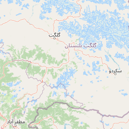
Map view of Machiara National Park

Use this park location map to pinpoint Machiara National Park in Pakistan, understand its exact geographic position, and read its mapped placement within the surrounding landscape more clearly.

Pigeon | © OpenStreetMap contributors

Location context for Machiara National Park

Azad Jammu and Kashmir
Park atlas

Explore Additional Himalayan Protected Landscapes and Compare Montane Biodiversity Regions

Discover Other National Parks and Protected Areas Surrounding Machiara National Park

Trace the broader geographic spread of protected areas surrounding Machiara National Park, including other Himalayan conservation landscapes and forest reserves in Pakistan's Azad Kashmir region. Compare diverse montane environments and map the regional context of vital wildlife habitats across a wider selection of national parks.
National parkKhyber Pakhtunkhwa
About 32 km away#1 closest

North

Saiful Muluk National Park: Mapped Protected Landscape and Alpine Terrain in Pakistan

Discover the geography and protected boundaries of this Himalayan national park.

Saiful Muluk National Park in Khyber Pakhtunkhwa, Pakistan, is a key protected area characterized by its stunning alpine lake and dramatic Himalayan topography. This entry details the park's geographic scope, mapped landscape features, and its role as a critical national park. Understand the unique subalpine forests and meadow habitats that define this mountainous region and its protected status.

Area
880 km²
Established
2003
IUCN
II
Relief
Mountain
National parkAzad Kashmir
About 52 km away#2 closest

South

Panjal Mastan National Park: High-Altitude Plateau Landscape in Azad Kashmir

Discover mapped terrain and protected area geography.

Panjal Mastan National Park represents a significant protected landscape within the Pir Panjal mountain range of Azad Kashmir, Pakistan. This national park is characterized by its expansive high-altitude plateau, sitting at an average elevation of 2,800 meters, offering a unique regional geography. Known for its dramatic mountainous surroundings and seasonal wildflower meadows that bloom in spring, the park provides valuable context for understanding the natural terrain and protected area distribution in this part of the western Himalayas.

Area
300 km²
IUCN
II
Relief
Mountain
Climate
Alpine
National parkBaramulla district
About 55 km away#3 closest

Southeast

Kazinag National Park: Protected Area Geography and Mapped Boundaries in Baramulla District

Explore the regional landscape and terrain of this national park.

Kazinag National Park represents a distinct protected area within India's Baramulla district. This entry provides structured geographic information, focusing on the park's mapped boundaries and its role as a national park. Users can explore its landscape context and understand its specific regional terrain, contributing to a comprehensive atlas view of protected lands.

Area
160 km²
Established
1992
IUCN
II
Relief
Mountain
National parkPakistan
About 70 km away#4 closest

Northeast

Lulusar-Dudipatsar National Park: Pakistan's Dramatic Western Himalayan Protected Area

Explore alpine lakes, mountain scenery, and protected landscape geography.

Lulusar-Dudipatsar National Park stands as a remarkable protected landscape within Pakistan's Western Himalayas. The park's geography is defined by towering peaks and a series of pristine glacial lakes, including the iconic Dudipatsar and Lulusar lakes. Users can explore its mapped terrain and understand its significance as a high-altitude ecosystem and a key component of Pakistan's protected areas network.

Established
2003
IUCN
II
Relief
Mountain
Climate
Alpine
National parkAzad Kashmir
About 76 km away#5 closest

Northeast

Ghamot National Park: Pakistan National Park Atlas and Protected Landscape

Explore mapped boundaries and regional geography in Azad Kashmir.

Ghamot National Park represents a cornerstone for protected area exploration in Pakistan, situated within the dramatic mountainous terrain of Azad Kashmir. As a national park, it is recognized for its critical function as a wildlife corridor, especially for the survival of the Himalayan Brown Bear, and harbors diverse avian populations. This page offers detailed insight into its geographic context and its significance within a broader regional conservation strategy, providing rich data for atlas-based discovery.

Established
2004
IUCN
II
Relief
Mountain
Access
Remote access
National parkKhyber Pakhtunkhwa
About 85 km away#6 closest

Southwest

Ayubia National Park: Protected Area Identity and Mountainous Terrain

Discover its mapped geography within Khyber Pakhtunkhwa

Ayubia National Park stands as a key protected landscape within the Himalayan foothills of Khyber Pakhtunkhwa, Pakistan. Its designation as a national park signifies its role in conserving unique temperate coniferous and mixed forests across steep mountainous terrain. This page details the park's geographic setting, its mapped boundaries, and the natural features that define its protected status, offering a structured view for atlas-driven exploration of Pakistan's natural heritage.

Area
33.12 km²
Established
1984
IUCN
V
Visitors
250K annual
National parkPunjab
About 86 km away#7 closest

South

Murree-Kotli Sattian-Kahuta National Park: Punjab Protected Landscape and Watershed

Western Himalayan foothills and Pothohar Plateau geography

Located in the Rawalpindi District, this national park preserves an extensive band of rugged terrain and chir pine forests. As a critical ecological bridge between neighboring protected areas, it provides essential habitat connectivity and maintains the health of river catchments that supply water to major urban centers in Punjab.

Area
473.7 km²
Established
2020
IUCN
II
Relief
Mountain
Nature reserveJammu and Kashmir
About 88 km away#8 closest

East

Wular Lake Nature Reserve: Protected Wetland and Freshwater Geography in the Kashmir Valley

Tectonic freshwater lake and Ramsar-recognized protected area.

Wular Lake stands as one of the largest freshwater bodies in South Asia, characterized by its tectonic origin and its role as a critical component of the Jhelum River catchment. The protected nature reserve landscape currently encompasses a mosaic of open water, reed beds, and muddy shallows that provide habitat for endemic snowtrout and migratory bird populations throughout the Kashmir Valley.

Established
1990
Relief
Lowland
Climate
Temperate
Scope
Terrestrial

Common questions about visiting, size, designation, and location context for Machiara National Park

Machiara National Park FAQs for park facts, access, geography, and protected area context

Find quick answers about Machiara National Park, including protected-area facts, park geography, trail and visitor context, and how the park fits into its surrounding country and regional landscape.
MoriAtlas Explorer

Continue Your Protected Areas Search Across the Global Atlas

Deepen your exploration by continuing the structured search for national parks and protected areas worldwide. Utilize the comprehensive filtering capabilities to compare different conservation landscapes and refine your understanding of global park geography. Discover more about the distribution and characteristics of protected natural areas.

Global natural geography