Mori Atlas logo
National parkMakhtesh Ramon

Explore millions of years of geological history etched into dramatic desert landscapes.

Makhtesh Ramon National Park: A Vast Erosion Cirque in Israel's Negev Desert

(Ramon Nature Reserve)

Makhtesh Ramon National Park, situated in Israel's southern Negev Desert, is an immense erosion cirque spanning 40 kilometers. This protected landscape showcases an extraordinary geological record, with exposed rock layers up to 200 million years old forming colorful clay hills, ancient volcanic remnants, and striking fossil-rich deposits. Its unique topography and vibrant desert terrain offer a captivating glimpse into Earth's past and the dynamic forces of nature that shaped this remarkable region.

Erosion CirqueDesert LandscapeGeological HeritageNegev DesertVolcanic FormationsFossil Sites

Makhtesh Ramon

National park

Park overview

Structured park overview, official facts, and landscape profile for Makhtesh Ramon

Makhtesh Ramon park facts, protected area profile, and essential visitor context
Review the core facts for Makhtesh Ramon, including designation, size, terrain, visitor scale, habitats, and operating context in one park-focused overview.

About Makhtesh Ramon

Makhtesh Ramon represents a geological treasure in the heart of Israel's desert landscape, offering visitors and researchers an extraordinary window into Earth's deep past. This vast erosion cirque, measuring 40 kilometers in length, was carved over approximately 5 million years as the Arava Rift Valley formed and rivers altered their courses, preferentially eroding softer rock layers within what was once a dome-shaped hill structure. The resulting depression exposes rock formations spanning up to 200 million years, with the oldest layers visible at the bottom near Ein Saharonim spring, the only natural water source sustaining wildlife throughout the year. The surrounding mountain ridges include Har Ramon, Har Ardon, Har Marpek, and Har Katum, each adding to the dramatic topography that distinguishes this landscape from typical desert terrain. Within the crater, visitors encounter an array of geological wonders: the black volcanic hill of Giv'at Ga'ash, the dark magmatic intrusion of Shen Ramon rising like a sharp tooth against the creamy southern wall, and the polygonal columnar formations of HaMinsara in the center. The northeastern hills preserve remains of spiral ammonite fossils, ranging from snail-sized to massive specimens, though most large fossils have been extracted over time. Today the Ramon Nature Reserve encompasses this entire landscape, providing protection for both its geological and ecological heritage.

Quick facts and research context for Makhtesh Ramon

Makhtesh Ramon lies in Israel's Southern District within the Negev Desert, with the small town of Mitzpe Ramon positioned on the northern edge of the depression. The formation spans roughly 40 kilometers in length and represents the world's largest erosion cirque, a unique geological landform created by gradual water erosion rather than volcanic or impact processes. The crater exposes ancient geological layers dating back approximately 200 million years, with the oldest rocks visible at the bottom near Ein Saharonim, the sole natural water source within the depression. The surrounding rim features prominent mountains including Har Ramon at the southern end and Har Ardon to the northeast, while the interior contains distinctive landmarks such as the columnar sandstone formation known as HaMinsara and the dark magmatic rock of Shen Ramon.

Park context

Deeper park guide and search-rich context for Makhtesh Ramon

Makhtesh Ramon history, landscape, wildlife, and travel context
Explore Makhtesh Ramon through its history, landscape character, ecosystems, wildlife, conservation priorities, cultural context, and seasonal travel timing in a structured park guide built for atlas discovery and search intent.

Why Makhtesh Ramon stands out

Makhtesh Ramon is renowned for its exceptional geological significance, displaying a remarkable sequence of ancient rock layers exposed through erosion over millions of years. The formation contains diverse geological features including red and yellow clay hills, ancient volcanic vents like Giv'at Ga'ash with its basalt flows, and the striking columnar jointed sandstone of HaMinsara that resembles a carpentry shop. The site preserves one of the world's most accessible and visually spectacular records of the Triassic period, with abundant ammonite fossils embedded in the northeastern cliffs. The park also stands out for its successful wildlife conservation programs, including the reintroduction of the Asiatic wild ass and Arabian oryx to their historic desert habitat.

Makhtesh Ramon history and protected-area timeline

The Makhtesh Ramon area carries human history spanning millennia, positioned along the ancient Incense Route that connected Arabia with Mediterranean markets. Within the depression lie ruins of Khan Saharonim, a substantial prehistoric stone structure that served as a caravanserai for Nabataean traders approximately 2,000 years ago. The Arabic word khan refers to this type of waystation where merchants and their animals could rest during the westward journey toward the port city of Gaza. Perched on the northern cliff rim, Metzad Mahmal represents another significant archaeological site, a fortified stronghold employed by both the Nabataeans and later the Romans to safeguard this lucrative trade route. Archaeological excavations at Metzad Mahmal revealed its importance as a surveillance and defense point along the Incense Route connecting Petra to Avdat. In 2005, these heritage sites were recognized by UNESCO as World Heritage sites, acknowledging their historical significance in the broader context of ancient trade networks across the region.

Makhtesh Ramon landscape and geographic character

The landscape of Makhtesh Ramon presents one of the most visually dramatic geological environments in the Middle East. The main crater depression, stretching 40 kilometers across the desert floor, creates a vast enclosed basin with walls rising 500 meters above the bottom. The interior displays an extraordinary palette of colors, with clay hills displaying striking red and yellow hues shaped by erosion into curious forms. Around the crater's perimeter, distinctive table mountains rise sharply: Har Ramon at the southern end reaches the highest elevation, while Har Marpek and Har Katum form prominent landmarks along the southern wall. The northeastern section contains the fossil-rich hills where ancient ammonite shells once completely covered the slopes. Black volcanic hills, particularly Giv'at Ga'ash in the north, mark ancient volcanic activity where lava flows cooled to form basalt, with similar formations appearing in the southern portion including Karnei Ramon. The centerpiece of the interior, HaMinsara, appears as a low hill composed of remarkable columnar sandstone that has been compressed and metamorphosed into hard quartzite, with its polygonal prismatic columns creating an appearance reminiscent of a carpentry shop's organized timber stacks.

Makhtesh Ramon ecosystems, habitats, and plant life

The ecological character of Makhtesh Ramon reflects the harsh yet resilient nature of desert ecosystems in the Negev. The presence of Ein Saharonim, the only natural spring within the crater, creates an essential ecological corridor supporting wildlife throughout this arid environment. The geological diversity translates into varied microhabitats, from the rocky slopes favored by Nubian ibex to the more vegetated areas where desert flora clings to moisture in sheltered locations. The ancient seabed that once covered this region, part of the Tethys Ocean, has left geological rather than ecological traces, but the resulting mineral-rich soils support specialized desert vegetation. Despite the extreme aridity, the protected area maintains remarkable biodiversity, with the reintroduced populations of Asiatic wild ass and Arabian oryx representing conservation successes that have restored species to lands where they were historically extirpated.

Makhtesh Ramon wildlife and species highlights

Makhtesh Ramon supports a diverse community of desert-adapted wildlife, with several species reintroduced as part of conservation programs. The Asiatic wild ass, known locally as the onager, has been successfully reintroduced to the crater, with the population growing from initial introductions to approximately 40 adults by 1995. These animals represent hybrids of two subspecies, the Turkmenian kulan and the Persian onager, as the original Syrian wild ass subspecies is now extinct. Large mammals roaming the area include Nubian ibex, recognizable by their distinctive curved horns, Dorcas gazelles, striped hyenas, Arabian wolves, caracals, and golden jackals. The reintroduction of Arabian oryx has further enriched the mammal community. Historical records indicate Arabian leopards once inhabited the region, though they are now believed to be extirpated from Israel. The presence of the spring at Ein Saharonim provides crucial water access supporting these species, particularly during dry periods when surface water becomes scarce.

Makhtesh Ramon conservation status and protection priorities

Makhtesh Ramon holds significant conservation importance as Israel's largest national park, protecting a unique combination of geological heritage and desert ecosystems. The Ramon Nature Reserve designation ensures preservation of the erosion cirque and its extraordinary geological exposures, which provide scientific access to rock layers spanning hundreds of millions of years. The wildlife conservation program represents a notable success story, particularly the reintroduction of the Asiatic wild ass and Arabian oryx, which have established viable populations within the protected boundaries. The presence of rare desert species, including the Nubian ibex and caracal, further underscores the ecological value of maintaining this protected area. The inclusion of the Incense Route sites, particularly Metzad Mahmal, within the UNESCO World Heritage designation in 2005 added cultural heritage to the conservation framework, ensuring integrated protection of both natural and archaeological resources.

Makhtesh Ramon cultural meaning and human context

The cultural dimension of Makhtesh Ramon centers on its position along the ancient Incense Route, a trade corridor that connected Arabian incense-producing regions with Mediterranean consumer markets. The Nabataean civilization, renowned for their stone-carving expertise and trade networks, established waystations throughout the Negev, with Khan Saharonim serving travelers moving through this vast depression. The strategic importance of the route is demonstrated by Metzad Mahmal, a fortified site on the northern rim providing both surveillance and defense capabilities. Following the Nabataean period, Roman control of the region maintained the route's significance, with the stronghold continuing to serve protective functions. The Arabic name Wadi Raman and Hebrew name מכתש רמון both reflect the site's identity, with the Hebrew term makhtesh specifically describing this unique erosion cirque landform that exists in only a few locations globally, all within Israel's Negev.

Top sights and standout views in Makhtesh Ramon

The geological wonders of Makhtesh Ramon make it a premier destination for understanding Earth's ancient history, with exposed rock layers spanning up to 200 million years visible in the crater walls. The dramatic contrast between the dark magmatic rock of Shen Ramon and the creamy-colored southern wall creates one of the most photographed scenes in the park. HaMinsara, with its remarkable columnar quartzite formations resembling a petrified forest of stone columns, offers a unique visual landmark not found elsewhere in the region. The successful reintroduction of the Asiatic wild ass and Arabian oryx provides wildlife viewing opportunities in a setting where these species had been extirpated. The archaeological remnants of the Incense Route, particularly the fortified site of Metzad Mahmal, add historical depth to the natural landscape, while the panoramic views from Mitzpe Ramon on the crater's rim encompass the entire depression and its mountain boundaries.

Best time to visit Makhtesh Ramon

The optimal time to explore Makhtesh Ramon spans the cooler months from October through April, when daytime temperatures are more comfortable for outdoor activities and the landscape displays greater visual appeal. Winter and early spring may bring brief rain showers that briefly green the desert floor, adding contrast to the typical arid colors. Summer months bring extreme heat that makes extensive hiking uncomfortable and limits time spent on exposed terrain. The crater's unique topography creates interesting atmospheric effects, with morning mists occasionally drifting down into the depression, while sunset from the rim offers particularly memorable views as the colorful rock formations shift through warm tones. Those interested in wildlife viewing may find early morning hours most productive, when animals are most active near the spring and before temperatures rise.
Park location guide

Geography guide, regional context, and park location map for Makhtesh Ramon

Makhtesh Ramon park geography, regions, and map view in Israel
Understand where Makhtesh Ramon sits in Israel through a broader geographic reading of the surrounding landscape, nearby location context, and its mapped position within the national park landscape.

How Makhtesh Ramon fits into Israel

Israel is a parliamentary republic in the Southern Levant, established in 1948 as a Jewish homeland. It borders Lebanon, Syria, Jordan, and Egypt, with Mediterranean coastline and access to the Red Sea. Jerusalem is the capital, though its status is contested, while Tel Aviv is the largest urban area. The country has a high-income economy with strong technology and innovation sectors.

Wider geography shaping Makhtesh Ramon in Israel

Israel occupies the Southern Levant region of West Asia. It is bordered by Lebanon to the north, Syria to the northeast, Jordan to the east, and Egypt to the southwest. The western coast lies on the Mediterranean Sea, while the southern tip reaches the Red Sea. The eastern border includes the Dead Sea, Earth's lowest point. The country occupies the West Bank, Gaza Strip, and Golan Heights.

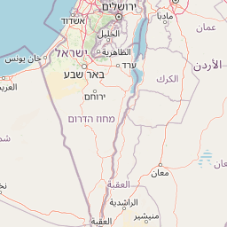
Map view of Makhtesh Ramon

Use this park location map to pinpoint Makhtesh Ramon in Israel, understand its exact geographic position, and read its mapped placement within the surrounding landscape more clearly.

Pigeon | © OpenStreetMap contributors
Park atlas

Compare regional protected areas, tracing their geographic spread and unique desert landscapes surrounding Makhtesh Ramon.

Discover Related National Parks and Protected Areas Surrounding Makhtesh Ramon
Browse other national parks and protected areas in the Negev Desert region, comparing landscapes, unique geological formations, and diverse conservation sites surrounding Makhtesh Ramon. This geographic overview allows for direct comparison of protected landscapes, helping you trace their spread and understand the distinct natural heritage preserved across the wider region.
Watercolor illustration of a canyon with winding river, mountains, and rolling hills
National parkIsrael

Ein Avdat National Park: A Spectular Desert Oasis and Protected Landscape in Israel

Explore its unique springs, waterfalls, and ancient Nabatean and Byzantine history.

Ein Avdat National Park showcases a rare desert oasis environment, a starkly beautiful protected landscape where natural springs emerge from the Negev's arid terrain. This park is celebrated for its dramatic waterfalls, deep pools, and the preserved remnants of ancient human habitation, including a remarkable Byzantine cave monastery carved directly into the canyon walls. Its geography, shaped by the Nahal Zin wadi, provides a vivid study in desert ecosystems and their capacity for supporting life and history over millennia, making it a key site for understanding landscape context in Israel.

Area
4.8 km²
IUCN
V
Relief
Mixed relief
Climate
Arid
Watercolor illustration of a mountainous landscape with multiple colored terrain layers
Biosphere reserveJordan

Dana Biosphere Reserve: Mapped Biosphere Reserve in Jordan's Geography

Explore protected landscape boundaries and regional context.

Dana Biosphere Reserve is a critical protected landscape in Jordan, recognized for its significant geographic features and ecological value. This page offers detailed insights into its mapped boundaries and its place within the broader regional geography of the Middle East. It serves as an essential resource for understanding the park's protected-area identity and its contribution to Jordan's natural heritage, facilitating a deeper atlas-driven exploration of its terrain and conservation significance.

Area
308 km²
Established
1989
Relief
Mixed relief
Scope
Terrestrial
Watercolor illustration showing a winding river through green hills with distant trees under a light sky
National park

Eshkol National Park: Desert Wetland Oasis with Archaeological Significance in Southern Israel

Mapped protected area featuring Ein HaBesor spring and Besor valley landscapes.

Eshkol National Park showcases a rare desert wetland environment sustained by the significant Ein HaBesor spring in Israel's Northern Negev. This protected natural area offers a distinctive landscape where water nourishes lush vegetation against the backdrop of arid terrain. Beyond its ecological value, the park encompasses archaeological remnants, including the mound of Khirbet Shalala, providing a rich geographical and historical discovery context within the Besor Stream basin.

Area
3.54 km²
Relief
Lowland
Climate
Arid
Access
Easy access
Nature reserveJordan

Wadi Mujib Nature Reserve: Explore Jordan's Dramatic Canyon Protected Landscape

Discover mapped boundaries and arid biodiversity within this unique rift valley gorge.

Wadi Mujib Nature Reserve represents a significant protected landscape in Jordan, celebrated for its deep desert canyon and dramatic slot canyon terrain. Situated in the Dead Sea region, this reserve protects a remarkable range of geography, from its lowest points near the Dead Sea to surrounding mountain terrain. Its status as a UNESCO biosphere reserve highlights its importance for arid biodiversity and its role as a migratory bird flyway, offering a distinct atlas-level discovery of Jordan's natural heritage.

Area
212 km²
Established
1987
IUCN
IV
Relief
Mountain
Watercolor painting of rolling hills with pink, green, and purple hues
National parkIsrael

Ashkelon National Park: Ancient Coastal Protected Landscape and Archaeological Atlas

Explore mapped ruins, Fatimid walls, and Mediterranean coastal geography.

Ashkelon National Park in Israel offers a unique dive into ancient urban development, preserving layers of history from multiple civilizations along the Mediterranean coast. This protected area features landmark archaeological discoveries, including the Middle Bronze Age gate and extensive Roman ruins, all situated within a distinct coastal landscape. Understanding its mapped boundaries and the progression of its terrain provides critical context for appreciating this significant heritage site's geographic and historical importance.

IUCN
V
Relief
Lowland
Climate
Mediterranean
Access
Access unknown
National parkIsrael

Castel National Park: A National Park for Geographic Discovery in Israel

Investigate the mapped protected landscape and regional terrain.

Castel National Park represents a key protected area within Israel, focusing on the discovery of its mapped terrain and geographic identity. As a national park, it serves as a crucial entity for understanding regional conservation landscapes and the distribution of protected areas across Israel. This detailed view allows for focused exploration of the park's boundaries and its contribution to the country's natural heritage, offering valuable context for atlas-based geographical inquiry.

Relief
Mountain
Climate
Mediterranean
Scope
Terrestrial
Water
No major water
National parkIsrael

Yarkon-Tel Afek National Park: Explore Its Protected Landscape and Israeli Geography

Mapped protected area and natural terrain context.

Gain a structured understanding of Yarkon-Tel Afek National Park, a designated national park within Israel. This detail entry focuses on its geographic identity and role as a protected landscape, providing essential context for atlas exploration. Understand the park's mapped boundaries and its contribution to the natural geography of the region without extraneous visitor details.

Scope
Terrestrial
Water
Minor water
Nature reserveAjloun Governorate

Ajloun Forest Reserve: A Protected Mediterranean Woodland in Jordan's Ajloun Governorate

Explore the unique protected landscape and mapped terrain of Ajloun Forest Reserve.

Ajloun Forest Reserve is a nature reserve located in Jordan's Ajloun Governorate, distinguished by its rare Mediterranean woodland ecosystem. This protected area provides crucial habitat and showcases a landscape of rolling hills and valleys, offering a stark contrast to the country's predominantly arid regions. Its designation as a UNESCO biosphere reserve underscores its importance for conservation, including efforts in roe deer restoration and the preservation of the black iris, Jordan's national flower. Discover the geographic context and protected nature of this significant Jordanian landscape.

Area
13 km²
Established
1988
IUCN
IV
Relief
Highland

Common questions about visiting, size, designation, and location context for Makhtesh Ramon

Makhtesh Ramon FAQs for park facts, access, geography, and protected area context
Find quick answers about Makhtesh Ramon, including protected-area facts, park geography, trail and visitor context, and how the park fits into its surrounding country and regional landscape.
MoriAtlas Explorer

Continue Your Protected Areas Search Across the Global Atlas

Deepen your exploration by continuing the structured search for national parks and protected areas worldwide. Utilize the comprehensive filtering capabilities to compare different conservation landscapes and refine your understanding of global park geography. Discover more about the distribution and characteristics of protected natural areas.

Global natural geography
Makhtesh Ramon National Park: Explore Israel's Erosion Cirque & Desert Geology