
Beaches
Park geography
Technical analysis of coastal forest landscapes, water features, and regional coordinates.
Geographic Profile and Mapped Boundaries of Manuel Antonio National Park in Puntarenas Province
Analyze the spatial footprint and natural configuration of Manuel Antonio National Park within Costa Rica. This profile details the 275.87 square kilometer expanse, encompassing significant marine and terrestrial zones, while highlighting integral coastal formations, river systems, and forest habitats documented across the Puntarenas Province landscape.
Related tags
Tropical ForestPacific CoastBeachesWildlife ViewingMarine Protected Area
Costa Rica's most visited national park where tropical forests meet white-sand beaches on the Pacific coast
Manuel Antonio National Park
Manuel Antonio National Park is a compact but ecologically rich protected area located on the Pacific coast of Costa Rica in Puntarenas Province, approximately 157 kilometers from the capital city of San José. The park sits just south of the coastal town of Quepos and encompasses a dramatic landscape where lush tropical forests descend directly onto a series of pristine white-sand beaches and rocky coastal islands. Established in 1972, the park covers 1,983 hectares of terrestrial land and protects an additional 25,634 hectares of surrounding marine waters, creating a cohesive coastal and terrestrial ecosystem. Despite being one of Costa Rica's smaller national parks by land area, Manuel Antonio has become the country's most visited protected area, drawing over four million visitors between 2012 and 2022. The park's exceptional popularity stems from its remarkable concentration of biodiversity, accessibility, and the striking visual contrast between its forested mountains and beach-lined coastline.
- Location
- Costa Rica
- Park type
- National park
- Established
- 1972
- Area
- 275.9 km²
Location overview
Mapped regional placement and coastal status in Puntarenas Province
Geographic Setting of Manuel Antonio National Park in Costa Rica
Manuel Antonio National Park is situated within the Puntarenas Province of Costa Rica. As a designated coastal park, the protected area represents a key regional division within the national conservation system.
- Countries
- Costa Rica
- Regions
- Puntarenas Province
- Primary location
- Puntarenas Province
- Geographic setting
- Coastal
Boundary and coordinates
Interactive boundary geometry and calculated spatial measurements
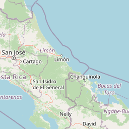
Manuel Antonio National Park Boundary Map and Spatial Extent
Mapped park outlines provide precise spatial context for the protected area limits and surrounding marine zones. Recorded area measurements and coordinate spans accompany the visual boundary geometry to detail total geographic extent.
- Boundary area
- 274.3 km²
- Boundary perimeter
- 195.1 km
- Northernmost point
- 9.4042° N
- Southernmost point
- 8.7657° N
- Easternmost point
- 83.9952° W
- Westernmost point
- 84.3593° W
- Geographic centre
- 9.0963° N, 84.2289° W
- North–south span
- 70.6 km
- East–west span
- 40 km
Terrain and natural features
Mixed relief classifications and recorded coastal and river features
Manuel Antonio National Park Terrain and Named Natural Features
Stored terrain records document mixed relief classifications across beaches, rivers, and viewpoints located within the protected boundary. Linked feature cards provide recorded types, names, and spatial relationships for each mapped natural feature.
Selected named natural features
Rivers
Río Portalón
Streams
Quebrada Barbudal
Beaches
Playa Gemelas
Viewpoints
Isla Olocuita
Beaches
Playa Puerto Escondido
Environmental setting
Tropical forest, coastal marine habitats, and mixed relief zones
Manuel Antonio National Park Environmental Classification and Physical Setting
Recorded habitat types, climate zones, and relief classifications form complementary ways to read the protected physical setting. Linked categories connect stored environmental attributes to relevant atlas destinations where available.
- Relief
- Mixed relief
- Climate
- Tropical
- Water
- Water-dominated
- Forest cover
- Mostly forested
- Seasonality
- Seasonal
Landscape features
Beach · Coast · Forest
Habitat types
Tropical forest · Coastal habitat · Marine habitat
Park atlas
Browse the diverse protected landscapes and coastal geography surrounding Manuel Antonio, tracing the regional spread of conservation.
Explore Other National Parks and Protected Areas Near Manuel Antonio National Park
After exploring Manuel Antonio National Park's unique coastal forests and beaches, delve into nearby national parks and protected areas to compare diverse conservation landscapes across the region. This geographic exploration allows for a deeper understanding of Costa Rica's protected-area network, tracing how different ecosystems are safeguarded.
National parkCosta Rica
27 km away#1 closest
Northeast

Los Quetzales National Park: Costa Rica National Park Landscape and Mapped Geography
Explore protected area boundaries and regional terrain context.
Los Quetzales National Park, a designated national park within Costa Rica, offers a focused entry point for exploring protected landscapes. This page provides detailed insight into the park's geographic setting, emphasizing its mapped boundaries and its role within the national atlas. Users can discover the specific landscape characteristics and regional terrain that define Los Quetzales National Park, enriching their understanding of Costa Rican protected areas.
- Area
- 50 km²
- Established
- 2006
- IUCN
- II
- Relief
- Mountain
Marine protected areaCosta Rica
About 33 km away#2 closest
Southeast
Ballena National Marine Park: Mapping a Protected Marine Area's Geographic Identity in Costa Rica
Explore coastal landscape and protected marine boundaries.
Ballena National Marine Park stands as a significant marine protected area along Costa Rica's Pacific coast. This page provides an atlas-focused exploration of its unique geographic identity, detailing its mapped marine boundaries and the distinctive coastal landscapes it encompasses. Understand how this protected area fits into the broader regional geography of Costa Rica, offering a valuable resource for anyone seeking structured information on conservation landscapes and natural terrain.
- Area
- 53.31 km²
- Established
- 1992
- IUCN
- II
- Relief
- Lowland
National parkCosta Rica
35 km away#3 closest
Northeast
Tapantí National Park: Costa Rica National Park Atlas and Mapped Landscape Exploration
Explore protected boundaries and natural terrain within its geographic setting.
Tapantí National Park is a designated national park in Costa Rica, offering specific insights into the country's protected natural landscapes. This page provides an atlas-style view of its geographic placement, the extent of its protected area, and the character of its natural terrain. Users can investigate the park's mapped context and understand its significance within the broader geography of Costa Rica, facilitating focused exploration of protected lands and regional landscape features.
- Area
- 583.2 km²
- Established
- 1982
- IUCN
- II
- Relief
- Mountain
National parkSan José Province
40 km away#4 closest
Northwest
La Cangreja National Park: Costa Rican National Park with Distinct Protected Landscape Identity
Explore its mapped boundaries and regional geographic context in San José Province.
La Cangreja National Park serves as a key protected area within the geography of San José Province, Costa Rica. This page facilitates a deeper understanding of its specific landscape character and mapped terrain, crucial for users interested in the structured discovery of national parks and their geographic significance. Examine the park's identity as a protected national park and its placement within the broader atlas of natural landscapes.
- Area
- 19 km²
- Established
- 1987
- IUCN
- II
- Relief
- Mountain
National parkCartago Province
44 km away#5 closest
East
Chirripó National Park: A Protected Landscape within Cartago Province's Geography
Explore its mapped boundaries and natural terrain.
This page provides detailed geographic context for Chirripó National Park, a designated national park located in the Cartago Province of Costa Rica. It focuses on the park's protected landscape identity, its position within the regional geography, and its distinct mapped boundaries. Understanding Chirripó National Park through its geographic and atlas-centric attributes offers a foundational insight into its natural significance.
- Area
- 508.49 km²
- Established
- 1975
- IUCN
- II
- Climate
- Alpine
National parkCosta Rica
About 65 km away#6 closest
Northwest
Carara National Park: Protected Landscape Geography in Costa Rica
Explore the mapped terrain and park boundaries.
Carara National Park offers a focused exploration of protected landscape geography within Costa Rica. As a National Park, its mapped boundaries are integral to understanding its role in the country's natural atlas. This detail page provides specific geographic context and details relevant to atlas-based discovery, highlighting the park's unique position and protected-area identity for users interested in detailed mapping and regional natural context.
- Area
- 52 km²
- Established
- 1978
- IUCN
- II
- Relief
- Mixed relief
National parkCartago Province
66 km away#7 closest
Northeast
Irazú Volcano National Park: National Park Protected Area Atlas
Mapped Boundaries and Volcanic Terrain
Irazú Volcano National Park stands as a distinct protected area within the landscape of Cartago Province, Costa Rica. This page provides an atlas-centric view, detailing the park's mapped boundaries and its identity as a national park. Explore the volcanic geography and regional context, understanding its contribution to the protected lands of Central America.
- Area
- 20 km²
- Established
- 1955
- IUCN
- II
- Relief
- Mountain
National parkCosta Rica
67 km away#8 closest
Southeast
Corcovado National Park: Geographic Boundaries and Rainforest Ecosystems in Costa Rica
Mapping primary forest corridors and coastal protected landscapes.
Corcovado National Park covers much of the Osa Peninsula, protecting the largest primary rainforest stand on the American Pacific coast. The park's rugged terrain includes inland mountainous ridges, extensive river networks, and vital coastal lagoons. This protected area functions as a biological corridor, sustaining diverse habitats that range from lowland tropical forests to elevated montane ecosystems.
- Area
- 424 km²
- Established
- 1975
- IUCN
- II
- Relief
- Mixed relief
MoriAtlas Explorer
Continue Your Atlas Exploration of Manuel Antonio National Park's Geography
Deepen your understanding of Manuel Antonio National Park by exploring its specific geographic features and protected landscape characteristics. Access detailed maps and regional context to fully grasp its significance as a national park. This structured approach aids in comparative geography and detailed atlas discovery beyond the immediate park boundaries.
Browse next
Global natural geography
Explore related park routes
Explore MoriAtlas Global ParksBrowse All MoriAtlas ParksGlobal Park Map DiscoveryMoriAtlas: Browse All CountriesBrowse All MoriAtlas ContinentsNational Park Environment AtlasGrand Canyon National Park AtlasYellowstone National Park AtlasYosemite National Park Atlas and GeographySerengeti National Park AtlasGalápagos National Park Protected LandscapeBanff National Park Geography and AtlasKruger National Park Atlas EntryUluṟu-Kata Tjuṯa National Park AtlasExplore Uluru-Kata Tjuta National Park GeographyPlitvice Lakes National Park AtlasFiordland National Park Protected LandscapeGreat Smoky Mountains National Park AtlasAfghanistan National Parks and Protected AreasAlbania National Parks and Protected AreasAlgeria National Parks and Protected AreasAmerican Samoa National Parks and Protected AreasAndorra National Parks and Protected AreasAngola National Parks and Protected AreasAntarctica National Parks and Protected AreasAntigua and Barbuda Park List