Mori Atlas logo
National parkMount Ilgaz National Park

A unique biogeographic transition zone in Kastamonu Province, Turkey

Mount Ilgaz National Park: Explore its Protected Landscape and Geographic Identity

(Ilgaz Dağı Milli Parkı)

Mount Ilgaz National Park is a vital protected area offering a singular geographic and ecological perspective within Kastamonu Province, Turkey. This national park represents a significant biogeographic transition, bridging Central Anatolian and Black Sea Region climates and vegetation systems. Explore its rugged mountain terrain, diverse forest ecosystems, and distinct mapped boundaries that define this unique natural landscape. Understand the regional context of the Ilgaz Mountains and their role in shaping the geography of northern Anatolia.

Mountain parksForested parksAlpine environmentsWinter sportsEndemic speciesWildlife conservation

Mount Ilgaz National Park

National park

Park overview

Structured park overview, official facts, and landscape profile for Mount Ilgaz National Park

Mount Ilgaz National Park park facts, protected area profile, and essential visitor context
Review the core facts for Mount Ilgaz National Park, including designation, size, terrain, visitor scale, habitats, and operating context in one park-focused overview.

About Mount Ilgaz National Park

Mount Ilgaz National Park occupies the Ilgaz Mountains, a range that forms a natural divide between Turkey's Black Sea coast and the Central Anatolian interior. Established in 1976, the park protects a mountainous landscape characterized by ridges, valleys, and peaks that stretch approximately 23 kilometers from west to east. The highest points are Büyükhacettepe at 2,587 meters and Küçükhacettepe at 2,546 meters, with several other peaks exceeding 2,300 meters. The mountains sit at the boundary of two river basins, with Gökırmak River originating on the northern slopes and Devrez Creek following the North Anatolian Fault on the southern side. This geographic positioning creates the park's distinctive character as a transitional zone between different climate systems, vegetation patterns, and geological formations.

Quick facts and research context for Mount Ilgaz National Park

Mount Ilgaz National Park spans the Ilgaz Mountains in northwestern Turkey, with its highest peaks reaching nearly 2,600 meters. The park lies at a biogeographic crossroads between the Black Sea coast and Central Anatolia, resulting in rich flora and fauna diversity. Forests cover approximately 82% of the park area, with vegetation zones ranging from oak and pine forests at lower elevations to alpine flora at summits. The North Anatolian Fault, Turkey's longest and most active geological fracture, runs along the southern foot of the mountains.

Park context

Deeper park guide and search-rich context for Mount Ilgaz National Park

Mount Ilgaz National Park history, landscape, wildlife, and travel context
Explore Mount Ilgaz National Park through its history, landscape character, ecosystems, wildlife, conservation priorities, cultural context, and seasonal travel timing in a structured park guide built for atlas discovery and search intent.

Why Mount Ilgaz National Park stands out

Mount Ilgaz National Park is best known for its position as a biogeographic transition zone between Central Anatolia and the Black Sea Region, creating a unique mosaic of forest types and species. The park features Turkey's nearest ski resort to Ankara, making it a popular winter sports destination. Its rich endemic flora, particularly in the alpine zone above 2,000 meters, includes several species found only in the Ilgaz Mountains. The diverse mammal population includes brown bears, grey wolves, lynx, and deer, thriving in the well-watered northern slopes and forest habitats.

Mount Ilgaz National Park history and protected-area timeline

Mount Ilgaz National Park was established on June 2, 1976, through the Turkish Ministry of Environment and Forest, designated as a national park under IUCN Category II. The protected area was created to preserve the mountain's natural resources while managing its recreational potential. The park's establishment came during a period when Turkey was expanding its network of protected areas to conserve unique ecological regions. The Ilgaz Mountains have long served as a natural corridor between the Black Sea coast and Anatolia, and the national park status formalized protection for the region's forests, wildlife, and geological features. Winter sports development began in the 1990s, with the Ilgaz Ski Resort officially established in 1997, adding recreational infrastructure that continues to attract visitors from Ankara and Istanbul.

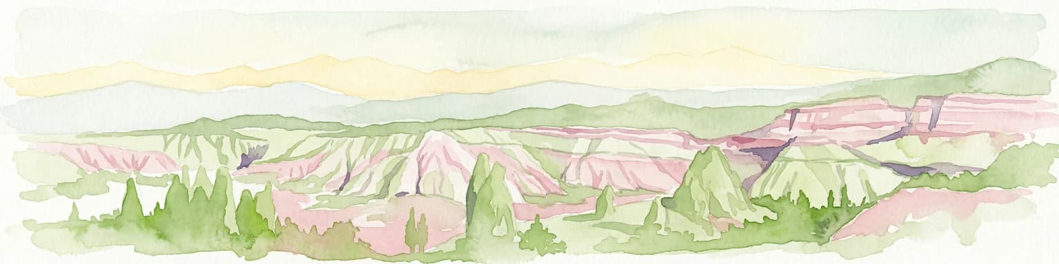
Mount Ilgaz National Park landscape and geographic character

The Mount Ilgaz landscape features a complex terrain of ridges, valleys, and peaks shaped by geological processes along the North Anatolian Fault zone. The mountains rise dramatically from the surrounding lowlands, with the highest points Büyükhacettepe and Küçükhacettepe reaching nearly 2,600 meters. The terrain consists primarily of serpentinite, schist, and volcanic rocks, with interesting geomorphological formations throughout the region. The mountain ridges run roughly east-west for about 23 kilometers, creating a pronounced backdrop visible from the adjacent provinces. Valleys carved by the Gökırmak River and Devrez Creek dissect the mountains, while north-facing slopes receive significantly more rainfall than southern aspects, creating contrasting landscapes within a relatively compact area.

Mount Ilgaz National Park ecosystems, habitats, and plant life

The park's ecological significance stems from its position in a biogeographic transition zone between the Euro-Siberian region of the Black Sea coast and the Irano-Turanian region of Central Anatolia. Forests dominate 81.7% of the park, with distinct vegetation zones changing with elevation. Lower northern slopes feature Turkey oak, European black pine, and fir forests, while the 1,000-1,300 meter zone brings hornbeam and beech dominance. At higher elevations between 1,500 and 2,000 meters, Turkish pine and Scots pine form pure or mixed forests. The alpine zone beginning above 2,000-2,200 meters contains rare and endemic dwarf shrub vegetation. Studies have documented 617 taxa in and around the park, including 37 species endemic to Turkey with four specifically endemic to the Ilgaz Mountains.

Mount Ilgaz National Park wildlife and species highlights

The Ilgaz Mountains support approximately 30 mammal species within a well-preserved forest habitat. The diverse mammal community includes deer and roe deer browsing in the forests, wild boar rooting in undergrowth, and predators such as grey wolves and brown bears. Red foxes, wildcats, and lynx hunt throughout the terrain, while European pine marten and beech marten patrol the tree canopy. Smaller mammals include weasels, rabbits, squirrels, hedgehogs, moles, bats, and European badgers. European otters occur along the streams that flow year-round through the park. This rich mammalian fauna, combined with abundant vegetation and permanent water sources, makes the Ilgaz Mountains an important wildlife corridor in northern Turkey.

Mount Ilgaz National Park conservation status and protection priorities

Mount Ilgaz National Park represents an important conservation unit in Turkey's protected area network, preserving a mountainous ecosystem at a critical biogeographic junction. The park protects significant forest cover in a country where forest ecosystems face pressure from development and land use change. Its location along the North Anatolian Fault zone also gives it geological significance, preserving evidence of active tectonic processes. The alpine zones harbor endemic species found nowhere else, making the park crucial for conserving Turkey's unique mountain flora. The 15.8% endemism rate among documented plant taxa highlights the park's importance for botanical conservation.

Mount Ilgaz National Park cultural meaning and human context

The Ilgaz Mountains have historically served as a natural boundary and travel corridor between the Black Sea coastal regions and Central Anatolia. The mountain pass through the park has been part of traditional routes connecting Ankara to the Black Sea coast, with the modern D.765 highway following ancient pathways. Local communities in the surrounding provinces of Kastamonu and Çankırı have maintained connections to the mountain landscape for generations, particularly in the surrounding villages where traditional land use practices continue.

Top sights and standout views in Mount Ilgaz National Park

The park combines ecological diversity with recreational opportunities in a mountain setting that is relatively accessible from major Turkish cities. The alpine flora above 2,000 meters contains rare endemic species found only in the Ilgaz Mountains. The well-developed forest structure supports healthy populations of large mammals including brown bears and wolves. Winter sports facilities make the park a year-round destination, with the nearest ski resort to Ankara. The transition-zone ecology creates a unique blend of Black Sea and Central Anatolian species and habitats within a single protected area.

Best time to visit Mount Ilgaz National Park

Mount Ilgaz National Park offers distinct experiences across seasons. Summer and early autumn provide the best conditions for hiking and exploring the forest trails, with comfortable temperatures in the mountain environment. Spring brings abundant wildflower displays in the meadows and forest clearings. Winter transforms the landscape into a ski destination, with snow persisting for about six months on the higher peaks and slopes. The ski season typically runs from December through March, when the park attracts visitors seeking winter sports. The shoulder seasons of May and September offer pleasant weather and fewer crowds for those interested in wildlife observation and forest exploration.

Park location guide

Geography guide, regional context, and park location map for Mount Ilgaz National Park

Mount Ilgaz National Park park geography, regions, and map view in Turkey
Understand where Mount Ilgaz National Park sits in Turkey through a broader geographic reading of the surrounding landscape, nearby location context, and its mapped position within the national park landscape.

How Mount Ilgaz National Park fits into Turkey

Turkey, officially the Republic of Türkiye, is a transcontinental country located mainly in Anatolia (West Asia) with a smaller portion in East Thrace (Southeast Europe). It borders the Black Sea to the north, several countries to the east and south, and the Aegean Sea and European countries to the west. The country has a population of over 86 million and operates as a secular, Muslim-majority presidential republic with Ankara as capital and Istanbul as its largest city.

Wider geography shaping Mount Ilgaz National Park in Turkey

Turkey is a transcontinental country with the majority of its territory (about 97%) located in Anatolia (West Asia) and a smaller portion called East Thrace in Southeast Europe. It borders the Black Sea to the north, Georgia, Armenia, Azerbaijan, and Iran to the east, Iraq and Syria to the south, and the Mediterranean Sea to the southwest. To the west, Turkey borders the Aegean Sea, Greece, and Bulgaria. The terrain includes mountains, plateaus, and coastal plains, with the Taurus Mountains running along the southern coast.

Map view of Mount Ilgaz National Park

Use this park location map to pinpoint Mount Ilgaz National Park in Turkey, understand its exact geographic position, and read its mapped placement within the surrounding landscape more clearly.

Pigeon | © OpenStreetMap contributors

Location context for Mount Ilgaz National Park

Çankırı ProvinceKastamonu Province
Park atlas

Compare protected landscapes, tracing regional geography and surrounding mountain environments

Discover Other National Parks and Protected Areas Near Mount Ilgaz National Park
Beyond Mount Ilgaz National Park, explore a curated list of nearby national parks and protected areas within Turkey, revealing diverse forest ecosystems and mountain terrain. Broaden your atlas exploration by comparing ecological characteristics and regional contexts across adjacent protected landscapes, enhancing your understanding of Turkey's conservation efforts.
Watercolor illustration depicting mountain ranges, green forests, and a valley with a body of water
National parkKastamonu Province

Küre Mountains National Park: Ancient Forests and Karst Canyons in Kastamonu Province

Explore Protected Landscape, Map Boundaries, and Regional Geography

Küre Mountains National Park, situated in Kastamonu Province, Turkey, offers a unique glimpse into ancient forest ecosystems and dramatic karst formations. As a protected national park, it is distinguished by its extensive canyon systems, including Horma and Valla, and significant cave networks like Ilgarini Cave. This entry provides detailed geographic context, helping users understand the park's terrain, protected boundaries, and its ecological importance within the Black Sea Region's natural landscape.

Area
377.53 km²
Established
2000
Relief
Mountain
Climate
Temperate
Watercolor illustration of a forested landscape with green trees, rolling hills, and distant mountains
National parkTurkey

Soğuksu National Park: Turkey's Highland Forest Protected Landscape Discovery

Explore mapped boundaries and unique Anatolian geography.

Soğuksu National Park serves as a significant protected natural area in central Turkey, celebrated for its substantial coniferous forest ecosystem. This park showcases a transition zone between major geographic regions, offering a unique highland landscape shaped by volcanic geology. Discover its mapped protected boundaries and its role as a vital natural atlas point within the broader Turkish geography, featuring diverse terrain and important ecological elements.

Area
11.87 km²
Established
1959
National parkYozgat Province

Yozgat Pine Grove National Park: Historic First National Park and Ancient Pine Forest

Explore the protected landscape of Turkey's original national park.

As Turkey's pioneering national park, Yozgat Pine Grove National Park offers a deep dive into a unique protected landscape. This site provides detailed geographic context for its ancient pine forest, set dramatically against the steppe terrain of Yozgat Province. Understand the park's mapped boundaries and its ecological significance as a historic conservation area. MoriAtlas facilitates a structured exploration of this important natural heritage site, highlighting its role in Turkish protected land history and its distinct regional geography.

Area
2.64 km²
Established
1958
IUCN
II
Relief
Highland
Watercolor painting showing multiple lakes surrounded by green trees and mountains under a light sky
National parkBolu Province

Yedigöller National Park: Bolu Province's Landslide Lake and Forested Protected Landscape

Discover mapped terrain and unique natural park geography.

Yedigöller National Park presents a distinctive protected landscape within Bolu Province, notable for its chain of seven landslide-formed lakes and extensive, dense forests. This page serves as your entry point to understanding the park's geographic distribution, mapped boundaries, and the characteristic terrain that defines this important natural area. Explore the unique ecosystem and its place within the broader regional geography through structured atlas-style discovery.

Area
16.23 km²
Established
1965
IUCN
II
Relief
Mixed relief
Watercolor painting of a lake surrounded by green hills and trees with colorful foliage
National parkBolu Province

Lake Abant National Park: Protected Volcanic Crater Lake & Alpine Landscape

Bolu Province, Turkey | National Park | Mapped Landscape

Lake Abant National Park is a protected national park renowned for its stunning volcanic crater lake and surrounding alpine forests within Bolu Province. This detailed entry provides insight into the park's geographic context, its unique volcanic terrain, and its status as a protected landscape. Explore the mapped boundaries and understand the ecological significance of this distinctive natural area in northwestern Turkey.

Area
11.965 km²
Established
2022
Relief
Mountain
Climate
Temperate
National parkAnkara Province

Mount Sarıçalı National Park: Turkey's Newest Protected Mountain Landscape

Ancient forests, endemic botany, and dramatic mountain terrain.

Mount Sarıçalı National Park, located in Ankara Province, Turkey, is a testament to the nation's commitment to conservation. This protected area is celebrated for its ancient forests, with larch, Kasnak oak, and juniper trees dating back 700-800 years. Its position at the confluence of three phytogeographic zones supports a rich array of 139 endemic plant species. The park's landscape is further characterized by the striking Uyuzsuyu Waterfall and the imposing Mount Sarıçalı peak, offering a profound geographic context for atlas exploration.

Area
10.24 km²
Established
2021
Relief
Mountain
Scope
Terrestrial
National parkTurkey

Göreme Historical National Park: A Mapped Volcanic Landscape and Protected Cultural Heritage in Turkey

Explore the unique geography and rock-cut churches of Cappadocia.

Göreme Historical National Park presents a globally significant protected landscape, celebrated for its dramatic volcanic geology and extensive rock-cut architecture. This national park in Turkey's Cappadocia region features iconic fairy chimneys and ancient cave dwellings, offering a rich context for exploring human adaptation to natural terrain. MoriAtlas facilitates a detailed discovery of its mapped boundaries and regional geography, highlighting the intersection of natural wonder and historical habitation within this unique protected area.

Watercolor illustration of a wetland landscape with distant mountains, grassy vegetation, and calm water.
National parkKayseri Province

Sultan Reedy National Park: A Vital Protected Wetland Ecosystem in Kayseri Province, Turkey

Mapped landscape focused on ornithological significance and lake ecosystems.

Sultan Reedy National Park stands as a cornerstone of wetland conservation in Turkey, located within the geographically distinct Kayseri Province. This national park is celebrated for its expansive freshwater lakes and dense reed marshes, forming a critical habitat for a vast diversity of bird species. Its Ramsar designation underscores its international importance as a stopover point for migratory birds traversing major flyways, offering a unique window into a dynamic aquatic ecosystem bordered by dramatic mountain terrain.

Area
243.57 km²
Established
2006
Relief
Lowland
Scope
Terrestrial

Common questions about visiting, size, designation, and location context for Mount Ilgaz National Park

Mount Ilgaz National Park FAQs for park facts, access, geography, and protected area context
Find quick answers about Mount Ilgaz National Park, including protected-area facts, park geography, trail and visitor context, and how the park fits into its surrounding country and regional landscape.
MoriAtlas Explorer

Continue Your Protected Areas Search Across the Global Atlas

Deepen your exploration by continuing the structured search for national parks and protected areas worldwide. Utilize the comprehensive filtering capabilities to compare different conservation landscapes and refine your understanding of global park geography. Discover more about the distribution and characteristics of protected natural areas.

Global natural geography