

Mori Atlas logo
National parkMungada Ridge National Park

Discover the mapped geographic boundaries and landscape context of this significant protected area.

Mungada Ridge National Park: A Protected National Park in Australia's Mid West Region

Mungada Ridge National Park stands as a designated national park within the expansive Mid West region of Western Australia. This page serves as a detailed geographic entry point, offering insights into the park's protected land status, its mapped boundaries, and its contribution to the regional landscape. Understand its place within Australia's network of natural reserves through structured atlas data and geographic exploration.

Banded Iron FormationsIndigenous HeritageGeological HeritageWestern AustraliaMid WestYalgoo Bioregion

Mungada Ridge National Park

National park

Park overview

Structured park overview, official facts, and landscape profile for Mungada Ridge National Park

Mungada Ridge National Park park facts, protected area profile, and essential visitor context
Review the core facts for Mungada Ridge National Park, including designation, size, terrain, visitor scale, habitats, and operating context in one park-focused overview.

About Mungada Ridge National Park

Mungada Ridge National Park represents a remarkable intersection of geological antiquity, biological diversity, and cultural significance in the heart of Western Australia's Mid West region. The park's defining feature is its banded iron formations, distinctive layered rock structures that formed billions of years ago during Earth's early geological periods when oxygen began accumulating in the atmosphere. These formations create a dramatic landscape of rusty red and grey bands that traverse the ridge, offering both scientific value and striking visual appeal. Located within the Yalgoo bioregion, the park protects a landscape that was for years under threat from iron ore mining operations that dominate the surrounding region. The successful rejection of mining proposals in 2014 marked a turning point, ultimately leading to the area's designation as a national park in 2022. This protection ensures that both the geological heritage and the ecological communities dependent on this unique terrain will be preserved for future generations. The park's establishment also represents evolving approaches to land management in Western Australia, incorporating Indigenous knowledge and participation through joint management arrangements.

Quick facts and research context for Mungada Ridge National Park

Mungada Ridge National Park covers 1,031 hectares in Western Australia's Mid West, established in January 2022. The park protects ancient banded iron formations among the oldest rock formations in the world. It is jointly managed by the Bundi Yamatji Aboriginal Corporation, the Conservation and Parks Commission, and the Department of Biodiversity, Conservation and Attractions. The area lies within an active iron ore mining region, and mining proposals for the ridge were rejected by the Environmental Protection Authority in 2014, clearing the way for permanent protection.

Park context

Deeper park guide and search-rich context for Mungada Ridge National Park

Mungada Ridge National Park history, landscape, wildlife, and travel context
Explore Mungada Ridge National Park through its history, landscape character, ecosystems, wildlife, conservation priorities, cultural context, and seasonal travel timing in a structured park guide built for atlas discovery and search intent.

Why Mungada Ridge National Park stands out

Mungada Ridge is best known for its extraordinary banded iron formations, which represent some of the oldest rock formations on the planet and serve as a window into Earth's early geological history. The ridge also stands as a conservation triumph, having been saved from industrial iron ore mining through successful environmental advocacy. The park's rare plant and animal life thrives in this ancient landscape, while its cultural significance as traditional Yamatji country adds depth to its natural value. The combination of geological antiquity, biodiversity, and Indigenous heritage makes this newly declared national park a notable addition to Western Australia's protected area network.

Mungada Ridge National Park history and protected-area timeline

Mungada Ridge's journey to national park status reflects a prolonged struggle between conservation imperatives and industrial development pressures. For many years, the ridge sat within an active iron ore mining region, and proposals were advanced to extract the mineral resources beneath its ancient formations. The threat of mining galvanised environmental advocacy and raised awareness about the geological and ecological values of the area. In 2014, the Environmental Protection Authority of Western Australia rejected a mining proposal for Mungada Ridge, citing unacceptable environmental impacts and the irreplaceable nature of the geological heritage. This decision paved the way for consideration of formal protected area status. Following years of consultation and negotiation, the park was officially declared on 17 January 2022, becoming one of the more recent additions to Western Australia's national park system. The establishment of the park also reflects the growing recognition of Indigenous rights and knowledge in land management, with the Bundi Yamatji Aboriginal Corporation becoming a key partner in the park's ongoing governance.

Mungada Ridge National Park landscape and geographic character

The landscape of Mungada Ridge National Park is dominated by its namesake ridge, a prominent topographical feature rising from the surrounding plains of the Mid West. The ridge's most striking characteristic is the banded iron formations that outcrop along its slopes and peaks, displaying characteristic alternating layers of iron-rich red rock and lighter siliceous material. These formations, among the oldest known on Earth, create a visually dramatic terrain with weathered cliffs, scarps, and eroded patterns that reveal the geological processes spanning billions of years. The broader park landscape includes lower-lying areas supporting diverse vegetation communities adapted to the semi-arid conditions of the Yalgoo bioregion. The contrast between the ancient, mineral-rich ridge and the surrounding pastoral and mining landscape highlights the ecological and aesthetic significance of the protected area.

Mungada Ridge National Park ecosystems, habitats, and plant life

Mungada Ridge National Park lies within the Yalgoo bioregion, a vast area of semi-arid shrubland and woodland that covers much of inland Western Australia. The park's vegetation reflects the region's character, with diverse plant communities adapted to low rainfall and nutrient-poor soils. The banded iron formations create microhabitats and ecological niches that support rare plant species not found in the surrounding landscape. The unique geological substrate, combined with the ridge's topographical variation, results in higher moisture retention and nutrient availability than the surrounding terrain, supporting plant life of particular conservation significance. The park's designation as a national park protects these biological values from the industrial disturbances that characterise the surrounding mining region, ensuring the continuation of ecological processes in this ancient landscape.

Mungada Ridge National Park wildlife and species highlights

The wildlife of Mungada Ridge National Park includes rare animal species that depend on the unique habitats created by the ancient ridge formations. While the source material notes the presence of rare animal life without specific details, the park's location in the Yalgoo bioregion suggests representation of the region's characteristic fauna. The semi-arid woodlands and rocky outcrops of the area provide shelter and foraging resources for various reptile species, small mammals, and birds adapted to inland Western Australian conditions. The contrast between the protected ridge environment and the disturbed surrounding landscape highlights the conservation importance of the park for wildlife that cannot survive in heavily modified areas. The band's iron formations and associated vegetation create habitat complexity that supports biodiversity values beyond what occurs in the broader region.

Mungada Ridge National Park conservation status and protection priorities

The establishment of Mungada Ridge National Park represents a significant conservation achievement in Western Australia's Mid West, a region otherwise dominated by extensive iron ore mining operations. The park protects both outstanding geological heritage, including some of the oldest rock formations on Earth, and associated biological values including rare plant and animal species. The successful prevention of mining development through the 2014 Environmental Protection Authority decision demonstrates the effectiveness of environmental assessment processes in protecting irreplaceable natural values. The park's joint management arrangement, incorporating the Bundi Yamatji Aboriginal Corporation alongside government agencies, reflects contemporary approaches to conservation that recognise Indigenous knowledge and custodial responsibilities. This model ensures that cultural values are integrated with scientific conservation objectives, potentially providing lessons for future protected area establishment in similar contexts.

Mungada Ridge National Park cultural meaning and human context

Mungada Ridge National Park is located on the traditional country of the Yamatji people, the Indigenous custodians of much of the Mid West region of Western Australia. The park's joint management arrangement with the Bundi Yamatji Aboriginal Corporation represents a meaningful partnership in which Indigenous knowledge and connection to country inform protected area governance. The Yamatji people have maintained cultural connections to this landscape across millennia, with the ridge holding significance beyond its geological and ecological values. This collaborative approach to park management, bringing together Indigenous corporate representation, the Conservation and Parks Commission, and the Department of Biodiversity, Conservation and Attractions, represents a progressive model for protected area governance in Western Australia. The integration of traditional ecological knowledge with contemporary conservation science enhances the effectiveness and cultural appropriateness of management approaches.

Top sights and standout views in Mungada Ridge National Park

Mungada Ridge National Park's primary highlight is its spectacular banded iron formations, among the oldest rock formations on the planet and a window into Earth's early geological history. The park's establishment in 2022 represents a conservation victory, having been saved from iron ore mining that continues to surround the area. The joint management arrangement with the Bundi Yamatji Aboriginal Corporation provides meaningful Indigenous involvement in park governance. The rare plant and animal life supported by the unique geological substrate adds biological significance to the area's appeal. As one of Western Australia's newest national parks, Mungada Ridge offers visitors the opportunity to experience both ancient geology and contemporary conservation practice in a landscape of cultural as well as natural importance.

Best time to visit Mungada Ridge National Park

The best time to visit Mungada Ridge National Park would be during the cooler months of autumn and winter in Western Australia, typically from April to September, when temperatures are more comfortable for outdoor exploration. Summer months in the Mid West can bring extreme heat, making outdoor activities potentially hazardous and less enjoyable. The semi-arid climate means that any visit should be planned with appropriate sun protection, adequate water supplies, and awareness of the remote nature of the area. As the park is newly established, visitors should check with local authorities regarding access arrangements, facilities, and any relevant visitor guidelines before planning trips.
Park location guide

Geography guide, regional context, and park location map for Mungada Ridge National Park

Mungada Ridge National Park park geography, regions, and map view in Australia
Understand where Mungada Ridge National Park sits in Australia through a broader geographic reading of the surrounding landscape, nearby location context, and its mapped position within the national park landscape.

How Mungada Ridge National Park fits into Australia

Australia is a constitutional monarchy and federal parliamentary democracy comprising six states and ten territories. With a population of nearly 28 million, it is one of the world's most urbanised countries, with most people concentrated on the eastern seaboard. The country has a high Human Development Index and is known for its cultural diversity, ancient Aboriginal heritage, and unique wildlife.

Wider geography shaping Mungada Ridge National Park in Australia

Australia occupies the entire Australian continent, the island of Tasmania, and numerous smaller islands. It is the world's flattest and driest inhabited continent, featuring vast deserts in the interior (the Outback), tropical rainforests along the eastern coast, and a coastline bordering the Indian and Pacific Oceans.

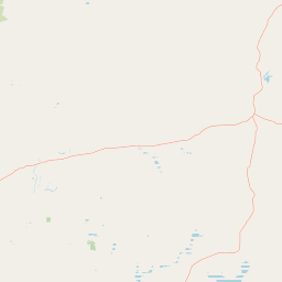
Map view of Mungada Ridge National Park

Use this park location map to pinpoint Mungada Ridge National Park in Australia, understand its exact geographic position, and read its mapped placement within the surrounding landscape more clearly.

Pigeon | © OpenStreetMap contributors

Location context for Mungada Ridge National Park

Mid WestWestern Australia
Park atlas

Compare Protected Landscapes and Geological Heritage in Western Australia's Mid West Region

Explore Nearby Protected Areas and National Parks Around Mungada Ridge National Park
After exploring Mungada Ridge National Park, continue geographic discovery by browsing national parks and protected areas throughout Western Australia's Mid West region. Uncover diverse geological formations, unique ecosystems, and conservation landscapes that define this part of Australia, offering rich context for regional park comparison.
National parkWestern Australia

Tathra National Park: Protected Landscape Identity and Mapped Geographic Boundaries

Western Australia national park exploration and regional context.

Delve into the protected landscape of Tathra National Park, a significant entity within Western Australia's network of natural areas. This detail provides a structured overview of its geographic position, mapped outlines, and ecological context, serving as a vital entry point for understanding Australia's diverse protected lands and regional geography.

Area
43.22 km²
Established
1970
IUCN
II
Relief
Upland
National parkWestern Australia

Watheroo National Park National Park: Mapping Protected Landscapes in Western Australia

Explore regional geography and mapped park boundaries.

Watheroo National Park represents a key protected landscape within the vast state of Western Australia. This detail page offers focused insight into the park's specific geographic character, its mapped boundaries, and its role within the regional atlas of protected areas. Understand the natural terrain and landscape context that defines this Australian national park.

Area
444.81 km²
Established
1969
IUCN
II
Relief
Upland
National parkWestern Australia

Alexander Morrison National Park: Discover Its Protected Landscape and Regional Geography

Mapped protected area boundaries and landscape context in Western Australia.

Alexander Morrison National Park represents a core protected natural landscape within Western Australia. As a national park, its identity is deeply tied to its mapped geographic extent and its role in the regional atlas. This destination provides a focused lens on a specific protected area, enabling users to understand its unique landscape features and its contribution to the conservation estate of Western Australia. Delve into its protected status and geographic orientation within Australia's largest state.

Area
85 km²
Established
1970
IUCN
II
Relief
Upland
National parkWestern Australia

Lakeside National Park: Protected Landscape in Western Australia's Murchison Bioregion

Explore its semi-arid terrain and mapped park boundaries.

Lakeside National Park is an 8,490-hectare national park located in Western Australia's Mid West region, declared in 2021. Situated within the Murchison bioregion, it encompasses characteristic semi-arid landscapes, including Mulga woodland and open plains. This protected area serves as a key site for understanding the geological heritage and ecological communities of inland Western Australia, offering a specific point for mapped landscape exploration.

Area
84.9 km²
Established
2021
IUCN
II
Climate
Arid
National parkWestern Australia

Badgingarra National Park: Mapped Boundaries and Protected Landscape Exploration

Explore its national park designation and regional geography.

Delve into the protected landscape identity of Badgingarra National Park, a designated national park situated in Western Australia. This entry provides detailed atlas-level information, focusing on the park's geographic scope, mapped boundaries, and its significance as a protected natural area. Understand its terrain and regional context for a deeper appreciation of Western Australia's conservation landscapes.

Area
131.08 km²
Established
1973
IUCN
II
Relief
Mixed relief
National parkWestern Australia

Lesueur National Park: Detailed National Park Atlas and Geographic Context

Explore the mapped protected landscape in Western Australia.

Lesueur National Park is a key protected area within the expansive geography of Western Australia. This resource provides detailed information on its national park status, mapped boundaries, and its significance within the regional atlas. Engage with the specific landscape identity of this protected territory and understand its role in the broader geographic context of Australia.

Area
272.35 km²
Established
1992
IUCN
II
Relief
Upland
National parkWestern Australia

Drovers Cave National Park: Protected National Park Landscape in Western Australia

Discover the mapped geography and natural context of this park.

Drovers Cave National Park stands as a key protected area within the expansive Western Australian region. This national park offers a focused lens through which to explore its specific geographic identity and landscape characteristics. As a designated national park, it is mapped within the larger atlas of Australia's protected lands, providing users with structured insights into its regional setting and natural terrain.

Area
26.81 km²
Established
1972
IUCN
II
Relief
Lowland
Watercolor illustration of a landscape with green rolling hills and pink clouds
National parkWestern Australia

Nambul National Park: A Protected Landscape Within Western Australia's Geographic Context

Explore mapped boundaries and regional terrain context.

Nambul National Park represents a distinct protected area within the expansive geography of Western Australia. This detailed park page offers users an atlas-driven exploration of its identity as a national park, highlighting its mapped natural landscape and its regional significance. Understand the specific geographic features and protected land context that define Nambul National Park within Australia's largest state, fostering deeper geographic discovery.

Area
192.68 km²
Established
1994
IUCN
II
Relief
Upland

Common questions about visiting, size, designation, and location context for Mungada Ridge National Park

Mungada Ridge National Park FAQs for park facts, access, geography, and protected area context
Find quick answers about Mungada Ridge National Park, including protected-area facts, park geography, trail and visitor context, and how the park fits into its surrounding country and regional landscape.
MoriAtlas Explorer

Continue Your Protected Areas Search Across the Global Atlas

Deepen your exploration by continuing the structured search for national parks and protected areas worldwide. Utilize the comprehensive filtering capabilities to compare different conservation landscapes and refine your understanding of global park geography. Discover more about the distribution and characteristics of protected natural areas.

Global natural geography