
Viewpoints
Park geography
Detailed analysis of regional location, surface area, and terrain characteristics
Comprehensive Geographic Profile and Mapped Boundaries of Mungo National Park in New South Wales
This geographic profile examines the physical characteristics and administrative placement of Mungo National Park. The data includes boundary-derived area and span measurements, alongside environmental classifications, to provide a clear understanding of the arid landscape and lacustrine features within the New South Wales region.
Related tags
World Heritage SiteArchaeological SiteIndigenous HeritageDry Lake LandscapeSemi-Arid Environment
Ancient lake bed, archaeological treasure, and living Indigenous heritage in outback New South Wales
Mungo National Park
Mungo National Park is a vast protected area in the semi-arid outback of south-western New South Wales, Australia, encompassing the ancient bed of Lake Mungo and its distinctive lunette dunes. The park forms the central conservation zone of the UNESCO World Heritage-listed Willandra Lakes Region, a landscape of seventeen dry lakes that preserves one of the world's most significant records of human habitation and ecological change spanning at least 100,000 years. The park is renowned internationally for the archaeological discoveries of Mungo Man and Mungo Lady, which together represent the oldest human remains in Australia and the earliest known evidence of ritual cremation anywhere on Earth. The dramatic Walls of China lunette, towering above the lake's eastern shore, marks the location where these ancient burials were interred. The park remains deeply sacred to the Muthi Muthi, Nyiampaar, and Barkinji Aboriginal peoples, whose traditional lands it encompasses.
- Location
- Australia
- Park type
- National park
- Established
- 1979
- Area
- 1,109.7 km²
Location overview
Regional and national alignment within New South Wales, Australia
Geographic Location of Mungo National Park in Australia
Mungo National Park is situated within the state of New South Wales in Australia. Regional data shows the protected area operates under a single domestic jurisdiction rather than a transboundary framework.
- Countries
- Australia
- Regions
- New South Wales
- Primary location
- New South Wales
Boundary and coordinates
Interactive boundary geometry and recorded spatial dimensions
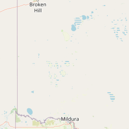
Mungo National Park Boundary Map and Geographic Extent
Mapped park outlines provide precise spatial context for the surrounding protected landscape. Accompanying measurements detail area span, coordinate limits, and centre positioning without official survey claims.
- Boundary area
- 1,226.6 km²
- Boundary perimeter
- 485 km
- Northernmost point
- 33.1925° S
- Southernmost point
- 33.8679° S
- Easternmost point
- 143.2342° E
- Westernmost point
- 142.8632° E
- Geographic centre
- 33.5186° S, 143.0535° E
- North–south span
- 74.9 km
- East–west span
- 34.5 km
Terrain and natural features
Stored lowland terrain classifications and internal natural features
Mungo National Park Terrain and Named Natural Features
Recorded lowland terrain classifications define the protected landscape alongside multiple named natural features situated within the protected area. Linked feature cards provide names, types, measurements, and spatial relationships where recorded.
Selected named natural features
Viewpoints
Red Top Lookout
Reservoirs
Round Tank
Reservoirs
Red Top Tank
Lakes
Lake Mungo
Wetlands
Lake Leaghur
Environmental setting
Arid lowland terrain, dunelands, and lacustrine features
Mungo National Park Environmental Setting and Classification Profile
Recorded arid classifications and lowland relief profiles offer complementary perspectives on physical terrain settings. Stored categories link directly to relevant regional atlas destinations where matching environmental criteria apply.
- Relief
- Lowland
- Climate
- Arid
- Water
- Minor water
- Forest cover
- No forest cover
- Seasonality
- Seasonal
Landscape features
Dunes · Lakes
Habitat types
Dune habitat · Lacustrine habitat
Park atlas
Trace connected protected landscapes and conservation areas within Australia's vast semi-arid outback.
Compare Other National Parks and Protected Areas Near Mungo National Park
Expand your exploration beyond Mungo National Park to discover additional national parks and protected areas across the Willandra Lakes Region and the broader semi-arid landscapes of New South Wales, Australia. Compare their unique ecological features, ancient histories, and conservation efforts to gain a deeper understanding of Australia's diverse protected geography.
National parkNew South Wales
About 52 km away#1 closest
Southwest

Mallee Cliffs National Park: Protected Landscape and Geographic Atlas Entry
Explore its mapped boundaries and regional New South Wales context.
Mallee Cliffs National Park is presented here as a distinct protected landscape, offering specific insights for atlas and geographic discovery. This entry details the park's national park designation and its position within New South Wales, highlighting its mapped boundaries and the surrounding regional geography. It provides the foundational geographic context needed to understand Mallee Cliffs National Park's presence within the broader landscape of protected areas, inviting detailed exploration for those interested in mapped natural terrain.
- Area
- 579.69 km²
- Established
- 1977
- IUCN
- II
- Relief
- Lowland
National parkNew South Wales
80 km away#2 closest
Northwest
Kinchega National Park: National Park Protected Area in New South Wales
Explore the mapped Darling River terrain and outback landscapes.
Kinchega National Park stands as a protected national park entity within New South Wales, Australia. Its geographic significance is deeply tied to the Darling River, which shapes its unique riparian ecosystems and contrasts with the surrounding semi-arid outback terrain. This park offers a valuable point for atlas-based discovery, allowing exploration of its mapped boundaries, landscape context, and the conservation of its distinct natural and cultural heritage within the regional geography.
- Area
- 442.59 km²
- Established
- 1967
- IUCN
- II
- Climate
- Arid
Biosphere reserveVictoria
About 82 km away#3 closest
Southwest
Hattah-Kulkyne and Murray-Kulkyne Biosphere Reserve: Protected Geography and Mapped Landforms
An inland mosaic of river corridors and semi-arid mallee habitats.
Located in northwestern Victoria, this biosphere reserve encompasses a distinct ecological assembly of Hattah lakes, seasonal floodplains, and sand-ridge terrains. Understand the interplay between the Murray River system and the surrounding dryland vegetation through detailed geographic context.
- Area
- 515 km²
- Established
- 1981
- Visitors
- 99K annual
- Relief
- Lowland
National parkNew South Wales
83 km away#4 closest
Southeast
Yanga National Park National Park: Mapped Boundaries and Regional Geographic Context in New South Wales
Protected landscape atlas entry for New South Wales.
Examine Yanga National Park, a dedicated national park situated in New South Wales, Australia. This entry provides essential details for atlas-based discovery, focusing on its mapped boundaries, protected area status, and integration into the regional geography. Understanding Yanga National Park contributes to a broader comprehension of protected lands and their distribution, offering a clear geographic perspective on conservation efforts within New South Wales for users seeking structured landscape data.
- Area
- 667.34 km²
- Established
- 2007
- IUCN
- II
- Relief
- Lowland
Biosphere reserveNew South Wales
About 84 km away#5 closest
Southwest
Barkindji Biosphere Reserve: Geography and Protected Landscapes in New South Wales
Mapping riverine wetlands and semi-arid dune systems
Barkindji Biosphere Reserve sits within the Murray-Darling Basin, creating a critical conservation area that spans river floodplains, sand plains, and semi-arid forest. This protected entity documents the transition between aquatic river environments and inland dryland terrain, highlighting complex soil and habitat variability across its vast, managed regional footprint.
- Area
- 1,918.23 km²
- Established
- 2005
- Visitors
- 133 annual
- Relief
- Mixed relief
National parkAustralia
97 km away#6 closest
Southwest
Hattah-Kulkyne National Park: Victoria's Ramsar Wetland National Park & Mallee Landscape
Explore its mapped protected area and semi-arid regional geography.
Delve into Hattah-Kulkyne National Park, a substantial protected area in northwestern Victoria, Australia, defined by its striking red-earth terrain and sprawling mallee woodlands. This national park is renowned for its dynamic seasonal lake system, a key component of the Murray River basin's wetland geography. The park's status as a Ramsar-designated wetland highlights its ecological importance, providing critical habitat within a distinct semi-arid environment. Discover the unique atlas-scale landscape character and protected land context of this significant Australian natural area.
- Area
- 480 km²
- Established
- 1960
- IUCN
- II
- Relief
- Lowland
National parkAustralia
104 km away#7 closest
Southwest
Murray-Sunset National Park: Iconic Pink Lakes and Mallee Wilderness in Victoria's Semi-Arid Interior
Explore its unique landscape, mapped boundaries, and regional geography.
Murray-Sunset National Park offers a compelling glimpse into Australia's semi-arid heart, featuring a dramatic landscape of salt lakes, gypsum plains, extensive sand dunes, and dense mallee woodlands. This vast protected area is renowned for the vibrant pink hue of its salt lakes, a phenomenon created by microscopic algae that flourishes in the hypersaline conditions during warmer months. The park's rich biodiversity and unique ecosystem make it a significant conservation asset, providing crucial habitat for numerous species adapted to this challenging yet beautiful environment.
- Area
- 6,330 km²
- Established
- 1991
- IUCN
- II
- Relief
- Lowland
Nature reserveNew South Wales
141 km away#8 closest
West
Scotia Sanctuary: Protected Nature Reserve and Mallee Landscape Geography in New South Wales
Arid zone conservation and dune-swale mapping.
Scotia Sanctuary serves as a primary example of arid-zone conservation in south-western New South Wales. This reserve protects vast tracts of intact eucalypt mallee shrubland and sheoak woodland, set across a distinctive landscape of parallel sand dunes and calcareous swales. Its geographic position within the Murray-Darling Depression makes it a critical site for understanding the intersection of land management, habitat restoration, and regional ecological patterns.
- Area
- 650 km²
- Established
- 1994
- Relief
- Lowland
- Climate
- Arid
MoriAtlas Explorer
Continue Your Geographic Discovery of Mungo National Park and New South Wales
Deepen your understanding of Mungo National Park by exploring its detailed geographic features and protected landscape context. This atlas-focused view helps situate the park within the natural terrain of New South Wales, offering a structured approach to discovering more about its regional importance and mapped identity.
Browse next
Global natural geography
Explore related park routes
Explore MoriAtlas Global ParksBrowse All MoriAtlas ParksGlobal Park Map DiscoveryMoriAtlas: Browse All CountriesBrowse All MoriAtlas ContinentsNational Park Environment AtlasGrand Canyon National Park AtlasYellowstone National Park AtlasYosemite National Park Atlas and GeographySerengeti National Park AtlasGalápagos National Park Protected LandscapeBanff National Park Geography and AtlasKruger National Park Atlas EntryUluṟu-Kata Tjuṯa National Park AtlasExplore Uluru-Kata Tjuta National Park GeographyPlitvice Lakes National Park AtlasFiordland National Park Protected LandscapeGreat Smoky Mountains National Park AtlasAfghanistan National Parks and Protected AreasAlbania National Parks and Protected AreasAlgeria National Parks and Protected AreasAmerican Samoa National Parks and Protected AreasAndorra National Parks and Protected AreasAngola National Parks and Protected AreasAntarctica National Parks and Protected AreasAntigua and Barbuda Park List