Mori Atlas logo
National parkMunzur Valley National Park

Discover the mapped boundaries and rich terrain of Turkey's largest national park.

Munzur Valley National Park: Protected Landscape Atlas and Geographic Context in Tunceli Province

(Munzur Vadisi Milli Parkı)

Munzur Valley National Park, situated in the rugged Tunceli Province of eastern Turkey, represents a significant protected landscape at the heart of the Munzur Mountains. This vast national park, established in 1971, spans approximately 420 square kilometers and is defined by dramatic alpine terrain, pristine river valleys carved by the Munzur and Mercan rivers, and a complex geological tapestry. As a critical refuge for biodiversity, it offers unparalleled opportunities for geographic and landscape discovery within Turkey's atlas.

Mountain ParksEastern AnatoliaNational ParksBiodiversity HotspotsForest Protected AreasAlpine Environments

Munzur Valley National Park

National park

Park overview

Structured park overview, official facts, and landscape profile for Munzur Valley National Park

Munzur Valley National Park park facts, protected area profile, and essential visitor context
Review the core facts for Munzur Valley National Park, including designation, size, terrain, visitor scale, habitats, and operating context in one park-focused overview.

About Munzur Valley National Park

Munzur Valley National Park represents one of Turkey's most significant protected areas, established to preserve the extraordinary natural values of the Munzur Valley region in eastern Anatolia. The park stretches from approximately 8 kilometers northwest of Tunceli city center northward toward the imposing Munzur Mountains, which form a natural boundary with elevations reaching 3,300 meters above sea level. The landscape is characterized by deep river valleys, towering mountain ridges, glacial lakes situated above 1,600 meters in the Mercan Valley, and a network of springs, canyons, and waterfalls that enrich the valley floors. The geological structure of the region is complex, comprising sedimentary, volcanic, and intrusive rocks that have been metamorphosed over geological time, with the mountain range divided by the Mercan and Munzur river systems. Beyond the formally designated protected area, the surrounding landscape remains remarkably well-preserved, a condition partly attributed to the local Alevi community's religious beliefs that emphasize respect for nature. The park is administered by Turkey's Directorate-General of Nature Protection and National Parks, operating under the Ministry of Environment and Forest.

Quick facts and research context for Munzur Valley National Park

Munzur Valley National Park spans 420 square kilometers in Tunceli Province, eastern Anatolia, Turkey. Established December 21, 1971, it is Turkey's largest national park by area and the most biodiverse. The park protects the Munzur Valley and portions of the Munzur Mountains, with peaks reaching 3,300 meters. The region experiences a continental climate with extreme winter temperatures and annual precipitation between 600-1,000mm. The area is administrated by the Directorate-General of Nature Protection and National Parks under the Ministry of Environment and Forest. The local Alevi population's religious respect for nature has contributed to the landscape's preservation.

Park context

Deeper park guide and search-rich context for Munzur Valley National Park

Munzur Valley National Park history, landscape, wildlife, and travel context
Explore Munzur Valley National Park through its history, landscape character, ecosystems, wildlife, conservation priorities, cultural context, and seasonal travel timing in a structured park guide built for atlas discovery and search intent.

Why Munzur Valley National Park stands out

Munzur Valley National Park is best known for its exceptional plant biodiversity, with 1,518 recorded plant species including 43 endemic to the park itself and 227 endemic to Turkey. The dramatic mountain landscape of the Munzur Mountains, rising sharply from the valley floor with glacial lakes, alpine meadows, and pristine rivers, defines its scenic character. The park protects significant wildlife including chamois and bezoar ibex, brown bears, Eurasian lynx, and populations of diurnal and nocturnal birds of prey. Its status as Turkey's largest and most biodiverse national park makes it a flagship conservation area for the country.

Munzur Valley National Park history and protected-area timeline

Munzur Valley National Park was established on December 21, 1971, making it one of Turkey's earlier national parks created during the country's modern conservation movement. The park was designated primarily to protect the region's exceptional wildlife, scenic beauty, and the rich biodiversity of the Munzur Valley ecosystem. Over the decades, the park has maintained its protected status, though it has faced development pressures. In the 1980s, construction began on a hydroelectric dam on the Mercan River, which became operational in 2003 with a 20-megawatt power plant. Subsequent investigation revealed that the dam had been constructed within the national park's boundaries. More recently, plans for additional dams along the Munzur River system have raised significant conservation concerns, with the World Wildlife Fund calling for enhanced protection of the park's unique ecosystem. The Turkish government has projected further dam construction that could potentially flood substantial portions of the national park, prompting ongoing controversy about the balance between development and conservation in this ecologically critical area.

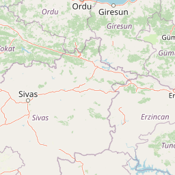
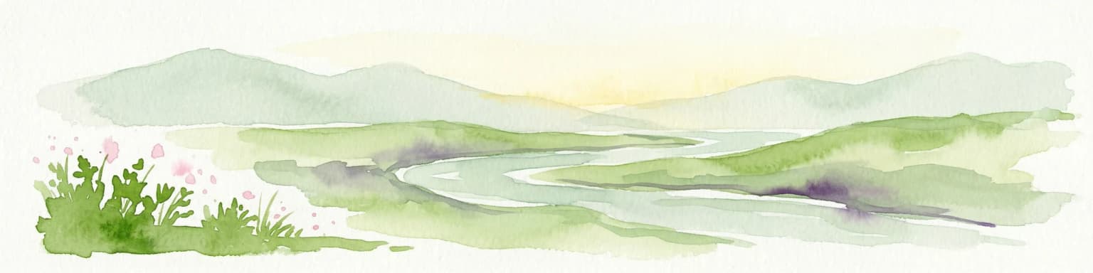
Munzur Valley National Park landscape and geographic character

The landscape of Munzur Valley National Park is defined by the dramatic interplay between the Munzur Valley and the towering Munzur Mountains, which rise sharply to elevations of approximately 3,300 meters in the northern portion of the park. The terrain is characterized by steep mountain ridges, deep river-cut valleys, and a complex geological foundation of sedimentary, volcanic, and metamorphic rocks that have been shaped by tectonic forces over millions of years. The Mercan and Munzur rivers form the primary drainage systems, carving through the mountainous terrain and creating a network of canyons and waterfalls along their courses. At higher elevations above 1,600 meters, glacial lakes such as Lake Karagöl occupy the Mercan Valley, remnants of the region's Pleistocene glacial history. The Ovacık Plain and surrounding areas feature numerous springs and travertine deposits, indicating significant geothermal activity beneath the surface. The valley floors support mixed deciduous forests and riparian vegetation, while the higher mountain slopes transition to alpine meadows and rocky, exposed terrain.

Munzur Valley National Park ecosystems, habitats, and plant life

The ecological character of Munzur Valley National Park is exceptionally rich, positioning the protected area as one of Anatolia's most significant biodiversity hotspots. The park lies within the Eastern Anatolian deciduous forests ecoregion, supporting a complex mosaic of habitats from valley-floor riparian zones through mixed broadleaf forests to subalpine and alpine environments at higher elevations. The flora is particularly notable, with 1,518 recorded plant species documented within the park boundaries. Of these, 43 species are endemic specifically to the Munzur Mountains and 227 are endemic to Turkey, reflecting the region's status as a center of plant evolution and differentiation. The vegetation includes diverse tree species such as oak, beech, elm, ash, plane tree, birch, and cedar in the forest communities, while the understory and open areas support a wide array of wild flowering plants including tulips, hyacinths, daffodils, snowdrops, and various herbaceous species. The local climate features continental characteristics with extreme winter temperatures and variable precipitation, creating conditions that support both forest and alpine meadow ecosystems.

Munzur Valley National Park wildlife and species highlights

Munzur Valley National Park supports a diverse fauna that reflects the park's varied habitats and its position at an ecological crossroads between different zoogeographical regions. The mammal population includes several species of conservation significance, with large mammals such as brown bears, Eurasian lynx, gray wolves, and wild boars inhabiting the forests and rocky areas. Chamois and bezoar ibex represent the park's wild goat diversity, occupying the steep alpine terrain. Smaller mammals include woolly dormouse, foxes, martens, European otters, badgers, squirrels, hares, and hedgehogs. The avifauna is particularly diverse, featuring both diurnal birds of prey including eagles, vultures, falcons, buzzards, hawks, and kestrels, and nocturnal species such as eagle-owls and various owl species. Threatened bird species found in the park include black stork, bearded vulture, Egyptian vulture, griffon vulture, Caspian snowcock, and golden eagle. The rivers and streams support populations of trout, which have traditionally held economic importance for the local community. The park also includes designated areas for the protection and breeding of various game species.

Munzur Valley National Park conservation status and protection priorities

Munzur Valley National Park holds significant conservation importance as Turkey's largest and most biodiverse national park, protecting a representative sample of the Eastern Anatolian deciduous forests ecoregion and its associated biodiversity. The park's value is underscored by its exceptional plant endemism, with 43 species found nowhere else in the world and 227 species endemic to Turkey. However, the protected area faces serious conservation challenges from proposed infrastructure development. The Mercan River hydroelectric dam, constructed within the park boundaries and operational since 2003, represents an intrusion into the protected area. More concerning are plans for additional dams along the Munzur River system, which could flood large portions of the park. The World Wildlife Fund has advocated for stronger protection of the park's unique ecosystem, noting that continued dam development would endanger the very values that motivated the park's establishment. Turkish law prohibits construction within national parks and forest protection zones, yet dam projects have proceeded, creating ongoing tension between development pressures and conservation objectives.

Munzur Valley National Park cultural meaning and human context

The cultural landscape of Munzur Valley National Park is intimately connected to the local Alevi communities who have inhabited this region for centuries. The Alevi population, whose religious beliefs incorporate a profound respect for nature and the protection of natural spaces, have contributed significantly to the preservation of the landscape both within and beyond the formal park boundaries. This spiritual relationship with the land has helped maintain the ecological integrity of the region despite its remote and challenging terrain. The valley has historically served as a homeland for these communities, with traditional land use practices that have coexisted with the natural environment rather than exploiting it. The park's establishment in 1971 represented recognition of values that local communities had long protected through their cultural practices.

Top sights and standout views in Munzur Valley National Park

The Munzur Valley offers exceptional natural highlights including the dramatic Munzur Mountains rising to 3,300 meters, glacial lakes above 1,600 meters in the Mercan Valley, the pristine Munzur and Mercan rivers with their waterfalls and canyon sections, and the extraordinary plant biodiversity with hundreds of endemic species. The park provides habitat for iconic wildlife species including brown bears, Eurasian lynx, chamois, and bezoar ibex, as well as diverse birdlife featuring numerous birds of prey. Recreational opportunities include rafting on the Munzur River, mountaineering in the mountains, hiking along forest trails, camping, and sports fishing. The northern Mercan Valley offers excellent trekking possibilities, while southern areas provide forested settings suitable for camping and picnicking.

Best time to visit Munzur Valley National Park

The optimal visiting window for Munzur Valley National Park spans from mid-June through late August, corresponding to the period when the harsh continental winter conditions have eased and the park's mountain trails become accessible. The climate features extreme winter temperatures and heavy snowfall, making the summer months the only practical time for most visitors to access the higher elevation areas and engage in outdoor activities. During this brief summer season, the park offers the full range of recreational opportunities including hiking, mountaineering, water sports, and wildlife observation. The brief window reflects the challenging environment of eastern Anatolia, where the continental climate creates dramatic seasonal contrasts that significantly influence accessibility and visitor experience.

Park location guide

Geography guide, regional context, and park location map for Munzur Valley National Park

Munzur Valley National Park park geography, regions, and map view in Turkey
Understand where Munzur Valley National Park sits in Turkey through a broader geographic reading of the surrounding landscape, nearby location context, and its mapped position within the national park landscape.

How Munzur Valley National Park fits into Turkey

Turkey, officially the Republic of Türkiye, is a transcontinental country located mainly in Anatolia (West Asia) with a smaller portion in East Thrace (Southeast Europe). It borders the Black Sea to the north, several countries to the east and south, and the Aegean Sea and European countries to the west. The country has a population of over 86 million and operates as a secular, Muslim-majority presidential republic with Ankara as capital and Istanbul as its largest city.

Wider geography shaping Munzur Valley National Park in Turkey

Turkey is a transcontinental country with the majority of its territory (about 97%) located in Anatolia (West Asia) and a smaller portion called East Thrace in Southeast Europe. It borders the Black Sea to the north, Georgia, Armenia, Azerbaijan, and Iran to the east, Iraq and Syria to the south, and the Mediterranean Sea to the southwest. To the west, Turkey borders the Aegean Sea, Greece, and Bulgaria. The terrain includes mountains, plateaus, and coastal plains, with the Taurus Mountains running along the southern coast.

Map view of Munzur Valley National Park

Use this park location map to pinpoint Munzur Valley National Park in Turkey, understand its exact geographic position, and read its mapped placement within the surrounding landscape more clearly.

Pigeon | © OpenStreetMap contributors

Location context for Munzur Valley National Park

Tunceli Province
Park atlas

Trace the regional spread of protected landscapes and park geography across Eastern Anatolia, offering comparative insights.

Explore National Parks and Protected Areas Around Munzur Valley National Park, Eastern Anatolia
After exploring Munzur Valley National Park, browse nearby national parks and protected areas within Eastern Anatolia's diverse mountain landscapes and river valleys. Continue your atlas-style park discovery, comparing their unique ecological features, mountainous terrain, and conservation profiles across this distinct ecoregion.
National parkBayburt Province

Mount Kop Defense National Historic Park: A Protected WWI Battlefield and Biodiversity Hotspot

Mapped protected area in Bayburt Province, Turkey.

Delve into Mount Kop Defense National Historic Park, a protected national park situated in the mountainous terrain of Bayburt Province, Turkey. This site is distinguished by its preserved World War I battlefield features and remarkable biodiversity, particularly its status as a critical habitat for numerous high-altitude butterfly species. Explore the mapped geography and unique conservation value of this significant protected landscape, understanding its distinct place within regional natural and historical atlases.

Area
6.335 km²
Established
2016
Relief
Mountain
Climate
Subpolar
Watercolor illustration showing a valley landscape with a lake, mountains, and grassy foreground
National parkTrabzon Province

Altındere Valley National Park: Discover its Dramatic Protected Landscape and Geography in Trabzon

Explore the unique cliff-side monastery and mountain terrain of this national park.

Altındere Valley National Park is a significant protected area within Turkey's Trabzon Province, renowned for its breathtaking geography. The park encompasses a dramatic valley in the Pontic Mountains, where the historic Sümela Monastery is famously situated on a sheer cliff face. Users can explore the mapped boundaries, distinct landscape features, and the regional context of this unique protected natural and cultural heritage site. This destination offers a compelling focus for understanding protected landscapes and their integration with the surrounding geography.

Area
44.68 km²
Established
1987
Relief
Mountain
Climate
Mediterranean
National parkŞanlıurfa

Tek Tek Mountains National Park: Protected Area with Ancient Ruins in Şanlıurfa, Turkey

Mapped geography and historical landscapes within Turkey's southeastern steppe.

Tek Tek Mountains National Park represents a vital protected area in Şanlıurfa Province, southeastern Turkey. This national park safeguards a unique landscape defined by the Tek Tek mountain range, featuring rugged terrain, rocky outcrops, and semi-arid steppe ecosystems. Beyond its natural beauty, the park is renowned for its significant archaeological heritage, including ancient settlements and religious sites that offer a glimpse into the region's historical depth. MoriAtlas provides a structured atlas view of this protected landscape, detailing its geographic features and its place within the regional context.

Area
193.35 km²
Established
2007
Relief
Mixed relief
Climate
Arid
National parkSiirt Province

Botan Valley National Park: Turkey's Largest National Park with Extensive Valley Landscape

Mapped Protected Area in Siirt Province, Southeastern Anatolia

Botan Valley National Park stands as Turkey's most significant protected area, renowned for its vast size and rich biodiversity. Centered around the dramatic Botan River valley in Siirt Province, the park offers a unique glimpse into southeastern Anatolia's rugged geography and diverse ecosystems. This atlas-focused entry allows for exploration of the park's mapped boundaries, its distinctive river valley landscape, and its role in regional nature conservation efforts.

Area
486 km²
Established
2019
IUCN
II
Watercolor illustration of a winding river through green hills with pink flowers in the foreground
National parkArtvin Province

Hatila Valley National Park: Dramatic V-Shaped Valley and Volcanic Terrain in Artvin Province

Explore protected landscape, waterfalls, and botanical diversity.

Hatila Valley National Park represents a significant protected area within Artvin Province, Turkey, notable for its exceptionally steep, V-shaped river valley. This national park features a striking volcanic landscape characterized by deep gorges, numerous waterfalls, and unique geomorphological structures. Its rich botanical diversity, with 769 documented plant species including many endemics, positions it as a key site for understanding protected landscapes and regional flora. The park's geographic setting at the eastern end of the Kaçkar Mountains provides context for its Mediterranean climate and varied terrain.

Area
169 km²
Established
1994
Relief
Mountain
Climate
Mediterranean
National parkTurkey

Sarıkamış-Allahuekber Mountains National Park: High-Altitude Protected Forest and WWI Memorial Landscape in Turkey

Explore the distinct protected terrain and historical geography of Turkey's eastern highlands.

Sarıkamış-Allahuekber Mountains National Park offers a unique exploration of high-altitude protected lands in Turkey. This national park is characterized by its remarkable pure Caucasian pine forests that thrive at elevations typically above the tree line, showcasing a rare alpine ecosystem. The park's rugged mountain terrain, marked by significant historical sites from the Battle of Sarikamish, provides a profound connection between natural landscape and human history within its mapped boundaries. Discover the geographic setting and protected status of this distinctive area.

Area
225.19 km²
Established
2004
Relief
Mountain
Scope
Terrestrial
National parkAdjara

Machakhela National Park: Adjara's Colchic Forest Protected Landscape

Explore Georgia's unique Caucasus mountain geography and mapped park boundaries.

Machakhela National Park represents a crucial protected area in Georgia's Adjara region, safeguarding the integrity of ancient Colchic broadleaf forests. This park's landscape is characterized by the steep Machakhelistsqali River valley, carved into the lower Caucasus mountains, offering a distinct geographic profile for atlas exploration. Discover the park's specific terrain, mapped boundaries, and its ecological significance as a vital component of the regional natural heritage.

Area
130.7 km²
Established
2012
IUCN
II
Relief
Mixed relief
Watercolor painting showing mountains, trees, and a lake in soft green and blue tones
National parkArtvin Province

Karagöl-Sahara National Park: Mapped Highland Lake and Plateau Protected Area

Discover Artvin Province's unique landslide lake and alpine terrain.

Karagöl-Sahara National Park presents a compelling protected landscape in Artvin Province, Turkey, renowned for its dramatic landslide lake, Karagöl, and the expansive Sahara plateau. This national park provides a unique map of highland geography, featuring dense conifer forests that give way to alpine meadows at elevations around 1,800 meters. Examine the geological character, including active landslide zones and sedimentary formations, that shape this distinctive terrain and contribute to its protected ecological value within the Black Sea Region.

Area
32.51 km²
Established
1994
Relief
Mountain
Climate
Boreal

Common questions about visiting, size, designation, and location context for Munzur Valley National Park

Munzur Valley National Park FAQs for park facts, access, geography, and protected area context
Find quick answers about Munzur Valley National Park, including protected-area facts, park geography, trail and visitor context, and how the park fits into its surrounding country and regional landscape.
MoriAtlas Explorer

Continue Your Protected Areas Search Across the Global Atlas

Deepen your exploration by continuing the structured search for national parks and protected areas worldwide. Utilize the comprehensive filtering capabilities to compare different conservation landscapes and refine your understanding of global park geography. Discover more about the distribution and characteristics of protected natural areas.

Global natural geography