Mori Atlas logo
National parkMurujuga National Park

Discover the geographic boundaries and mapped terrain of this significant national park.

Murujuga National Park: Exploring Australia's Protected Pilbara Landscape

Murujuga National Park stands as a distinct protected area within the expansive Pilbara region of Western Australia. This page offers a deep dive into the park's mapped geography, helping you understand its landscape context and protected territory. Explore the natural terrain and regional setting of Murujuga National Park, contributing to a richer understanding of Australia's conservation landscapes.

Rock ArtAboriginal HeritageWorld Heritage SiteCoastal LandscapePilbaraArchaeological Site

Murujuga National Park

National park

Park overview

Structured park overview, official facts, and landscape profile for Murujuga National Park

Murujuga National Park park facts, protected area profile, and essential visitor context
Review the core facts for Murujuga National Park, including designation, size, terrain, visitor scale, habitats, and operating context in one park-focused overview.

About Murujuga National Park

Murujuga National Park occupies the northern and western sections of the Burrup Peninsula, a landscape of ancient rock formations, coastal cliffs, and sheltered bays along the Indian Ocean coast of the Pilbara region. The park's terrain is characterized by granite and basalt rock platforms that have served as natural canvases for Aboriginal artists for millennia. The Burrup Peninsula landscape features a mix of coastal scenery and inland rocky outcrops, with the rock engravings found throughout these formations, particularly on shaded overhangs and protected rock faces. The park is accessible via Dampier Road and Burrup Peninsula Road, providing visitors with the opportunity to witness one of humanity's oldest artistic traditions in situ. The establishment of Murujuga as a national park represented a significant achievement in Western Australia's conservation estate, combining natural landscape protection with the preservation of irreplaceable cultural heritage.

Quick facts and research context for Murujuga National Park

Murujuga National Park is situated on the Burrup Peninsula, approximately 15 kilometers north of Karratha and about 200 kilometers west of Port Hedland in Western Australia's Pilbara region. The park was declared in 2013 as the state's 100th national park and protects an area of 48.51 square kilometers. The Burrup Peninsula is also known by its Aboriginal name, Murujuga. The park features the Ngajarli Trail, a 700-meter universal boardwalk completed in August 2020 with interpretative signage, allowing visitors to experience the rock art galleries while respecting cultural protocols. The surrounding region has seen significant industrial development including LNG processing facilities, which has prompted ongoing monitoring and debate regarding the preservation of the rock art.

Park context

Deeper park guide and search-rich context for Murujuga National Park

Murujuga National Park history, landscape, wildlife, and travel context
Explore Murujuga National Park through its history, landscape character, ecosystems, wildlife, conservation priorities, cultural context, and seasonal travel timing in a structured park guide built for atlas discovery and search intent.

Why Murujuga National Park stands out

Murujuga National Park is best known for its extraordinary collection of ancient Aboriginal rock art. The park preserves what is recognized as the world's highest concentration of petroglyphs, with thousands of rock engravings carved into the ancient granite and basalt formations of the Burrup Peninsula. These images span thousands of years of continuous Aboriginal occupation and represent one of the most significant rock art sequences globally. The engravings depict a remarkable range of subjects including megafauna, thylacines (Tasmanian tigers), human figures, hunting scenes, and abstract symbols. The cultural significance of this landscape led to its 2025 World Heritage inscription as the Murujuga Cultural Landscape, acknowledging both its artistic and archaeological importance.

Murujuga National Park history and protected-area timeline

Murujuga National Park was officially declared on 17 January 2013, marking a milestone as the 100th national park established in Western Australia. The declaration represented decades of advocacy for the protection of the Burrup Peninsula's extraordinary rock art heritage. Prior to national park status, the area had been recognized for its cultural significance but lacked formal protected area designation. The establishment process involved collaboration between the Western Australian government and Traditional Owners, acknowledging the Aboriginal heritage of the landscape. In 2020, the Ngajarli Trail was completed, providing visitors with safe access to viewing areas while respecting cultural protocols. The trail includes a boardwalk and interpretative signage explaining the significance of the rock art. The park's World Heritage listing was achieved in July 2025, when UNESCO inscribed the broader Murujuga Cultural Landscape, encompassing nearly 100,000 hectares including the national park.

Murujuga National Park landscape and geographic character

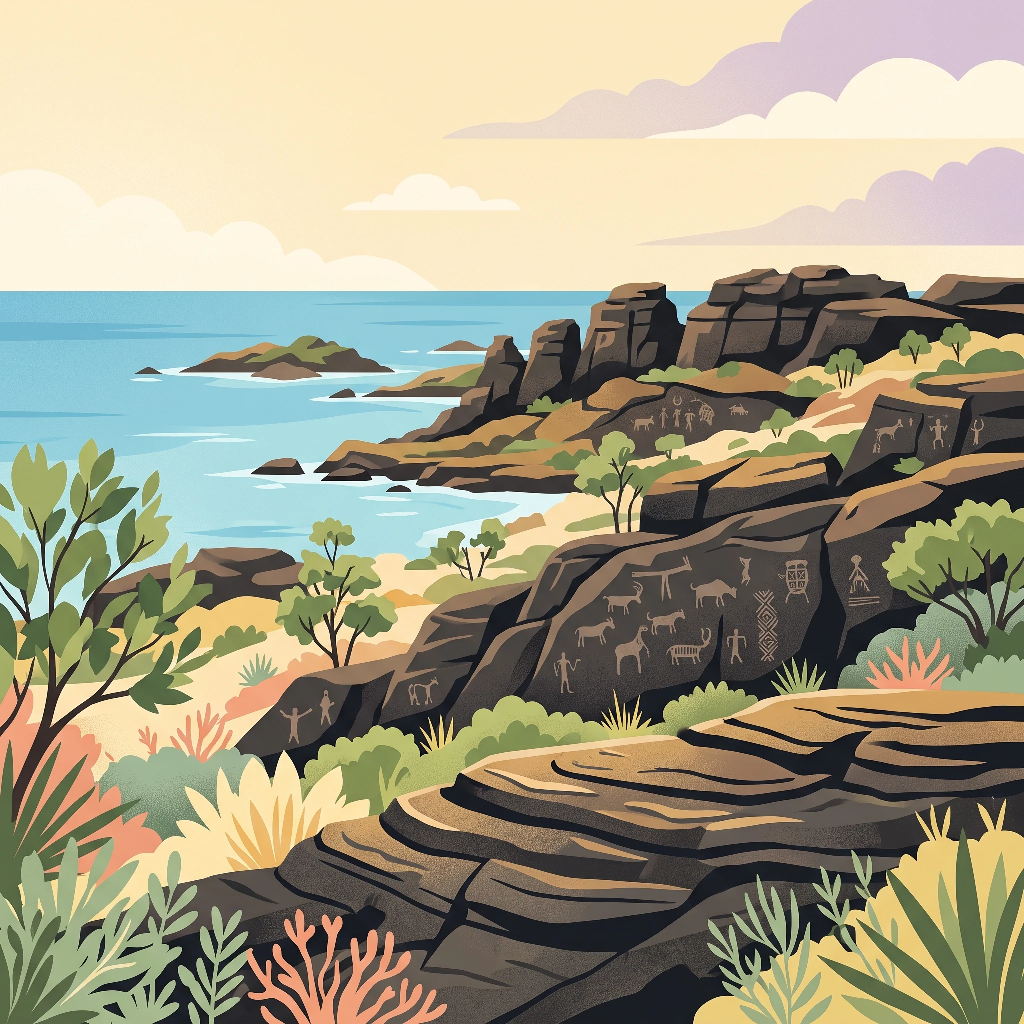
The Burrup Peninsula landscape within Murujuga National Park consists of ancient Precambrian rock formations rising from the coastal plain of the Pilbara region. The terrain features exposed granite and basalt inselbergs, rock platforms, and cliff lines that have been weathered over hundreds of millions of years. These ancient rocks provide the substrate for the extensive rock art galleries found throughout the park. The coastline features rocky headlands, small beaches, and sheltered bays where the engravings are often located on vertical faces and sheltered overhangs. The inland areas contain scattered spinifex grasslands and scrub vegetation adapted to the arid conditions. The dramatic contrast between the ancient dark rock formations and the blue waters of the Indian Ocean creates a visually striking landscape that has been a significant place for Aboriginal people for tens of thousands of years.

Murujuga National Park ecosystems, habitats, and plant life

The Burrup Peninsula and surrounding Pilbara region supports a range of adapted desert and coastal ecosystems despite the arid conditions. The vegetation communities include spinifex grasslands, samphire flats along the coast, and scattered scrublands dominated by acacia and eucalyptus species. The rocky terrain provides habitat for a variety of reptiles including goannas and snakes adapted to the harsh environment. Coastal areas support birdlife including seabirds and shorebirds, while the surrounding waters contain marine species typical of the Pilbara coast. The ecological value of the area, however, is primarily centered on the cultural landscape rather than biodiversity, as the rock art sites themselves are the defining natural and cultural feature of the park.

Murujuga National Park wildlife and species highlights

The wildlife of Murujuga National Park reflects the arid and coastal nature of the Pilbara region. Reptile species including various skinks, dragons, and goannas are present throughout the rocky terrain. The surrounding coastal waters and mangroves support fish species and marine invertebrates. Birdlife includes seabirds such as terns and osprey along the coastline, while inland areas host desert bird species adapted to the harsh environment. While the park is not primarily known for wildlife viewing, the rock formations also provide shelter and habitat for small mammals and reptiles. The broader Pilbara region is known for its unique fauna including endangered species, though the national park's main significance lies in its cultural rather than ecological value.

Murujuga National Park conservation status and protection priorities

Murujuga National Park was established specifically to protect one of the world's most significant rock art assemblages. The conservation of these ancient engravings faces challenges from industrial development in the surrounding Burrup Peninsula, which has seen significant expansion of LNG and other resource processing facilities. A monitoring program has been implemented to assess potential impacts of air pollution on the rock art, with extensive research conducted in recent years. The 2025 World Heritage inscription recognizes the outstanding universal value of the cultural landscape and provides additional framework for international protection. The management of the park involves collaboration between the Department of Biodiversity, Conservation and Attractions and the Murujuga Aboriginal Corporation, representing Traditional Owners who maintain ongoing connection to this ancient cultural landscape.

Murujuga National Park cultural meaning and human context

Murujuga holds profound significance for the Aboriginal peoples of the Pilbara region, representing thousands of years of continuous cultural practice and connection to Country. The rock engravings were created by Ancestral beings and represent a living cultural tradition that continues today. The Burrup Peninsula contains what is believed to be the densest concentration of rock art anywhere in the world, with images representing different time periods and cultural phases. The landscape is embedded with Dreaming stories and continues to be a place of ceremony and cultural practice for Traditional Owners. The collaboration between government agencies and Aboriginal corporations in managing the park reflects the recognition of Aboriginal people as the primary custodians of this heritage. The Ngajarli Trail project represents a model of culturally appropriate visitor access that allows appreciation of the rock art while respecting its sacred significance.

Top sights and standout views in Murujuga National Park

The defining highlight of Murujuga National Park is the extraordinary density and diversity of ancient Aboriginal rock art preserved within its boundaries. Visitors can explore the Ngajarli Trail boardwalk, which provides accessible viewing of significant rock art galleries with interpretative signage explaining the cultural and historical context. The 2025 World Heritage inscription of the broader Murujuga Cultural Landscape recognizes the global significance of this ancient artistic tradition. The park offers a unique opportunity to witness rock art in its natural setting, with images ranging from simple geometric marks to detailed representations of animals and human figures spanning thousands of years. The dramaticPilbara landscape provides a striking backdrop for this cultural experience, combining natural and cultural heritage in a way few other places can match.

Best time to visit Murujuga National Park

Murujuga National Park can be visited year-round, though the cooler months from May to September offer more comfortable conditions for exploring the outdoor trail. The Pilbara region experiences hot temperatures throughout the summer months, which can make outdoor activity challenging. The dry season typically runs from May to October, providing clearer skies and more pleasant hiking conditions. Visitors should be aware that the park may experience temporary closures for cultural ceremonies or management activities, and checking with park management before visiting is recommended. The boardwalk and trail are designed for universal access, making the rock art experience available to visitors with varying mobility levels.
Park location guide

Geography guide, regional context, and park location map for Murujuga National Park

Murujuga National Park park geography, regions, and map view in Australia
Understand where Murujuga National Park sits in Australia through a broader geographic reading of the surrounding landscape, nearby location context, and its mapped position within the national park landscape.

How Murujuga National Park fits into Australia

Australia is a constitutional monarchy and federal parliamentary democracy comprising six states and ten territories. With a population of nearly 28 million, it is one of the world's most urbanised countries, with most people concentrated on the eastern seaboard. The country has a high Human Development Index and is known for its cultural diversity, ancient Aboriginal heritage, and unique wildlife.

Wider geography shaping Murujuga National Park in Australia

Australia occupies the entire Australian continent, the island of Tasmania, and numerous smaller islands. It is the world's flattest and driest inhabited continent, featuring vast deserts in the interior (the Outback), tropical rainforests along the eastern coast, and a coastline bordering the Indian and Pacific Oceans.

Map view of Murujuga National Park

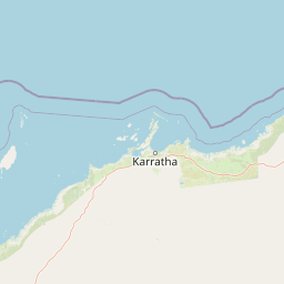
Use this park location map to pinpoint Murujuga National Park in Australia, understand its exact geographic position, and read its mapped placement within the surrounding landscape more clearly.

Pigeon | © OpenStreetMap contributors

Location context for Murujuga National Park

PilbaraWestern Australia
Park atlas

Trace the regional protected landscape spread and compare similar park geography around the Pilbara.

Explore Nearby National Parks and Protected Areas Beyond Murujuga National Park
Discover additional national parks and protected areas situated within Western Australia's Pilbara region and its surrounding coastal geography. Expand your exploration of unique ancient cultural landscapes and diverse protected terrain by comparing similar park entities across the mapped atlas.
National parkWestern Australia

Millstream Chichester National Park: A Mapped Protected Landscape in Western Australia

Explore its geographic spread and natural terrain features.

Millstream Chichester National Park is a designated national park within the vast geographic expanse of Western Australia. This entry provides detailed atlas-level information focused on its protected boundaries and distinct landscape characteristics. Understand the park's role within the regional geography and its significance as a mapped natural area for discovery and exploration.

Area
2,381.67 km²
Established
1970
IUCN
II
Relief
Mixed relief
National parkWestern Australia

Karijini National Park: Explore the Protected Landscape and Geographic Context in Western Australia

Mapped natural terrain and regional geography for this Australian national park.

Karijini National Park is a designated national park in Western Australia, offering a distinct protected landscape for geographic exploration. This detailed entry provides context on its specific location within the state, its mapped boundaries, and the surrounding natural terrain. It serves as a foundational element for understanding the park's role within the larger atlas of protected areas and natural geography across Australia.

Area
6,274.22 km²
Established
1969
IUCN
II
Visitors
166K annual
Watercolor illustration showing a coastal scene with shoreline, water, and landforms
National parkWestern Australia

Cape Range National Park: Exploring Western Australia's Protected Landscape Identity

Mapped boundaries and regional geographic context.

Cape Range National Park is a vital protected area located in Western Australia, offering a distinct geographic profile for atlas exploration. This entry focuses on its identity as a national park, detailing its mapped landscape and regional context. Users can discover the park's place within the state's diverse terrain and understand its significance as a mapped conservation area, contributing to a structured understanding of Australia's protected lands.

Area
476.55 km²
Established
1965
IUCN
II
Relief
Highland
National parkAustralia

Cape Range (South) National Park: Exploring Australia's Arid Semiarid Landscape Atlas

Mapped protected boundaries and regional terrain in Western Australia.

Cape Range (South) National Park, situated in Western Australia, is a vital protected area safeguarding a significant portion of the Carnarvon xeric shrublands. This national park offers a glimpse into a unique arid-zone landscape defined by low ranges, sandy plains, and characteristic acacia shrubland. Its establishment extends conservation efforts in the Gascoyne region, providing crucial context for mapped geography and the distribution of arid-adapted ecosystems within Australia's broader atlas.

Area
270.72 km²
Established
2020
IUCN
II
Relief
Upland
National parkWestern Australia

Mount Augustus National Park: Western Australia National Park & Protected Landscape

Explore its mapped terrain and regional geographic context.

Mount Augustus National Park represents a significant protected area within the diverse geography of Western Australia. This page serves as a portal to understanding its specific protected landscape characteristics and its contribution to the state's mapped natural areas. Users can explore the park's geographic identity, its defined boundaries, and its role within a broader atlas of protected lands, providing essential context for regional landscape discovery.

Area
91.68 km²
Established
1989
IUCN
III
Relief
Mountain
National parkGascoyne

Kennedy Range National Park: Explore Its Dramatic Sandstone Plateau and Canyon Geography

Discover the protected landscapes of Gascoyne's arid terrain.

Kennedy Range National Park is a protected area defined by its striking geological formations, including a vast sandstone plateau and deeply incised canyons that create a dramatic mesa landscape. Situated in the Gascoyne region, this national park serves as a significant example of Australia's inland semi-arid environments, offering rich context for mapped terrain exploration. Understand the park's protected boundaries, its unique arid-zone ecosystems, and the visual contrast it presents within the regional geography, providing valuable insights for atlas-driven discovery.

Area
1,416.6 km²
Established
1993
IUCN
II
Relief
Highland
National parkWestern Australia

Collier Range National Park National Park: Mapped Boundaries and Western Australia Geography

Discover protected area context and regional landscape features.

Collier Range National Park is a key protected area offering a focused lens into the diverse geography of Western Australia. This national park's mapped boundaries provide essential structure for understanding its place within the regional landscape. Explore the specific geographic context and protected-area identity of Collier Range National Park, contributing to a richer comprehension of Western Australia's natural terrain.

Area
2,351.62 km²
Established
1978
IUCN
II
Relief
Mixed relief
National parkGascoyne

Pimbee National Park: Australian National Park with Gascoyne Regional Geography

Mapped protected boundaries and natural landscape context.

Pimbee National Park represents a key protected area within Australia's vast Gascoyne region. This national park provides a specific geographic focus, allowing for detailed exploration of its mapped boundaries and the surrounding natural landscape. Understanding Pimbee National Park's place within the regional geography of Western Australia is crucial for a comprehensive atlas-driven discovery of the continent's protected lands and their unique terrain.

Established
2023
Climate
Arid
Scope
Terrestrial

Common questions about visiting, size, designation, and location context for Murujuga National Park

Murujuga National Park FAQs for park facts, access, geography, and protected area context
Find quick answers about Murujuga National Park, including protected-area facts, park geography, trail and visitor context, and how the park fits into its surrounding country and regional landscape.
MoriAtlas Explorer

Continue Your Protected Areas Search Across the Global Atlas

Deepen your exploration by continuing the structured search for national parks and protected areas worldwide. Utilize the comprehensive filtering capabilities to compare different conservation landscapes and refine your understanding of global park geography. Discover more about the distribution and characteristics of protected natural areas.

Global natural geography