Peaks
Alto Los Pinos
1,257 m

Detailed landscape analysis of regional terrain, mountain peaks, and spatial dimensions.
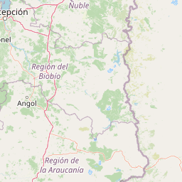
Examine the precise geographic layout of Nahuelbuta National Park, a protected wilderness situated within the La Araucania Region. This profile details the mountain terrain, spanning 68 square kilometers, and catalogs significant natural features such as the Cordillera de Nahuelbuta and the iconic Piedra del Aguila peak at 1379 meters in elevation.
Related tags
Ancient monkey puzzle forest sanctuary in Chile's Coastal Range
Nahuelbuta National Park is a protected area in south-central Chile situated atop the Cordillera de Nahuelbuta, the highest section of the Chilean Coastal Mountain Range in La Araucanía Region. Established in 1939, the park encompasses approximately 6,832 hectares of mountainous terrain just 162 kilometers northeast of Temuco. The park's name derives from the Mapuche language, meaning "big tiger," reflecting the cultural heritage of the indigenous communities who historically inhabited this region. Nahuelbuta serves as a critical sanctuary for one of the southern hemisphere's most ancient conifer species, the monkey puzzle tree, with some specimens estimated to be over 2,000 years old. The park's elevated position creates a distinctive ecological island of Andean-Patagonian vegetation isolated within the broader Mediterranean-climate landscape of central Chile.
Regional administration and geographic status in La Araucanía, Chile
Nahuelbuta National Park’s mapped outline covers 68 km²
Mountain relief summary and recorded natural features
Peaks
1,257 m
Peaks
1,530 m
Named stones
Peaks
1,379 m
Peaks
1,448 m
Peaks
1,402 m
Temperate forest cover and mountain relief classifications across the protected landscape
Mountains · Forest · Woodland
Temperate coniferous forest · Temperate broadleaf forest
Explore the geographic spread of protected areas surrounding Nahuelbuta National Park, comparing diverse landscapes in Chile's Coastal Mountain Range.
Southeast

Explore the protected landscape and regional context of this park.
Tolhuaca National Park is a protected national park located in Chile, offering a distinct point for geographic and landscape discovery. This detailed view focuses on the park's mapped boundaries, its environmental setting within Chile, and its overall protected-area identity. Engage with structured data that clarifies its position in the broader atlas of natural landscapes, providing context for regional geography and conservation efforts.
Southeast
Discover unique terrain within La Araucanía Region's geography.
Conguillío National Park is a vital protected landscape offering rich opportunities for geographic discovery. This page details the park's specific location within La Araucanía Region, highlighting its mapped natural features and protected boundaries. Understand Conguillío National Park's role as a national park and explore its distinct terrain and regional landscape context.
East
Explore regional park geography and landscape context.
Laguna del Laja National Park represents a key protected area with distinct geographic attributes within the Bío Bío Region. This profile focuses on its identity as a national park, providing context for its mapped boundaries and natural landscape. Discover its place in regional geography, offering valuable insights for any atlas-focused exploration of Chile's protected lands.
Southeast
Mapped protected area in the Andean foothills of Southern Chile.
Delve into the protected landscape of Huerquehue National Park, a key component of Chile's southern conservation efforts within the La Araucanía Region. This national park is defined by its ancient araucaria forests, home to the iconic monkey puzzle tree, and a network of clear glacial lakes including Tinquilco Lake. Its mountainous terrain, rising from 720 to 2,000 meters, showcases a vital representative of the Andean-Patagonian forest ecosystem, offering rich context for map exploration and understanding protected-area geography.
Southeast
Mapped boundaries and regional geography exploration
Villarrica National Park represents a crucial protected area within the diverse geography of Chile's La Araucanía Region. This atlas-focused entry provides detailed geographic context and mapped park boundaries, essential for understanding the park's landscape identity. Explore the foundational elements of this national park for structured geographic discovery.
Southeast

Explore the protected area's mapped terrain and glacial lakes.
Lanín National Park offers a deep dive into the dramatic geography of Argentine Patagonia, centered around the prominent Lanín volcano. This national park preserves ancient araucaria forests, diverse ecosystems, and breathtaking glacial lakes like Huechulafquen and Lácar. Its extensive protected landscape provides critical habitat and opportunities to explore unique Andean terrain through map-driven discovery.
South
Discover mapped terrain and unique Valdivian ecosystem geography.
Alerce Costero National Park stands as a significant protected landscape in Chile's Los Ríos Region, celebrated for its ancient Fitzroya trees and as a sanctuary for the Valdivian temperate rainforest. The park's protected boundaries encompass rugged terrain within the Cordillera Pelada, offering insights into unique watershed geography and the resilience of an ancient forest ecosystem. Its diverse landscape, a mosaic of old-growth woods and natural clearings, provides essential habitat and a remarkable geographic context for atlas exploration.
Southeast
Mapped protected area and regional landscape context.
Laguna Blanca National Park represents a key protected landscape within the expansive geography of Neuquén Province, located in the Patagonia region of Argentina. This national park entity serves as a critical node for atlas exploration, allowing users to understand its specific protected boundaries and its contribution to the regional protected-area network. Investigate Laguna Blanca National Park to gain insight into its unique geographic setting and its role within the mapped natural areas of Western Argentina.
Delve deeper into the geographic context and protected landscape of Nahuelbuta National Park. By understanding its position atop the Cordillera de Nahuelbuta and its unique ecological characteristics, you can gain a richer appreciation for this significant natural area. Continue your atlas exploration to uncover more about the mapped terrain and regional geography that define this remarkable national park.