Mori Atlas logo
Nearby park discovery

Geographic distribution and landscape context of nearby protected land corridors

Parks and Protected Natural Areas Located Near Naturpark Mølleåen in Northern Zealand

Identify protected areas and natural landscapes situated within the regional geography surrounding Naturpark Mølleåen. This comparison maps the spatial relationship between glacial features, valley corridors, and protected lands across the northern Zealand region of Denmark to provide a clear view of nearby environmental zones.

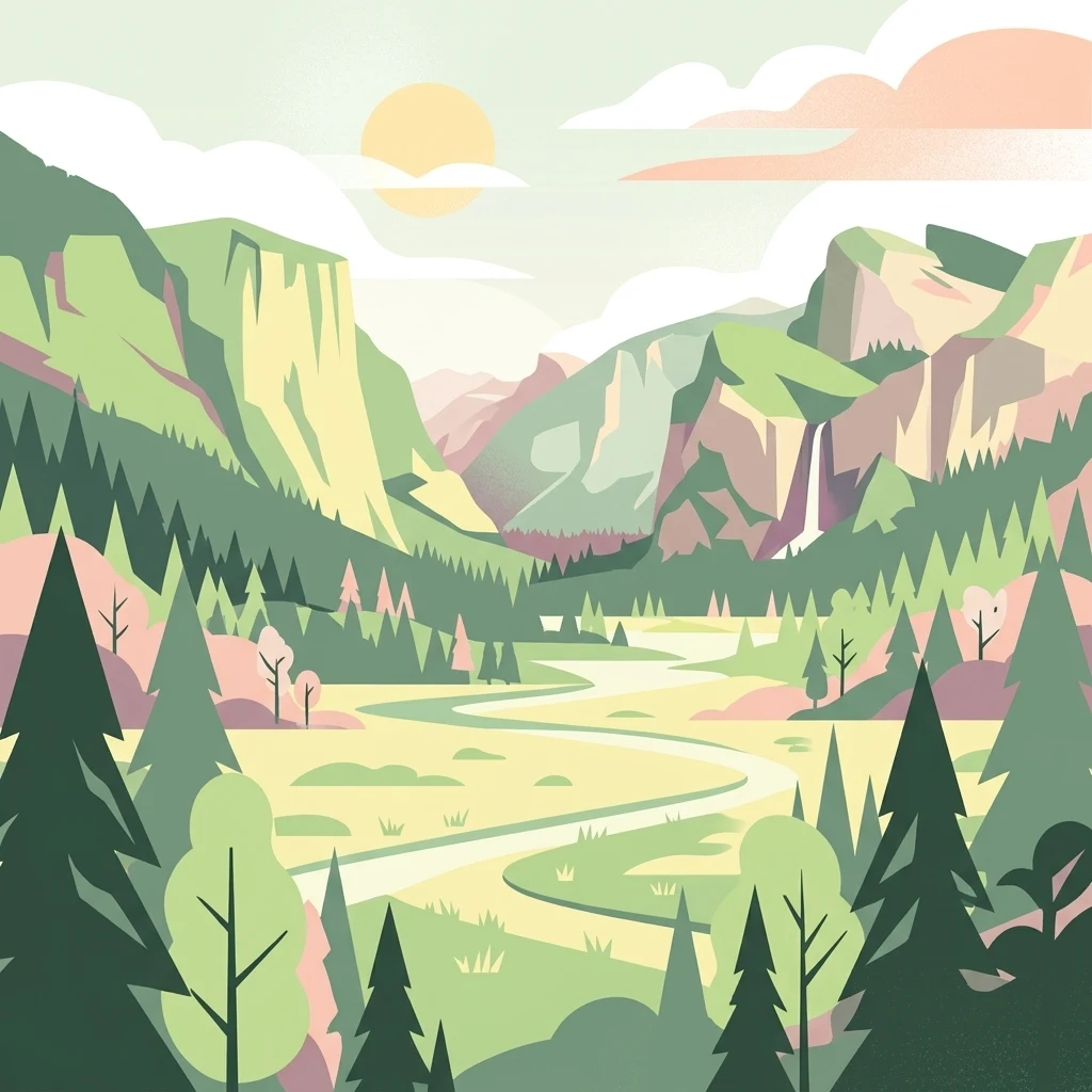
A digital illustration of a scenic valley landscape featuring mountains, pine trees, a meandering river, and a waterfall under a soft sun.

Denmark's oldest and largest nature park, built around an Ice Age glacial valley north of Copenhagen.

Naturpark Mølleåen

Naturpark Mølleåen is a protected nature park in northern Zealand, Denmark, that wraps around the upper Mølleå valley, a glacial landscape shaped during the last Ice Age. The park covers a continuous natural area of around 50 square kilometers, stretching between the old villages of Farum, Vassingerød, Lynge-Uggeløse, Slangerup, Jørlunde, Ølstykke, Slagslunde, Ganløse, Kirke Værløse and Lille Værløse. Roughly three quarters of the park's land is formally protected forest or nature reserve, and the broader corridor is recognized as a national geological interest area and a Natura 2000 habitat site. Although it received formal certification in 2016, the park represents Denmark's oldest nature park idea, with origins reaching back to 1942, when a civic initiative aimed to give Copenhageners a nearby place to experience nature. Today it combines tunnel valley lakes, streams, wooded hills and medieval villages into a single protected landscape that functions both as an ecological refuge and as a popular recreational area for the Copenhagen region. The park is valued for its blend of characteristic glacial landforms and intact North Zealand village environment, with small farms at Ganløse Mørke and around Ryet and Buresø still forming part of its unspoiled cultural setting.

Location
Denmark
Park type
Protected landscape
Established
1942
Area
50 km²
Naturpark Mølleåen Geography and Atlas Map
Regional park map

See the ranked park cluster in its geographic setting

Nearby parks around Naturpark Mølleåen

This regional map shows the same 20 nearby parks ranked below around Naturpark Mølleåen. Select a ranked marker to highlight that park’s boundary where boundary data is available.
Reference park: Naturpark MølleåenRanked nearby park20 nearby parks shown
20 nearby parks

Ranked distance relationships and regional park geography across Denmark

Parks and Protected Areas Geographically Near Naturpark Mølleåen

Geographic proximity metrics establish a structured ranking of protected areas situated near Naturpark Mølleåen based on boundary separation and direction. Examining surrounding park environments allows researchers to compare varied regional terrain, country context, and ecological characteristics across northern Zealand.
A watercolor illustration of a serene lakeside landscape with green hills, foliage, and calm water, painted in soft pastel colors.
Protected areaNorth Zealand
About 12 km away#1 closest

East

Furesø Protected Area: Mapping the Deepest Glacial Lake and Wetland Systems of North Zealand

Glacial tunnel valley landscapes and Natura 2000 protected waters.

Spanning deep basins and shallow shorelines, Furesø represents a significant protected freshwater body within the North Zealand region. The surrounding mosaic of peatlands and alder swamps highlights a legacy of glacial activity and ongoing conservation efforts. This area remains a focal point for understanding the interplay between metropolitan geography and preserved natural terrain.

Area
9.41 km²
Relief
Lowland
Climate
Temperate
Access
Easy access
A pale watercolor painting depicting a marshy landscape with rolling green hills, tall grasses in the foreground, and a calm body of water, rendered in soft pastel tones.
Protected areaDenmark
About 15 km away#2 closest

Southeast

Smør- og Fedtmosen: Glacial Tunnel Valley and Protected Mire Geography in Denmark

A key hydrological watershed site and managed meadow reserve

Examine the topographic features of Smør- og Fedtmosen, where groundwater-fed mires and dead-ice depressions create a distinct wetland system. This protected area showcases a transition from saturated reed beds to grazed meadows, illustrating the intersection of long-term conservation and the natural geography of a former tunnel valley.

Area
1.5 km²
Established
1943
Relief
Lowland
Scope
Terrestrial
Nature reserveGentofte Kommune
About 20 km away#3 closest

East

Brobæk Mose Nature Reserve: Protected Wetland and Glacial Geography in Gentofte Kommune

Mapped wetland habitat and natural terrain analysis.

Brobæk Mose serves as a primary example of a spring-fed wetland within the glacial landscapes of Gentofte Kommune. The area preserves rich fens and developing natural forest, offering a clear view of post-glacial valley geography and protected ecological zones surrounded by the Copenhagen suburban environment.

Established
1988
Water
Major water bodies
Watercolor illustration of green hills, a body of water, and vegetation
National parkDenmark
About 21 km away#4 closest

North

Kongernes Nordsjælland National Park: Protected Landscape Geography and Map Context

Explore North Zealand's protected natural terrain.

Delve into the protected landscape of Kongernes Nordsjælland National Park, a significant national park in Denmark's North Zealand region. This section provides a structured overview of its mapped boundaries and geographic setting, allowing for a detailed atlas-style discovery of its natural terrain. Understand how this protected area contributes to the region's conservation landscape and mapped geography.

IUCN
II
A horizontal watercolor painting depicting a soft, light-filled meadow landscape with scattered trees, low vegetation, and patches of water.
Nature reserveCopenhagen
About 29 km away#5 closest

Southeast

Amager Fælled Nature Reserve: Mapping Copenhagen's Distinctive Protected Landscape

Explore pioneer plant habitats and coastal meadow geography

Amager Fælled functions as a 223-hectare nature reserve that borders the urban development of Copenhagen. The landscape offers a study in contrasts, featuring thin drought-prone soils, historical military and landfill substrates, and protected coastal meadow strips. This site remains a vital geographical reference for understanding urban-edge conservation and the long-term layering of human land use.

Area
2.23 km²
Established
1992
Relief
Lowland
Climate
Temperate
Nature reserveSolrød Kommune
About 34 km away#6 closest

South

Staunings Ø Nature Reserve: Exploring the Coastal Geomorphology of Solrød Kommune

A mapped barrier spit and wetland habitat on the eastern Zealand shoreline.

Staunings Ø functions as a textbook example of a coastal sand bar accretion in the shallow waters of Køge Bugt. This nature reserve protects a vital sequence of dunes, lagoons, and reedbeds that provide a clear view of coastal succession. Located near the urban edge of Solrød Kommune, it serves as a key site for understanding the interaction between natural coastal landforms and maritime environments in eastern Denmark.

Area
0.6 km²
Established
1999
Relief
Lowland
Climate
Temperate
Nature reserveFaxe Municipality
About 50 km away#7 closest

South

Bagholt Mose: Protected Peatland Mosaic and Fen Geography in Faxe Municipality, Denmark

A high-value Natura 2000 protected wetland and bog habitat.

Bagholt Mose is a significant nature reserve situated within the Munkeskov forest of southern Zealand. The landscape features a distinct combination of historical peat cuttings and raised bog remnants, which together form a rare mosaic of nutrient-poor and calcareous fen communities that support an exceptional diversity of lowland bog flora.

Area
0.17 km²
Established
1985
Relief
Lowland
Scope
Terrestrial
Watercolor painting of the island of Nekselø showing green hills rising above a pale sea against a light sky.
Nature reserveKalundborg Kommune
About 59 km away#8 closest

West

Nekselø Nature Reserve: An Atlas Entry for the Unique Steppe-Climate Island in Denmark

Coastal geography and protected wetland terrain in Kalundborg Kommune

Nekselø represents a distinctive protected area in Denmark, where a unique microclimate creates favorable conditions for diverse, warmth-loving flora and fauna. As a managed nature reserve in Kalundborg Kommune, it offers a compelling study in island geography and small-scale, community-led conservation efforts within the international Ramsar and Natura 2000 protected frameworks.

Area
2.2 km²
Established
1951
Relief
Lowland
Scope
Mixed
Nature reserveKalundborg Municipality
About 62 km away#9 closest

West

Saltbæk Vig Nature Reserve: Geography and Protected Wetland Landscapes in Kalundborg Municipality

A brackish lagoon basin shaped by historic land reclamation efforts.

Saltbæk Vig is a major coastal water body on the northwestern edge of Zealand, Denmark, defined by shallow waters and low-lying wetland terrain. This nature reserve serves as an important regional landmark, where historic drainage embankments now form unique boundaries that define the lagoon's ecological character and protected status.

Area
26 km²
Established
1992
Relief
Lowland
Climate
Temperate
National parkSweden
About 63 km away#10 closest

Northeast

Söderåsen National Park: A Protected Ridge Landscape in Southern Sweden's Geography

Mapped protected area with varied terrain and dense forest cover.

Delve into the protected landscape of Söderåsen National Park, a national park in Southern Sweden distinguished by its unique ridge topography, steep slopes, and extensive forests. This site serves as a key point for atlas-based exploration of natural terrain and regional geography, offering a clear view of its mapped boundaries and ecological significance within the Southern Swedish highlands. Understand the character of this protected area and its place in the broader mapped landscape.

Established
2001
IUCN
II
Scope
Terrestrial
Watercolor painting of green trees on rolling hills under a pink and orange sunset
National parkSweden
About 70 km away#11 closest

East

Dalby Söderskog National Park: Explore Southern Sweden's Smallest Protected Deciduous Forest

Unique limestone geology, spring flowers, and mapped terrain.

Dalby Söderskog National Park, though only 36 hectares, offers exceptional botanical discovery rooted in its fertile limestone soils. This protected area in Scania, Sweden, showcases a dense deciduous forest ecosystem with remarkable diversity, particularly evident in its vibrant spring wildflower displays. Use MoriAtlas to explore the park's mapped boundaries and understand its significant role within the regional geography and broader protected landscape atlas.

Area
0.36 km²
Established
1918
IUCN
II
Relief
Lowland
A soft watercolor illustration showing a hazy green landscape with rolling hills, a line of trees, and a calm body of water in the foreground.
Nature reserveKalundborg Municipality
About 76 km away#12 closest

Southwest

Flasken Nature Reserve: Mapped Protected Landscapes in Kalundborg Municipality

Coastal river mouths and brackish lagoon ecology

Flasken stands as a significant protected nature reserve in western Denmark, defined by the confluence of the Halleby Å river and the Storebælt. This mapped landscape provides essential context for understanding the long-term coastal geomorphology of the Reersø tombolo and the wider wetland ecosystems of the Åmosen basin.

Established
1979
Relief
Lowland
Climate
Temperate
Access
Access unknown
Wildlife reserveDenmark
About 82 km away#13 closest

South

Dybsø Fjord Wildlife Reserve: Coastal Geography and Protected Wetland Map in Denmark

A shallow fjord system on the southwestern coast of Zealand

Dybsø Fjord represents a primary protected landscape in Denmark, featuring a broad and exceptionally shallow lagoon environment. By tracing its boundaries and surrounding peninsulas, users can analyze a critical wetland habitat that supports international bird protection networks and reflects the unique coastal scenery of the Baltic region.

Area
17 km²
Established
1940
Relief
Lowland
Scope
Mixed
A horizontal watercolor painting showing a soft green shoreline in the foreground and rolling hills across the water in the distance.
Nature reserveNaestved Municipality
About 83 km away#14 closest

Southwest

Dybsø Nature Reserve: Protected Coastal Landscape in Naestved Municipality

Geographic atlas of a protected Danish barrier island

Dybsø is a distinct barrier island situated off the coast of Zealand. Its protected landscape consists of open grasslands, coastal reed beds, and freshwater ponds that shelter the shallow waters of the fjord system. As a designated nature reserve, the area represents a critical wildlife refuge, maintained through traditional grazing to preserve its unique maritime terrain and geological history.

Area
1.34 km²
Established
1978
Relief
Lowland
Climate
Temperate
A minimalist watercolor painting showing a horizontal landscape of green islands and shoreline against a white background.
Protected areaDenmark
About 86 km away#15 closest

West

Stavns Fjord Protected Area: An Atlas of Danish Coastal Landscapes

Mapping the islands and tidal flats of Samsø

Stavns Fjord offers a rare glimpse into a sheltered coastal landscape set entirely within the island of Samsø. Characterized by its calm waters, shallow tidal flats, and the curving spit of Besser Rev, this protected site is a critical Ramsar wetland habitat for coastal bird populations. Explore the unique geography and layered history, from Viking canals to medieval fortifications, that define this essential Danish protected area.

Area
20 km²
Established
1926
Relief
Lowland
Access
Moderate access
Nature reserveDenmark
About 88 km away#16 closest

Southwest

Stigsnæs-Borreby-Basnæs Nor Nature Reserve: Mapped Geography and Coastal Landscape Context

Protected wetlands and migration corridors in southern Denmark

Stigsnæs-Borreby-Basnæs Nor encompasses a complex interplay of manor-influenced farmland, reed-fringed shallows, and essential marshlands. This nature reserve functions as a critical funnel for migratory raptors and waterfowl on the southwestern edge of the Zealand coast. The area integrates deep cultural history with internationally recognized habitats, offering a clear window into the coastal terrain and wetland structure of the region.

Area
12.15 km²
Established
1978
Relief
Lowland
Scope
Mixed
Watercolor illustration showing rolling hills, a lake, pink flowering trees, and distant mountains
National parkDenmark
About 96 km away#17 closest

Northwest

Mols Bjerge National Park: Glacial Geography and Protected Terrain in Central Jutland

Mapping the coastal cliffs and rolling heathland of Denmark

Mols Bjerge National Park protects a sweeping mosaic of glacial hills, woodlands, and coastal zones on the Djursland peninsula. With a landscape shaped by ancient ice sheets, the park offers a detailed view into Denmark's geological history, preserved ancient barrows, and rich botanical diversity along the Kattegat sea.

Area
180 km²
Established
2009
IUCN
II
Relief
Upland
Nature reserveRegion Midtjylland
About 98 km away#18 closest

West

Natura 2000-område nr. 55 Stavns Fjord, Samsø Østerflak og Nordby Hede Protected Landscapes

Coastal lagoons and glacial islands in Region Midtjylland

Gain insight into the expansive marine and terrestrial geography of this protected site. The area spans a diverse mosaic of salt meadows, dunes, and shallow reefs while supporting critical habitats for waterbirds and seals within the Kattegat sea.

Area
156.63 km²
Established
1981
Relief
Lowland
Climate
Temperate
Nature reserveRegion Midtjylland
About 106 km away#19 closest

Northwest

Stubbe Sø Nature Reserve: A Geographic Exploration of Djursland Protected Landscapes

Mapping the wetlands, forest fringes, and mire systems of eastern Jutland.

Stubbe Sø is a central protected feature within the landscape of eastern Jutland, comprising a large shallow lake surrounded by alder-birch shorelines and coniferous plantations. This nature reserve offers deep insight into the glaciated terrain and wetland mosaic of the Djursland peninsula, providing an essential geographic reference for understanding local conservation habitats and regional waterbird migration corridors.

Area
7.78 km²
Established
1963
Relief
Lowland
Climate
Temperate
Watercolor painting depicting a gentle, rolling green landscape leading to a distant blue sea under a pale sky.
Protected areaRegion Midtjylland
About 106 km away#20 closest

West

Nordby Bakker Protected Area: Glacial Moraine and Grasslands in Region Midtjylland

Coastal cliffs, dunes, and rare calcareous ecosystems

Nordby Bakker preserves one of the largest continuous dry grassland complexes in Denmark, set upon a prominent glacial terminal moraine. Located at the northern tip of Samsø, this protected area features a unique synthesis of coastal dunes, beach ridges, and inland lakes that support a distinct array of rare plant and insect species within the central Kattegat region.

Area
6.28 km²
Relief
Upland
Climate
Temperate
Scope
Mixed
Distance methodology

Geographic measurements, not driving distances

How nearby park distances are calculated

Distances use park boundaries whenever the available geometry allows it. When one or both boundaries are missing, the mapped park locations provide a clearly labelled estimate. Every value represents straight-line geographic separation and does not use roads or routing.

Boundary distance

Calculated between the nearest points of both park boundaries.

Location-to-boundary estimate

Estimated from one mapped park location to the nearest boundary of the other park.

Mapped-location estimate

Estimated between the mapped locations of both parks.

MoriAtlas Explorer

Examine the Glacial Topography and Protected Boundaries of Naturpark Mølleåen

Open the detailed geographic view of Naturpark Mølleåen to trace its complex tunnel valley systems and protected forest boundaries. MoriAtlas provides a structured look at the glacial landforms, lake networks, and historical village fringes that define this unique Danish nature park and its significance within the Zealand region.