

Mori Atlas logo
Wildlife reserveNinginganiq National Wildlife Area

Explore the geographic boundaries, coastal tundra, and bowhead whale habitats of this sanctuary in Nunavut.

Ninginganiq National Wildlife Area: A Protected Arctic Marine Landscape on Baffin Island

(Réserve nationale de faune Ninginganiq)

Ninginganiq National Wildlife Area represents a critical protected landscape situated along the eastern coastline of Baffin Island, Nunavut. This sanctuary guards Isabella Bay, a pivotal marine gathering point that functions as a seasonal feeding ground for bowhead whales within the High Arctic. The reserve encompasses a complex interplay of tundra slopes, rocky headlands, and glacially carved inlets, reflecting the unique environmental character of the Canadian Arctic region.

Arctic coastlinemarine wildlifebowhead whaletundraislandindigenous co-management

Ninginganiq National Wildlife Area

Wildlife reserve

Park overview

Structured park overview, official facts, and landscape profile for Ninginganiq National Wildlife Area

Ninginganiq National Wildlife Area park facts, protected area profile, and essential visitor context

Review the core facts for Ninginganiq National Wildlife Area, including designation, size, terrain, visitor scale, habitats, and operating context in one park-focused overview.

About Ninginganiq National Wildlife Area

Ninginganiq National Wildlife Area occupies a striking stretch of the eastern Baffin Island coastline in Nunavut, in one of the most remote and weather-defined regions of the Canadian Arctic. Although the reserve covers a substantial surface area of marine and coastal land, its identity is firmly tied to a single ecological stage: Isabella Bay.

Isabella Bay is a long, narrow inlet that opens into Davis Strait. Its shallow shelves and zooplankton-rich bottom currents create ideal feeding conditions for bowhead whales, which arrive in the area during the brief open-water season and remain through the autumn. Sightings in the bay have recorded close to a hundred whales in a single day and an estimated three hundred individuals across the season, numbers that place the bay among the most important bowhead feeding areas in the North Atlantic.

The reserve's ecosystem extends well beyond the whales themselves. The same nutrient-rich, ice-fringed waters that attract bowheads support seals, including ringed seals, and predators such as polar bears that patrol the floe edge. Narwhals also use the area, and the shoreline and cliffs host Arctic seabirds such as the king eider, long-tailed duck, dovekie, and northern fulmar. Together, these populations make the bay one of the more ecologically productive places along this otherwise austere coastline.

Ninginganiq is also notable for the way it was established. The protection of Isabella Bay was a long-standing goal of the community of Clyde River and international conservation organizations, working to secure formal recognition of the area since the early 1980s. Decades of negotiation between the Government of Canada and Inuit representatives resulted in agreements that combined federal wildlife protection with the recognition of ongoing Inuit traditional activities, including hunting. The reserve was officially designated in June 2010, alongside the companion Akpait and Qaqulluit national wildlife areas, marking a significant expansion of Canada's formal Arctic conservation network.

Quick facts and research context for Ninginganiq National Wildlife Area

Ninginganiq National Wildlife Area lies on the eastern coast of Baffin Island in Nunavut, near the Inuit community of Clyde River. It is administered under the National Wildlife Area system by the Canadian Wildlife Service and was formally designated on 3 June 2010.

The reserve spans roughly 3,362 square kilometres of sea, coast, and adjacent land, centered on Isabella Bay. It was created primarily to protect the bowhead whale (Balaena mysticetus), which gathers there in unusually high concentrations during the late open-water season. The site's name comes from the Inuktitut word meaning approximately "the place where the fog reigns."

Protection and recognition

Examine the documented marine protection status and official management records for Ninginganiq National Wildlife Area.

Ninginganiq National Wildlife Area Protection Status and Marine Conservation Scope

Ninginganiq National Wildlife Area features a documented marine protection scope maintained within international database records. Conservation researchers review these structured marine designation facts to understand baseline protected area governance.

Protection details

Protection scope
Marine
Transboundary protection
No
WDPA ID
555516428
Park context

Deeper park guide and search-rich context for Ninginganiq National Wildlife Area

Ninginganiq National Wildlife Area history, landscape, wildlife, and travel context

Explore Ninginganiq National Wildlife Area through its history, landscape character, ecosystems, wildlife, conservation priorities, cultural context, and seasonal travel timing in a structured park guide built for atlas discovery and search intent.

Why Ninginganiq National Wildlife Area stands out

Ninginganiq is best known as the first Canadian sanctuary devoted exclusively to the bowhead whale. Isabella Bay within the reserve hosts the largest documented aggregation of bowhead whales in Canadian waters, a seasonal concentration that makes the site internationally significant for the recovery and long-term study of the species. The reserve has also gained recognition as a landmark example of co-developed Arctic conservation, in which federal protection, Inuit traditional use, and scientific research are combined in a single management framework. Its combination of fog-bound Arctic seascape, marine mammal abundance, and cultural significance gives Ninginganiq a strongly defined identity among Canada's High Arctic protected areas.

Ninginganiq National Wildlife Area history and protected-area timeline

The history of Ninginganiq begins long before its formal designation. The community of Clyde River, located near the bay, and the World Wildlife Fund began advocating for protected-area status for Isabella Bay in 1982, recognizing its extraordinary concentration of bowhead whales at a time when the species was still recovering from historical commercial whaling pressures.

By the mid-2000s, this long-running effort converged with broader negotiations between the Government of Canada and Inuit organizations over land and resource protection in Nunavut. In February 2007, agreements were concluded that paved the way for the formal protection of Isabella Bay. As part of the arrangement, the Canadian government committed approximately 8.3 million dollars over seven years to support site management, tourism development, and archaeological research, while Inuit communities retained the right to continue traditional activities such as subsistence hunting within the area.

On 3 June 2010, the reserve was officially established under the Canadian Wildlife Service system as the Réserve nationale de faune Ninginganiq. It was designated at the same time as the Akpait and Qaqulluit national wildlife areas, completing a suite of Arctic reserves that gave legal protection to three ecologically and culturally important sites in Nunavut.

Ninginganiq National Wildlife Area landscape and geographic character

Ninginganiq's landscape is shaped by the meeting of High Arctic sea and land along the eastern margin of Baffin Island. The reserve covers a long sweep of coastline along Davis Strait, where steep shores and tundra slopes descend into bays, inlets, and floe-edge habitats typical of the eastern Canadian Arctic.

Isabella Bay itself defines the physical character of the area. It is a long inlet whose complex shoreline includes headlands and shallow shelves that concentrate marine life during the open-water season. Zodiacs and small boats are often forced to navigate slowly through persistent sea fog, a defining climatic feature of the region captured in the reserve's Inuktitut-derived name.

Beyond the bay, the surrounding terrain is composed of typical Baffin Island tundra, with low vegetation, rocky ridges, and glacially carved valleys. Ice conditions shift dramatically through the year, with the coastline locked in seasonal pack ice in winter and opening into mobile brash ice and open leads during the brief summer. This pronounced seasonality shapes everything from the visibility of marine mammals to the kinds of coastal landforms that visitors and researchers encounter.

Ninginganiq National Wildlife Area ecosystems, habitats, and plant life

From an ecological perspective, Ninginganiq is a concentrated patch of biological richness in an otherwise vast and harsh region. Its character is defined by the productivity of its marine waters rather than its terrestrial vegetation. The bay's nutrient circulation supports a thriving zooplankton community, which in turn sustains the large seasonal aggregations of bowhead whales that the reserve exists to protect.

Along the coast and adjacent tundra, the ecological profile shifts toward classic Arctic patterns. Low-growing tundra vegetation hugs the rocky shores, while the marine shoreline hosts ice-associated seabirds and marine mammals. The reserve's protected status keeps the broader ecological system intact, allowing predator-prey interactions, such as polar bears stalking seals at the floe edge, to play out with minimal human disruption.

The combination of marine productivity, ice-edge habitat, and tundra gives Ninginganiq a layered ecological identity that is larger than any single group of species. Even without factoring in its cetacean significance, the area would stand out as one of the more ecologically intact stretches of coastline in the eastern Canadian Arctic.

Ninginganiq National Wildlife Area wildlife and species highlights

The bowhead whale is unquestionably the flagship species of Ninginganiq. Also known by its scientific name Balaena mysticetus, these large baleen whales travel into Isabella Bay during the Arctic summer and remain there through the autumn, feeding on zooplankton concentrated by the bay's flow patterns. Up to one hundred bowheads have been observed in the bay on a single day, and the broader seasonal population in the area is estimated at roughly three hundred individuals.

Polar bears are also a regular presence along the coast and on pack ice at the floe edge, where they hunt ringed seals. The ringed seal itself is a key resident species: small, numerous, and central to the annual ecological cycle of Arctic marine waters. Narwhals occur in the area as well, adding to the reserve's importance for Arctic cetaceans.

The seabird community contributes a further layer to the site's wildlife significance. King eiders (Somateria spectabilis) and long-tailed ducks (Clangula hyemalis) are regular visitors and breeders along the coast, while dovekies (Alle alle) and northern fulmars (Fulmarus glacialis) exploit the same productive waters as the marine mammals. Together, the assemblage places Ninginganiq firmly among the wildlife-rich anchor points of the eastern Arctic coast.

Ninginganiq National Wildlife Area conservation status and protection priorities

Ninginganiq's conservation importance rests on its role as Canada's first protected area explicitly dedicated to the bowhead whale. The bowhead population of the western North Atlantic had been severely depleted by historical commercial whaling, and the recovery of the species remains a concern. By safeguarding Isabella Bay, where the whales aggregate in unusually high numbers, the reserve helps protect feeding habitat that is directly relevant to the long-term recovery of the population.

Beyond cetaceans, the reserve contributes to broader marine and coastal conservation in the eastern Arctic. The combination of marine mammal habitat, seabird breeding and foraging areas, and intact tundra shoreline makes the protected area a useful baseline for monitoring changes in the Arctic marine system, including those driven by climate shifts.

Management is also a defining conservation feature of the site. The reserve was established through agreements that explicitly recognize Inuit traditional activities and stewardship, including sustainable hunting, alongside federal protection. This cooperative model positions Ninginganiq as a notable example of how protected-area status in the Canadian Arctic can be paired with respect for Indigenous land use and rights.

Ninginganiq National Wildlife Area cultural meaning and human context

Ninginganiq is culturally significant as a place where Inuit knowledge and federal conservation policy intersect. The reserve's name itself is drawn from Inuktitut, referring to the persistent fog that defines the local maritime atmosphere, and the protection of the area is rooted in long-standing Inuit advocacy from the nearby community of Clyde River.

Through the negotiated framework that preceded the reserve's establishment, Inuit communities retained the right to carry out traditional activities within the protected area, including subsistence hunting. This approach reflects the central role of Inuit land users in the stewardship of the bay, and it positions the reserve as a culturally anchored site rather than a strictly exclusionary one.

The reserve also stands as one element of a broader pattern of Indigenous-led conservation in Nunavut, in which the protection of ecologically important Arctic places is shaped by the communities whose identities and livelihoods are connected to those landscapes.

Top sights and standout views in Ninginganiq National Wildlife Area

The standout feature of Ninginganiq is the seasonal spectacle of dozens to hundreds of bowhead whales feeding in Isabella Bay during the Arctic open-water season, an event that places the reserve at the heart of bowhead conservation in Canada. The site's name, drawn from Inuktitut and meaning "the place where the fog reigns," captures the atmospheric, weather-defined character of the bay itself, where boats move slowly through shifting curtains of sea fog.

As the first Canadian sanctuary built around a single species, the bowhead whale, Ninginganiq also stands out as a policy milestone. Its establishment alongside the Akpait and Qaqulluit national wildlife areas marked a deliberate expansion of formal Arctic protection in Nunavut, and its cooperative management model offers a template for how national conservation frameworks in the North can be paired with Inuit-led stewardship.

Best time to visit Ninginganiq National Wildlife Area

The character of a visit to Ninginganiq is fundamentally shaped by the Arctic calendar. The narrow window of open water in late summer and early autumn is when conditions match the reserve's identity, with sea ice loosening enough to allow small-boat access to Isabella Bay and the chance of seeing bowhead whales gathered at the surface in their largest numbers of the year.

Earlier in the summer, ice conditions tend to be heavier and visibility more limited, while outside the open-water season the bay is essentially inaccessible to surface travel. Anyone seeking the bowhead phenomenon specifically should plan around the late open-water period, when whales, seabirds, and the interplay of fog and shifting ice all combine to define the experience of the bay. Visitors should also anticipate that weather in this region can shift rapidly, and fog, a defining feature of the landscape, is part of the experience rather than an obstacle to it.
Monthly climate preview

Measured monthly temperature ranges and precipitation averages for Nunavut

Ninginganiq National Wildlife Area Climate Normals and Temperature Rhythms

Ninginganiq National Wildlife Area exhibits recorded long-term temperature averages ranging from deep sub-zero winter minimums to positive summer peaks alongside varying monthly precipitation rates. Detailed twelve-month climate profiles provide comprehensive weather data to evaluate the representative coordinate across all seasons.
Annual mean-11 °C
-26 °C4 °C
Jan-25°
Feb-26°
Mar-23°
Apr-15°
May-6°
Jun
Jul
Aug
Sep-1°
Oct-7°
Nov-15°
Dec-22°
Warmest month
July

3.9 °C

Coolest month
February

-26 °C

Wettest month
September

2.1 mm/day

Driest month
February

0.6 mm/day

Park location guide

Geography guide, regional context, and park location map for Ninginganiq National Wildlife Area

Ninginganiq National Wildlife Area park geography, regions, and map view in Canada

Understand where Ninginganiq National Wildlife Area sits in Canada through a broader geographic reading of the surrounding landscape, nearby location context, and its mapped position within the national park landscape.

How Ninginganiq National Wildlife Area fits into Canada

Canada is a federal parliamentary constitutional monarchy spanning North America from the Atlantic to the Pacific and Arctic Oceans. With a population of over 41 million, it is officially bilingual in English and French at the federal level. The country gained independence from the United Kingdom through a gradual process culminating in 1982.

Wider geography shaping Ninginganiq National Wildlife Area in Canada

Canada occupies the northern portion of North America, sharing its longest international border with the United States. The country extends from the Atlantic Ocean to the Pacific Ocean and northward into the Arctic Ocean, giving it the longest coastline of any nation.

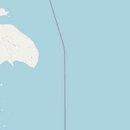
Map view of Ninginganiq National Wildlife Area

Use this park location map to pinpoint Ninginganiq National Wildlife Area in Canada, understand its exact geographic position, and read its mapped placement within the surrounding landscape more clearly.

Pigeon | © OpenStreetMap contributors

Location context for Ninginganiq National Wildlife Area

Nunavut
Natural feature types

Explore the Geographic Features of Ninginganiq National Wildlife Area

Trace the diverse natural terrain and marine features that define the High Arctic character of Ninginganiq National Wildlife Area. MoriAtlas enables structured discovery of the specific coastal bays, tundra slopes, and ice-influenced landforms that contribute to the landscape context of this sanctuary.
Park atlas

Compare adjacent High Arctic protected areas, coastal marine habitats, and regional tundra landscapes.

Exploring Parks Near Ninginganiq National Wildlife Area and Surrounding Arctic Reserves

Browsing other parks near Ninginganiq National Wildlife Area reveals broader ecological patterns across the eastern coast of Baffin Island. Comparing these adjacent protected landscapes provides essential geographic context for understanding Arctic marine reserves and regional wildlife habitats.
National parkNunavut
107 km away#1 closest

Southeast

Auyuittuq National Park: Nunavut National Park and Protected Landscape Atlas

Explore Arctic protected area geography and mapped boundaries.

Auyuittuq National Park is a key protected area within Nunavut, Canada, serving as a vital component of the national park system. This entry provides the essential geographic and atlas context for understanding Auyuittuq National Park, highlighting its status as a mapped protected landscape. Examine its role within the regional geography of Nunavut and its contribution to the broader atlas of Canadian conservation lands.

Area
21,470 km²
Established
1972
IUCN
II
Visitors
256 annual
Wildlife reserveQikiqtaaluk
260 km away#2 closest

Southeast

Qaqulluit National Wildlife Area: Protected Marine Geography and Arctic Cliff Landscapes

A remote wildlife reserve along the eastern Arctic coastline.

Qaqulluit National Wildlife Area is a strictly protected reserve in Nunavut, recognized for its concentration of seabird nesting cliffs at Cape Nuvuttiq. The geography is defined by the sharp transition between towering rock walls and cold marine waters, creating a unique coastal environment that supports significant Arctic breeding colonies and marine mammals.

Area
398.21 km²
Established
2010
IUCN
Ib
National parkNunavut
About 579 km away#3 closest

Northwest

Sirmilik National Park: Nunavut National Park Atlas and Protected Landscape Map

Explore the geographic boundaries and regional context of Sirmilik National Park.

This entry provides detailed insights into Sirmilik National Park, a designated national park situated in Nunavut, Canada. It serves as a focal point for understanding the park's specific geography, its mapped protected landscape, and its role within the regional atlas. Users can explore the park's defined boundaries and its contribution to the broader landscape context of Nunavut, making it an essential destination for detailed geographic discovery.

Area
22,200 km²
Established
2001
IUCN
II
Visitors
6 annual
Wildlife reserveNunavut
824 km away#4 closest

Southwest

Refuge d'oiseaux de la baie Est: Protected Coastal Landscapes on Southampton Island

Wildlife reserve in the Nunavut territory of Canada

Refuge d'oiseaux de la baie Est functions as a federally protected sanctuary within the Hudson Strait ecosystem. The terrain is characterized by broad intertidal flats, coastal saltmarshes, and low-lying tundra that supports migratory birds at the edge of their Arctic breeding range. This site maps as a cornerstone of conservation in the Kivalliq region, safeguarding seasonal habitats from the coast to the inland wetlands.

Area
1,128.11 km²
Established
1959
IUCN
Ib
Relief
Lowland
Watercolor illustration of green rolling hills and a body of water under a pale sky
National parkGreenland
850 km away#5 closest

Northeast

Northeast Greenland National Park: Arctic Wilderness and Protected Landscape Atlas

Explore the world's largest national park and its mapped terrain.

Northeast Greenland National Park represents an extraordinary expanse of Arctic wilderness, renowned as the largest protected area globally. This national park protects a diverse landscape, from the interior Greenland Ice Sheet to dramatic glacial fjords and ice-free polar desert regions. Discover its extensive mapped boundaries and its significance as a sanctuary for vital Arctic megafauna, offering a profound case study in large-scale protected landscape geography.

Area
972,000 km²
Established
1974
IUCN
II
Relief
Mixed relief
National parkNunavut
899 km away#6 closest

West

Ukkusiksalik National Park: Nunavut Protected Area Geography and Map Context

Explore the protected landscape and mapped terrain of this Canadian National Park.

Ukkusiksalik National Park serves as a protected national park within Nunavut, offering a distinct geographic identity. This entry provides structured insights into the park's mapped boundaries and its surrounding regional landscape, facilitating a deeper understanding of its place within the broader atlas of protected areas. Examine the geographic context and discover the unique attributes of Ukkusiksalik National Park's protected territory.

Area
20,885 km²
Established
2003
IUCN
II
Relief
Mixed relief
National parkNewfoundland and Labrador
996 km away#7 closest

South

Torngat Mountains National Park: National Park Atlas and Protected Landscape Exploration

Explore the mapped geography and protected status of this Canadian national park.

Gain a structured understanding of Torngat Mountains National Park, a protected national park in Newfoundland and Labrador. This destination focuses on its geographic identity, mapped boundaries, and place within the broader regional landscape of the Canadian Arctic. Discover the park's terrain and conservation context, essential for anyone exploring Canada's protected areas and natural geography.

Area
9,700 km²
Established
2008
IUCN
II
Visitors
599 annual
National parkNunavut
1,192 km away#8 closest

Northwest

Qausuittuq National Park: Explore Nunavut's Protected National Park Landscape and Geography

Mapped protected area boundaries and regional geographic context.

Delve into Qausuittuq National Park, a key protected area in Nunavut offering rich opportunities for geographic exploration. This destination provides detailed mapping of its protected boundaries and a comprehensive overview of its landscape context within the Arctic region. Discover how Qausuittuq National Park contributes to the mapped protected lands of Canada, ideal for users seeking structured geographic data and atlas-style discovery.

Area
11,000 km²
Established
2015
IUCN
II
Relief
Upland

Common questions about visiting, size, designation, and location context for Ninginganiq National Wildlife Area

Ninginganiq National Wildlife Area FAQs for park facts, access, geography, and protected area context

Find quick answers about Ninginganiq National Wildlife Area, including protected-area facts, park geography, trail and visitor context, and how the park fits into its surrounding country and regional landscape.
MoriAtlas Explorer

Continue Your Protected Areas Search Across the Global Atlas

Deepen your exploration by continuing the structured search for national parks and protected areas worldwide. Utilize the comprehensive filtering capabilities to compare different conservation landscapes and refine your understanding of global park geography. Discover more about the distribution and characteristics of protected natural areas.

Global natural geography
