
Mori Atlas logo
Protected landscapeNock Mountains National Park

Tracing the rounded alpine summits and glacial refugium terrain of this unique Austrian mountain range

Nock Mountains National Park: A Distinctive Protected Landscape within the Gurktal Alps of Carinthia, Austria

(Nationalpark Nockberge)

Nock Mountains National Park protects the central highlands of the Nock Mountains, a unique range defined by gentle, grass-covered dome summits known locally as Nocken. Spanning parts of Carinthia, Salzburg, and Styria, this protected area features a rolling alpine terrain largely spared by Ice Age glaciation. The landscape hosts extensive alpine meadows, subalpine forests of spruce, larch, and Swiss stone pine, and diverse habitats that serve as an ancient refugium for rare alpine species.

alpine landscapebiosphere reservedomed summitsalpine meadowssubalpine forestsmountain lakes
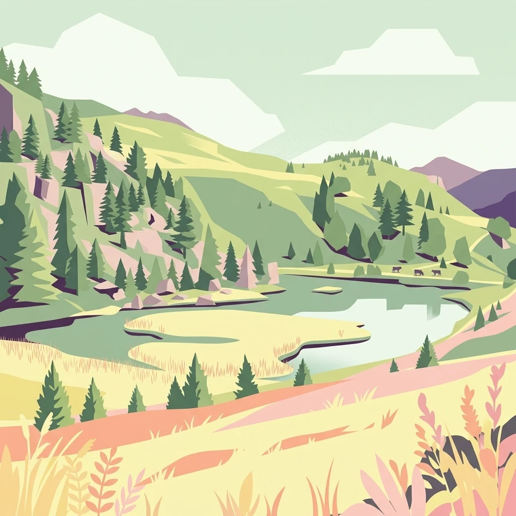
A flat-style digital illustration of an alpine mountain landscape with a lake, evergreen trees, and rolling grassy hills.

Nock Mountains National Park

Protected landscape

Park overview

Structured park overview, official facts, and landscape profile for Nock Mountains National Park

Nock Mountains National Park park facts, protected area profile, and essential visitor context

Review the core facts for Nock Mountains National Park, including designation, size, terrain, visitor scale, habitats, and operating context in one park-focused overview.

About Nock Mountains National Park

Nock Mountains National Park protects the heart of an alpine landscape that is unusually gentle and rounded for such a high mountain environment. The Nock Mountains rise across three Austrian states but the national park and its successor biosphere reserve focus on the central Carinthian area between the Lieser Valley, the Gurk Valley, and the southern settlements of Bad Kleinkirchheim and Radenthein.

What makes the park distinctive is its pre-glacial terrain; unlike the sharper, glacier-carved High Tauern nearby, the Nock Mountains preserved ancient land surfaces that have been only modestly reshaped by ice. This older landscape supports a particularly rich mix of habitats, ranging from mixed montane forests to subalpine larch and Swiss stone pine stands, and onward to flowering alpine meadows, bogs, and small mountain lakes.

The park also embodies the close connection between natural habitats and centuries-old pastoral use. Alpine farming has long shaped the park's meadows, paths, and forest edges, and the protected landscape designation reflects this balance between nature conservation and traditional land management. Combined with its extensive biosphere reserve status, the park serves as both a refuge for alpine biodiversity and a living example of long-standing human presence in the Alps.

Quick facts and research context for Nock Mountains National Park

The Nock Mountains form the western and highest section of the Gurktal Alps, straddling three Austrian federal states: Carinthia, Salzburg, and Styria. Although the name includes "National Park," the site is formally classified as a protected landscape (IUCN Category V), a designation that emphasizes the relationship between natural ecosystems and traditional human land use.

The protected central zone covers roughly 184 square kilometers within the Carinthian portion of the range, with the broader UNESCO Biosphere Reserve extending to about 1,490 square kilometers when including the adjacent Lungau region in Salzburg. The park territory stretches from Krems and the Lieser Valley in the west to Reichenau in the east, with Bad Kleinkirchheim and Radenthein defining much of the southern boundary.

Protection and recognition

Examine documented terrestrial protection history and conservation scope for Nock Mountains National Park.

Nock Mountains National Park Protection Status and Designation Records

Nock Mountains National Park features a documented terrestrial protection status established in two thousand twelve. Structured records compile official designation history and management scope for environmental analysis.

Protection details

Protection scope
Terrestrial
Designated year
2012
Transboundary protection
No
Park context

Deeper park guide and search-rich context for Nock Mountains National Park

Nock Mountains National Park history, landscape, wildlife, and travel context

Explore Nock Mountains National Park through its history, landscape character, ecosystems, wildlife, conservation priorities, cultural context, and seasonal travel timing in a structured park guide built for atlas discovery and search intent.

Why Nock Mountains National Park stands out

The Nock Mountains are best known for their distinctive, dome-shaped grass-covered summits that give the range its name, a softer alpine profile very different from the jagged peaks of the neighboring High Tauern. Because the area was largely unglaciated during the last Ice Age, it retained a remarkably old Tertiary landscape and acted as a glacial refugium, supporting a high number of relict species. The region is also recognized for its mosaic of near-natural forests, alpine pastures, and traditional cultural landscapes, as well as for its role as part of one of Austria's largest UNESCO Biosphere Reserves.
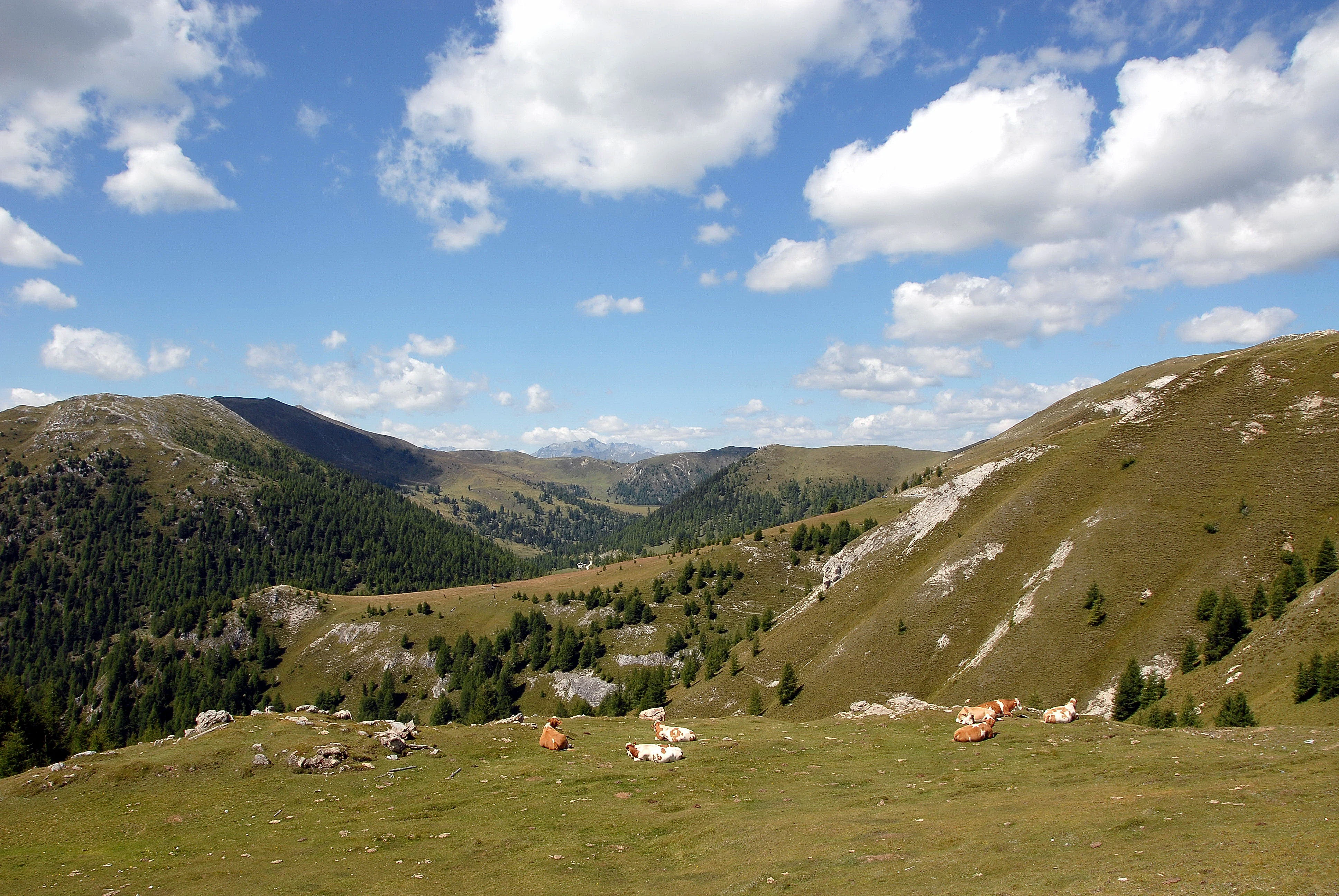
A wide view of the Nock Mountains landscape in Austria, showing rolling green hills, patches of forest, and cattle grazing on a pasture in the foreground under a blue sky with scattered clouds.
Grazing cattle on the rolling, grass-covered slopes characteristic of the Nock Mountains.

Nock Mountains National Park history and protected-area timeline

The history of Nock Mountains National Park is closely tied to the balance between tourism development and conservation in the Austrian Alps. The remote highland area was first opened up to broader public access through the construction of the scenic Nockalm Road beginning in 1979, a panoramic alpine route that remains one of the park's most important visitor features today.

In 1980, plans to develop a large skiing resort in the area were halted when a citizens' initiative and a public referendum drew overwhelming opposition, with roughly 94 percent of voters rejecting the project. This decisive local action paved the way for formal protection, and on 1 January 1987 the Carinthian state government established Nock Mountains National Park in the central portion of the range.

Although it carried the name "national park," the area was designated as a protected landscape under IUCN Category V, reflecting not only ecological preservation but also the continuing role of traditional alpine farming. In July 2012 the park area, together with the adjacent Lungau region across the border in Salzburg, was recognized by UNESCO as a Biosphere Reserve, placing the protected landscape within an international framework for conservation, research, and sustainable development.

Nock Mountains National Park landscape and geographic character

The landscape of the Nock Mountains is defined by wide, sweeping ridges and grass-covered dome summits rather than by sharp, rocky peaks. The terrain carries the imprint of a much older, Tertiary land surface that was largely spared the heavy glacial carving seen in neighboring alpine ranges, giving the entire massif an unusually gentle, rolling character.

The highest point of the range, the Eisenhut at 2,441 m, lies in Styria, while the Rosennock at 2,440 m is the highest summit within Carinthia. Other prominent peaks include the Wöllaner Nock, the Millstätter Alpe, the Königstuhl, and the Mirnock, together with numerous unnamed Nocken, the local term for the rounded summits that give the mountains their identity. Moraines and U-shaped valleys such as the Drau Valley testify to the powerful Ice Age glaciers that flowed past, though they did not bury the broad upper surfaces of the Nockberge themselves.

Important mountain passes such as the Katschberg, Flattnitz, Turracher Höhe, and Schönfeldsattel connect the range to surrounding valleys, while lakes including the Turracher See, Flattnitzer See, Windebensee, Afritzer See, and Brennsee punctuate the landscape. The Nockalm Road, a toll scenic route through the heart of the park, allows visitors to traverse this rounded alpine world between the Gurk Valley and the Lieser Valley.

Nock Mountains National Park ecosystems, habitats, and plant life

The park covers an unusually varied ecological gradient for a relatively compact alpine area. From low-lying cultural landscapes to high alpine zones, the Nockberge harbor forests, pastures, mires, mountain lakes, rocky habitats, and exposed alpine grasslands, each contributing distinct plant and animal communities.

In the montane belt, spruce forests and mixed deciduous woodlands dominate, with larch and Swiss stone pine increasingly taking over in the subalpine zone between roughly 1,700 and 2,200 meters. Larches often glow yellow in autumn, while Swiss stone pines, mountain pine, and a rich dwarf-shrub layer of alpenrose, blueberry, cranberry, and juniper shape the transition toward the tree line.

Above the forests, broad alpine meadows such as the Bürstling-Weiderasen and Krummseggenrasen cover many former pastures and naturally treeless areas. These meadows harbor classic alpine flowers including gentians, Alpine pasqueflowers, arnica, edelweiss, silver thistle, and Alpine columbine, with rare species concentrated in the calcareous soils of the narrow limestone and dolomite band that runs through the range. Small mountain lakes, springs, bogs, and slow-flowing streams add further ecological diversity and host a characteristic community of fish, amphibians, and waterbirds.

Nock Mountains National Park wildlife and species highlights

The wildlife of the Nock Mountains reflects both the diversity of habitats and the long-standing blend of wild nature and cultural landscape. Common forest mammals include red deer, roe deer, fox, badger, pine marten, stone marten, and red squirrel, while typical alpine mammals include Alpine marmot, chamois, and Alpine ibex-free but ecologically similar species such as the snow hare.

The mountains are known for occasional visits by brown bears from neighboring populations and by roaming wolves whose presence has been documented in Carinthia in recent decades. Birdlife is especially rich, ranging from forest species such as black grouse, hazel grouse, three-toed woodpecker, pygmy owl, and crested tit, to characteristic species of the higher altitudes such as ring ouzel, Alpine accentor, water pipit, golden eagle, and the very rare dotterel.

The range holds considerable significance for invertebrates as well, with over 30 ant species, numerous butterflies including the rare woodland brown and the Apollo butterfly, and specialized alpine spiders and harvestmen, some of which are endemic to the Eastern Alps. Fish communities include brown trout, grayling, rainbow trout, and arctic char in the mountain lakes, alongside rare native species such as the Ukrainian brook lamprey.

Nock Mountains National Park conservation status and protection priorities

The conservation significance of Nock Mountains National Park rests on its unusually well preserved pre-glacial terrain, its role as a glacial refugium, and the close integration of protected areas with traditional alpine land use. The range harbors relict species with arctic-alpine distributions, rare endemic invertebrates, and a dense mosaic of near-natural habitats rarely found elsewhere in the Eastern Alps at such elevations.

Recognition as a UNESCO Biosphere Reserve in 2012, combining the original national park with the adjacent Lungau region in Salzburg, expanded the protected footprint to roughly 1,490 square kilometers and created a transboundary framework for coordinated conservation, monitoring, and sustainable development. The biosphere reserve supports ongoing biodiversity surveys such as the annual GEO Day of Nature, which in 2021 recorded over 1,250 plant, animal, and fungi species within just one square kilometer around the Predigerstuhl, underscoring the area's exceptional species richness.

The protected landscape model deliberately preserves traditional alpine farming as an ecological force, recognizing that centuries of managed grazing, hay-making, and forest use have shaped much of the habitat diversity that the park aims to protect.

Nock Mountains National Park cultural meaning and human context

The Nock Mountains have been shaped for centuries by alpine pastoralism, and this long human presence is central to the identity of the protected landscape. Seasonal grazing on high-altitude almweiden, hay-making meadows in the montane valleys, and careful forest management have created a cultural landscape that complements the park's ecological priorities rather than conflicting with them.

Local place names reflect this layered cultural history. The term Nock itself, referring to a rounded, grass-covered summit, likely evolved through a reshaping of older Slavic -nik place names, as illustrated by historical spellings such as Rosenik for what is now called the Rosennock. Today the name has become strongly identity-forming for the region, reinforced by tourism branding that playfully compares the area to the Rocky Mountains under the nickname Nocky Mountains.

Top sights and standout views in Nock Mountains National Park

The park's defining highlights include its unique gently rounded alpine summits, the sweeping panorama of the Nockalm Road, the scenic mountain lakes such as the Windebensee and Turracher See, and the wide flowering alpine pastures that bloom with gentians, arnica, and edelweiss.

For nature enthusiasts, the area offers a remarkable mix of ancient glacial refugium forests, larch and Swiss stone pine woodlands, moss-rich raised bogs, and a high density of alpine birds and invertebrates. Combined with its status as part of one of Austria's largest UNESCO Biosphere Reserves, the park stands out as both an ecologically rich area and a model of integrated alpine conservation.

Best time to visit Nock Mountains National Park

Summer and early autumn are the most rewarding seasons for experiencing the Nock Mountains, when the Nockalm Road and high alpine trails are open, the alpine meadows are in full flower, and the lakes and bogs are most accessible. Late spring brings lingering snow patches and fresh green growth in the valleys, while early autumn sets the larch forests glowing yellow and offers crisp, clear views across the rounded summits.

Winter brings a quieter, snow-covered atmosphere, though deep snow and limited access mean that many high areas are best appreciated during the warmer months. Wildlife observation is generally easiest in early morning hours during late spring and summer, when alpine birds, marmots, and grazing chamois are most active.
Monthly climate preview

Long-term representative point measurements tracking monthly temperature and precipitation rhythms

Nock Mountains National Park Climate Normals and Annual Weather Patterns

Representative coordinate records show average monthly temperatures ranging from sub-zero winter lows to warm summer maximums alongside varying daily precipitation volumes. Detailed monthly climate profiles provide complete twelve-month temperature averages and precipitation totals for thorough regional analysis.
Annual mean4 °C
-6 °C14 °C
Jan-6°
Feb-6°
Mar-2°
Apr
May
Jun12°
Jul14°
Aug14°
Sep
Oct
Nov
Dec-5°
Warmest month
July

13.7 °C

Coolest month
January

-6.3 °C

Wettest month
July

5 mm/day

Driest month
January

1.4 mm/day

Park location guide

Geography guide, regional context, and park location map for Nock Mountains National Park

Nock Mountains National Park park geography, regions, and map view in Austria

Understand where Nock Mountains National Park sits in Austria through a broader geographic reading of the surrounding landscape, nearby location context, and its mapped position within the national park landscape.

How Nock Mountains National Park fits into Austria

Austria is a landlocked country in Central Europe, bordered by Germany, Czech Republic, Slovakia, Hungary, Slovenia, Italy, Switzerland, and Liechtenstein. The country is a federal semi-presessional republic composed of nine states, with Vienna as its capital and largest city. It has a population of approximately 9.1 million people.

Wider geography shaping Nock Mountains National Park in Austria

Austria is located in Central Europe, lying in the Eastern Alps. It is bordered by Germany and Czech Republic to the north, Slovakia to the northeast, Hungary to the east, Slovenia and Italy to the south, and Switzerland and Liechtenstein to the west.

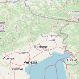
Map view of Nock Mountains National Park

Use this park location map to pinpoint Nock Mountains National Park in Austria, understand its exact geographic position, and read its mapped placement within the surrounding landscape more clearly.

Pigeon | © OpenStreetMap contributors

Location context for Nock Mountains National Park

Carinthia

Explore rounded dome summits, ancient glacial refugium forests, and protected alpine habitats.

Nock Mountains National Park Photos and Landscapes: Visualizing Alpine Scenery

Visual documentation of Nock Mountains National Park reveals the gentle, grass-covered dome summits and rolling terrain that distinguish the range from jagged alpine peaks. Examining these protected landscapes, mountain lakes, and subalpine woodlands provides deeper insight into an unusually old Tertiary ecosystem.

A wide view of the Nock Mountains landscape in Austria, showing rolling green hills, patches of forest, and cattle grazing on a pasture in the foreground under a blue sky with scattered clouds.

A high-angle view of a small mountain lake called Windebensee surrounded by gentle, grass-covered slopes and sparse coniferous trees.

Park atlas

Compare adjacent alpine ranges, regional biosphere reserves, and connected protected landscapes.

Other Parks Near Nock Mountains National Park and Surrounding Protected Areas

Browse nearby national parks and protected areas sharing the wider geography of the Austrian Alps. Extending exploration beyond Nock Mountains National Park reveals connected regional landscapes and diverse alpine terrain.
National parkAustria
About 27 km away#1 closest

West

Hohe Tauern National Park: Regional Geography and Protected Alpine Mountain Terrain

Major protected area in the heart of the Austrian Alps

Hohe Tauern National Park protects a grand scale of alpine terrain, including towering summits above 3,000 meters and the longest glacial systems in the country. This atlas record provides insights into the park's vertical landscape, encompassing glacial valleys, waterfalls, and diverse ecological zones that define the High Tauern mountain range in Austria.

Watercolor illustration of a river flowing through a forested valley with mountains in the background
National parkSlovenia
About 48 km away#2 closest

South

Triglav National Park: A Mapped Alpine Protected Landscape in Slovenia

Julian Alps geography, glacial lakes, and karst terrain.

Triglav National Park is Slovenia's premier protected area, covering 880 square kilometers of the Julian Alps. This page details its dramatic alpine geography, including Mount Triglav, glacial valleys, and significant karst features. Understand the mapped boundaries and landscape context of this national park, a key entry in the MoriAtlas geographic discovery resource for understanding protected lands.

Area
880 km²
Established
1981
IUCN
II
Visitors
1.6M annual
Protected areaStyria
About 64 km away#3 closest

East

Zirbitzkogel Protected Area: Mapping the Alpine Landscapes and Glacial Terrain of the Seetal Alps

High mountain geography and protected terrain in Styria, Austria

Zirbitzkogel represents the highest point of the Seetal Alps, characterized by crystalline geology, slate, and gneiss. The landscape features a clear progression from subalpine spruce and larch forests to broad, level summit plateaus covered in ragged sedge grasslands. Beyond its alpine vegetation and glacial tarns, the area serves as a critical protected habitat for diverse alpine fauna, offering an ideal setting for understanding regional alpine ecology and complex mountain landforms.

Established
2006
Relief
Mountain
Climate
Alpine
Access
Easy access
Watercolor painting showing mountain ranges with green, yellow, and pink hues, depicting layered peaks and cloud formations
National parkAustria
About 77 km away#4 closest

West

Hohe Tauern National Park: Alpine Geography and Protected Landscape Atlas

High-altitude mountain terrain and glacial systems in Austria

Hohe Tauern serves as a primary protected area within the Austrian Alps, showcasing a vast sequence of glacial valleys, sharp mountain massifs, and high-alpine tundra. This exploration details the park's physical boundaries and its significance in preserving diverse ecological gradients and wilderness core zones across the Central Eastern Alps.

Area
1,806 km²
Established
1981
IUCN
II
Relief
Mountain
Watercolor illustration showing mountain ranges, forests, and a river under a light sky.
National parkBavaria
About 83 km away#5 closest

Northwest

Berchtesgaden National Park: Protected Landscape and Regional Geographic Context in Bavaria

Mapped natural terrain and protected area exploration.

Berchtesgaden National Park represents a crucial protected landscape situated in Bavaria, Germany. This entry provides detailed information focused on its protected area status, unique geographic setting, and mapped natural terrain. It serves as a gateway to understanding the park's specific identity within the regional atlas of Germany, offering insights into its boundaries and its significance as a curated natural landscape for discovery.

Area
210 km²
Established
1978
IUCN
II
Relief
Mountain
A soft watercolor illustration showing a panoramic view of mountain ridgelines in muted green, blue, and faint pink tones against a white background.
Nature reserveSalzkammergut
About 84 km away#6 closest

North

Loser Plateau Nature Reserve: Alpine Karst Geography in the Salzkammergut Mountain Range

Protected high alpine plateau and extensive karst systems

The Loser Plateau is a distinctive high-altitude nature reserve in the Salzkammergut region of Austria. This protected area features expansive limestone pavements, complex karst sinkholes, and massive mountain crags that dominate the skyline above Lake Altaussee. It provides a unique window into high alpine geology, showcasing fossil-rich layers and an intricate network of documented cave systems that rank among the most significant in the Eastern Alps.

Area
12 km²
Relief
Mountain
Climate
Alpine
Access
Easy access
A horizontal watercolor painting showing a soft mountain range with green forests, a winding river valley, and wildflowers in the foreground.
Protected areaAustria
About 84 km away#7 closest

Southeast

Geopark Karawanken: Alpine Protected Landscape and Tectonic Geography in Austria

A cross-border protected area defined by tectonic uplift and deep alpine valleys.

Geopark Karawanken showcases a profound geological record formed by tectonic plate convergence. The protected area features sharp mountain massifs, subterranean karst systems, and deep-cut gorges that reveal the underlying structural complexity of the alpine range, offering a clear view of how tectonic forces shape regional geography.

Area
1,067 km²
Established
2013
Relief
Mountain
Climate
Alpine
National parkStyria
About 94 km away#8 closest

Northeast

Gesäuse National Park: Detailed Protected Landscape and Alpine Geography in Styria

Explore Austria's dramatic river gorge and rugged peaks.

Gesäuse National Park in Styria represents a significant alpine protected area, characterized by the striking Enns river gorge cutting through the Gesäuseberge. This national park offers a unique geographic context, showcasing steep limestone peaks, dramatic rock faces, and a rich hydrological network. Discover the mapped boundaries and protected landscape of one of Austria's most visually striking natural passages, ideal for detailed atlas exploration and understanding alpine conservation.

Area
110 km²
Established
2002
IUCN
II
Relief
Mountain

Common questions about visiting, size, designation, and location context for Nock Mountains National Park

Nock Mountains National Park FAQs for park facts, access, geography, and protected area context

Find quick answers about Nock Mountains National Park, including protected-area facts, park geography, trail and visitor context, and how the park fits into its surrounding country and regional landscape.
MoriAtlas Explorer

Continue Your Protected Areas Search Across the Global Atlas

Deepen your exploration by continuing the structured search for national parks and protected areas worldwide. Utilize the comprehensive filtering capabilities to compare different conservation landscapes and refine your understanding of global park geography. Discover more about the distribution and characteristics of protected natural areas.

Global natural geography