
Mori Atlas logo
Nature reserveNordre Øyeren naturreservat

Understanding the mapped boundaries and river delta terrain of Norway's significant inland wetland reserve

Nordre Øyeren naturreservat Protected Landscape and Inland Delta Geography in Akershus

Nordre Øyeren naturreservat functions as a complex wetland landscape situated at the confluence of the Glomma, Leira, and Nitelva rivers in Akershus. As the largest inland delta in the Nordic countries, the reserve creates a distinctive mosaic of islands, shallow bays, and winding channels that define its unique protected status. This geographic focus provides clear insight into the river deposition patterns and freshwater habitats that characterize this significant Norwegian conservation area.

wetlandinland deltaramsar sitenature reservewaterbirdsmigratory birds
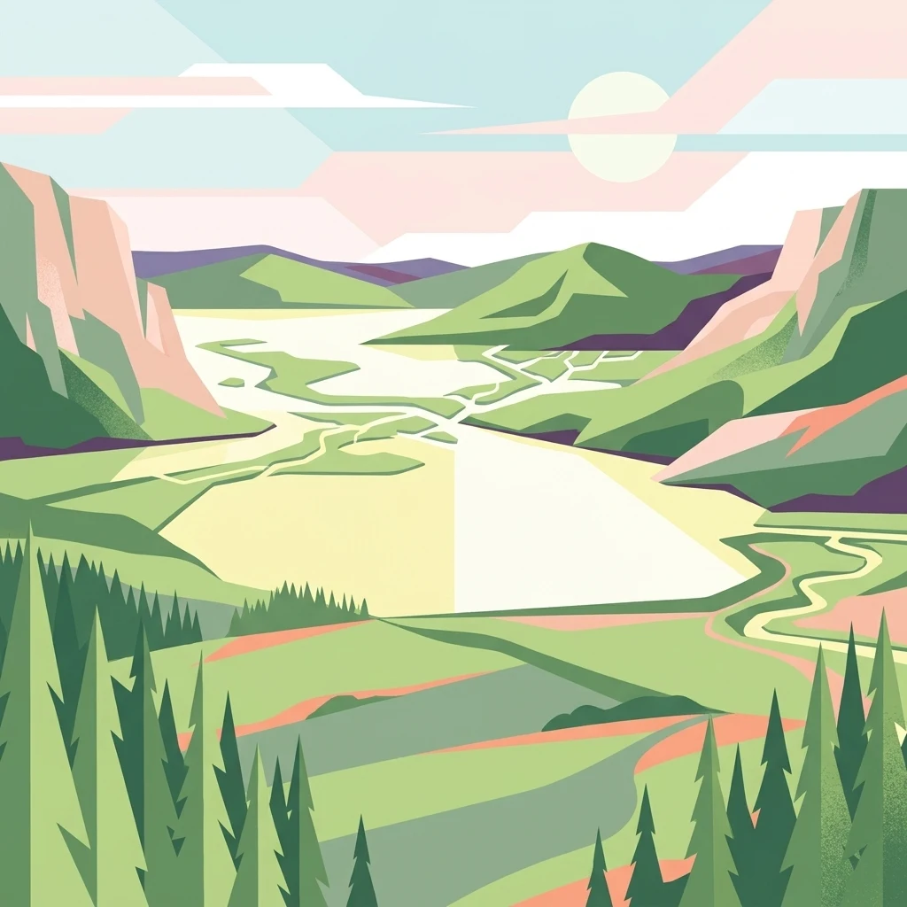
A stylized flat vector illustration of an inland river delta flowing through green hills and coniferous forests under a pale sun.

Nordre Øyeren naturreservat

Nature reserve

Park overview

Structured park overview, official facts, and landscape profile for Nordre Øyeren Nature Reserve

Nordre Øyeren Nature Reserve park facts, protected area profile, and essential visitor context

Review the core facts for Nordre Øyeren Nature Reserve, including designation, size, terrain, visitor scale, habitats, and operating context in one park-focused overview.

About Nordre Øyeren Nature Reserve

Nordre Øyeren Nature Reserve is a large freshwater wetland in southeastern Norway, located where the country's longest river, the Glomma, together with the rivers Leira and Nitelva, discharges into lake Øyeren. The reserve encompasses the lake Svellet and the northern portion of Øyeren itself, along with the extensive delta systems formed by the three incoming rivers. This setting, at the meeting point of major watercourses north of the Norwegian capital, has produced a landscape of exceptional ecological interest for an inland location.

Geologically and ecologically, the reserve is defined by its delta dynamics. Over time, river deposition has created a classic bird's-foot delta pattern of islands, shallow bays (evjer), lagoons, channels, and mudflats, interspersed with wet meadows and marshlands. This mosaic of habitats gives the area unusually high biological diversity for an inland site. More than 320 species of aquatic and marsh plants have been recorded, alongside around 260 bird species, a substantial proportion of which are associated with wetland habitats.

The reserve is managed with a dual mandate. It is a Norwegian nature reserve under national conservation law, established in 1975, and it also holds Ramsar status, granted in 1985, reflecting its international importance for migratory waterbirds. Nordre Øyeren is widely regarded as Norway's single most important inland waterbird area, functioning primarily as a critical staging site during spring and autumn migration, while also supporting breeding populations of several characteristic wetland birds. The reserve sits adjacent to the smaller Sørumsneset Nature Reserve to the north, together forming a larger complex of protected freshwater wetland.

Quick facts and research context for Nordre Øyeren Nature Reserve

Nordre Øyeren Nature Reserve lies in the municipalities of Lillestrøm, Rælingen, and Enebakk in Akershus county, southeastern Norway. It was established as a nature reserve on 5 December 1975 and was designated a Ramsar site in 1985 in recognition of its significance for migratory waterbirds.

The reserve covers roughly 62.5 square kilometres, with the majority being open water and a substantial portion made up of delta flats and islands. It includes the lake Svellet and the northern part of lake Øyeren, together with the delta systems formed by the rivers Glomma, Leira, and Nitelva. Nordre Øyeren is described as the largest inland delta in the Nordic countries and is considered Norway's most important inland area for waterbirds.

Protection and recognition

Documented terrestrial protection metrics and official designation records

Nordre Øyeren Naturreservat Protection Status and Designation History

Nordre Øyeren naturreservat maintains a documented terrestrial protection status established in 1985. Structured designation records outline the historical framework governing this protected area within the regional landscape.

Protection details

Protection scope
Terrestrial
Designated year
1985
Transboundary protection
No
Park context

Deeper park guide and search-rich context for Nordre Øyeren Nature Reserve

Nordre Øyeren Nature Reserve history, landscape, wildlife, and travel context

Explore Nordre Øyeren Nature Reserve through its history, landscape character, ecosystems, wildlife, conservation priorities, cultural context, and seasonal travel timing in a structured park guide built for atlas discovery and search intent.

Why Nordre Øyeren Nature Reserve stands out

Nordre Øyeren is best known as the largest inland river delta in the Nordic countries and as one of Norway's premier wetland reserves for waterbirds. The reserve is internationally recognized both as a Ramsar site and as a national nature reserve, a combination that highlights its importance for migratory bird species that travel between northern breeding grounds and wintering areas further south. The reserve's distinctive landform is the so-called bird's-foot delta, shaped by the interplay of three major rivers entering lake Øyeren. This pattern of islands, channels, and shallow bays creates a mosaic of aquatic and terrestrial habitats that support high biodiversity. Nordre Øyeren is particularly associated with large flocks of ducks, geese, and waders that use the area as a resting and feeding site during migration, as well as a breeding ground for several characteristic wetland species.
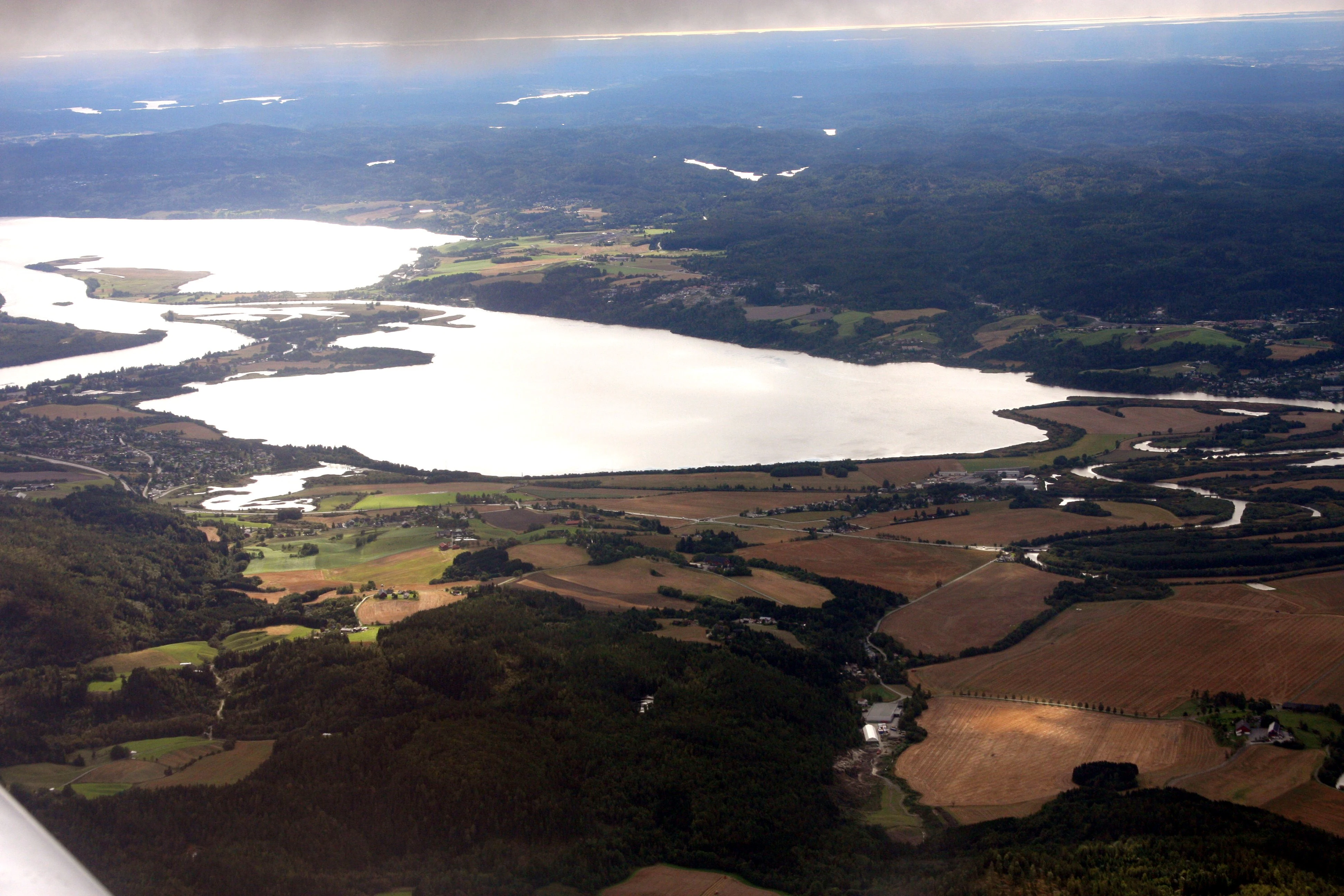
Aerial photograph showing a large lake and branching wetland delta surrounded by forest patches and agricultural fields, with distant tree-covered hills on the horizon.
Aerial view of Nordre Øyeren Nature Reserve showing the inland delta, lake, and surrounding forests and agricultural fields in Akershus, Norway.

Nordre Øyeren Nature Reserve history and protected-area timeline

Nordre Øyeren Nature Reserve was established on 5 December 1975, becoming one of Norway's significant inland wetland protection initiatives of the mid-1970s. The decision to protect the area was closely tied to the recognition of the ecological importance of the delta at the outlet of Glomma, Leira, and Nitelva into lake Øyeren.

In 1985 the reserve received international recognition when it was designated a Ramsar site under the Ramsar Convention on Wetlands. This designation reflected the reserve's exceptional role as a staging area for migratory waterbirds and reinforced its standing as a wetland of national and international importance. The adjacent Sørumsneset Nature Reserve, covering roughly 1,100 decares to the north, complements the reserve and helps extend the protected wetland complex that has developed around northern Øyeren.

Nordre Øyeren Nature Reserve landscape and geographic character

The landscape of Nordre Øyeren is shaped almost entirely by water. Roughly 55 square kilometres of the reserve are open water, while around 20 square kilometres consist of delta flats and approximately 7 square kilometres are composed of islands. The result is a mosaic of shallow lakes, slow-moving channels, muddy shores, marshy meadows, and tree-covered islands that shift gradually as rivers deposit new sediments.

The defining landform is a bird's-foot delta, formed where the Glomma, Leira, and Nitelva enter lake Øyeren. The rivers have built up elongated islands and sandbars, creating the characteristic pattern of narrow land projections surrounded by shallow water. Within this framework, visitors find bays (evjer), lagoons, and winding channels that flood and drain with the seasons. The reserve's freshwater setting, far from the coast, makes this mosaic particularly distinctive in a Norwegian context, where most large wetland systems are tidal or coastal.

Nordre Øyeren Nature Reserve ecosystems, habitats, and plant life

Nordre Øyeren supports an unusually rich freshwater wetland ecosystem for an inland Norwegian location. The diversity of habitats, including open water, flooded meadows, reed marshes, and wooded islands, allows a large number of plant and animal species to coexist in a relatively compact area.

More than 320 species of aquatic and marsh plants have been recorded in the reserve. Roughly half of these are true aquatic plants that remain submerged for more than half of the growing season. The wetland vegetation creates conditions for a varied insect and invertebrate fauna, which in turn supports the reserve's famous bird populations. The mosaic of habitats also provides breeding cover, feeding grounds, and refuge areas that change character with seasonal water levels.

The reserve holds particular ecological significance as a transitional zone between running and still water, and between terrestrial and aquatic habitats. The dynamic nature of the delta means that habitats are continually renewed, supporting both established species and opportunities for colonization by new arrivals.

Nordre Øyeren Nature Reserve wildlife and species highlights

Wildlife is the defining feature of Nordre Øyeren. Around 260 bird species have been recorded in the reserve, with more than half of these tied to wetland habitats. The reserve's most important ecological role is as a staging area during the spring and autumn migrations, when tens of thousands of waterbirds gather to feed and rest. Species regularly recorded in large numbers include teal, black-headed gull, mallard, common gull, yellow wagtail, lapwing, whooper swan, wigeon, Canada goose, goosander, curlew, golden plover, white wagtail, and reed bunting.

The reserve also sustains important breeding populations. Breeding species documented include mallard, yellow wagtail, lapwing, goosander, curlew, white wagtail, and reed bunting, while whooper swan and Canada goose are regular winter visitors. Several species of conservation concern occur, including fish-eating raptors such as osprey, marsh harrier, and hobby, together with a range of ducks and waders listed on the Norwegian Red List, such as lesser white-fronted goose, bean goose, scaup, common scoter, long-tailed duck, garganey, smew, great snipe, and water rail.

Beyond birds, at least 18 mammal species occur in the area, along with amphibians and reptiles, including the northern pool frog. The aquatic fauna includes an estimated 25 fish species, ranging from common perch, pike, and roach to more unusual species such as asp and whitefish. Notably, lake Øyeren is the only location in Norway where asp is known to spawn, giving the reserve additional conservation significance for freshwater biodiversity.

Nordre Øyeren Nature Reserve conservation status and protection priorities

Nordre Øyeren stands out as a conservation area for two reasons: it is one of Norway's most important inland wetlands for waterbirds, and it has been recognized internationally through the Ramsar Convention. The reserve is part of the national nature reserve network, providing strong legal protection against damaging interference with habitats, hydrology, and wildlife.

Its Ramsar status in 1985 brought international attention to the reserve's role in supporting migratory waterbird populations, particularly as a staging site where birds can rest and refuel during long-distance movements between Arctic breeding grounds and wintering areas further south. The reserve's mosaic of habitats makes it resilient and productive across seasons, supporting both breeding populations and seasonal visitors.

The reserve's conservation value is further enhanced by its position next to Sørumsneset Nature Reserve, extending the protected area along the northern shore of Øyeren. Together, these reserves safeguard one of the most significant inland freshwater wetland complexes in Scandinavia, with particular importance for maintaining healthy populations of migratory waterbirds and a wide range of associated plant and animal species.

Top sights and standout views in Nordre Øyeren Nature Reserve

The reserve's standout feature is its status as the largest inland delta in the Nordic countries, where three major Norwegian rivers converge with lake Øyeren. The resulting bird's-foot delta of islands, channels, and shallow bays creates habitats that are exceptionally rare in an inland Norwegian context.

Equally distinctive is the reserve's ornithological importance. With roughly 260 recorded bird species, a Ramsar designation, and tens of thousands of waterbirds concentrated here during migration, Nordre Øyeren is widely recognized as Norway's most important inland area for waterfowl. Lake Øyeren is also the only known spawning site for asp in Norway, giving the reserve additional unique conservation significance for freshwater biodiversity.

Best time to visit Nordre Øyeren Nature Reserve

The most rewarding periods to experience Nordre Øyeren's wildlife are during the spring and autumn migrations, when the reserve hosts enormous numbers of ducks, geese, swans, and waders using the delta as a staging area. Spring brings intense concentrations of northward-bound waterbirds, while autumn migration offers similar gatherings as birds move south.

Summer offers a quieter but ecologically rich period, when breeding wetland species, growing vegetation, and active delta landscapes can be observed. Winter attracts species such as whooper swan and Canada goose to the reserve. Two bird observation towers, at Jørholmen and Årnestangen, provide vantage points at these key seasons.
Monthly climate preview

Long-term monthly temperature averages and precipitation patterns for Akershus

Nordre Øyeren Naturreservat Climate Normals and Annual Weather Rhythm

Representative coordinate measurements reveal a clear annual cycle of freezing winter minimums and moderate summer maximums across the protected area. Reviewing the complete twelve-month temperature and precipitation dataset provides deeper analytical insight into long-term regional climate normals.
Annual mean5 °C
-5 °C16 °C
Jan-5°
Feb-5°
Mar-1°
Apr
May10°
Jun14°
Jul16°
Aug15°
Sep10°
Oct
Nov
Dec-5°
Warmest month
July

16.1 °C

Coolest month
January

-5.5 °C

Wettest month
August

3.7 mm/day

Driest month
March

1.9 mm/day

Park location guide

Geography guide, regional context, and park location map for Nordre Øyeren Nature Reserve

Nordre Øyeren Nature Reserve park geography, regions, and map view in Norway

Understand where Nordre Øyeren Nature Reserve sits in Norway through a broader geographic reading of the surrounding landscape, nearby location context, and its mapped position within the national park landscape.

How Nordre Øyeren Nature Reserve fits into Norway

Norway, officially the Kingdom of Norway, is a Nordic country in Northern Europe located on the Scandinavian Peninsula. It encompasses mainland Norway, the Arctic islands of Svalbard and Jan Mayen, and maintains dependencies including Bouvet Island and Antarctic claims. The country has a population of about 5.6 million and is bordered by Sweden, Finland, and Russia. Norway is a unitary parliamentary constitutional monarchy with Oslo as its capital and largest city.

Wider geography shaping Nordre Øyeren Nature Reserve in Norway

Norway occupies the western and northern portions of the Scandinavian Peninsula in Northern Europe. The country shares a long eastern border with Sweden, and borders Finland and Russia to the northeast. Norway has an extensive coastline facing the Skagerrak, North Sea, Norwegian Sea, and Barents Sea. The terrain is predominantly mountainous with numerous fjords along the coastline.

Map view of Nordre Øyeren Nature Reserve

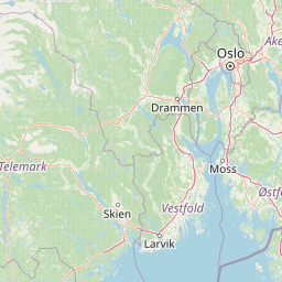
Use this park location map to pinpoint Nordre Øyeren Nature Reserve in Norway, understand its exact geographic position, and read its mapped placement within the surrounding landscape more clearly.

Pigeon | © OpenStreetMap contributors

Location context for Nordre Øyeren Nature Reserve

Akershus

Visual reference collection showcasing river channels, mudflats, and migratory bird habitats

Nordre Øyeren naturreservat Photos, Inland Delta Landscapes, and Protected Wetland Scenery

Visual documentation of Nordre Øyeren naturreservat reveals the complex terrain of the largest inland delta in the Nordic countries, capturing expansive waterways, shallow bays, and dynamic river deposits. Examining these protected wetland environments provides clear insight into the ecological character and distinct physical geography of the reserve.

Aerial photograph showing a large lake and branching wetland delta surrounded by forest patches and agricultural fields, with distant tree-covered hills on the horizon.

Wide aerial photograph showing lakes, wetlands, agricultural fields, forests, and a town in the Nordre Øyeren Nature Reserve area.

Park atlas

Compare surrounding landscapes and connected wetland ecosystems across southeastern Norway

Explore Other Parks Near Nordre Øyeren naturreservat and Regional Protected Areas

Browse protected areas and river valley habitats situated close to Nordre Øyeren naturreservat for deeper geographic comparison. Discovering adjacent regional reserves reveals the broader conservation patterns shaping Scandinavian freshwater and wetland terrain.
National parkØstfold
About 88 km away#1 closest

South

Ytre Hvaler National Park: Norway's Coastal Marine Protected Landscape Atlas

Explore protected archipelago geography and unique cold water coral reefs.

Discover Ytre Hvaler National Park, a pivotal marine protected area on Norway's Østfold coast. This atlas entry provides detailed insight into its defining skerry landscape, the significant Tisler cold water coral reef, and its role as a protected marine ecosystem. Understand the mapped boundaries and geographic context of this unique Norwegian coastal wilderness, crucial for understanding the region's natural and maritime heritage.

Area
354 km²
Established
2009
IUCN
II
Climate
Temperate
Watercolor illustration of a coastal landscape with reeds in shallow water and distant green hills under a pale yellow sky
National parkFærder Municipality
About 93 km away#2 closest

South

Færder National Park: Norway's Coastal Archipelago & Marine Protected Area Atlas

Explore mapped landscapes and regional geography.

Færder National Park represents a significant protected landscape in Norway, characterized by its extensive marine environment and scattered archipelago. Situated east of Færder Municipality, the park's geography is defined by a mosaic of granite islands, coastal waters, and the iconic Færder Lighthouse. This entry provides atlas-level insight into the park's mapped boundaries, its role as a protected coastal ecosystem, and its contribution to the broader regional geography of Norway's southern coast.

Area
340 km²
Established
2013
IUCN
II
Relief
Lowland
Nature reserveRingerike
About 93 km away#3 closest

Northwest

Vikerfjell naturreservat: Geographic Atlas of Protected Forests in Ringerike, Norway

Mapped terrain of high-lying plateaus, ancient coniferous forests, and wetland mosaic.

Vikerfjell naturreservat serves as a vital protected area for old-growth coniferous forests and vulnerable lichen species. This atlas provides a detailed view of its mountain plateaus, forested slopes, and the expansive mire systems that characterize this key southern Norwegian conservation landscape within the Ringerike municipality.

Area
80.335 km²
Established
2016
Relief
Mountain
Climate
Boreal
Nature reserveInnlandet
About 99 km away#4 closest

North

Åkersvika naturreservat: Protected Wetland Ecosystems and Geography in Innlandet

A vital Ramsar wetland and avian sanctuary in Southern Norway

Åkersvika naturreservat functions as a key wetland protected area at the northern end of Lake Mjøsa. The reserve preserves diverse aquatic habitats including shallow bays, reed beds, and shoreline meadows. It serves as a landmark example of lowland wetland conservation in Norway, providing essential breeding and migration grounds for waterfowl and waders within the Innlandet geographic context.

Area
3.25 km²
Established
1974
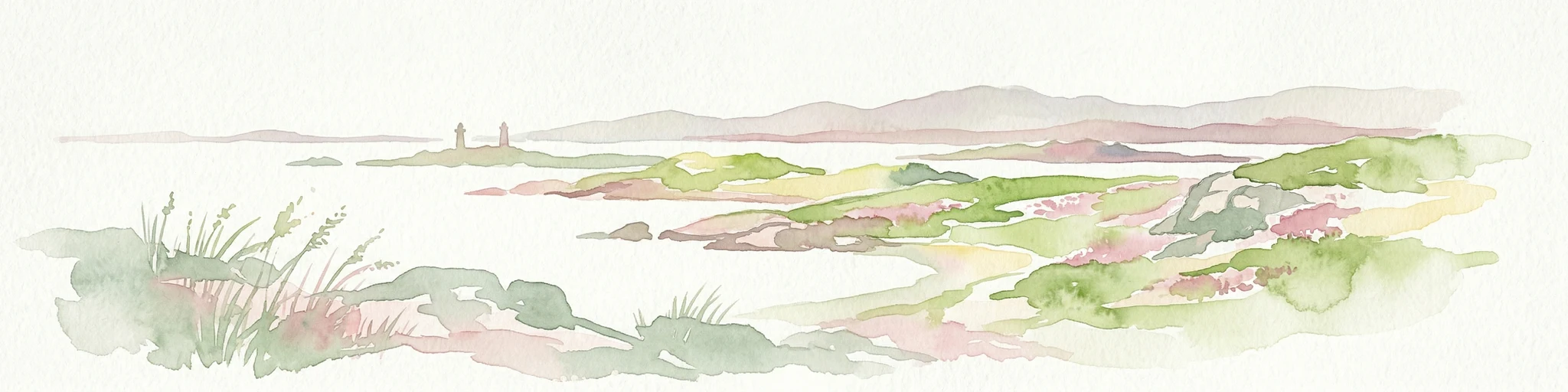
Watercolor illustration of a coastal landscape with islands, grassy areas, and water
National parkVästra Götaland County
About 99 km away#5 closest

South

Kosterhavet National Park: A Marine National Park Exploring Unique Archipelago Geography

Discover its mapped underwater terrain and rich marine biodiversity.

Kosterhavet National Park, located in Västra Götaland County, is Sweden's first marine national park, dedicated to protecting the unique aquatic environment of the Koster Islands. This protected area is renowned for its exceptional marine biodiversity, including rare cold-water coral reefs and the country's largest seal colony, all situated within a dramatic underwater geography characterized by deep fjords. Use MoriAtlas to explore the mapped extent of this vital marine protected landscape and understand its significant place in regional and national conservation efforts.

Area
388.78 km²
Established
2009
IUCN
II
Visitors
90K annual
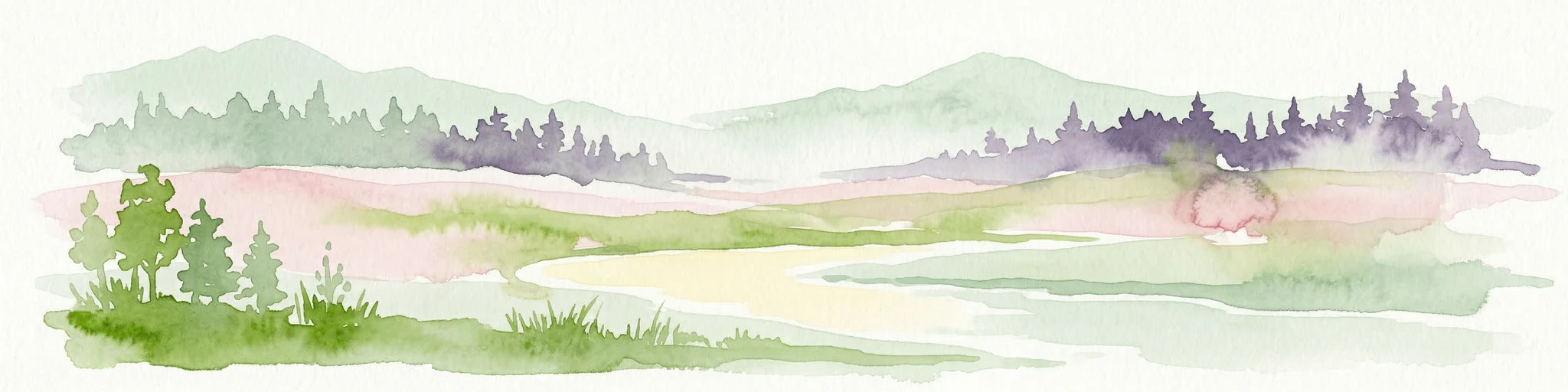
Watercolor illustration of a river, forested area, and mountains
National parkVästra Götaland County
About 100 km away#6 closest

South

Tresticklan National Park: Preserved Old-Growth Forest on Rocky Heathland

Explore the geographic context and mapped boundaries of this vital protected area.

Tresticklan National Park is a vital protected landscape in Västra Götaland County, Sweden, safeguarding one of southern Scandinavia's most significant old-growth forest ecosystems. The park's terrain is defined by exposed granite bedrock, sparse heath pine forests, and a wild, remote character. MoriAtlas provides a structured overview of Tresticklan National Park, detailing its geographic setting and protected area status for explorers and cartographers.

Area
28.97 km²
Established
1996
IUCN
II
Relief
Upland
National parkTelemark
About 148 km away#7 closest

Southwest

Jomfruland National Park: Coastal Archipelago and Skagerrak Marine Atlas

Norway's unique marine-focused national park landscape.

Jomfruland National Park is a significant protected landscape in Telemark, Norway, renowned for its coastal island geography and a landscape predominantly composed of marine waters. Covering 117 square kilometers, this national park emphasizes the conservation of both terrestrial island habitats and the surrounding Skagerrak coastal ecosystem. Explore the park's mapped boundaries and discover its regional geographic context, offering a unique perspective on Norway's protected areas and maritime natural heritage through MoriAtlas.

Area
117 km²
Established
2016
IUCN
II
Scope
Mixed
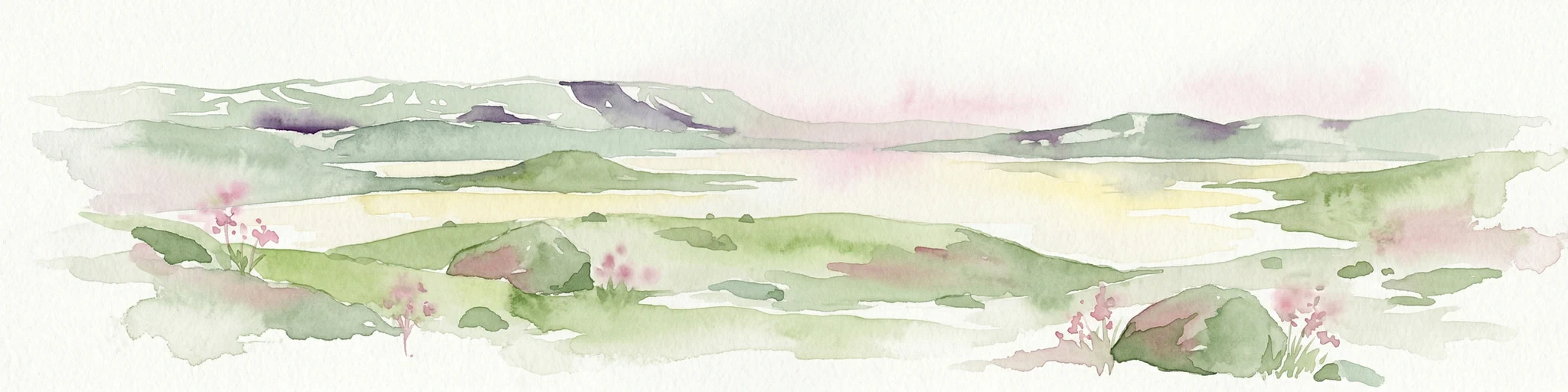
Watercolor painting of rolling green hills, a body of water, and pink flowers
National parkVestland
About 164 km away#8 closest

West

Hardangervidda National Park: Vast Arctic Plateau and European Peneplain Discovery

Explore Norway's largest national park and its unique tundra ecosystem.

Delve into the geography of Hardangervidda National Park, Norway's largest national park, featuring the expansive Arctic plateau and Europe's largest peneplain. This protected landscape offers a unique mapped environment characterized by treeless moorland, numerous lakes, and important wildlife habitats, including significant wild reindeer populations. Understand its position within the Vestland region and its value as a key protected area for geographic exploration and landscape context.

Area
3,422 km²
Established
1981
IUCN
II
Relief
Highland

Common questions about visiting, size, designation, and location context for Nordre Øyeren Nature Reserve

Nordre Øyeren Nature Reserve FAQs for park facts, access, geography, and protected area context

Find quick answers about Nordre Øyeren Nature Reserve, including protected-area facts, park geography, trail and visitor context, and how the park fits into its surrounding country and regional landscape.
MoriAtlas Explorer

Continue Your Protected Areas Search Across the Global Atlas

Deepen your exploration by continuing the structured search for national parks and protected areas worldwide. Utilize the comprehensive filtering capabilities to compare different conservation landscapes and refine your understanding of global park geography. Discover more about the distribution and characteristics of protected natural areas.

Global natural geography