
Bays
Park geography
A technical overview of park dimensions, terrain features, and regional landscape context.
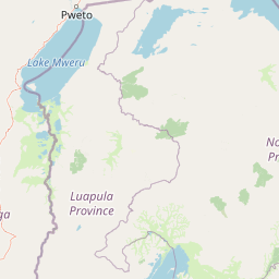
Geographic Profile and Mapped Boundaries of Nsumbu National Park in Northern Zambia
This geographic profile covers the extent and physical landscape of Nsumbu National Park within Zambia, providing detailed measurements for its 2026 square kilometer area. The data includes internal features like Kasaba Bay, Nkamba Bay, and various river systems, alongside an analysis of its lowland terrain and tropical environment across the Northern Province.
Related tags
Lake TanganyikaMiombo woodlandsGame fishingLakeside wildlifeNorthern Province Zambia
Zambia's hidden lakeside wilderness on the shores of Lake Tanganyika
Nsumbu National Park
Nsumbu National Park is a protected wilderness area spanning approximately 2,026 square kilometers along the western shore of Lake Tanganyika near its southern extremity in Zambia's Northern Province. The park encompasses about 80 kilometers of diverse lake shoreline featuring rocky cliffs, pristine sandy beaches, and four distinct bays: Kasaba, Kala, Nkamba, and Sumbu, along with the Nundo Head Peninsula. Established in 1985 and managed by Zambia's Department of National Parks and Wildlife, Nsumbu offers a distinctive combination of terrestrial and aquatic ecosystems, with the Itigi-Sumbu thicket and Central Zambezian Miombo woodlands providing critical habitat for diverse wildlife. The park's dramatic setting includes views across the lake to the mountainous eastern shore, creating a striking backdrop for visitors seeking an off-the-beaten-path African safari experience.
- Location
- Zambia
- Park type
- National park
- Established
- 1985
- Area
- 2,026 km²
Location overview
Protected area geography in the Northern Province of Zambia
Geographic Setting and Coastal Context of Nsumbu National Park
Nsumbu National Park is officially located within the Northern Province of Zambia. Official atlas records classify the protected territory as a coastal park with no transboundary status.
- Countries
- Zambia
- Regions
- Northern Province
- Primary location
- Zambia
- Geographic setting
- Coastal
Boundary and coordinates
Nsumbu National Park’s mapped boundary spans 2,026 km²
Nsumbu National Park mapped boundary and 2,026 km² area
Nsumbu National Park has stored boundary geometry that maps the breadth of its 2,026 km² protected extent. The database records that size as one overall area, without separate land or marine values and without a perimeter measurement.
- Boundary area
- 2,081.9 km²
- Boundary perimeter
- 286.5 km
- Northernmost point
- 8.4904° S
- Southernmost point
- 9.0419° S
- Easternmost point
- 30.7427° E
- Westernmost point
- 30.1434° E
- Geographic centre
- 8.7402° S, 30.4052° E
- North–south span
- 61 km
- East–west span
- 65.9 km
Terrain and natural features
Recorded lowland relief classifications and aquatic geographic entities
Nsumbu National Park Terrain and Named Natural Features
Stored terrain classifications align with recorded bays, rivers, streams, lakes, and capes within the protected landscape. Associated feature cards detail names, types, measurements, and spatial relationships where documented.
Selected named natural features
Rivers
Nkamba
Streams
Kamwinda
Rivers
Lufubu
Streams
Chisala
Lakes
Lake Tanganyika
773 m
Environmental setting
Tropical lowland relief, major water bodies, and forest cover classifications
Nsumbu National Park Environmental Classifications and Physical Settings
Recorded landscape features, habitat types, and climate zones offer complementary ways to read the physical setting of Nsumbu National Park. Stored classifications connect recorded environmental categories to relevant atlas destinations across the protected area.
- Relief
- Lowland
- Climate
- Tropical
- Water
- Major water bodies
- Forest cover
- Mostly forested
- Seasonality
- Year-round
Landscape features
Valleys · Forest · Woodland · Coast · Beach · Cliffs
Habitat types
Temperate broadleaf forest · Savanna · Riverine habitat · Wetland
Park atlas
Map and compare protected areas, regional landscapes, and conservation efforts across the wider geography surrounding Nsumbu National Park.
Explore Other National Parks and Protected Areas Near Nsumbu National Park, Zambia
Explore other national parks and protected areas located in the vicinity of Nsumbu National Park, tracing connected miombo woodlands and diverse lakeside ecosystems. Compare park geography and diverse conservation landscapes across the region, providing valuable insights into the broader protected area network beyond Nsumbu National Park.
National parkNorthern Province
29 km away#1 closest
West

Mweru Wantipa National Park: National Park in Northern Province, Zambia
Discover mapped boundaries and regional geography
Delve into Mweru Wantipa National Park, a protected national park located in Zambia's Northern Province. This entry provides detailed geographic context, focusing on the park's mapped boundaries and its role as a protected landscape. Understand its position within regional geography and explore its contribution to the broader atlas of natural areas.
- IUCN
- II
- Relief
- Lowland
- Climate
- Tropical
- Access
- Highly restricted
National parkLuapula Province
About 125 km away#2 closest
Southwest
Lusenga Plain National Park: Zambia National Park Geographic Atlas
Mapped park boundaries and regional landscape context.
Gain a structured understanding of Lusenga Plain National Park, a dedicated national park situated in Zambia's Luapula Province. This resource details the park's geographic dimensions and its placement within the regional landscape, providing essential context for atlas exploration and a mapped view of protected lands.
- Area
- 800 km²
- Established
- 1972
- IUCN
- II
- Relief
- Lowland
National parkKatavi Region
About 195 km away#3 closest
Northeast

Katavi National Park: A Vast Protected Landscape in Tanzania's Katavi Region
Explore its unique floodplains, seasonal wetlands, and wildlife spectacles.
Katavi National Park is a significant national park located in the Katavi Region of Tanzania, spanning over 4,471 square kilometers. This remote protected area is characterized by extensive floodplains, the vital Katuma River system, and seasonal lakes like Lake Katavi and Lake Chada, which undergo dramatic changes throughout the year. The park's geography supports a dynamic ecosystem renowned for its large wildlife populations, including spectacular hippo gatherings during dry periods and vast herds of buffaloes and elephants roaming its uncrowded savannas. Katavi offers an unparalleled glimpse into a wild, untamed African landscape.
- Area
- 4,471 km²
- Established
- 1974
- IUCN
- II
- Visitors
- 1.5K annual
National parkUvinza District
232 km away#4 closest
North
Mahale Mountains National Park: Tanzania's Remote Mountain Forest & Lake Tanganyika Landscape
Explore unique primate habitats and dramatic protected terrain.
Mahale Mountains National Park stands as a testament to unique ecological convergence, where the Mahale Mountains' dense forests dramatically meet the vast expanse of Lake Tanganyika. This protected area is globally recognized for harboring the largest wild population of eastern chimpanzees, offering a rare glimpse into their behavior within a pristine wilderness. The park's landscape is defined by steep mountain slopes, diverse woodland, and aquatic environments, creating a distinctive geographic context that sets it apart from typical savanna protected areas in Tanzania.
- Area
- 1,650 km²
- Established
- 1985
- IUCN
- II
- Visitors
- 1.1K annual
National parkNorthern Province
About 239 km away#5 closest
South
Isangano National Park: Exploring Its Protected Landscape and Geographic Identity in Northern Province
Discover the mapped boundaries and regional context of this national park.
Isangano National Park stands as a protected national park within the vast geographic expanse of Zambia's Northern Province. This dedicated entry provides critical context for understanding the park's role as a conservation landscape, detailing its physical geography and its position within regional atlas data. Explore the mapped outlines and natural terrain features that define Isangano National Park, offering a foundational view for broader geographic exploration and protected-area research.
- Area
- 840 km²
- Established
- 1972
- Relief
- Lowland
- Climate
- Tropical
National parkHaut-Katanga Province
296 km away#6 closest
Southwest

Kundelungu National Park National Park: Central Africa's Protected Savanna Landscape
Explore the mapped terrain and dramatic geography of this Haut-Katanga Province protected area.
Kundelungu National Park stands as a significant protected area within the Haut-Katanga Province, offering a deep dive into Central Africa's expansive savanna ecosystems and unique natural landmarks. This national park is defined by its rolling grasslands, dotted with characteristic forest galleries that trace the region's water systems, alongside the awe-inspiring Lofoi Falls. Understanding Kundelungu National Park through its mapped boundaries and geographic context reveals its importance as a protected landscape and a key component of regional conservation efforts within the DRC.
- Area
- 7,600 km²
- Established
- 1970
- IUCN
- II
- Relief
- Upland
National parkDemocratic Republic of the Congo
311 km away#7 closest
West
Upemba National Park: Protected Landscape and Geographic Atlas within the Democratic Republic of the Congo
Explore its mapped boundaries and diverse ecosystems.
Upemba National Park, located in the Democratic Republic of the Congo, is a premier destination for understanding protected landscapes and regional geography. This national park is characterized by its extensive wetlands, lake ecosystems, and mountainous terrain, providing a rich environment for atlas-driven discovery. Its unique geographic context and diverse habitats make it a pivotal site for exploring central African protected areas and their ecological significance.
- Area
- 11,730 km²
- Established
- 1939
- IUCN
- II
- Relief
- Mixed relief
National parkTanzania
316 km away#8 closest
East
Ruaha National Park: Tanzania National Park, Protected Landscape and Geographic Atlas
Mapped boundaries and regional landscape context for Ruaha National Park.
Explore the protected landscape of Ruaha National Park in Tanzania. This page provides detailed mapping of its boundaries and offers insights into its geographic setting. Understand its significance as a national park within the atlas of protected areas, focusing on its natural terrain and regional context without travel logistics.
- Area
- 20,226 km²
- Established
- 1964
- IUCN
- II
- Visitors
- 21.3K annual
MoriAtlas Explorer
Continue Exploring Nsumbu National Park's Unique Geographic Setting and Protected Landscape
Delve deeper into the atlas representation of Nsumbu National Park to understand its specific terrain features, the distribution of its protected landscapes, and its place within the broader geographic context of Zambia. This detailed view facilitates structured discovery of the park's unique environmental characteristics and its significance as a protected area.
Browse next
Global natural geography
Explore related park routes
Explore MoriAtlas Global ParksBrowse All MoriAtlas ParksGlobal Park Map DiscoveryMoriAtlas: Browse All CountriesBrowse All MoriAtlas ContinentsNational Park Environment AtlasGrand Canyon National Park AtlasYellowstone National Park AtlasYosemite National Park Atlas and GeographySerengeti National Park AtlasGalápagos National Park Protected LandscapeBanff National Park Geography and AtlasKruger National Park Atlas EntryUluṟu-Kata Tjuṯa National Park AtlasExplore Uluru-Kata Tjuta National Park GeographyPlitvice Lakes National Park AtlasFiordland National Park Protected LandscapeGreat Smoky Mountains National Park AtlasAfghanistan National Parks and Protected AreasAlbania National Parks and Protected AreasAlgeria National Parks and Protected AreasAmerican Samoa National Parks and Protected AreasAndorra National Parks and Protected AreasAngola National Parks and Protected AreasAntarctica National Parks and Protected AreasAntigua and Barbuda Park List