Mori Atlas logo
National parkNyungwe Forest National Park

Discover the mapped boundaries and regional geography of this significant protected area.

Nyungwe Forest National Park: Rwanda's Protected National Park Landscape

Nyungwe Forest National Park stands as a vital protected landscape within Rwanda, offering a unique geographic identity for atlas exploration. This national park page provides detailed insight into its specific mapped boundaries and the surrounding regional context, crucial for understanding its place within the broader East African geography. Delve into the park's natural terrain and protected land status, essential for any comprehensive geographic discovery focused on Rwanda's conservation areas.

Montane RainforestPrimatesChimpanzeesBirdwatchingUNESCO World Heritage SiteAlbertine Rift Endemics

Nyungwe Forest National Park

National park

Park overview

Structured park overview, official facts, and landscape profile for Nyungwe Forest National Park

Nyungwe Forest National Park park facts, protected area profile, and essential visitor context

Review the core facts for Nyungwe Forest National Park, including designation, size, terrain, visitor scale, habitats, and operating context in one park-focused overview.

About Nyungwe Forest National Park

Nyungwe Forest National Park represents one of the last great wilderness areas in East Africa, protecting a globally significant expanse of ancient montane rainforest that has remained largely intact despite centuries of human activity in the region. The park's ecological importance stems from its unique position at the intersection of multiple biogeographical zones, creating a remarkable diversity of habitats including primary rainforest, bamboo forest, grasslands, swamps, and bogs. This habitat heterogeneity supports an extraordinary concentration of biodiversity, with the forest harboring species found nowhere else on Earth. The park's elevation gradient from 1,500 to 3,000 meters creates distinct ecological zones, from lower montane forest to bamboo-dominated areas and alpine-like heath at the highest elevations. Water flows from the park's eastern slopes into tributaries of the Nile, while western drainage feeds the Congo River system, placing Nyungwe at a critical hydrological crossroads for the entire continent. The forest also provides essential ecosystem services to surrounding communities, including watershed protection, climate regulation, and sustainable livelihood opportunities.

Quick facts and research context for Nyungwe Forest National Park

Nyungwe Forest National Park is situated in southwestern Rwanda at elevations ranging from 1,500 to 3,000 meters above sea level, with Mount Bigugu reaching 2,921 meters within the park boundaries. The protected area was originally established as a forest reserve in 1933 during the Belgian colonial period and was redesignated as a national park in 2005. In 2023, Nyungwe became Rwanda's third UNESCO World Heritage Site. The park contains 13 primate species representing a quarter of all primate species found in Africa, over 300 bird species including 30 Albertine Rift endemics, and more than 1,000 plant species. African Parks assumed management responsibility in 2020 through an agreement with the Rwanda Development Board.

Park context

Deeper park guide and search-rich context for Nyungwe Forest National Park

Nyungwe Forest National Park history, landscape, wildlife, and travel context

Explore Nyungwe Forest National Park through its history, landscape character, ecosystems, wildlife, conservation priorities, cultural context, and seasonal travel timing in a structured park guide built for atlas discovery and search intent.

Why Nyungwe Forest National Park stands out

Nyungwe Forest is renowned for its extraordinary primate populations, particularly the large colonies of chimpanzees and Angola colobus monkeys that inhabit the canopy. The forest supports the highest concentration of primate species found anywhere in Africa, with 13 documented species including the rare L'Hoest's monkey, golden monkey, and Hamlyn's monkey. It is also celebrated as one of the most important birdwatching destinations on the continent, harboring over 300 bird species with 30 Albertine Rift endemics. The park's distinction as the best-preserved montane rainforest in Africa, combined with its UNESCO World Heritage status, makes it a cornerstone of regional conservation and a flagship for Rwanda's eco-tourism industry.

Nyungwe Forest National Park history and protected-area timeline

Nyungwe Forest Reserve was established in 1933 by the Belgian colonial government amid growing concern about accelerating forest conversion to agricultural land in Rwanda during the 1920s. Colonial regulations prohibited clearing forests for agriculture while preserving community rights to collect firewood and permitting commercial exploitation of valuable hardwood timber, though enforcement remained inconsistent. Following Rwanda's independence in 1962, forest reserves fell under the jurisdiction of the Ministry of Agriculture. The period from 1958 to 1973 saw significant forest loss, with Nyungwe reduced by over 150 square kilometers due to fires, logging, hunting, and small-scale agriculture. By 1969, elephant populations had declined dramatically, and the last buffalo was killed in 1974. In 1984, biodiversity surveys conducted by the Wildlife Conservation Society documented colobus groups of up to 400 individuals, an unprecedented finding. The 1994 genocide devastated the country and destroyed research facilities at Uwinka, though park staff remained to protect the resource. The park began systematic recovery in 1995, and in 2005 it was officially designated as a national park. African Parks assumed management in 2020 through a 20-year agreement with the Rwanda Development Board.

Nyungwe Forest National Park landscape and geographic character

Nyungwe Forest occupies a dramatic mountainous landscape in southwestern Rwanda, characterized by steep ridges, deep valleys, and cascading streams that descend from the central highlands. The terrain is bisected by numerous rivers and streams that have carved intricate drainage patterns through the ancient rainforest. Mount Bigugu, rising to 2,921 meters, dominates the eastern section of the park and provides sweeping views across the forest canopy to Lake Kivu and the Democratic Republic of the Congo beyond. The park's topography creates a mosaic of microclimates and habitats, from the misty, cool conditions of the upper montane forest to the warmer, more humid lower slopes. Bamboo forest zones interrupt the evergreen canopy in certain areas, creating distinct visual and ecological character. The landscape also includes extensive swampy areas and bogs that serve as critical water storage and filtration systems.

Nyungwe Forest National Park ecosystems, habitats, and plant life

The ecological character of Nyungwe Forest is defined by its status as the most intact montane rainforest ecosystem in Africa. The forest represents a critical stronghold for Albertine Rift montane forest species, harboring more endemic species than any other surveyed forest in this mountain range. The park's vegetation includes tall primary forest trees exceeding 50 meters in height, dense understory layers, and open bamboo thickets. The combination of high rainfall, persistent mist, and nutrient-rich soils supports extraordinary plant productivity and diversity. The forest sits within a transitional zone where Central African and East African floral provinces meet, creating a unique blend of species assemblages. This ecological crossroads position, combined with the elevational range, produces remarkable habitat diversity within a relatively compact area.

Nyungwe Forest National Park wildlife and species highlights

Nyungwe Forest contains one of the highest concentrations of primate species in Africa, with 13 species documented within the park boundaries representing approximately one-quarter of all primate species found on the entire continent. Chimpanzee populations thrive throughout the forest, and the park supports some of the largest known social groups. The Angola colobus monkey, now extinct in its namesake country due to intensive hunting, maintains significant populations here in groups that can exceed 400 individuals, a remarkable aggregation unique to Nyungwe. The bird fauna includes over 300 species with 30 Albertine Rift endemics such as the Rwenzori turaco and several sunbird species. The park also supports 85 mammal species, 38 reptile species, and 32 amphibian species, many of which are restricted to the Albertine Rift ecoregion.

Nyungwe Forest National Park conservation status and protection priorities

Nyungwe Forest National Park represents a conservation priority of global significance, recognized by its 2023 UNESCO World Heritage inscription. The park protects what is considered the best-preserved montane rainforest in Africa and serves as a critical refuge for numerous species with extremely limited distributions. The Albertine Rift montane forests are identified as a biodiversity hotspot of global importance, and Nyungwe stands as one of its largest and most intact remaining fragments. The presence of 13 primate species, including several threatened species, makes the park essential for primate conservation in Africa. African Parks' management partnership, established in 2020, brings professional conservation expertise and sustainable financing to ensure long-term protection. The park generates significant revenue for Rwanda's economy while supporting conservation programs, infrastructure development, and community livelihoods.

Nyungwe Forest National Park cultural meaning and human context

While Nyungwe Forest is primarily valued for its ecological significance, the forest has historical connections to local communities who traditionally relied on its resources for honey collection, woodcutting, and subsistence activities. These traditional uses were incorporated into the colonial-era regulations that governed the forest reserve, allowing community access for firewood collection while restricting agricultural conversion and commercial timber extraction. The forest holds cultural significance for surrounding communities, though the primary value today lies in conservation and eco-tourism rather than traditional resource extraction.

Top sights and standout views in Nyungwe Forest National Park

Nyungwe Forest offers exceptional chimpanzee tracking experiences through guided activities that provide intimate encounters with these intelligent primates in their natural habitat. The park's canopy walkway, suspended high above the forest floor, provides unprecedented access to the otherwise inaccessible upper forest layers and panoramic views across the treetops. Birdwatchers find particular value in the park's 30 Albertine Rift endemic species, including specialized sightings of rwenzori turacos, great blue turacos, and a diversity of sunbirds. The trail system, developed from 1987 onward from the Uwinka center, allows access to waterfalls, tea plantations at the park edges, and scenic viewpoints overlooking the Congo-Nile watershed. The recent UNESCO World Heritage designation elevates the park's international recognition and reinforces Rwanda's commitment to preserving this irreplaceable ecosystem.

Best time to visit Nyungwe Forest National Park

The dry seasons from June to September and December to February generally offer the most favorable conditions for wildlife viewing and hiking in Nyungwe Forest. During these periods, trail conditions are more accessible and wildlife tends to concentrate near water sources, making chimpanzee and primate tracking more productive. The wetter months from March to May and October to November bring heavier rainfall that can make trails slippery and visibility reduced, though the forest remains lush and green. The monsoon seasons also bring increased mist and cloud cover to the higher elevations, creating the atmospheric conditions that define the montane rainforest environment. Visitors seeking to see primates should be prepared for variable weather regardless of season, as the forest's elevation creates its own climate patterns distinct from the surrounding lowlands.

Monthly climate preview

Long-term temperature and precipitation records measured at representative park coordinates

Nyungwe Forest National Park Climate Normals and Monthly Weather Patterns

Nyungwe Forest National Park exhibits steady monthly temperature ranges alongside distinct seasonal shifts in daily precipitation across the representative coordinate. Reviewing the complete twelve-month climatology profile reveals comprehensive data for evaluating long-term weather patterns.
Annual mean19 °C
18 °C20 °C
Jan19°
Feb20°
Mar19°
Apr19°
May18°
Jun18°
Jul18°
Aug19°
Sep20°
Oct20°
Nov19°
Dec19°
Warmest month
September

20 °C

Coolest month
June

17.8 °C

Wettest month
November

6.6 mm/day

Driest month
July

0.8 mm/day

Park location guide

Geography guide, regional context, and park location map for Nyungwe Forest National Park

Nyungwe Forest National Park park geography, regions, and map view in Rwanda

Understand where Nyungwe Forest National Park sits in Rwanda through a broader geographic reading of the surrounding landscape, nearby location context, and its mapped position within the national park landscape.

How Nyungwe Forest National Park fits into Rwanda

Rwanda is a landlocked East African nation bordered by Uganda, Tanzania, Burundi, and the Democratic Republic of the Congo. The country features mountains in the west, savanna in the southeast, and several volcanoes in the northwest forming part of the Virunga chain. It has a tropical highland climate with two rainy and two dry seasons annually.

Wider geography shaping Nyungwe Forest National Park in Rwanda

Rwanda lies in the Great Rift Valley of East Africa, bordered by Uganda to the north, Tanzania to the east, Burundi to the south, and the Democratic Republic of the Congo to the west. The western region features mountains and lakes, while the southeast consists of savanna. Several volcanoes forming part of the Virunga Mountains are located in the northwest.

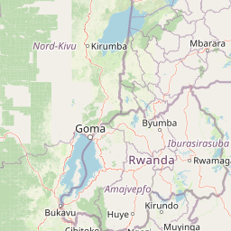
Map view of Nyungwe Forest National Park

Use this park location map to pinpoint Nyungwe Forest National Park in Rwanda, understand its exact geographic position, and read its mapped placement within the surrounding landscape more clearly.

Pigeon | © OpenStreetMap contributors
Park atlas

Explore Surrounding Montane Rainforests and Regional Protected Landscapes for Deeper Comparison

Discover Nearby National Parks and Protected Areas Around Nyungwe Forest National Park

Explore other national parks and protected areas near Nyungwe Forest National Park, including contiguous montane rainforests and vital conservation landscapes across the surrounding Albertine Rift geography. This focused atlas view helps you compare park features, understand regional ecosystem connections, and trace the spread of protected zones within Eastern Africa's biodiversity hotspot.
National parkRwanda
Mapped park locations coincide#1 closest

Nyungwe National Park: Rwanda's Protected National Park for Geographic Discovery

Explore its mapped natural landscape and protected terrain.

Nyungwe National Park represents a vital protected area within Rwanda, contributing a unique landscape to the nation's geographic atlas. This national park offers a specific focus for understanding protected lands, their mapped boundaries, and the natural terrain they encompass. By examining Nyungwe National Park, users gain insight into Rwanda's regional geography and the significance of its conservation efforts within the broader context of East African natural landscapes.

National parkBurundi
About 50 km away#2 closest

South

Kibira National Park: Burundi's Protected National Park Landscape and Geography

Mapped protected area within the Great Rift Valley region.

Kibira National Park represents a vital protected national park entity within Burundi's diverse geography. As part of the Great Rift Valley's expanse, its mapped boundaries and landscape identity offer a focal point for understanding regional protected areas. This park's presence in Burundi contributes essential data to a structured atlas of natural landscapes and conservation lands across East Africa.

Area
400 km²
IUCN
II
Relief
Mountain
Climate
Tropical
Watercolor illustration of a landscape with mountains, water bodies, and grassy fields
National parkDemocratic Republic of the Congo
About 60 km away#3 closest

West

Kahuzi-Biega National Park: Protected Volcanic and Rainforest Landscapes in the Congo

Geographic atlas of the Mitumba Mountains and lowland rainforest transition

Kahuzi-Biega National Park occupies a significant expanse in the eastern Democratic Republic of the Congo, connecting mountainous volcanic terrain with sprawling tropical lowland forests. The area supports an unparalleled diversity of vegetation, tracking from subalpine summits down to rare swamp and riparian habitats. This site acts as a key reference for understanding the ecological richness of the Albertine Rift and the broader Congo Basin landscape.

Area
6,000 km²
Established
1970
IUCN
II
Relief
Mixed relief
National parkSouth Kivu Province
About 62 km away#4 closest

West

Kahuzi-Biéga National Park: Protected Mountain and Rainforest Geography in South Kivu

Mapped terrain from volcanic summits to equatorial forest basins.

Kahuzi-Biéga National Park represents a significant protected area within the South Kivu Province. The geography features two distinct sectors connected by a narrow ecological corridor, encompassing everything from high-altitude subalpine heather zones to dense tropical lowland environments. This dataset provides a detailed look at the park boundaries, volcanic topography, and the regional landscape context that defines this essential habitat.

Area
6,000 km²
Established
1970
IUCN
II
Relief
Mixed relief
National parkWestern Province
About 83 km away#5 closest

North

Gishwati Forest National Park: Discover Rwanda's Protected Landscape Geography

Mapped protected area boundaries and regional natural landscape.

Gishwati Forest National Park offers a focused exploration of a significant protected natural landscape in Rwanda's Western Province. This resource provides detailed geographic context, highlighting the park's mapped boundaries and its role within the country's conservation areas. Understand its terrain and regional landscape importance through an atlas-centric view.

Area
32.02 km²
Established
2015
IUCN
IV
Relief
Mountain
National parkRwanda
About 83 km away#6 closest

North

Gishwati-Mukura National Park: Rwanda's Protected Montane Forest Landscape in the Albertine Rift

Explore its mapped boundaries and regional geography.

Gishwati-Mukura National Park, located in western Rwanda, is a vital protected area renowned for its montane forest ecosystems. This national park occupies mountainous terrain characteristic of the Albertine Rift, contributing significantly to watershed protection and regional biodiversity. Users can explore its specific geographic context, mapped landscape features, and its role within Rwanda's broader conservation atlas.

Area
32.02 km²
Established
2015
IUCN
II
Relief
Highland
National parkBurundi
About 84 km away#7 closest

South

Rusizi National Park: National Park in Burundi's Geographic Landscape Context

Explore mapped protected area boundaries and regional geography.

Rusizi National Park stands as a significant protected area within Burundi, contributing to the nation's conservation atlas. This national park offers a distinct geographic profile, showcasing its specific landscape and terrain features within the East African context. Users can delve into the mapped boundaries of Rusizi National Park to understand its protected status and its role in the regional geography, facilitating detailed geographic discovery.

Area
90 km²
Established
1980
IUCN
II
Climate
Tropical
Watercolor illustration of rolling hills, mountains, and a river or lake
National parkDemocratic Republic of the Congo
About 95 km away#8 closest

North

Virunga National Park: Democratic Republic of the Congo's Premier Protected Landscape

Mapped boundaries and diverse Albertine Rift endemic geography.

Virunga National Park represents a pivotal protected area within the Democratic Republic of the Congo, characterized by an exceptional range of geographic features and vital ecosystems. Its protected landscape includes active volcanoes like Nyiragongo with its lava lake, the towering Rwenzori Mountains, and diverse lowland savannas. This atlas-focused entry highlights the park's unique position in the Albertine Rift, crucial for numerous endemic species and offering significant insight into regional geography and protected land context.

Area
7,800 km²
Established
1925
IUCN
II
Relief
Mountain

Common questions about visiting, size, designation, and location context for Nyungwe Forest National Park

Nyungwe Forest National Park FAQs for park facts, access, geography, and protected area context

Find quick answers about Nyungwe Forest National Park, including protected-area facts, park geography, trail and visitor context, and how the park fits into its surrounding country and regional landscape.
MoriAtlas Explorer

Continue Your Protected Areas Search Across the Global Atlas

Deepen your exploration by continuing the structured search for national parks and protected areas worldwide. Utilize the comprehensive filtering capabilities to compare different conservation landscapes and refine your understanding of global park geography. Discover more about the distribution and characteristics of protected natural areas.

Global natural geography