
Mori Atlas logo
Nature reserveOstoja Rogalińska

A detailed atlas of riparian floodplains, ancient oak forests, and moraine lake systems.

Ostoja Rogalińska Nature Reserve: Mapped Protected Landscapes and Glacial Terrain in Wielkopolska

(Obszar specjalnej ochrony ptaków Ostoja Rogalińska (PLB300017))

Ostoja Rogalińska represents a core protected area within the Wielkopolska Lowland, characterized by a complex post-glacial mosaic of moraine ridges, inland dunes, and eutrophic lake basins. This Natura 2000 site traces the Warta River corridor, supporting diverse habitats ranging from softwood riparian forests and boggy alder woods to dry pine-covered sands. The mapped boundaries reveal a landscape of significant ecological transitions, shaped by centuries of geological activity and currently serving as a crucial sanctuary for diverse avian species.

Natura 2000Special Protection AreaBird sanctuaryPost-glacial landscapeInland dunesLake district
A graphic illustration showing a river flowing through a canyon with a waterfall on the right, pine trees on the banks, and cattails in the foreground.

Ostoja Rogalińska

Nature reserve

Park overview

Structured park overview, official facts, and landscape profile for Ostoja Rogalińska

Ostoja Rogalińska park facts, protected area profile, and essential visitor context

Review the core facts for Ostoja Rogalińska, including designation, size, terrain, visitor scale, habitats, and operating context in one park-focused overview.

About Ostoja Rogalińska

Ostoja Rogalińska sits at the heart of the Wielkopolska Lowland, a flat but subtly varied region shaped by successive Pleistocene glaciations. The protection area occupies the left bank of the Warta River south of Poznań and stretches across an unusually broad belt of terrain that includes moraine uplands, lake districts, riverine floodplains, and extensive forests. The intact character of this landscape, largely preserved despite centuries of agricultural pressure in surrounding areas, is the foundation of the site's ecological importance.

The area straddles three recognized mesoregions: the Kotlina Śremska basin, the Pojezierze Poznańskie lake district, and the Poznański Przełom Warty section where the river cuts through the lowland. This convergence of basin, lake plain, and river gorge creates a wide range of microhabitats within a relatively compact zone. Sandy outwash plains support dry pine forest, while kettle depressions and former meltwater channels hold mires and lakes that vary from eutrophic basins to dystrophic, peat-stained pools.

Beyond its geological setting, Ostoja Rogalińska is significant because it integrates two of the region's most important formal protected landscapes. The northern portion overlaps with Wielkopolski National Park, Poland's second-oldest national park and an established stronghold of lowland forest conservation. The southern portion lies within the Rogaliński Landscape Park, an area defined largely by the cultural landscape around the village of Rogalin and its celebrated historical oaks. By knitting these two zones together with the surrounding countryside, the bird directive site functions as a connective matrix for forest, wetland, and farmland habitats across central Wielkopolska.

The sanctuary's identity is also shaped by human heritage. The Rogalin estate, with its neoclassical palace and adjacent old-growth oaks, has long anchored the region's cultural memory and lends its name to the protected area. While the Natura 2000 designation is ecological rather than cultural, the persistence of open parkland, avenues of ancient trees, and historically wooded patches has created conditions that benefit saproxylic invertebrates, owls, and cavity-nesting birds, reinforcing the link between cultural heritage and biodiversity conservation in this part of Poland.

Quick facts and research context for Ostoja Rogalińska

Ostoja Rogalińska is a Natura 2000 Special Protection Area for birds, designated in 2007 and recorded under the code PLB300017. It lies in the wielkopolskie voivodeship within the mesoregions of Kotlina Śremska, Pojezierze Poznańskie, and Poznański Przełom Warty.

The protection area covers roughly 21,763 hectares along the left bank of the Warta River south of Poznań. It overlaps with parts of Wielkopolski National Park in the north and the Rogaliński Landscape Park in the south, and contains two nature reserves. Its conservation significance is anchored in a rich post-glacial landscape of moraine hills, inland dunes, lakes, and boggy forests that supports a wide range of European-threatened bird species.

Protection and recognition

Documented terrestrial protection scope and international recognition sources

Ostoja Rogalińska Protection Status and Natura 2000 Designation Records

Terrestrial protection status and official Natura 2000 recognition records outline the conservation framework established for Ostoja Rogalińska. Structured management data and verified designation sources provide clear context for evaluating regional protected area governance.

International recognition

Protection details

Protection scope
Terrestrial
Transboundary protection
No
Park context

Deeper park guide and search-rich context for Ostoja Rogalińska

Ostoja Rogalińska history, landscape, wildlife, and travel context

Explore Ostoja Rogalińska through its history, landscape character, ecosystems, wildlife, conservation priorities, cultural context, and seasonal travel timing in a structured park guide built for atlas discovery and search intent.

Why Ostoja Rogalińska stands out

Ostoja Rogalińska is best known as one of the most important bird protection areas in the Wielkopolska region, hosting breeding and migratory populations of species such as the white-tailed eagle, black stork, both species of kite, bittern, and little bittern. Its mosaic of post-glacial lakes, mires, riparian forests, and ancient oaks around Rogalin creates a rare combination of aquatic and woodland habitats within a single Natura 2000 site. The area is also recognized for its dramatic Quaternary geology. Twelve lakes, predominantly eutrophic, lie among moraine ridges, inland dunes, kettle hollows, and glacial erratics, with Osowa Góra rising as the highest point at about 132 meters. This layered glacial terrain, combined with the Warta floodplain, gives the sanctuary a landscape character distinct from the more uniform lowlands that surround it.
A wide, calm river winding through a lush green landscape with trees on the banks, under a clear blue sky.
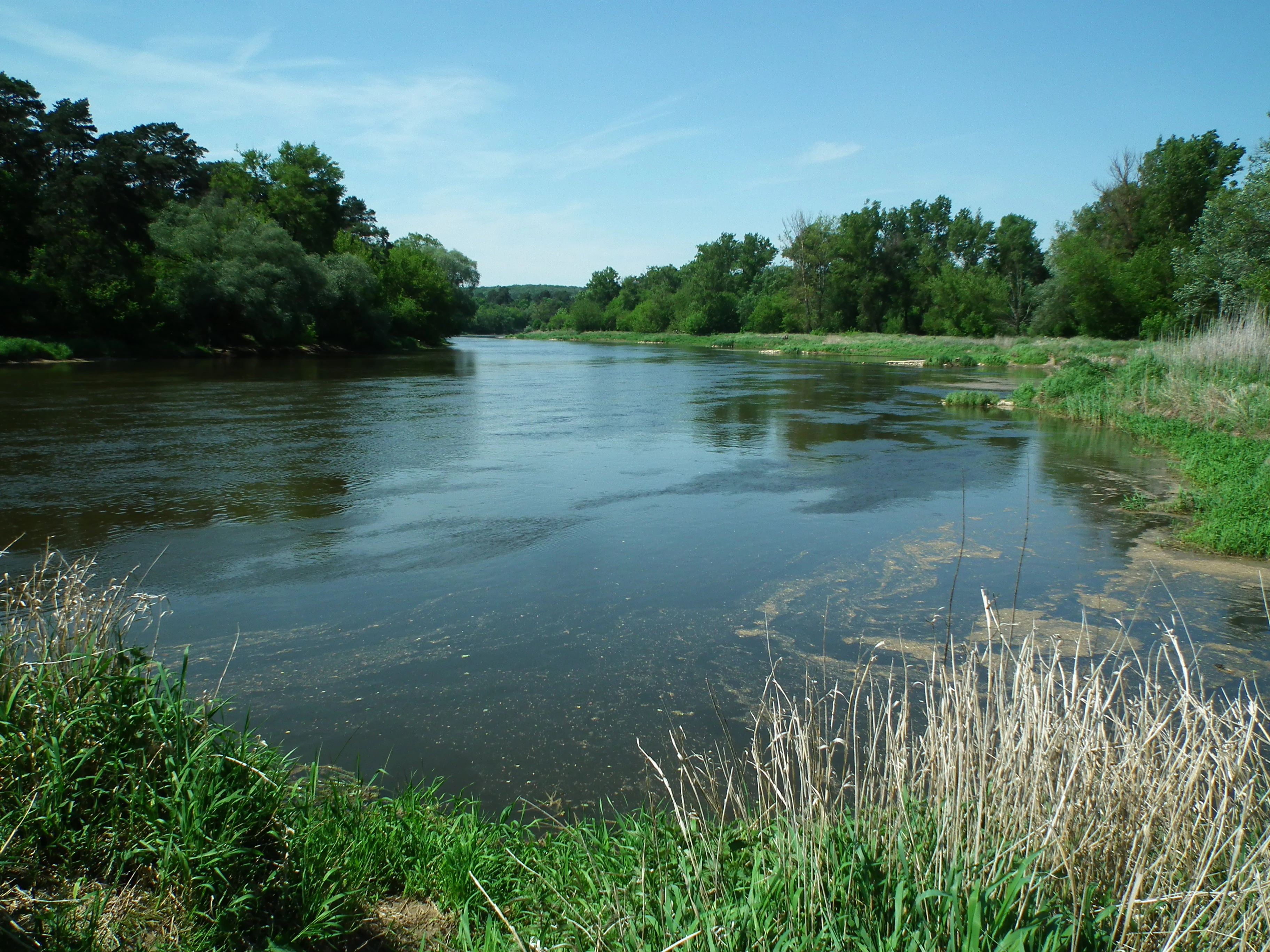
The Warta River flowing through the Ostoja Rogalińska protected area.

Ostoja Rogalińska history and protected-area timeline

Ostoja Rogalińska was formally established in 2007 as a Special Protection Area for birds under the European Union's Natura 2000 network, receiving the site code PLB300017. The designation reflected accumulating evidence that the central Wielkopolska landscape along the Warta River qualified under the European Birds Directive for its breeding and migratory bird populations.

Although the Natura 2000 designation is comparatively young, much of the land within it had already been protected under other instruments for decades. The northern portion of the area falls within Wielkopolski National Park, which was created in 1957 and remains one of Poland's earliest and most important lowland national parks. The southern portion lies inside the Rogaliński Landscape Park, established to safeguard the landscape character, oak stands, and historical parkland around Rogalin. Two nature reserves, Krajkowo and Goździk Siny w Grzybnie, sit within the boundary as well, indicating a longer history of site-specific habitat protection.

The combined effect of national park status, landscape park zoning, nature reserves, and Natura 2000 designation means that Ostoja Rogalińska represents a layering of conservation frameworks rather than a single stand-alone act of protection. This history of overlapping designations has helped preserve not only large forest tracts but also the old trees, mires, riverine corridors, and small landscape features that contribute most to the area's bird value today.

Ostoja Rogalińska landscape and geographic character

The landscape of Ostoja Rogalińska is a textbook example of lowland glacial morphology. The terrain carries the unmistakable signatures of Pleistocene ice movement: rounded moraine ridges, glacial erratics scattered across the ground, and former subglacial channels now occupied by lakes and mires. Twelve lakes have been mapped within the area, the great majority of them eutrophic and associated with low-lying basins that retain mineral-rich waters.

Among the most striking geomorphological features are the numerous inland dunes, or wydmy śródlądowe, which rise from the otherwise flat outwash plains. These sandy ridges, formed as wind reworked glacial sediments after the ice retreated, support dry grassland and open pine woodland and create localized xerothermic conditions unusual in central Wielkopolska kettle hollows, or rynny polodowcowe, dissect the terrain further, channeling meltwater routes that still function as wetland corridors. The highest point within the protection area is Osowa Góra, a moraine hill reaching roughly 132 meters above sea level, which serves as a modest but distinct landmark in an otherwise low-relief landscape.

The Warta River itself defines the western edge of the area. Its floodplain contributes oxbow lakes, periodically flooded muddy margins, softwood riparian forests of willow and poplar, and periodically disturbed gravel bars. Together, the moraines, dunes, lake basins, and river corridor create a landscape of frequent ecological transitions, where coniferous upland forest can lie within a short distance of open water, boggy alder stand, or sandy clearings with thermophilous vegetation.
A tractor plowing a field, creating a cloud of dust, with a line of trees in the background.
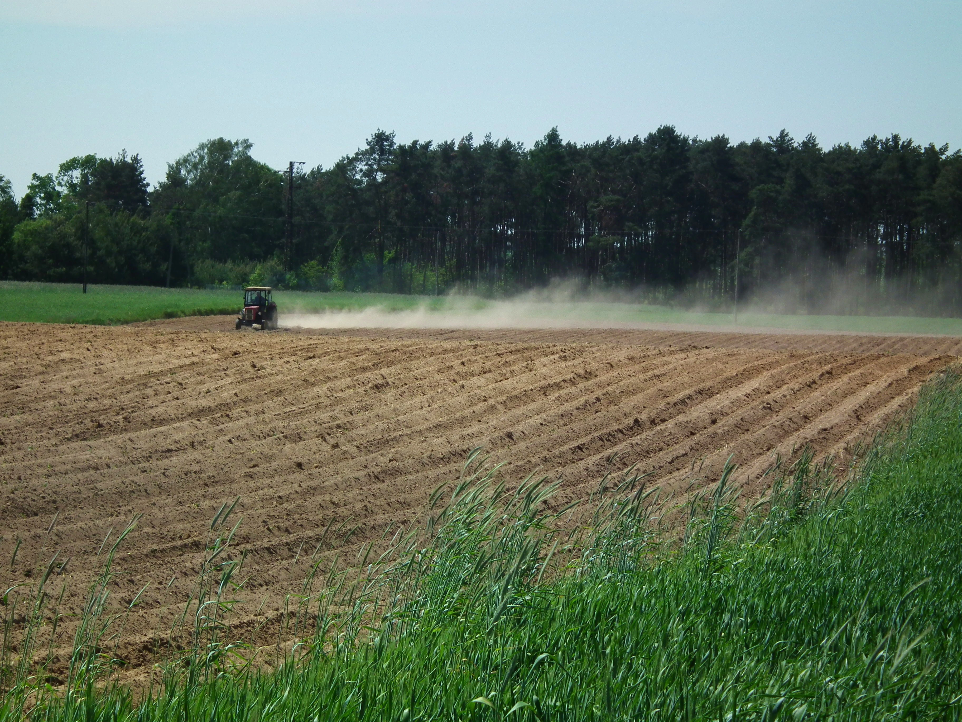
A tractor working on farmland within the Ostoja Rogalińska protected area.

Ostoja Rogalińska ecosystems, habitats, and plant life

The ecological richness of Ostoja Rogalińska reflects the diversity of its physical setting. Pine-dominated forests form the prevailing vegetation cover, typically on the drier sandy and moraine soils, with mixtures of oak, spruce, birch, hornbeam, and small-leaved linden giving the canopy compositional variety. Where drainage is poor, the forest changes character: alder carrs and willow scrub take over, and peat-forming processes create conditions favorable for bog vegetation and uncommon plant communities.

The protected area contains an unusually full set of European habitat types. Inland dunes harbor dry Corynephorus and Agrostis grasslands; the Warta floodplain supports oxbow lakes, periodically flooded muddy riverbanks with Chenopodion and Bidention vegetation, and riverside tall-herb communities of the Convolvuletalia type. Open landscapes include thermophilous xerothermic swards, Molinion meadows of variable wetness, Cnidion celery meadows, and traditional extensively managed Arrhenatherion hay meadows. Forest habitats range from raised bogs capable of natural regeneration, through birch-oak acidophilous woodland in the Pomeranian style, to riparian willow-poplar-alder-ash galleries, oak-elm-ash lowland riverside forests, and warm-loving oak woodland on south-facing slopes.

Wetland and aquatic ecosystems are particularly conspicuous. The twelve lakes of the area include eutrophic open-water bodies with Nympheion and Potamion communities, dystrophic pools stained dark by humic acids, and calcareous fens with Cladium, Carex buxbaumii, and Schoenus nigricans. Plants of European conservation concern recorded here include the pasqueflower (Pulsatilla patens) and Angelica palustris-like meadow species that depend on the persistence of traditional land management alongside intact hydrology.

Ostoja Rogalińska wildlife and species highlights

The wildlife profile of Ostoja Rogalińska is dominated by birds, which is consistent with the site's status as a Special Protection Area under the Birds Directive. The area supports breeding or regularly occurring populations of bittern and little bittern, white and black stork, greater white-fronted goose, honey buzzard, black and red kite, white-tailed eagle, three species of harrier, lesser spotted eagle, spotted crake, corncrake, common crane, ruff, common and black tern, common kingfisher, black and middle spotted woodpecker, wood lark, tawny pipit, barred warbler, red-breasted flycatcher, red-backed shrike, and ortolan bunting, among many others.

Mammals of European importance include the Eurasian beaver and European otter, both strongly associated with the Warta River corridor and its oxbow lakes and wetland margins. Bats recorded in the area include species such as the western barbastelle and large mouse-eared bat, which benefit from old-growth oaks around Rogalin and from cavities in the national park forests.

Aquatic fauna is similarly notable. Fish such as the asp, bitterling, weather loach, and sabrefish reflect the area's well-oxygenated, structurally varied river and lake habitats. Invertebrate interest is high in and around the veteran Rogalin oaks, where saproxylic species including the stag beetle, the oak longhorn beetle, and the hermit beetle depend on the continuity of old broadleaf trees. Dragonflies and other aquatic invertebrates add a further layer of biodiversity to the lakes, oxbows, and bog pools.

Ostoja Rogalińska conservation status and protection priorities

Ostoja Rogalińska matters for conservation because it concentrates, in a single Natura 2000 site, a combination of habitats that have become increasingly rare across the European lowlands. Vast lowland pine forests, riverine floodplains, inland dunes with dry grasslands, and a chain of lakes with associated mires, all under partial protection through overlapping Polish protected-area categories, represent the kind of habitat mosaic that cannot be recreated at scale once lost.

The site's designation under the Birds Directive in 2007 was based on the presence of numerous bird species of European conservation concern, several of which are listed in Annex I of the directive. White-tailed eagle, black stork, black and red kite, lesser spotted eagle, bittern, little bittern, and corncrake all require large, structurally diverse territories, and their continued presence here indicates the maintenance of conditions favorable not only to those species themselves but to the broader habitat systems on which they depend.

A second layer of conservation significance lies in the site's role as a connector between Wielkopolski National Park and the Rogaliński Landscape Park. By linking a strictly protected national nucleus with a broader landscape-scale buffer, the bird protection area extends effective conservation planning across administrative boundaries. The presence of two nature reserves, Krajkowo and Goździk Siny w Grzybnie, and of ancient oak stands around Rogalin, adds further weight: these are reserves protecting both representative habitat types and rare plant species, and their inclusion reinforces the long-term ecological coherence of the area.

Ostoja Rogalińska cultural meaning and human context

Ostoja Rogalińska takes its name from the village of Rogalin, an estate long associated with Poland's aristocratic and cultural history and home to a neoclassical palace and a renowned arboretum. The surrounding parkland contains avenues of veteran oaks that have become an emblematic feature of the wider landscape and have helped give the protected area a recognizable identity beyond the ecological community.

The relationship between the cultural landscape and the Natura 2000 site is unusually direct. Centuries of continuous habitation, traditional meadow management, and the deliberate retention of old trees in parkland have created structural conditions in the forests and open ground that benefit cavity-nesting birds, bats, and saproxylic invertebrates. In this sense, the protection area preserves not only a natural heritage site but also a working example of how historical land use and biodiversity conservation can reinforce each other in the Polish lowlands.

Top sights and standout views in Ostoja Rogalińska

Highlights of Ostoja Rogalińska include the twelve-lake glacial landscape, the inland dunes and moraine uplands that diversify an otherwise lowland terrain, and the Warta River floodplain with its oxbows and riparian forests. The Rogalin oaks, the largest group of ancient pedunculate oaks in the region, are an irreplaceable highlight for both their cultural and ecological significance.

Equally notable is the area's ornithological richness. Breeding populations of white-tailed eagle, black stork, and lesser spotted eagle, alongside a long supporting list of Annex I species, place the site firmly among the most substantial bird protection areas in Wielkopolska and underscore its value beyond the regional scale.

Best time to visit Ostoja Rogalińska

Ostoja Rogalińska rewards visits across much of the year, but the character of a visit changes with the seasons. Spring brings the arrival of breeding birds, with bittern, marsh harrier, and woodland species establishing territories across the wetlands and forests; woodland bird song and canopy activity peak in this period. Summer is the most stable time for observing reedbed and lakeside species, with dragonflies over warm water and meadow flora in full display, while late summer into early autumn often brings migratory flocks of waterbirds and raptors moving along the Warta corridor. Winter reveals the structure of the post-glacial landscape most clearly, with snow outlining the dunes, moraine ridges, and lake basins, and raptor sightings, including white-tailed eagle, becoming a possibility around open water and carrion sources.
Monthly climate preview

Trace long term monthly temperature ranges and precipitation averages across the protected area coordinate.

Ostoja Rogalińska Climate Normals and Measured Annual Temperature Patterns

Historical NASA Power records document measured monthly temperature fluctuations and precipitation rates across a representative coordinate within Ostoja Rogalińska. Examining the complete twelve month climatology profile provides structured insight into long term environmental rhythms.
Annual mean9 °C
-2 °C20 °C
Jan-2°
Feb-1°
Mar
Apr
May14°
Jun18°
Jul20°
Aug20°
Sep15°
Oct
Nov
Dec-1°
Warmest month
July

20.3 °C

Coolest month
January

-2 °C

Wettest month
July

2.6 mm/day

Driest month
April

1.1 mm/day

Park location guide

Geography guide, regional context, and park location map for Ostoja Rogalińska

Ostoja Rogalińska park geography, regions, and map view in Poland

Understand where Ostoja Rogalińska sits in Poland through a broader geographic reading of the surrounding landscape, nearby location context, and its mapped position within the national park landscape.

How Ostoja Rogalińska fits into Poland

Poland, officially the Republic of Poland, is a Central European country spanning from the Baltic Sea in the north to the Carpathian Mountains in the south. It borders Germany, Czech Republic, Slovakia, Ukraine, Belarus, Lithuania, and Kaliningrad Oblast. The country has a temperate climate, diverse landscapes, and is known for its rich history, cultural heritage, and strong economic position within the EU.

Wider geography shaping Ostoja Rogalińska in Poland

Poland occupies 312,696 km2 in Central Europe, extending from the Baltic Sea coast in the north to the Sudetes and Carpathian Mountains in the south. It borders Germany to the west, Czech Republic and Slovakia to the south, Ukraine and Belarus to the east, and Lithuania and Kaliningrad Oblast to the northeast. The landscape includes lowland plains, uplands, and mountain ranges.

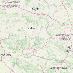
Map view of Ostoja Rogalińska

Use this park location map to pinpoint Ostoja Rogalińska in Poland, understand its exact geographic position, and read its mapped placement within the surrounding landscape more clearly.

Pigeon | © OpenStreetMap contributors

Location context for Ostoja Rogalińska

Wielkopolska Voivodeship
Recorded earthquake history

Explore the Historical Earthquake Records Associated with Ostoja Rogalińska

Access the comprehensive collection of documented seismic activity near Ostoja Rogalińska. This MoriAtlas archive allows for the exploration of historical event data, including magnitude and epicenter metrics, to provide context on the seismic history of this protected Polish landscape.

Ostoja Rogalińska Earthquake History

Catalogued events

44 events

Strongest magnitude

Magnitude 3.9

Most recent event

Mar 23, 2001

This history includes earthquakes recorded inside the park or within 50 km of its borders

Visual reference for post-glacial terrain, ancient oaks, and Warta River habitats

Ostoja Rogalińska Landscape Photos and Protected Area Scenery

Photographic documentation reveals the diverse post-glacial topography, ancient oak clusters, and wetland corridors defining Ostoja Rogalińska. Visual exploration of these protected habitats provides deeper insight into the ecological character of the Warta River floodplain.

A wide, calm river winding through a lush green landscape with trees on the banks, under a clear blue sky.

A red rectangular sign with white text reading OBSZAR NATURA 2000 OSTOJA ROGALIŃSKA stands in a wooded area, next to a weathered circular traffic sign.

A tractor plowing a field, creating a cloud of dust, with a line of trees in the background.

Park atlas

Discover related reserves, glacial terrain, and neighboring conservation areas

Exploring Parks Near Ostoja Rogalińska and Surrounding Protected Landscapes

Visitors comparing Ostoja Rogalińska can browse nearby protected areas, wetland reserves, and post-glacial landscapes across the Warta River region. Expanding the discovery route reveals connected regional ecosystems, neighboring bird sanctuaries, and varied lowland terrain.
Watercolor painting of a landscape with hills, a lake, and forested areas
National parkPoland
Mapped location lies within the park boundary#1 closest

Northwest

Wielkopolska National Park: Poland's Glacial Landscape and Lake District Protected Area

Explore the mapped terrain and protected landscape.

Wielkopolska National Park is a vital protected landscape in western Poland, notable for its characteristic post-glacial terrain. Featuring a landscape defined by numerous kettle lakes nestled within mixed forests and gently rolling hills, this national park offers a representative sample of the Greater Poland lake district's natural heritage. Its mapped boundaries delineate an area of ecological importance, providing valuable context for understanding regional geography and protected area distribution through structured atlas exploration.

IUCN
II
National parkWielkopolska Voivodeship
Park boundaries overlap#2 closest

Northwest

Wielkopolski Park Narodowy: Protected Glacial Landscapes and Regional Geography in Poland

Post-glacial moraine systems and lake basins

Wielkopolski Park Narodowy captures a dense collection of post-glacial landforms, from rolling moraine uplands to clear kettle lakes and esker ridges. This protected area offers a deep look into the geomorphological history of the Wielkopolska region through its varied forest habitats and preserved terrain.

Area
75.84 km²
Established
1957
Visitors
1.2M annual
Relief
Lowland
Watercolor painting of a calm pond with green trees on the banks, reeds in the foreground, and distant rolling hills.
Nature reservePoland
About 12 km away#3 closest

South

Rezerwat przyrody Miranowo: Protected Peatland Ecosystem and Botanical Nature Reserve

A preserved wetland landscape in the Polish lake country

Located near the shores of Lake Dolskie Wielkie, Rezerwat przyrody Miranowo represents a significant protected area focused on the conservation of rare calcareous peatland habitats. The reserve sustains a dense collection of over 230 vascular plant species, offering a unique opportunity to study relict vegetation in a managed wetland environment within Poland.

Area
0.099 km²
Established
1972
Relief
Lowland
Climate
Temperate
A soft watercolor painting of a serene wetland landscape with scattered deciduous trees, low grassy banks, and calm water, rendered in light green and muted earth tones against a white background.
Nature reserveGreater Poland Voivodeship
About 16 km away#4 closest

East

Dębno nad Wartą Nature Reserve: Geographic Profile and Protected Landscape Boundaries

Riparian forest sanctuary in the Warta river valley.

Located in the heart of the Greater Poland Voivodeship, this faunistic nature reserve protects a vital fragment of lowland floodplain forest. The site is defined by its complex oak, ash, and elm canopy, which supports rare invertebrate populations rarely found in the broader surrounding region. This atlas entry provides a detailed look at its protected boundaries, hydrologic landscape, and integral role within the Warta river corridor.

Area
0.217 km²
Established
1974
Relief
Lowland
Climate
Temperate
A watercolor painting showing a soft landscape with green rolling hills and sparse trees against a white background.
Nature reserveGreater Poland Voivodeship
About 18 km away#5 closest

Northwest

Rezerwat przyrody Duszniczki: A Focused Protected Landscape in Greater Poland Voivodeship

Mapping a unique forest reserve and its Polish larch population

Rezerwat przyrody Duszniczki stands as a primary example of small-scale ecological protection within the Wielkopolska region. This forest reserve safeguards rare Polish larch populations integrated within a mature oak and hornbeam woodland, highlighting the importance of focused conservation in the lowland terrain of central Poland.

Area
0.008 km²
Established
1958
Relief
Lowland
Climate
Temperate
A horizontal watercolor painting depicting a soft-toned landscape with a foreground pond, grassy banks with sparse trees, and hazy, layered hills in the background.
Nature reserveWielkopolska Voivodeship
About 19 km away#6 closest

North

Rezerwat przyrody Meteoryt Morasko: Protected Crater and Forest Landscape in Wielkopolska

Geological reserve featuring impact craters and woodland habitats

Rezerwat przyrody Meteoryt Morasko encompasses a rare concentration of impact craters and post-glacial terrain near Poznań. The reserve protects diverse forest types, including oak-hornbeam and elm-ash systems, while preserving geological sites that offer insight into the region's ancient landscape formation and its modern natural preservation.

Area
0.543 km²
Established
1976
Relief
Upland
Climate
Temperate
Nature reservePoland
About 20 km away#7 closest

East

Rezerwat przyrody Dwunastak: Protected Forest Reserve and Landscape Map

Ecological mapping in the Wielkopolska region of Poland.

Located in the Warta river corridor, Rezerwat przyrody Dwunastak protects a rare mosaic of riparian and oak-hornbeam forests. This small but significant nature reserve provides a critical study site for lowland woodland habitat connectivity and regional conservation efforts within the broader Żerkowo-Czeszewski Landscape Park framework.

Established
1959
Nature reserveGreater Poland Voivodeship
20 km away#8 closest

North

Uroczyska Puszczy Zielonki: Protected Nature Reserve and Glacial Landscape Context

Key protected area in the Poznan Lake District, Poland

Uroczyska Puszczy Zielonki consists of four distinct enclaves that safeguard diverse aquatic and forest ecosystems. The geography is shaped by the Poznan Lake District, featuring a mix of calcareous fens, acidophilous oak woods, and eutrophic lake basins. This site serves as a critical conservation corridor, offering valuable insight into the glacial origins and hydrologic patterns of west-central Poland.

Area
14.96 km²
Established
2011
Relief
Lowland
Climate
Temperate

Common questions about visiting, size, designation, and location context for Ostoja Rogalińska

Ostoja Rogalińska FAQs for park facts, access, geography, and protected area context

Find quick answers about Ostoja Rogalińska, including protected-area facts, park geography, trail and visitor context, and how the park fits into its surrounding country and regional landscape.
MoriAtlas Explorer

Continue Your Protected Areas Search Across the Global Atlas

Deepen your exploration by continuing the structured search for national parks and protected areas worldwide. Utilize the comprehensive filtering capabilities to compare different conservation landscapes and refine your understanding of global park geography. Discover more about the distribution and characteristics of protected natural areas.

Global natural geography