
Mori Atlas logo
National parkParc national des lacs Korónia, Vólvi et du Témpi macédonien

Understanding the mapped boundaries, riparian forest terrain, and lake basin geography

Geographic Overview of Parc national des lacs Korónia, Vólvi et du Témpi macédonien in Greece

(National Park of the Wetlands of Lakes Korónia, Vólvi and Macedonian Tempi)

Parc national des lacs Korónia, Vólvi et du Témpi macédonien spans a significant wetland corridor in northern Greece, uniting two major freshwater lake basins with a river gorge. This protected landscape functions as a critical node for biodiversity, encompassing diverse riparian zones, muddy flats, and forested slopes that drain toward the Strymonian Gulf. Through map-based analysis, observe how these distinct sub-areas form a continuous conservation network across the Macedonian region.

wetlandsfreshwater lakesMediterranean ecosystemsbird sanctuarymigratory birdsriparian forest
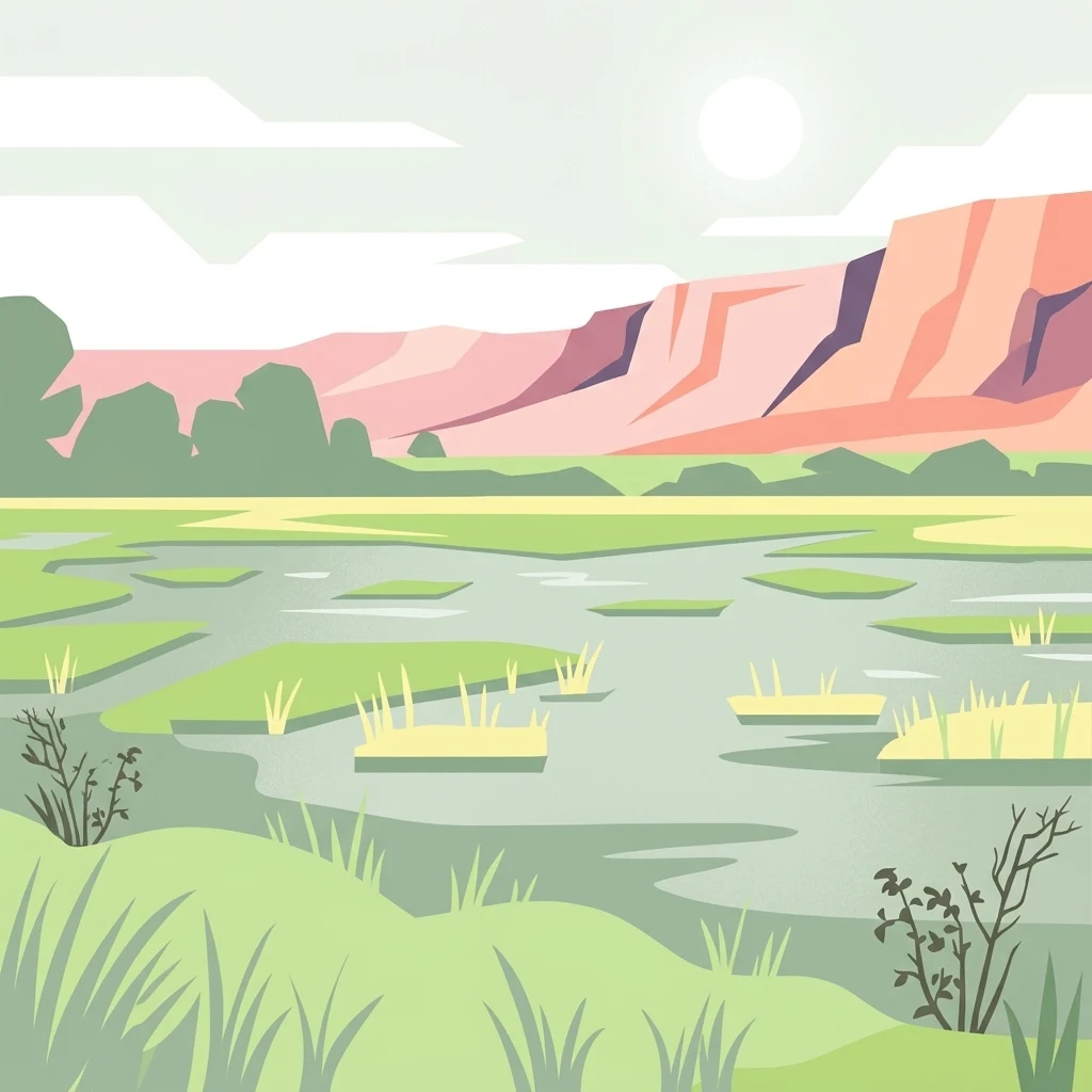
A flat vector illustration of a wetland scene with a calm pool of water, grassy islets, and a pinkish ridgeline in the background under a pale sky.

Parc national des lacs Korónia, Vólvi et du Témpi macédonien

National park

Park overview

Structured park overview, official facts, and landscape profile for National Park of Lakes Korónia, Vólvi and Macedonian Tempi

National Park of Lakes Korónia, Vólvi and Macedonian Tempi park facts, protected area profile, and essential visitor context

Review the core facts for National Park of Lakes Korónia, Vólvi and Macedonian Tempi, including designation, size, terrain, visitor scale, habitats, and operating context in one park-focused overview.

About National Park of Lakes Korónia, Vólvi and Macedonian Tempi

The National Park of Lakes Korónia, Vólvi and Macedonian Tempi is one of the major wetland-focused protected areas of mainland Greece, recognized for its combination of large lake ecosystems, riparian woodland, and a connecting river gorge. Its location in Central Macedonia, just east of the Thessaloniki urban region, places it within a transitional zone between the densely settled coastal plain and the rolling landscapes of the interior, giving the park an unusually important role in the regional environmental network.

At the heart of the protected area are two interconnected lake basins. Lake Korónia, the western component, has historically been one of the more ecologically compromised wetlands in Greece, affected for decades by water extraction, agricultural runoff, and surrounding industrial pressure. Lake Vólvi, the central and eastern component, is by contrast the second largest natural lake in Greece by area and remains a critical freshwater resource. The two lakes are linked by channelized watercourses that are themselves part of the park's perimeter, an acknowledgment that the hydrological connections between basins are as important to conservation as the open water itself.

The third component, the Macedonian Tempi, is the gorge of the Richios River, which drains Lake Vólvi eastward into the Strymonian Gulf. Known in French and English sources as the Rentína Gorge, this narrow valley adds a forested, more topographically dramatic element to an otherwise lacustrine landscape and provides habitat continuity between the inland lake system and the coastal wetlands further east.

The wider natural environment of the park reflects the typical Mediterranean wetland gradient. Aquatic and riparian vegetation communities characterize the lake margins, while hygrophile woodland such as the Apollonía Forest, covering around 60 hectares to the south of Lake Vólvi, adds structural diversity. The fauna includes fish species endemic to Lake Vólvi, amphibians, reptiles, mammals such as the European Otter and Bechstein's Bat, and one of the more substantial waterbird assemblages in northern Greece.

Although the park is not associated with dramatic mountain scenery, its significance lies in the scale and ecological density of its wetland habitats, and in the institutional effort it represents. Created in 2004, the protected area brings together sites that had previously been recognized individually under Ramsar, Natura 2000, and BirdLife International frameworks, formalizing their joint conservation under a single national designation and a dedicated management body headquartered in Langadás.

Quick facts and research context for National Park of Lakes Korónia, Vólvi and Macedonian Tempi

The National Park of Lakes Korónia, Vólvi and Macedonian Tempi was established in 2004 and is administered as an IUCN Category VI protected area, indicating a managed resource reserve focused on sustainable use alongside conservation. It lies in Central Macedonia, east of Thessaloniki and west of the Chalkidiki peninsula, with the nearest major city being Thessaloniki itself.

The park's three principal sub-areas are Lake Korónia in the west, Lake Vólvi in the center, and the Rentína Gorge (the Macedonian Tempi) in the east, connected by the Richios River and channelized watercourses that link the two lakes. The protected area is recognized under the Ramsar Convention as a wetland of international importance, sits within the European Natura 2000 network as both a Special Protection Area for birds and a Special Area of Conservation for habitats, and is listed by BirdLife International as an Important Bird Area.

Protection and recognition

Explore terrestrial protection records, management scope, and conservation designations.

Parc national des lacs Korónia, Vólvi et du Témpi macédonien Protection Status

Terrestrial protection status, management scope, and documented designation details for Parc national des lacs Korónia, Vólvi et du Témpi macédonien remain assembled for reference. Structured conservation metrics outline the recorded boundaries and administrative parameters associated with the protected area.

Protection details

Protection scope
Terrestrial
Transboundary protection
No
WDPA ID
125468
Park context

Deeper park guide and search-rich context for National Park of Lakes Korónia, Vólvi and Macedonian Tempi

National Park of Lakes Korónia, Vólvi and Macedonian Tempi history, landscape, wildlife, and travel context

Explore National Park of Lakes Korónia, Vólvi and Macedonian Tempi through its history, landscape character, ecosystems, wildlife, conservation priorities, cultural context, and seasonal travel timing in a structured park guide built for atlas discovery and search intent.

Why National Park of Lakes Korónia, Vólvi and Macedonian Tempi stands out

The park is best known for its extensive wetland ecosystems and their importance for waterbird conservation in the eastern Mediterranean. Lake Vólvi, the second largest natural lake in Greece, supports diverse freshwater habitats and endemic fish populations, while the surrounding riparian zones and the Apollonía Forest shelter hygrophile vegetation communities. About 238 bird species have been recorded in the wider park area, including globally threatened species such as the White-headed Duck, the European Turtle Dove, and the Dalmatian Pelican, alongside numerous near-threatened shorebirds, ducks, and raptors. Equally distinctive is the park's role as a conservation laboratory for degraded wetlands. Lake Korónia has suffered dramatic ecological decline from eutrophication, dropping from depths above 8 meters in the 1960s to less than 1 meter since 2001, and was placed on the Montreux Record of the Ramsar Convention in 1990. The park's existence reflects the long-running effort to manage these pressures through coordinated protection, restoration planning, and EU-level enforcement.
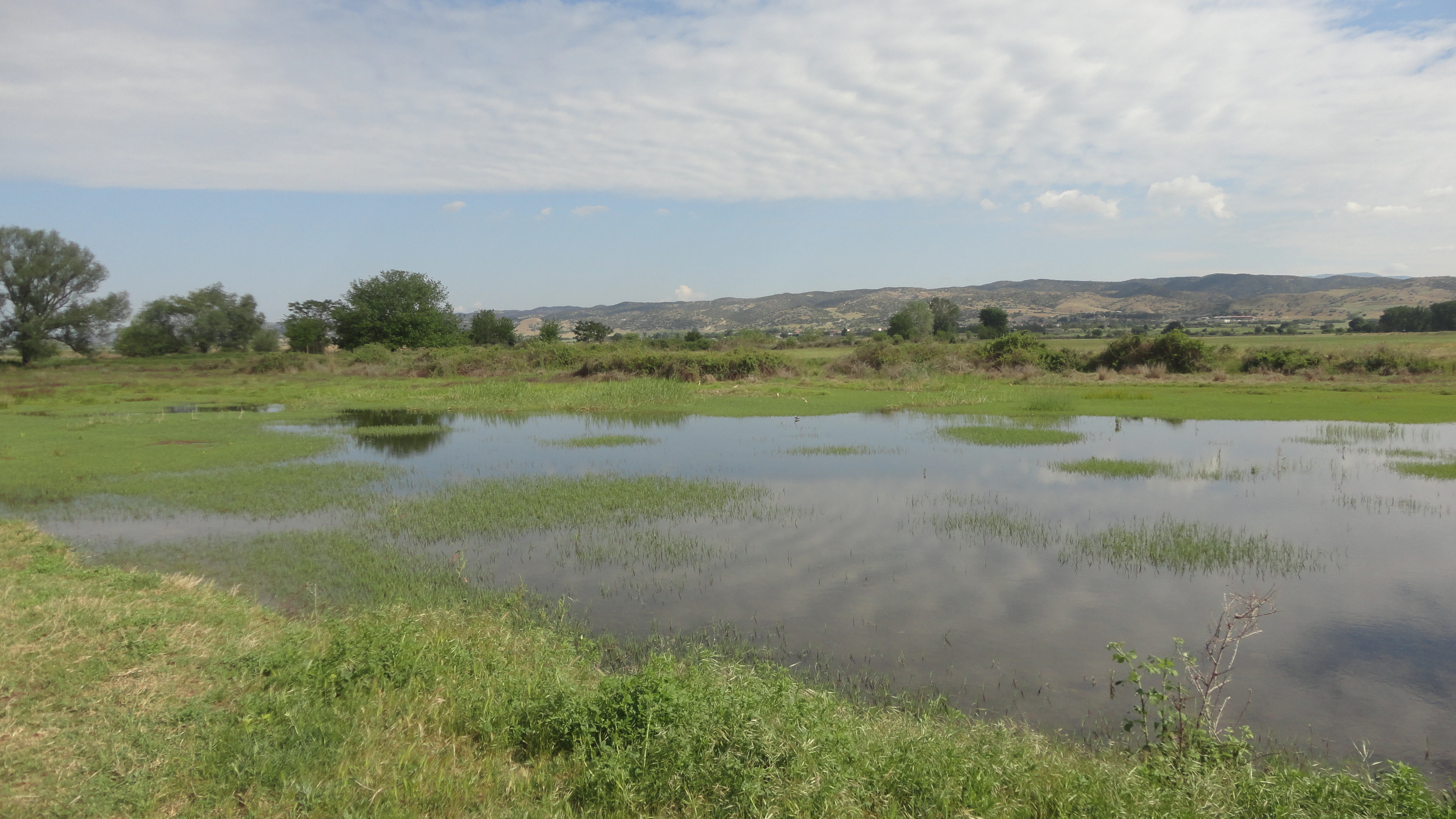
A wide view of a shallow wetland area with patches of green vegetation emerging from the water, with rolling hills in the background under a sky with light cloud cover.
A peaceful view of the wetland landscape within the park.

National Park of Lakes Korónia, Vólvi and Macedonian Tempi history and protected-area timeline

The protection history of this area is closely tied to the gradual international recognition of Greek wetlands and to the long crisis surrounding Lake Korónia. Although Lake Korónia had been a traditional feature of the Macedonian landscape for centuries, it was only in the second half of the twentieth century that its ecological decline became severe enough to trigger formal international concern. By 1990, the disruption of the lake's ecosystems was significant enough for Greece to request that the site be added to the Montreux Record of the Ramsar Convention, a register of priority wetlands whose ecological character has changed or is under threat.

The wider recognition of the area's conservation value developed in parallel with European conservation policy. The lake systems and surrounding habitats were progressively designated as Special Protection Areas for birds under the European Birds Directive and as Special Areas of Conservation for natural habitats under the Habitats Directive, folding the region into the broader Natura 2000 network. BirdLife International also recognized the area as an Important Bird Area, reflecting its importance for migratory and wintering waterbirds.

The establishment of the National Park of Lakes Korónia, Vólvi and Macedonian Tempi in 2004 consolidated these overlapping international, European, and national designations into a single coherent national framework. The park was entrusted to a dedicated management body, the Management Body of Korónia-Vólvi-Chalkidiki, based in Langadás, which is responsible for coordinating conservation, monitoring, and restoration efforts across the three sub-areas.

Subsequent years have been marked by ongoing concern about the persistence of degradation, particularly in Lake Korónia. Despite successive rehabilitation plans, the lake's condition prompted the European Commission to bring Greece before the Court of Justice of the European Union in January 2011 over the failure to adequately protect the wetland, underscoring both the symbolic and the practical significance of the national park designation.

National Park of Lakes Korónia, Vólvi and Macedonian Tempi landscape and geographic character

The landscape of the Korónia-Vólvi-Témpi park is defined by water and the transitions between water and land. Lake Korónia, on the western side, sits in a shallow basin surrounded by agricultural lowlands and small settlements, with margins that have been heavily modified by drainage, irrigation, and industrial activity over the decades. Its shallowness, once supporting a maximum depth above 8 meters in the 1960s, now defines much of the visible character of the lakeshore.

Lake Vólvi, in the center, is a much larger and more visually substantial waterbody, stretching across a significant portion of the park area. Its shores are a mosaic of reeds, muddy flats, alluvial deposits, and patches of riparian woodland, with the Apollonía Forest occupying a particularly notable hygrophile woodland zone to the south. The lake's ecological importance is reinforced by its position within the broader Macedonian water network, connected by channelized streams to Lake Korónia and drained eastward via the Richios River.

The eastern limit of the park is marked by the Macedonian Tempi, the gorge through which the Richios River leaves Lake Vólvi and flows toward the Strymonian Gulf. The gorge is narrower and more enclosed than the open lacustrine landscapes of the two lake basins, with forested slopes and steeper valley sides that contrast with the flat wetlands further west. Together, the shallow lake basin, the larger lake with its riparian margins, and the river gorge form a continuous landscape gradient across the protected area.

National Park of Lakes Korónia, Vólvi and Macedonian Tempi ecosystems, habitats, and plant life

Ecologically, the national park represents a typical yet significant example of a Mediterranean lacustrine and riparian system, combining open freshwater, marshy margins, hygrophile woodland, and a forested river gorge within a single management perimeter. The two lake basins in particular showcase contrasting ecological histories: Lake Vólvi retains substantial freshwater biological richness, while Lake Korónia has become a textbook case of nutrient-driven degradation in southern European wetlands.

The vegetation of the park does not include notably endemic species but is characteristic of wetland communities found across the eastern Mediterranean. Aquatic plants fringe the lake margins, reedbeds and marsh communities occupy transitional zones, and hygrophile forests such as the Apollónia Forest add a more structurally complex woodland element. The Aegean and Western Turkey sclerophyllous and mixed forests ecoregion extends into the drier slopes and elevated parts of the park's perimeter, supporting evergreen and Mediterranean shrub communities alongside the wetland vegetation.

The hydrological network linking the two lakes and feeding the Richios River is in itself an ecological feature. These watercourses, partly channelized, maintain connectivity between distinct habitat patches and allow for the migration of fish, the dispersal of aquatic plants, and seasonal movements of waterbirds between the basins.

National Park of Lakes Korónia, Vólvi and Macedonian Tempi wildlife and species highlights

Wildlife is the area's most prominent conservation asset, particularly its birdlife. The park supports a recorded avifauna of approximately 238 species, making it one of the more species-rich wetland complexes in northern Greece. Its position along Mediterranean migration routes and its combination of open water, marshland, riparian woodland, and agricultural surroundings all contribute to this diversity.

Several globally threatened bird species depend on the park's wetlands, including the White-headed Duck, the European Turtle Dove, and the Common Pochard. Numerous near-threatened species are also regularly recorded, including the Black-tailed Godwit, the Curlew Sandpiper, the Northern Lapwing, the Great Snipe, the Dalmatian Pelican, the Pallid Harrier, the Meadow Pipit, the Red-footed Falcon, and the Ferruginous Duck. The site's status as a Special Protection Area under the European Birds Directive reflects this concentration of protected avifauna.

Mammal and herpetofauna records also contribute to the park's ecological profile, with some 34 mammal species recorded and around 19 reptile and amphibian species. The European Otter is among the most ecologically significant mammals, dependent on clean riparian habitats along the lake margins and the Richios River. Bechstein's Bat is also recorded, reflecting the importance of mature woodland for sensitive bat species.

The freshwater fish fauna of Lake Vólvi is of particular scientific interest. Around 24 fish species have been recorded, including two endemic species of conservation concern native to the lake. However, environmental change in the lake and the introduction of non-native or translocated fish species from elsewhere in Greece have raised concerns about the long-term status of these endemic populations.

National Park of Lakes Korónia, Vólvi and Macedonian Tempi conservation status and protection priorities

From a conservation perspective, the Korónia-Vólvi-Témpi park sits at the intersection of multiple international and European protection regimes. It is recognized as a wetland of international importance under the Ramsar Convention, is part of the Natura 2000 network as both a Special Protection Area for birds and a Special Area of Conservation for habitats, and is included by BirdLife International in its inventory of Important Bird Areas. The park's IUCN Category VI designation reflects an approach that combines ecosystem protection with the sustainable management of surrounding resources.

The conservation narrative of the park is inseparable from the long-running crisis of Lake Korónia. Once a deeper, more ecologically balanced lake, Korónia has been reduced to a shallow, eutrophic waterbody, prompting its listing in the Montreux Record of the Ramsar Convention in 1990 and contributing to the European Commission's decision to refer Greece to the Court of Justice of the European Union in 2011 over persistent management failures.

The management of the park is delegated to a dedicated body, the Management Body of Korónia-Vólvi-Chalkidiki, headquartered in Langadás, whose leadership includes representatives of the Greek Ministry of Environment and Energy. This institution coordinates conservation action across the three sub-areas, including habitat monitoring, restoration planning, and the integration of agriculture and other land uses into a more sustainable relationship with the wetland system.

National Park of Lakes Korónia, Vólvi and Macedonian Tempi cultural meaning and human context

The lakes and gorge that constitute the park have long featured in the geography and economy of Macedonia. Lake Korónia and Lake Vólvi have historically been important to local fishing, agriculture, and water supply, and their names appear repeatedly in descriptions of the Macedonian plain in both ancient and modern sources. Tensions between these traditional uses and ecological conservation are central to the park's management context.

The Macedonian Tempi, the gorge of the Richios River, occupies a specific place in regional identity as a natural landmark east of Thessaloniki, distinct from the more famous Tempi valley further south in Thessaly. The use of the term Témpi in the park's official name reflects this local recognition, even though the surrounding area is otherwise characterized by rural villages, small towns, and low-intensity land use rather than dramatic historical settlement.

Top sights and standout views in National Park of Lakes Korónia, Vólvi and Macedonian Tempi

Three features define the park's distinctive conservation identity: the second largest natural lake in Greece at Lake Vólvi, the internationally recognized wetland crisis of Lake Korónia, and the rich waterbird assemblage that has earned the wider area Special Protection Area and Important Bird Area status. The Macedonian Tempi gorge adds a landscape and habitat dimension that complements the open lake basins.

Equally distinctive is the park's role as a coordination platform. By bringing together ecosystems of very different conservation status under a single national designation and a single management body, the park represents an institutional effort to manage regional wetland decline as a coherent problem rather than a series of isolated local issues.

Best time to visit National Park of Lakes Korónia, Vólvi and Macedonian Tempi

The park offers different experiences depending on the season, with birdlife being the dominant seasonal variable. Spring and autumn migrations bring concentrations of waterbirds through the lakes, while winter is the period when many species arrive to winter in the more sheltered Macedonian wetlands, particularly around Lake Vólvi.

Summer tends to be quieter in terms of migrant waterbird presence but offers warmer conditions for observing the broader wetland landscapes, the riparian vegetation, and the Apollónia Forest. Lake Korónia's ecological condition is most visibly apparent during the warmer months, when high evaporation and low water levels underscore the lake's long-running degradation. Visitors interested in the gorge of the Macedonian Tempi may find cooler shoulder seasons more comfortable for exploring the steeper valley terrain.
Monthly climate preview

Long term temperature ranges and precipitation averages recorded across twelve monthly intervals

Climate Normals and Monthly Weather Patterns in Parc national des lacs Korónia, Vólvi et du Témpi macédonien

Historical data records wide annual temperature shifts alongside measured precipitation levels at a representative coordinate within Parc national des lacs Korónia, Vólvi et du Témpi macédonien. Examining the complete monthly climate profile provides detailed insight into long term meteorological conditions across the protected terrain.
Annual mean15 °C
4 °C27 °C
Jan
Feb
Mar
Apr13°
May18°
Jun24°
Jul27°
Aug27°
Sep22°
Oct16°
Nov10°
Dec
Warmest month
July

26.7 °C

Coolest month
January

4.3 °C

Wettest month
December

1.9 mm/day

Driest month
August

0.7 mm/day

Park location guide

Geography guide, regional context, and park location map for National Park of Lakes Korónia, Vólvi and Macedonian Tempi

National Park of Lakes Korónia, Vólvi and Macedonian Tempi park geography, regions, and map view in Greece

Understand where National Park of Lakes Korónia, Vólvi and Macedonian Tempi sits in Greece through a broader geographic reading of the surrounding landscape, nearby location context, and its mapped position within the national park landscape.

How National Park of Lakes Korónia, Vólvi and Macedonian Tempi fits into Greece

Greece, officially the Hellenic Republic, is a country in Southeast Europe occupying the southern Balkans. It borders Albania, North Macedonia, Bulgaria, and Turkey, with coastlines on the Aegean, Ionian, and Mediterranean seas. The country has over 10 million people and is renowned for its ancient Greek heritage, philosophy, democracy, and the Olympic Games.

Wider geography shaping National Park of Lakes Korónia, Vólvi and Macedonian Tempi in Greece

Greece occupies the southern tip of the Balkan peninsula in Southeast Europe. It shares land borders with Albania to the northwest, North Macedonia and Bulgaria to the north, and Turkey to the east. The Aegean Sea lies to the east of the mainland, the Ionian Sea to the west, and the Sea of Crete and Mediterranean Sea to the south. The country spans thousands of islands across nine traditional geographic regions and has the longest coastline in the Mediterranean basin.

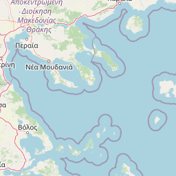
Map view of National Park of Lakes Korónia, Vólvi and Macedonian Tempi

Use this park location map to pinpoint National Park of Lakes Korónia, Vólvi and Macedonian Tempi in Greece, understand its exact geographic position, and read its mapped placement within the surrounding landscape more clearly.

Pigeon | © OpenStreetMap contributors

Explore protected area photographs, wetland habitats, and lake basin terrain across northern Greece.

Visualizing Parc national des lacs Korónia, Vólvi et du Témpi macédonien Landscapes and Scenery

Photographic records reveal the distinct wetland habitats, shallow lake basins, and river gorge terrain that define Parc national des lacs Korónia, Vólvi et du Témpi macédonien. Visual documentation helps researchers and visitors examine environmental conditions, riparian vegetation, and protected landscapes across the region.

A wide view of a shallow wetland area with patches of green vegetation emerging from the water, with rolling hills in the background under a sky with light cloud cover.

Park atlas

Discover related national parks, wetland reserves, and regional conservation landscapes.

Explore Protected Areas Near Parc national des lacs Korónia, Vólvi et du Témpi macédonien

Compare adjacent wetland habitats, river gorges, and freshwater ecosystems situated close to Parc national des lacs Korónia, Vólvi et du Témpi macédonien. Examining these connected protected areas provides broader geographical context for Mediterranean conservation networks.
Watercolor depiction of a river delta with green fields, a winding river, wildflowers, and distant hills
National parkCentral Macedonia
About 59 km away#1 closest

West

Axios Delta National Park: Central Macedonia's Premier Protected Wetlands and Bird Sanctuary

Mapping the unique geography of this vital European bird migration corridor.

Axios Delta National Park is a significant protected wetland located in Central Macedonia, Greece, renowned for its role as a critical stopover and breeding ground for countless bird species along the East Atlantic Flyway. The park's landscape is shaped by the Axios, Haliacmon, Loudias, and Gallikos river deltas, creating a dynamic mosaic of lagoons, reedbeds, and coastal dunes. As a Ramsar site and Natura 2000 network area, it highlights the importance of understanding mapped protected landscapes and their regional geographic context for conservation efforts. Explore the distinct natural features and ecological significance of this unique delta.

Area
338 km²
Established
2009
IUCN
VI
Relief
Lowland
Watercolor painting of a lake landscape with marshy foreground reeds, distant hills, and soft pastel colors.
Protected areaCentral Macedonia
About 62 km away#2 closest

North

Lake Kerkini Protected Area: Geography and Wetland Mapping in Central Macedonia

A significant reservoir within a mountain-framed basin

Lake Kerkini functions as a vital wetland habitat in the Central Macedonia region of Greece. Created as a reservoir along the Strymon River, it serves as a central waypoint for migratory species while providing a structured landscape of water, reed beds, and riverside forest. This atlas entry covers its geographic boundaries and its character as a working ecosystem shaped by both natural features and agricultural heritage.

Area
75 km²
Established
1932
Relief
Mixed relief
Climate
Mediterranean
Watercolor illustration of green mountains and a lake with trees
National parkBlagoevgrad Province
About 104 km away#3 closest

North

Pirin National Park: Protected Area and Regional Geographic Context in Bulgaria

Explore Pirin National Park's mapped boundaries and landscape.

Pirin National Park serves as a vital national park entity within the atlas of Blagoevgrad Province, Bulgaria. This page details its protected landscape, offering a structured view of its geographic setting and mapped terrain. Users can investigate the park's specific identity and its relation to the surrounding regional geography, providing essential context for understanding protected areas and natural landscapes within a comprehensive map-driven framework.

Area
403.56 km²
Established
1962
IUCN
II
Relief
Mountain
Watercolor painting of a mountain range, pine trees, and a small stream in the foreground against a light, misty background.
National parkThessaly
About 105 km away#4 closest

Southwest

Olympus National Park: Protected Mountain Landscapes and Geographic Mapping of Northern Greece

High mountain terrain, forest zones, and protected boundaries

Olympus National Park preserves the towering summit of Mount Olympus and its surrounding canyons. This record highlights the park's geologic structure, its diverse vegetation zones ranging from Bosnian pine to alpine grasslands, and its status as a cornerstone of the natural geography spanning the borders of Thessaly and Central Macedonia.

Area
39.88 km²
Established
1938
IUCN
II
Visitors
180K annual
Watercolor illustration showing mountains, river, and forested area
National parkGreece
About 130 km away#5 closest

Northeast

Rodopi Mountain Range National Park: Greece's Largest Protected Forest Landscape Explorer

Mapped boundaries, old-growth ecosystems, and Balkan geography.

Rodopi Mountain Range National Park is a critical protected forest area in Greece, safeguarding one of Europe's last primeval forests, the Frakto Virgin Forest. As the nation's largest woodland conservation site, it showcases remarkable biodiversity and complex mountain terrain, from low-lying forests to subalpine meadows. This page provides detailed mapping context and geographic specifics for understanding this unique protected landscape and its ecological significance within the Rhodope Mountains.

Area
1,731.5 km²
Established
2009
IUCN
VI
Relief
Mountain
Watercolor painting of a mountainous landscape with a lake and green fields
National parkBulgaria
About 140 km away#6 closest

North

Rila National Park: Bulgaria's Largest National Park with Alpine Terrain and Glacial Lakes

Explore mapped boundaries and protected landscape features.

Rila National Park, situated in Bulgaria's Rila mountain range, stands as the country's largest national park and a vital protected landscape. Its territory is characterized by dramatic glacial topography, including the iconic Seven Rila Lakes, and ascends to Musala Peak, the highest summit in the Balkan Peninsula. This atlas entry details the park's extensive mapped boundaries and unique ecosystems, emphasizing its importance for understanding regional geography and protected area networks.

Area
810.46 km²
Established
1992
IUCN
II
Relief
Mountain
Watercolor illustration of a coastal landscape with hills, trees, and a body of water
Marine protected areaGreece
About 142 km away#7 closest

Southeast

National Marine Park of Alonnisos Northern Sporades: Protected Marine Landscape and Aegean Geography

Explore Greece's largest marine protected area and its vital ecosystems.

Investigate the National Marine Park of Alonnisos Northern Sporades, an extensive marine protected area situated in the northern Aegean Sea. This protected landscape is internationally significant for its role in conserving the Mediterranean monk seal and for its healthy Posidonia oceanica seagrass meadows. Understanding this park's geographic scope and its protected marine terrain offers crucial insights into Mediterranean island ecosystems and conservation efforts within the region.

Area
2,260 km²
Established
1992
IUCN
II
Relief
Mixed relief
Watercolor painting depicting a wide, soft-focus view of marshland, low-lying green vegetation, and distant purple mountains under a clear sky.
National parkEastern Macedonia and Thrace
About 155 km away#8 closest

East

Parc national de Macédoine-Orientale-et-Thrace: Wetland Atlas and Geographic Boundaries

Coastal lagoons and river delta protected landscapes

Gain insight into the ecological and geographic structure of Parc national de Macédoine-Orientale-et-Thrace. This protected area encompasses a complex mosaic of river deltas, shifting saline lagoons, and remnant riparian forests that anchor the natural landscape of Eastern Macedonia and Thrace.

Area
929.47 km²
Established
2008
IUCN
V
Relief
Lowland

Common questions about visiting, size, designation, and location context for National Park of Lakes Korónia, Vólvi and Macedonian Tempi

National Park of Lakes Korónia, Vólvi and Macedonian Tempi FAQs for park facts, access, geography, and protected area context

Find quick answers about National Park of Lakes Korónia, Vólvi and Macedonian Tempi, including protected-area facts, park geography, trail and visitor context, and how the park fits into its surrounding country and regional landscape.
MoriAtlas Explorer

Continue Your Protected Areas Search Across the Global Atlas

Deepen your exploration by continuing the structured search for national parks and protected areas worldwide. Utilize the comprehensive filtering capabilities to compare different conservation landscapes and refine your understanding of global park geography. Discover more about the distribution and characteristics of protected natural areas.

Global natural geography