

Mori Atlas logo
Protected areaPhou Xieng Thong National Protected Area

A striking conservation mosaic of river cliffs, rocky plateau flats, and evergreen forest corridors

Phou Xieng Thong National Protected Area: Mapped Landscapes and Geographic Boundaries in Southern Laos

Phou Xieng Thong National Protected Area stands as the only protected landscape in Laos directly bordering the Mekong River. The terrain transitions sharply from riverbank cliffs to an inland plateau, where elevations climb from one hundred metres near the water to over seven hundred metres at the summit of Phou Nangam. This protected zone provides a vital habitat mosaic, blending semi-evergreen forests with expansive rocky flats that support threatened species and diverse avian populations.

Mekong Riversemi-evergreen forestrocky plateauriver cliffsImportant Bird Areanational protected area

Phou Xieng Thong National Protected Area

Protected area

Park overview

Structured park overview, official facts, and landscape profile for Phou Xieng Thong National Protected Area

Phou Xieng Thong National Protected Area park facts, protected area profile, and essential visitor context

Review the core facts for Phou Xieng Thong National Protected Area, including designation, size, terrain, visitor scale, habitats, and operating context in one park-focused overview.

About Phou Xieng Thong National Protected Area

Phou Xieng Thong National Protected Area occupies a distinctive position in Laos's protected-area network as the country's only national park that directly borders the Mekong River. The protected area sits in the southern part of the country, roughly 50 kilometres north of Pakse, where the Mekong forms an international boundary between Laos and Thailand's Ubon Ratchathani Province, with the Thai Pha Taem National Park lying on the opposite bank.

Geographically, the park spans from the river's edge up to an elevated inland plateau. Along the Mekong, near-vertical cliffs rise directly from the water, transitioning into a plateau that sits broadly between 300 and 500 metres in elevation. The highest point in the park is Phou Nangam, reaching about 716 metres, giving the protected area a notable vertical relief of more than 600 metres over a relatively compact horizontal extent.

Ecologically, the park is dominated by semi-evergreen forest, with forest cover interrupted by the rocky flats that characterise much of the plateau. This mosaic of closed-canopy forest and more open rocky terrain creates a varied habitat structure that supports a diverse fauna. Surveys have documented at least 16 mammal species and 188 bird species, and the park contains the Phou Xiang Thong Important Bird Area.

From a conservation and management perspective, Phou Xieng Thong is an important component of regional efforts to maintain forest connectivity and biodiversity along the Mekong corridor in southern Laos. It also has an ecotourism dimension, drawing visitors interested in its scenery, riverside cliffs, and wildlife. Across the river from a major Thai national park, it forms part of a transboundary natural landscape along the Mekong.

Quick facts and research context for Phou Xieng Thong National Protected Area

Phou Xieng Thong is a national protected area of roughly 1,200 square kilometres under IUCN Category VI, recognising it as a protected area with sustainable use of natural resources. It lies across Khongsedone and Lakhonepheng districts of Salavan Province and Sanasomboun District of Champasak Province in southern Laos, with Pakse as the nearest city.

Its decreed area dates from 29 October 1993, when the area was declared both a National Reserved Forest and a National Biodiversity Conservation Area. The park contains the Phou Xiang Thong Important Bird Area, covering about 367 square kilometres along part of the eastern bank of the Mekong.

Protection and recognition

Examine documented terrestrial protection parameters, management scope, and conservation recognition records.

Phou Xieng Thong National Protected Area Protection Status and Official Designation Record

Phou Xieng Thong National Protected Area maintains a documented terrestrial conservation scope within regional protected area networks. Official designation records detail baseline protection parameters and regulatory frameworks without external international recognition sources.

Protection details

Protection scope
Terrestrial
Transboundary protection
No
Park context

Deeper park guide and search-rich context for Phou Xieng Thong National Protected Area

Phou Xieng Thong National Protected Area history, landscape, wildlife, and travel context

Explore Phou Xieng Thong National Protected Area through its history, landscape character, ecosystems, wildlife, conservation priorities, cultural context, and seasonal travel timing in a structured park guide built for atlas discovery and search intent.

Why Phou Xieng Thong National Protected Area stands out

Phou Xieng Thong is best known for being Laos's only national protected area on the Mekong River and for the striking transition between near-vertical riverside cliffs and an inland forested plateau. The combination of semi-evergreen forest, rocky plateau flats, and riverside habitat gives the park both scenic and ecological significance. It is also recognised for its role as an Important Bird Area and for hosting populations of regionally notable and endangered species, including the green peafowl, Asian black bear, Sumatran serow, banteng, pangolin, monitor lizard, and Indochinese leopard.
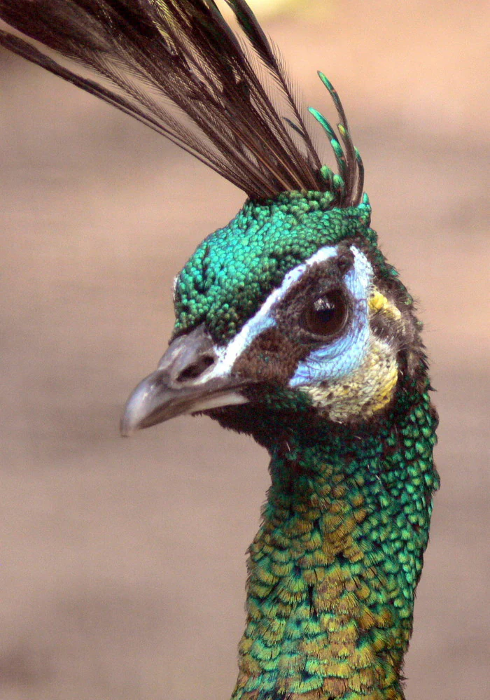
A close up profile portrait of a green peafowl head showing vibrant iridescent green scale like feathers, a tall dark crest, and light blue patches around the eye.
A close up view of a Green Peafowl, Pavo muticus, highlighting its distinct iridescent green plumage and crested head.

Phou Xieng Thong National Protected Area history and protected-area timeline

The origins of Phou Xieng Thong National Protected Area lie in earlier forest-protection measures in southern Laos. In 1983, an area within what is now the park, known as Phou Kang Heuan, was declared a Forest Reserve, establishing a baseline of formal protection for the region's forests.

Commercial logging within the current park boundaries was halted in 1992, reducing a major direct pressure on the area's forests. On 29 October 1993, the broader landscape was elevated in status, being declared both a National Reserved Forest and a National Biodiversity Conservation Area, which gave it the formal status it retains today as a national protected area.

Following its establishment as a protected area, formal wildlife surveys began in 1996, helping to document the area's mammal and bird populations and providing the basis for its later recognition as an Important Bird Area. The park has since remained a focus of conservation management in southern Laos, while also being promoted as an ecotourism destination.

Phou Xieng Thong National Protected Area landscape and geographic character

Phou Xieng Thong's landscape is defined by an abrupt transition from river to plateau. Along its western edge, the Mekong River forms a long, straight boundary, and near-vertical cliffs rise sharply from the water, giving the park an immediately dramatic river frontage that contrasts with the gentle agricultural Mekong floodplains found elsewhere in the region.

Above the cliffs, the terrain opens onto a broad plateau that constitutes most of the park's interior. This plateau sits at elevations between roughly 300 and 500 metres and is interrupted by extensive rocky flats that break up the forest cover and create open clearings within an otherwise wooded landscape. The summit of Phou Nangam, at about 716 metres, marks the highest point in the protected area, rising well above the surrounding plateau.

The overall vertical range of the park, from around 100 metres near the Mekong to over 700 metres at Phou Nangam, gives it a layered visual character, with lowland riverside habitats, steep cliff faces, mid-elevation plateau forest, and rocky uplands all present within the same protected boundary.

Phou Xieng Thong National Protected Area ecosystems, habitats, and plant life

The ecological character of Phou Xieng Thong is anchored by semi-evergreen forest, which is the dominant vegetation type across the protected area. This forest forms a continuous cover over much of the plateau, but it is regularly interrupted by the exposed, rocky flats that define the higher terrain, producing a patchwork of closed-canopy woodland and more open, sparsely vegetated ground.

The combination of forested plateau, rocky flats, and the steep riverside cliffs along the Mekong gives the park a diverse habitat structure. Elevation ranges from lowland riverbank environments near the Mekong up to higher plateau interiors, allowing different vegetation zones and microhabitats to coexist within the same protected area.

The diversity of habitats is a key factor in the park's ecological importance. It supports not only typical semi-evergreen forest species but also birds and mammals associated with cliffs, riverbanks, and more open rocky terrain, contributing to the broader biodiversity of the Mekong corridor in southern Laos.

Phou Xieng Thong National Protected Area wildlife and species highlights

Phou Xieng Thong's wildlife profile reflects the variety of habitats found across its plateau forests, rocky flats, and Mekong riverbank. Surveys have recorded at least 16 mammal species and 188 bird species, underscoring the area's importance for fauna in southern Laos.

Mammal species documented in the park include the Asian black bear, Sumatran serow, banteng, pangolin, and leopard (Indochinese leopard), several of which are of regional or global conservation concern. Monitor lizards are also present and contribute to the park's reptile fauna.

The birdlife of Phou Xieng Thong is particularly notable. The park contains the Phou Xiang Thong Important Bird Area, which covers about 367 square kilometres and includes part of the Mekong's eastern bank. Endangered bird species recorded in the IBA include the green peafowl, grey-headed parakeet, and red-collared woodpecker, while species considered rare within the park include the red-vented barbet, eared pitta, and grey-faced tit-babbler.

Phou Xieng Thong National Protected Area conservation status and protection priorities

Phou Xieng Thong holds a clear conservation role both nationally and regionally. As a National Biodiversity Conservation Area and National Reserved Forest, it forms part of Laos's formal network of protected landscapes, and its IUCN Category VI designation recognises the importance of maintaining natural ecosystems alongside sustainable use of resources.

The protected area is a significant component of biodiversity conservation along the Mekong corridor in southern Laos. Its location directly on the Mekong, opposite Thailand's Pha Taem National Park, makes it part of a wider transboundary ecological landscape, and its forests contribute to maintaining habitat continuity in a region that has historically been subject to logging and land conversion.

Recognition of the Phou Xiang Thong Important Bird Area within the park highlights its particular value for bird conservation, especially for threatened species such as the green peafowl, grey-headed parakeet, and red-collared woodpecker. Conservation concerns in the park include pressures from settlement expansion along the Mekong, destructive fishing practices in streams, hunting of pangolins and monitor lizards, and ongoing small-scale logging, all of which pose long-term threats to forest and bird populations.

Top sights and standout views in Phou Xieng Thong National Protected Area

Phou Xieng Thong stands out as Laos's only national protected area directly on the Mekong River, giving it a unique position within the country's conservation network. The near-vertical cliffs rising from the Mekong to the forested plateau are among its most visually distinctive features.

The park's importance is reinforced by its biodiversity, with semi-evergreen forest supporting endangered mammals such as the Asian black bear and Sumatran serow, and its Important Bird Area providing habitat for threatened birds including the green peafowl. Its transboundary position opposite Pha Taem National Park in Thailand adds an additional layer of regional significance.

Best time to visit Phou Xieng Thong National Protected Area

The best period to experience Phou Xieng Thong typically coincides with the cooler and drier months in southern Laos, generally between roughly November and February, when forest trails are more accessible, river conditions along the Mekong are calmer, and the contrast between the riverside cliffs and the plateau forest is easiest to appreciate. Temperatures are more moderate than during the hot pre-monsoon months, and bird activity often remains productive across the plateau and along the river.

The wet season, from around May to October, brings heavy rainfall, higher humidity, and more challenging trail and riverbank conditions, but also supports lush semi-evergreen forest cover and active wildlife behaviour. Visitors interested primarily in scenery, river views, and general wildlife observation tend to find the cooler months more comfortable, while those comfortable with seasonal conditions may visit the park at other times of year depending on their interests.

Monthly climate preview

Long term representative temperature and precipitation averages recorded month by month

Phou Xieng Thong National Protected Area Climate Normals and Annual Weather Patterns

Representative coordinates record distinct shifts in annual temperature ranges and monthly precipitation volumes across the protected area. Examining the complete twelve month climatology profile provides precise insight into long term weather behavior at this specific elevation.
Annual mean26 °C
23 °C30 °C
Jan24°
Feb27°
Mar29°
Apr30°
May29°
Jun27°
Jul26°
Aug26°
Sep26°
Oct25°
Nov24°
Dec23°
Warmest month
April

30.3 °C

Coolest month
December

23.2 °C

Wettest month
August

9.3 mm/day

Driest month
January

0.3 mm/day

Park location guide

Geography guide, regional context, and park location map for Phou Xieng Thong National Protected Area

Phou Xieng Thong National Protected Area park geography, regions, and map view in Laos

Understand where Phou Xieng Thong National Protected Area sits in Laos through a broader geographic reading of the surrounding landscape, nearby location context, and its mapped position within the national park landscape.

How Phou Xieng Thong National Protected Area fits into Laos

Laos, officially the Lao People's Democratic Republic, is a unitary communist state in mainland Southeast Asia. As the only landlocked country in the region, it shares borders with Myanmar, China, Vietnam, Cambodia, and Thailand. The country has a population of over 7 million and is known for its mountainous terrain, Buddhist heritage, and three UNESCO World Heritage Sites: Luang Prabang, Vat Phou, and the Plain of Jars. The Boten, Vientiane railway completed in 2021 connects Laos to China.

Wider geography shaping Phou Xieng Thong National Protected Area in Laos

Laos is located in mainland Southeast Asia, occupying a mountainous and forested landscape. It is bordered by Myanmar and China to the northwest, Vietnam to the east, Cambodia to the southeast, and Thailand to the west and southwest. As the only landlocked country in Southeast Asia, it has no coastline. The country lies at approximately 17.967°N latitude and 102.6°E longitude.

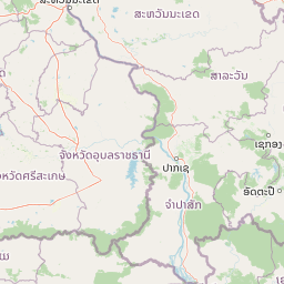
Map view of Phou Xieng Thong National Protected Area

Use this park location map to pinpoint Phou Xieng Thong National Protected Area in Laos, understand its exact geographic position, and read its mapped placement within the surrounding landscape more clearly.

Pigeon | © OpenStreetMap contributors

Location context for Phou Xieng Thong National Protected Area

Champasak ProvinceSalavan Province

Visual reference of river cliffs, forest canopy, and plateau terrain

Phou Xieng Thong National Protected Area Photos and Landscapes

Visual documentation captures the dramatic transition from Mekong riverside cliffs to forested plateau across Phou Xieng Thong National Protected Area. Examining these habitats and terrain features helps researchers understand the environmental character of southern Laos conservation lands.

A close up profile portrait of a green peafowl head showing vibrant iridescent green scale like feathers, a tall dark crest, and light blue patches around the eye.

Park atlas

Compare regional protected areas, river corridors, and adjacent upland terrain in southern Laos

Explore Other Parks Near Phou Xieng Thong National Protected Area and Surrounding Protected Landscapes

Browse neighboring protected areas and regional conservation zones situated along the Mekong corridor. Compare adjacent riverfront terrain, forested plateaus, and regional reserves to understand the wider ecological landscape.
National parkUbon Ratchathani Province
About 31 km away#1 closest

Southwest

Pha Taem National Park: Mapped Protected Landscape in Ubon Ratchathani

National park exploration and geographic context

Pha Taem National Park serves as a distinct protected area within Ubon Ratchathani Province, offering a focused lens for geographic discovery. Understand its specific location, mapped boundaries, and the surrounding natural landscape context that defines this national park. This entry supports detailed atlas exploration of Thailand's protected territories.

Area
340 km²
Established
1991
IUCN
II
Visitors
180.2K annual
National parkUbon Ratchathani Province
About 43 km away#2 closest

Southwest

Kaeng Tana National Park: Mapped Protected Landscape in Ubon Ratchathani Province

Explore Thailand's national park geography and boundaries.

Kaeng Tana National Park is a designated national park located in Ubon Ratchathani Province, Thailand. This atlas-focused content helps users understand its unique protected landscape identity and geographic setting. Explore the mapped context of Kaeng Tana National Park, contributing to a structured understanding of conservation areas and natural terrain within Thailand's broader geography.

Area
80 km²
Established
1981
IUCN
II
Visitors
31.2K annual
Protected areaChampassak Province
About 104 km away#3 closest

Southeast

Beung Kiat Ngong Wetlands: Protected Area and Freshwater Landscape in Champassak Province

A rare tropical peatland mosaic and conservation corridor in southern Laos

Beung Kiat Ngong Wetlands is a distinct protected area in Champassak Province characterized by its rare tropical peatland formations, perennial swamps, and seasonal marshes. This site acts as a key flood regulator and biodiversity refuge within the Indo-Burma Biodiversity Hotspot, offering a complex terrain that bridges aquatic habitats with the nearby Xe Pian National Protected Area.

Area
23.6 km²
Established
2010
Relief
Lowland
Climate
Tropical
National parkAmnat Charoen Province
About 118 km away#4 closest

Northwest

Phu Sa Dok Bua National Park: National Park with Mapped Protected Boundaries

Explore protected landscapes in Amnat Charoen Province, Thailand.

Discover Phu Sa Dok Bua National Park, a designated national park situated within the geographic context of Amnat Charoen Province. This profile focuses on the park's protected area identity and its mapped boundaries, offering essential geographic information for atlas-based exploration and understanding its role within Thailand's conservation landscape.

Area
231 km²
Established
1992
IUCN
II
Visitors
1.8K annual
National parkUbon Ratchathani Province
About 124 km away#5 closest

South

Phu Chong, Na Yoi National Park: Protected Landscape Exploration in Ubon Ratchathani

Discover the park's mapped boundaries and regional geographic context.

Phu Chong, Na Yoi National Park offers a distinct entry point for exploring protected natural areas in Thailand. As a designated national park within Ubon Ratchathani Province, its geographic features and mapped protected land contribute to a richer understanding of regional landscape patterns. This park provides essential context for atlas-based discovery of Thailand's conservation landscapes.

Area
686 km²
Established
1987
IUCN
II
Visitors
127.4K annual
Protected areaSavannakhet Province
About 134 km away#6 closest

North

Phou Xang He National Protected Area: Geographic Overview and Forest Landscape Mapping

Protected forest ecosystems in Savannakhet Province, Laos

Phou Xang He National Protected Area encompasses a vast, relatively undisturbed forest expanse in central Laos. This detailed look at the park's physical geography highlights its characteristic mix of deciduous and evergreen woodlands, serving as a vital habitat within the Annamite foothills region. Understand the spatial distribution of this protected landscape and its regional importance to conservation efforts across Savannakhet Province.

Area
1,180 km²
Established
1993
IUCN
VI
Access
Access unknown
National parkMukdahan Province
About 137 km away#7 closest

Northwest

Phu Pha Thoep National Park: Mukdahan Province Protected National Park Geography

Explore its mapped protected landscape and regional context.

Phu Pha Thoep National Park is a designated national park in Thailand's Mukdahan Province, offering a distinct focus for geographic exploration. This resource provides detailed insights into its protected landscape, outlining mapped park boundaries and its integration within the regional geography. Understand the park's specific natural terrain and its value for structured atlas-style discovery, moving beyond simple location data to grasp its protected area significance.

Area
48 km²
IUCN
II
Visitors
47.6K annual
Relief
Upland
National parkRatanakiri province
About 148 km away#8 closest

Southeast

Virachey National Park: Cambodia's Vast Highland Protected Landscape in Ratanakiri

Explore its remote montane forest ecosystems and diverse terrain.

Virachey National Park, Cambodia's largest national park, offers a profound glimpse into one of mainland Southeast Asia's last great wildernesses. Spanning remote highland terrain in Ratanakiri province, it features dramatic elevation changes from 400 to 1,500 meters, supporting diverse ecosystems including dense lowland forests, unique montane cloud forests, and upland savannahs. Its recognition as an ASEAN Heritage Park underscores its critical regional conservation value, making it a significant destination for understanding protected landscapes and their geographic context.

Area
3,380.57 km²
Established
1993
IUCN
II
Relief
Mountain

Common questions about visiting, size, designation, and location context for Phou Xieng Thong National Protected Area

Phou Xieng Thong National Protected Area FAQs for park facts, access, geography, and protected area context

Find quick answers about Phou Xieng Thong National Protected Area, including protected-area facts, park geography, trail and visitor context, and how the park fits into its surrounding country and regional landscape.
MoriAtlas Explorer

Continue Your Protected Areas Search Across the Global Atlas

Deepen your exploration by continuing the structured search for national parks and protected areas worldwide. Utilize the comprehensive filtering capabilities to compare different conservation landscapes and refine your understanding of global park geography. Discover more about the distribution and characteristics of protected natural areas.

Global natural geography
