Peaks
Gibraltar Rock
640 m

A comprehensive analysis of mountain terrain, peak distribution, and park landscape extent
Analyze the formal geographic scope of Porongurup National Park, situated in the Great Southern region of Western Australia. This profile examines the 26.21 square kilometer boundary, elevation reaching 670 meters at the highest point, and the diverse network of peaks and watercourses contained within its mountainous forest ecosystem.
Related tags
Ancient granite peaks and karri forest in Western Australia's Great Southern
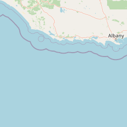
Porongurup National Park is a protected area in the Great Southern region of Western Australia, approximately 360 kilometers southeast of Perth and 40 kilometers north of Albany. The park encompasses the Porongurup Range, a remarkable ancient mountain system formed over 1.2 billion years ago during the Precambrian era, making it one of the oldest mountain ranges on Earth. The range comprises dramatic granite peaks that rise abruptly from the surrounding plains, with the highest summit Devils Slide reaching 670 meters above sea level. The park is part of the Southwest Australia Biodiversity Hotspot, one of 34 globally recognized regions of exceptional plant and animal diversity. Its karri forest ecosystem represents a significant outlier, existing hundreds of kilometers east of the species' typical southwest distribution. The landscape creates unique microclimates on its peaks, supporting vegetation communities that differ substantially from the surrounding agricultural lowlands.
Analyzing regional placement across Western Australia and global indexes
Porongurup National Park maps a compact 26.21 km² extent
Explore recorded mountain peaks and stream networks inside the reserve.
Peaks
640 m
Peaks
640 m
Streams
Peaks
Peaks
652 m
Peaks
670 m
Temperate mountain relief, forest cover, and year round classification types
Mountains · Forest · Woodland
Temperate broadleaf forest · Temperate coniferous forest
Discover the broader regional park geography, comparing Porongurup National Park with other protected areas and their surrounding landscapes.
North

Discover its mapped boundaries and regional landscape context.
Stirling Range National Park is a protected national park in Western Australia, offering critical insights into regional geography and landscape mapping. This page provides structured information on the park's protected area status, its geographic setting, and its value for atlas-based exploration. Understand the extent of its mapped boundaries and discover its unique natural terrain within the broader context of Western Australia's vast geography.
Southwest
Explore mapped boundaries and regional geographic context in Great Southern.
Gain a structured understanding of Mount Lindesay National Park, a designated national park in Australia's Great Southern region. This detail view focuses on its protected landscape identity, mapped geographic features, and its place within the nation's network of conservation areas. Discover the specific terrain and regional atlas context that makes this park a distinct element of Australia's natural geography.
South
Discover mapped boundaries and natural terrain in Western Australia.
Gull Rock National Park serves as a key protected area for exploring the geographic diversity of Western Australia. As a national park, it offers a focal point for understanding mapped landscape features, conservation boundaries, and the unique natural terrain of the region. This entry provides essential context for atlas-based discovery of protected lands across Australia.
East
Explore the geographic identity and park boundaries of Hassell National Park.
Hassell National Park offers a focused view of protected natural landscapes within Western Australia. This atlas entry details the park's specific geographic scope and its designation as a national park, providing essential context for understanding its mapped features and regional landscape. Explore how Hassell National Park contributes to the protected area geography of the state.
Southeast
Explore Western Australia's mapped natural landscapes and park geography.
Gain a structured understanding of Waychinicup National Park as a key protected landscape within Western Australia. This detailed atlas entry focuses on its geographic distribution and mapped boundaries, providing essential context for regional park and natural landscape exploration. Discover the unique characteristics of this national park's setting and its place within the broader mapped terrain.
South
Explore protected lands within Western Australia's geography.
Torndirrup National Park serves as a significant protected natural area, offering valuable insights into the geographic character of Western Australia. This detailed entry focuses on its mapped boundaries and its role as a protected landscape, providing essential context for atlas-based exploration of Australia's diverse regions and natural terrains.
West
Mapped boundaries and natural terrain of this national park.
Mount Roe National Park offers a distinct protected landscape for atlas exploration, situated within the geographic scope of the Great Southern region. This detail page provides a structured view of the park's mapped boundaries and its natural terrain. Understand how Mount Roe National Park contributes to the regional geography and the overall map of protected areas in Australia.
Southwest
Explore dramatic sea cliffs, ancient karri forests, and Torbay Head.
West Cape Howe National Park offers a distinct protected landscape experience in Western Australia, highlighted by its position at mainland Australia's southernmost point, Torbay Head. This park showcases a rugged 23-kilometer stretch of the Southern Ocean coastline, featuring towering sea cliffs that descend to pristine beaches and rocky shores. Inland, visitors find ancient karri forests and diverse vegetation types, contributing to a rich mosaic of protected habitats. Its geographic significance and unique coastal terrain make it a key destination for understanding regional protected area geography.
Deepen your understanding of Porongurup National Park by examining its ancient granite terrain and unique karri forest ecosystem in greater detail. This protected area offers a fascinating case study in regional geography and landscape evolution within Western Australia. Continue exploring its mapped features and protected status to gain a comprehensive atlas view of this significant natural site, revealing the intricate details of its ancient geology and ecological distinctiveness.